| |
 Home A Bibliography of County Maps - Large Scale County Maps of England. Tooley R.V. The Printed Maps in the Atlases of Great Britain and Ireland1579-1870 Chubb Thomas Dawson 1927 |
 To resize images: hold CTRL and use mouse scroll-wheel |
Berkshire 1597 Christopher Saxton for his English Atlas (Image courtesy of The Mechanical Curator & Wikimedia)
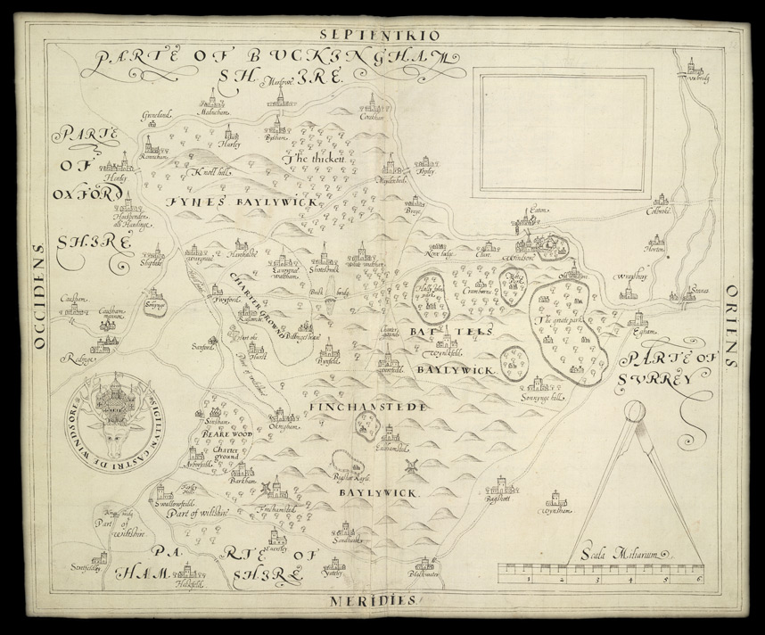
Estates at Windsor: Berkshire 1595 Anon
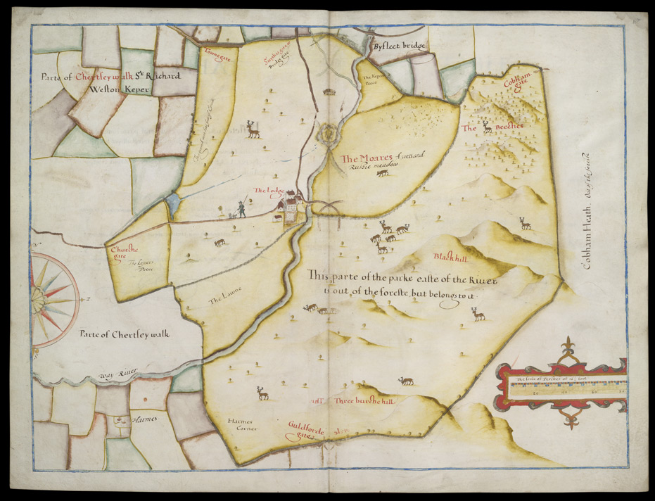
Map of Byflete Parke 1607 John Norden
Berkshire 1611 John Speed in The Theatre of the Empire of Great Britaine (Chubb p.23. XXII)
(Image courtesy of Princeton Historic Map Collection)
Berkshire 1612 Michael Drayton to illustrate his Polyolbion (Chubb p.45 XXXIII)
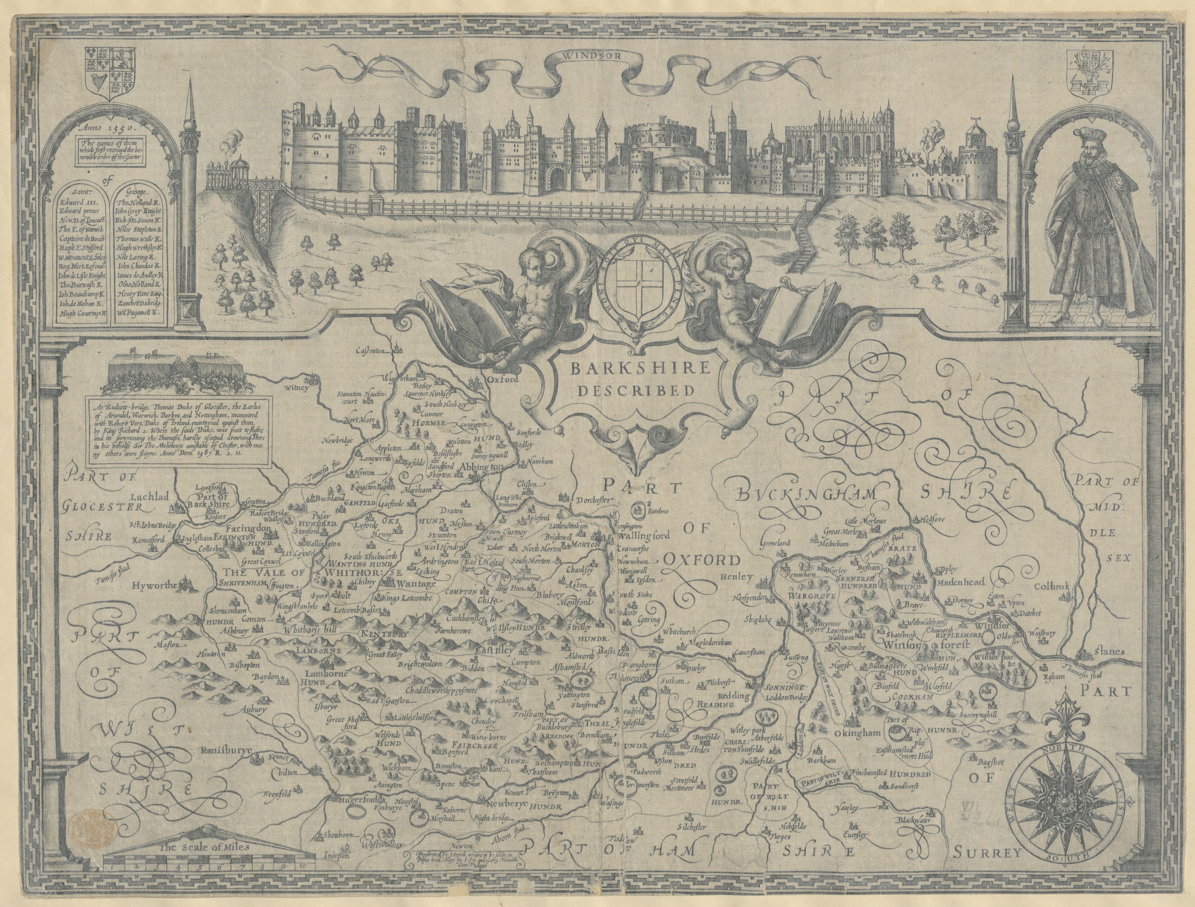
Barkshire Described 1614 John Speed (Sudbury and Humble Edition
(Image courtesy of The British Library King's Collection Maps K.TOP.7.2.1. )
Comitatus Bercheriae vulgo Barkshyre. 1620 William Hole after Christopher Saxton
(Image courtesy of Princeton Historic Map Collection) (not in Cubb for this date.)
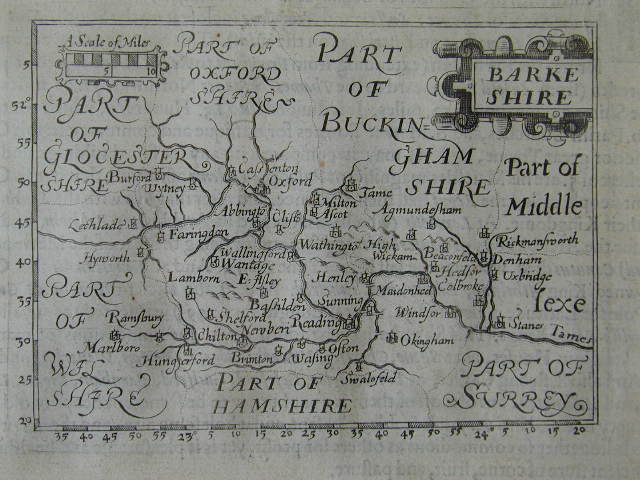
Berkshire 1626 John Bill in An Abridgement of Camden's Britannia (Chubb p.52 XLI)
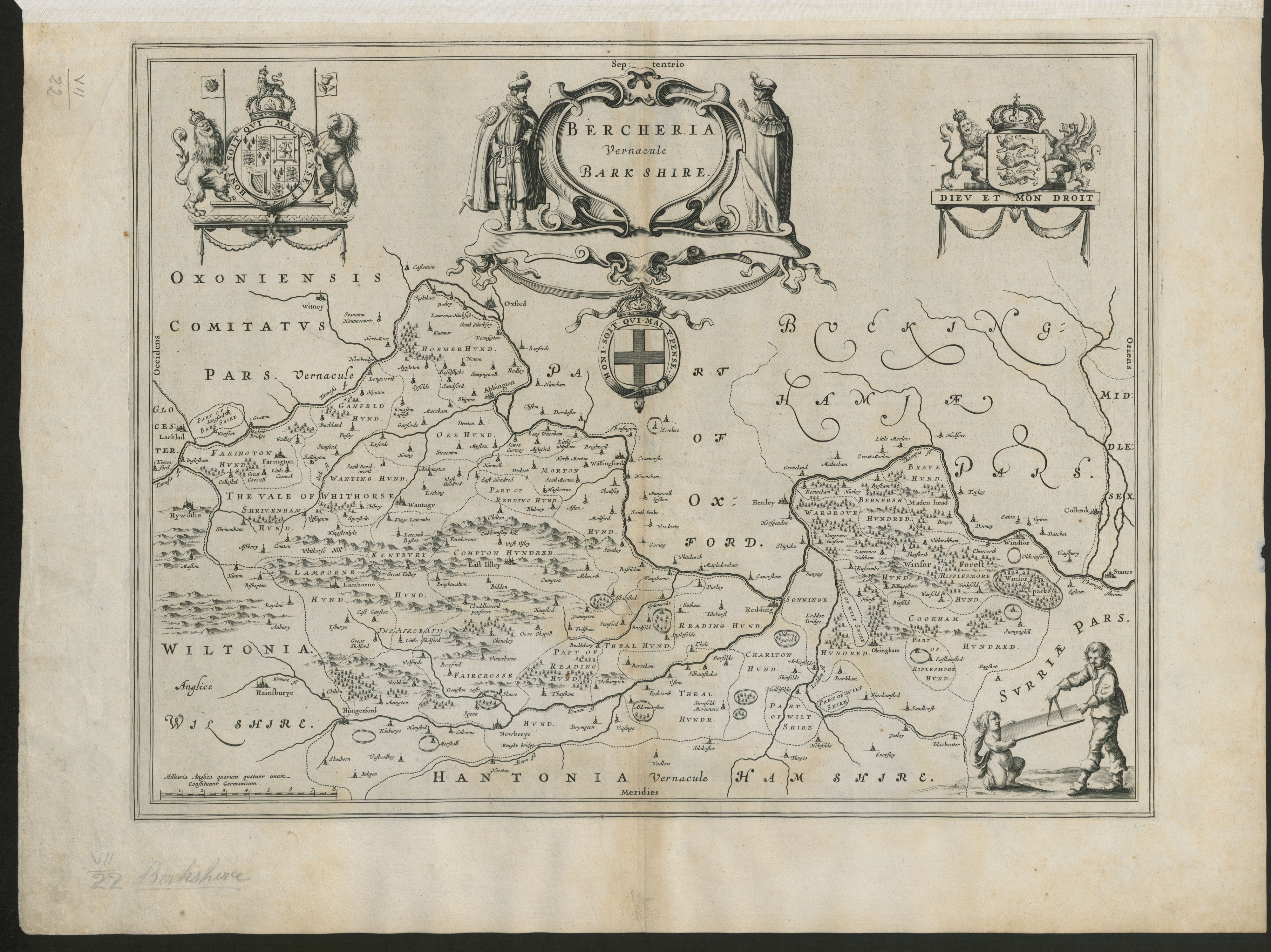
Bercheria Vernacule Barkshire 1648 Joan Blaeu in Theatrum Orbis Terrrarum sive Atlas Novus
(Image courtesy of The British Library King's Collection Maps K.TOP.7.22. )
Berkshire 1662 John Speed in A Prospect of the Most Famous Parts of the World (Roger Rea Edition)
A New Map of BARKSHIRE with all the Hundreds: Parkes: and other Places thereunto belonging 1670 & !738 Wenceslas Hollar (Image courtesy of The British Library King's Collection Maps K.TOP.7.23.)
Berkshire 1667 Joan Blaeu in Le Grand Atlas: volume 5
( Image courtesy of The British Library King's Collection Maps K.TOP)
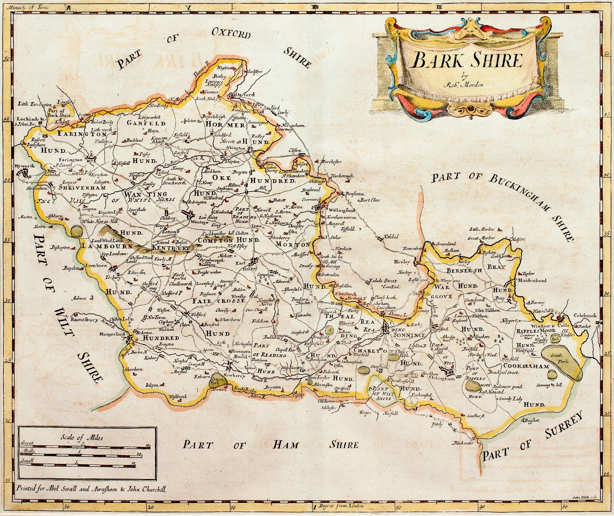
Berkshire 1701 Robert Morden for The New Description and State of England (Chubb p.100 CXXXIV)
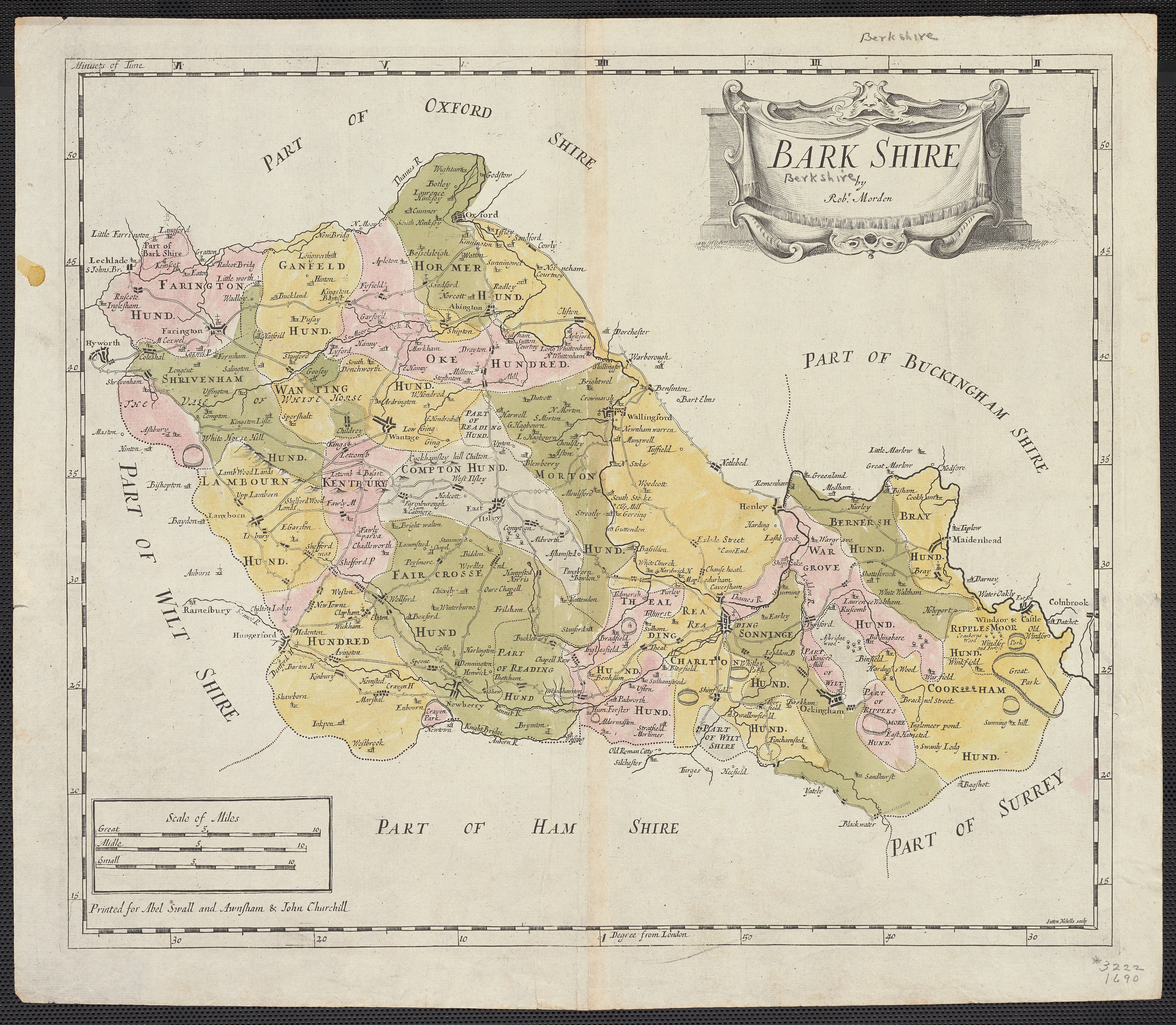
Bark-Shire 1690 Robt.Morden for Camden's Britannia
(Image courtesy of Yale University Library )
A New Map of BARKSHIRE with all the Hundreds: Parkes: and other Places thereunto belonging 1670 & !738 Wenceslas Hollar (Image courtesy of The British Library King's Collection Maps K.TOP.7.23.)
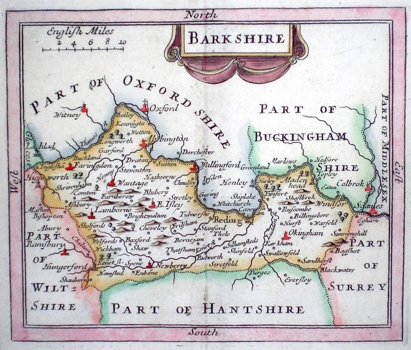
Bark-Shire 1690 Robt.Morden (Chubb CXlll )
(Image courtesy of Yale University Library )
Berkshire 1673 Richard Blome in his Britannia (Chubb p.81 XCIX)
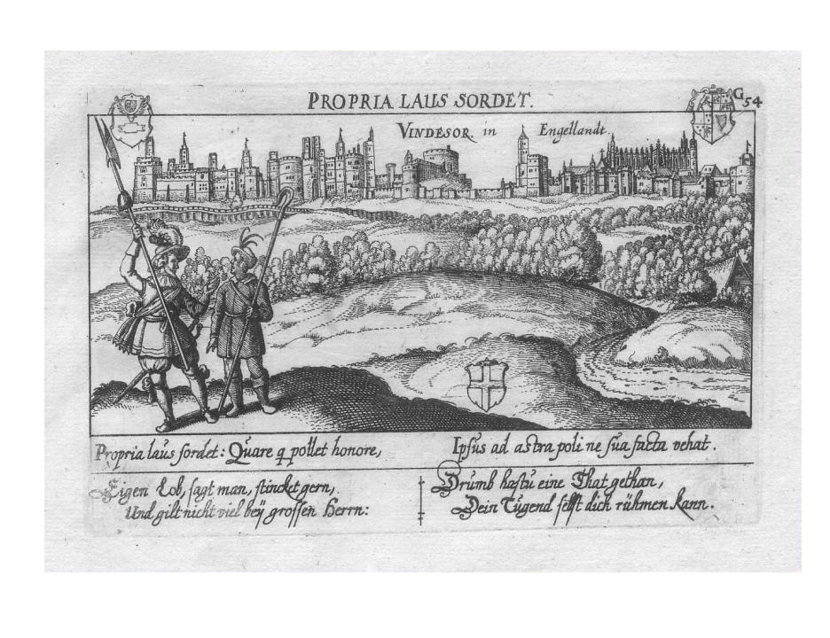
Windsor 1700 Daniel Meisner
Berkshire 1701-1703 John Seller for Camden's Britannia Abridged or: using the same plates; The History of England or: also: Anglia Contracta.: and finally: (post mortem) for Francis Grose's Antiquities of England and Wales 1777 -87 Chubb p.100 CXXII)
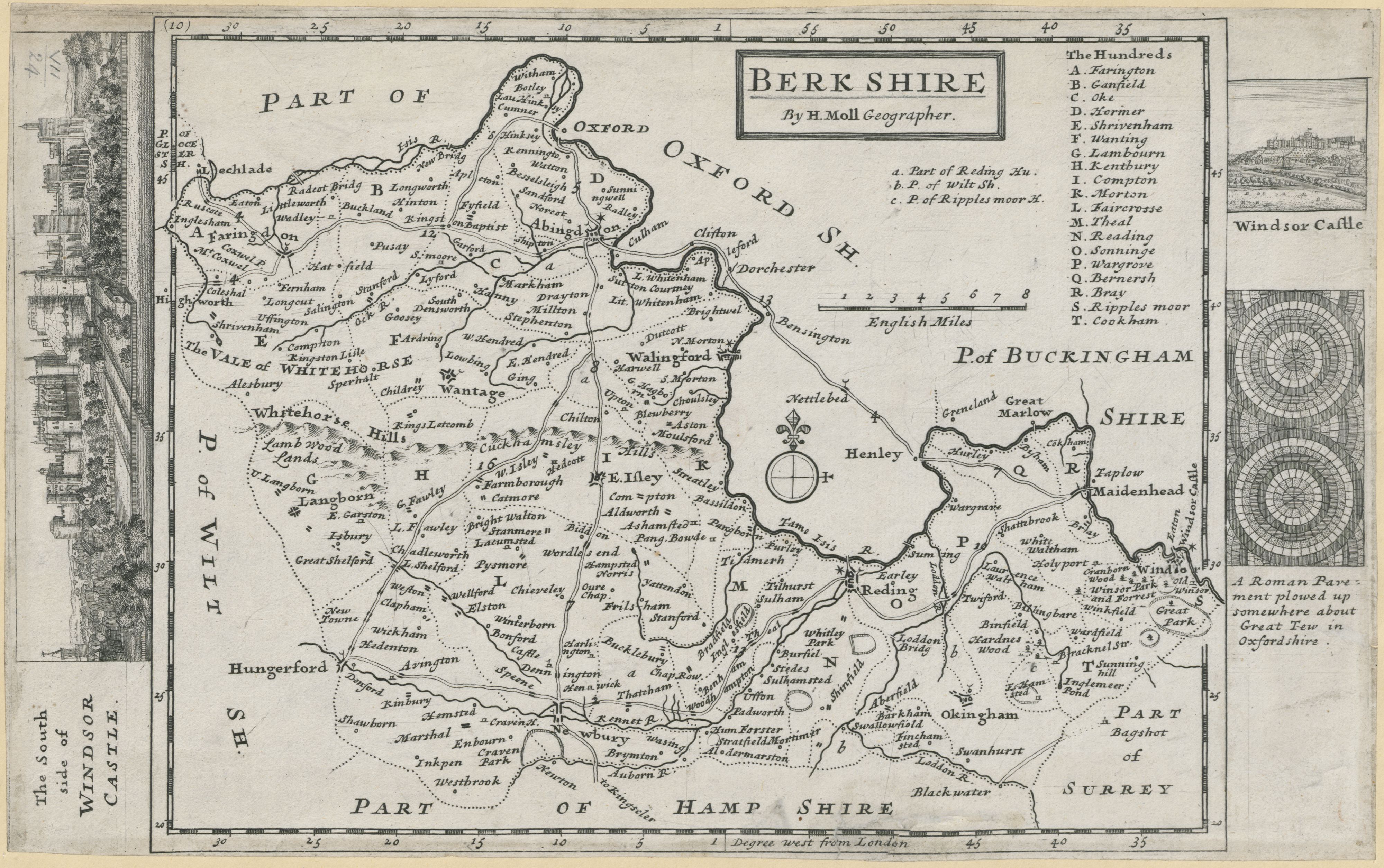
Berkshire 1724 Herman Moll
(Image courtesy of The British Library King's Collection Maps K.TOP.)
Berkshire 1742 (First State)Thomas Badeslade and William Toms in their Chorographia Britanniae (Chubb p.135 CLXXIIV
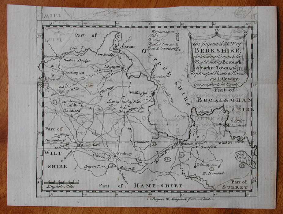
Berkshire 1744 John Cowley in R.Dodsley's Geography of England (Chubb p.139 CLXXXI)
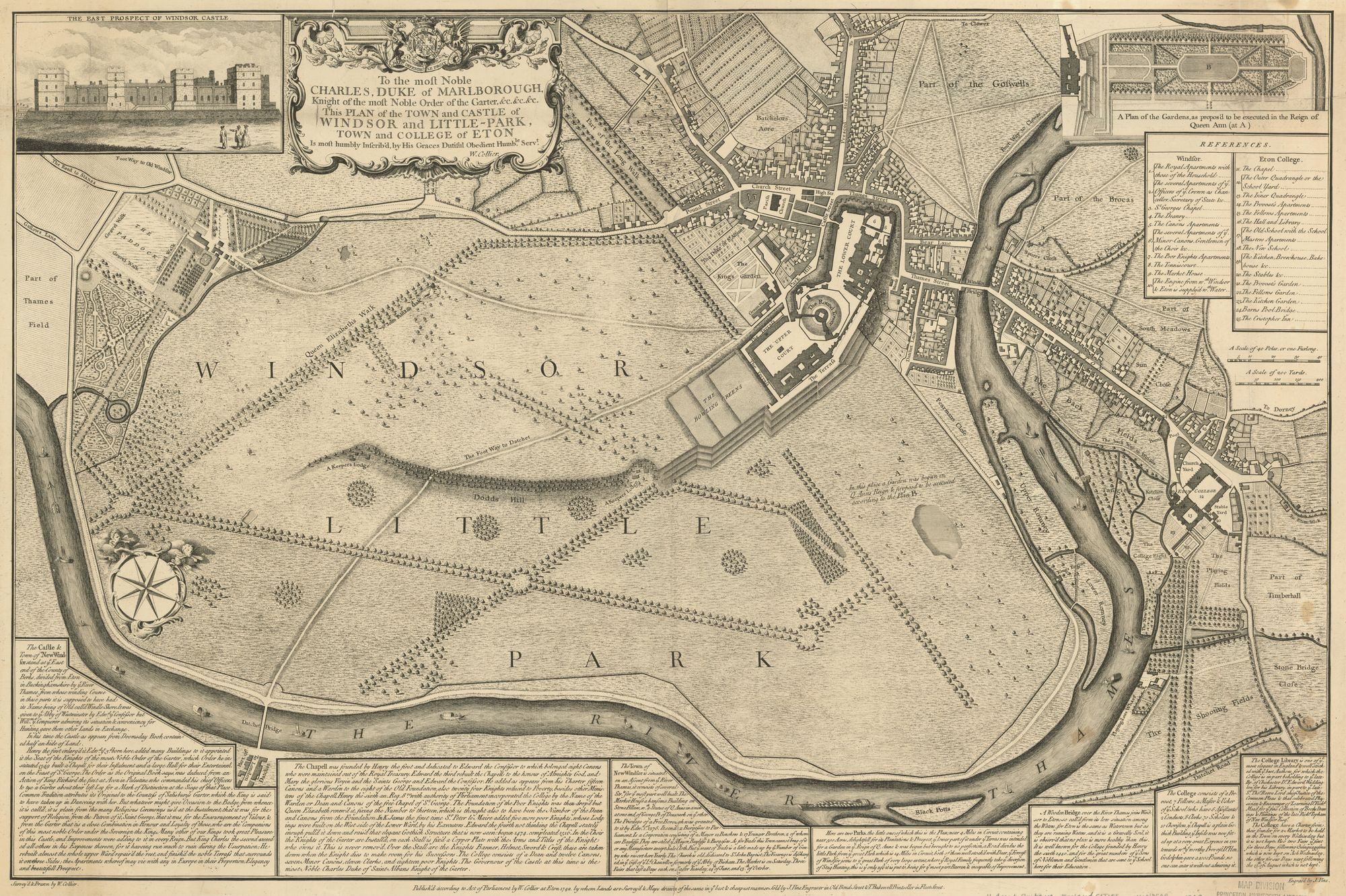
Plan of the town and castle of Windsor and Little-Park: town and college of Eton 1742 J. Pine
Berkshire 1746 Samuel Simpson in The Agreeable Historian...(Chubb p.141 CLXXXIV)
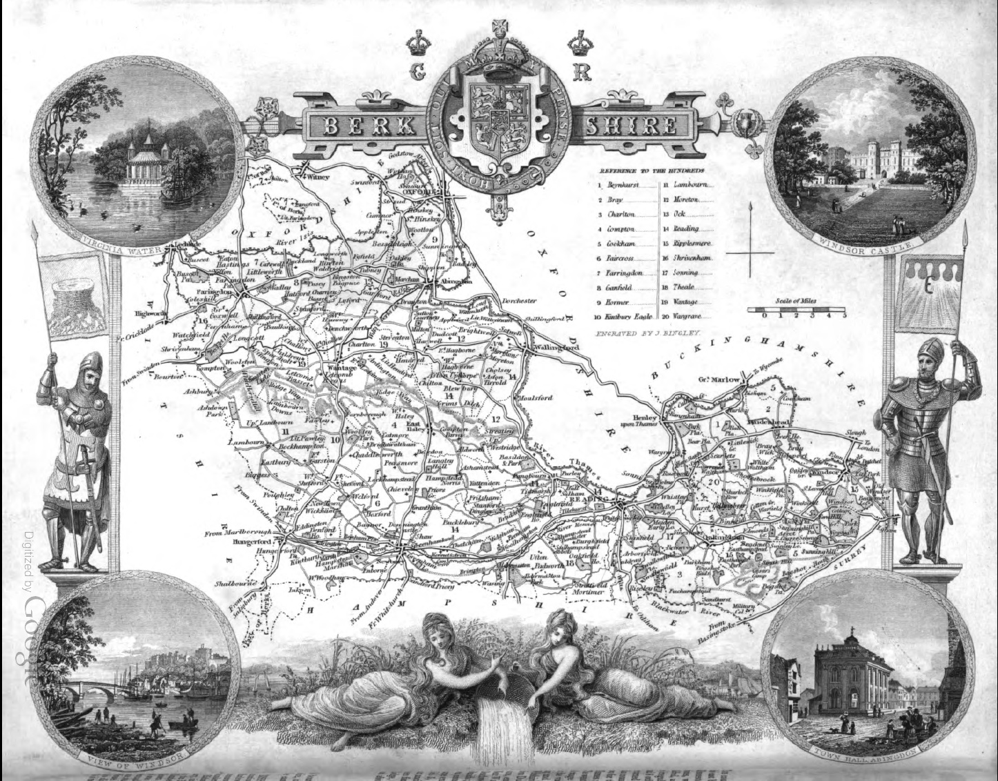
Berkshire 1749 Emanuel Bowen in The Large English Atlas Chubb p.157 CXCV)
(Image Courtesy of Biblioteca National de Espana)
Berkshire 1751 Thomas Kitchin in The London Magazine (Chubb p.144-5 CLXXXVII)
Berkshire 1752 Jean Rocque. The First Sheet of an Actual Survey of Berkshire in 18 sheets
(Image courtesy of The British Library King's Collection Maps K.TOP)
Berkshire 1756 Emanuel Bowen
(Image courtesy of The British Library King's Collection Maps K.TOP)
A Topographical Survey of the County of Berkshire 1761 Jean Rocque: Reduced from his 18 sheet Survey
(Image courtesy of The British Library King's Collection Maps K.TOP)
Berkshire 1753 Jean Rocque in The Small English Atlas (Chubb p.172 CCVII)
(Image Courtesy of Princeton Historic Map Collection)
Berkshire 1756 Emanuel Bowen (Image courtesy of The British Library King's Collection Maps K.TOP)
Berkshire 1756 Emanuel Bowen (Image courtesy of Yale University Library)
Berkshire 1769 Thomas Kitchen in England Displayed
The Thames Canal 1771 Gentleman's Magazine
Berkshire 1785 Emanuel Bowen in The Large English Atlas (5th Edition) (Chubb p.165 CXCIX)
Berkshire 1787 John Seller for Francis Grose's Antiquities of England and Wales (see also Sellar 1701)
10 Miles around Reading 1790 Thomas Pride
(Image courtesy of The British Library: King's Collection Maps K.Top.7.36.3)
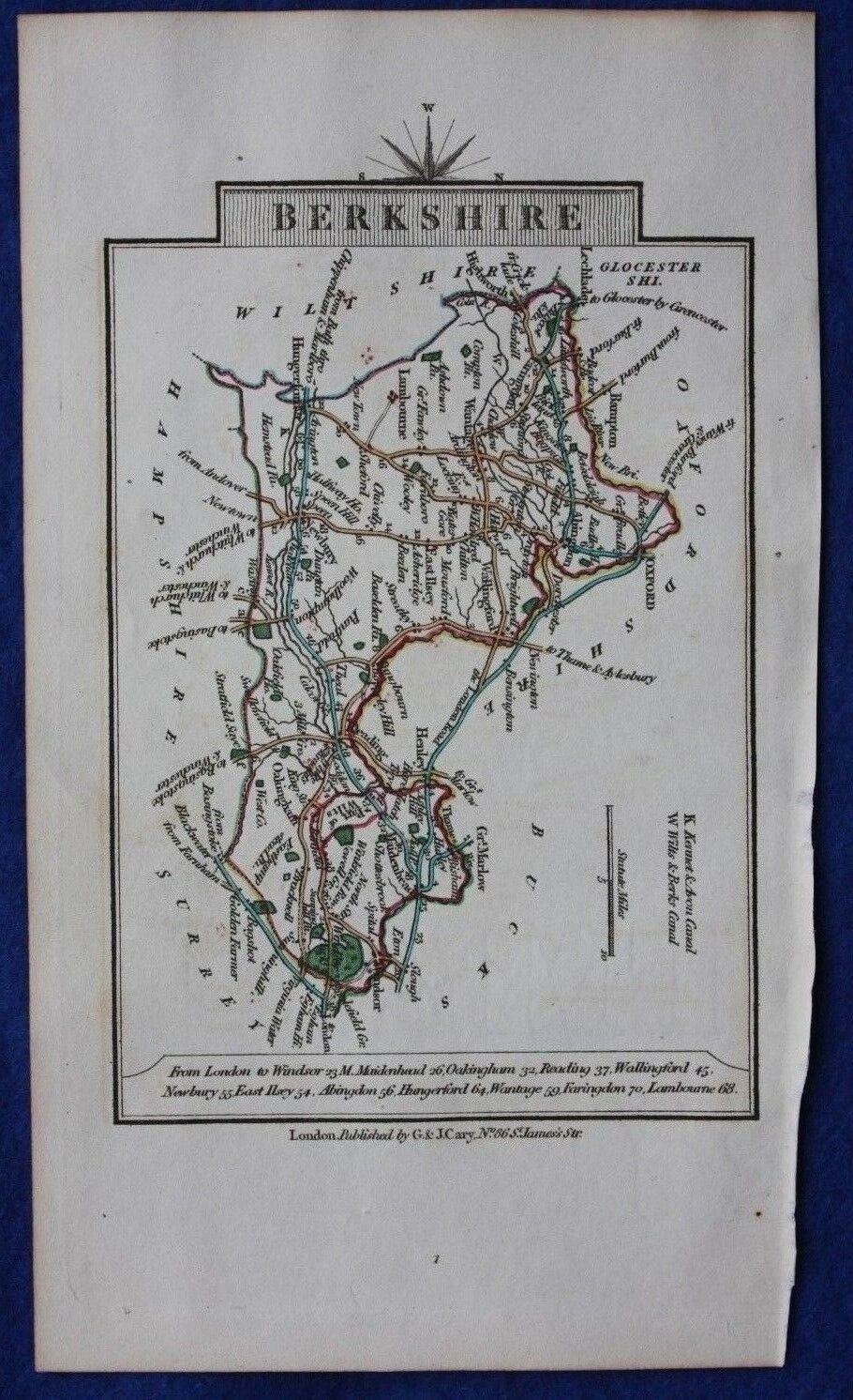
Berkshire 1790 John Cary in Cary's Travellers' Companion (Chubb p.220 CCLXXIII
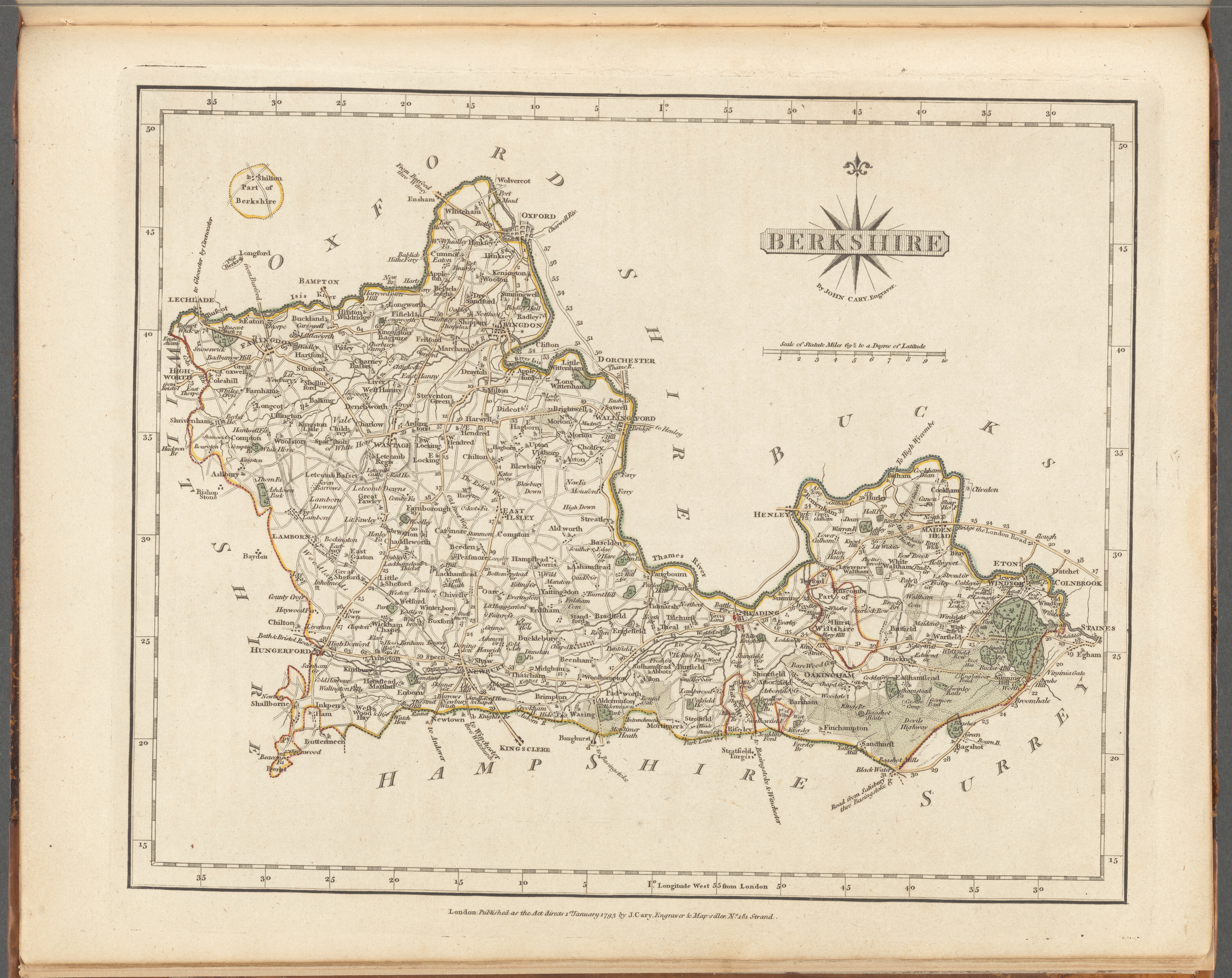
Berkshire 1793 John Cary in his New and Correct English Atlas Chubb p.213 CCLX)
(Image Courtesy of New York Library digital collections)
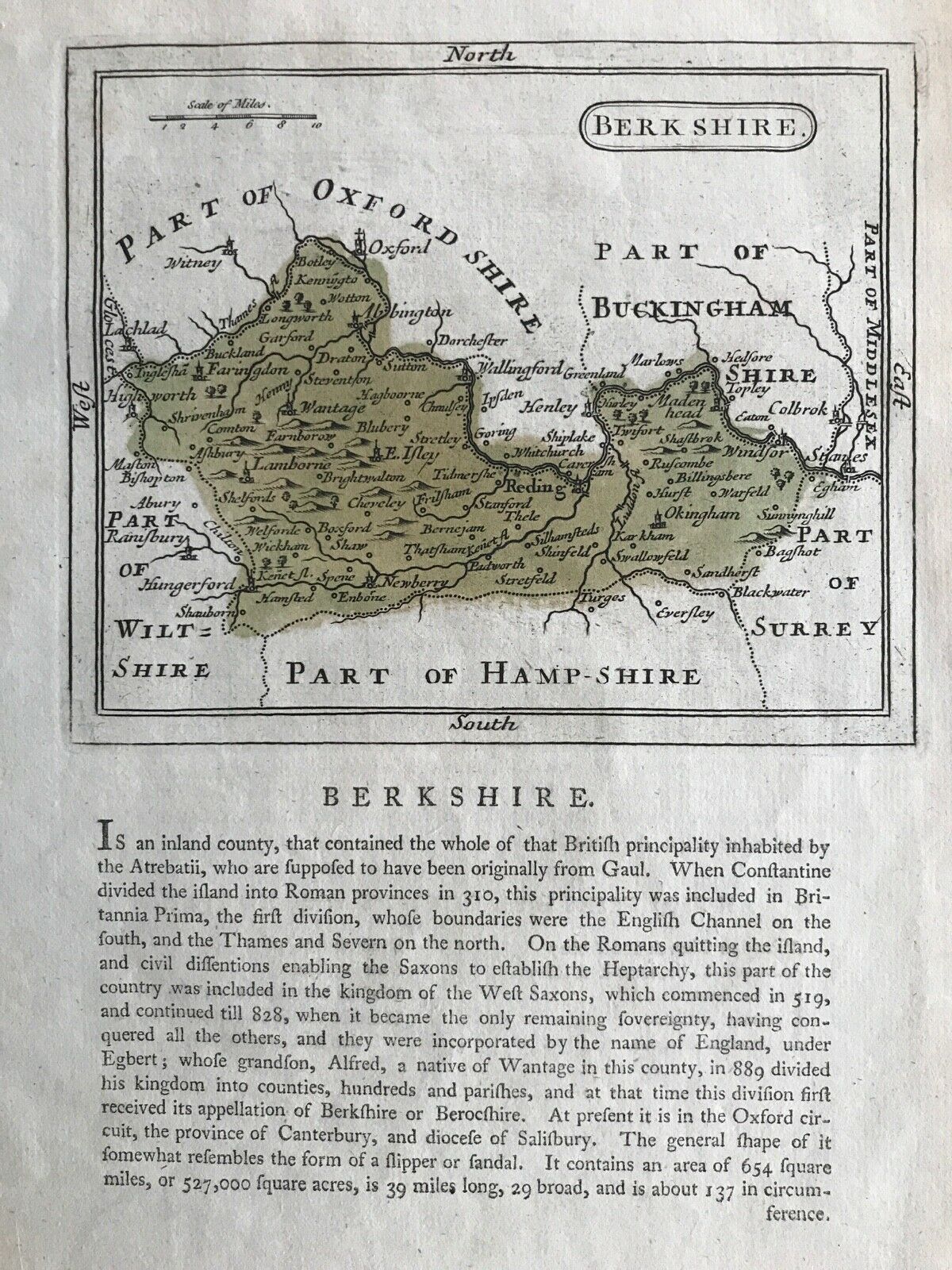
Berkshire 1803 (5th edition) John Aikin in England Delineated ( A simplified Atlas
...to make my young countrymen better acquainted than they are usually found to be with their native land)
(Chubb p.223 CCLXXXIX)
Berkshire 1804 William Green in The Picture of England
( Image courtesy of The British Library: King's Collection Maps K.Top.
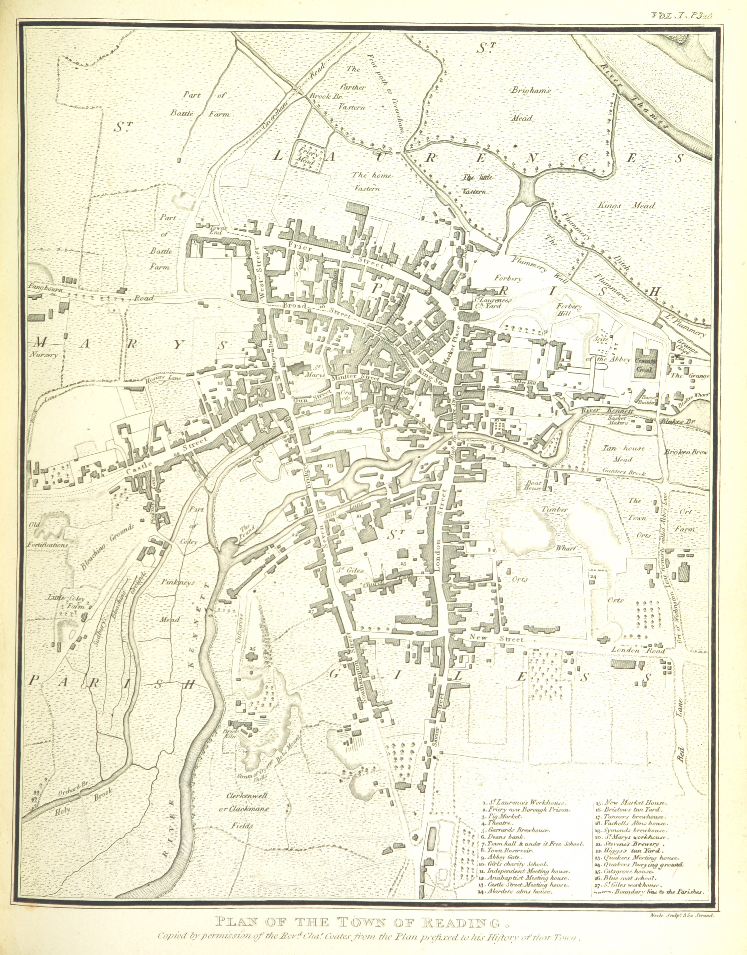
Plan of the Town of Reading 1806 Samuel Neele in Lyson's Magna Britannia
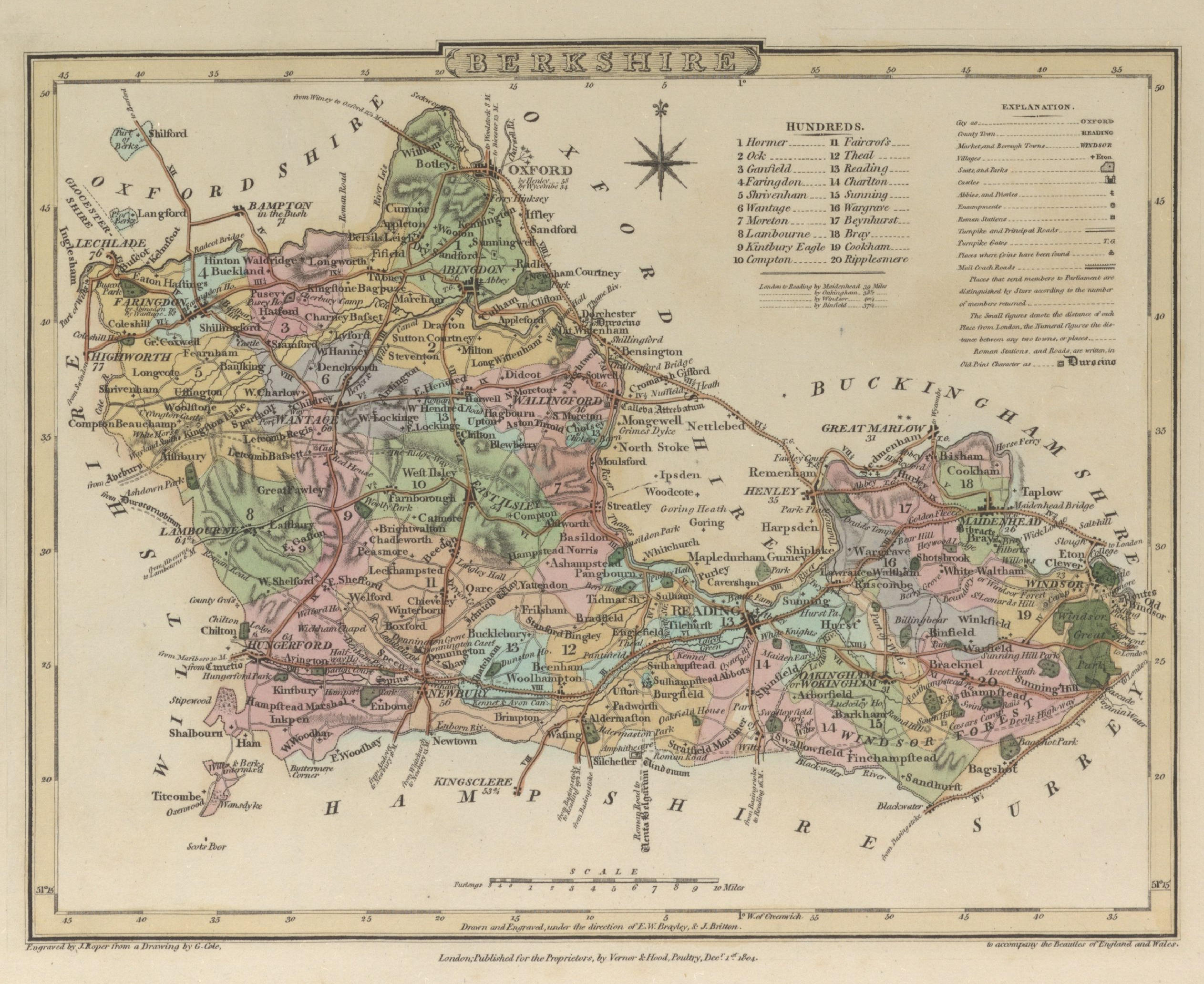
Berkshire 1804 George Cole and John Roper in their British Atlas (Chubb p.250 CCCXXXIX)
(Image courtesy of The British Library-King's Topographical Collection
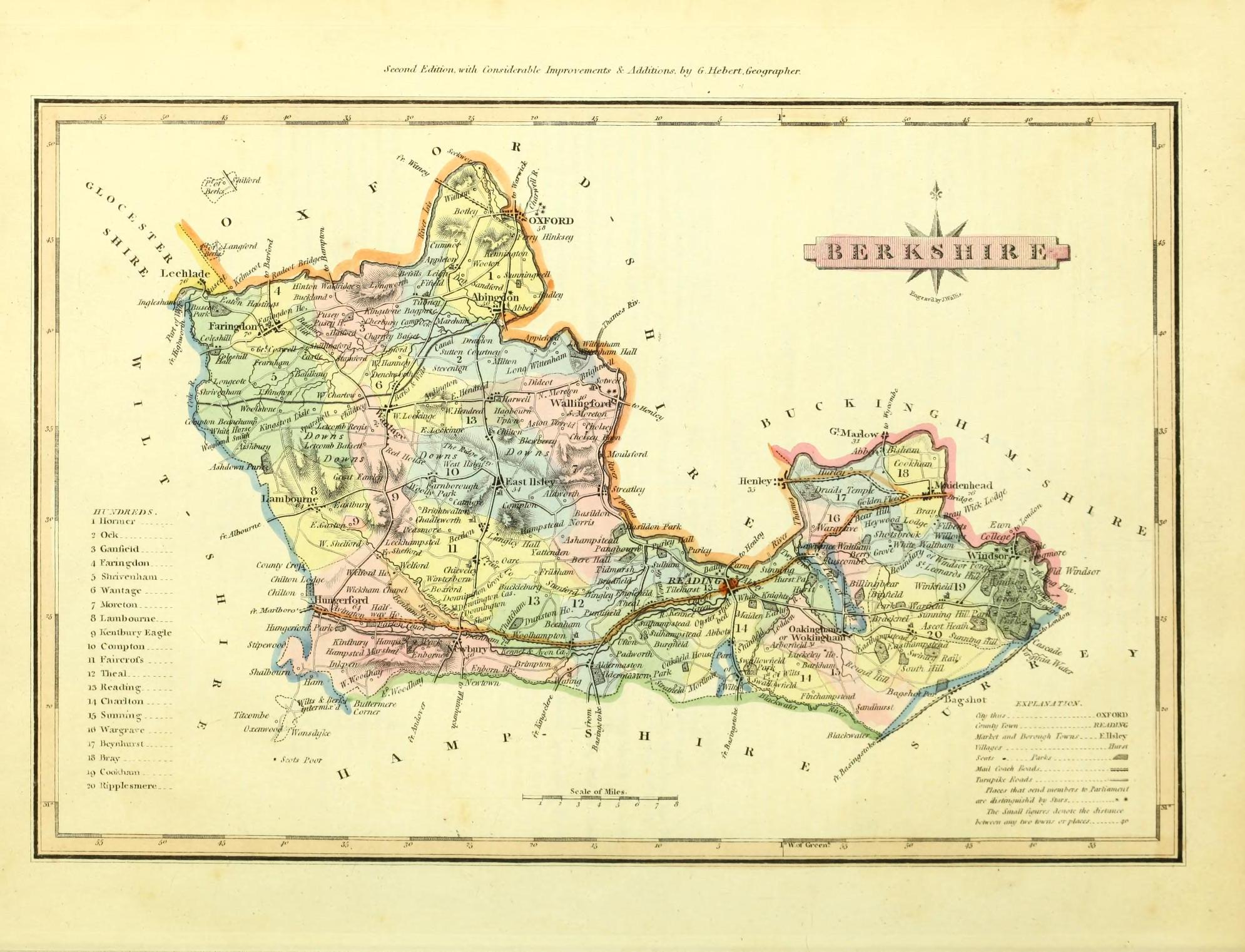
Berkshire 1809 Benjamin Pitts Capper in A Topographical Dictionary of the United Kingdom (Chubb p. 245 CCCXXVIII)
( Image courtesy of Google Books)
The Environs of Windsor 1813 James Hakewell (hand-drawn map)
Berkshire 1819 Ellis's New and Correct Atlas Chubb p.266 CCCLXIII)
Berkshire 1819 W. Lewis for Lewis's New Travellers Guide (Chubb p.267 CCCLXIV
Berkshire 1824 George Carrington Gray in Gray's New book of the Roads (Chubb p.281 CCCXCII)
Berkshire 1828 John Cary in Cary's Travellers' Companion (Chubb p.281 CCCXCII)
Berkshire 1829 C.& J Greenwood in An Atlas of the Counties of England (Chubb P.316 CCCCLVIIIa ) large file
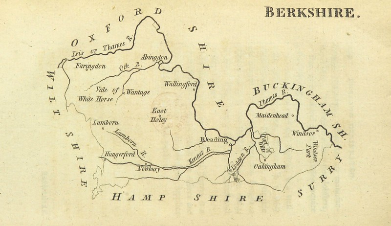
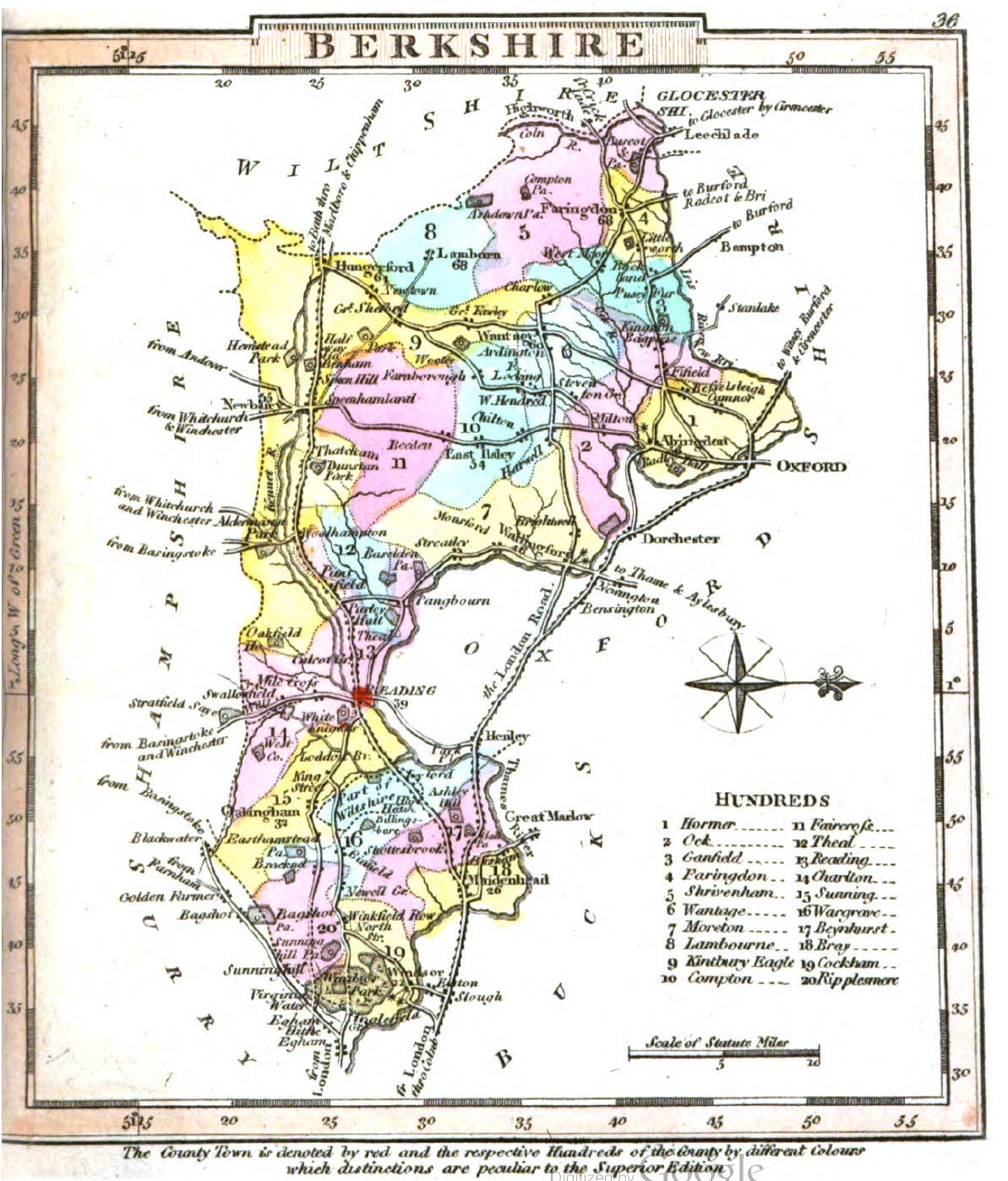
Berkshire 1832 JohnThomson
Reading 1832 Robert Kearsley Dawson for Plans of the Cities and Boroughs of England and Wales
Windsor 1832 Robert Kearsley Dawson for Plans of the Cities and Boroughs of England and Wales
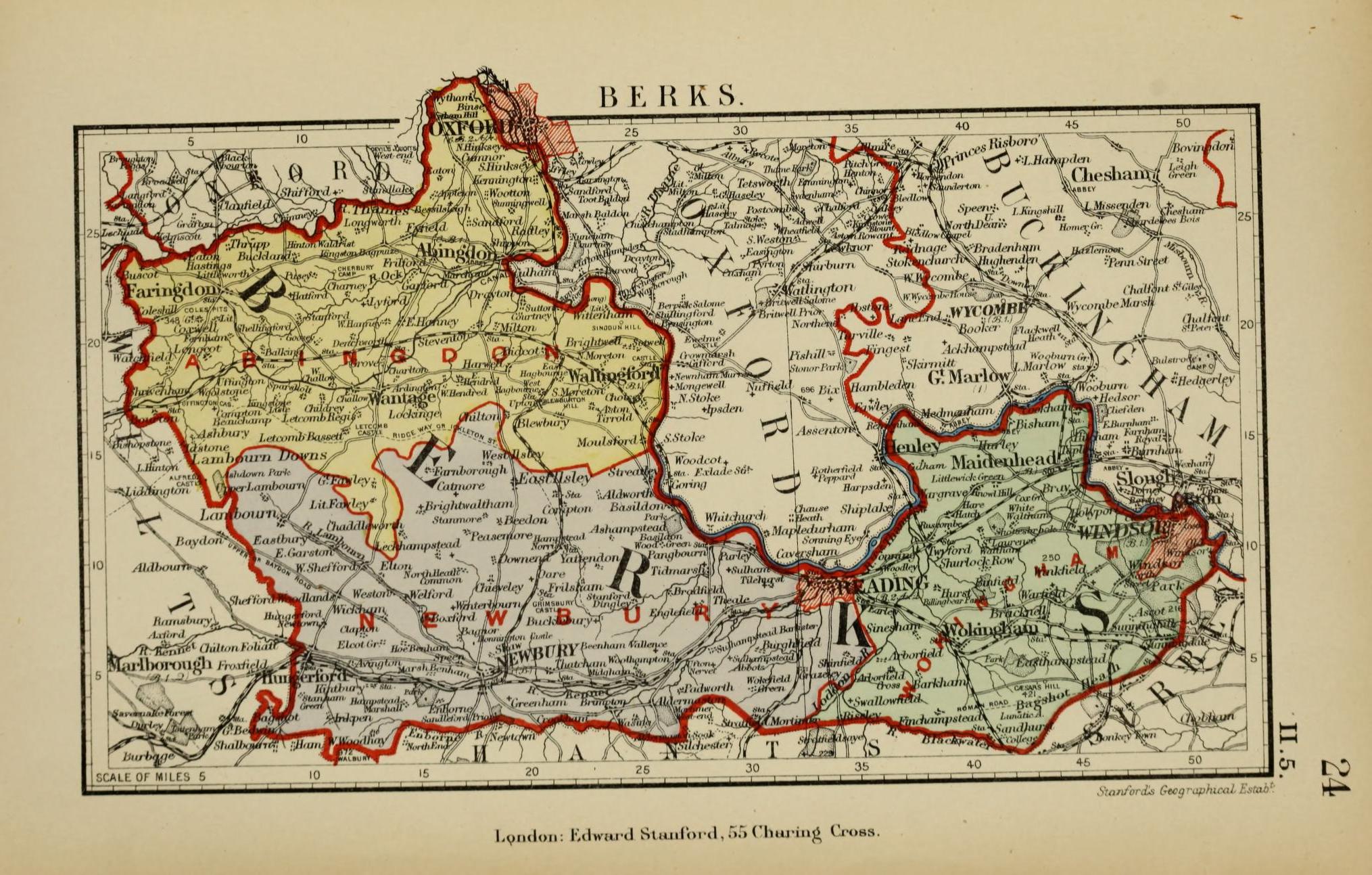
Abingdon 1835 Robert Creighton for Lewis's Topographical Dictionary (Chubb p.322 CCCCLXIV)
Berkshire 1835 Joshua Archer for Thomas Dugdale's Curiosities of England and Wales
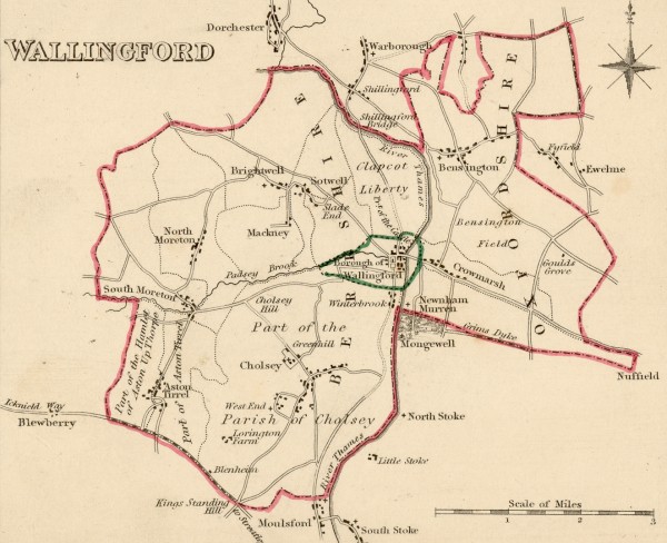
Wallingford 1835 Robert Creighton for Lewis's Topographical Dictionary (Chubb p.322 CCCCLXIV)
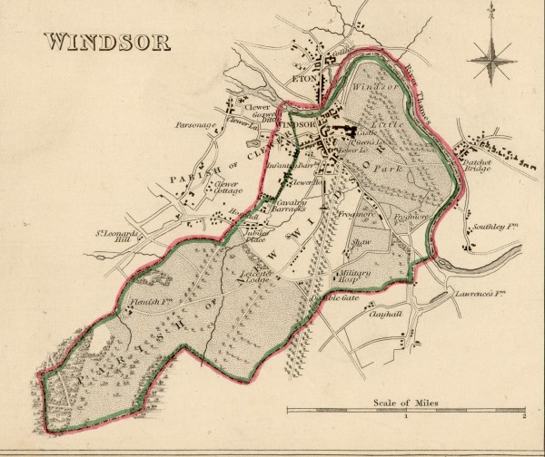
Windsor 1835 Robert Creighton for Lewis's Topographical Dictionary (Chubb p.322 CCCCLXIV)
Berkshire 1836 Samuel Hall in his New British Atlas
Berkshire 1837 Thomas Moule in The English Counties Delineated (Chubb p.325 CCCLXXI)
Berkshire 1839 J. Pigot for Pigot & Co.'s Pocket Atlas (Chubb p.325)
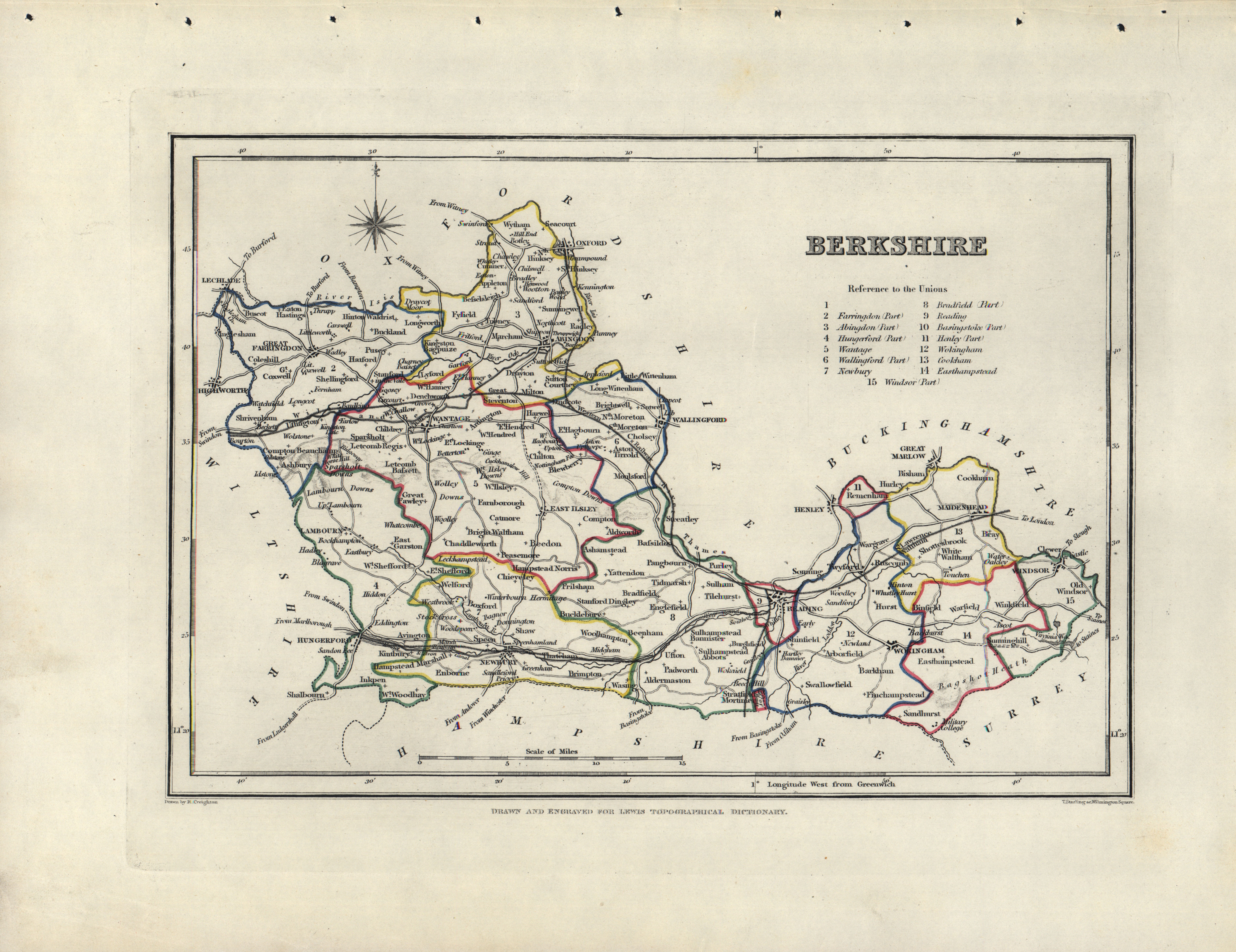
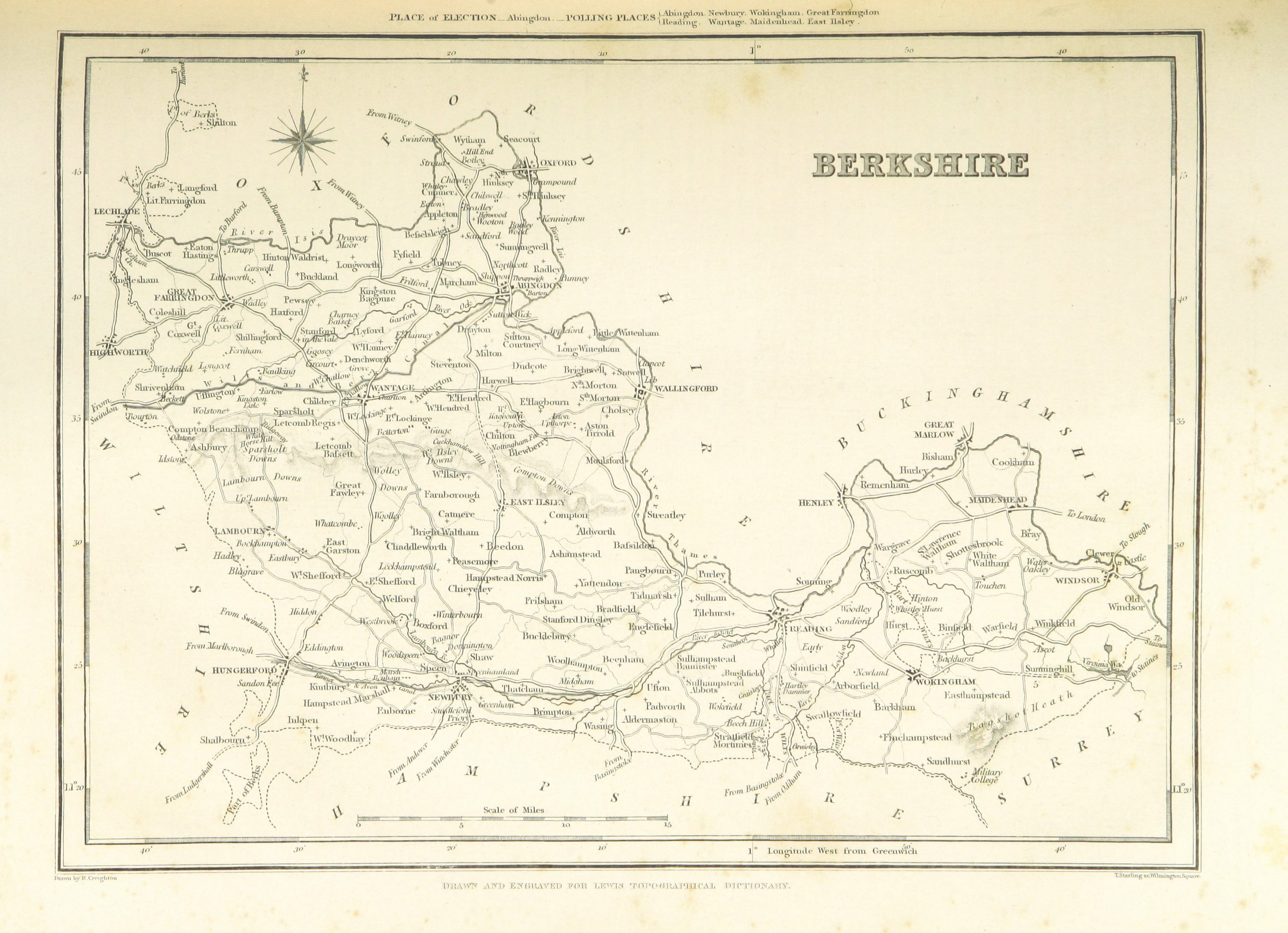
Berkshire 1848 Robert Creighton for Samuel Lewis's Topographical Dictionary of England
Berkshire 1865 Samuel Lewis in A Topographical Dictionary of England (Chubb p.322 CCCCLXIV)
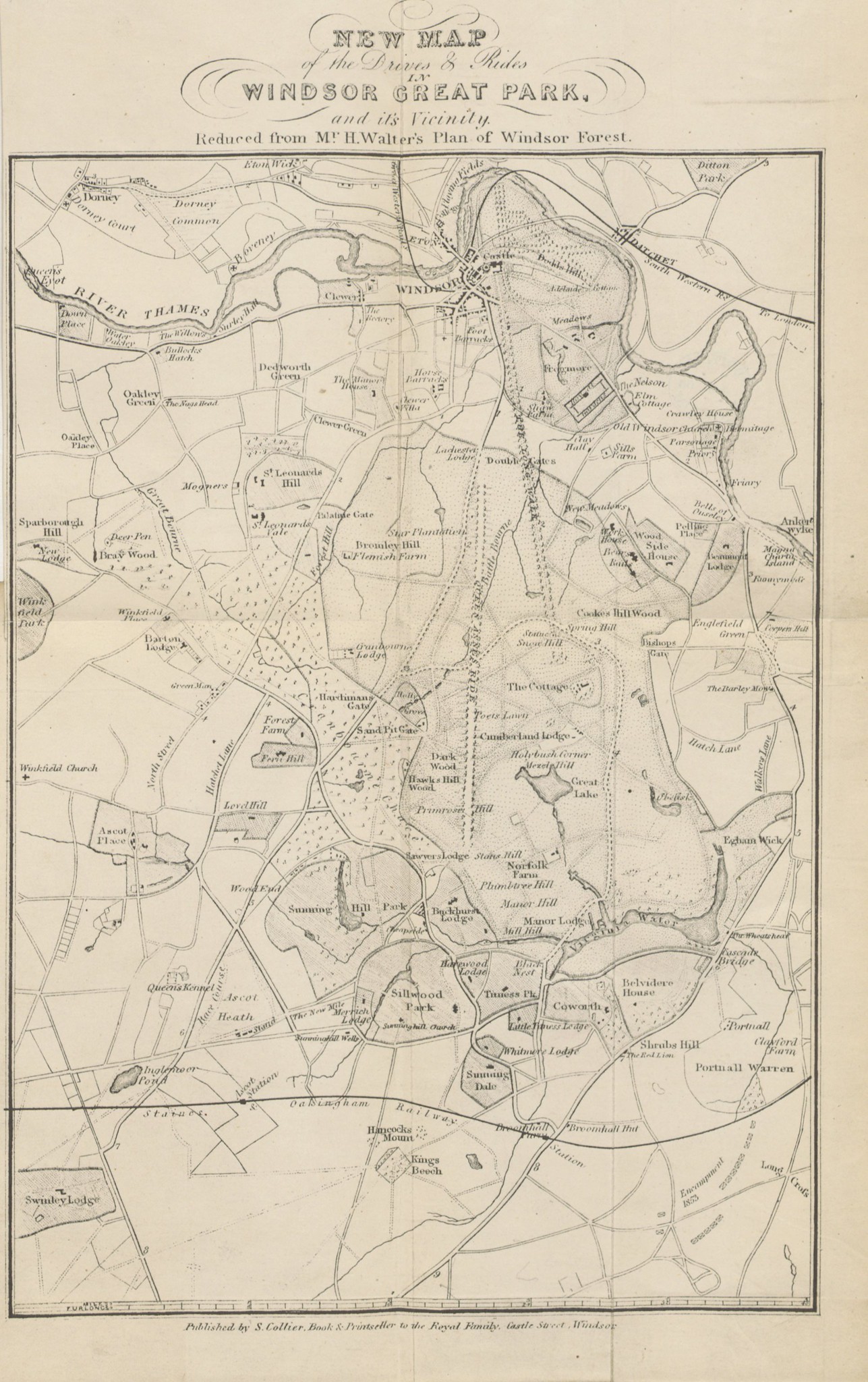
Windsor Great Park 1868 in The Royal Windsor Guide
Berkshire 1885 Stanford's Parliamentary County Atlas
Berkshire St.Peters College-Radley Bounds
(Image Courtesy of Yale University Library)
.jpg)
%20Princeton%20Historic%20Map%20Collection.jpg)
%20Princeton%20Historic%20Map%20Collection.jpg)
%20%20.jpg)
.jpg)
.jpg)
.jpg)
(Image%20Courtesy%20of%20Biblioteca%20National%20de%20%20.jpg)
%20Princeton%20Historic%20Map%20Collection.jpg)
%20.jpg)
%20.%20.jpg)
%20.jpg)
.jpg)
.jpg)
%20%20Image%20courtesy%20of%20Google%20Books%20-%20Copy.jpg)
.jpg)
.jpg)
%201832%20Robert%20Kearsley%20Dawson%20for%20Plans%20of%20the%20Cities%20and%20Boroughs%20of%20England%20and%20Wales.png)
.jpg)