 Resources
consulted for Cambridgeshire:
A Bibliography of County Maps - Large Scale County Maps of England. Tooley R.V. The Printed Maps in the Atlases of Great Britain and Ireland1579-1870 Chubb Thomas Dawson 1927 |
 To resize image:
hold CTRL and use mouse scroll-wheel |
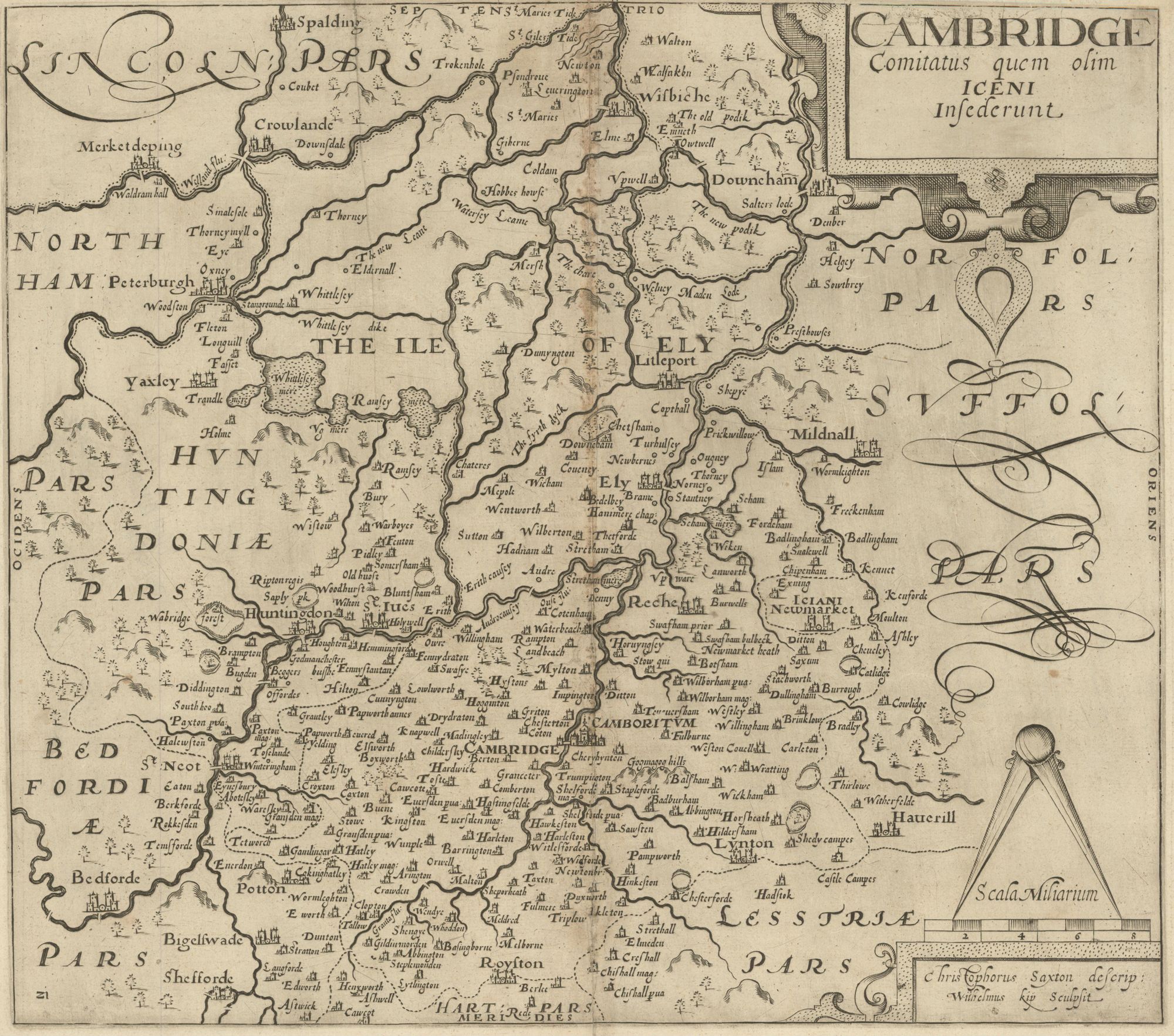
Cambridgeshire 1579 Christopher Saxton (Chubb p.3) (Image courtesy of Stephen S. Clark Library: University of Michigan Library)
Cambridge 1574 Richard Lyne (Image Courtesy of Cambridge University Library
Cantebrigia 1575 Georg Braun and Remigius Hogenberg (1772 reproduction)
Cambridge 1581 Georg Braun and Remegius Hogenberg (Princeton Historic Map Collection)
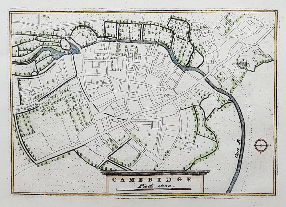
Cambridge 1600 Piedi reproduced by Vincento Coronelli in 1720
Fennes 1603 Hendric Hondius (Image courtesy of the Clark Library: University of Michigan )
Cambridgeshire 1605 Pieter van den Keere in his British Atlas (Chubb LX)
Cambridge 1607 William Kip after Christopher Saxton
Cambridge 1610 John Speed in The Theatre of The Empire of Great Britaine (Chubb p.23 XXII) (Image courtesy of Harvard University Library)
Cambridge shire 1617 (Chubb p.15) Pieter van den Keere
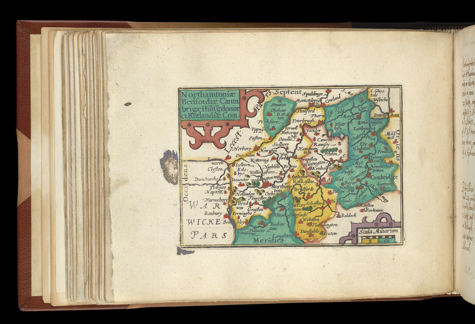
Cambridgeshire 1626 John Bill in The Abridgement of Camden's Britannia (Chubb p.51 XLI)
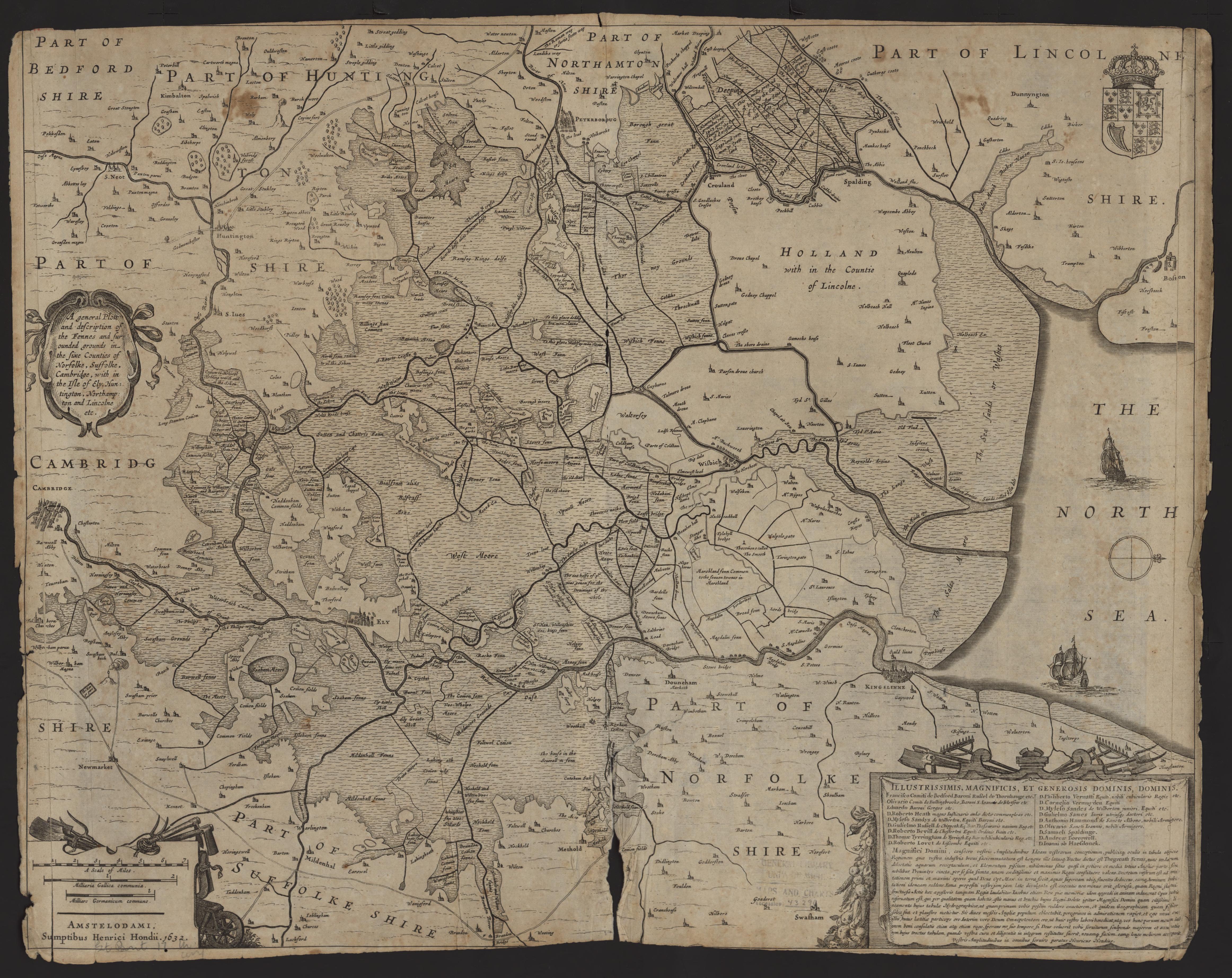
The Fens 1632 Henrici Hondii
Cambridgeshire 1646 Jan Jansson in his Atlas Novus (Image courtesy of The British Library
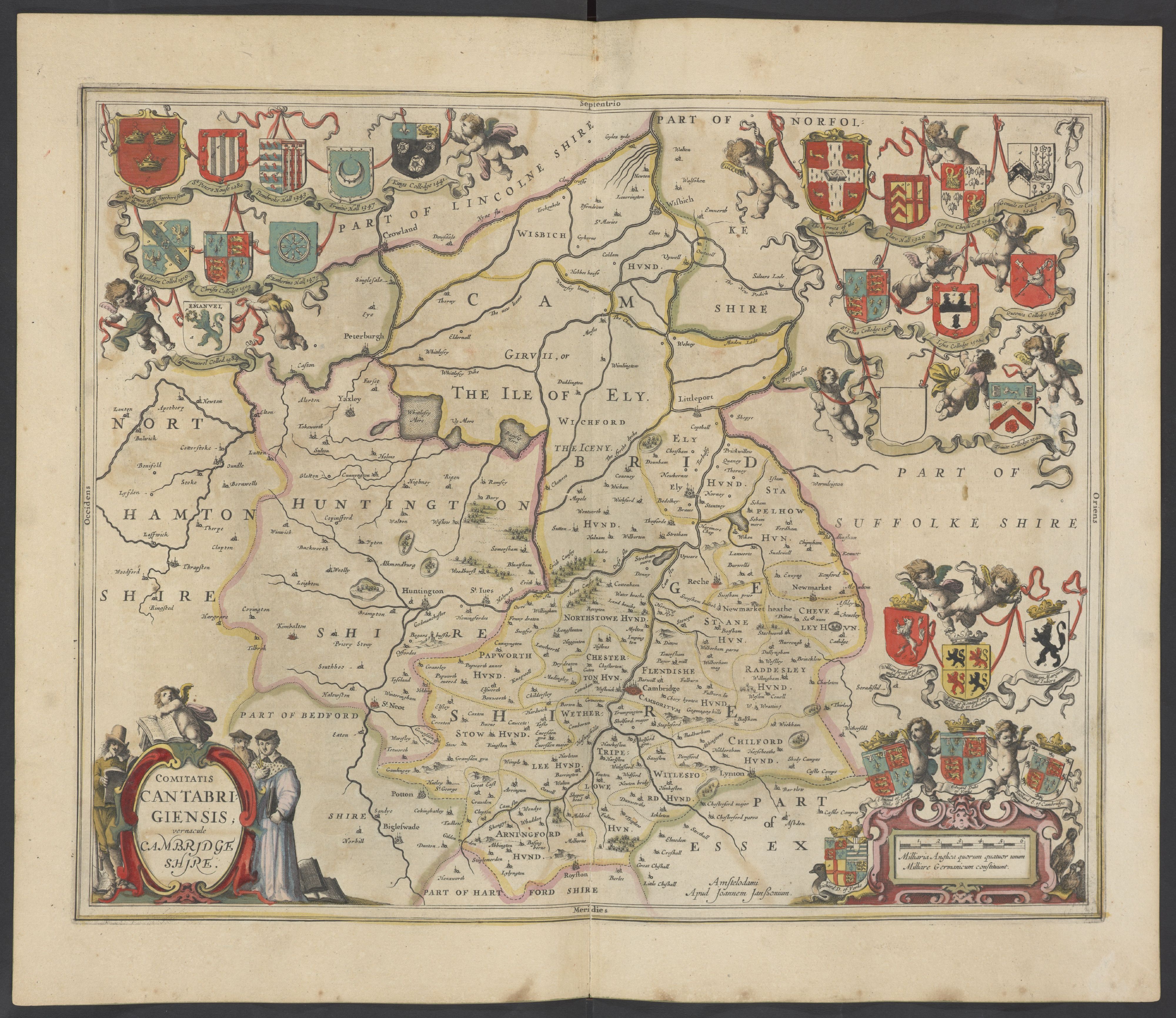
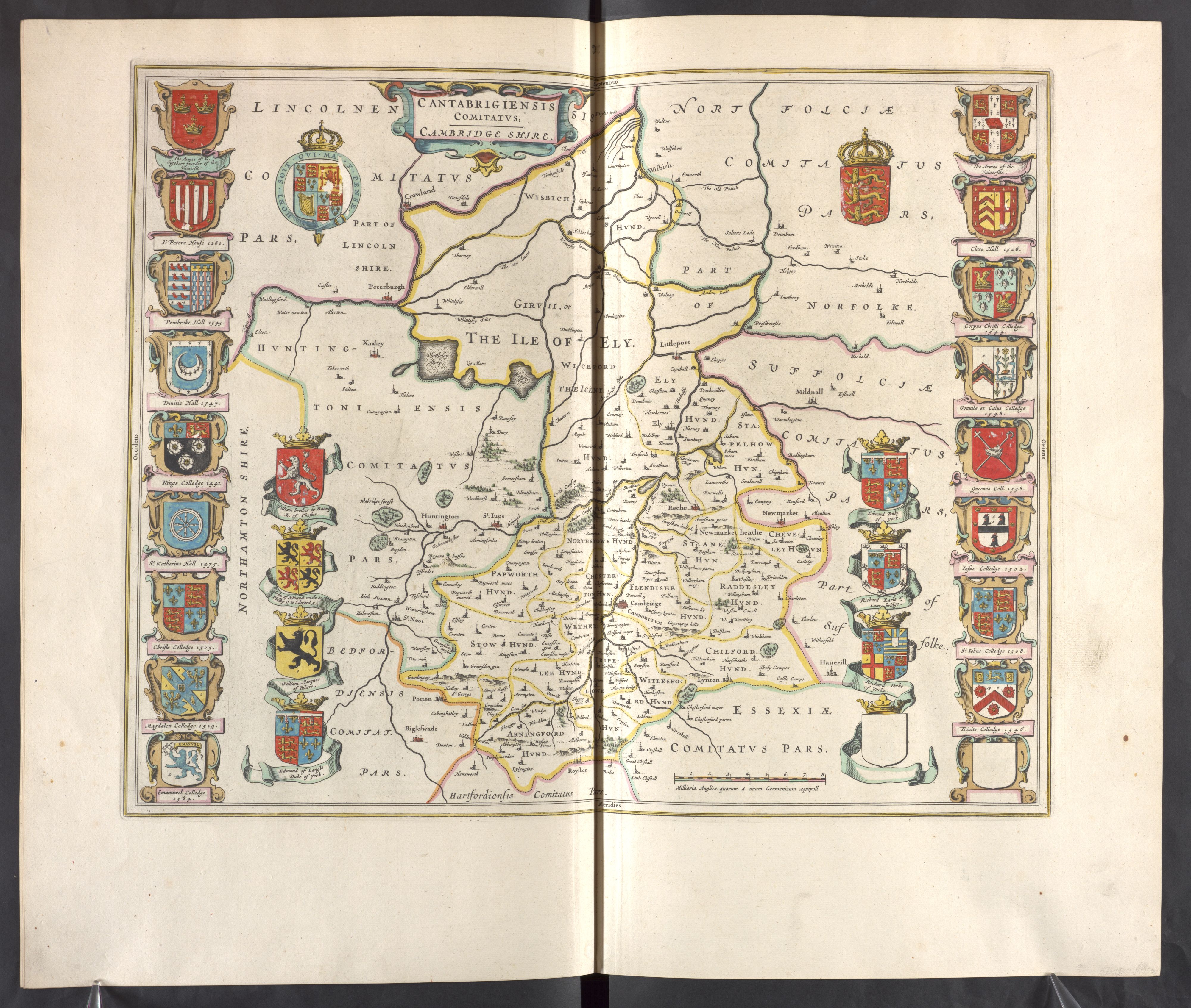
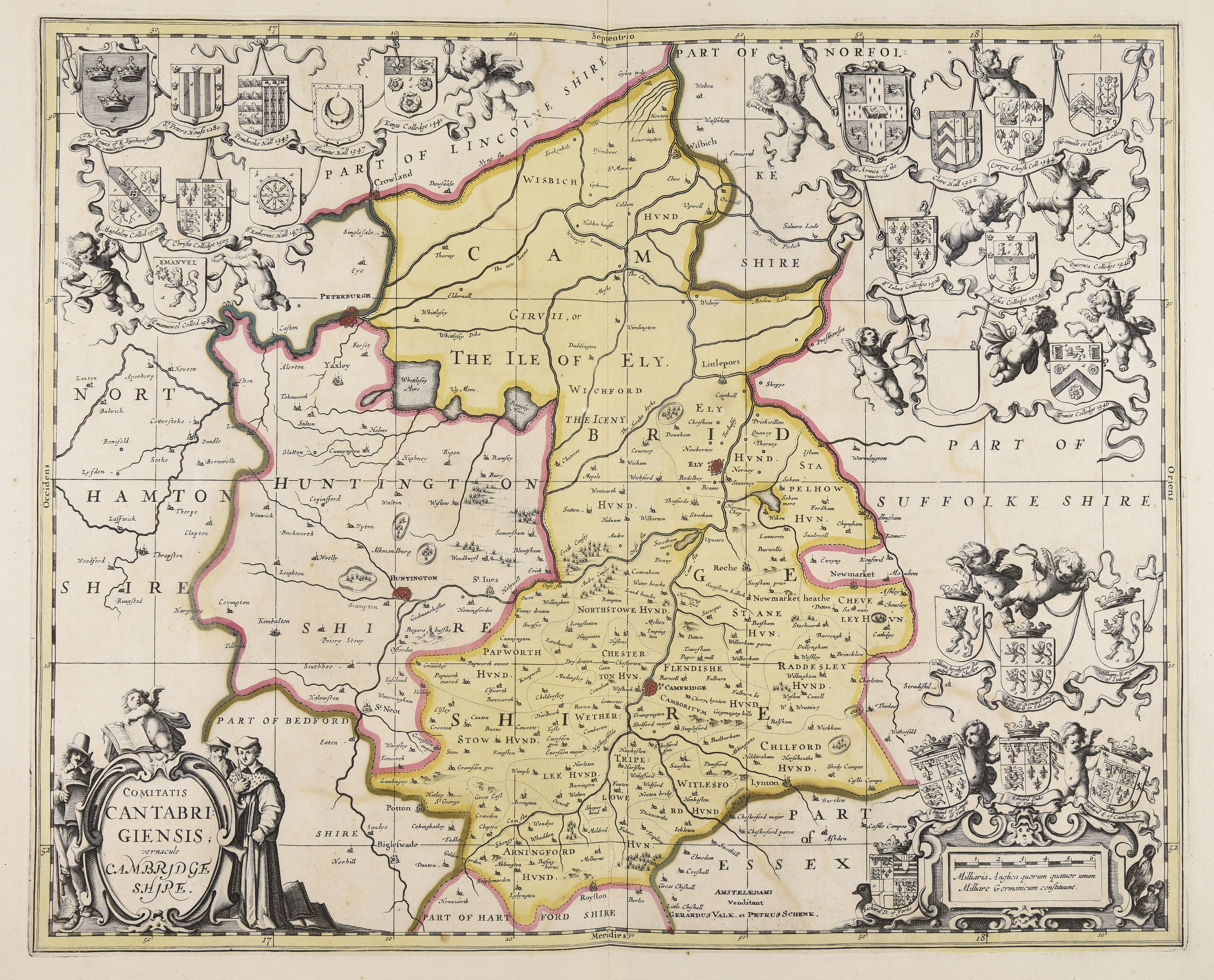
Cantabrigiensis Comitatus 1667 (Chubb p.57 LIX) Joan Blaeu in Atlas Major (Image courtesy of Wikimedia)
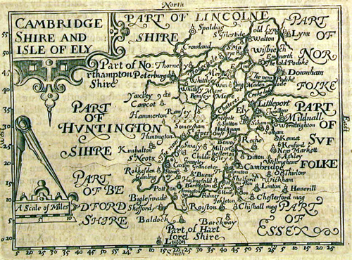
Cambridge 1667 Pieter van den Keere (Chubb p.77 XCIII)
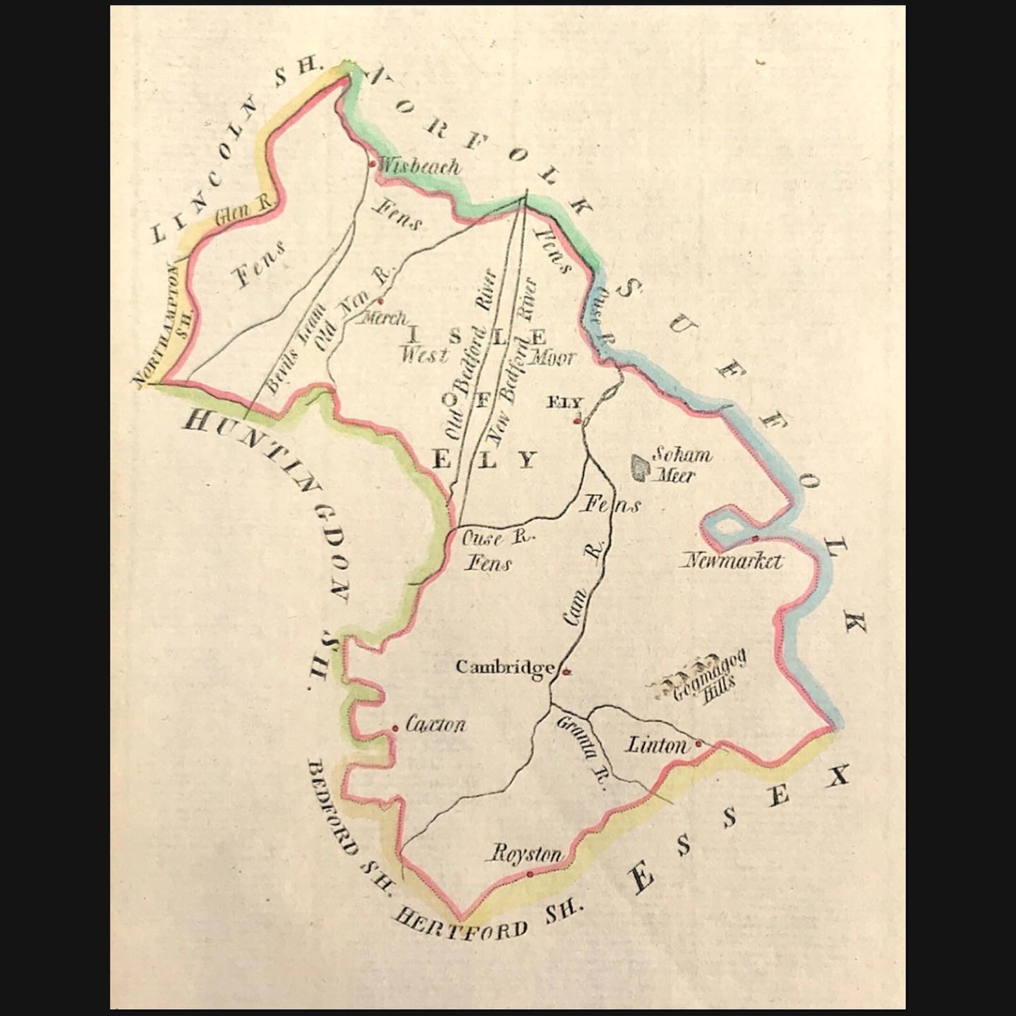
Cambridgeshire 1662 John Speed in A Prospect of the Most Famous Parts of the World (Roger Rea Edition) (Image courtesy of The British Library King's Collection Maps K.Top.)
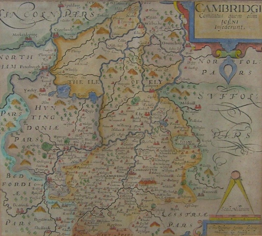
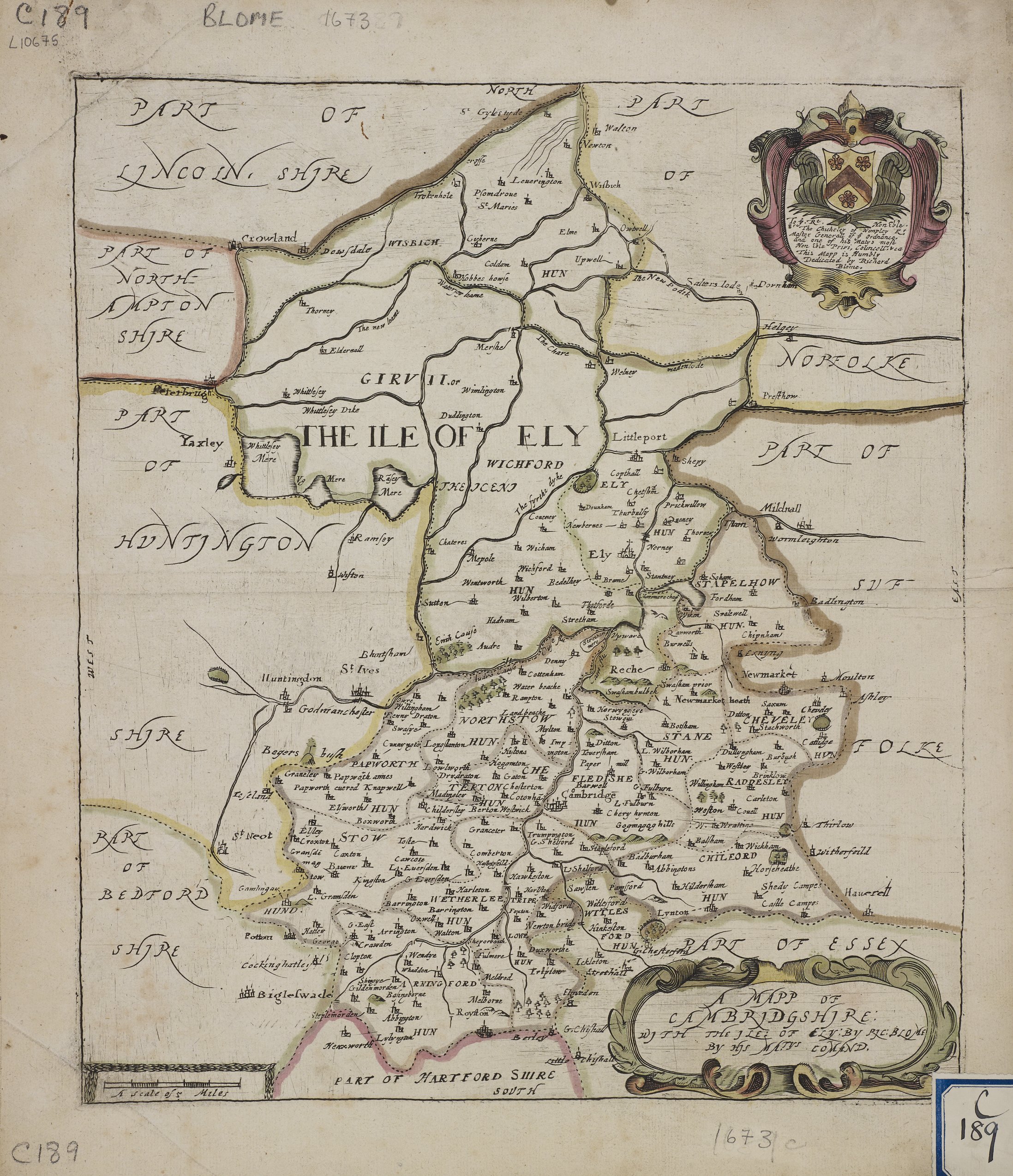
A Map of Cambridge with the Isle of Ely 1673 Richard Blome in his Britannia (Chubb p.81 XCIX) (Image Courtesy of Manchester University Library)
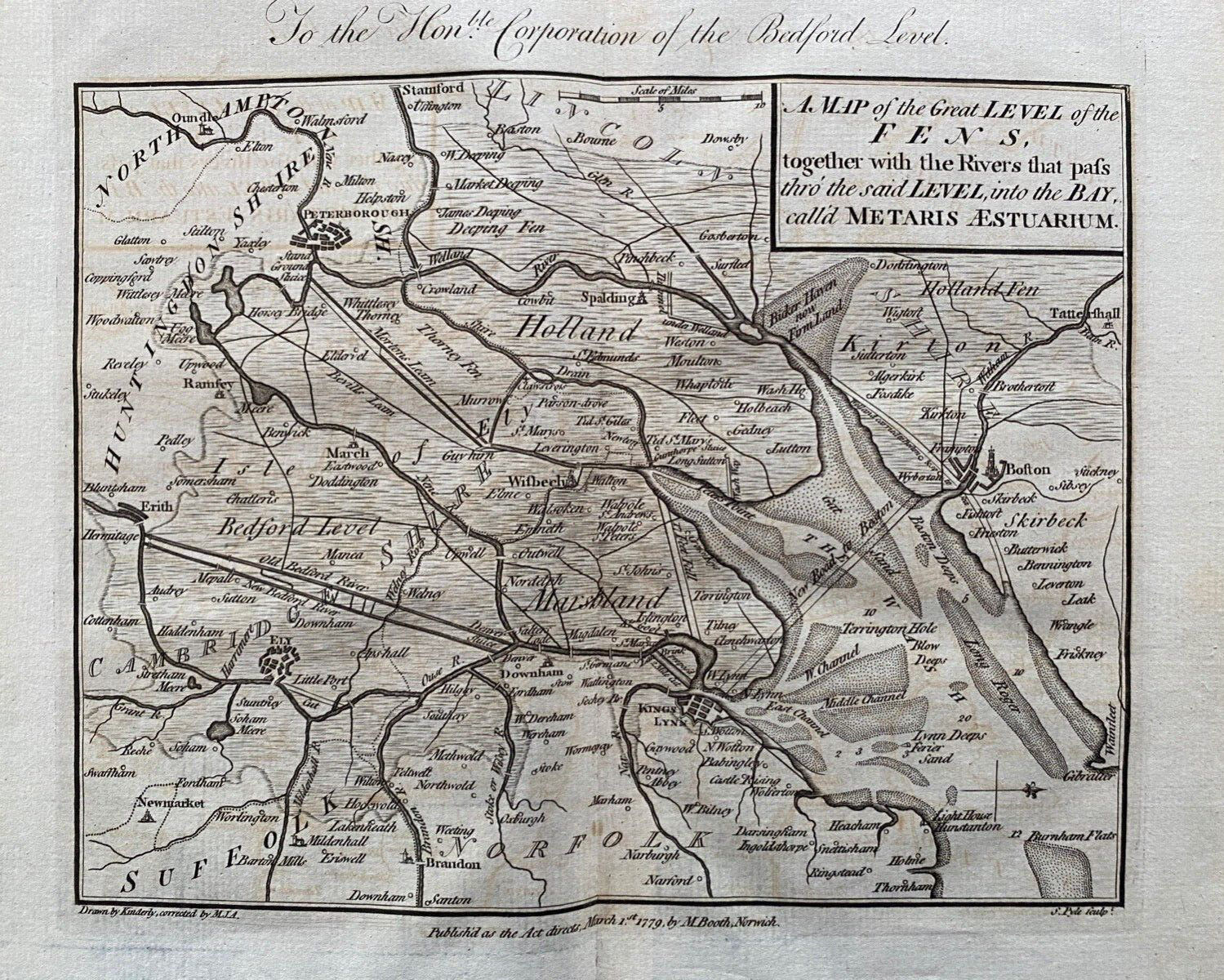
Cambridge A Map of the Great Level of the Fens 1779 M. Booth
Cambridgeshire 1680 John Seller in Britannia Contracta. The same plates also used for Camden's Britannia Abridg'd (1701) (Chubb p.89 CVII0) and A History of England (1703 ) (Chubb p.91-p.99) and lastly for Francis Grose's Antiquities... (with Seller's name removed.)
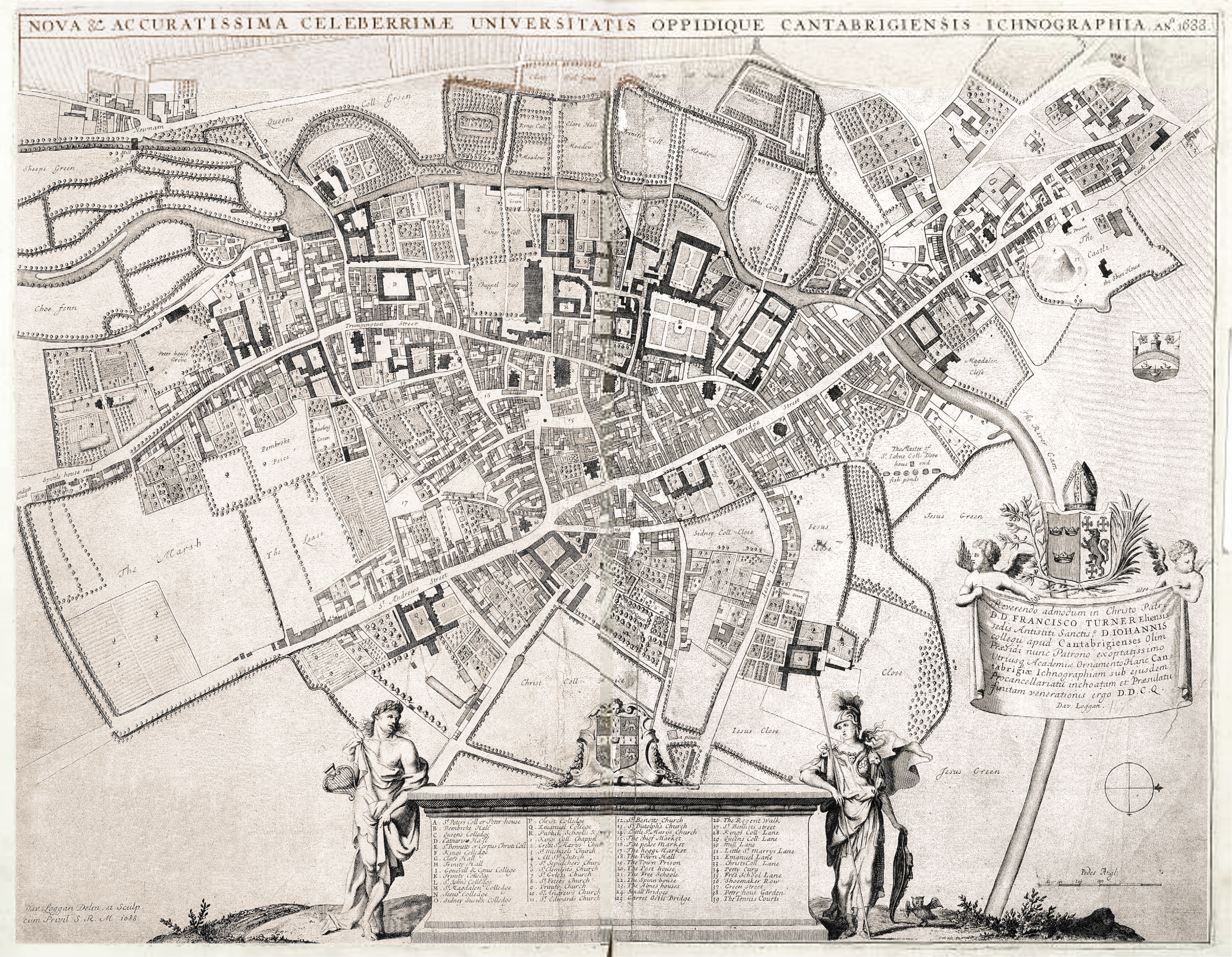
Plan of Cambridge 1690 by David Loggan
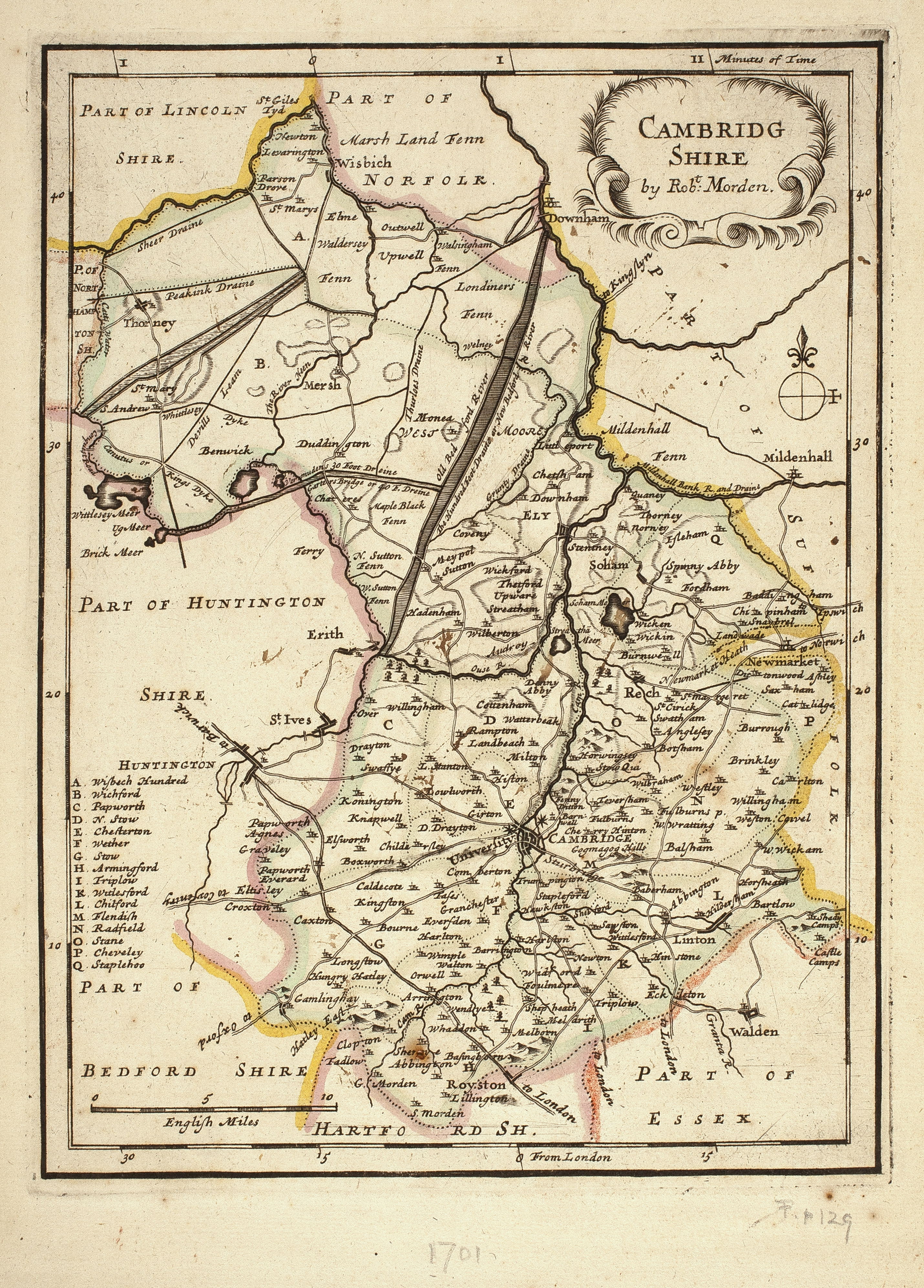
Cambridgeshire 1695 Robert Morden for Camden's Britannia (image Courtesy of the British Library)
Cambridgeshire 1701 reprinted 1720. Robt Morden: in The New Description and State of England (Chubb p.100 CXXIV)
Cambridge_Shire 1715 Shenk and Valk in Atlas Anglois (After Jan Jansson)
(Chubb p.74 LXXXIX)
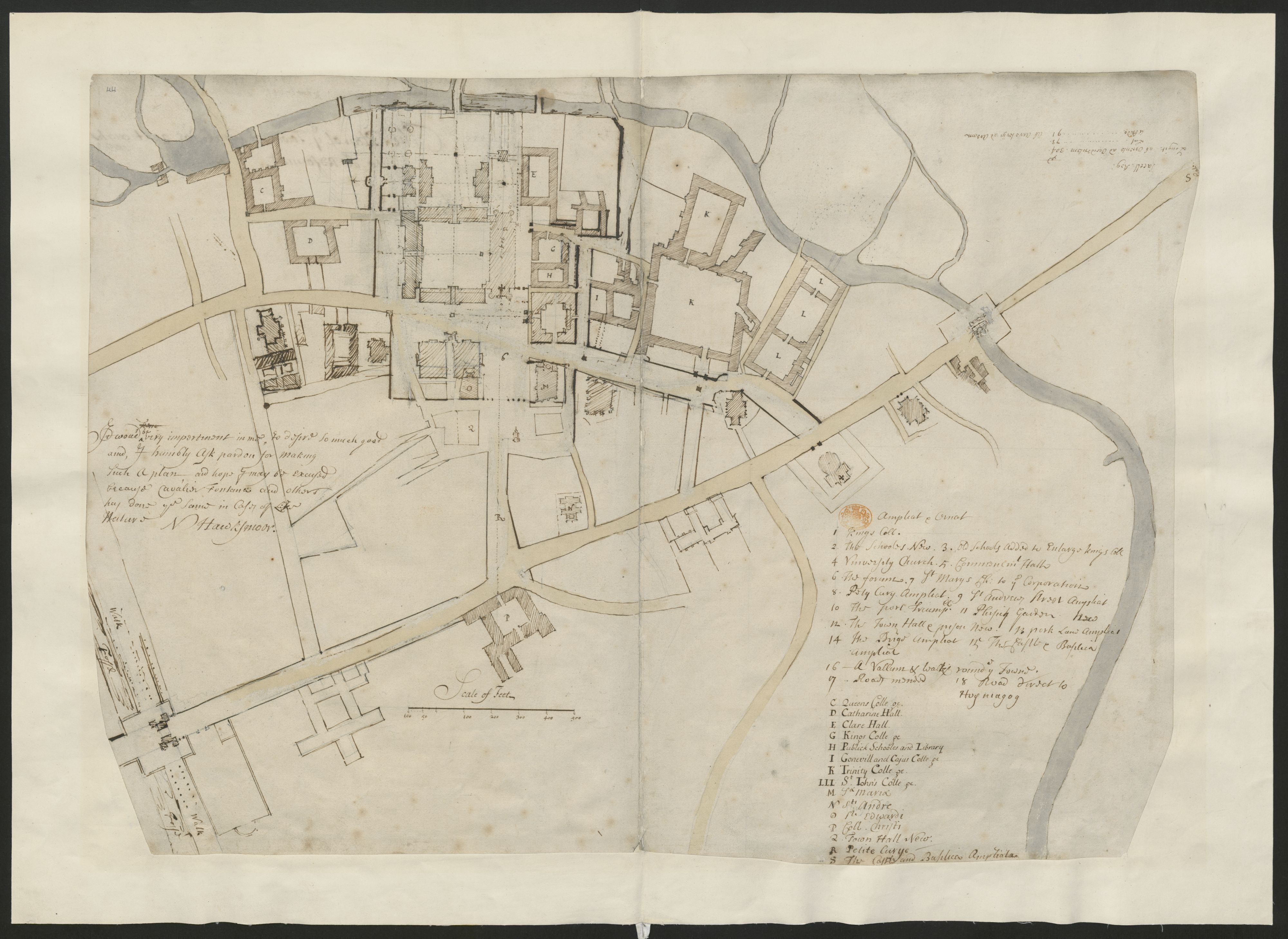
Plan of Cambridge 1720-1730 N. Hawksmoor (Image courtesy of The British Library: King's Collection Maps K.TOP
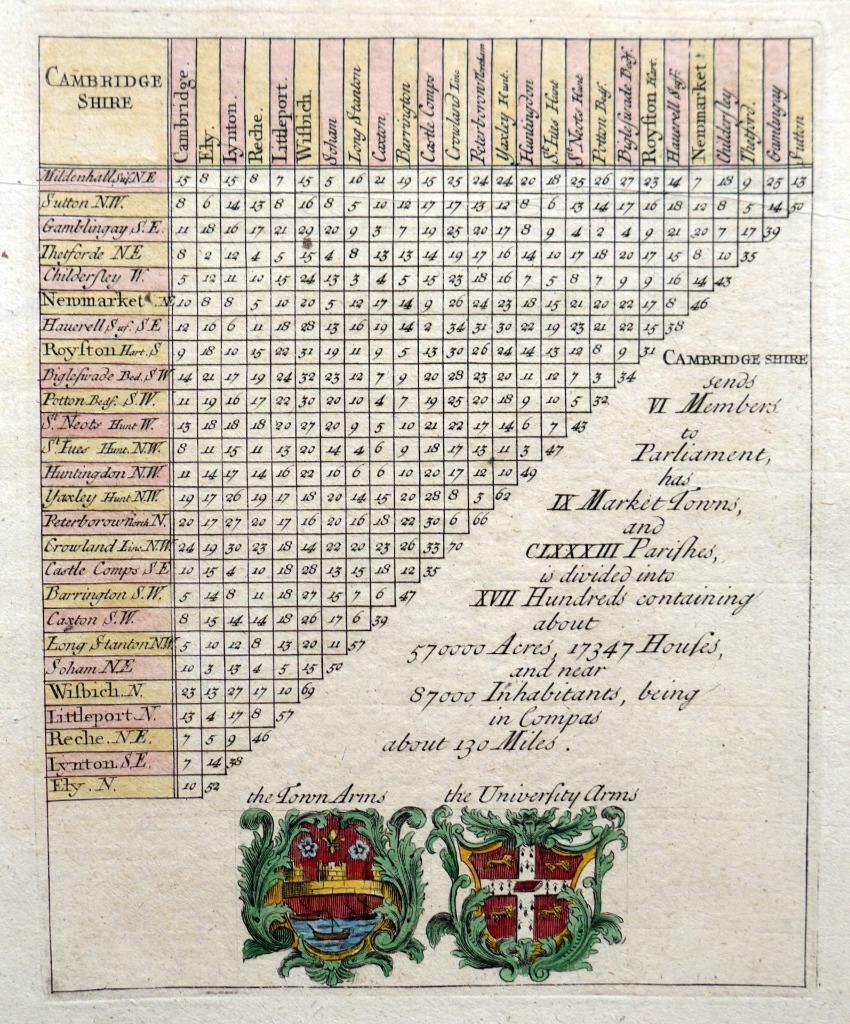
Cambridge Distance Chart 1720 Matthew Symons and Jacob van Langeren
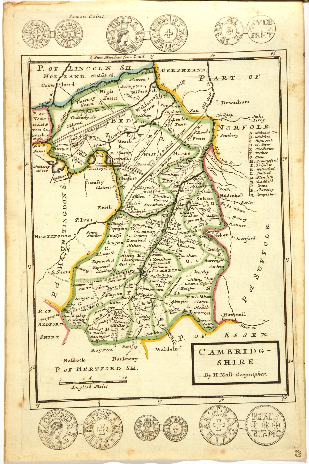
Cambridgeshire 1724 Herman Moll in A New Description of England and Wales (Chubb CLX: CLXI)
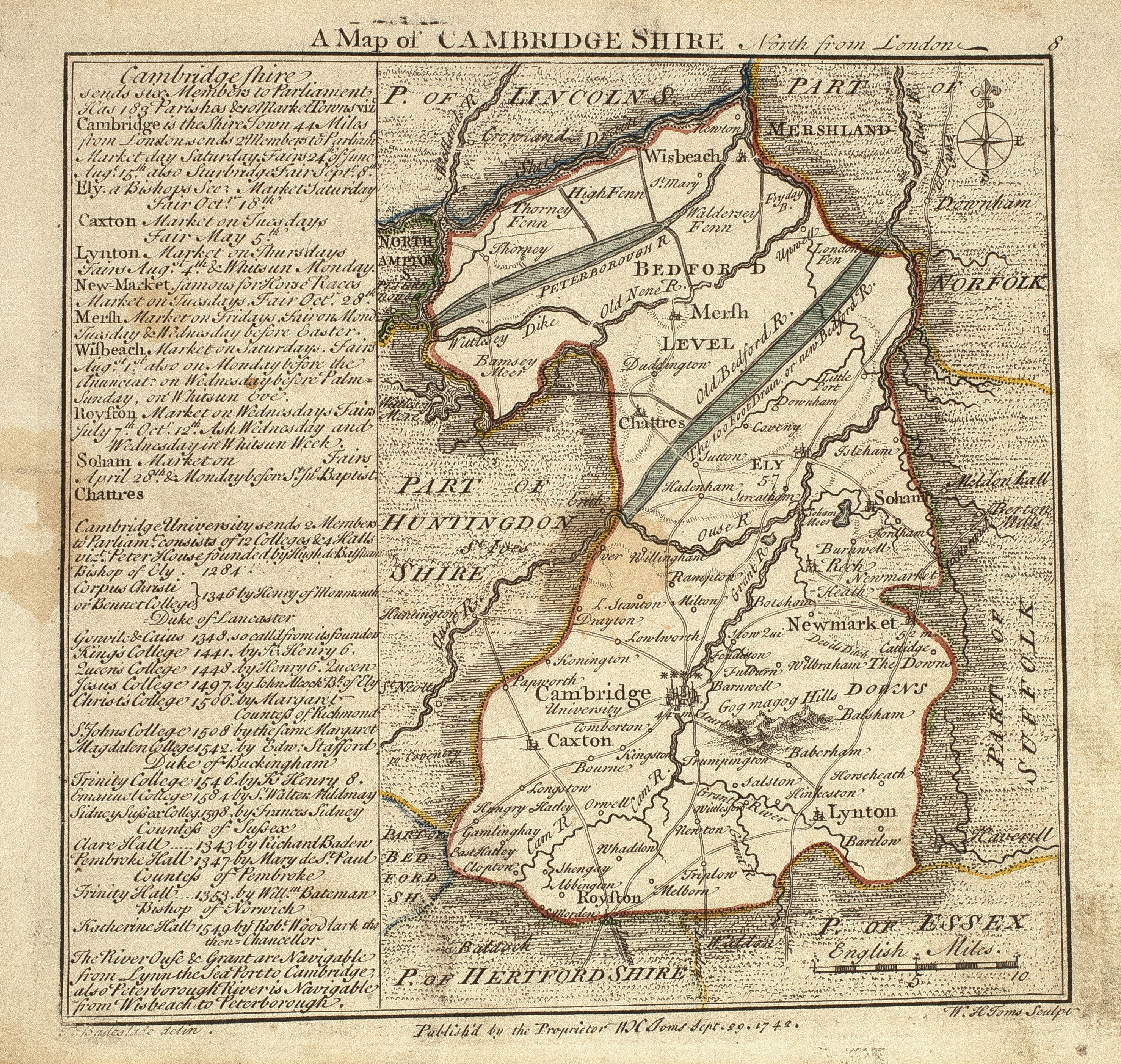
Cambridgeshire 1742 Thomas Badeslade and William Toms in Chorographia Brintanniae (Chubb 134 CLXX) (Image courtesy of Cambridge Antiquarian Society)
Cambridge 1746 Samuel Simpson Chubb p.141 XXXIV)
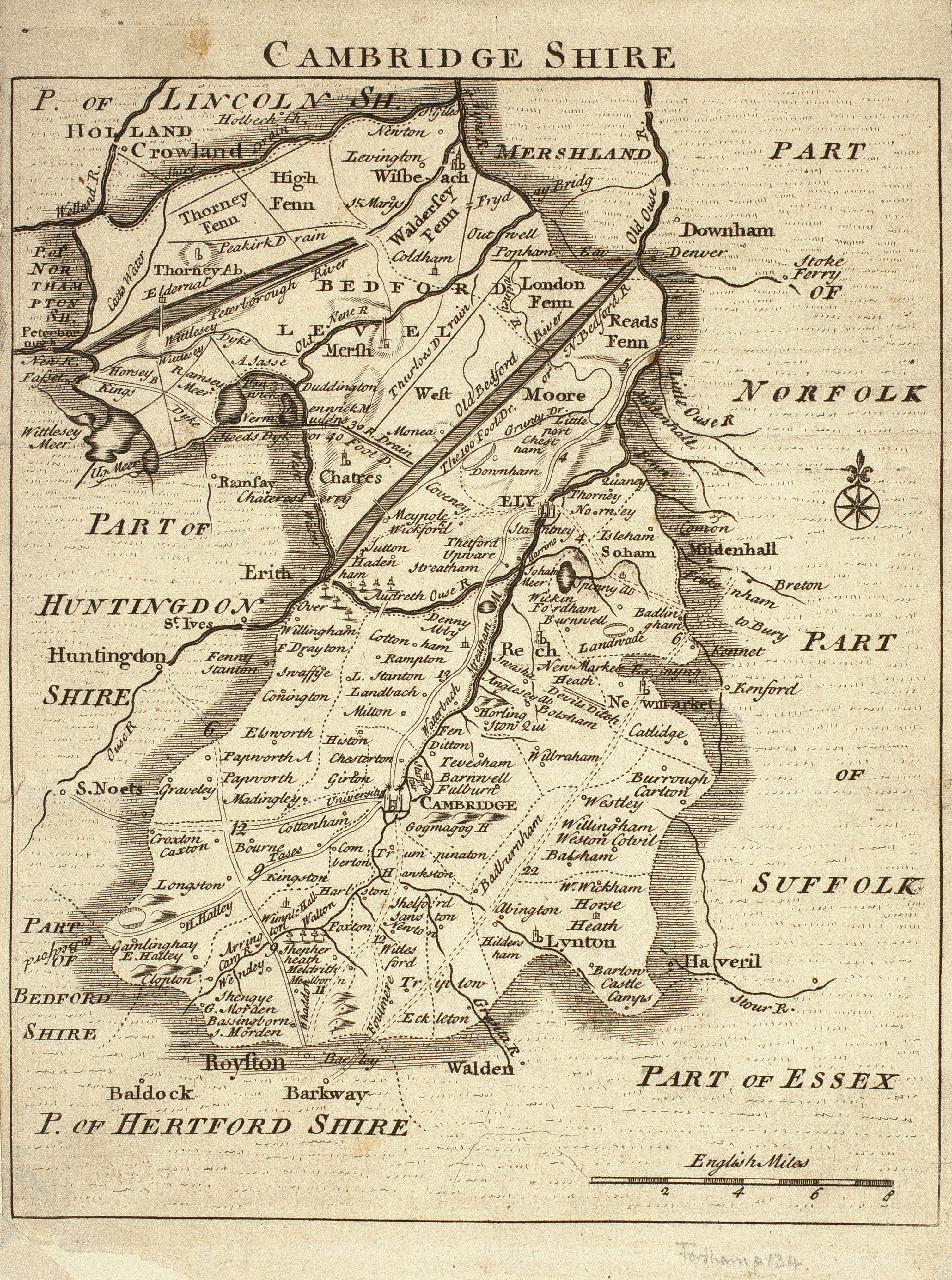
Cambridgeshire 1747 Jean Rocque from The English Traveller: and also published in Rocque's Small British Atlas (Chubb p.143 CLXXXV) (Image courtesy of Cambridge Antiquarian Society)
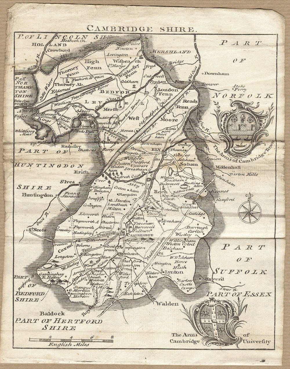
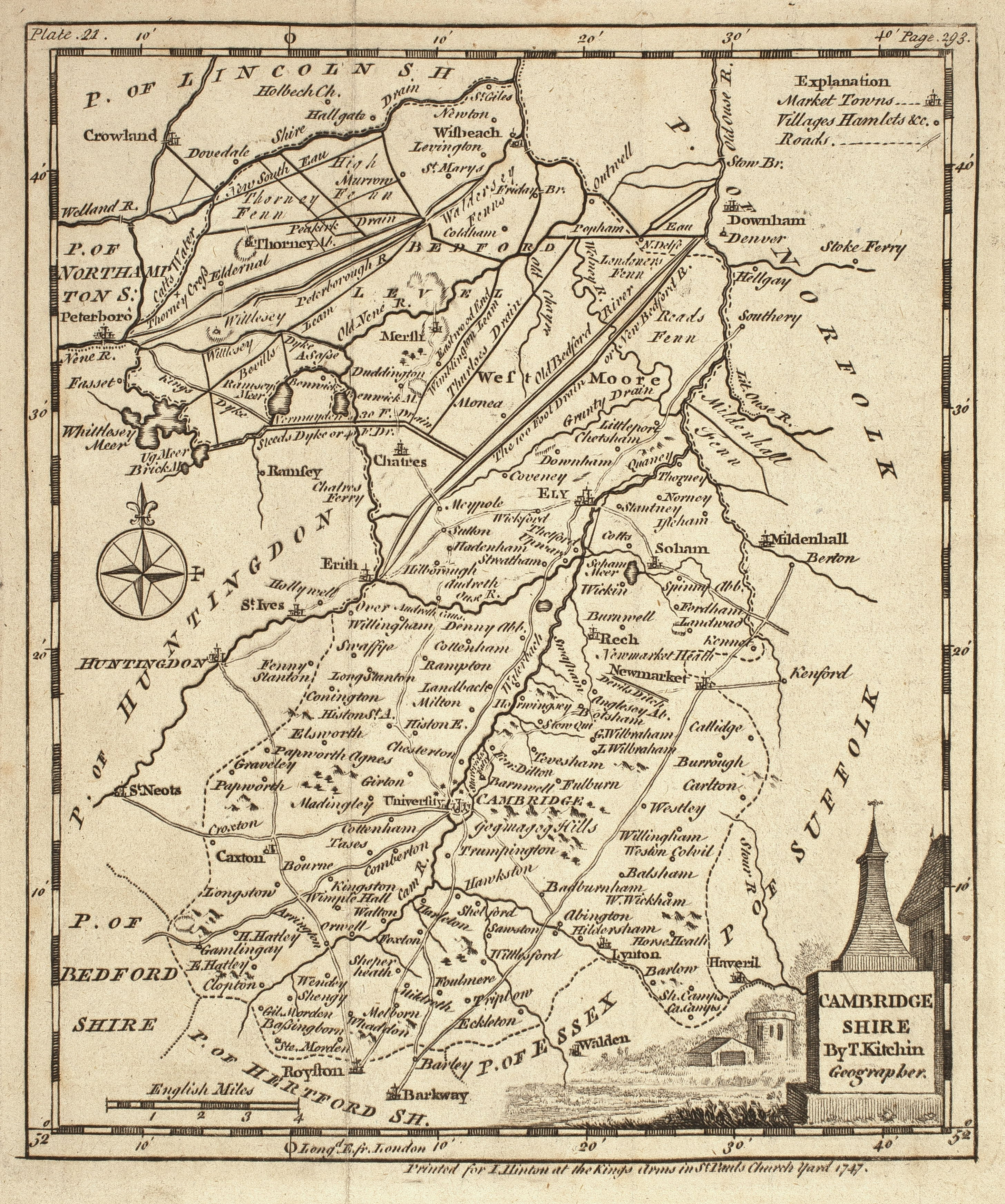
Cambridgeshire 1747 Thomas Kitchin: from The Universal Magazine of Knowledge & Pleasure (Chubb p.146 CLXXXVIII) (Image courtesy of Cambridge Antiquarian Society)
Cambridgeshire 1749. Thomas Kitchin & Thomas Jefferys in The Small English Atlas (Chubb p.151 CXCII) (Image courtesy of Cambridge Antiquarian Society)
An Accurate Map of Cambridgeshire 1750 Emanuel Bowen in the Large English Atlas
Cambridgeshire 1750 Thomas Kitchin. (Chubb p.143-44 CLXXXVII) From the London Magazine or Gentleman?s Monthly Intelligencer. Engraved and sold over 13 Years (Chubb p.143 CLXXXVII) (Image courtesy of Cambridge Antiquarian Society)
An Accurate map of Cambridgeshire 1751 Emanuel Bowen in The Large English Atlas (Image courtesy of The British Library: King's Collection Maps K.Top)
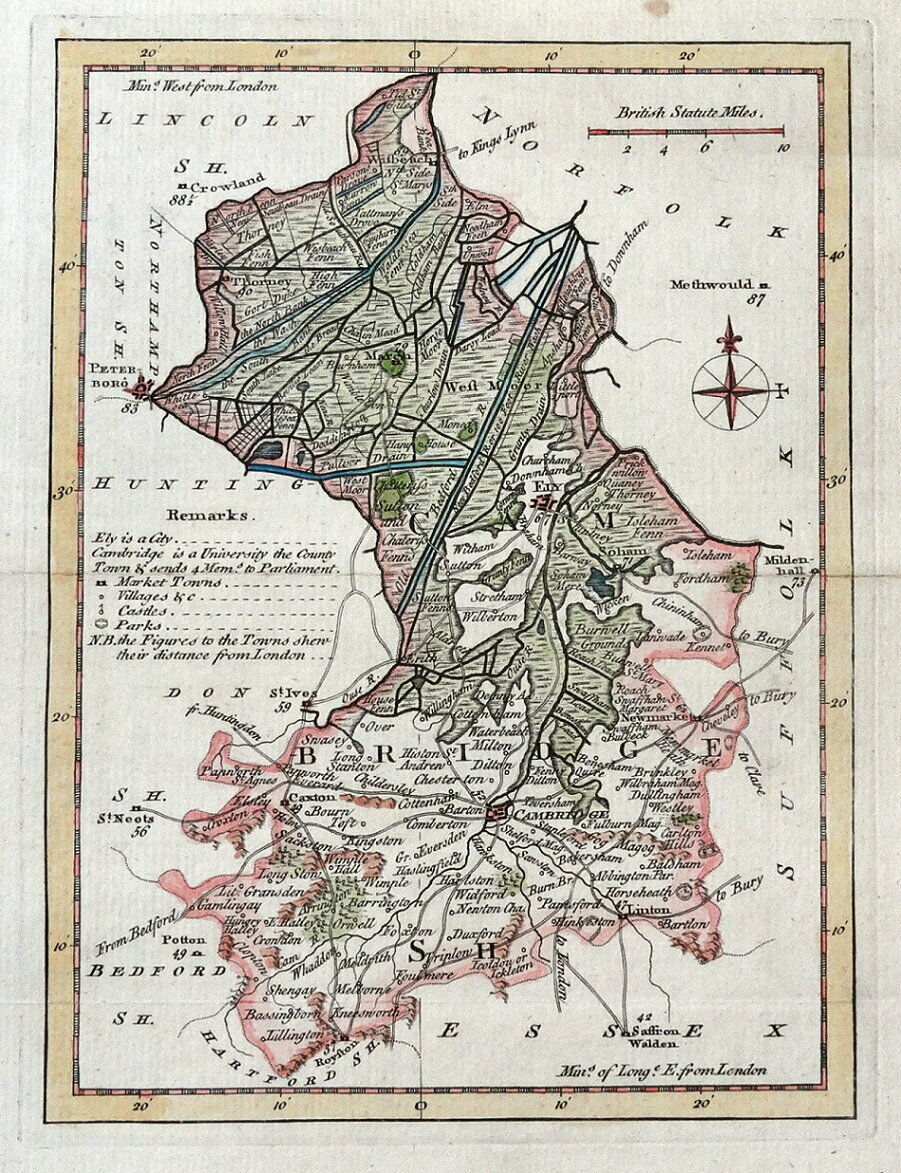
The County of Cambridge 1759 Emanuel Bowen in Benjamin Martin's The Natural History of England (Chubb p.177 CCXV)
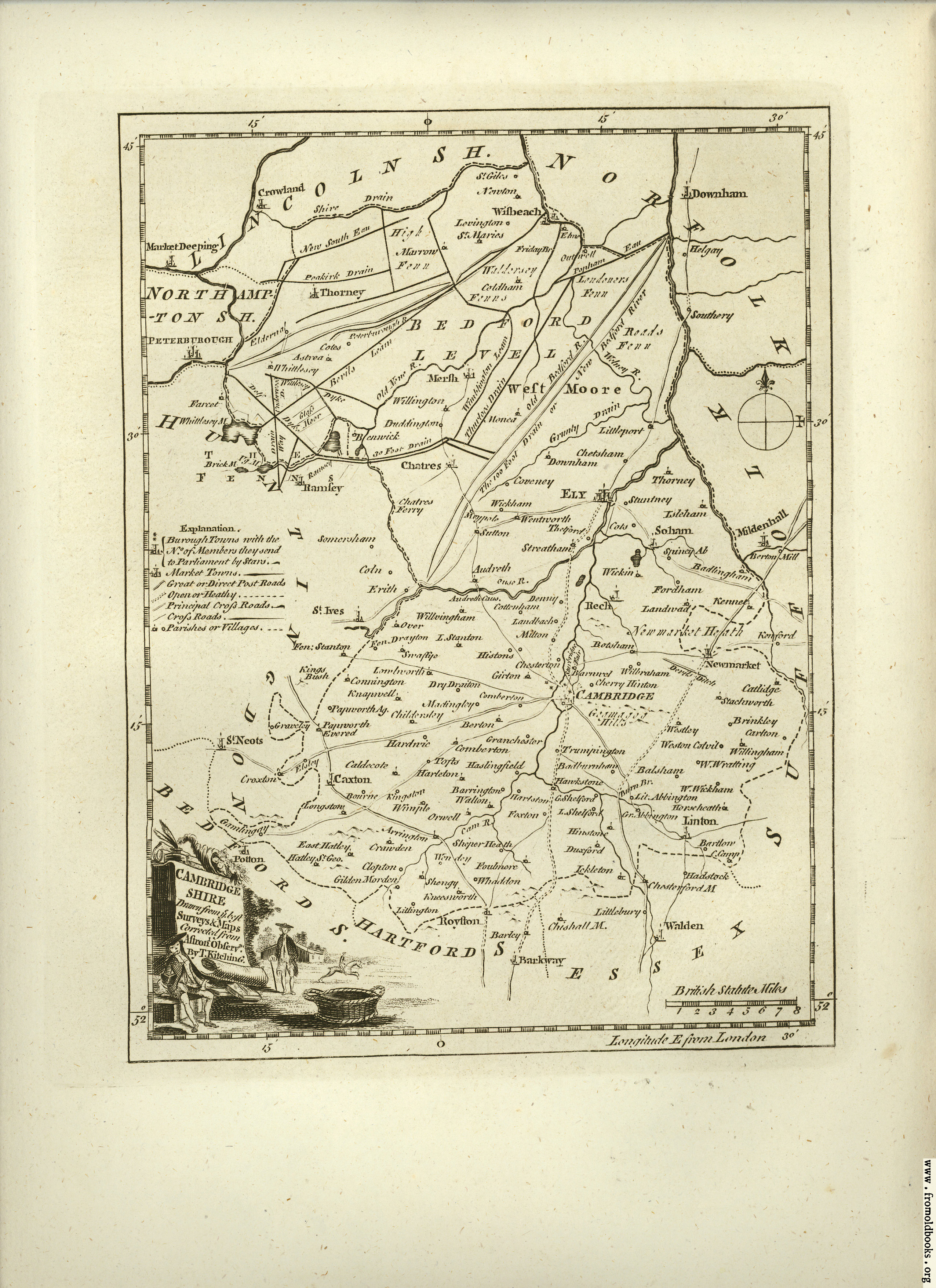
A Modern map of Cambridgeshire from the latest surveys. 1766. John Ellis for Ellis' English Atlas (Chubb p.189 CCXXVII)
(Image courtesy of Cambridge Antiquarian Society)
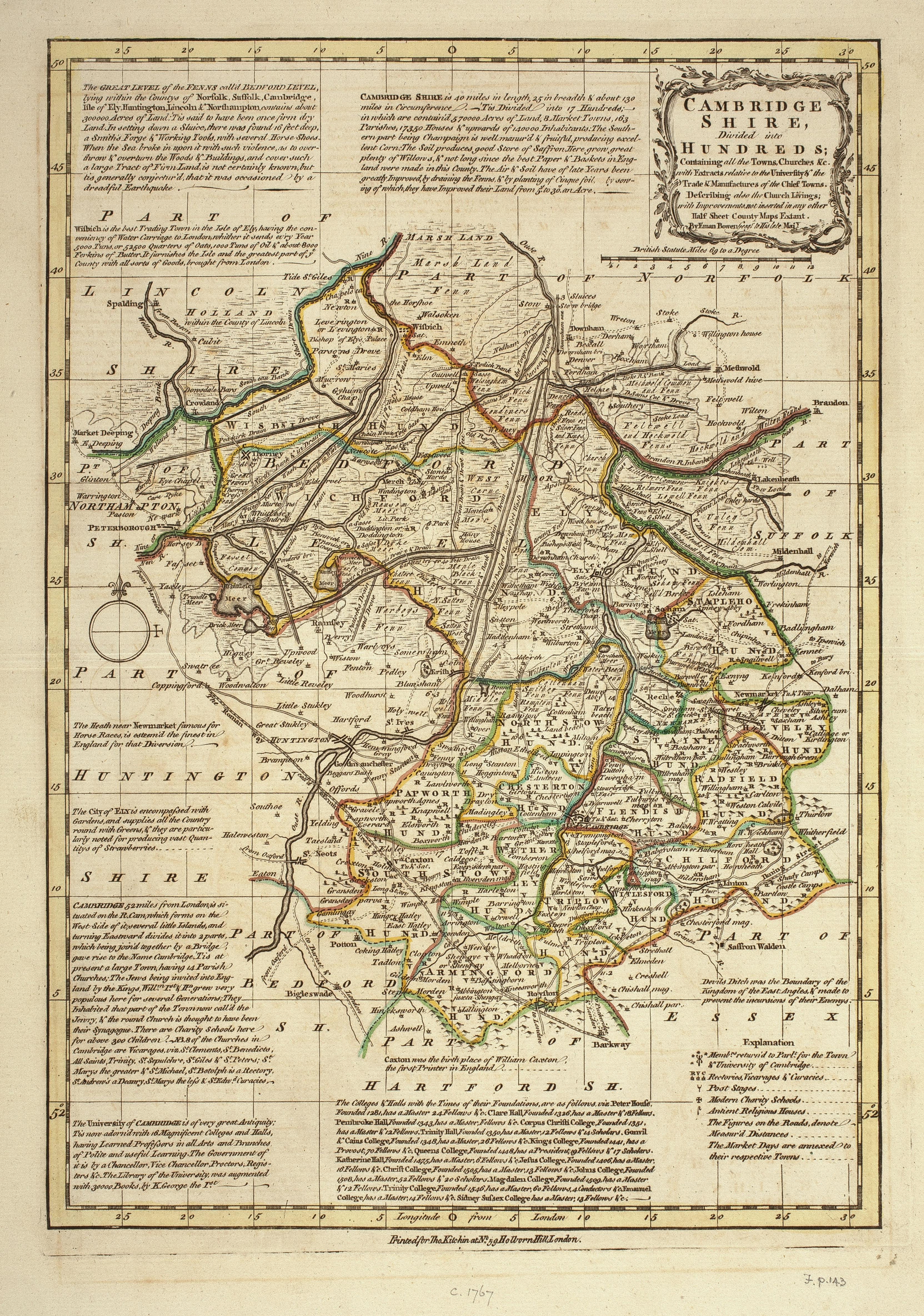
Cambridgshire divided into Hundreds. 1767 Emanuel Bowen & T. Kitchin. from Bowen?s Atlas Anglicanus (Chubb p.192 CCXXXII) (Image courtesy of Cambridge Antiquarian Society)
Cambridgeshire 1769 Jean Rocque in England Displayed: first published as The English Traveller (1746): and subsequently as The Small British Atlas (1753) Chubb p.172 CCVII)
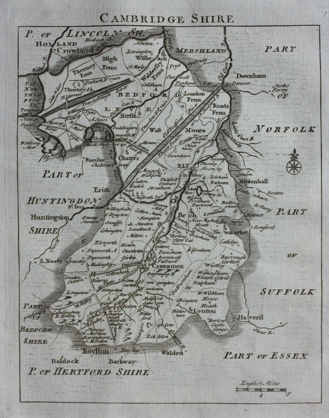
Cambridgeshire 1769 Thomas Kitchen in his Pocket Atlas (Chubb p.195 CCXXXV)
Cambridge: A Map of the Great Level of the Fens: 1779 M. Booth
Cambridgeshire 1786 Thomas Kitchen in Henry Boswell's The Antiquities of England and Wales (Chubb p.210 CCLVII)
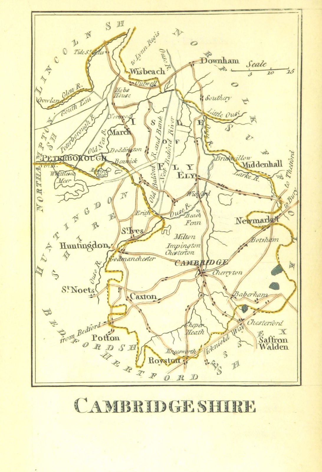
Cambridgeshire 1790 John Cary in Cary's Traveller's Companion (Chubb p.220 CCLXXIII)
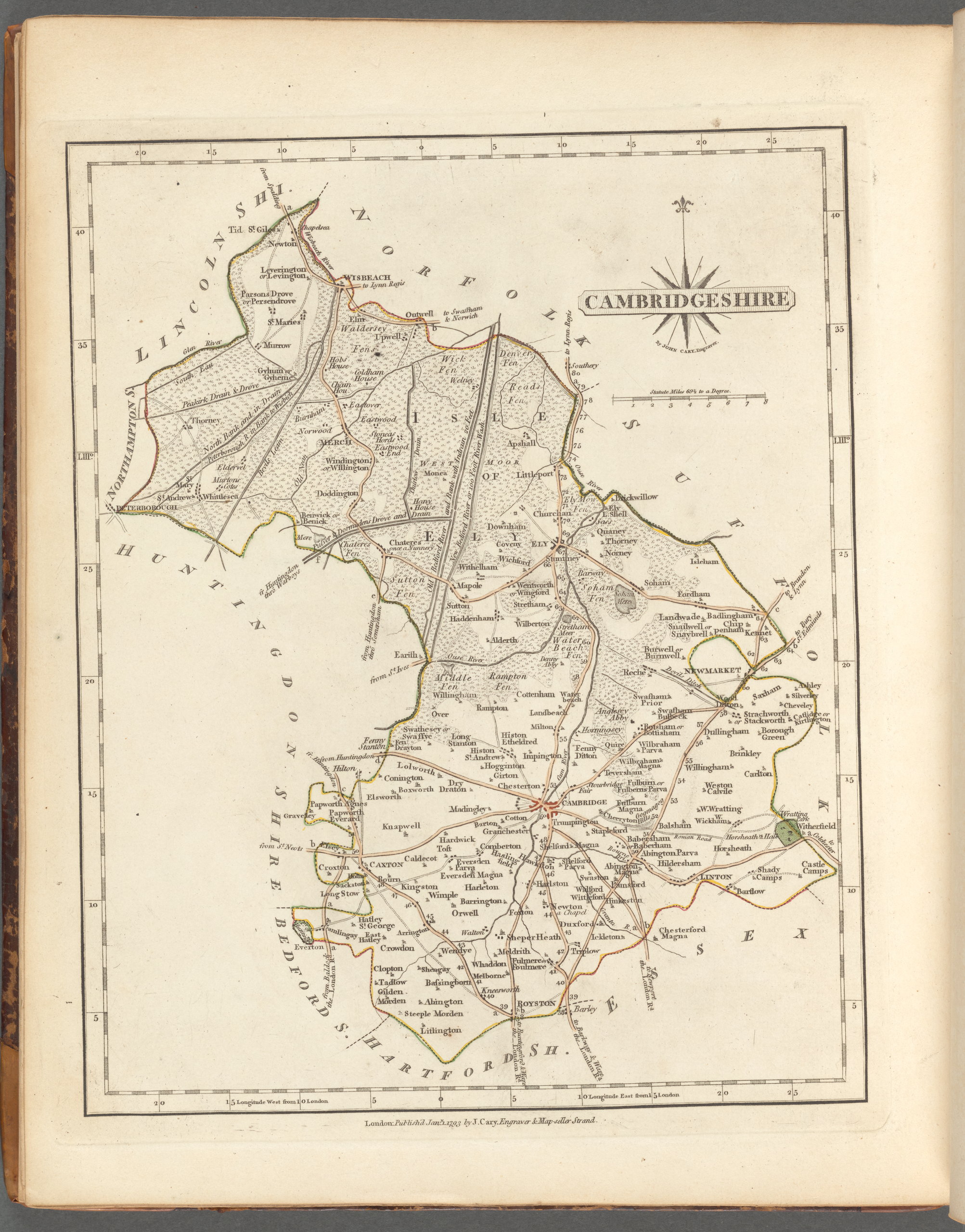
Cambridgeshire 1793 John Cary in his New and Correct English Atlas (Chubb p.214 CCLXI) (Image courtesy of New York Library Digital Collections)
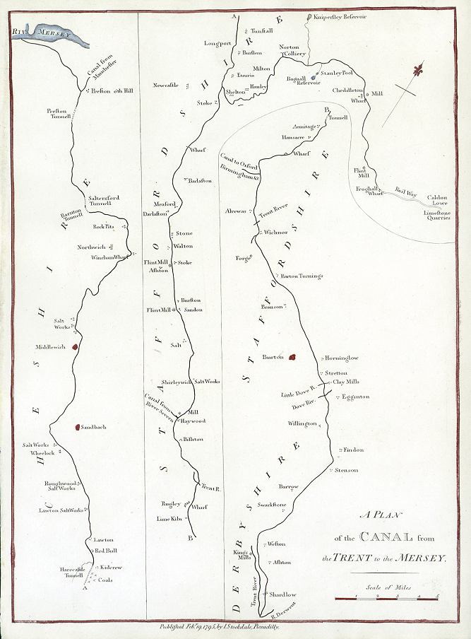
Plan of the Canal from the Trent to the Mersey 1794 John Aiken & John Stockdale
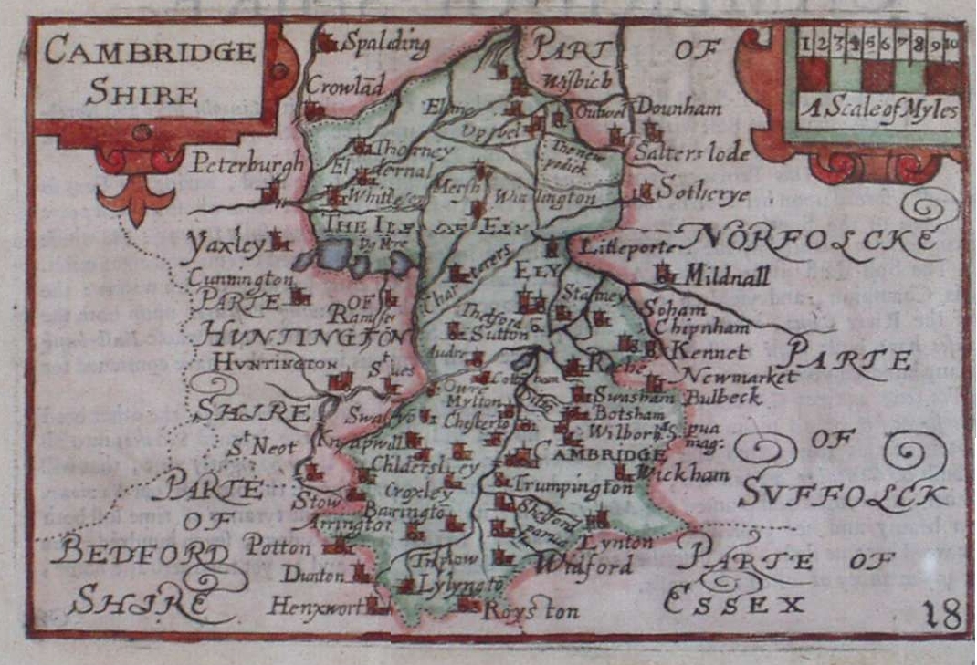
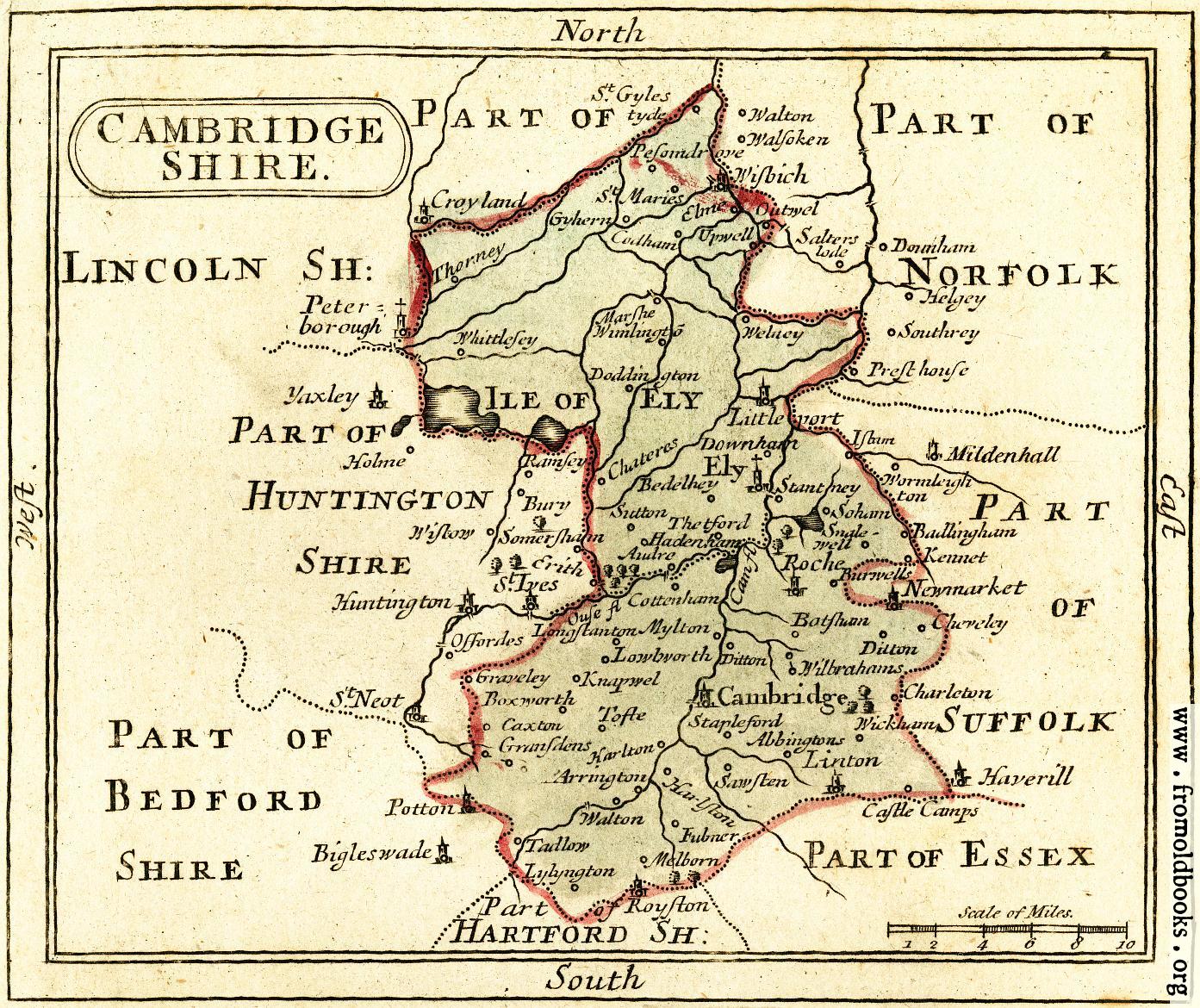
Cambridgeshire 1795 John Seller for Francis Grose's Antiquities (Chubb p.201 CCXLIX)
Cambridgeshire 1803 5th Edn.John Aikin in England Delineated "to Make my young countrymen better acquainted than they are usually found to be with their native land" (Chubb 236 CCCVII)
Cambridgeshire 1804 William Green in The Picture of England (Chubb p.243 CCXVIII)
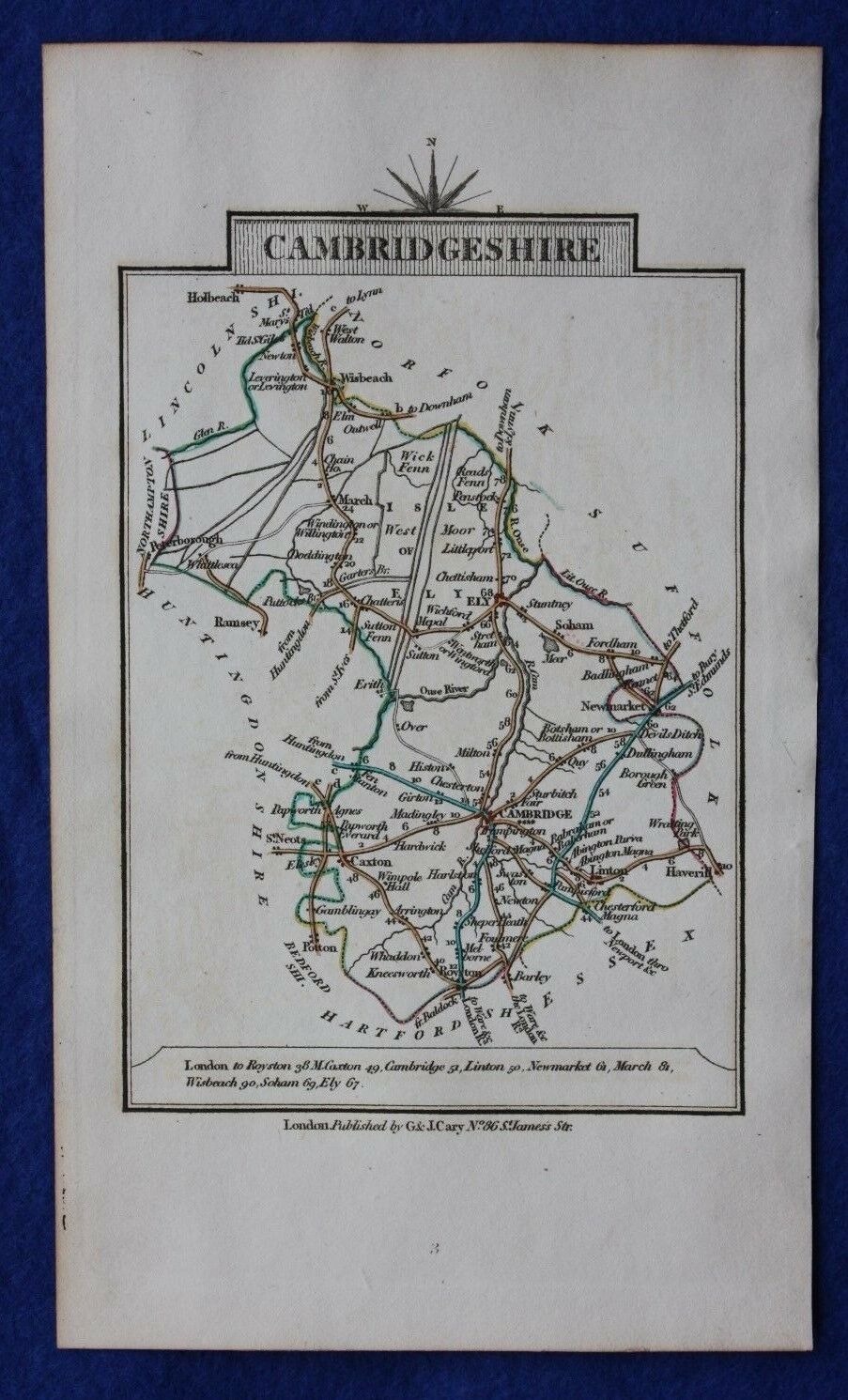
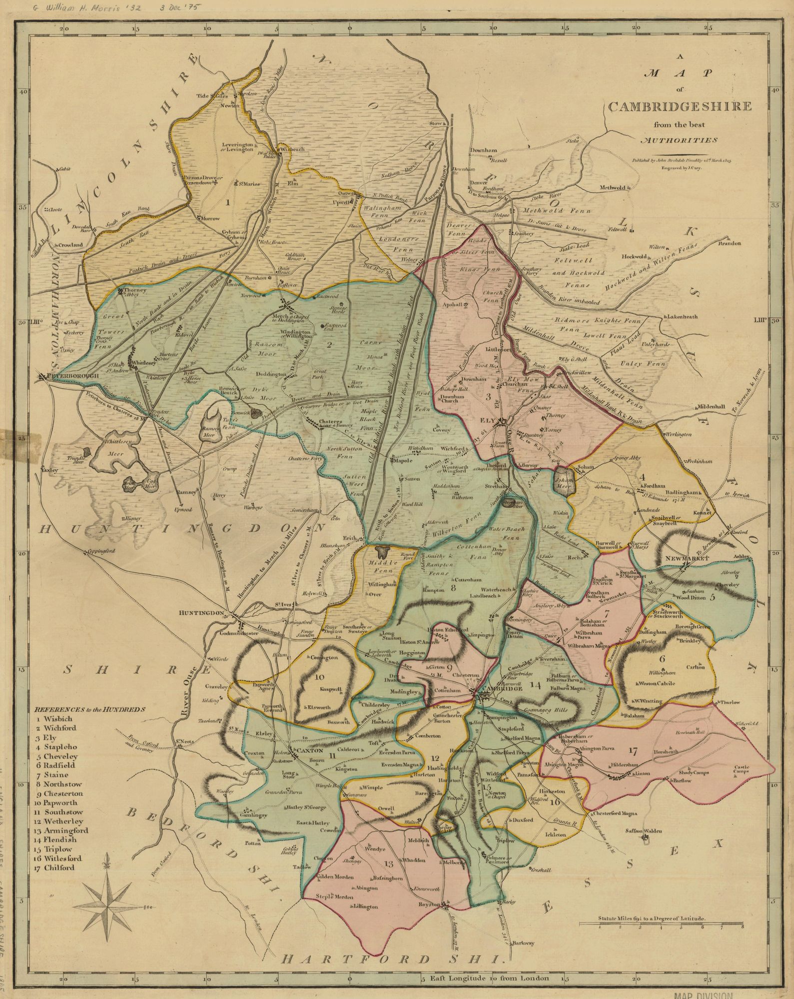
Cambridgeshire 1805 John Cary pub. J. Stockdale for The New British Atlas .(Image courtesy of Princeton Historic Map Collection) (Chubb p.243 CCCXIX )
Plan of Cambridge 1806 Samuel Lysons 1763-1819) in Magna Britannia Vol.III (not in Chubb))
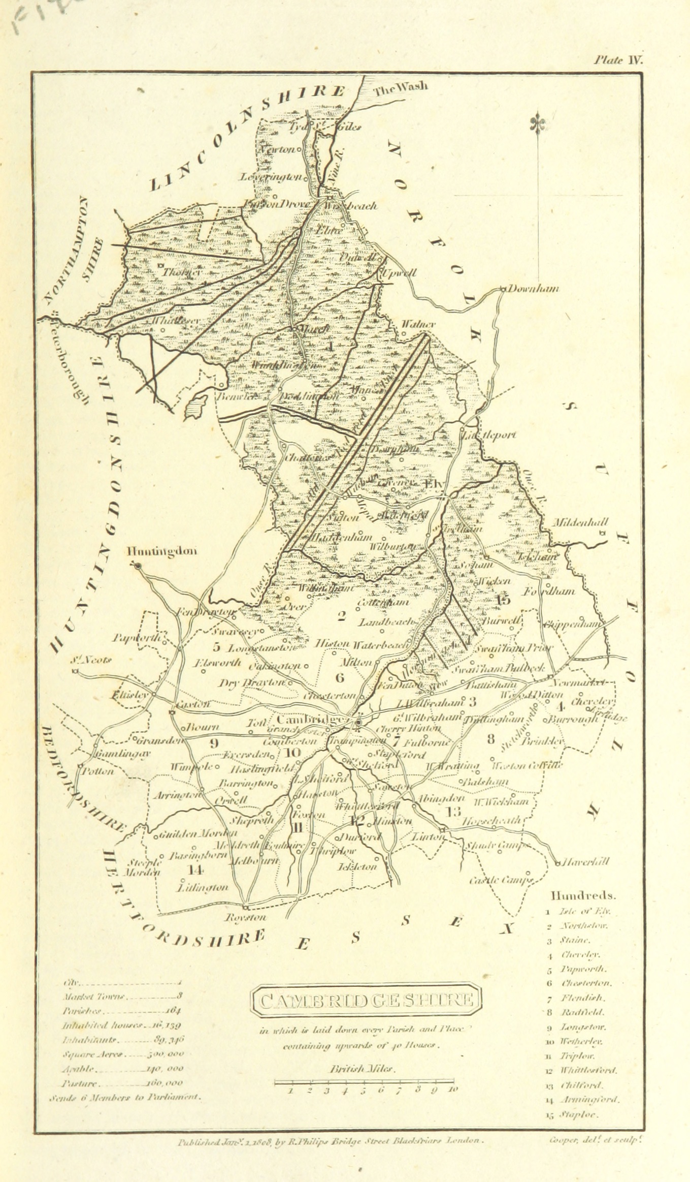
Cambridge shire 1808 Benjamin Pitts Capper in A Topographical Dictionary of the United Kingdom (Image courtesy of Wikimedia) (Chubb p.245 CCCXXVII)
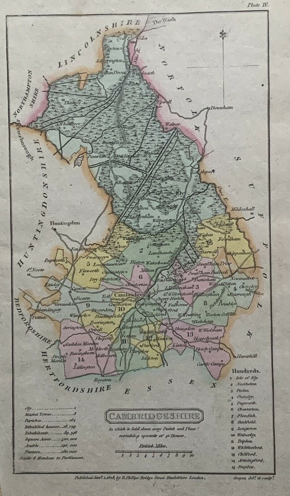
Cambridgeshire 1808 Henry Cooper for Benjamin Pitts Cappper's Atlas of the British Islands (Chubb p.245 CCCXXIII)
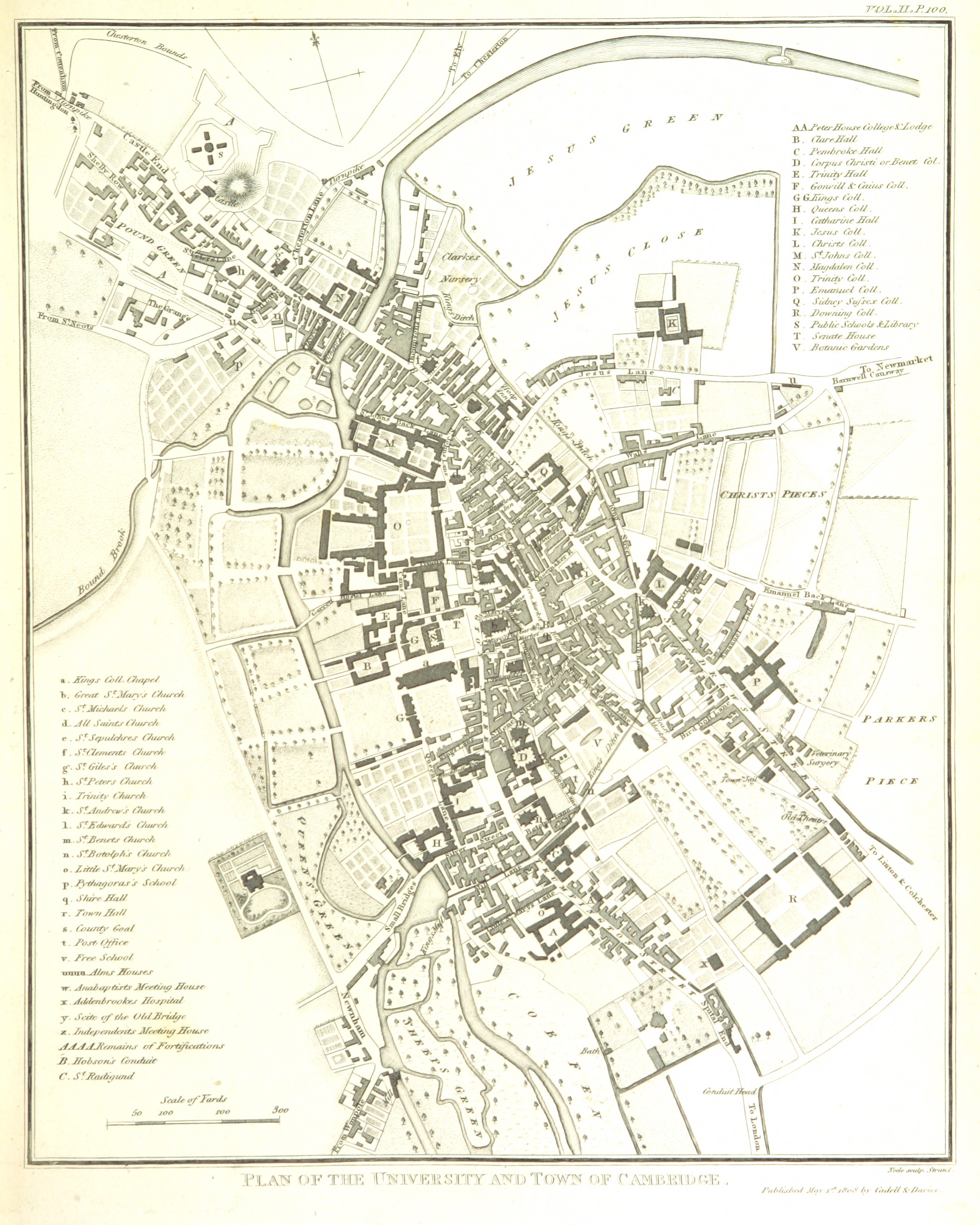
Plan of Cambridge 1808 John Roper in The Beauties of England and Wales... later The British Atlas of England and Wales (Chubb p.249 CCCXXXIX)
Cambridgeshire 1809 John Seller in Francis Grose's Antiquities of Britain (Chubb p.97 CXVIII)
Cambridgeshire 1819 Ellis's New and Correct Atlas
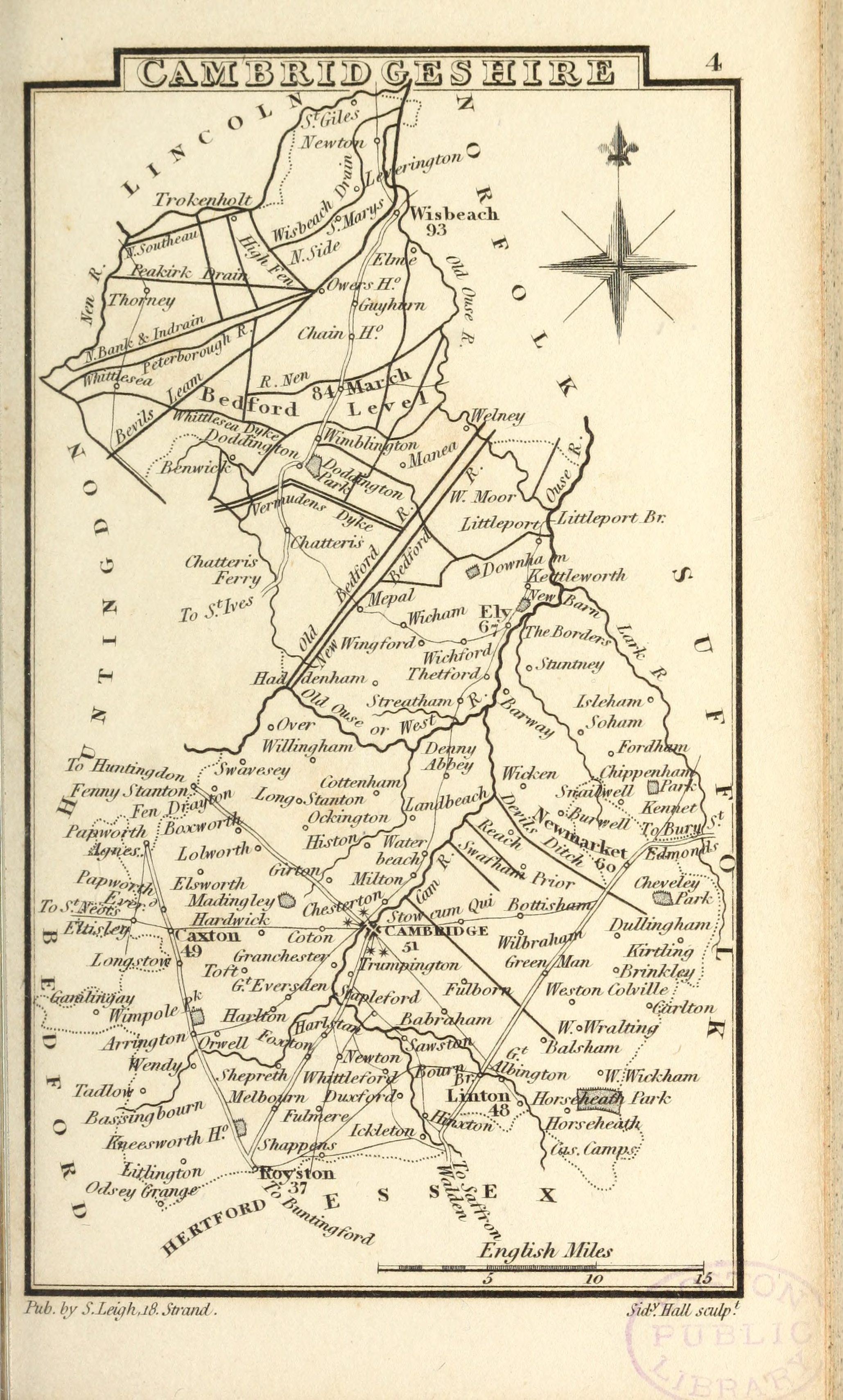
Cambridgeshire 1822 Samuel Leigh from Leigh's New Pocket Atlas (Chubb p.273 CCCLXXIV)
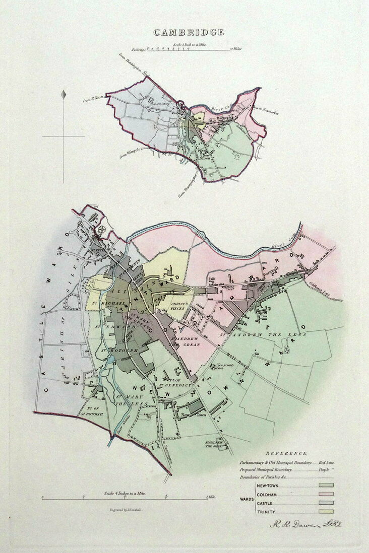
Cambridge 1832 Robert Kearsley Dawson showing electoral Boundaries (Chubb p.297 CCCCXXXIX) (Image courtesy of Cambridge Antiquarian Society)
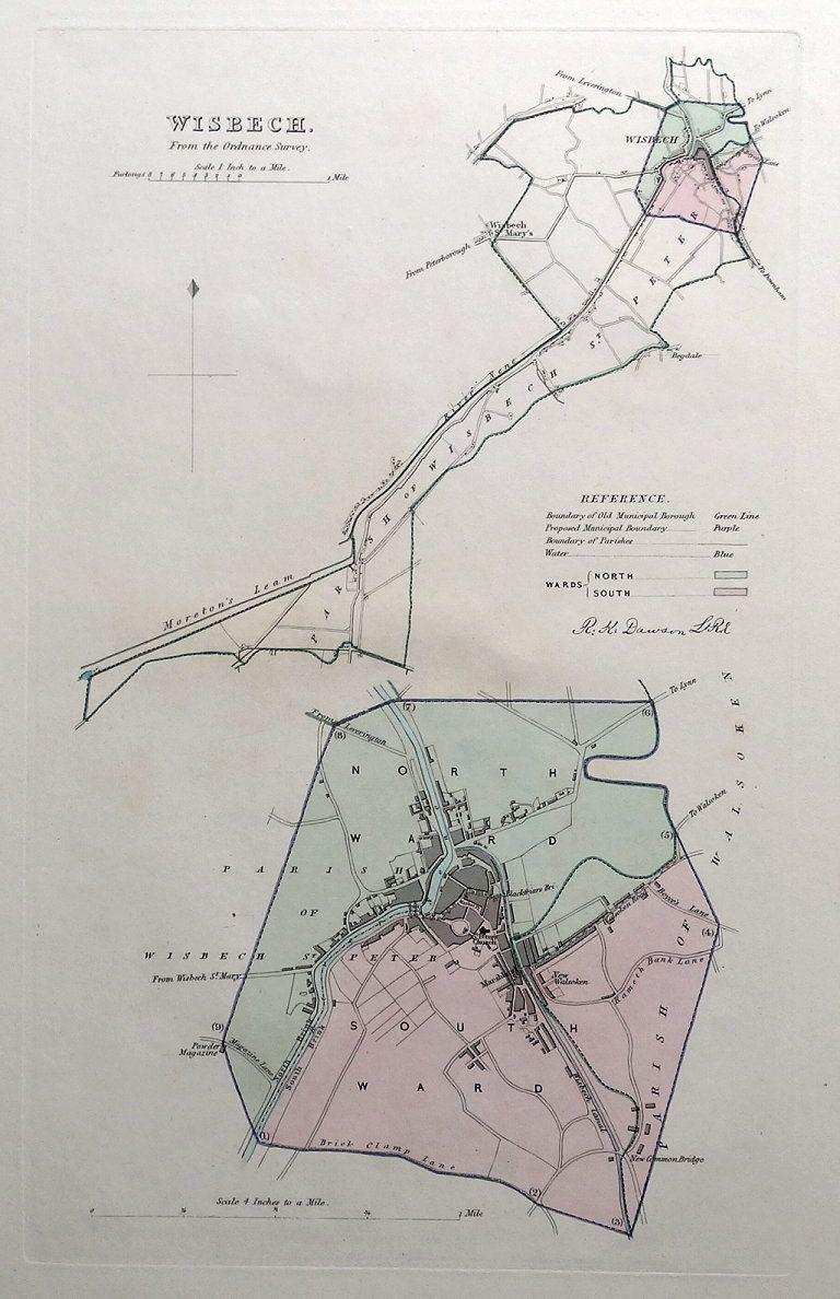
Wisbech 1832 Robert Kearsley Dawson for The Boundaries Commission (Chubb p.297 CCCCXXXIX)
Cambridge 1834 C. and J. Greenwood in Atlas of the Counties of England (Chubb CCCCLVIIl) (Image courtesy of www.davidrumsey.com)
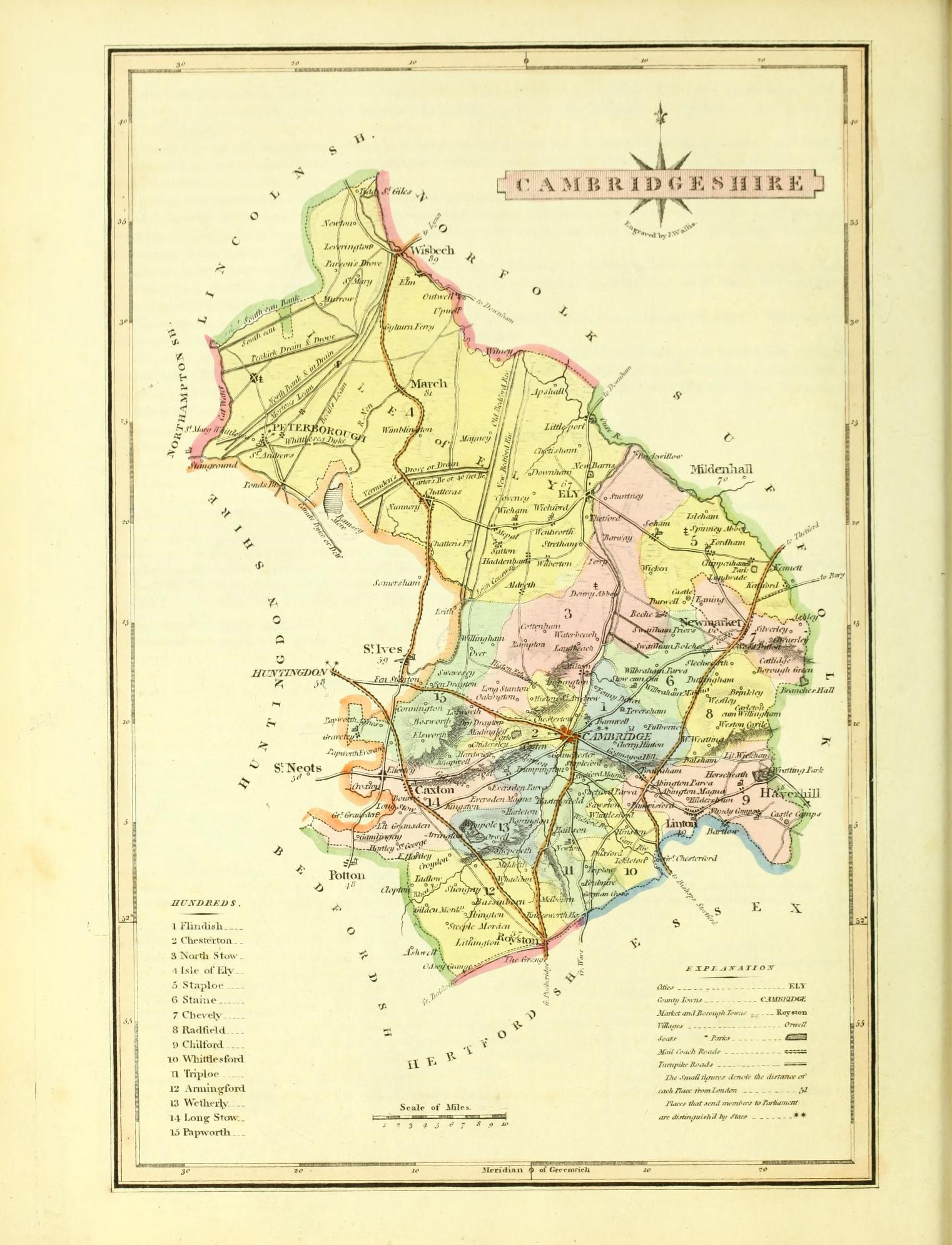
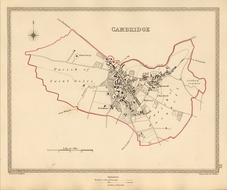
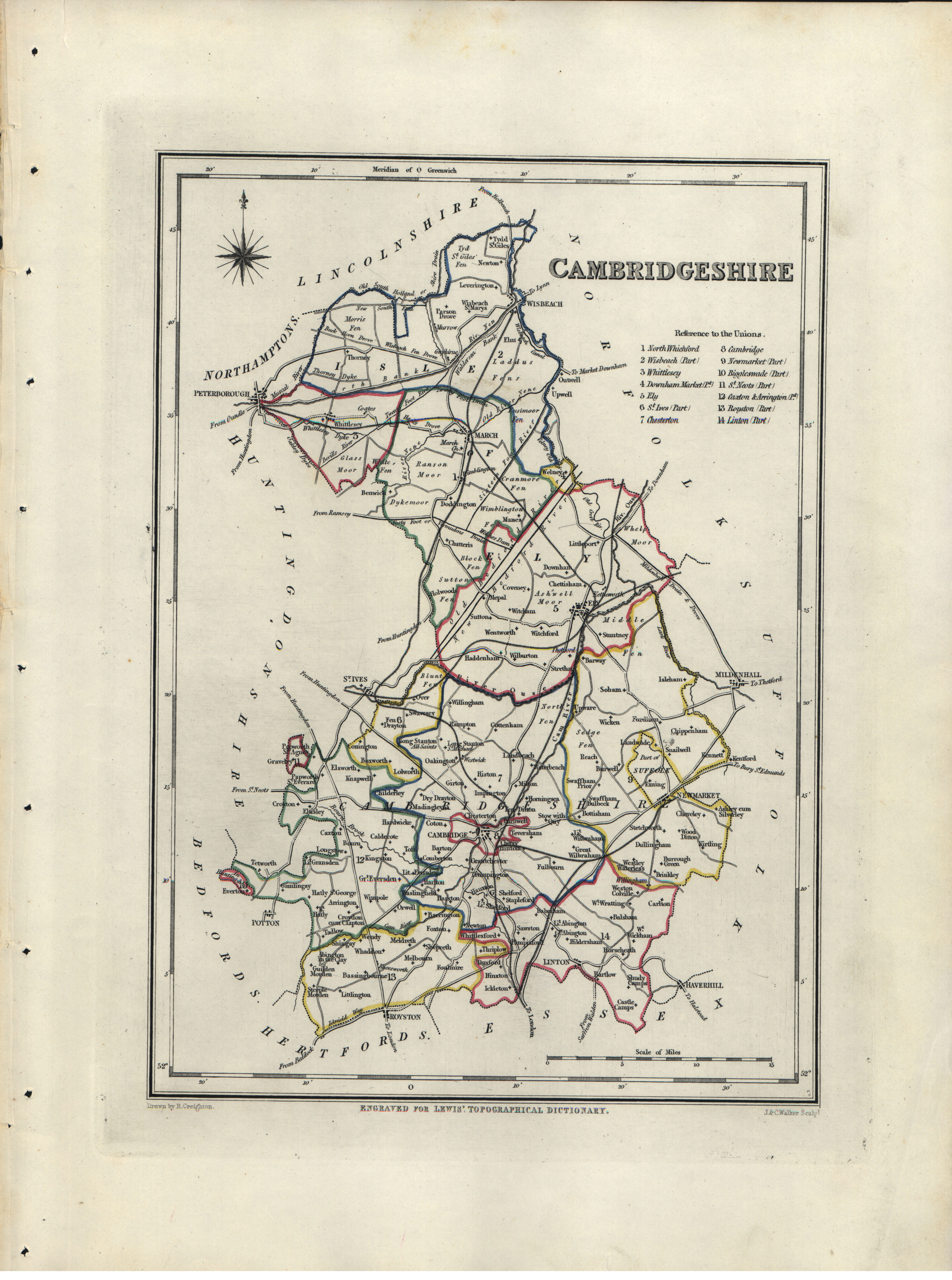
Cambridge 1835 Robert Creighton for Lewis' Topographical Dictionary
(Chubb p:296 CCCCXXXII)
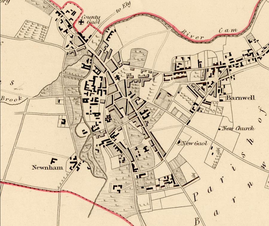
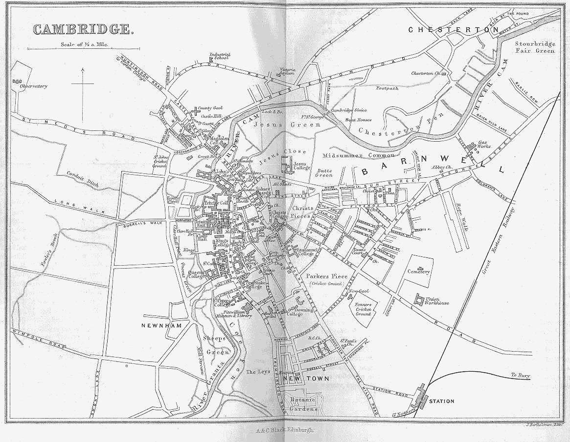
Cambridge (detail) 1835 Robert Creighton for Lewis' Topographical Dictionary
(Chubb p:296 CCCCXXXII)
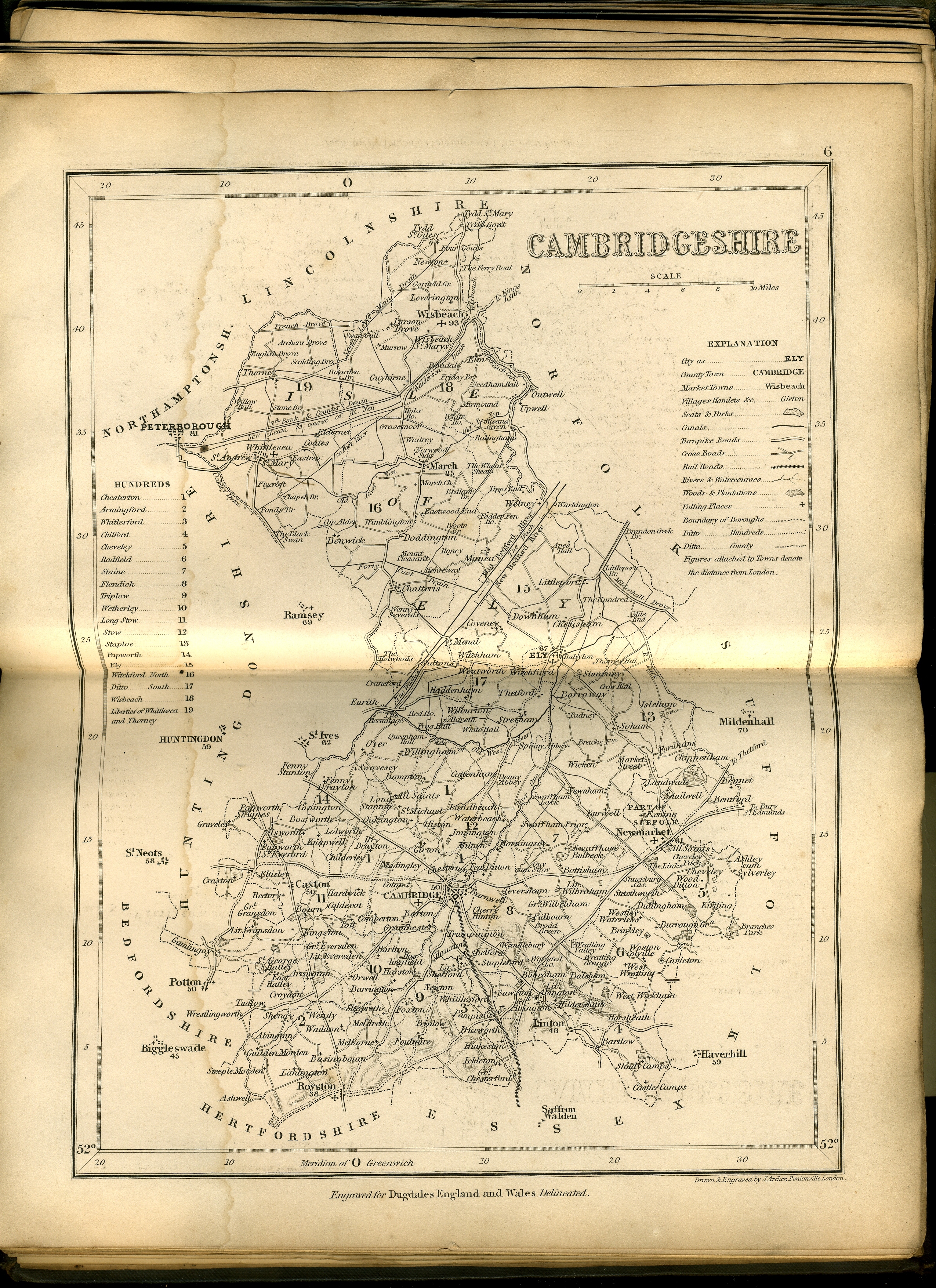
Cambridgeshire 1835 Joshua Archer in Dugdale's England and Wales Delineated (Chubb p.323 CCCCLXVI)
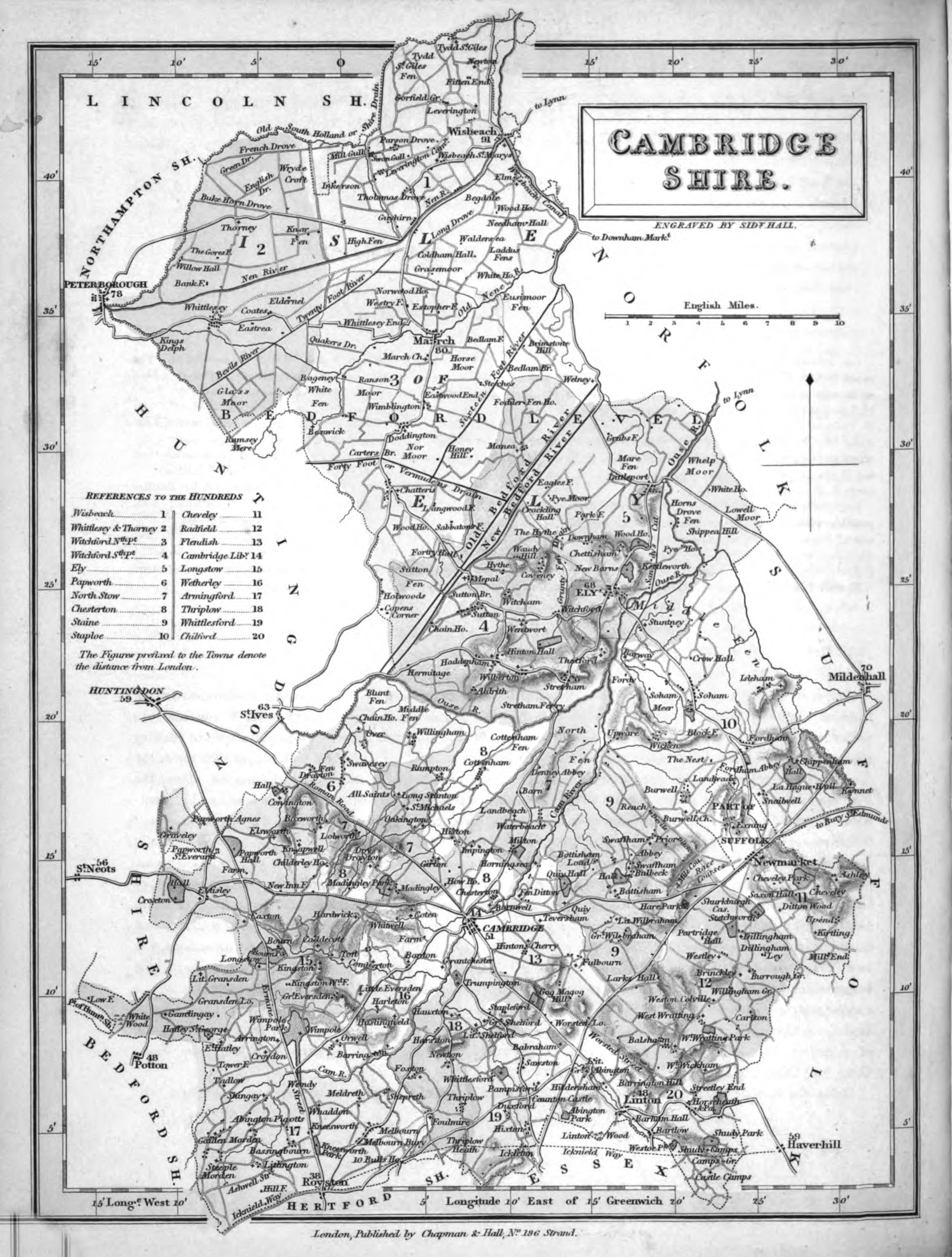
Cambridgeshire 1836 Sidney Hall in his New British Atlas (Chubb p. 314 CCCCLI)
Cambridgeshire 1842 James Pigot in A Pocket Topography and Gazetteer of England (Image courtesy of The British Library King's Collection Maps K.Top)
Cambridgeshire 1848 Robert Creighton for the Atlas to Lewis' Topographical Dictionary Chubb p:296 CCCCXXXII)
Plan of Cambridge 1883 Adam Black in Black's Guide To England and Wales
Canterbury 1884 A. & C. Black (Image courtesy of The Mechanical Curator & Wikimedia)
Cambridge 1884
(Left Sheet)
(Right Sheet)
A + C Black (Image courtesy of The Mechanical Curator & Wikimedia)
Cambridgeshire 1885 Stanford's Parliamentary Atlas
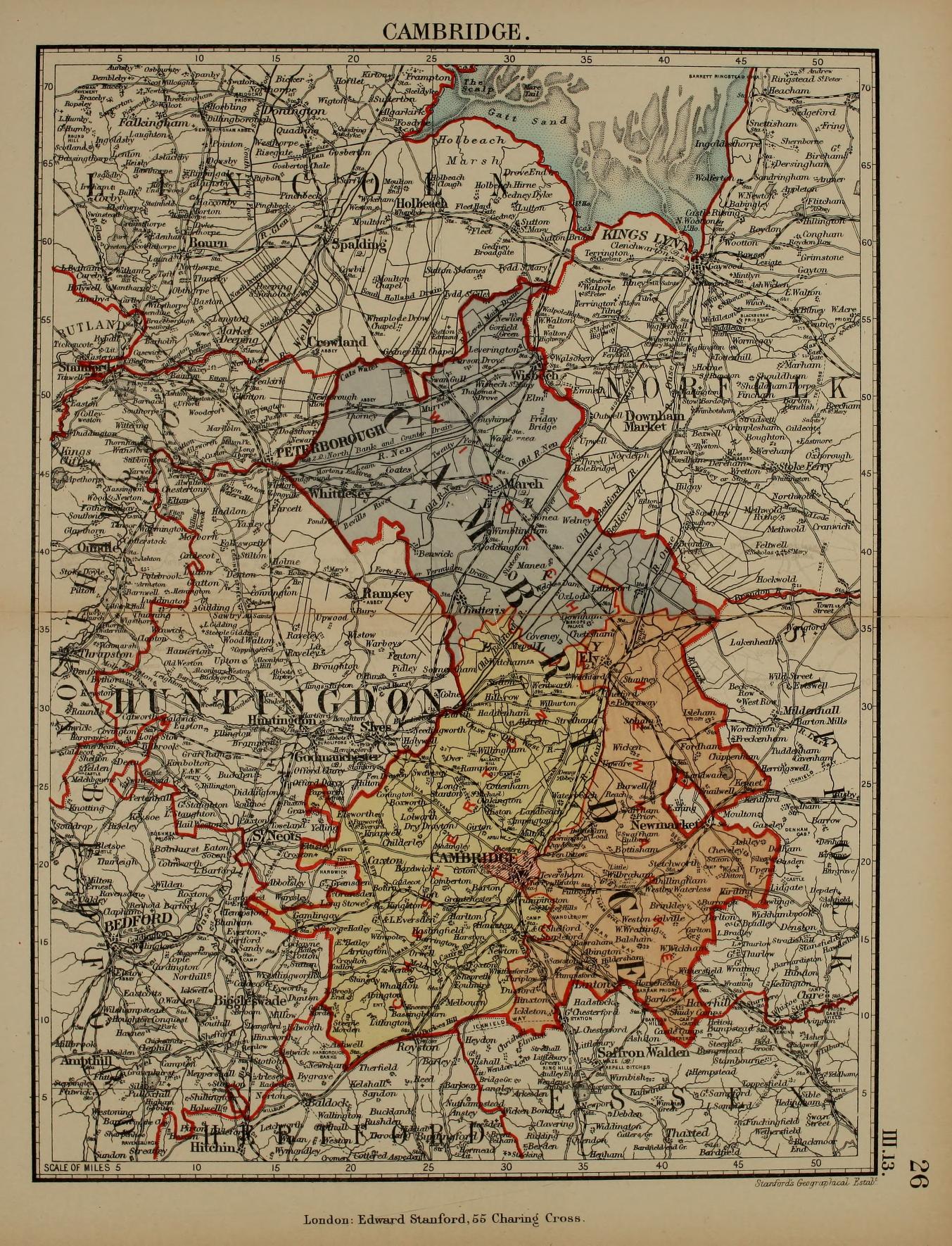
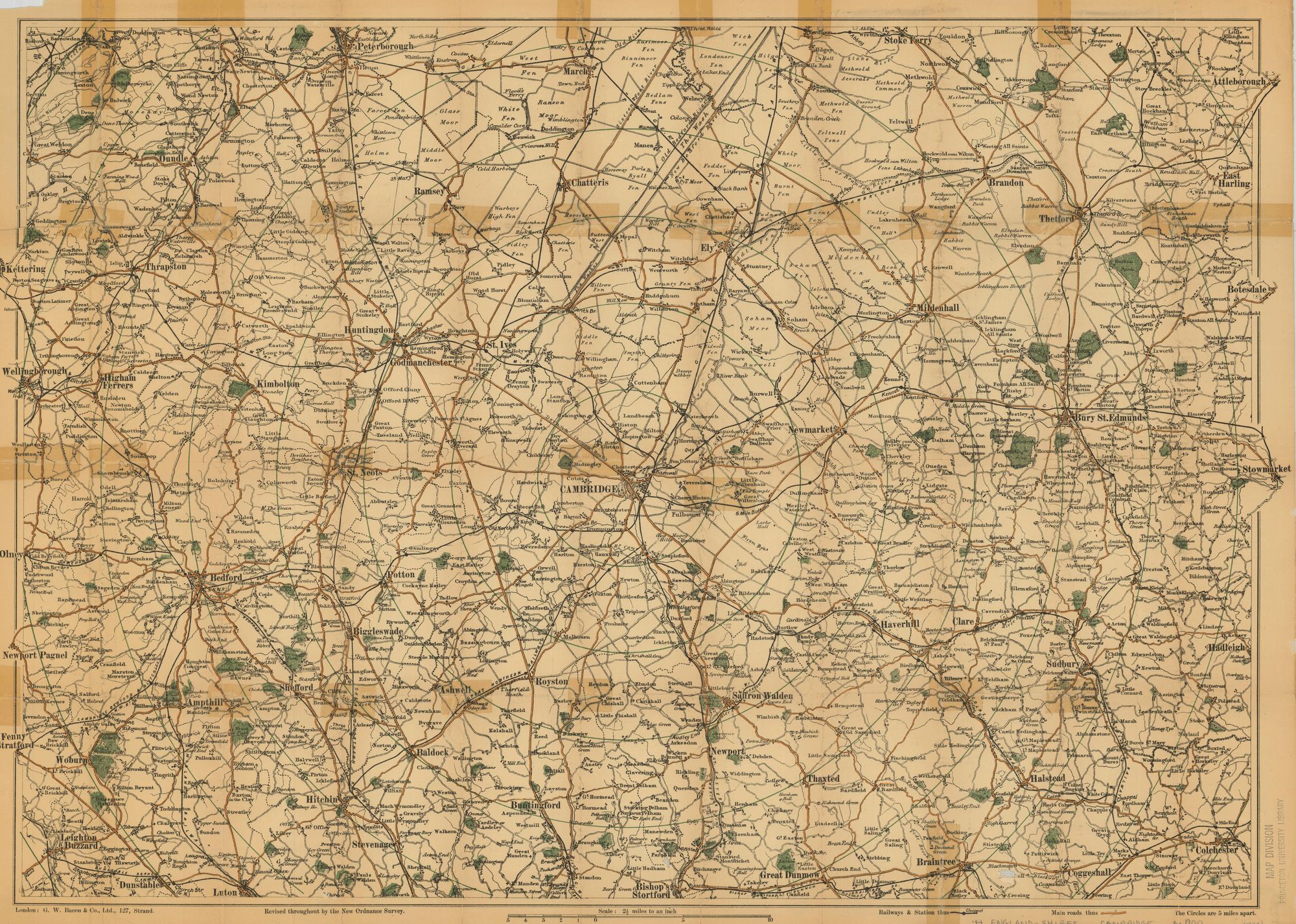
Cambridgeshire 1890 G.W. Bacon (Image courtesy ofPrinceton Historic Map Collection)
Plan of Cambridge 1898 anon
.jpg)
.jpeg)
%20Princeton%20Historic%20Map%20Collection.jpg)
%20.jpg)
(Image%20courtesy%20of%20The%20British%20Library%20King's%20Collection%20Maps%20K.Top%20.jpg)
.jpg)
%20(Image%20courtesy%20of%20www.davidrumsey.com).jpg)
.jpg)
%20.jpg)
%20.jpg)
%20.jpg)