| |
 Resources consulted for Derbyshire: A Bibliography of County Maps - Large Scale County Maps of England. Tooley R.V. The Printed Maps in the Atlases of Great Britain and Ireland1579-1870 Chubb Thomas Dawson 1927 |
 |
| To resize image: hold CTRL and use mouse scroll-wheel |
Derbyshire 1611 John Speed in The Theatre of the Empire of Great Britaine
(Chubb p.23 XXII) (Image courtesy of The British LibraryDerbyshire 1612 Michael Drayton to illustrate his Polyolbion l(Chubb XXXV)
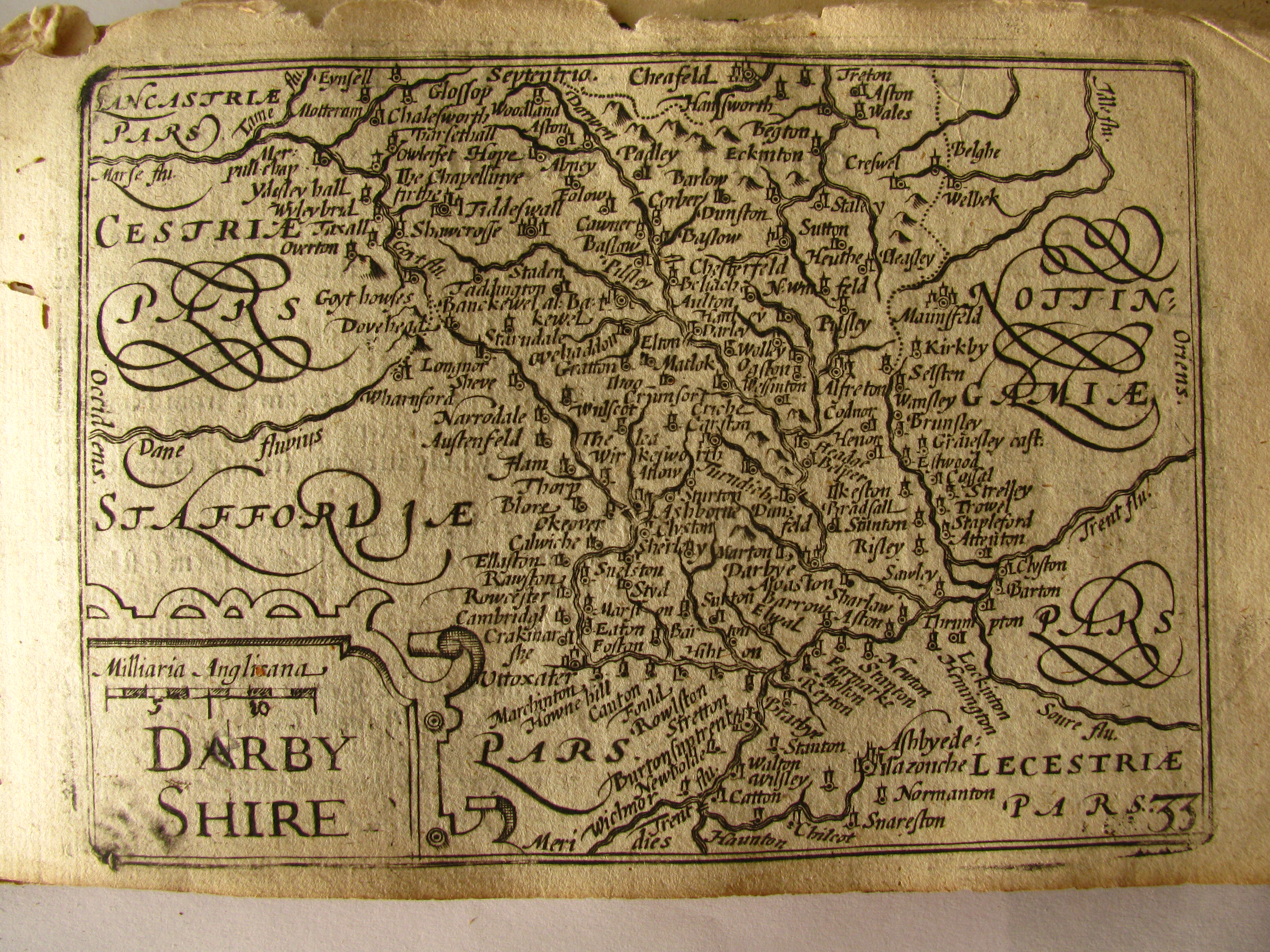
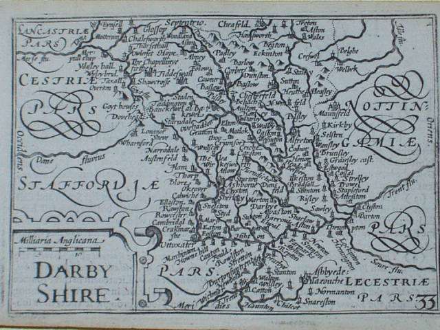
Derbyshire 1627 (01) Pieter van den Keere
. (Chubb LX)
Derbyshire 1630 (02) Pieter van den Keere
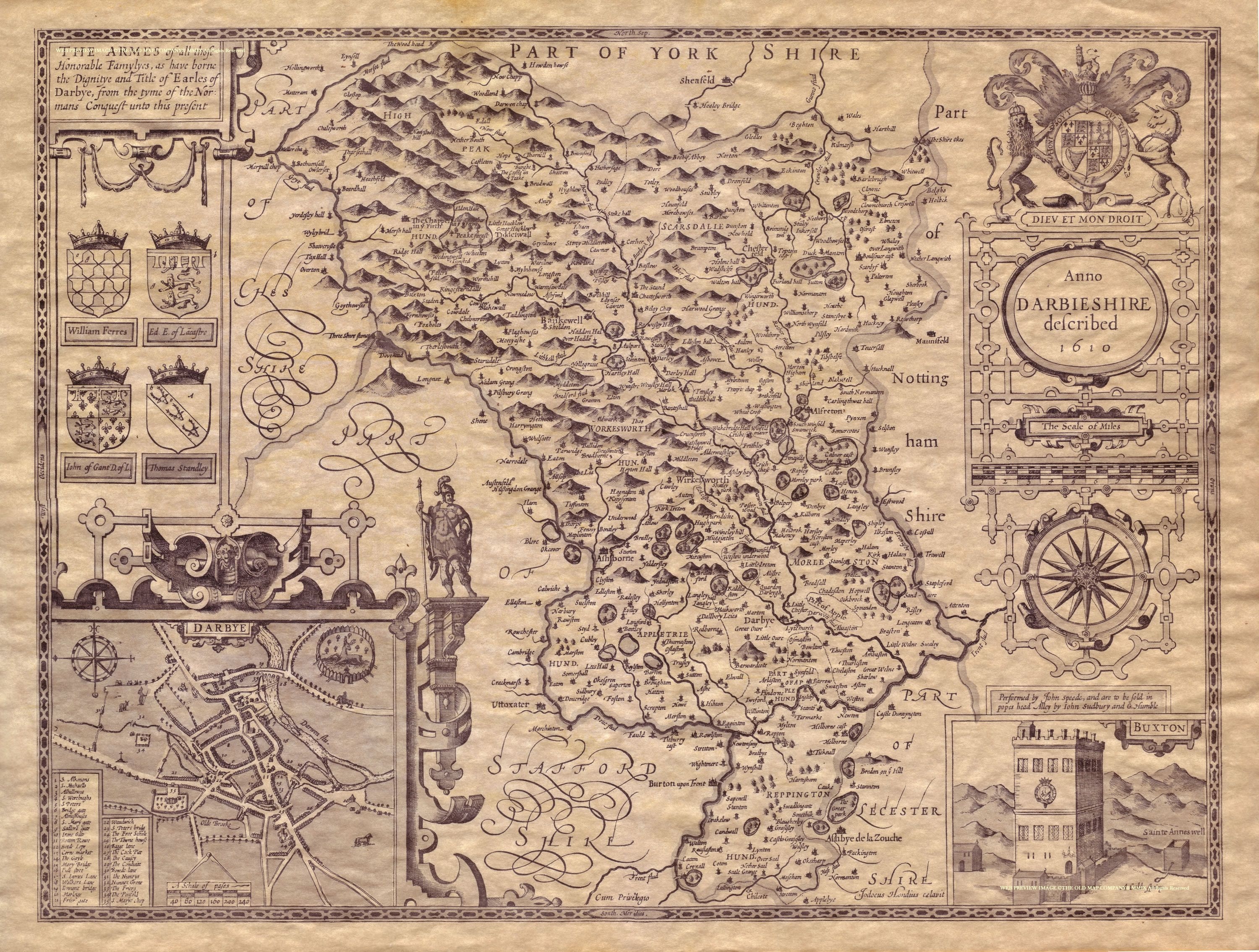
Derbyshire 1645 Joan Blaeu in his Atlas Novus
Derbyshire 1646 Jan Jansson for his Atlas Novus (Image courtesy of The British Library: King's Collection. Maps K.TOP.11.2
Derbyshire 1662 John Speed in A Prospect of the Most Famous Parts of the World (Roger Rea Edition
(Image courtesy of The British Library King's Collection Maps K.TOP)
Derbyshire 1667 Joan Blaeu in Le Grand Atlas volume 5 (Image courtesy of The British Library King's Collection Maps K.TOP)
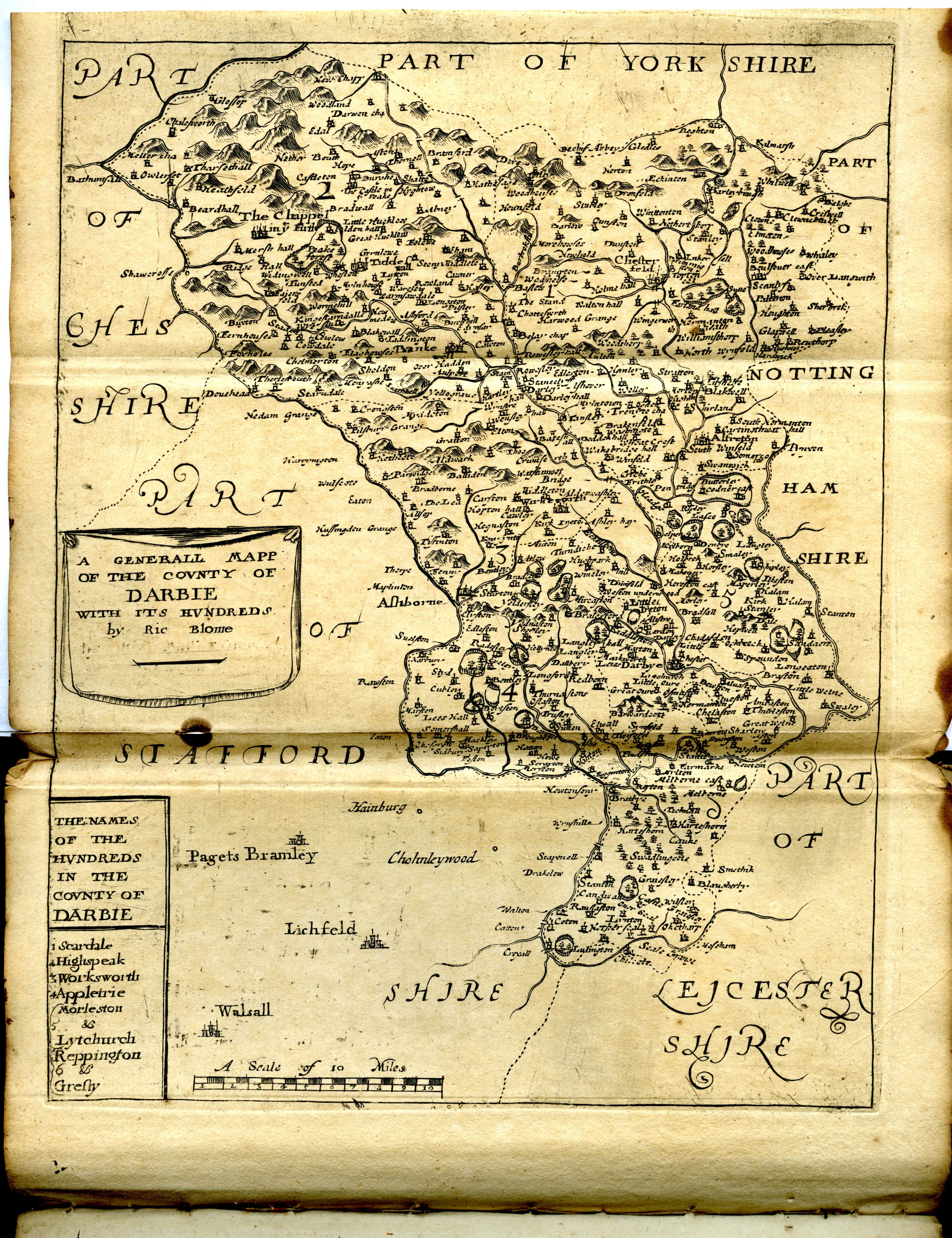
Derbyshire 1670 Richard Blome originally published in Thomas Taylor's England Exactly Described (1671) and republished here as Speed's Maps Epitomiz'd with Blome's name partially erased
(Image courtesy of MacMaster University Library
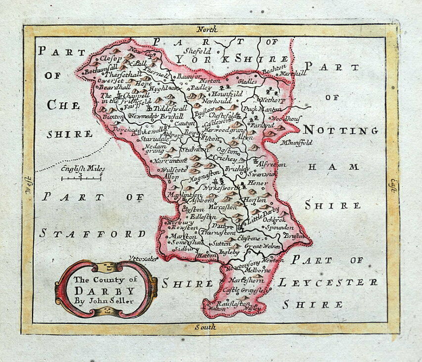
Derbyshire 1686 John Seller for Anglia Contracta (Chubb CXX)
Derbyshire 1690 Robert Morden for Camden's Britannia (Chubb p.93 CXIII) (Image courtesy of Yale University Library)
Derbyshire 1720 Emanuel Bowen in Britannia Depicta
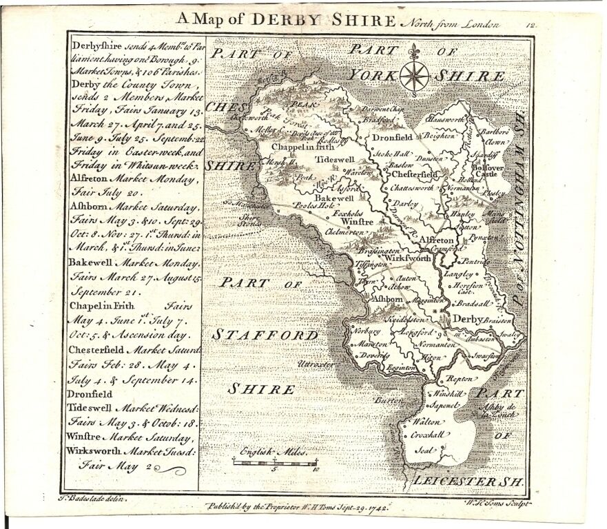
Derbyshire 1724 Thomas Badeslade: engraved by W.Toms: published in the Chorographia Britanniae
Derbyshire 1724 Herman Moll (Image courtesy of The British Library King's Collection. Maps K.TOP.11.3.)
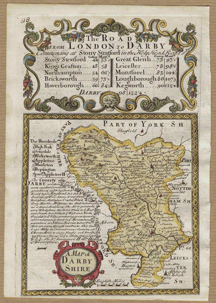
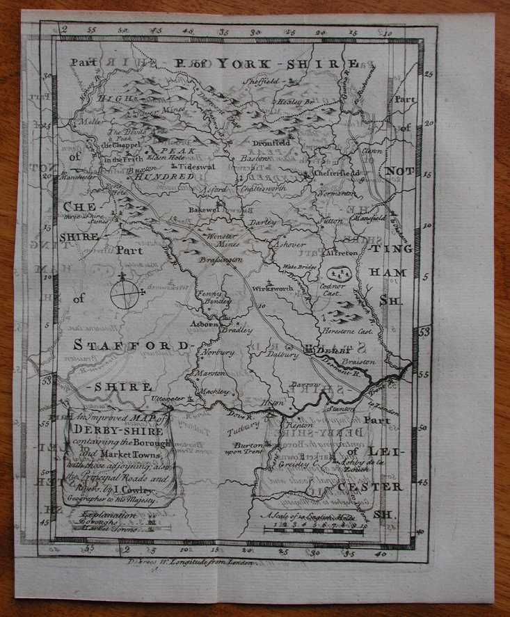
Derbyshire. 1744 John Cowley for R.Dodsley's The Geography of Britain
Derbyshire 1758 Emanuel Bowen in his Large English Atlas (Chubb p.158 CXCVI)
(Image courtesy of Yale University Library)
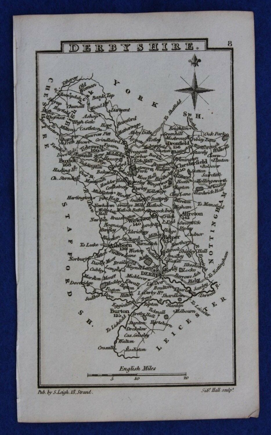
Derbyshire 1780 Samuel Leigh in Leigh's Pocket Atlas of England and Wales
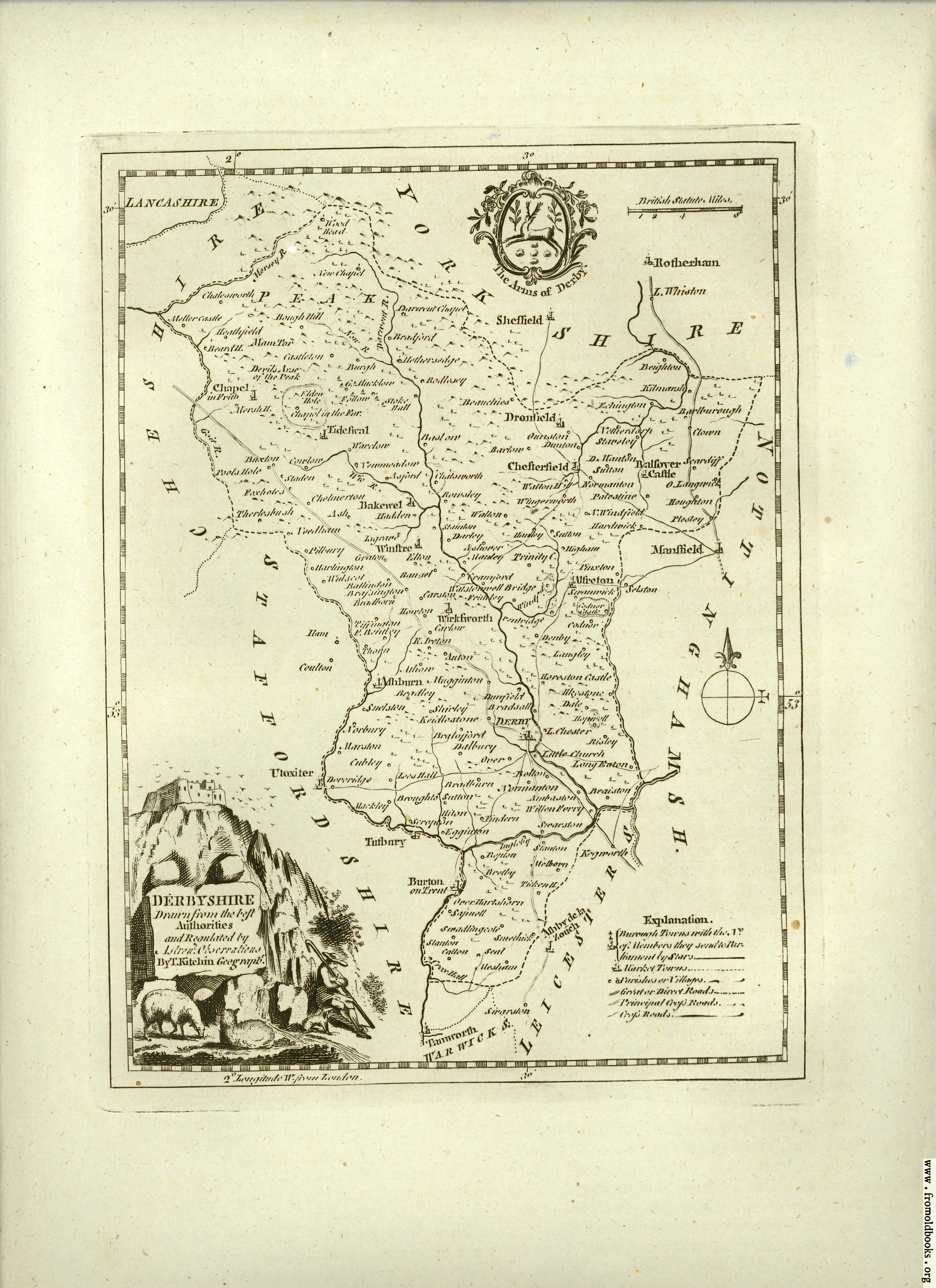
Derbyshire 1786 Thomas Kitchen in Henry Boswell's The Antiquities of England and Wales
(Chubb p.210 CCLVII)
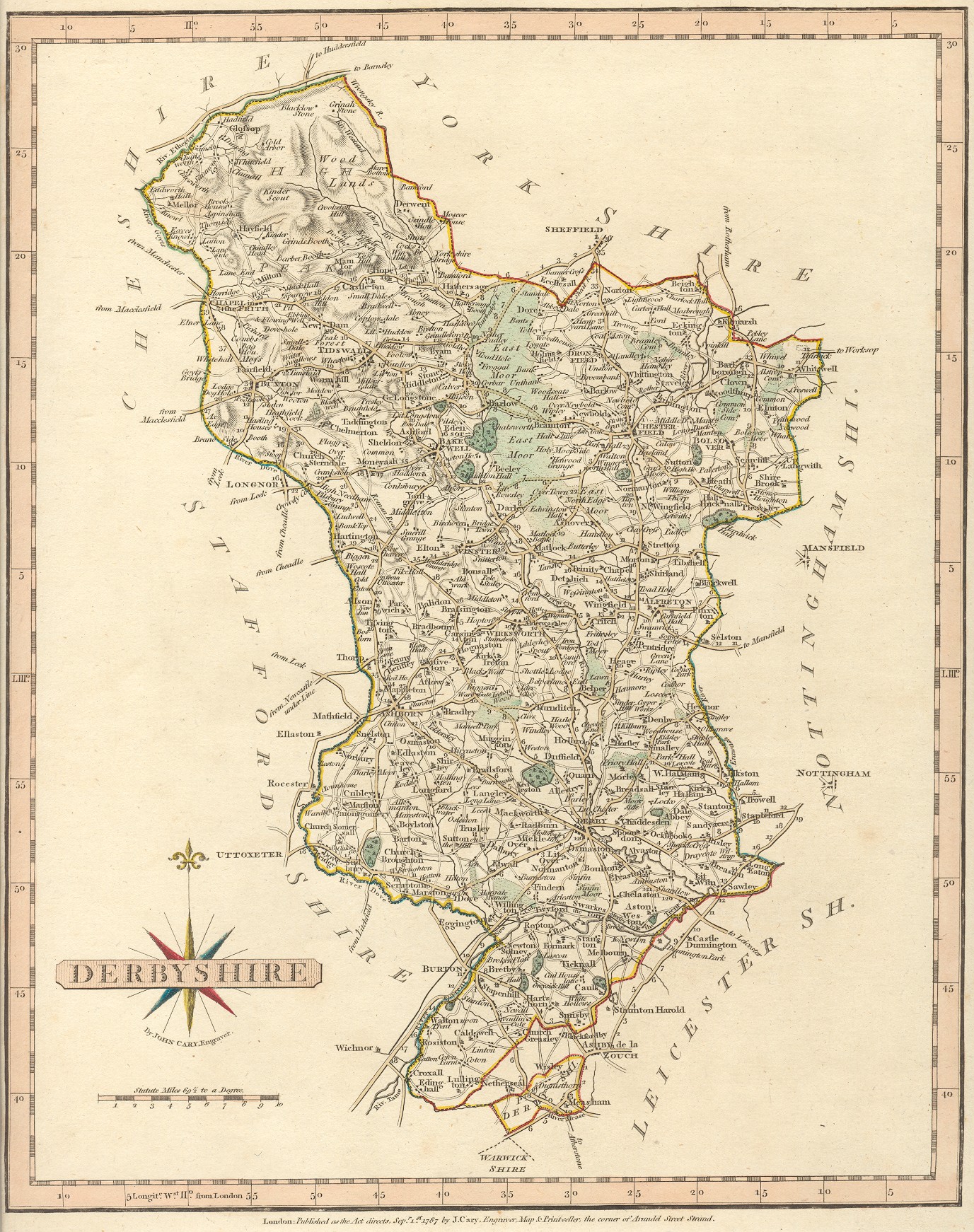
Derbyshire 1797 John Cary in his New and Correct English Atlas (Chubb p.214 CCLXI)
Derbyshire 1800 John Aikin in England Delineated "for the Use of Younger Persons" (Image courtesy of The British Library King's Collection Maps K.TOP)
Derbyshire 1805 John Cary and John Stockdale in thir New English Atlas( Chubb p. 243 CCCXIX)
Derbyshire 1806 Samuel and Daniel Lysons in Magna Britannia (Image courtesy of The British Library King's Collection Maps K.TOP)
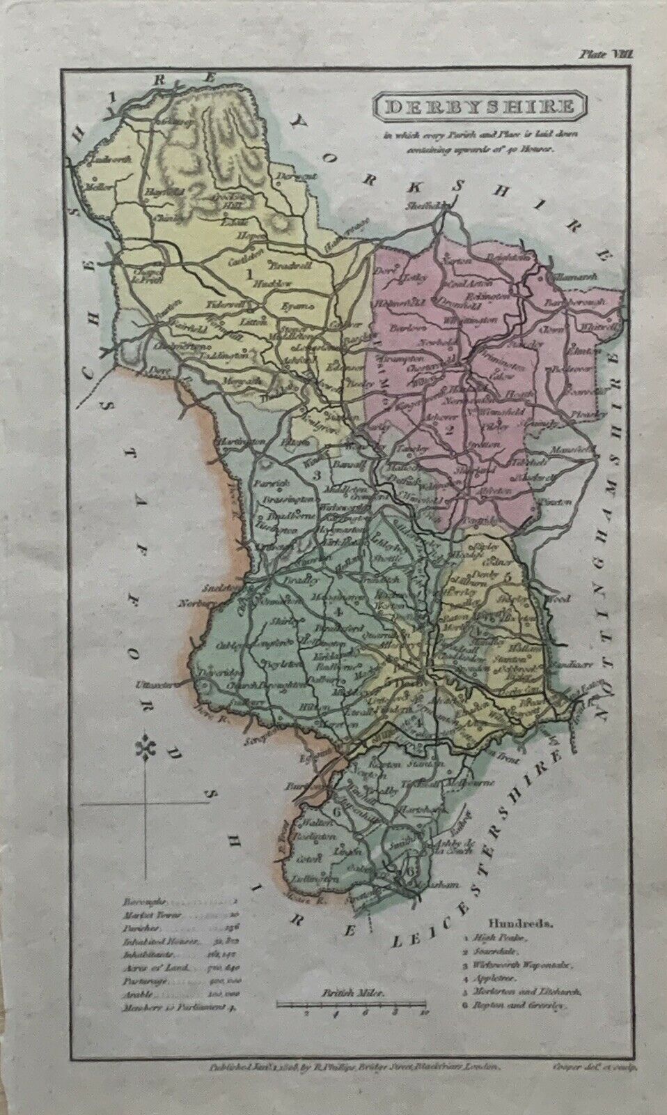
Derbyshire 1808 Henry Cooper in An Atlas of the British Islands
Derbyshire 1809 Benjamin Pitts Capper in A Topographical Dictionary of the United Kingdom (Chubb p. 245 CCCXXVIII) Image courtesy of Google Books
City Plan of Derby 1810 George Cole and John Roper in The British Atlas of England and Wales (Chubb p.249 CCCXXXIX)
Derbyshire 1814. James Wallis in Wallis' New British Atlas (Chubb p.260 XXXLXIX)
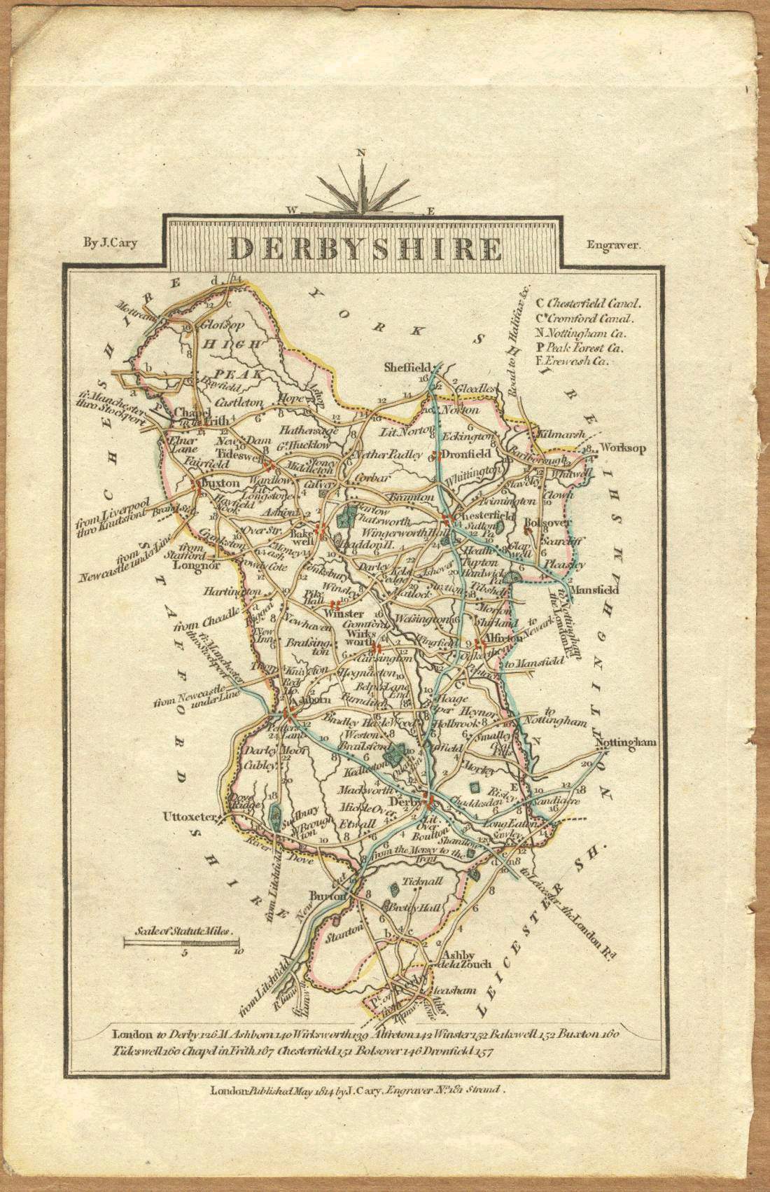
Derbyshire 1814 John Cary in Cary's Traveller's Companion
Derbyshire 1819 Ellis's New and Correct Atlas
Derbyshire 1822 Samuel Leigh in Leigh's Pocket Atlas
Derbyshire 1830 C.&J.Greenwood (Chubb p.316 CCCCLVIIIa )
Chesterfield 1832 Robert Kearsley Dawson for The Boundaries Commission Plans of the Cities and Boroughs of England and Wales
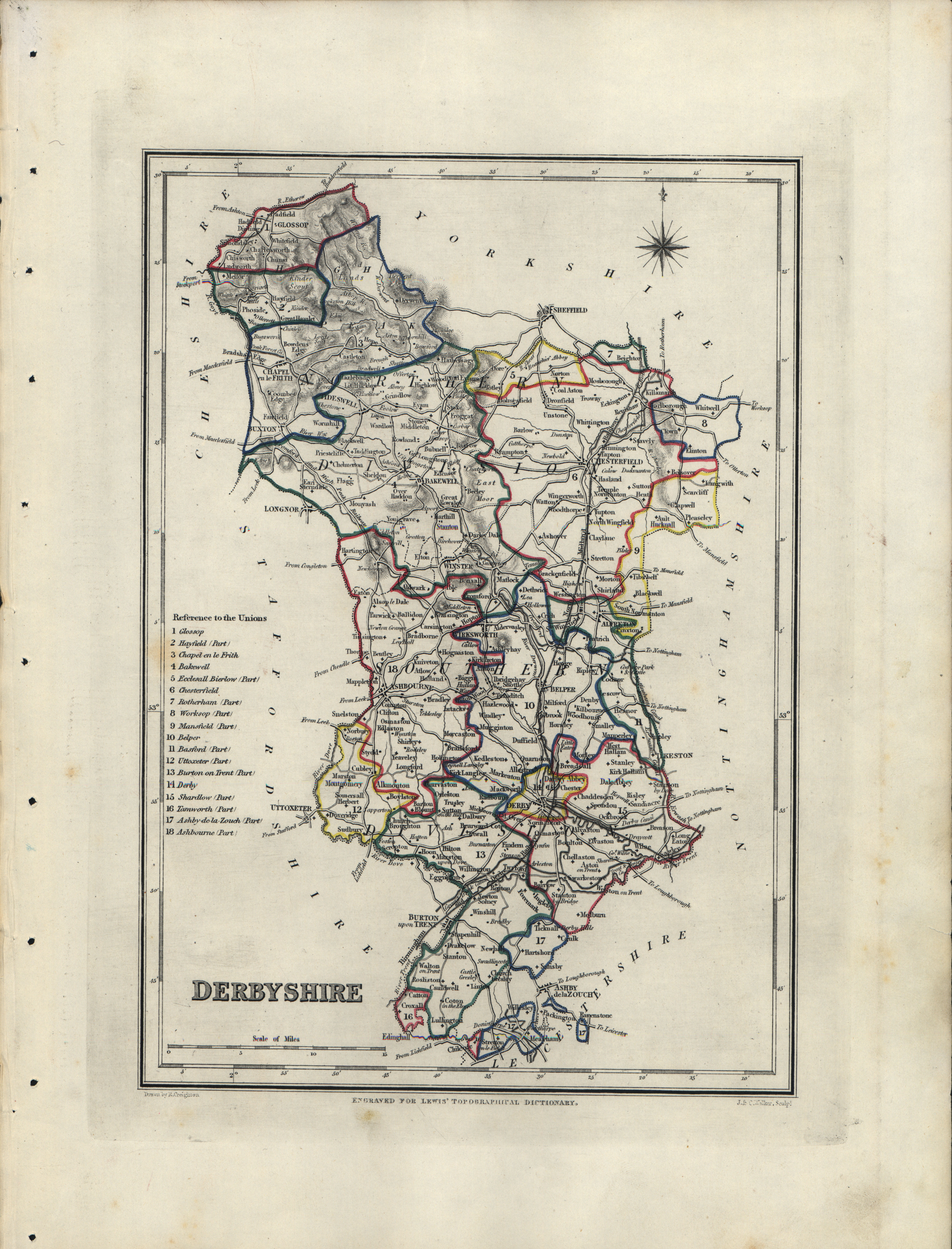
Derby 1835 Robert Creighton for Lewis's Topographical Dictionary (Chubb p.322 CCCCLXIV)
Derbyshire 1835 James Pigot in A Pocket Topography and Gazetteer of England (Chubb p.321 CCCCLXIII)
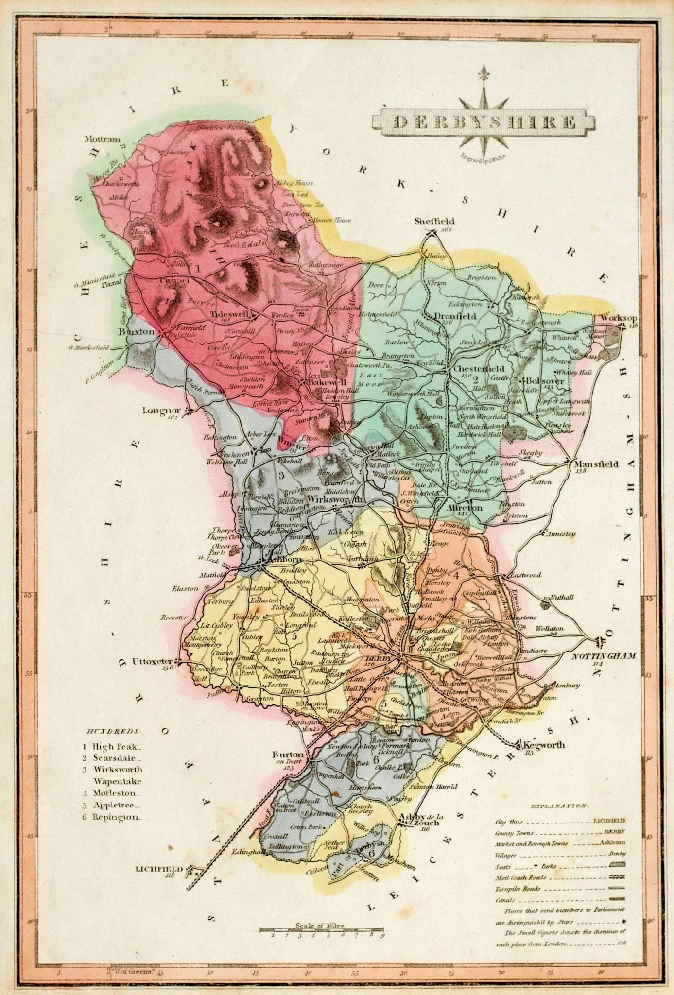
Derbyshire 1835 Robert Creighton for Lewis's Topographical Dictionary (Chubb p.322 CCCCLXIV)
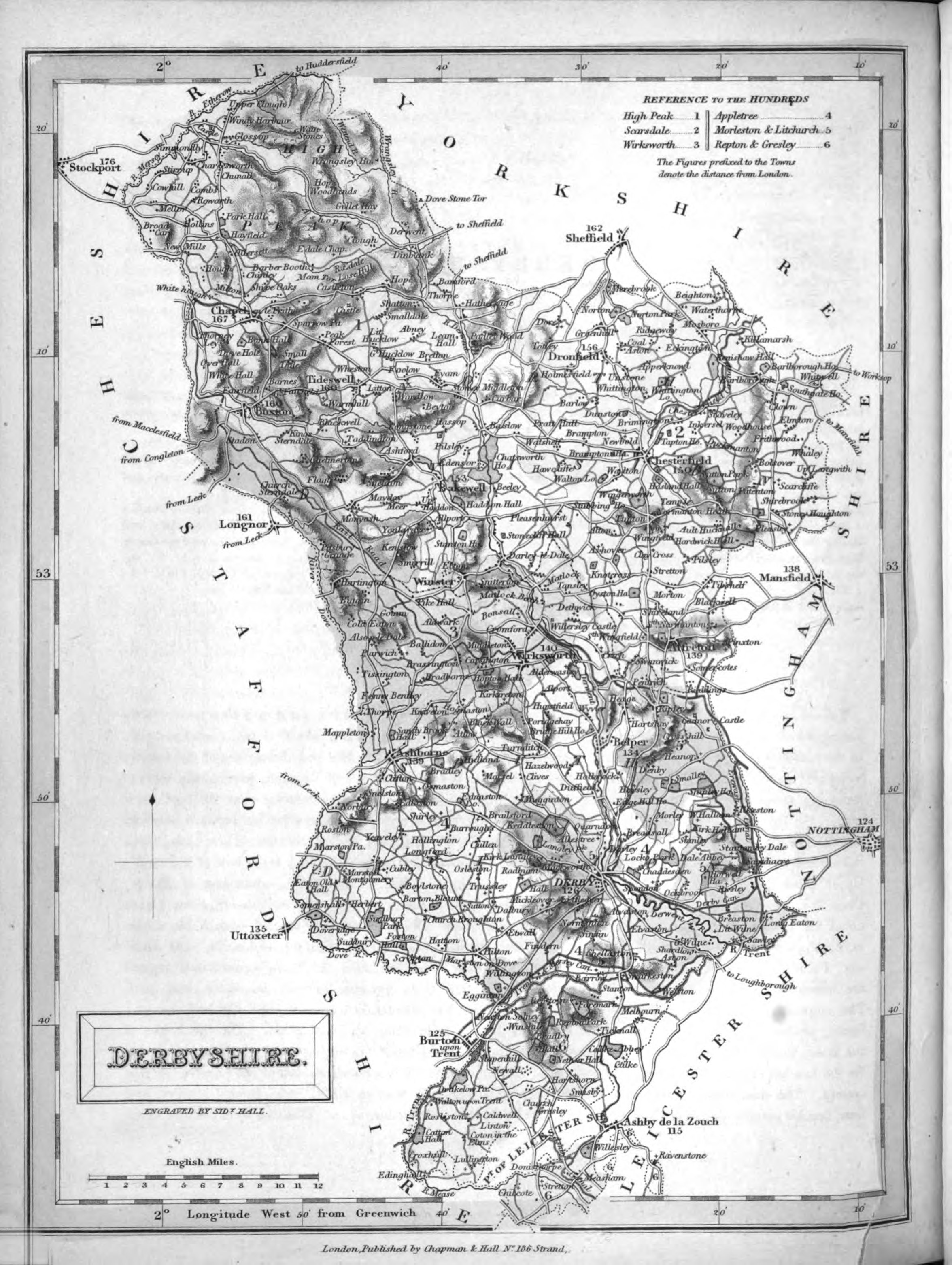
Derbyshire 1836 Sidney Hall in A New British Atlas (Chubb p.314 CCCCLi)
Derbyshire 1837 W. Schmollinger. for Thomas Moule's The English Counties Delineated; or A Topographical Description of England. (Chubb p.325 CCCCLXXXI) CCCCLXV)
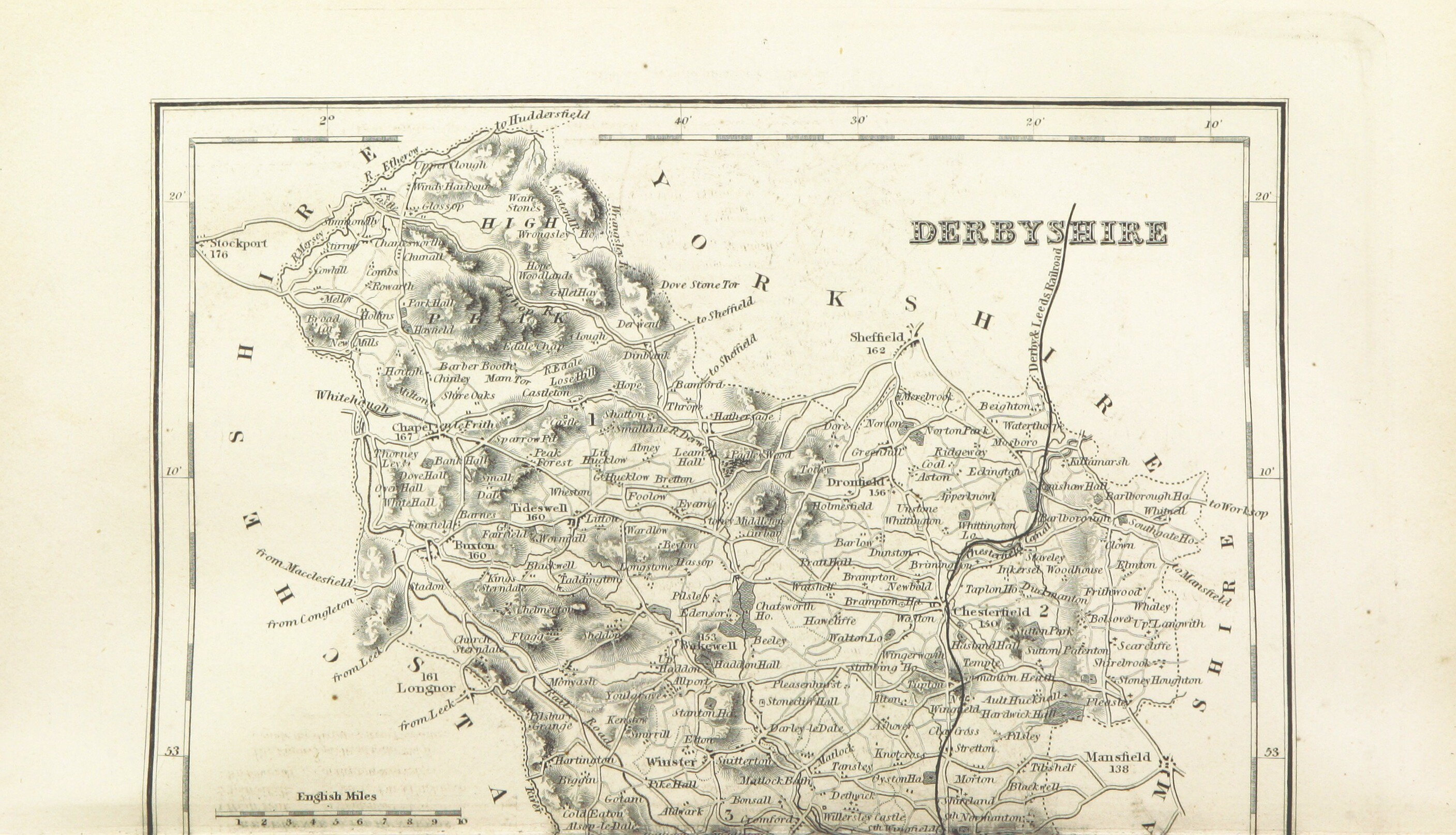
Derbyshire 1841 in The Parliamentary Gazetteer of England and Wales (upper part only)
Derbyshire 1842 Pigot and Co (Image courtesy of The Mechanical Curator & Wikimedia)
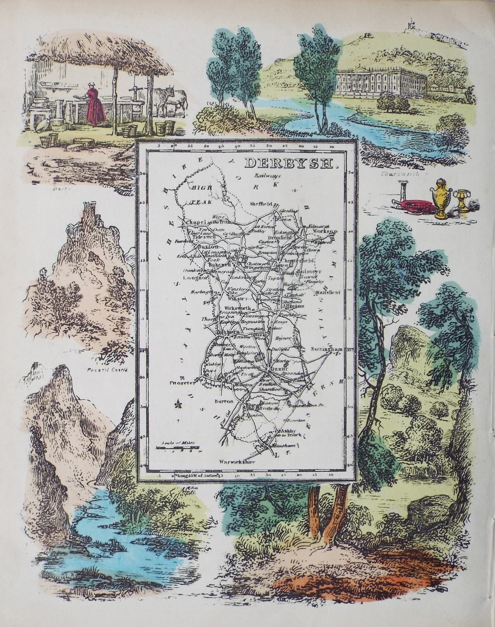
Derbyshire 1845 Reverend Samuel Clarke for The Travels of Reuben Ramble (Chubb 345 DXVII)
Derbyshire. 1848 Robert Creighton for Lewis's Topographical Dictionary
Derbyshire 1848 Joshua Archer for Thomas Dugdale's Curiosities of Great Britain Chubb p.323 CCCCLXVI)
Derbyshire 1884 (left sheet) A & C Black (Image courtesy of The Mechanical Curator & Wikimedia)
Derbyshire 1884 (right sheet) A & C Black (Image courtesy of The Mechanical Curator & Wikimedia)
Street Plan of Derby 1884 A. & C. Black (Image courtesy of The Mechanical Curator & Wikimedia)
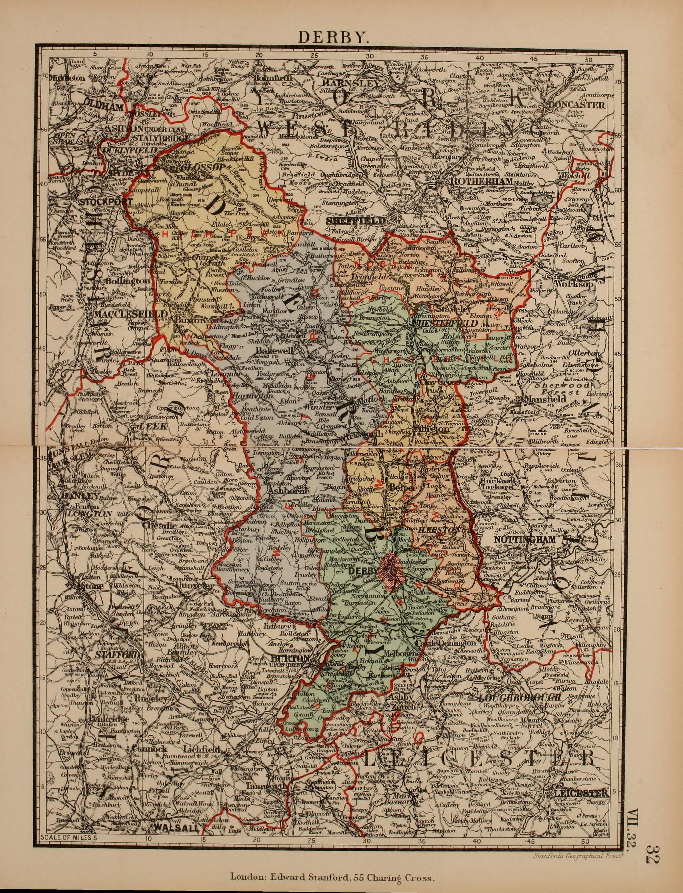
Derbyshire 1885 Stanford's Parliamentary Atlas
(Image%20courtesy%20of%20The%20British%20Library%20King's%20Collection%20Maps%20K.TOP).jpg)
.jpg)
%20.jpg)
.jpg)
.jpg)
.jpg)
%20.jpg)
%20.jpg)
%20%20Image%20courtesy%20of%20Google%20Books.jpg)
.jpg)
%201832%20Robert%20Kearsley%20Dawson%20for%20The%20Boundaries%20Commission%20Plans%20of%20the%20Cities%20and%20Boroughs%20of%20England%20and%20Wales.jpg)
.jpg)
.jpg)
%20%20A%20%20&%20C%20Black%20(Image%20courtesy%20of%20The%20Mechanical%20Curator%20&%20Wikimedia).jpg)
.jpg)
%20.jpg)