| |
 Resources consulted for Durham A Bibliography of County Maps - Large Scale County Maps of England. Tooley R.V. The Printed Maps in the Atlases of Great Britain and Ireland1579-1870 Chubb Thomas Dawson 1927 |
To resize image:
hold CTRL and use mouse scroll-wheel |
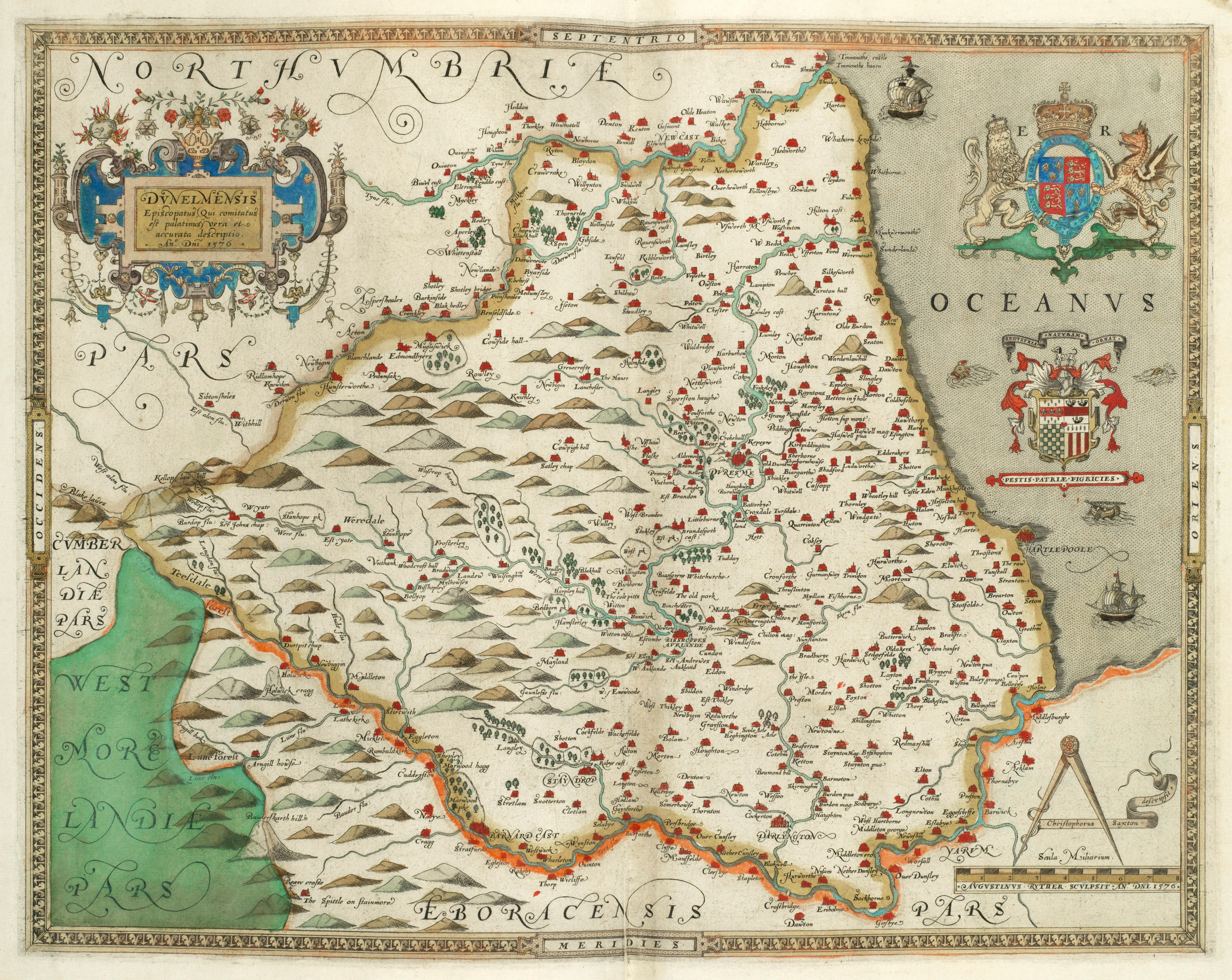
Dunelmiensis Episcopatus 1579 Christopher Saxton (Chubb p.3)
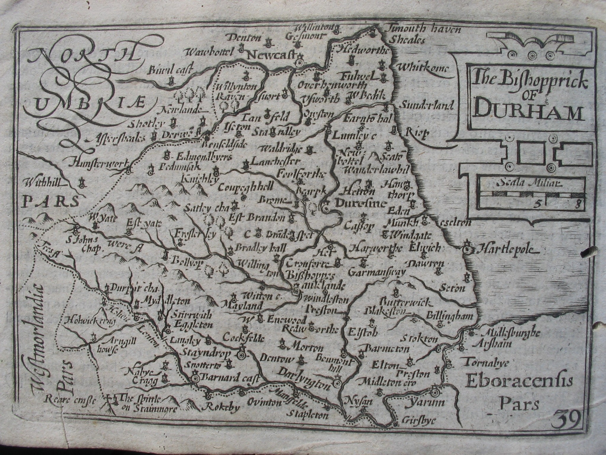
The
Bishopric of Durham 1605 (01) Pieter van den
Keere in his Atlas of the British Isles (Chubb LX)
Durham 1605 (02) Pieter van den Keere in his Atlas of the British Isles
Durham 1605 (02) Pieter van den Keere in his Atlas of the British Isles
The Bishopric of Durham 1610 John Speed in The Theatre of the Empire of Great Britaine (Chubb p.23 XXII)
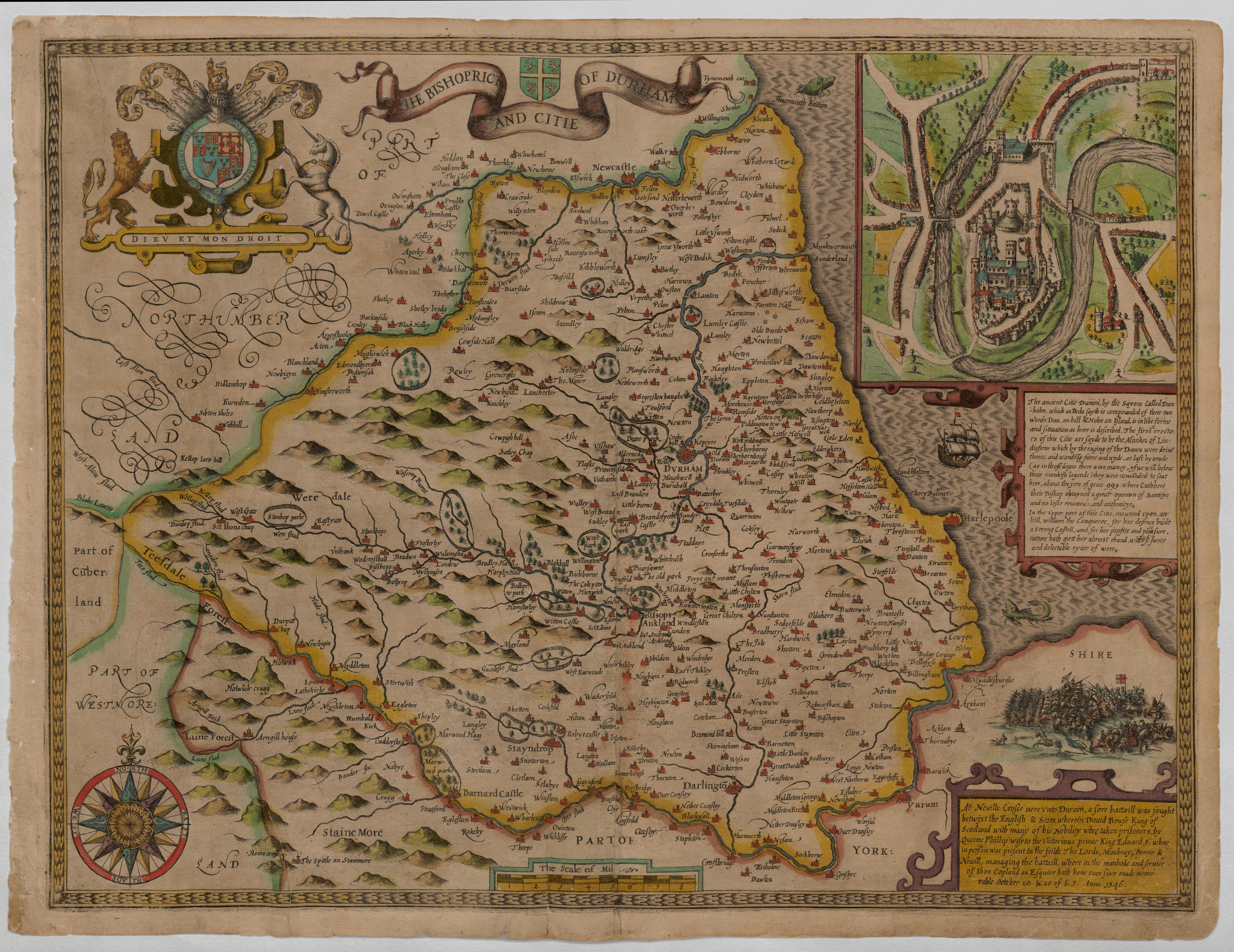
(Image courtesy of Wikimedia)
The Bishopric of Durham 1626 John Bill in An Abridgement of Camden's Britannia (Chubb p.52 XLI)
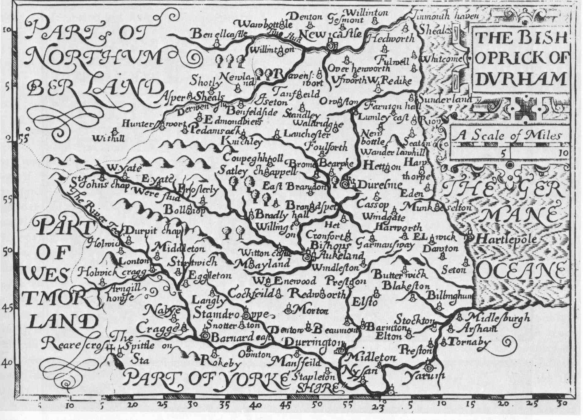
Northumbria Cumberland and Durham 1638 Gerard Mercator (Image courtesy of The British Library Maps K.TOP.
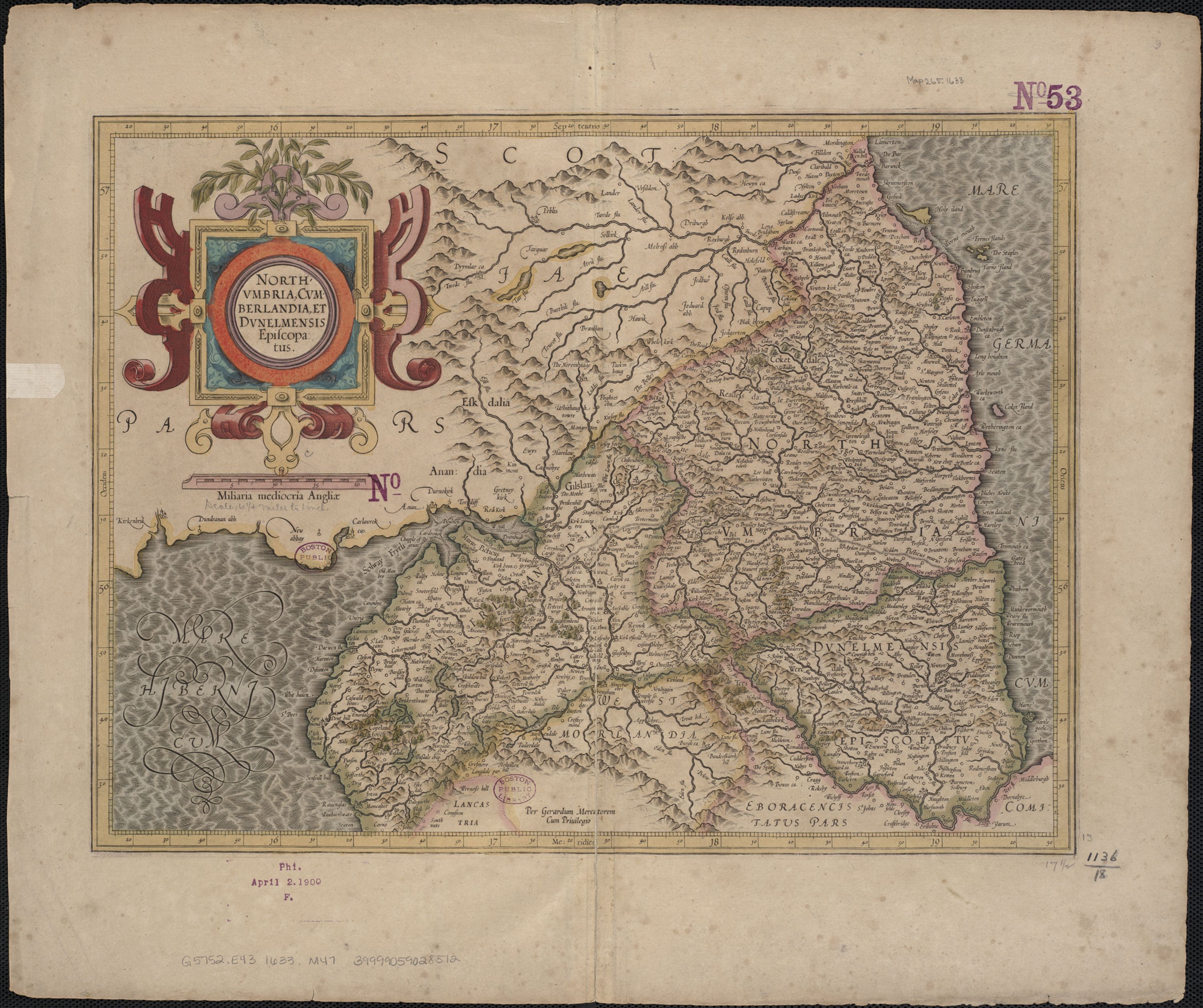
Durham 1645 Jan Jansson for his Atlas Novus (Image courtesy of The British Library Maps K.TOP.12.27
The Bishopric of Durham 1664 Roger Rea after John Speed in A Prospect of the Most Famous Parts of the World
(Image courtesy of The British Library King's Collection)
Durham 1665 Joan Blaeu (image courtesy of British Library - Albums)
.jpg)
The Bishopric of Durham 1673 Richard Blome in his Britannia
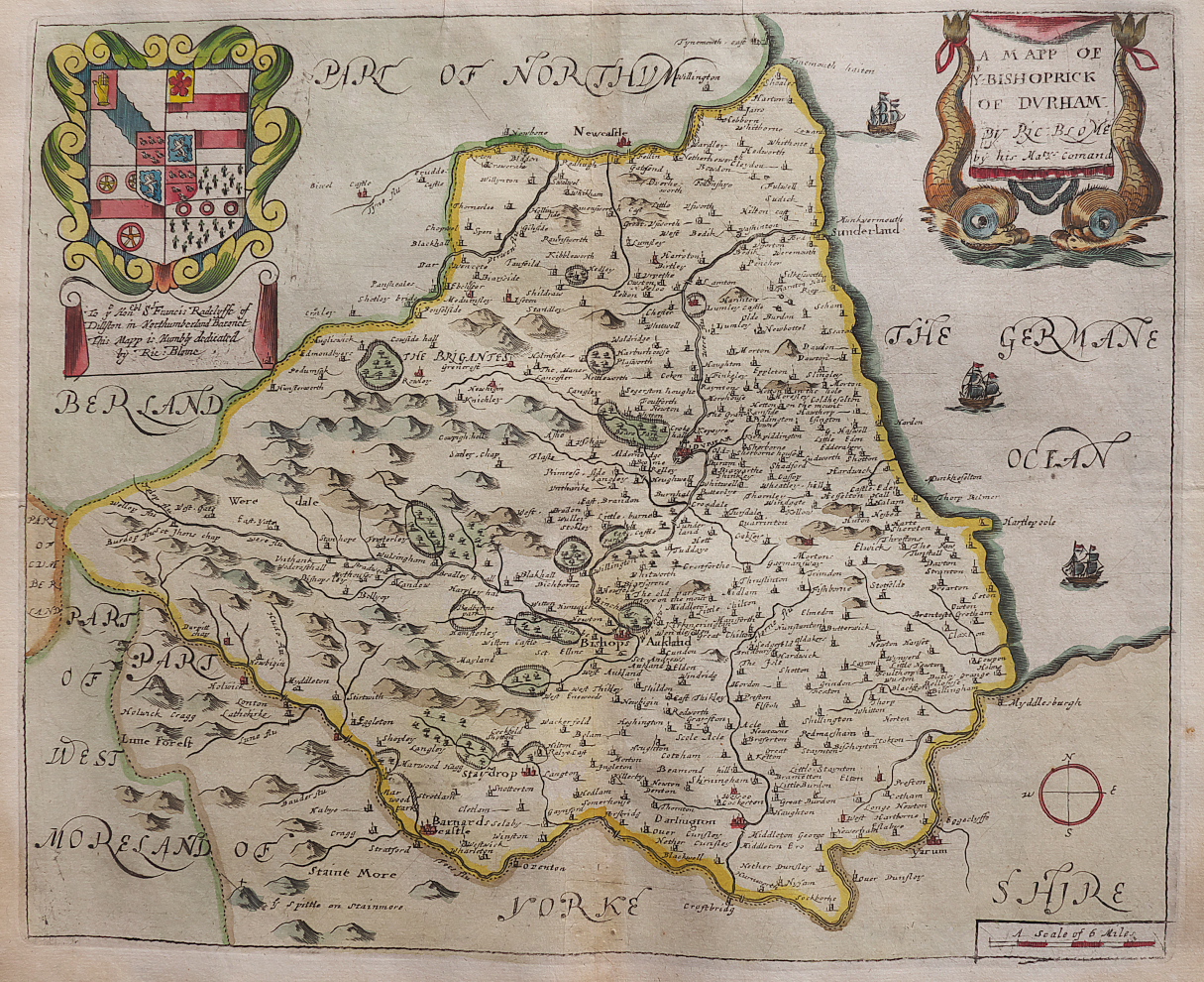
(Chubb p.81 XCIX)
Durham 1680 map accompaying a petition (Image courtesy of Yale University Library)
%20Yale%20University%20Library%20.jpg)
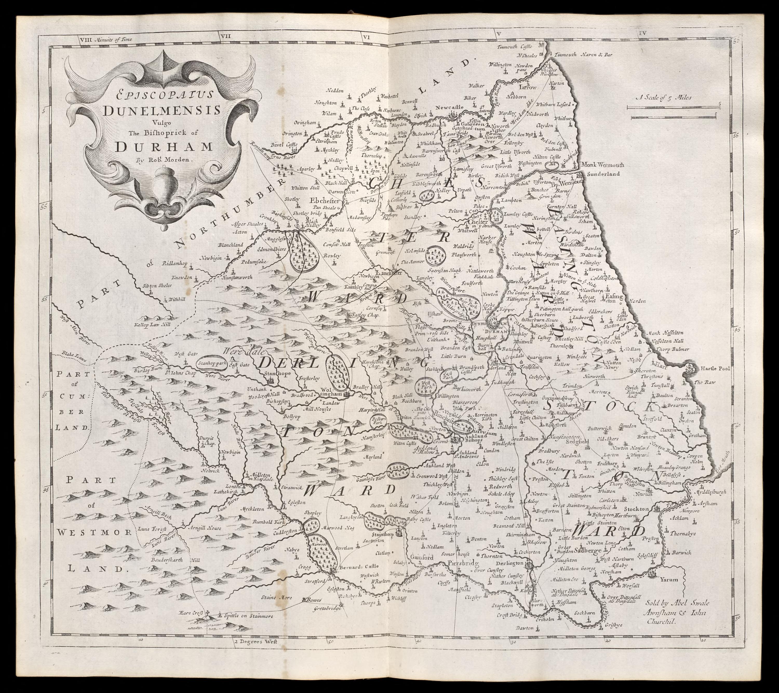
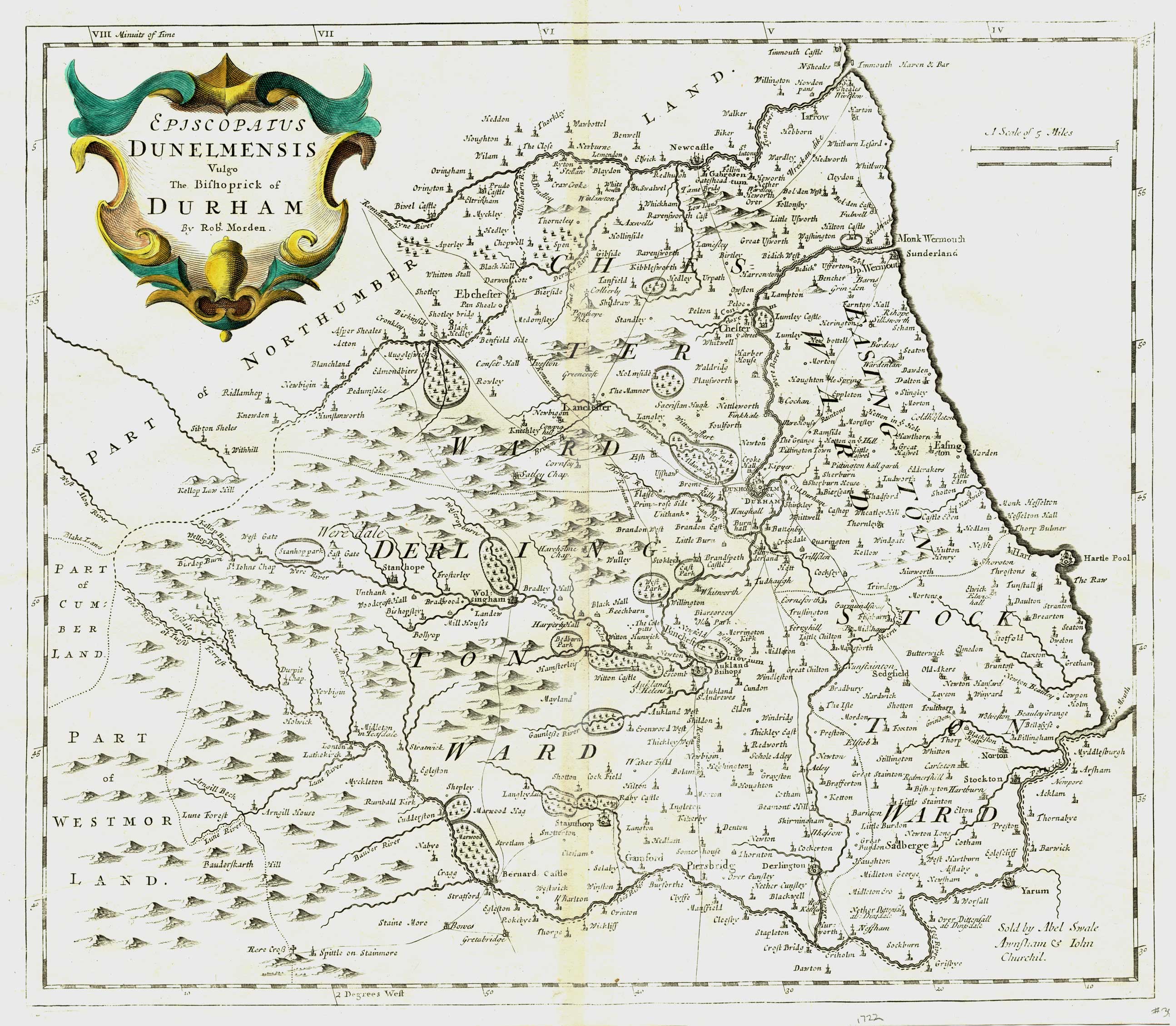
The Bishopric of Durham (01) 1690 R.Morden (Image courtesy of Yale University Library )
%20%20%20Robert%20Morden%20for%20Camden's%20Britannia%20.jpg)
The Bishopric of Durham (02) 1690 R.Morden (Image courtesy of Yale University Library
%201690%20R.Morden%20%20%20(Image%20courtesy%20of%20Yale%20University%20Library%20%20.jpg)
Durham (03) 1695 Robert Morden for Camden's Britannia (image Courtesy of the British Library
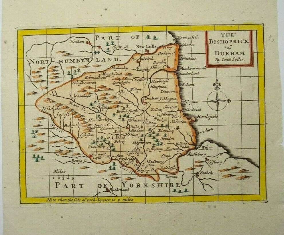
The Bishopric of Durham 1701-1703 John Seller for Camden's Britannia Abridged or: using the same plates; The History of England or: also: Anglia and Contracta. and finally (post mortem) for Francis Grose's Antiquities of England and Wales 1777 -87 with Seller's imprint removed (Chubb p.100 CXXII)
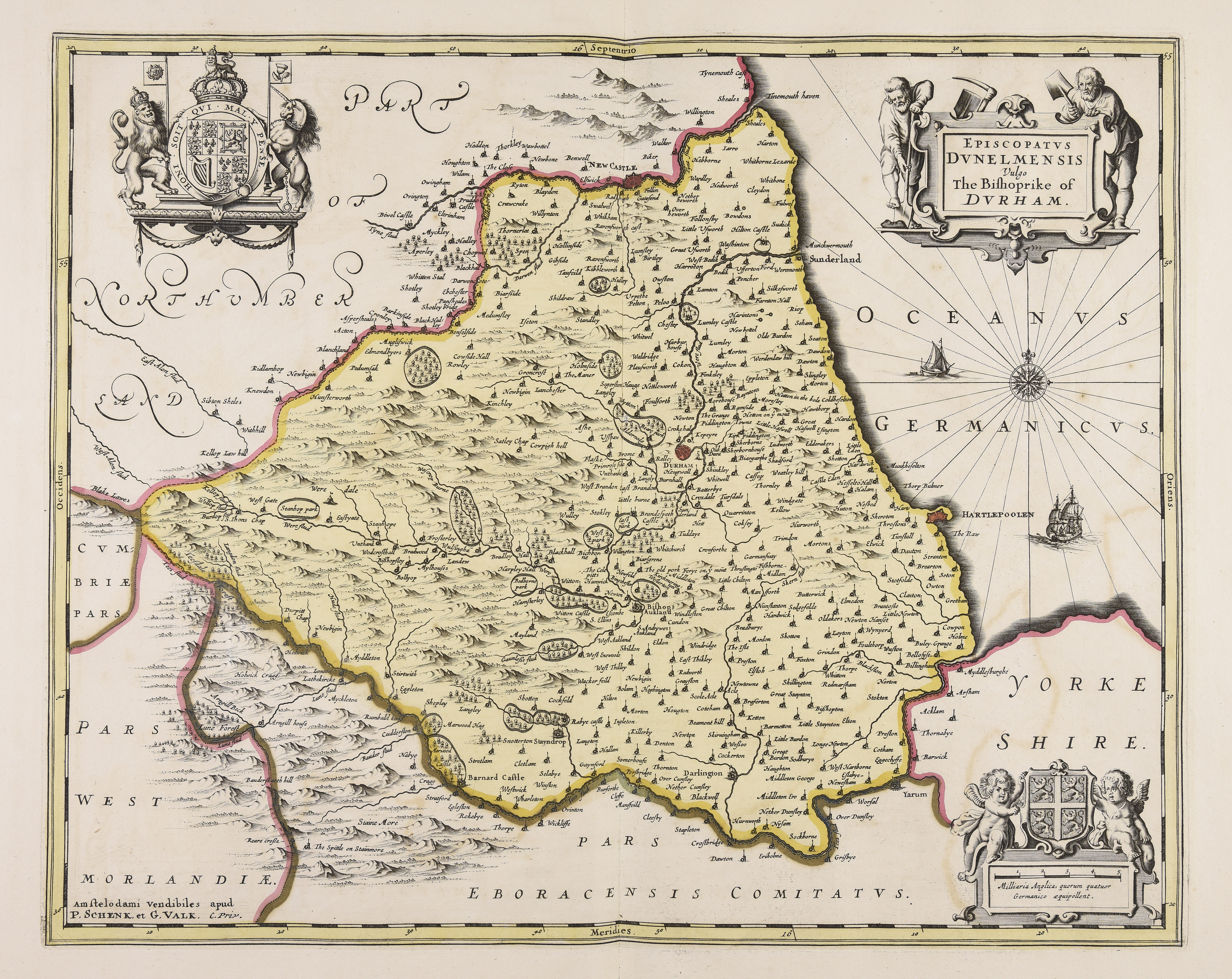
Bishoprike of Durham 1715 re-published by Gerardum Valk & Petrum Shenk after Jansson's death Wikimedia (Chubb p.74 LXXXIX)
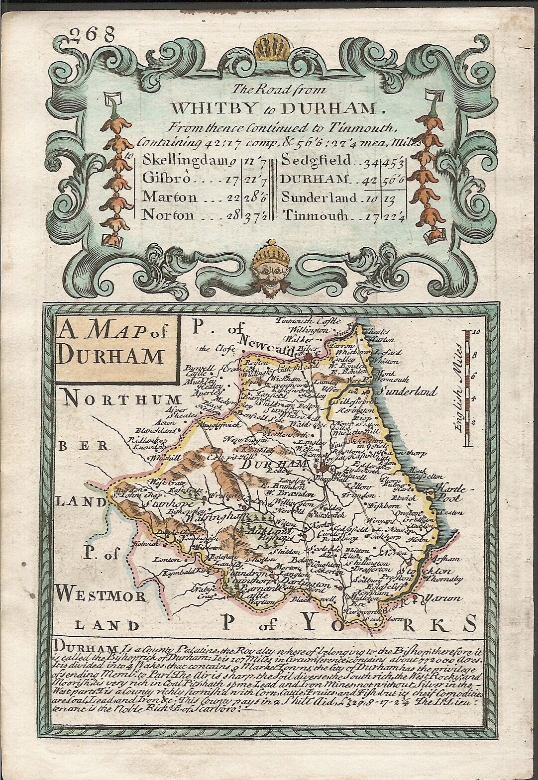
A Distance Chart of Durham 1720 Matthew Symonds and Van Langeren
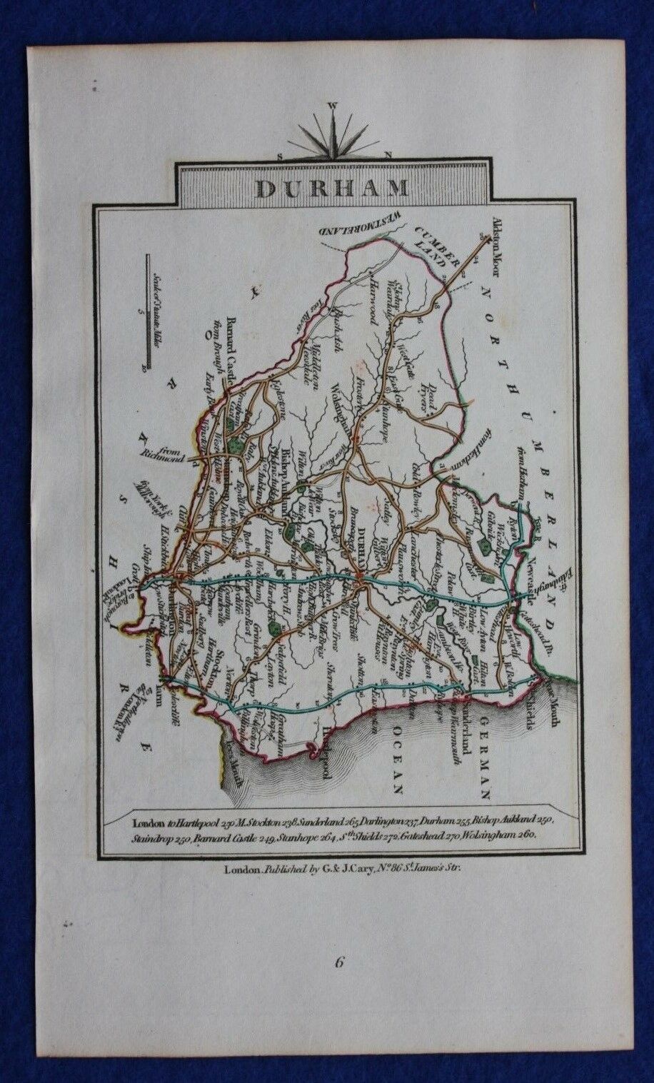
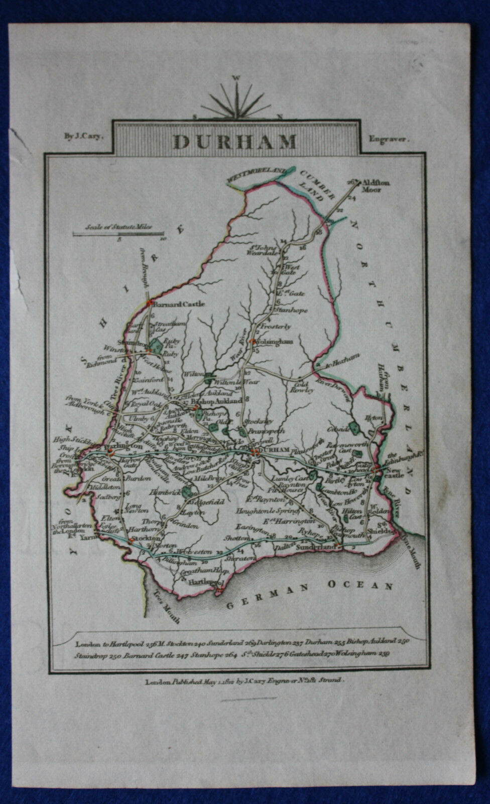
Durham 1720 John Cary in Cary's Travellers' Companion (Chubb p.220 CCLXXIII)
A map of Durham 1720 in Emanuel Bowen's Britannia Depicta (Chubb p.117 CXLVII)
Durham Canal 1722 Stockton to Winston Robert Whiteworth
Bishopric of Durham 1722 Robert Morden. Reprint of Morden's 'Britannia' Map of 1695 (Chubb p.CLVII)
Durham 1724 Herman Moll in A New Description of England and Wales (Chubb CLX: CLXI)
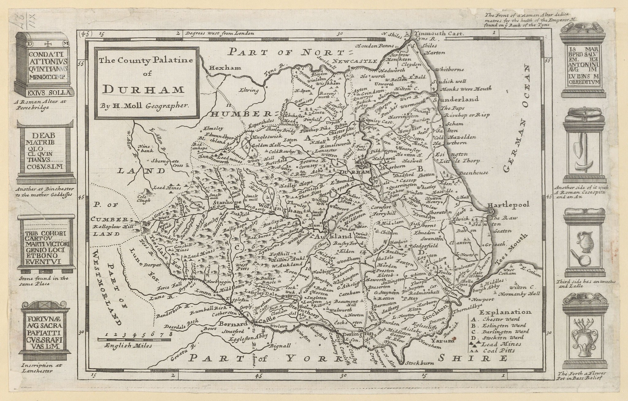
(Image courtesy of The British Library-King's Topographical Collection Maps K.Top .12.27. )
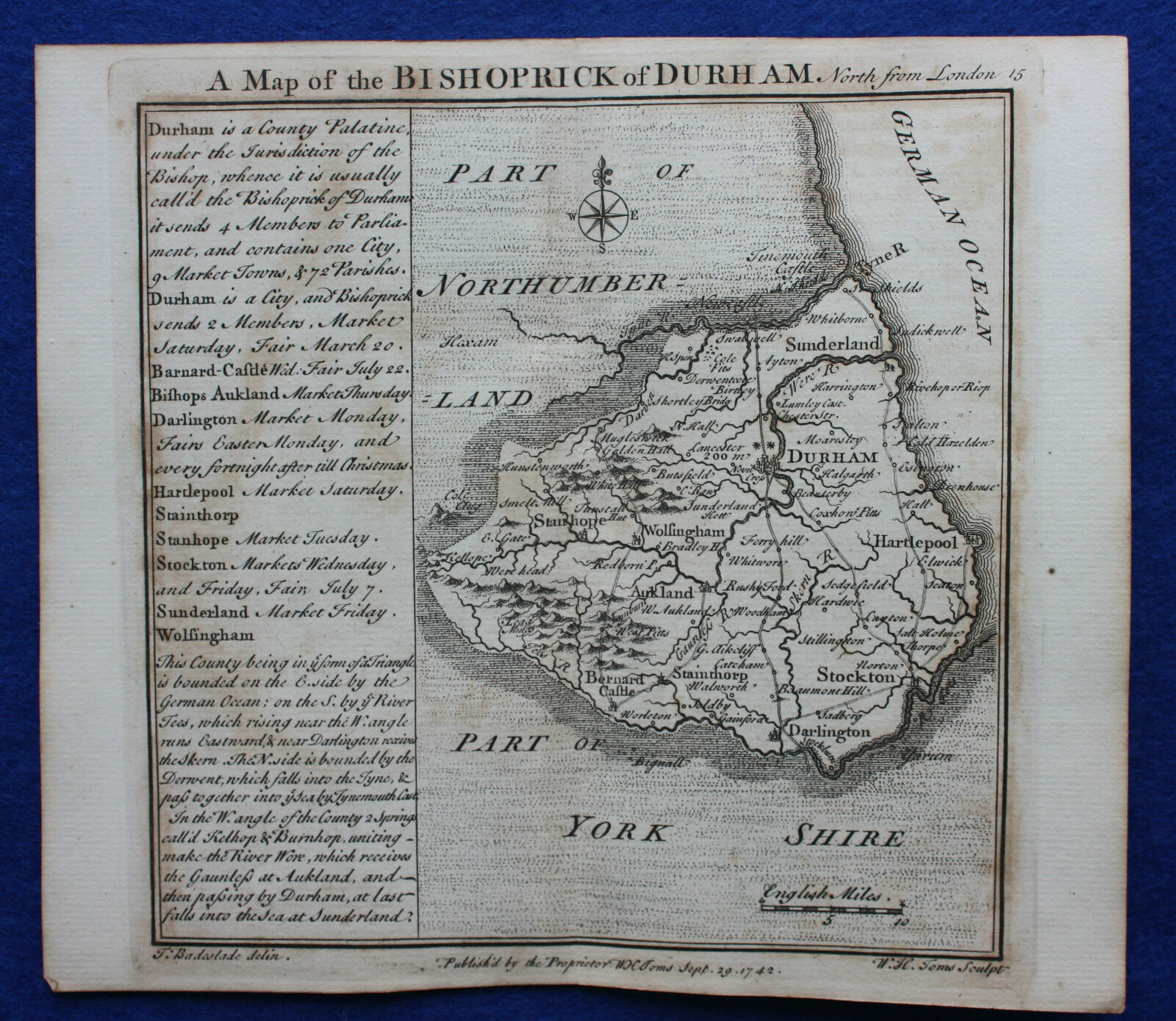
Bishopric of Durham 1742 Badeslade and Toms (Chubb p.135 CLXXIIV
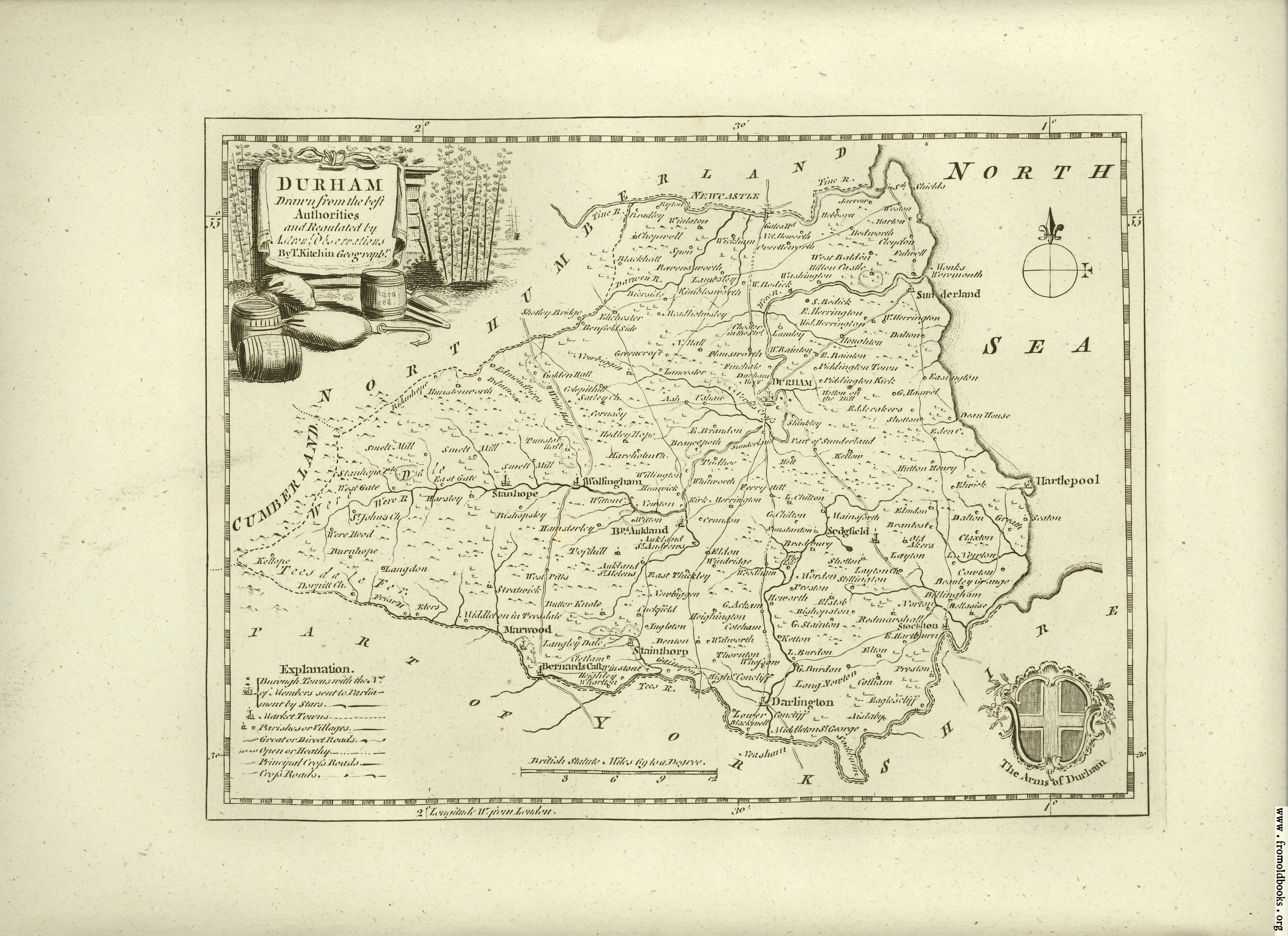
Durham 1746 Thomas Kitchin
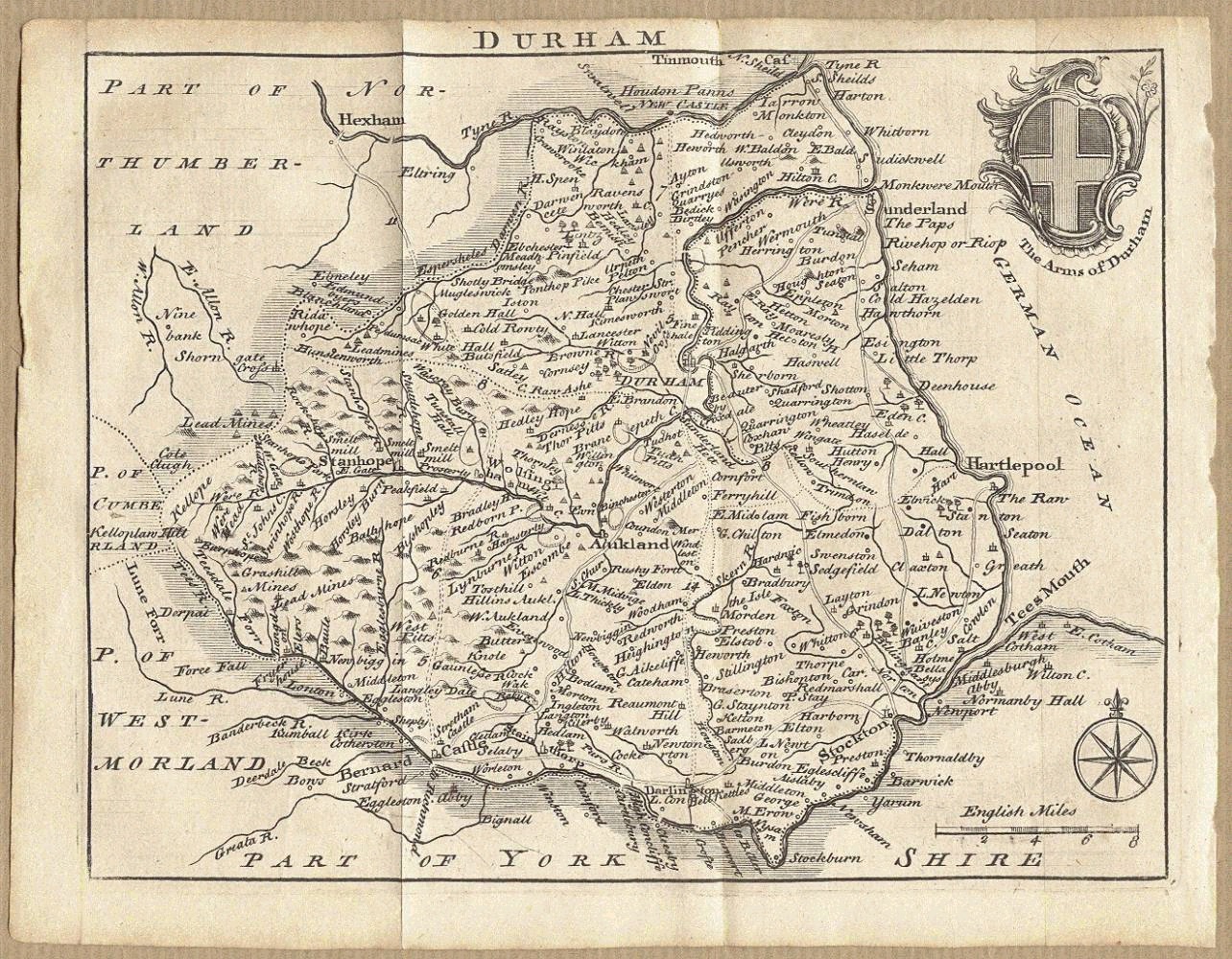
Durham 1746 Samuel Simpson in his Agreeable Historian
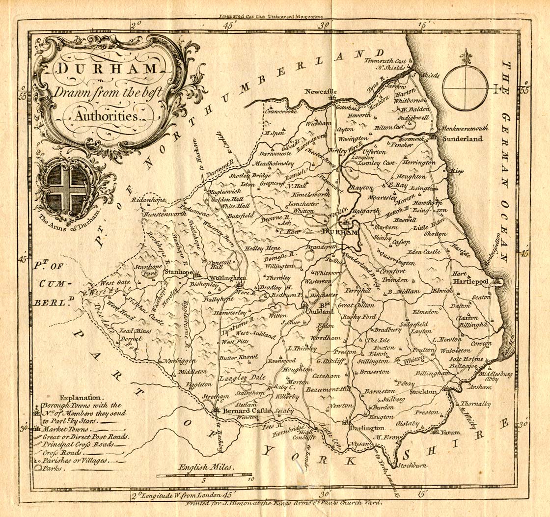
Durham 1749 Thomas Kitchin for The Universal Magazine
The County Palatine of Durham 1750 Thomas Kitchin in The Large English Atlas (Chubb p.157 CXCV)
(Image Courtesy of Biblioteca National de Espana)
The Bishopric of Durham 1750 Thomas Kitchin and Emanuel Bowen in The Royal English Atlas (Chubb p.179 CCXVII)
%20%20%20Yale%20University%20Library%20.jpg)
(Image courtesy of Yale University Library)
A map of Durham 1759 Owen and Bowen in Britannia Depicta (Chubb p.117 CXLVII)
.jpg)
The Bishopric of Durham 1760 Thomas Kitchen in Kitchin's English Atlas
.jpg)
Plan and West Prospect of Stoke Town bef.1756 (Image courtesy of The British Library King's Collection Maps K.TOP.)
%20.jpg)
The County Palatine of Durham 1760 Thomas Jefferys: pub. Robert Sayer (Image courtesy of The British Library King's Collection Maps K.TOP.)
%20.jpg)
An Accurate map of Durham 1760 Thomas Kitchin fror The Large English Atlas (Image courtesy of The British Library
Durham 1769 John Roque for The Small English Atlas (Chubb p.172 CCVII)( and the same plates used for Rocque's England Displayed)
A Plan of The River Tees ...1772 Robert Whitworth for The Gentleman's Magazine
Canal from Chesterfield to Stockwith 1770 Robert Whitworth in The Gentleman's Magazine
A Plan of The River Tees ...1772 Robert Whitworth for The Gentleman's Magazine
Thomas Kitchin (Image courtesy of Biblioteca Digital Hispanica)
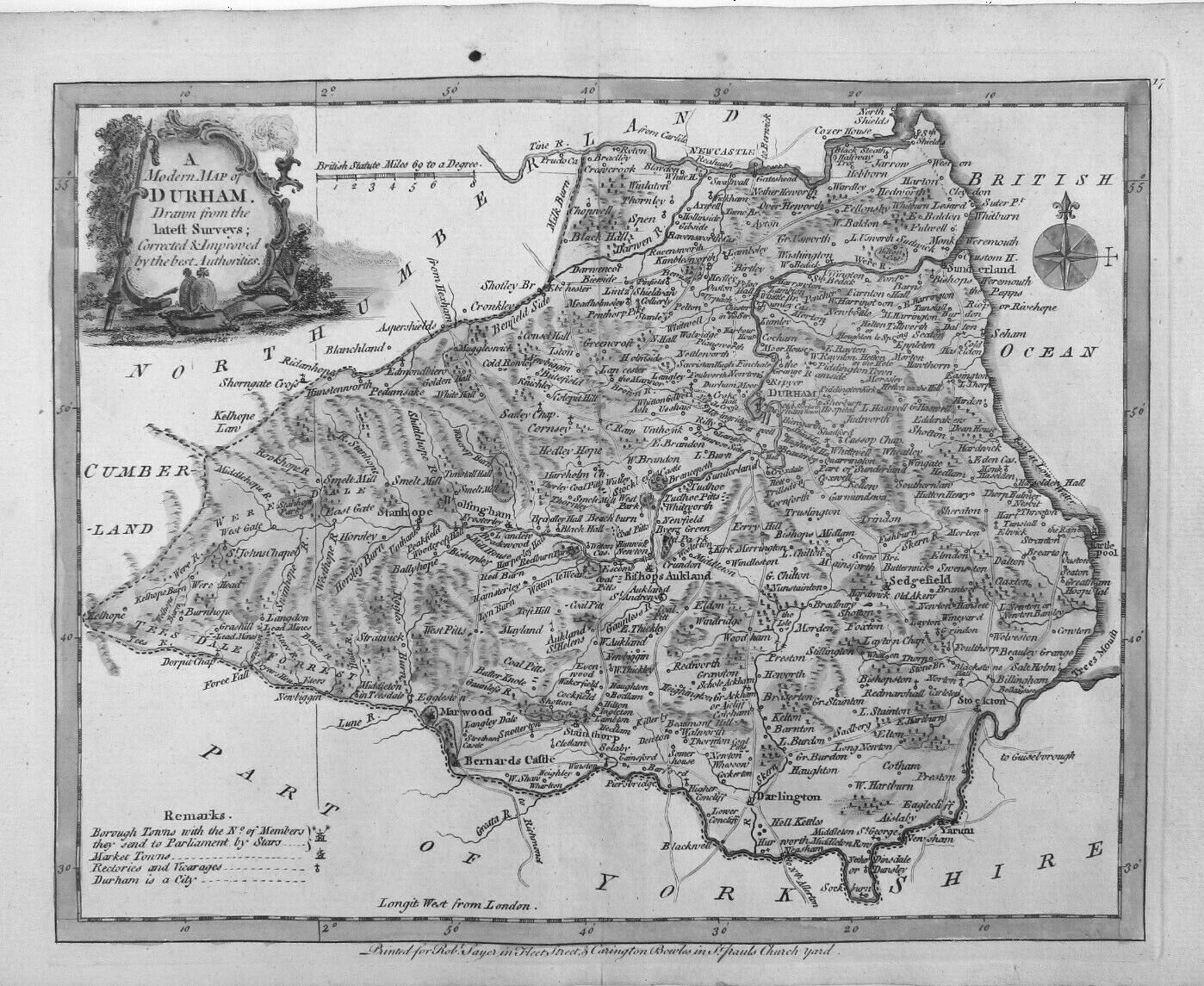
A Modern Map of Durham 1777 J Ellis in his English Atlas
Durham 1786 Thomas Kitchen in The Antiquities of England and Wales
County Durham 1790 John Cary in Cary's Travelers' Companion (Chubb p.220 CCLXXIII
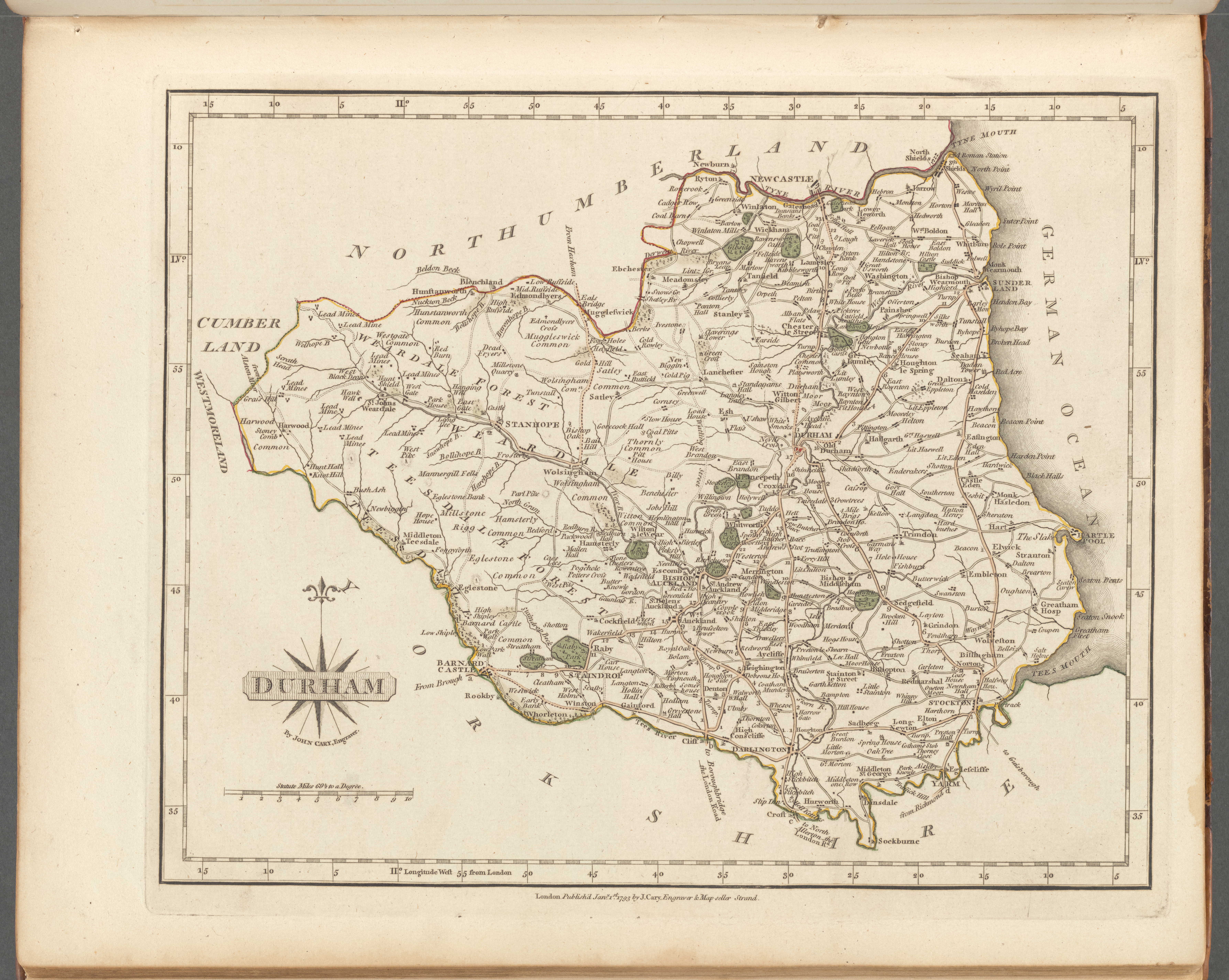
Durham 1793 John Cary in his New and Correct English Atlas New (Chubb p.213 CCLX) (Image courtesy of York Library Digital Collections)
Durham 1800 John Aikin in England Delineated ( A simplified Atlas
.jpg)
..."to make my young countrymen better acquainted than they are usually found to be with their native land") (Chubb p.223 CCLXXXIX)
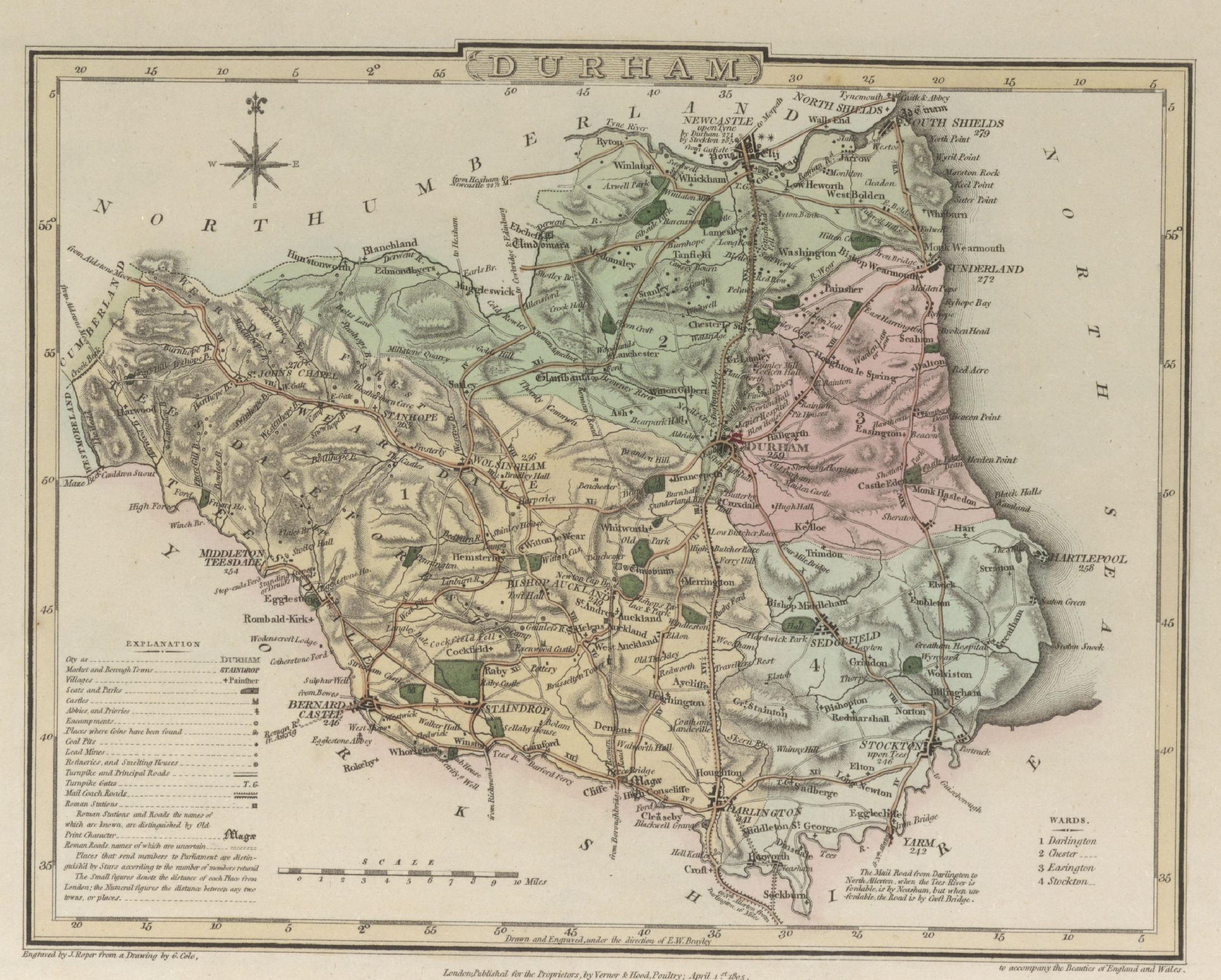
Plan of Durham 1805 G. Cole and J. Roper in The British Atlas of England and Wales (Chubb p.250 CCCXXXIX)
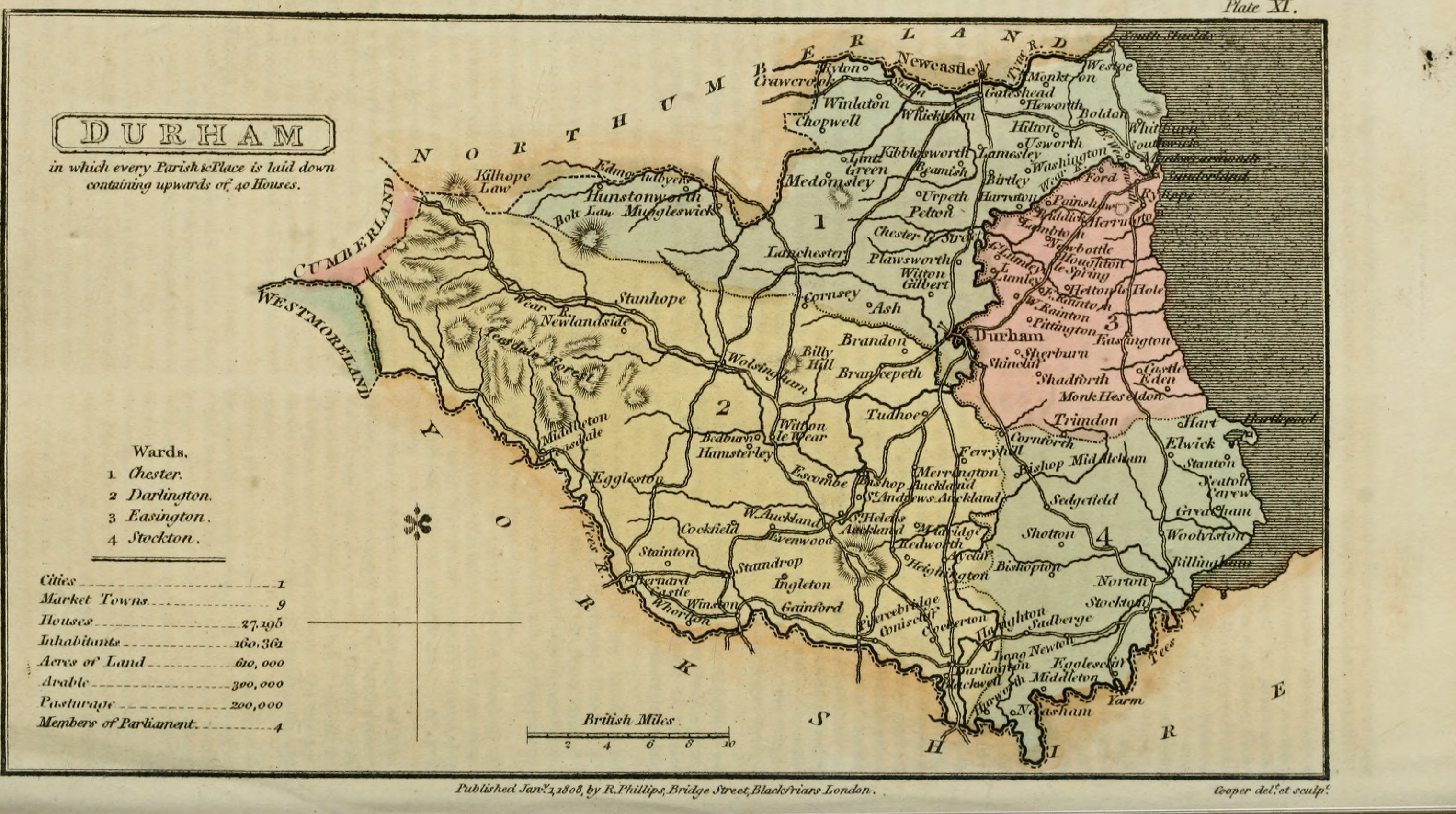
The Bishopric of Durham 1808 Henry Cooper with Benjamin Pitts Capper to accompany The Beauties of England and Wales (Chubb p.245 CCCXXVII)
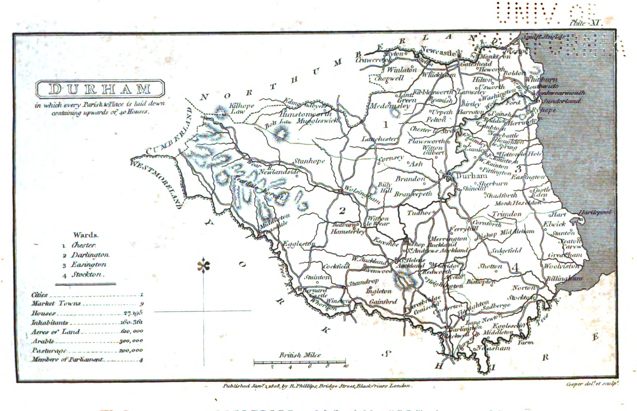
The Bishopric of Durham 1808 Benjamin Pitts Capper in A Topographical Dictionary of the United Kingdom (Chubb p.245 CCCXXVII) Wikimedia
County Durham 1809 George Cole and John Roper in their British Atlas (Chubb p.250 CCCXXXIX)
(Image courtesy of The British Library-King's Topographical Collection
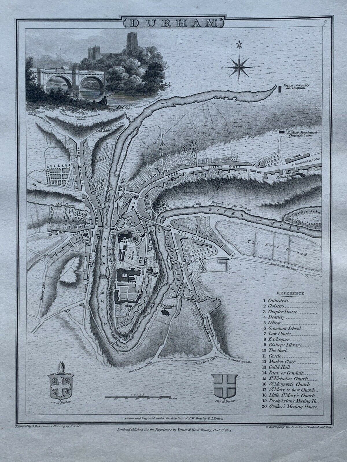
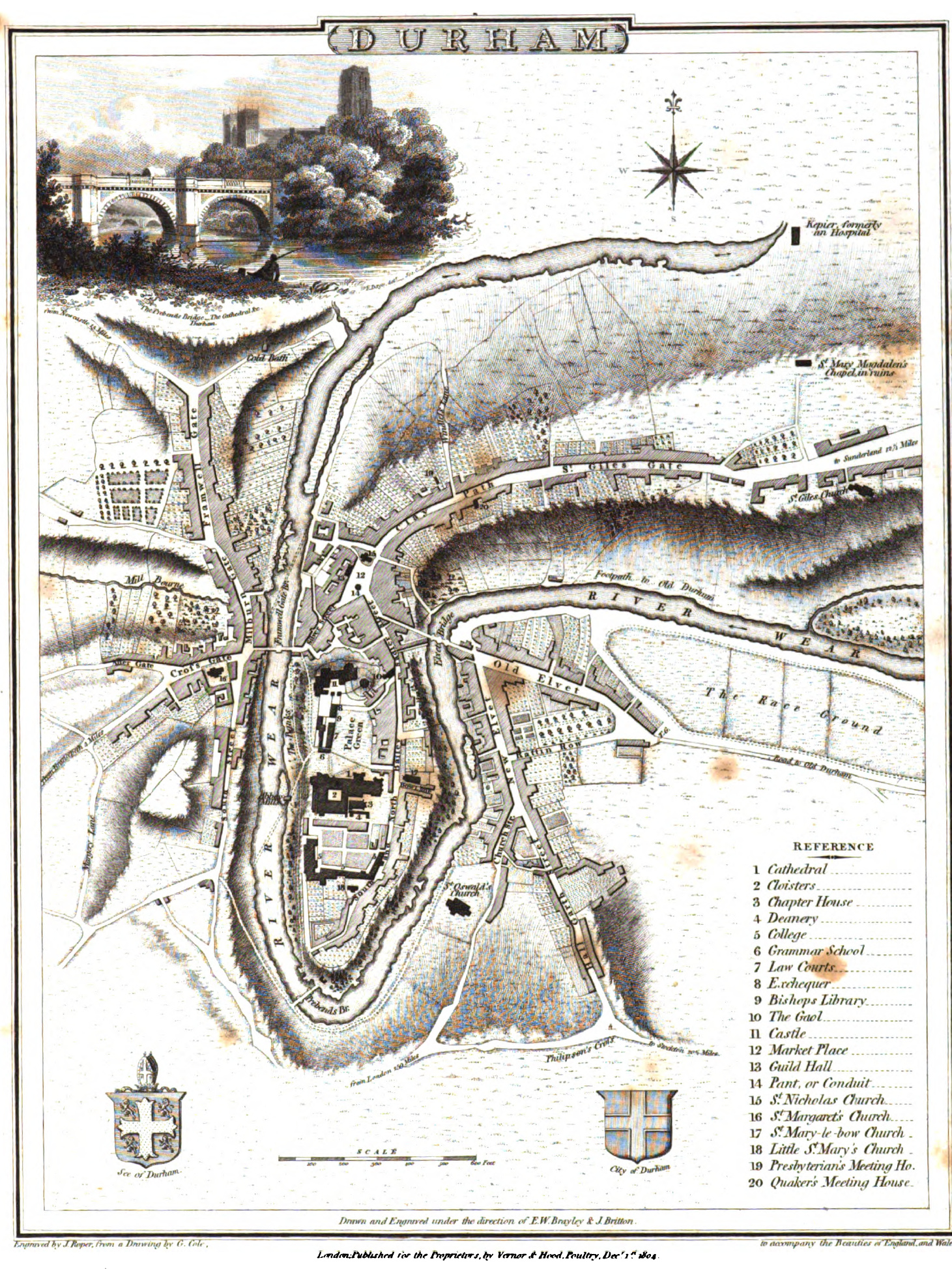
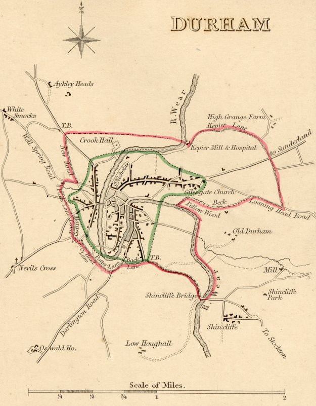
Plan of the city of Durham 1809 John Roper The British Atlas of England and Wales Chubb p.248 CCCXXXIX)
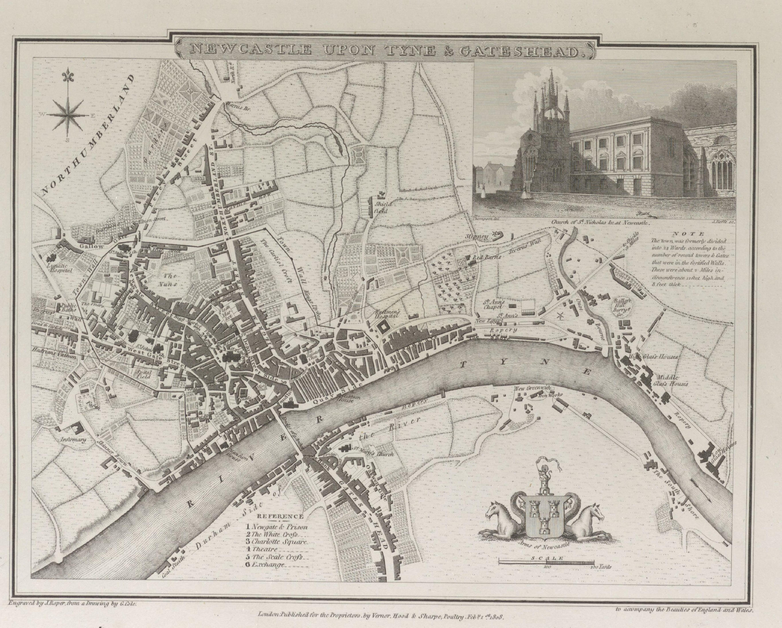
Newcastle upon Tyne and Gateshead 1810 George Cole and John Roper in their British Atlas (Image courtesy of The British Library-King's Topographical Collection
The Bishopric of Durham 1812 J. Wallis in A New and Improved County Atlas (Chubb p.256 CCCXLIV)
Durham 1813 Benjamin Pitts Capper for A Topographical Dictionary of the United Kingdom (Image courtesy of The British Library King's Collection Maps K.TOP.)
%20.jpg)
The Bishopric of Durham 1819 William Lewis in The New Traveller's Guide (Chubb o.267 CCCLXIV)
Durham 1819 Ellis's New and Correct Atlas p.266 CCCLXIII)
Durham 1823 Aristide Perrot in L'Angleterre...etc. (not in Chubb)
.jpg)
Durham 1824 George Carrington Gray in Gray's New Book of Roads (Chubb p.281 CCCXCII)
Durham 1827 Thomas Moule in his English Counties Delineated
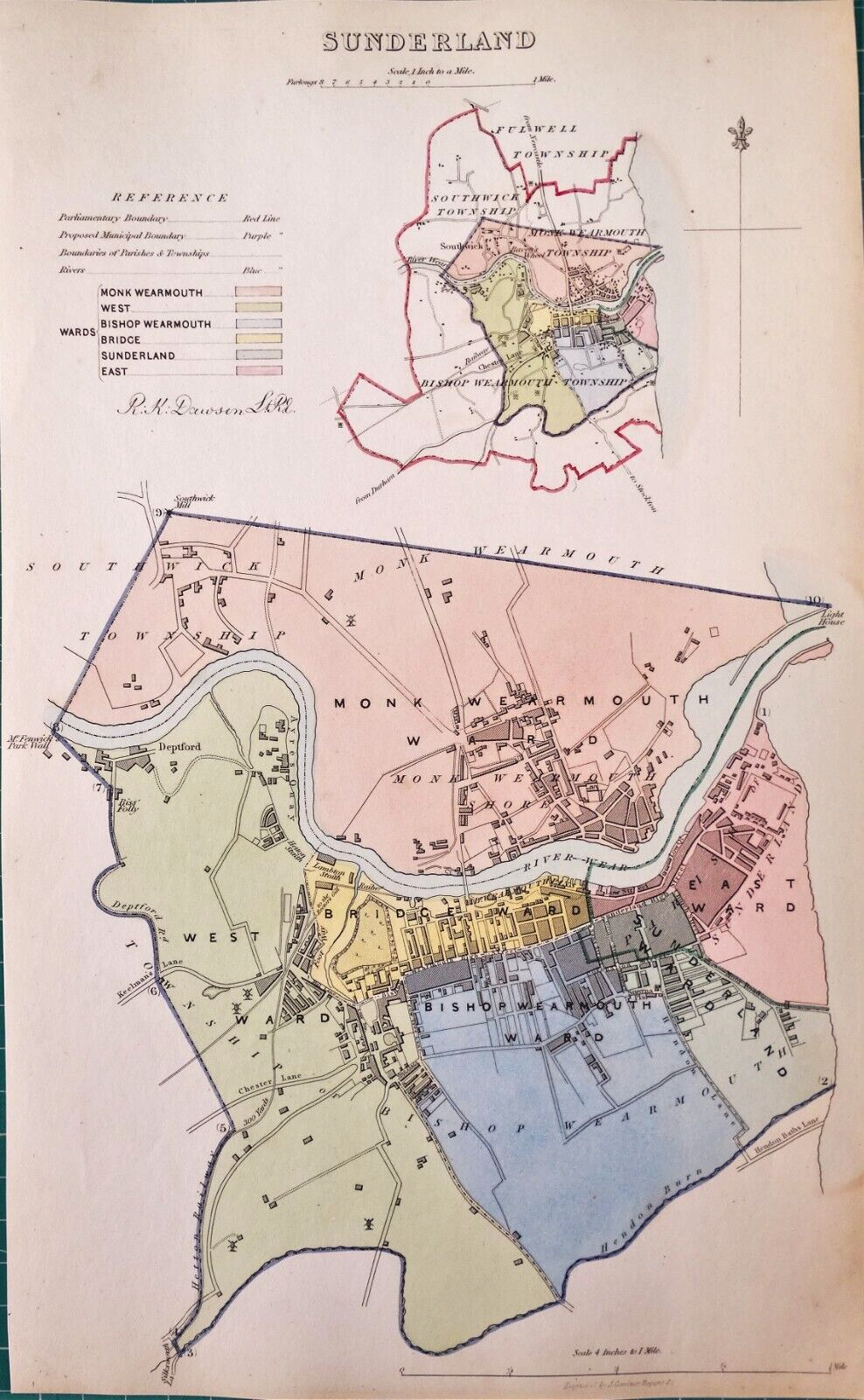
Sunderland 1832 Robert Kearsley Dawson for Plans of the Cities and Boroughs of England and Wales
Durham 1836 Thomas Moule in his English Counties Delineated (Chubb p.325 CCCCLXII)
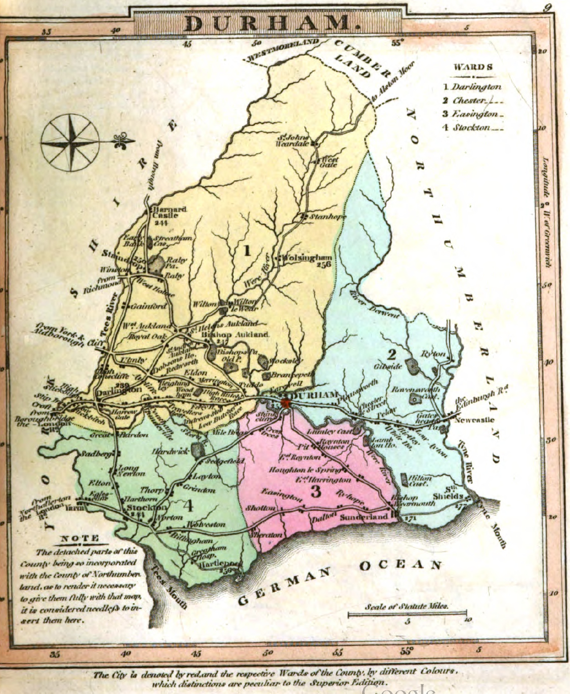
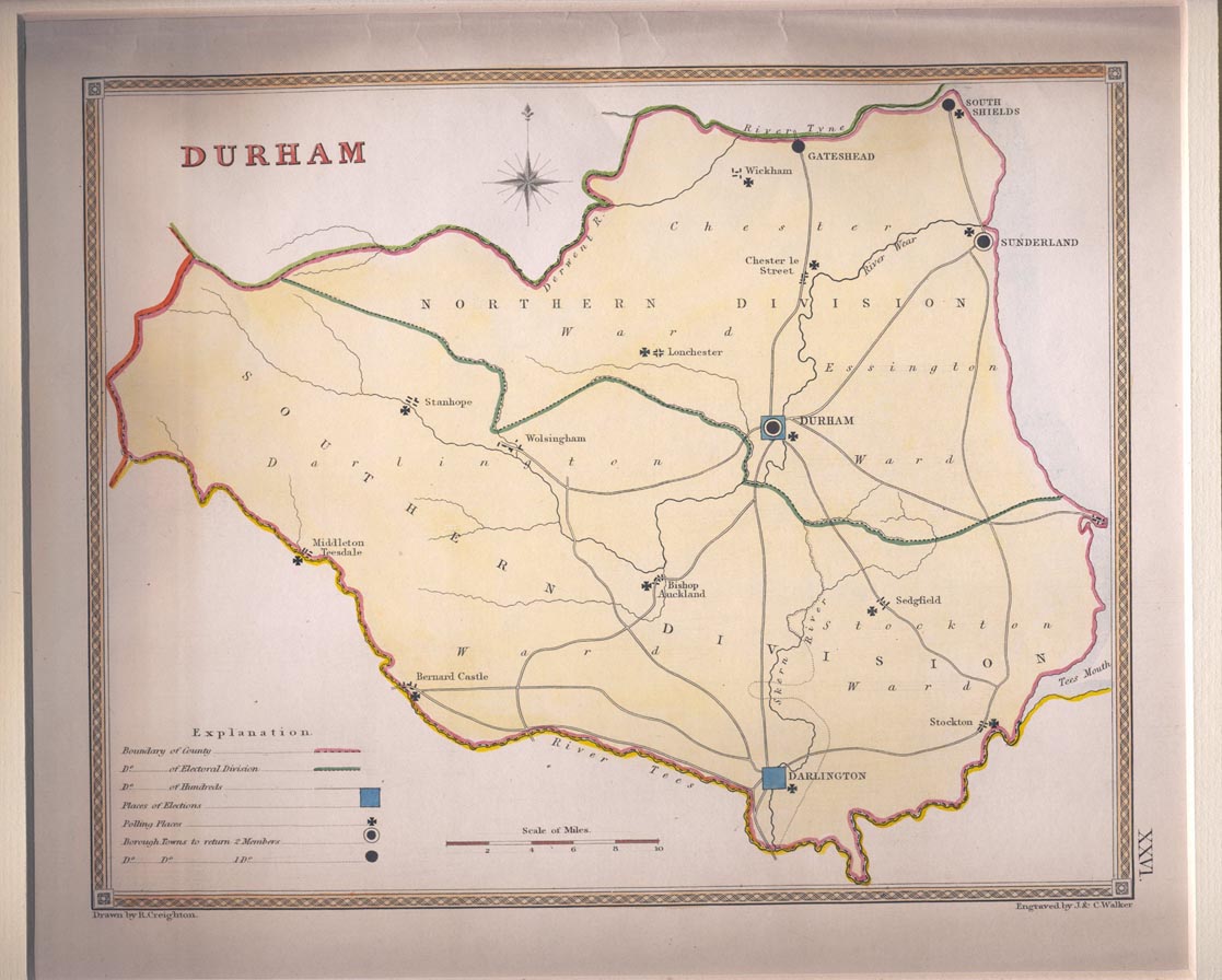
The Bishopric of Durham 1835 Robert Creighton for Samuel Lewis in
A Topographical Dictionary of England (Chubb p.322 CCCCLXIV)
Durham 1835 Robert Creighton for Lewis's Topographical Dictionary(Chubb p.322 CCCCLXIV)
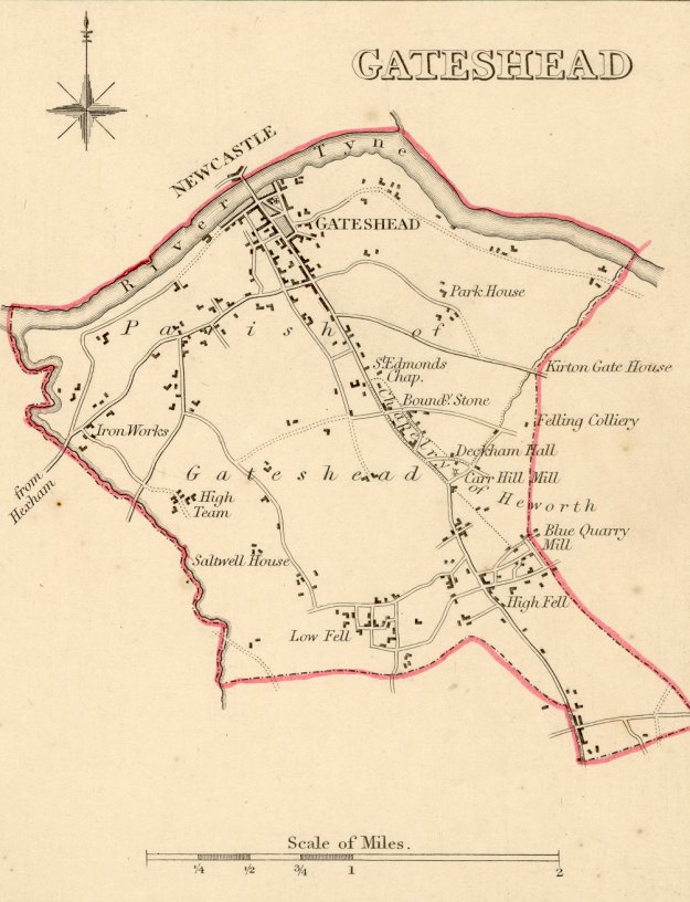
Gateshead 1835 Robert Creighton for Lewis's Topographical Dictionary (Chubb p.322 CCCCLXIV)
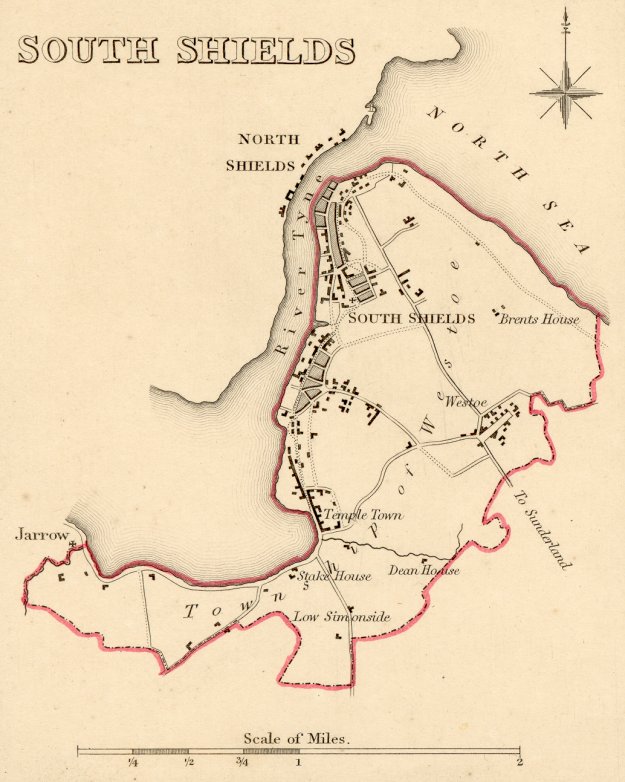
South Shields 1835 Robert Creighton for Lewis's Topographical Dictionary (Chubb p.322 CCCCLXIV)
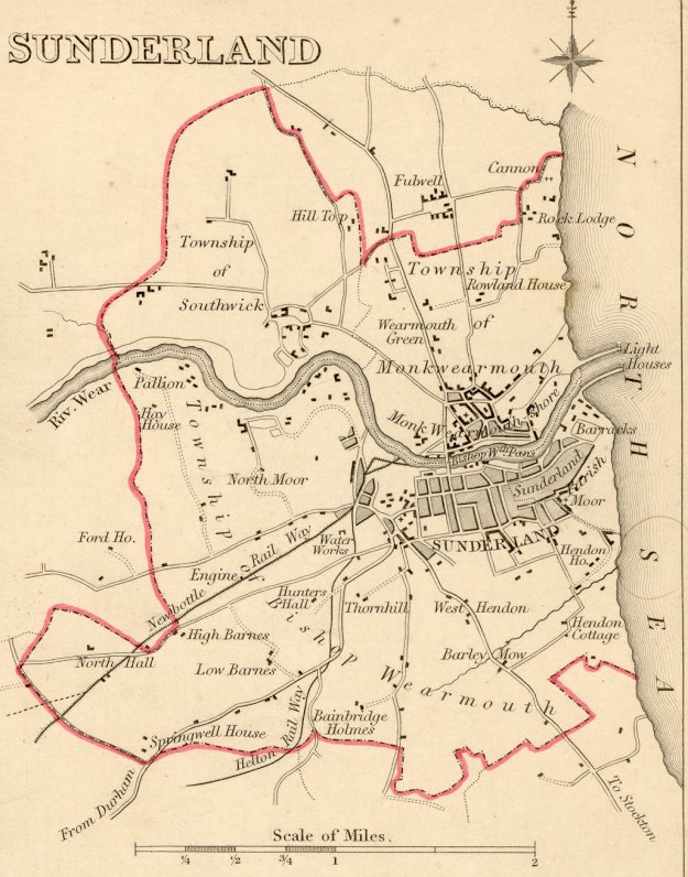
Sunderland 1835 Robert Creighton for Lewis's Topographical Dictionary (Chubb p.322 CCCCLXIV)
The Bishopric of Durham 1836 Sydney Hall in The New British Atlas
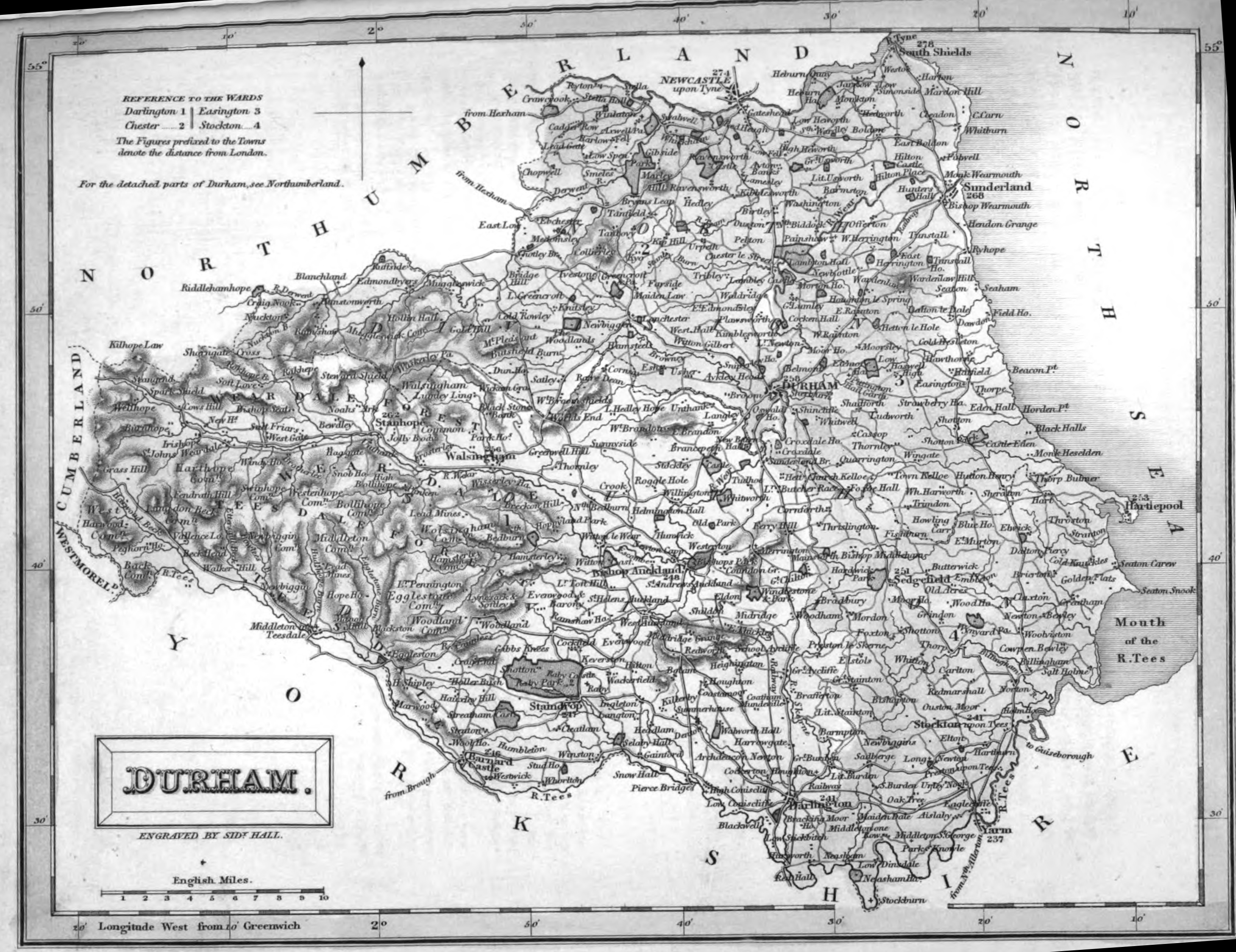
(Chubb p. 314 CCCCLI)
The Bishopric of Durham 1840 Joshua Archer in Dugdales Curiosities of England and Wales (Chubb p:322 CCCCLXV
The Bishopric of Durham 1842 James Pigot in A Pocket Topography and Gazetteer of England (Chubb p.321 CCCCLXIII)
(Image courtesy of Wikimedia)
Durham 1843 Reverend Samuel Clarke for The Travels of Reuben Ramble (Chubb 345 DXVII)
.jpg)
The Bishopric of Durham 1848 Joshua Archer in The Universal English Dictionary
Durham 1848 Thomas Starling for Lewis's Topographical Dictionary
.jpg)
(Chubb p. 297 CCCCXXX)
Derbyshire 1848 Joshua Archer for Thomas Dugdale's Curiosities of Great Britain Chubb p.323 CCCCLXVI)
Durham 1850 Robert Creighton and J. & C. Walker for Lewis's Topographical Dictionary (Chubb p.322 CCCCLXIV)
West Hartlepool Dock 1852 George Bartholomew
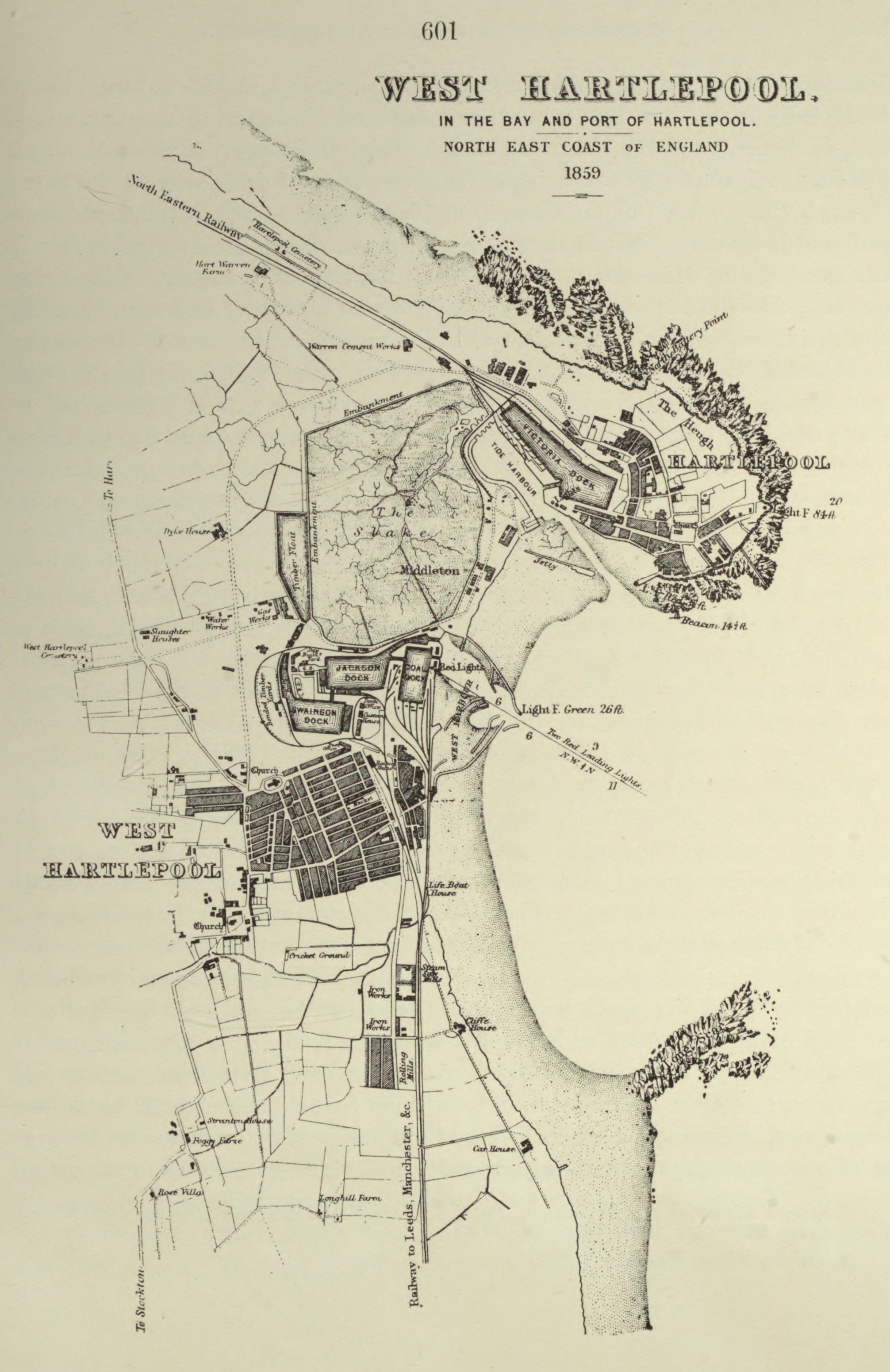
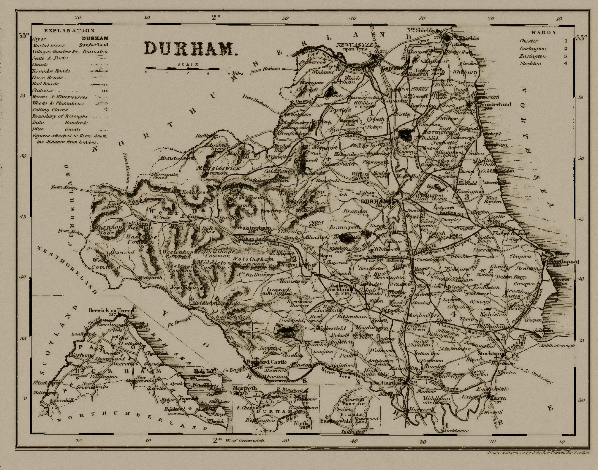
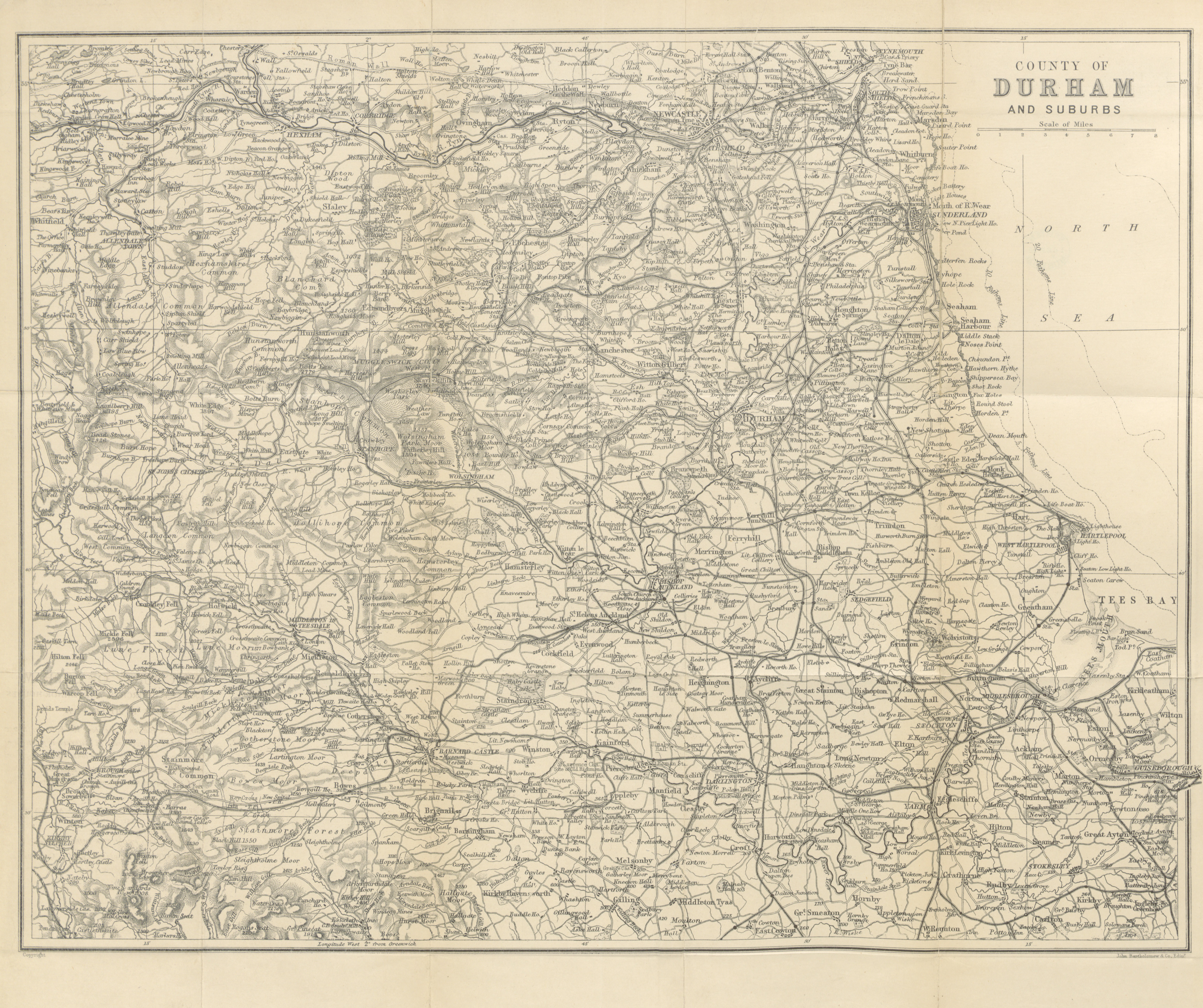
County Durham 1885 George Phillip
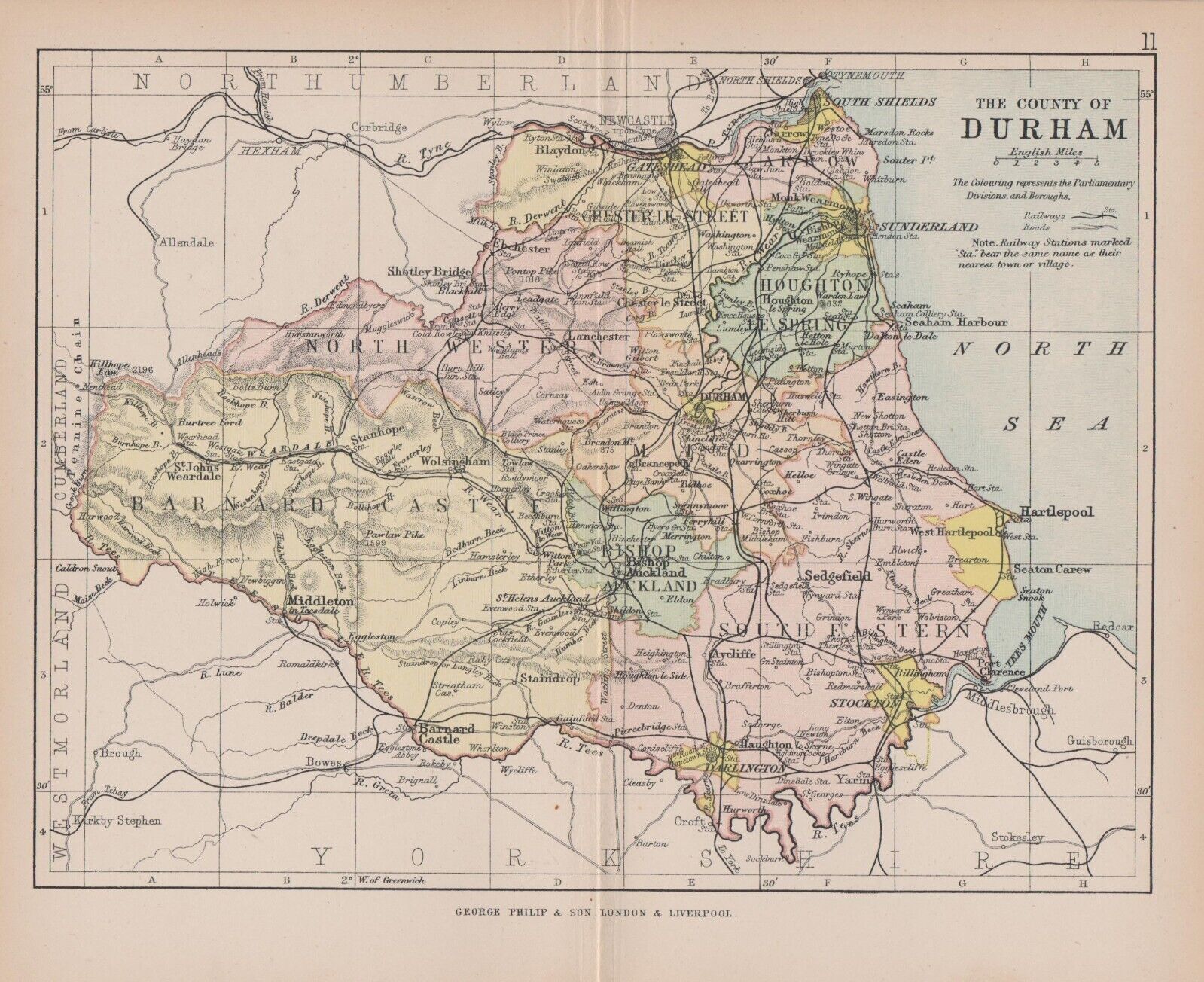
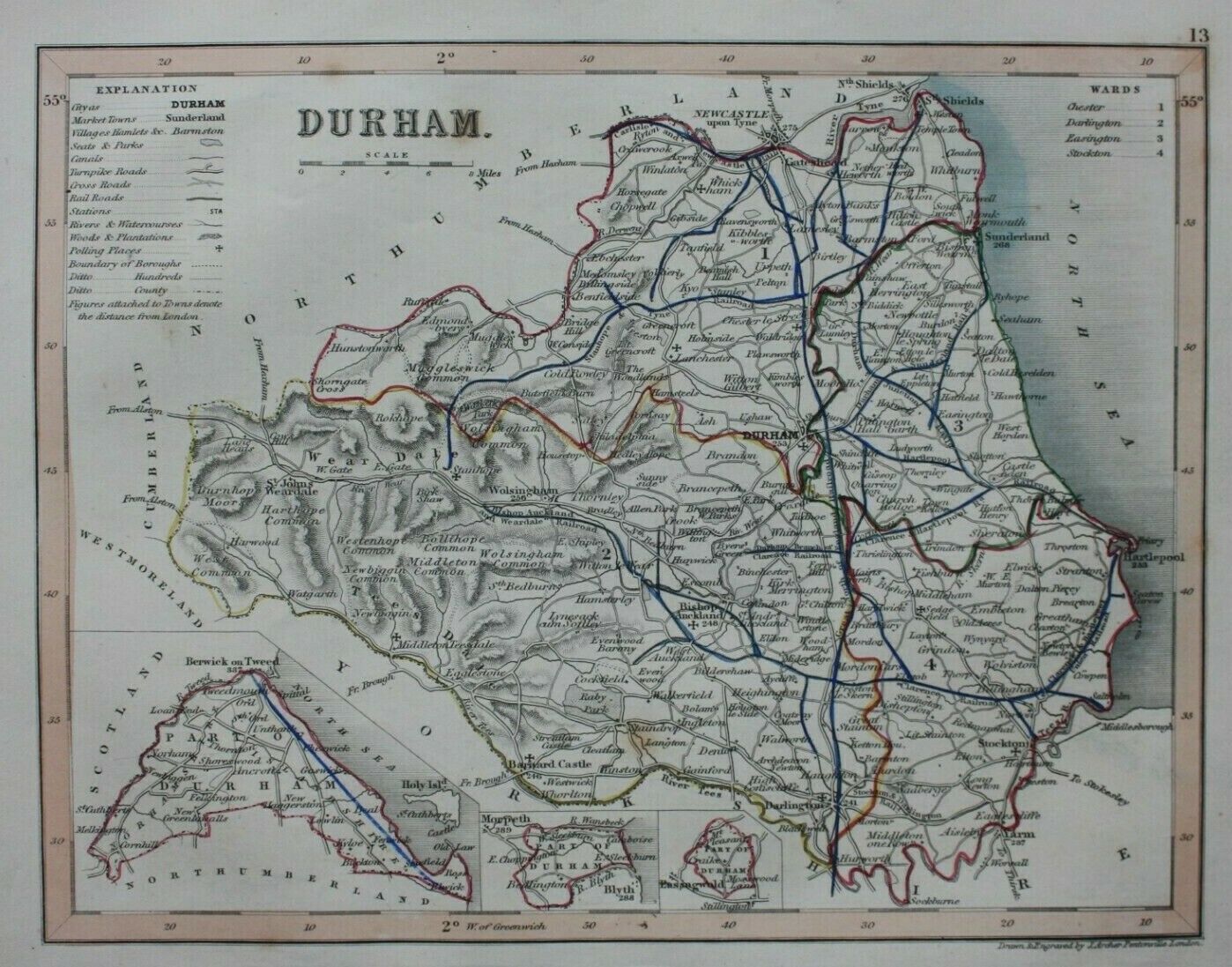
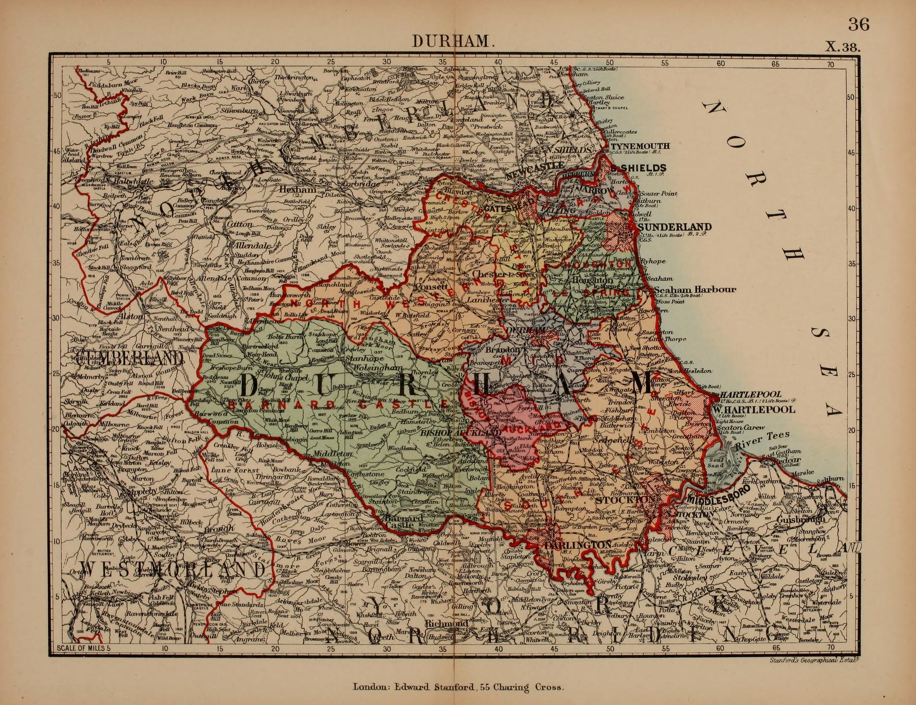
The Bishopric of Durham 1868 James Virtue
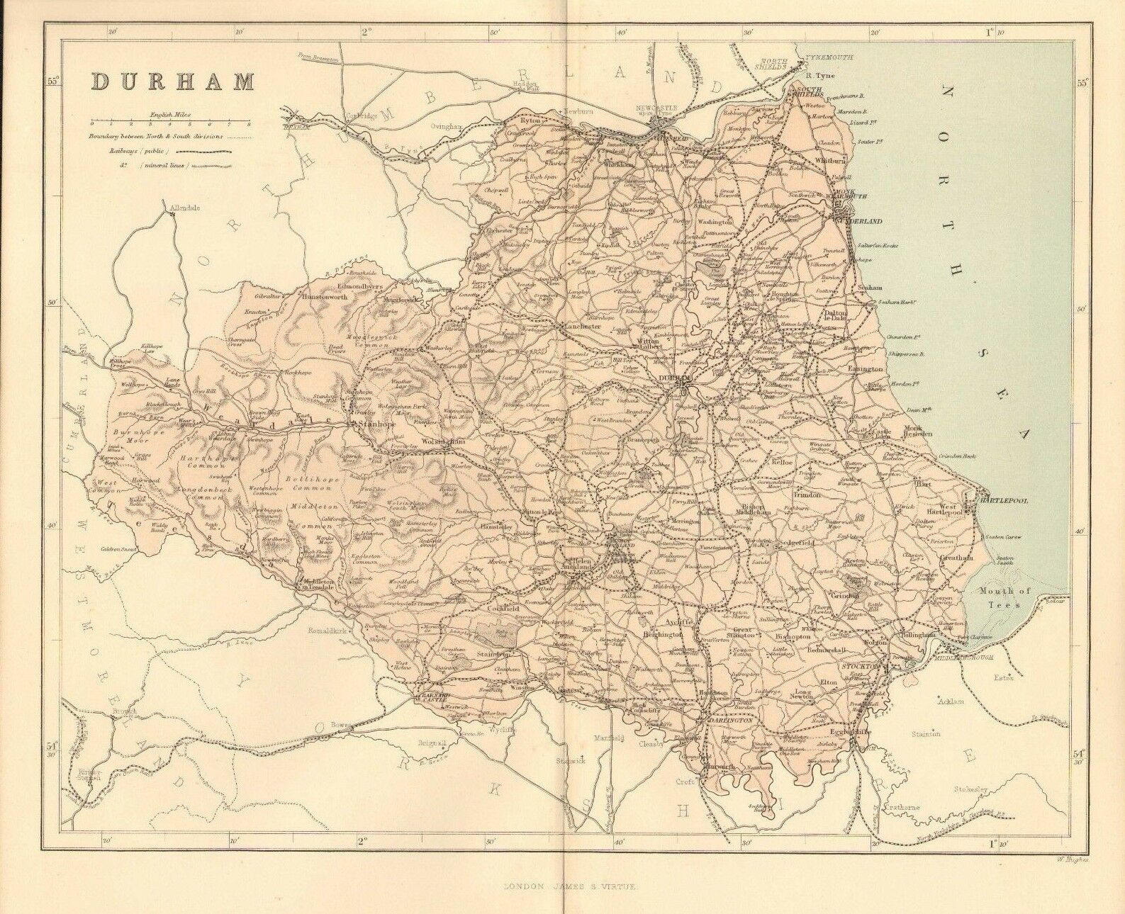
Durham 1885 Stanford's Parliamentary Atlas
Durham 1884 A + C Black (Image courtesy of The Mechanical Curator & Wikimedia)
%20.jpg)
Plan of the City of Durham 1885 in The Royal Atlas of England and Wales
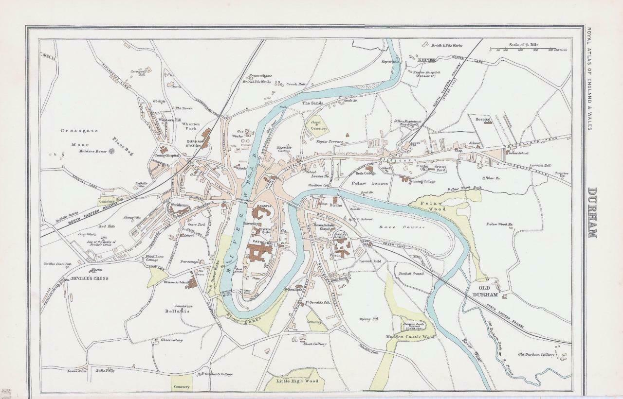
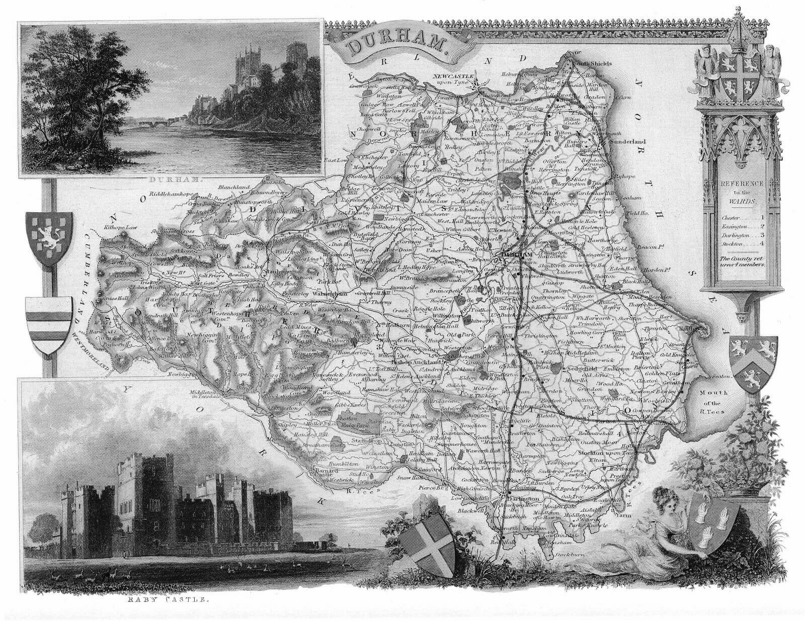
County Durham 1892 John Richard Boyle in A Comprehensive Guide to the County of Durham
(Image courtesy of Wikimedia)