| |
 Home Resources consulted for Essex: A Bibliography of County Maps - Large Scale County Maps of England. Tooley R.V. The Printed Maps in the Atlases of Great Britain and Ireland1579-1870 Chubb Thomas Dawson 1927 |
 To resize images:
Hold CTRL and use mouse wheel |
(see also London)
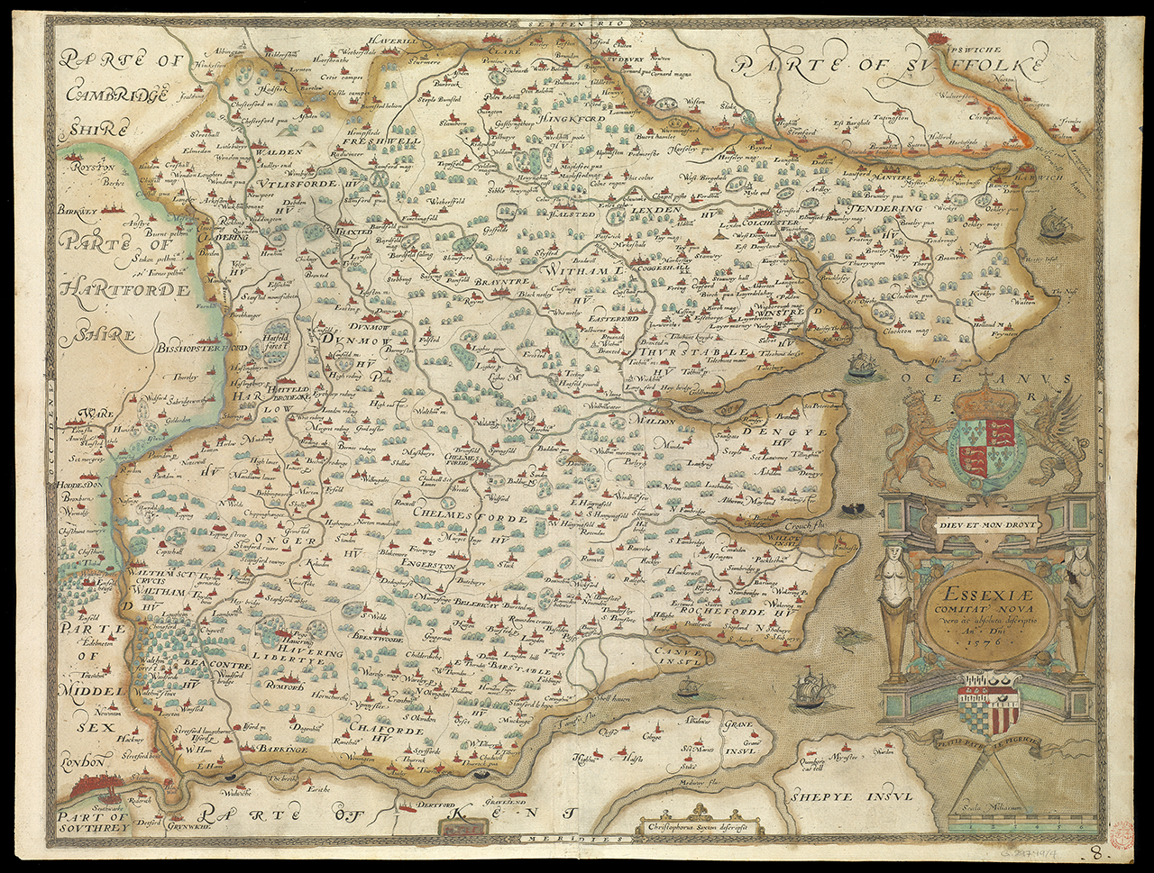
Essex 1579 Christopher Saxton for An Atlas of England and Wales
(Chubb p.3)
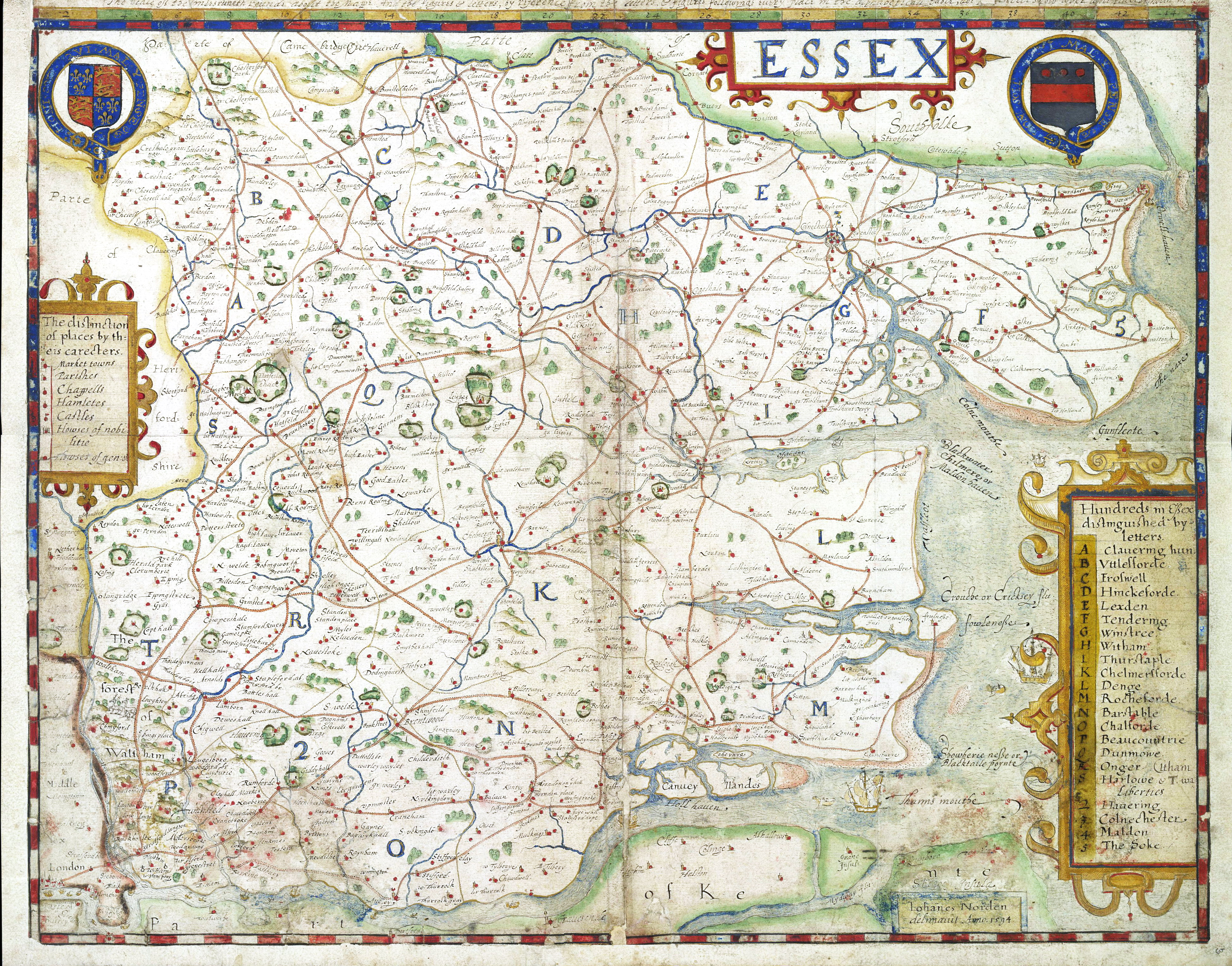
Essex 1594 John Norden 1607 in his Speculum Brittaniae
(image courtesy of Essex Records Office)
Essex 1607 William Kip after Christopher Saxton (Chubb p.9 XVIII)
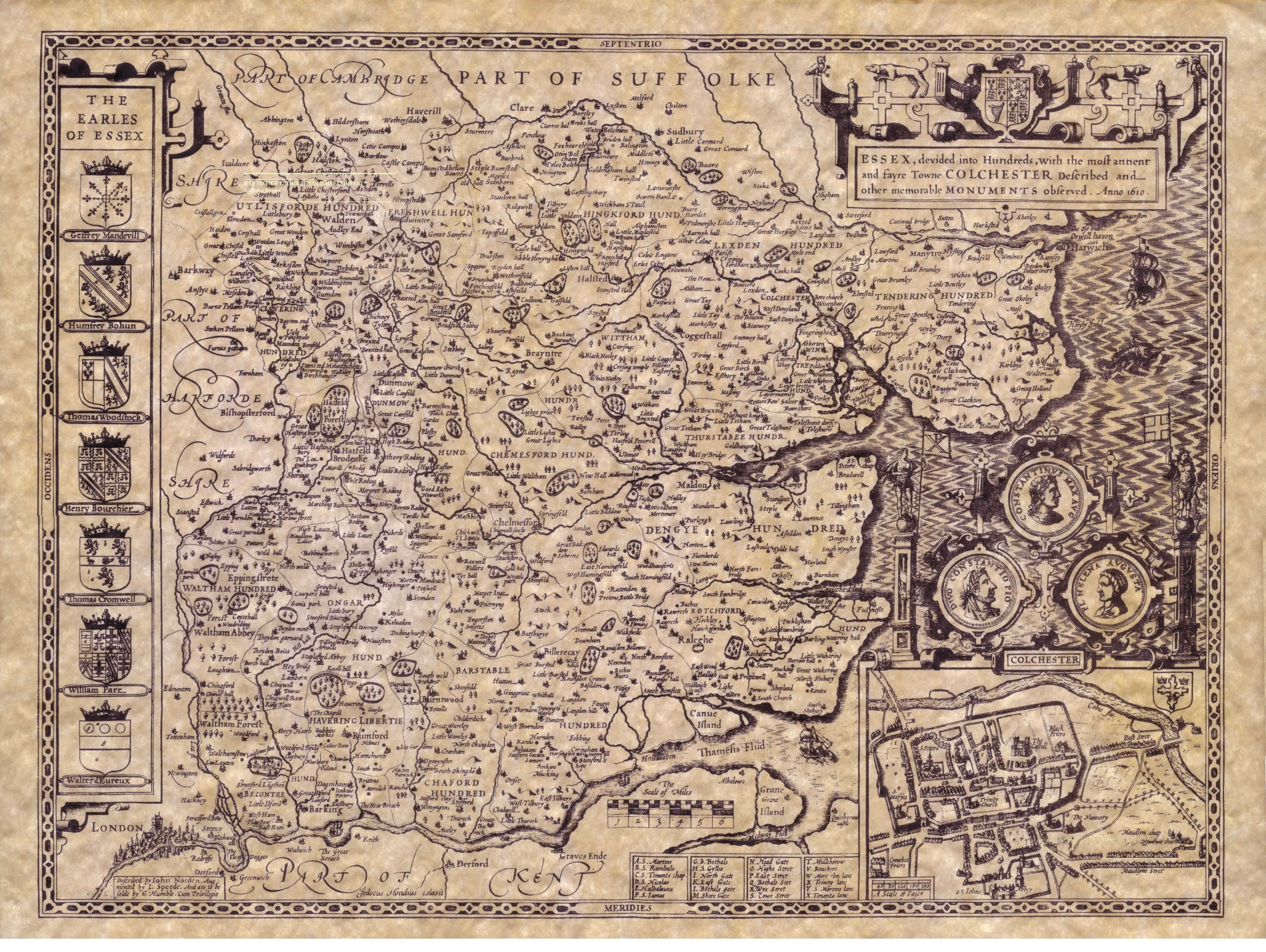
Essex 1610 John Speed in The Theatre of the Empire of Great Britaine (Proof Copy)
(Image Courtesy of Cambridge University Library)
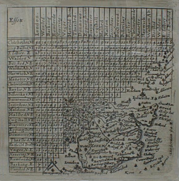
Essex 1643 Distance Tables Matthew Simons: Thomas Jenner and van Langeren (Chubb p.13 vXLIV) in A Direction for The British Traveller
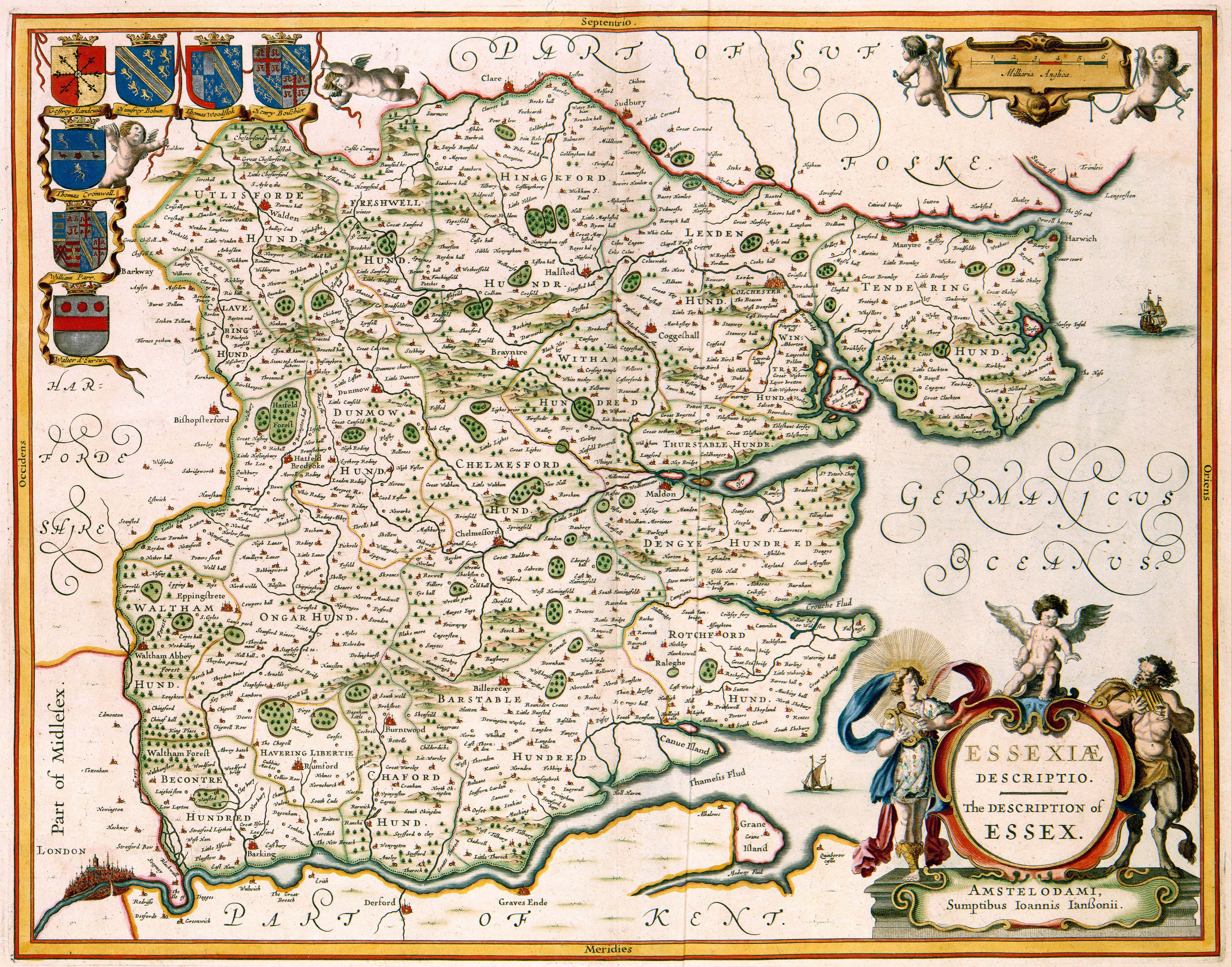
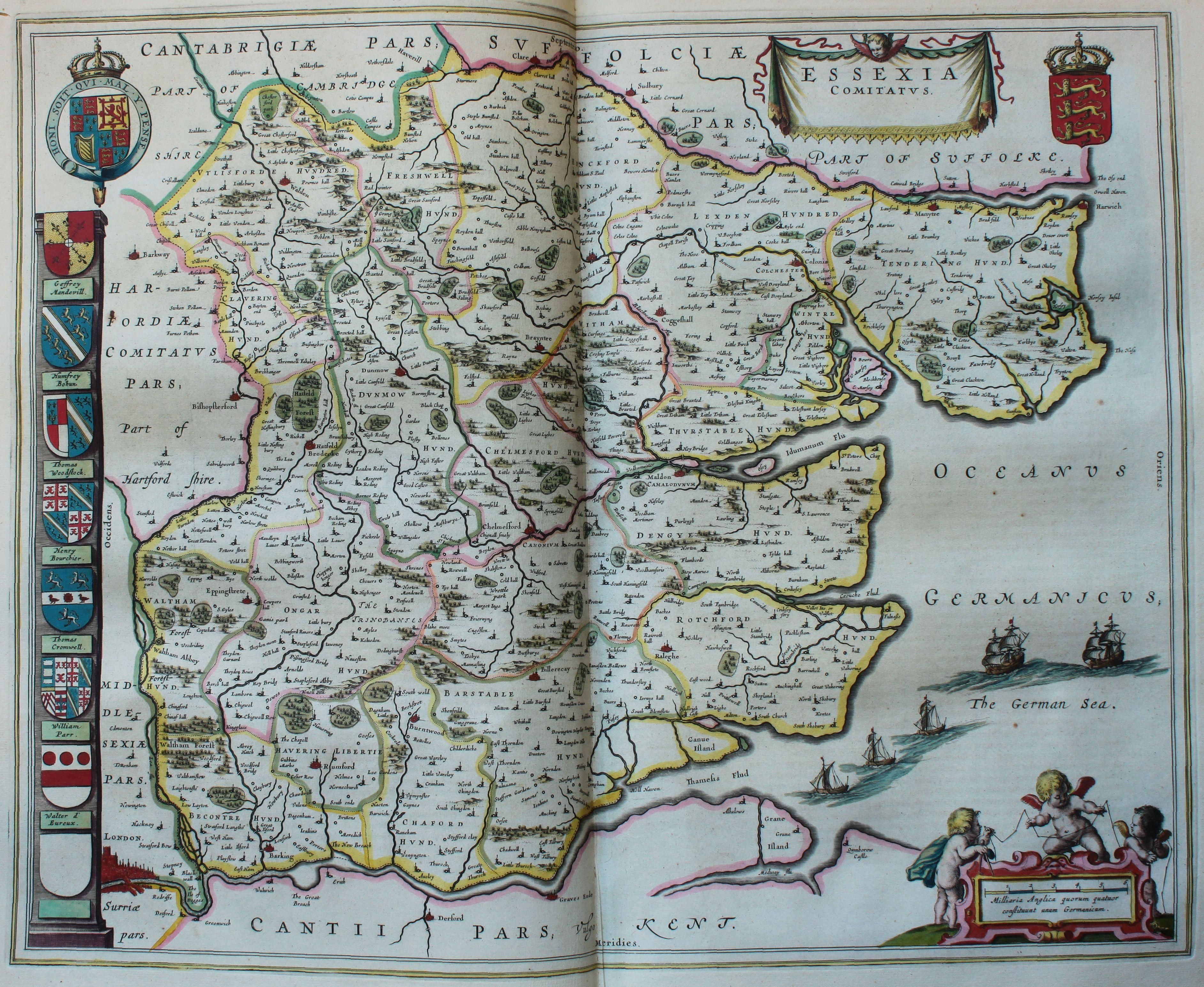
Essex 1646 Jan Jansson in his Novus Atlas (Chubb p.65 LXX)
The Description of Essex 1649 Jan Jansson (Image Courtesy of Wikimedia)
Essex 1670 Richard Blome in Thomas Taylor's England Exactly Described (Image Courtesy of Wikimedia)
Essex 1768 John Ogilby and William Norman. The only map published of a planned Collaboration (Publisher Philip Lea) (Image courtesy of Wikimedia
Harwich 1680 Bern de Gomme
Essex 1690 Robt. Morden in Camden's Britannia (Image Courtesy of Yale University Library)
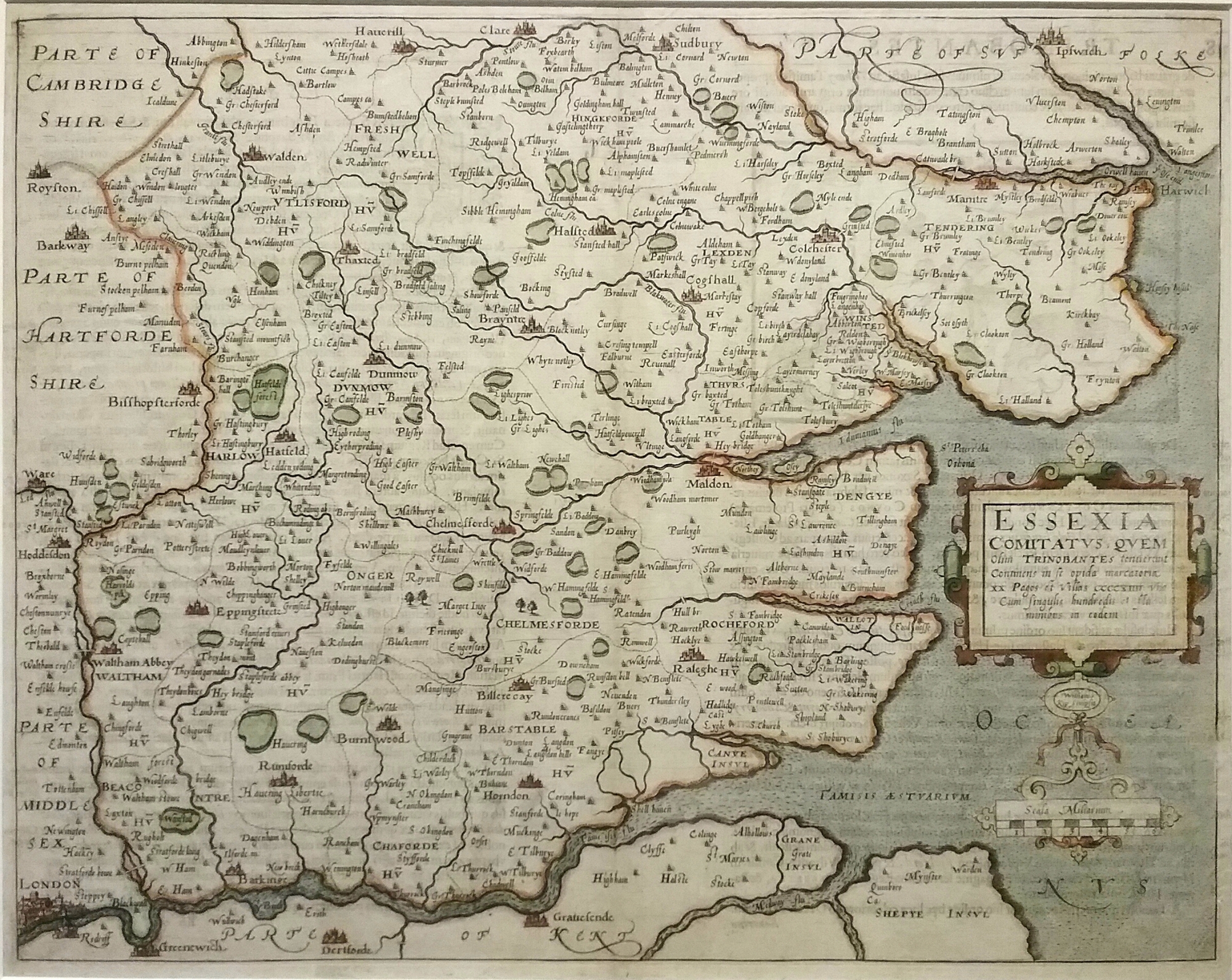
A Part of Essex 1694 John Norden
Essex 1696 Jno.Oliver (Image Courtesy of Yale University Library) Large File - May be slow to load)
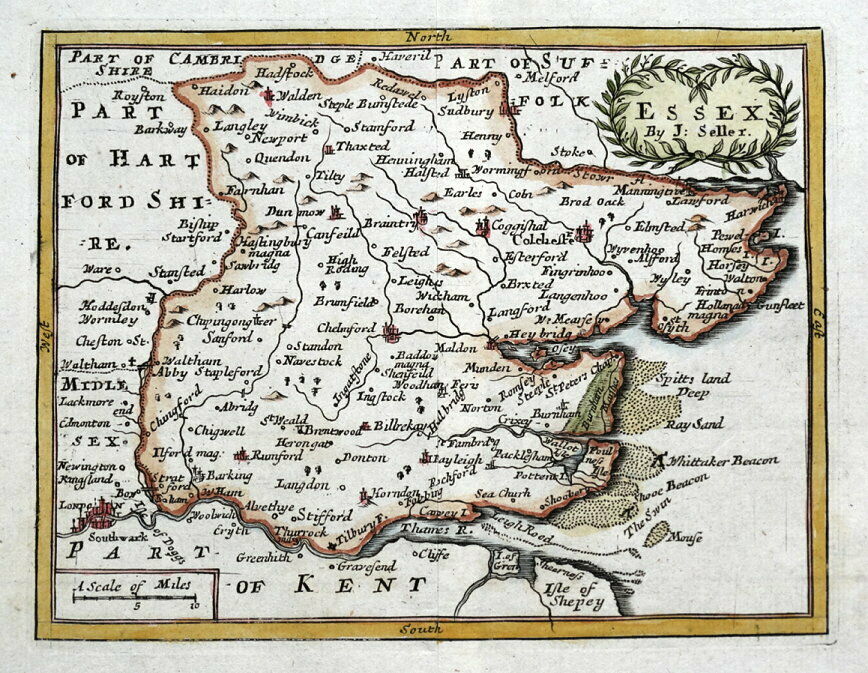
Essex 1698 John Seller in Anglia Contracta
Nobility & Gentry of Essex 1700 Robt. Morden
Essex 1701 Francis Gross after John Seller (image courtesy of oldessexmaps )
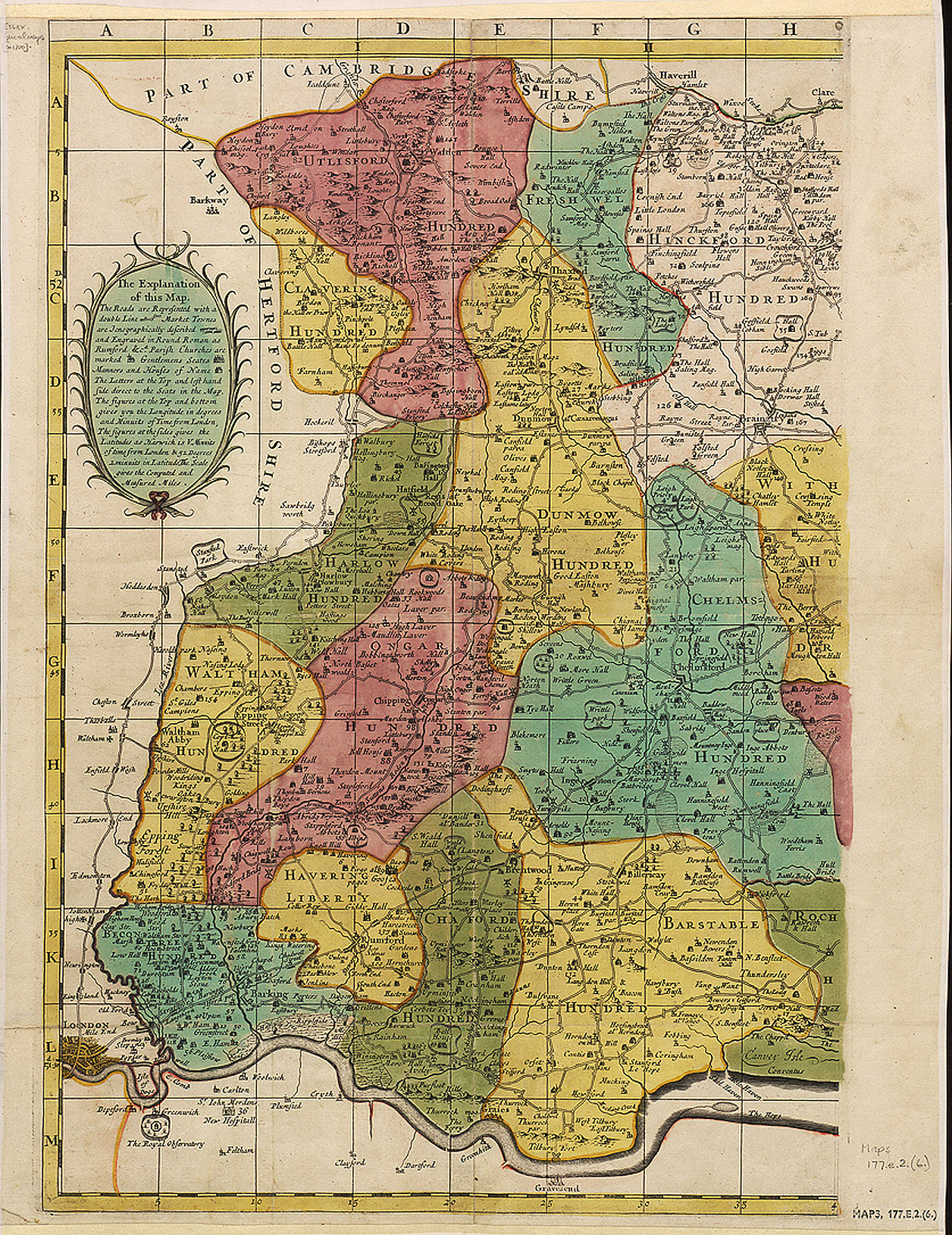
A New map of the County of Essex 1704 William Green in An Atlas of England - Sold by R. Buttars. Chubb notes that many of the maps in this Atlas were printed upside-down, presumed to be by William Green, author of The Picture of England 1705, a 2 volume descriptive atlas where the same maps have been published correctly aligned, (Chubb p.238 CCCX & p.243 CCCXVIII) image courtesy of The British Library )King's Collection Maps K.Top.)
Essex 1713 Overton after C. Smith (with roads added)
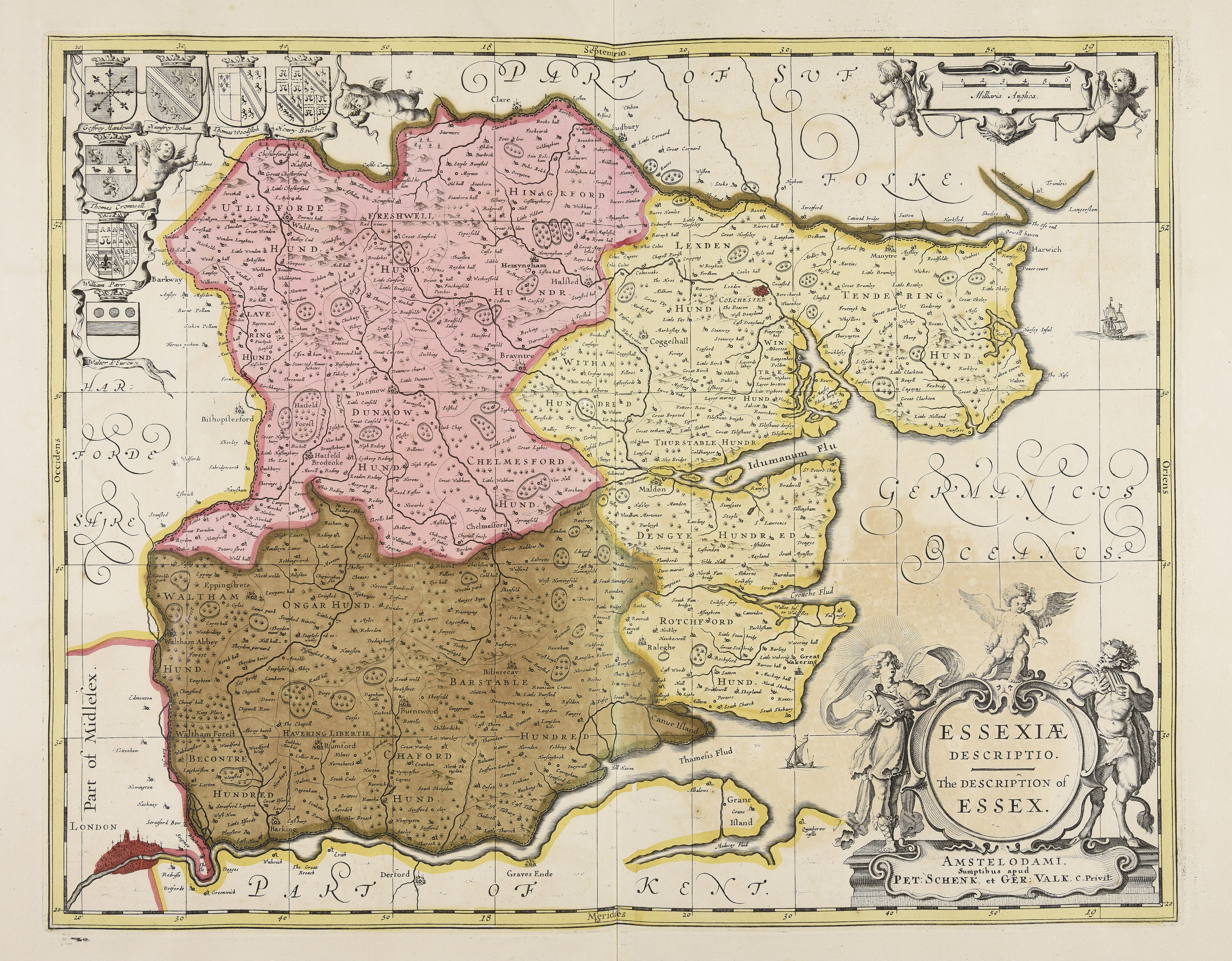
Essex 1720 Gerardum Valk & Petrum Shenk with their imprint replacing that of Jan Jansson (Image courtesy of Wikimedia)
Essex 1724 Herman Moll in A New Description of England and Wales (Image courtesy of The British Library
Chigwell Essex 1727 Thomas Brown
(Image courtesy of The British Library King's Collection Maps K.Top.13.31.4.b..
Essex 1733 William Morgan (without John Ogilby's imprint)
(Image courtesy of The British Library King's Collection. Maps K.Top.13.4.)
Hampshire and Isle of Wight 1758 Pieter Meijer
A Plan Of the Borough & Port of Boston 1742 Robert Hall
(Image courtesy of The British Library King's Collection Maps K.Top.19.22.)
Essex 1742 Thomas Badeslade and Toms in Chorographia Britanniae (Chubb p.135 CLXXIIV
Essex 1744 John Cowley for Robert Dodsley's Geography of England
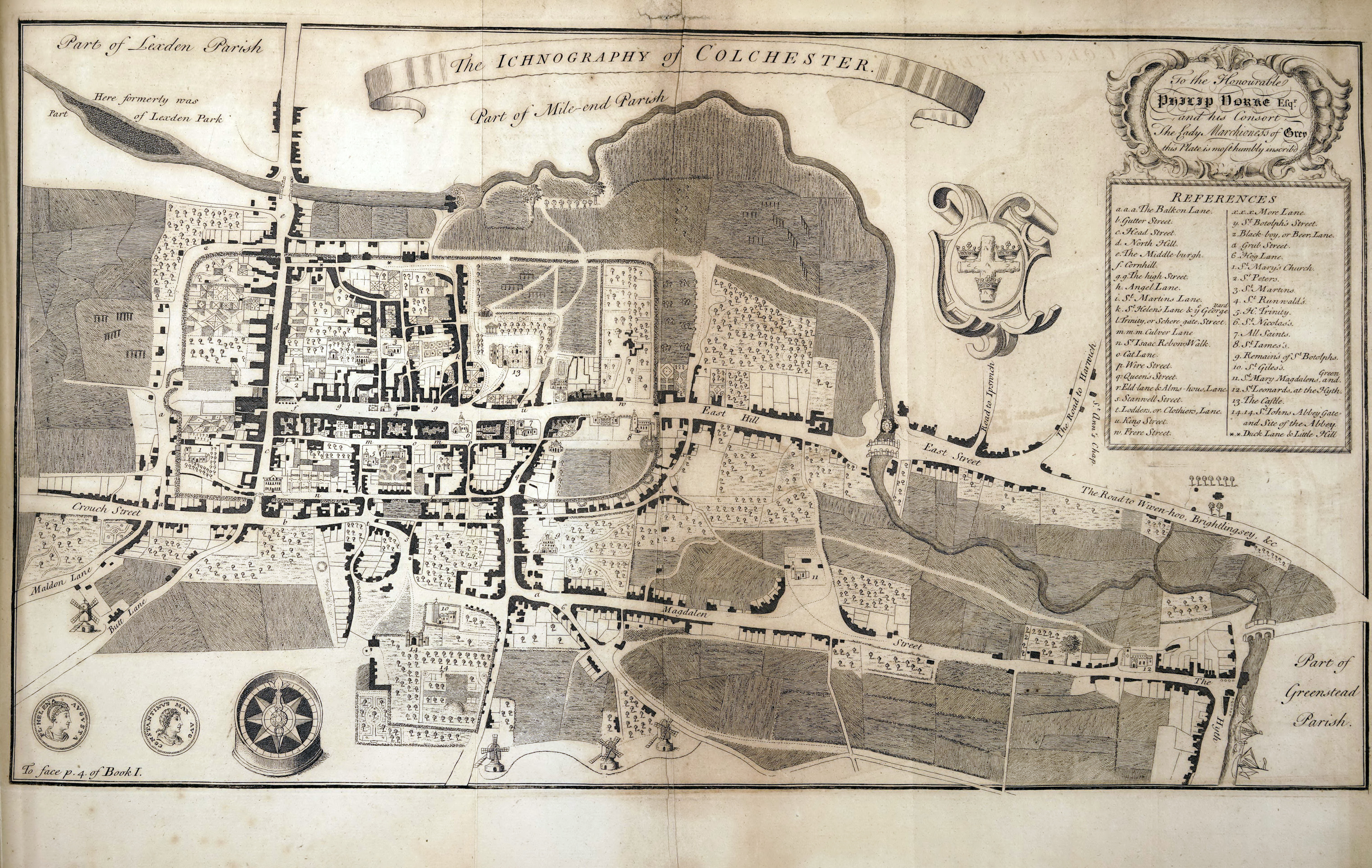
The Ichnography Of Colchester 1748 J. Deane
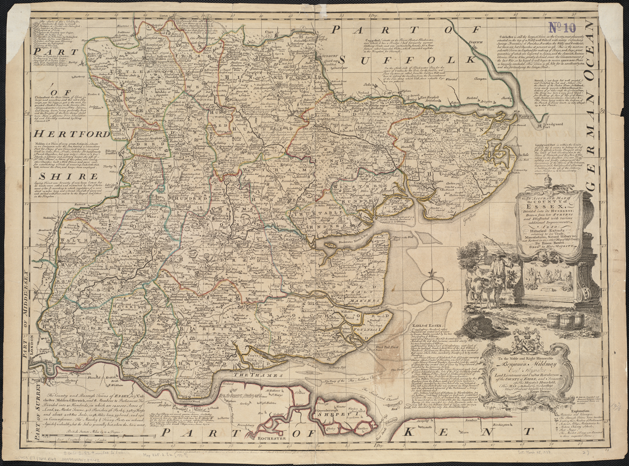
An Accurate Map of the County of Essex 1749 Emanuel Bowen in the Universal Magazine of Knowlede and Pleasure (Image courtesy of The British Library King's Collection)
Essex 1749 Emanuel Bowen in The Large English Atlas Chubb p.157 CXCV)
Image Courtesy of Biblioteca National de Espana)
Essex 1751 Thomas Kitchin
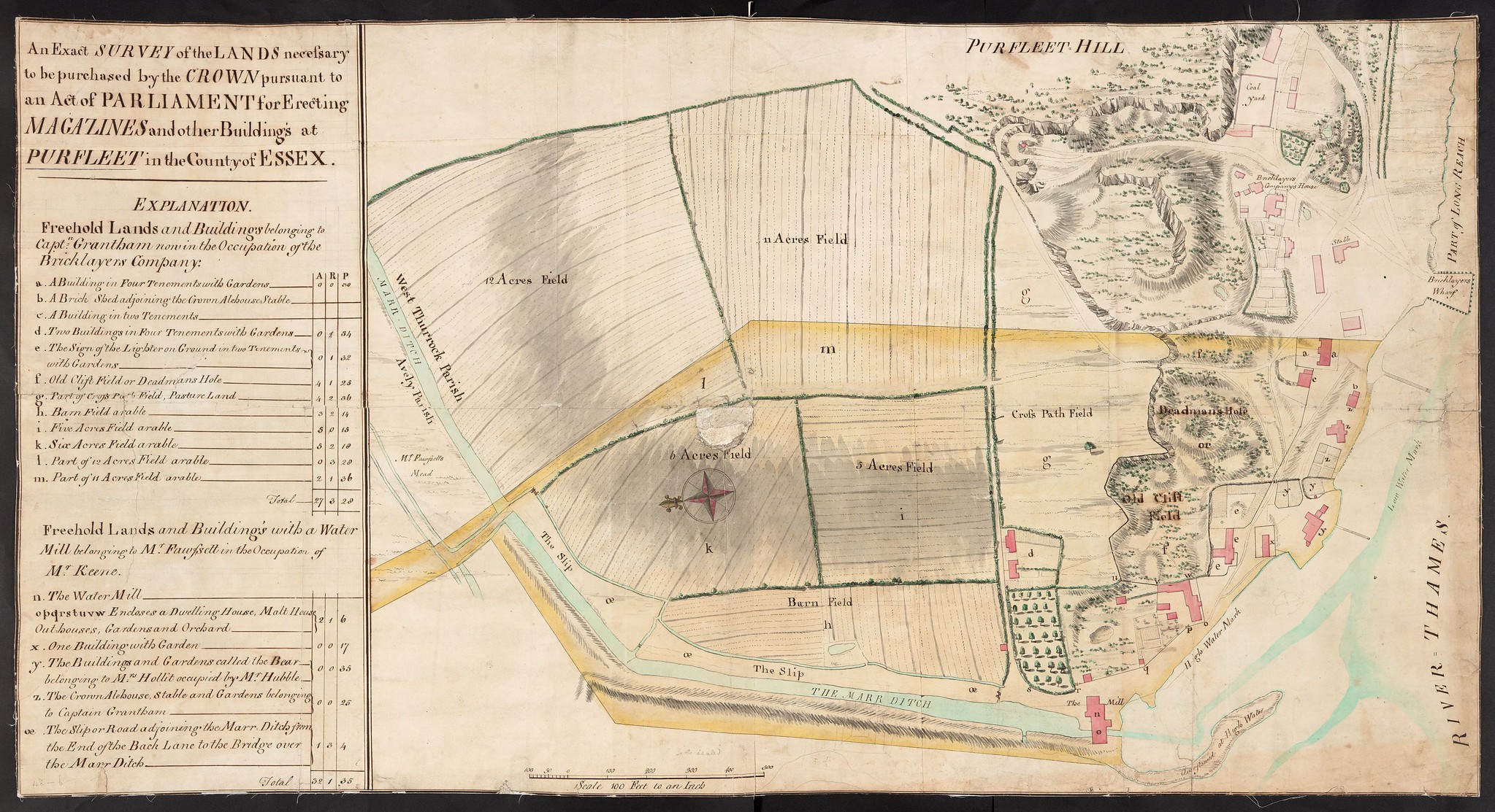
Essex 1760 Purfleet
Essex 1764 Thomas Kitchin for England Illustrated (Chubb p.185 CCXXIV)
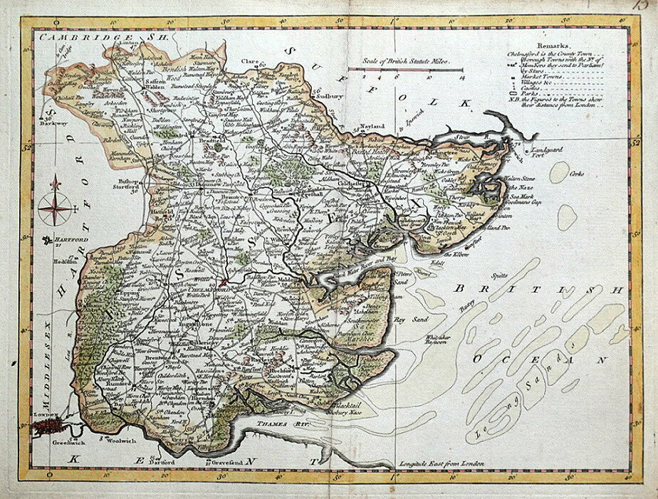
An accurate map of Essex divided into its hundreds 1765 Emanuel Bowen in The Royal English Atlas
Essex 1769 Thomas Kitchin in his Pocket Atlas
Essex 1769 Jean Rocque in England Displayed reprinted from The Small English Atlas (1753) (Chubb p.174 CCX)
A Map of the County of Essex from an Actual Survey 1777 Thomas Kitchin
(Image courtesy of Biblioteca Digital Hispanica)
Plan of Colchester 1777 John Chapman and Peter Andre Large File - May be slow to load)
A Map of the County of Essex from an Actual Survey 1777
Peter Andre & John Chapman
(Image courtesy of MacMaster University Library
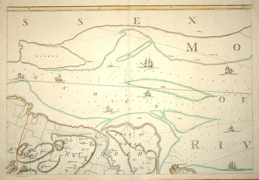
The Thames Estuary 1780 Andrews
Essex 1786 Thomas Kitchen in The Antiquities of England and Wales
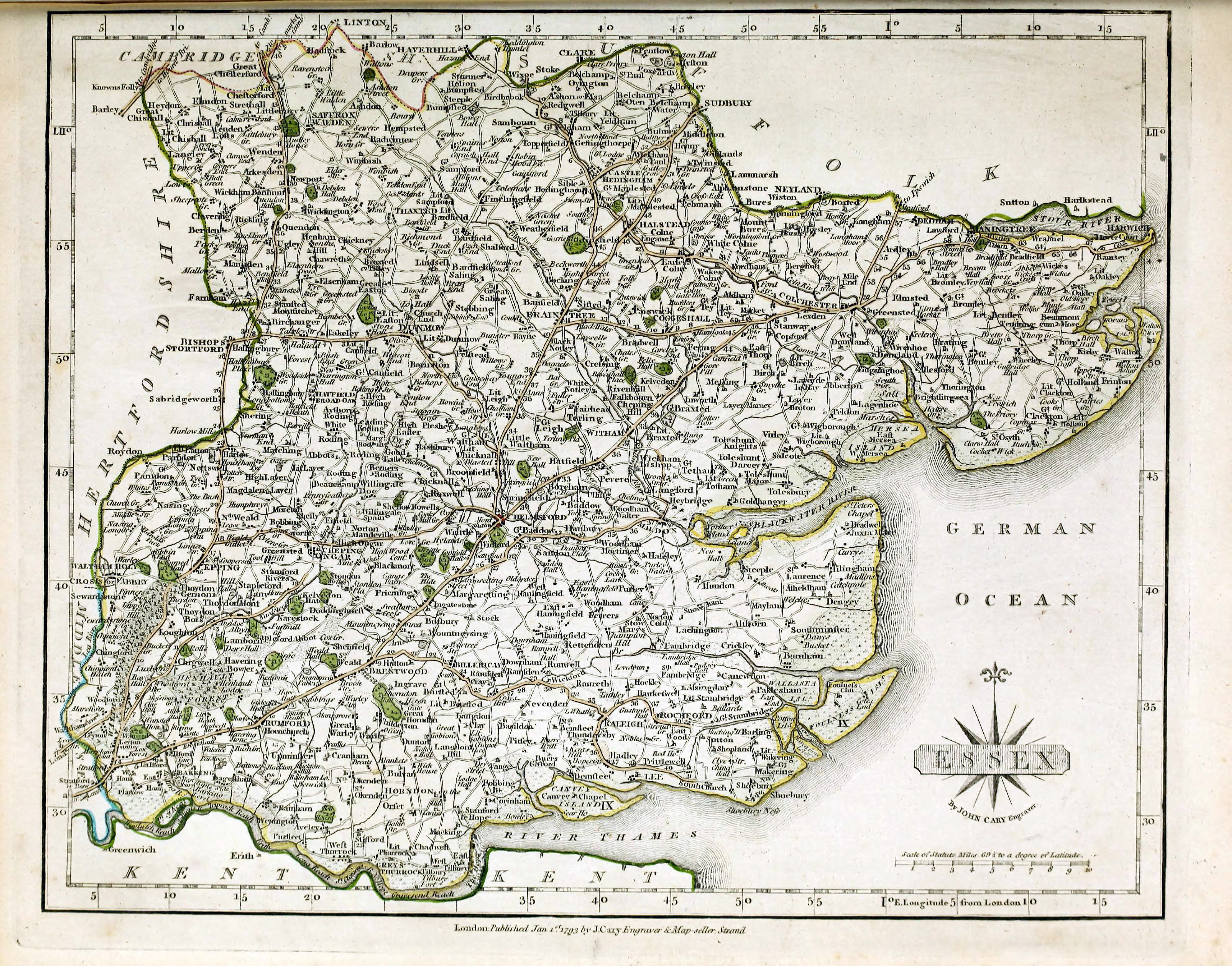
Essex 1793 (01) John Cary in Cary's New and Correct Atlas (Chubb p.213 CCLX)
Essex 1793 (02) John Cary in his New and Correct English
(Chubb p.213 CCLX) (Image Courtesy of Atlas New York Library Digital Collections)
Essex 1800 John Aiken in England and Wales Delineated (Chubb p.223 CCLXXXVI)...to make my young countrymen better acquainted than they are usually found to be with their native land) (Image courtesy of The Mechanical Curator & Wikimedia)
Essex 1801 John Wilkes in Encyclopaedia Londoniensis
Essex 1804 William Green in The Picture of England (Chubb p.243 CCXVIII)
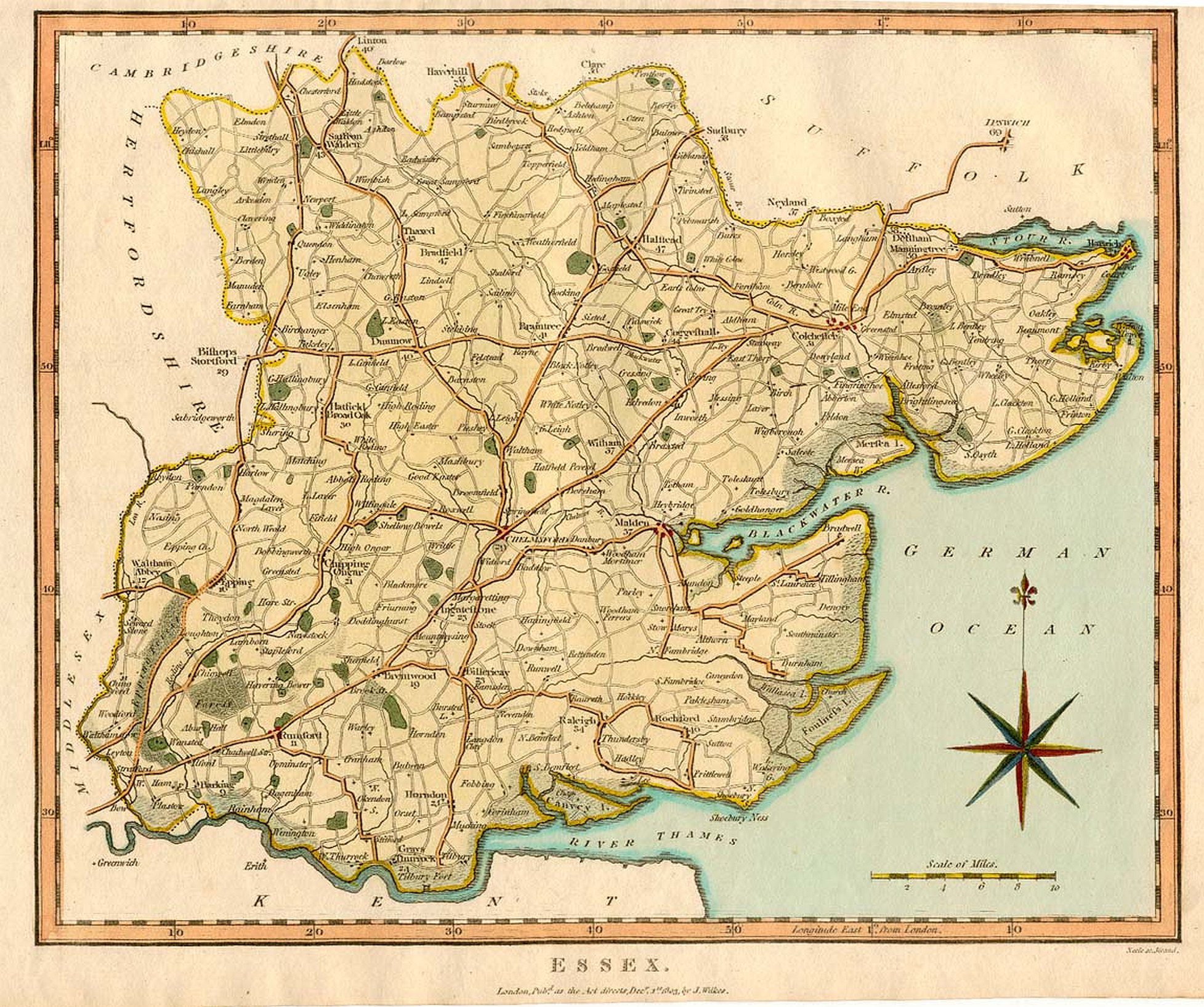
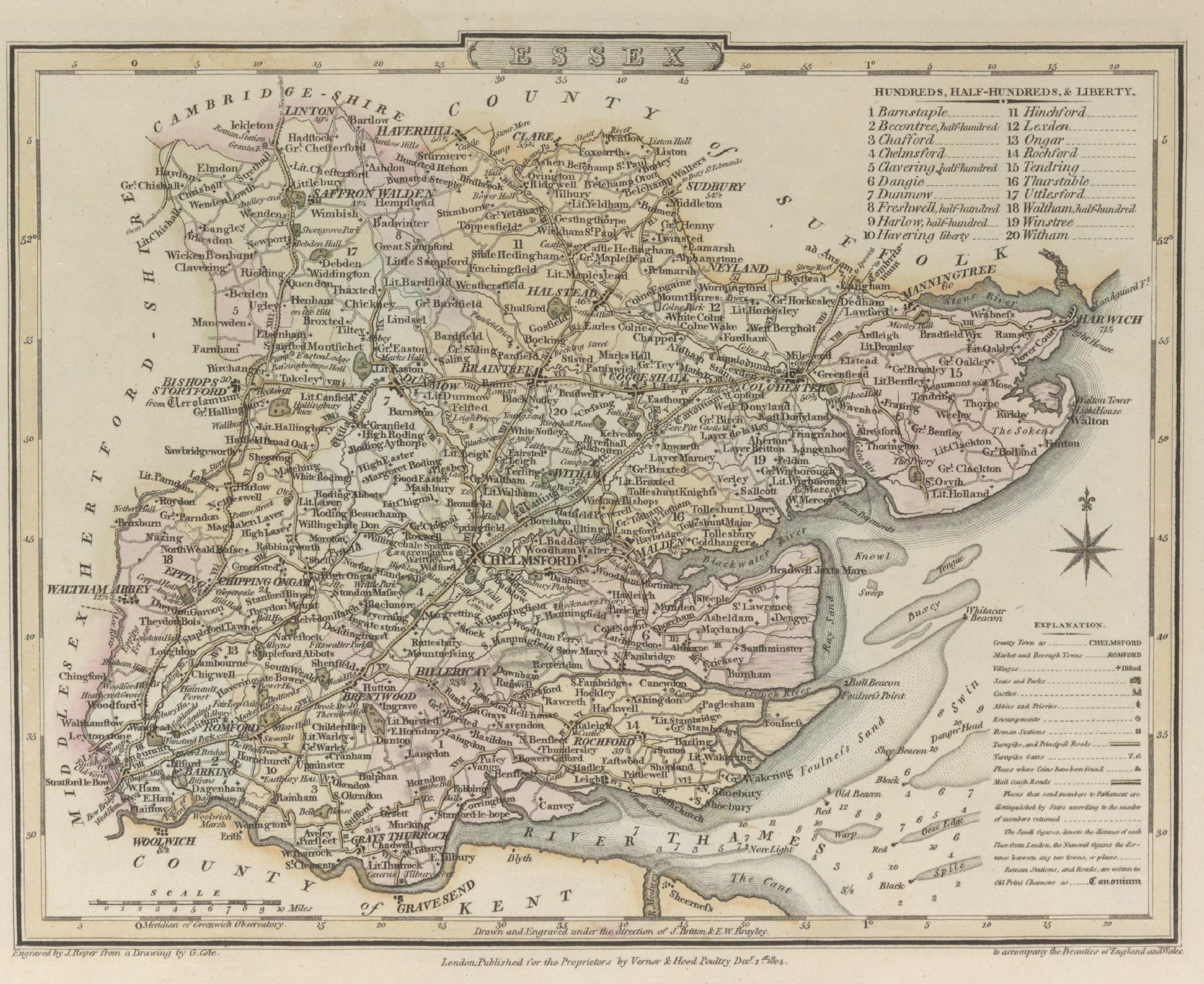
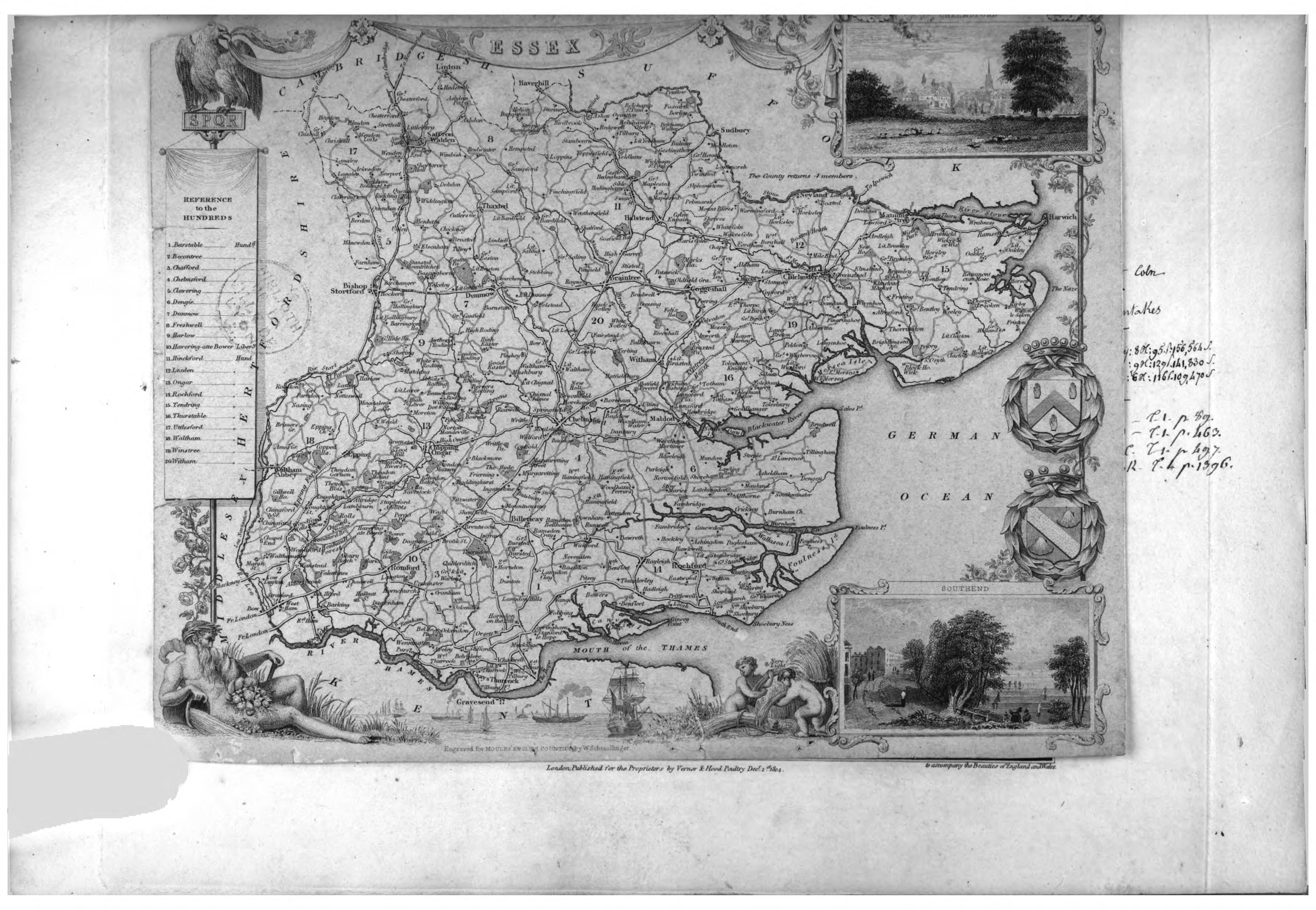
1804 Essex 1804 J. Schmollinger originally made for Moule's English Counties and then for The Beauties of England
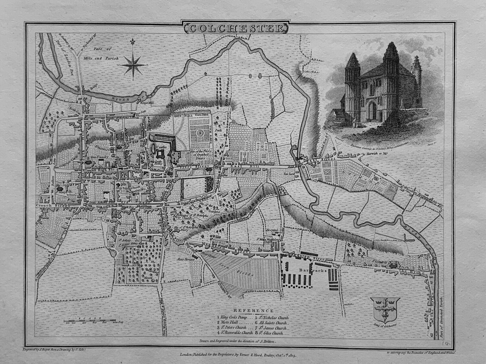
Plan of Colchester 1805 G. Cole and J. Roper in The British Atlas
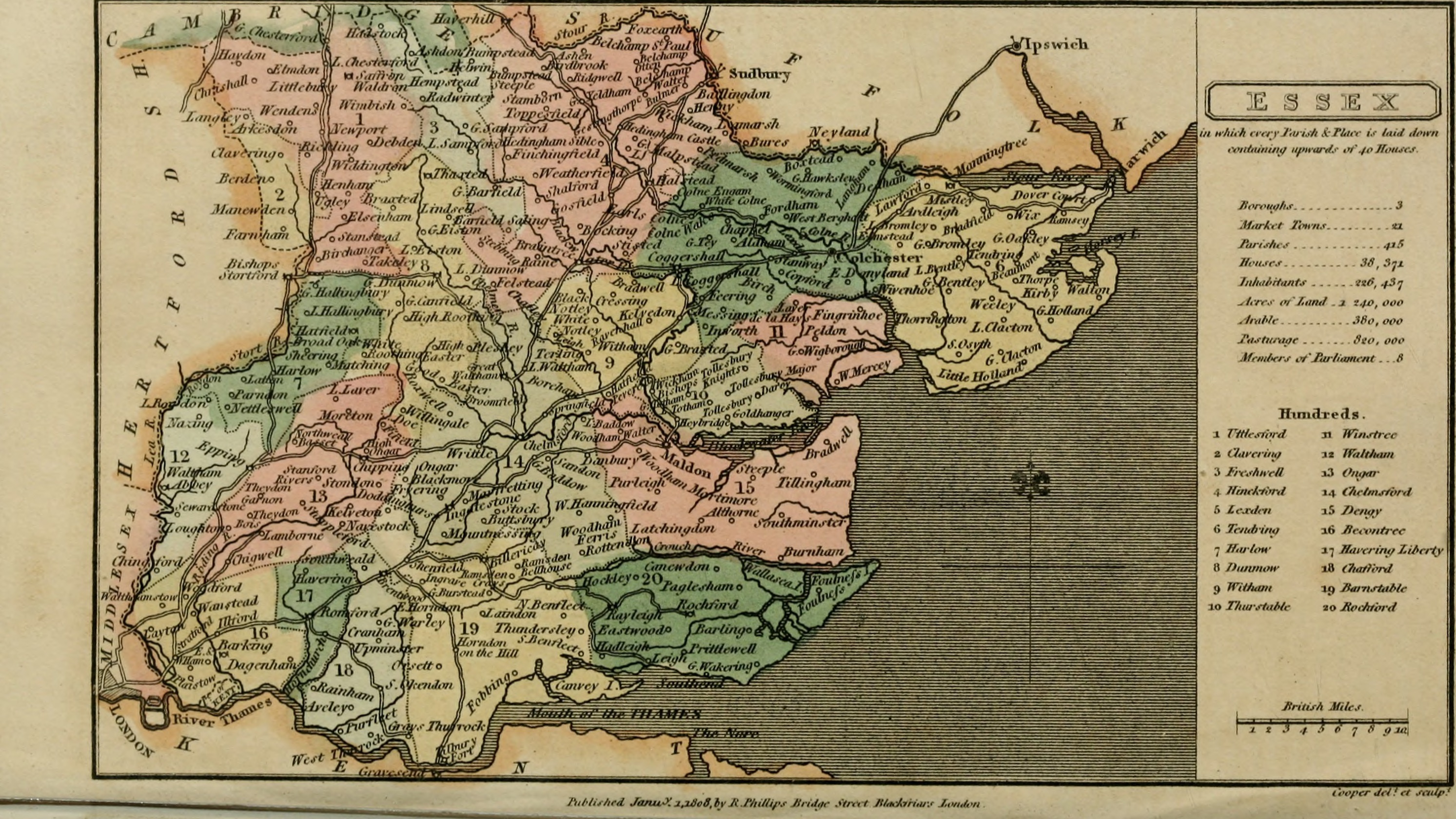
Essex 1808 Benjamin Pitts Capper in A Topographical Dictionary of the United Kingdom (Chubb p.245 CCCXXVII) Image courtesy of Google Books
Essex 1809 John Roper in The British Atlas of England and Wales Chubb p.250 CCCXXXIX)
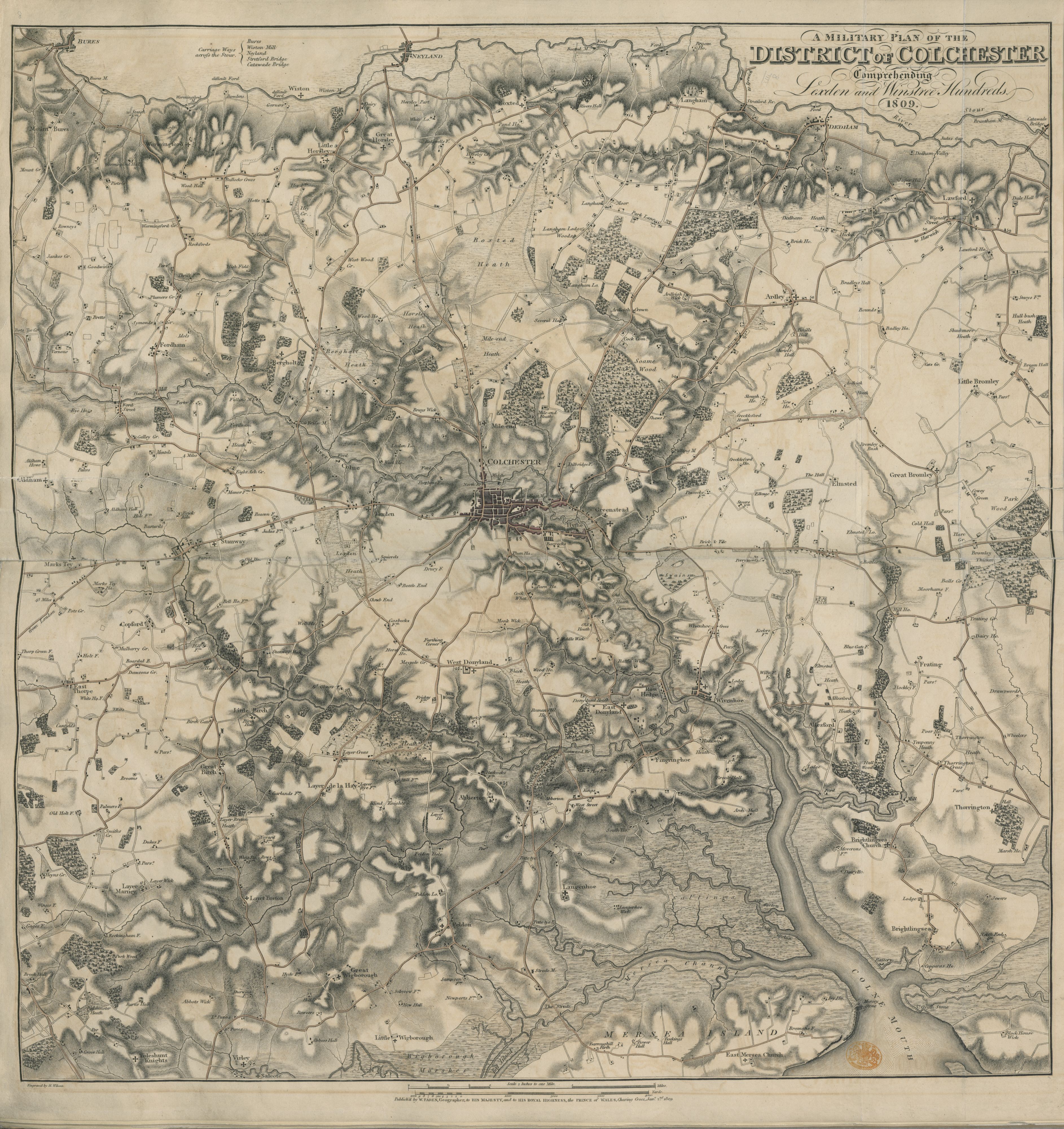
A Military Plan of the District of Colchester 1809 William Faden (Image courtesy of The British Library King's Collection Maps K.Top.13.8.)
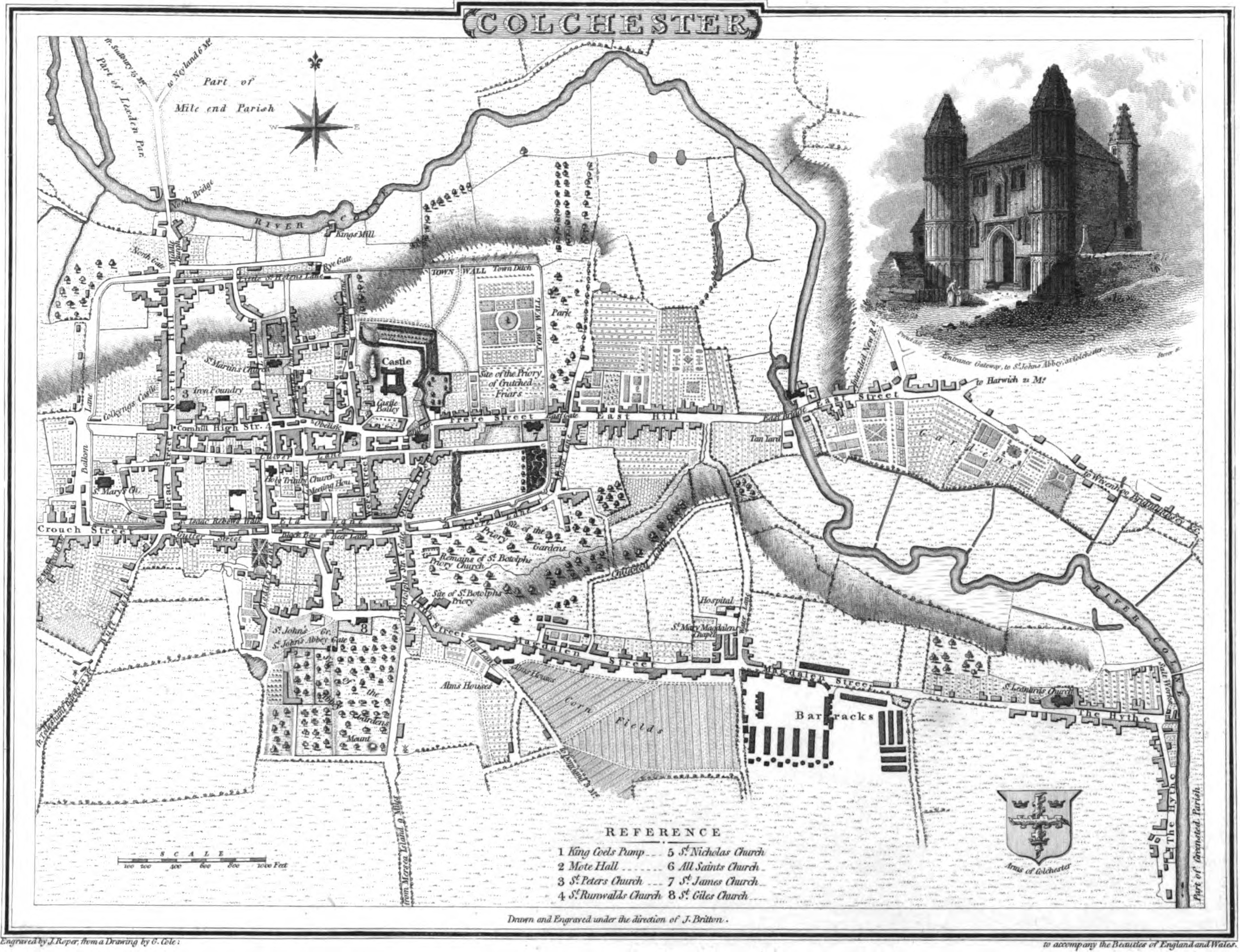
Plan of Colchester 1809 John Roper and George Cole in the British Atlas of England and Wales
Essex 1813 Benjamin Pitts Capper in A Topographical Dictionary of the United Kingdom Chubb p.250 CCCXXXIX)
(Image Courtesy of Wikimedia)
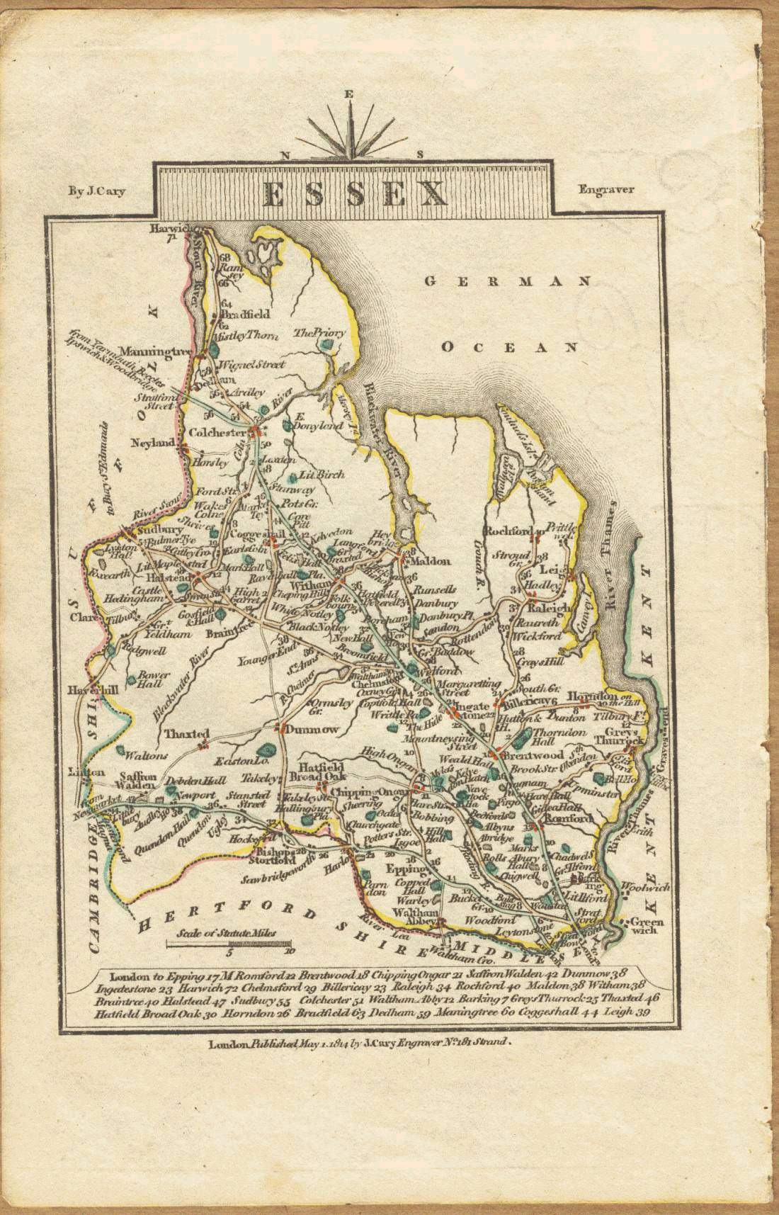
Essex 1814 John Cary in Cary's Traveller's Companion
(Chubb p.220 CCLXXIII)
Essex 1816 Robert Rowe (Chubb p.262 CCCLIVa)
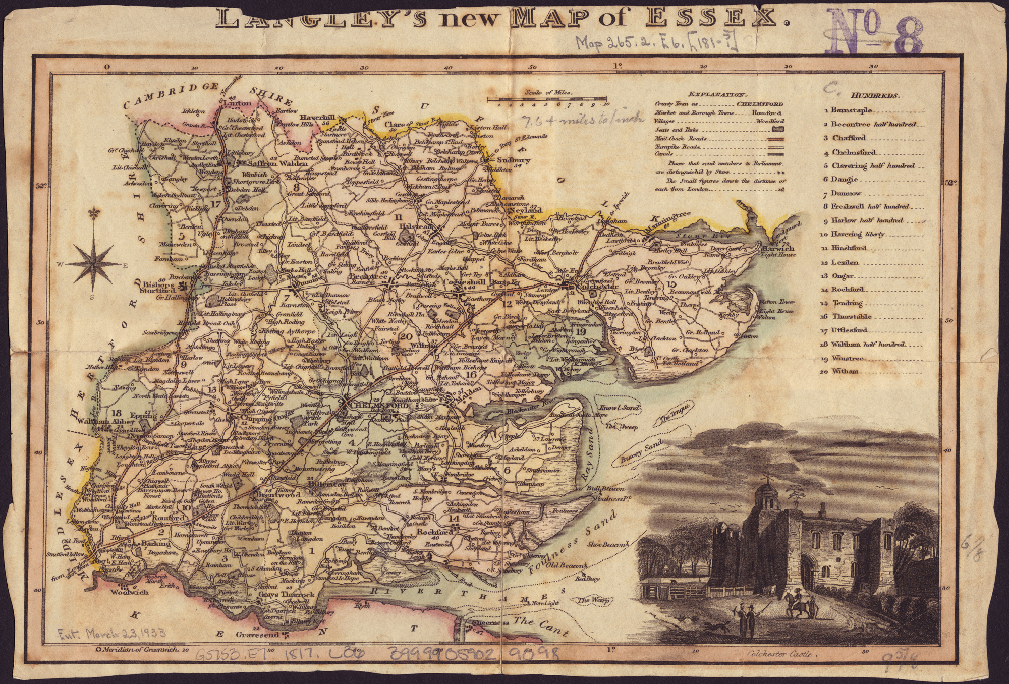
Langleys new map of Essex 1817 Edward Langley (Image courtesy of Wikimedia)
Essex 1819 Ellis's New and Correct Atlas (Chubb p.266 CCCLXIII)
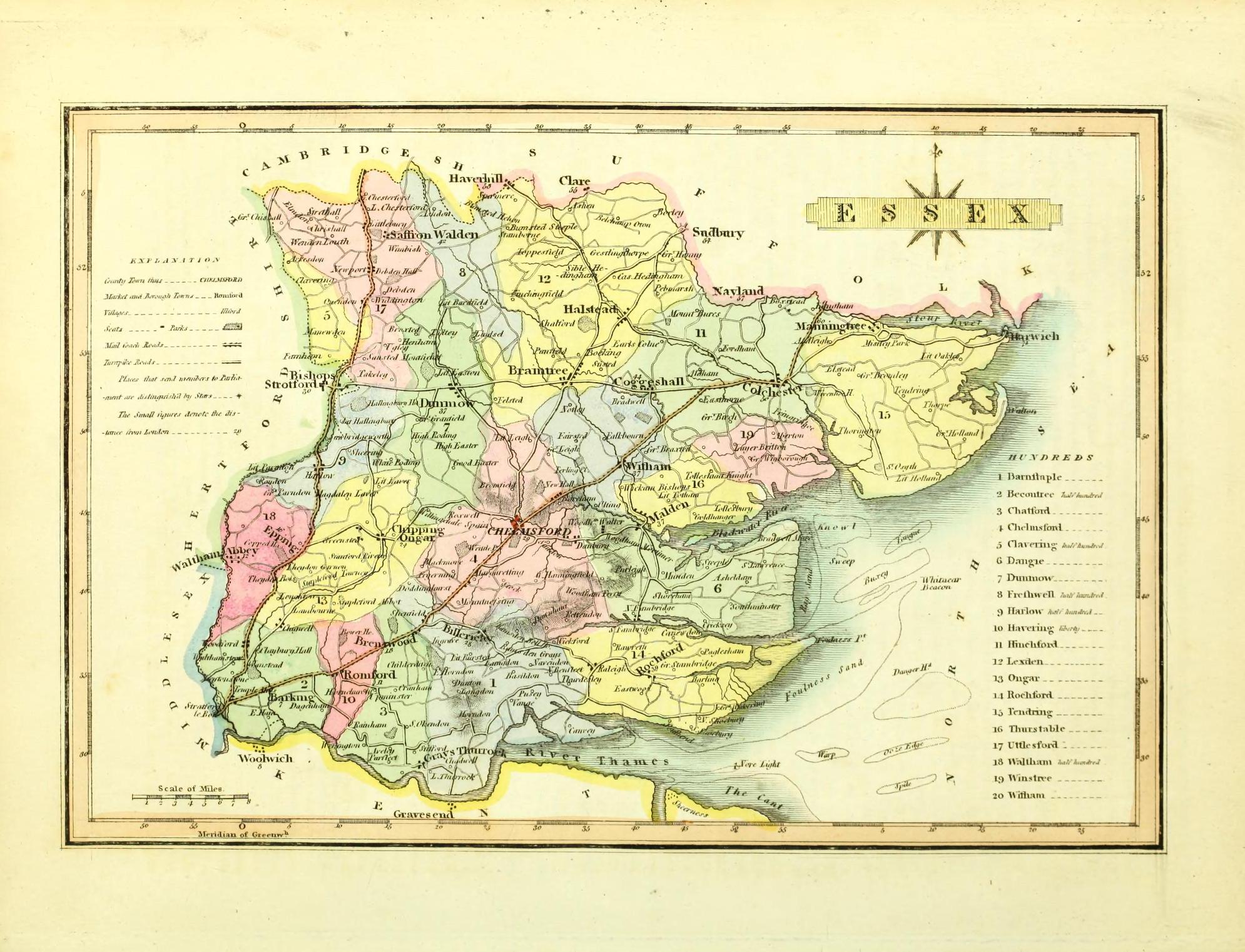
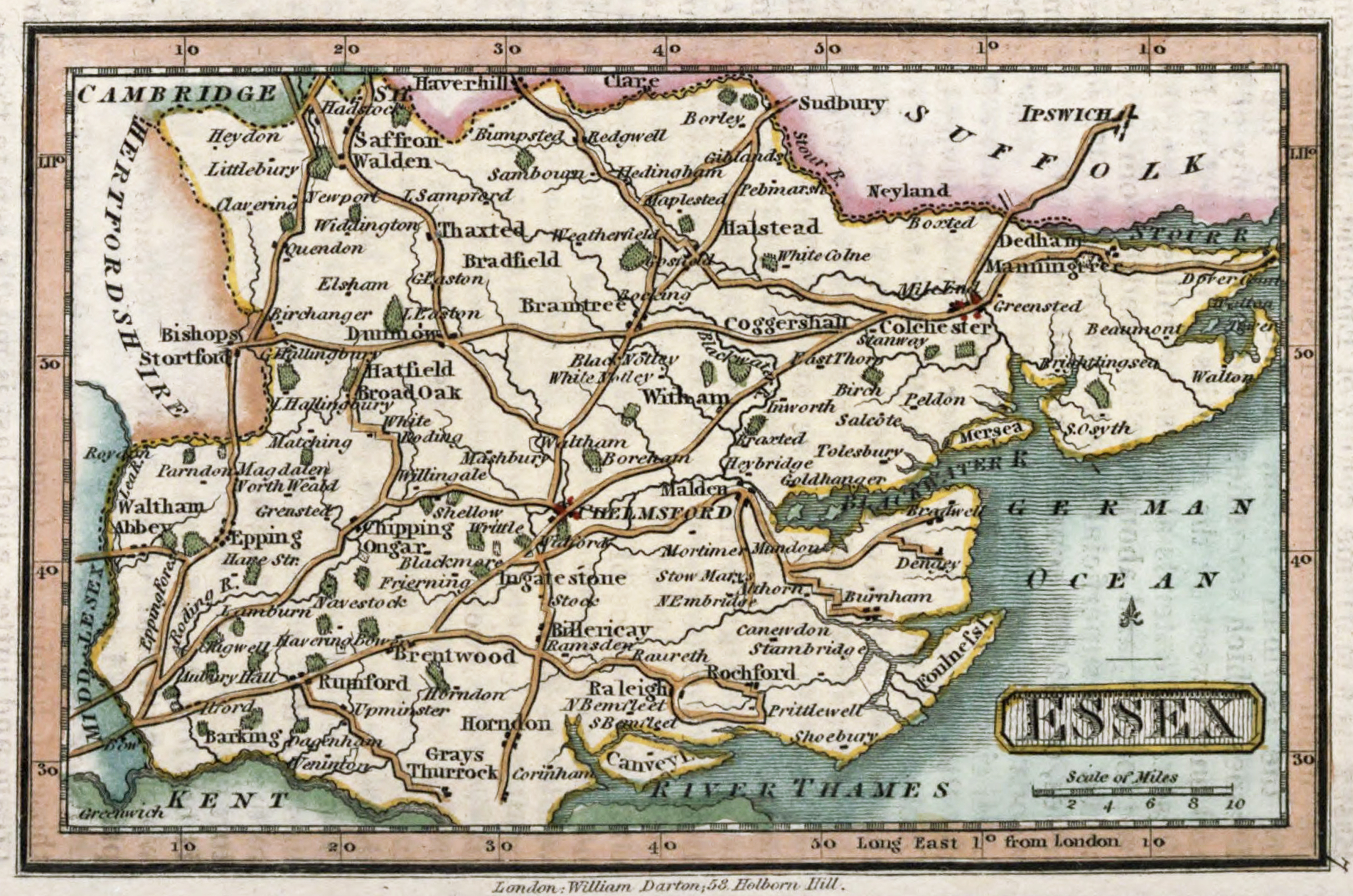
Essex 1820 William Darton
Essex 1822 Samuel Leigh in Leighs New Pocket Atlas
Essex 1824 George Carrington Gray in Gray's New Book of the Roads (Chubb p.281 CCCXCII)
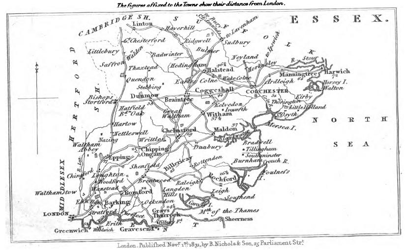
Essex 1831 Samuel Tymms in The Family Topographer (Chubb p.304 CCCCXLI )
Colchester 1832 Robert Kearsley Dawson for Plans of the Cities and Boroughs of England and Wales
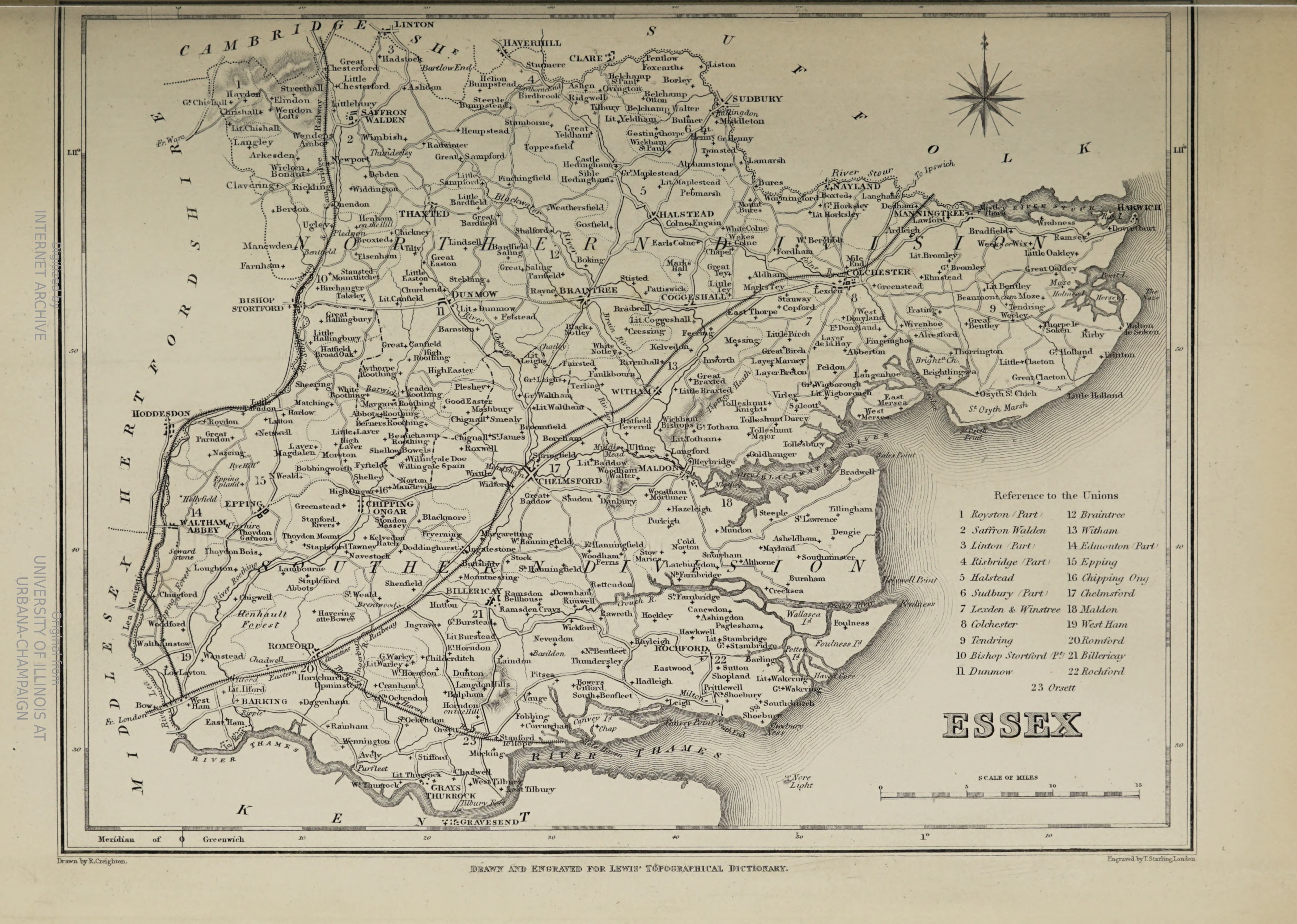
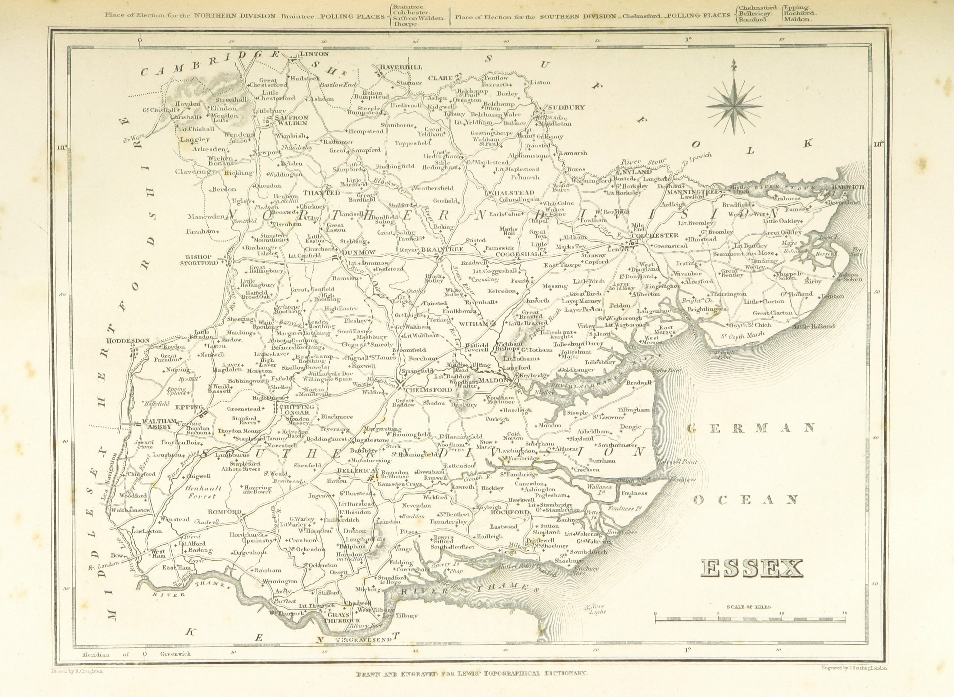
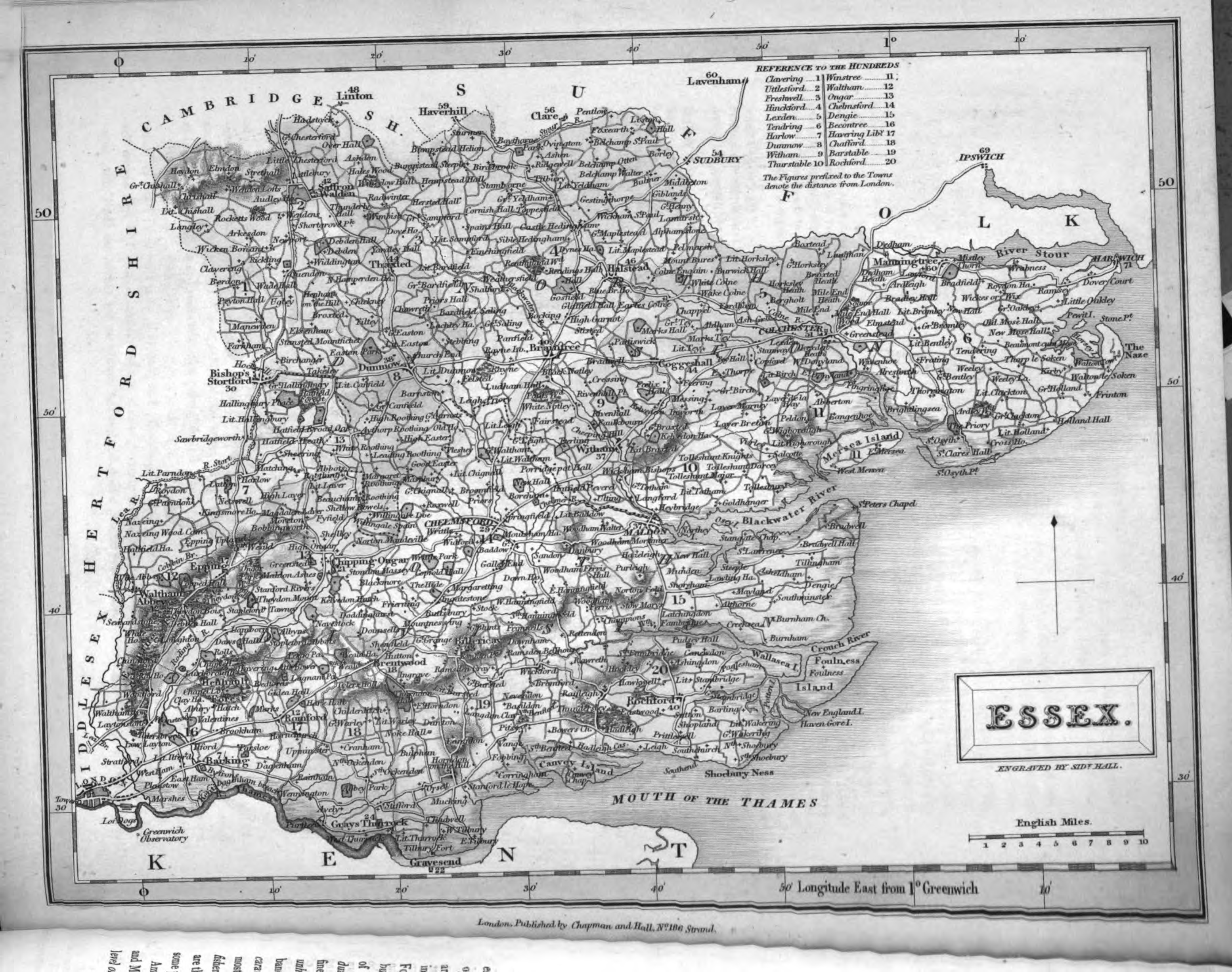
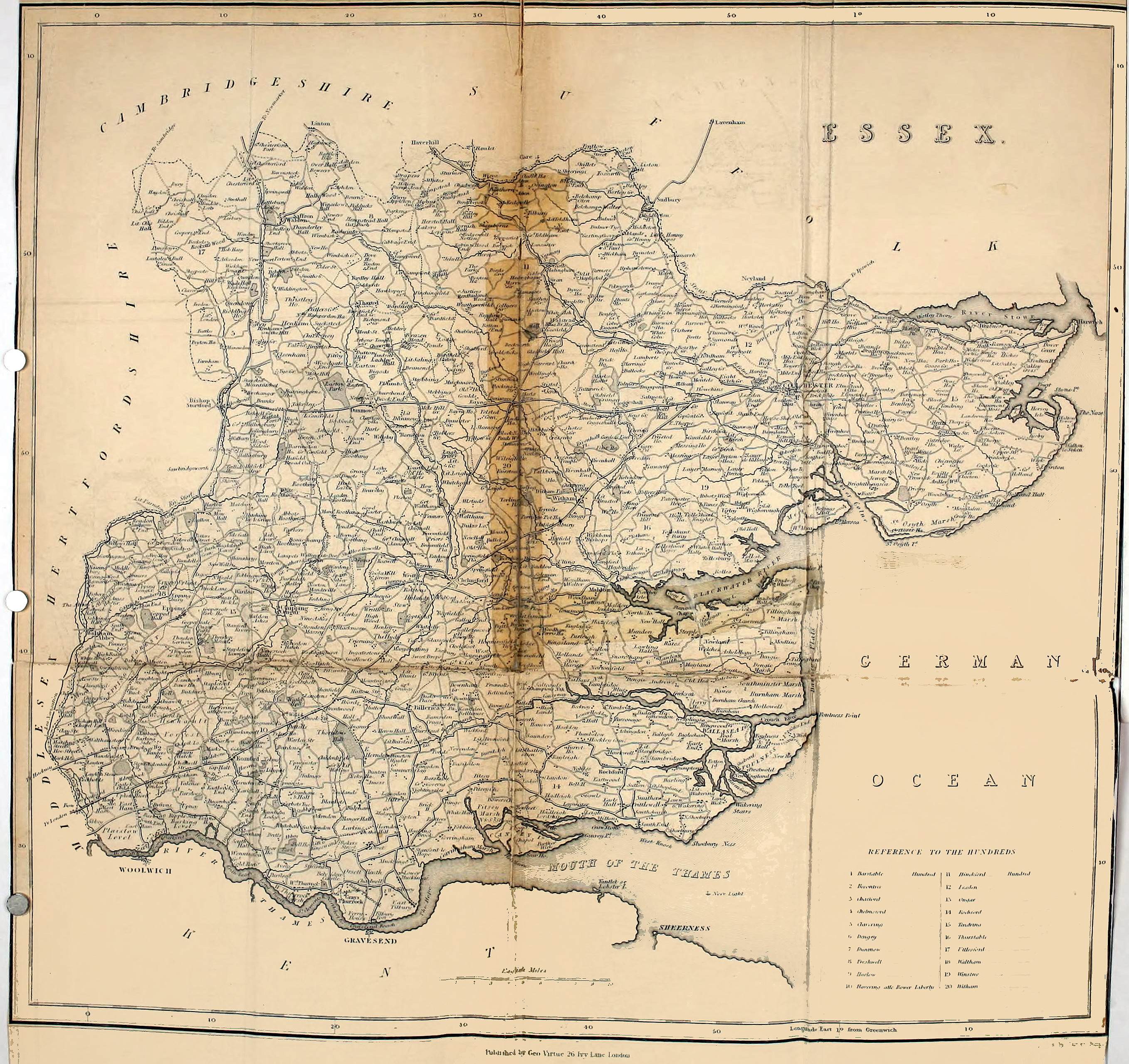
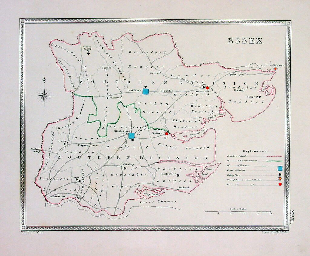
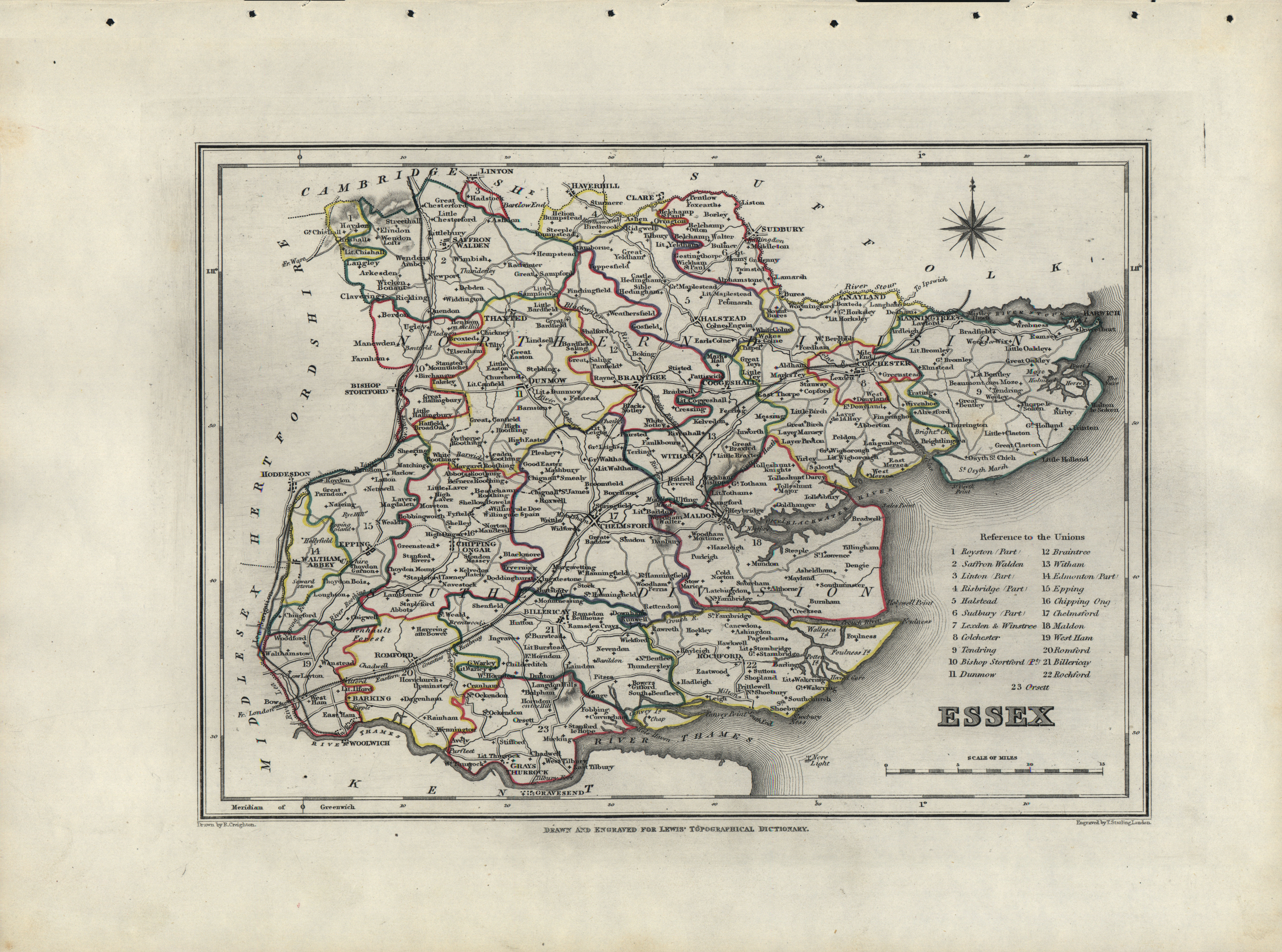
Essex 1833 Robert Creighton for Lewis's Topographical Dictionary (Chubb p.322 CCCCLXIV)
Essex 1834 Shmollinger for Thomas Moule's The English Counties Delineated
Essex 1834 C. and J. Greenwood in Atlas of the Counties of England (Chubb p.322 CCCCLXIV)
(Image courtesy of www.davidrumsey.com)
Essex 1835 Robert Creighton for Samuel Lewis in A Topographical Dictionary of England (Chubb p.322 CCCCLXIV)
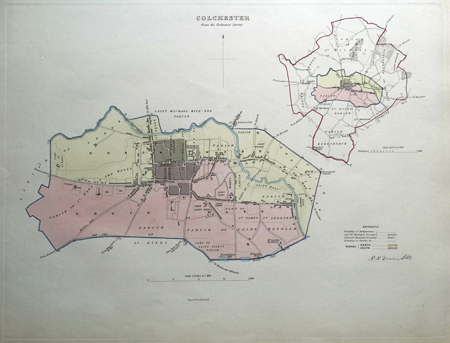
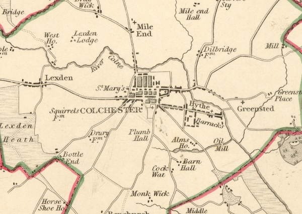
Colchester 1835 Robert Creighton for Lewis's Topographical Dictionary (Chubb p.322 CCCCLXIV)
Essex 1836 Sidney Hall in The New British Atlas (Chubb p. 314 CCCCLI)
Essex 1836 Thomas Wright in A History and Topography of Essex
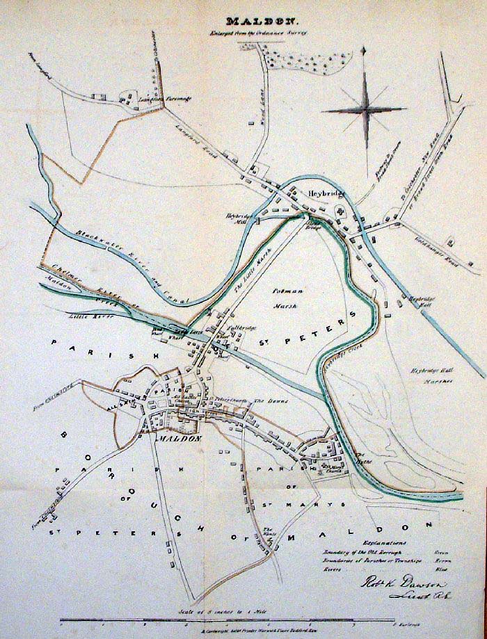
Maldon 1837 Robert Kearsley Dawson for The Boundary Commission
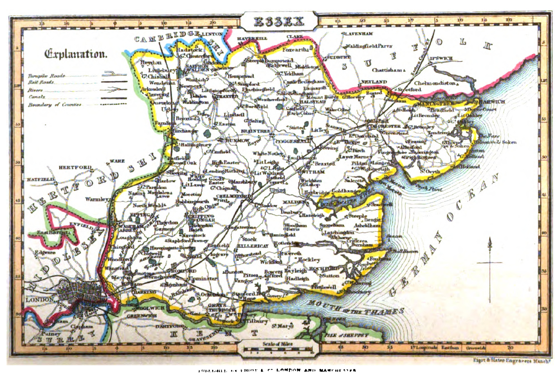
Essex 1839 Pigot & Co.
Essex 1842 Robert Creighton (Chubb p.322 CCCCLXIV)
Essex 1842 James Pigot in A Pocket Topography and Gazetteer of England
Essex 1848 Robert Creighton for the Atlas to Lewis' Topographical Directory (Chubb p.322 CCCCLXIV)
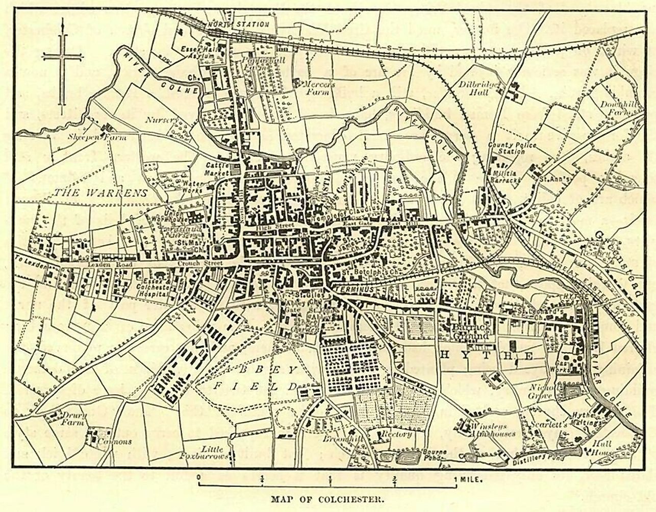
Plan of Colchester 1874 Mary Benham in A Guide to Colchester and its Environs
(Image courtesy of The British Library King's Collection Maps K.Top)
Plan of Colchester 1880 A & C. Black
Epping Forest ca.1880 Bartholomew
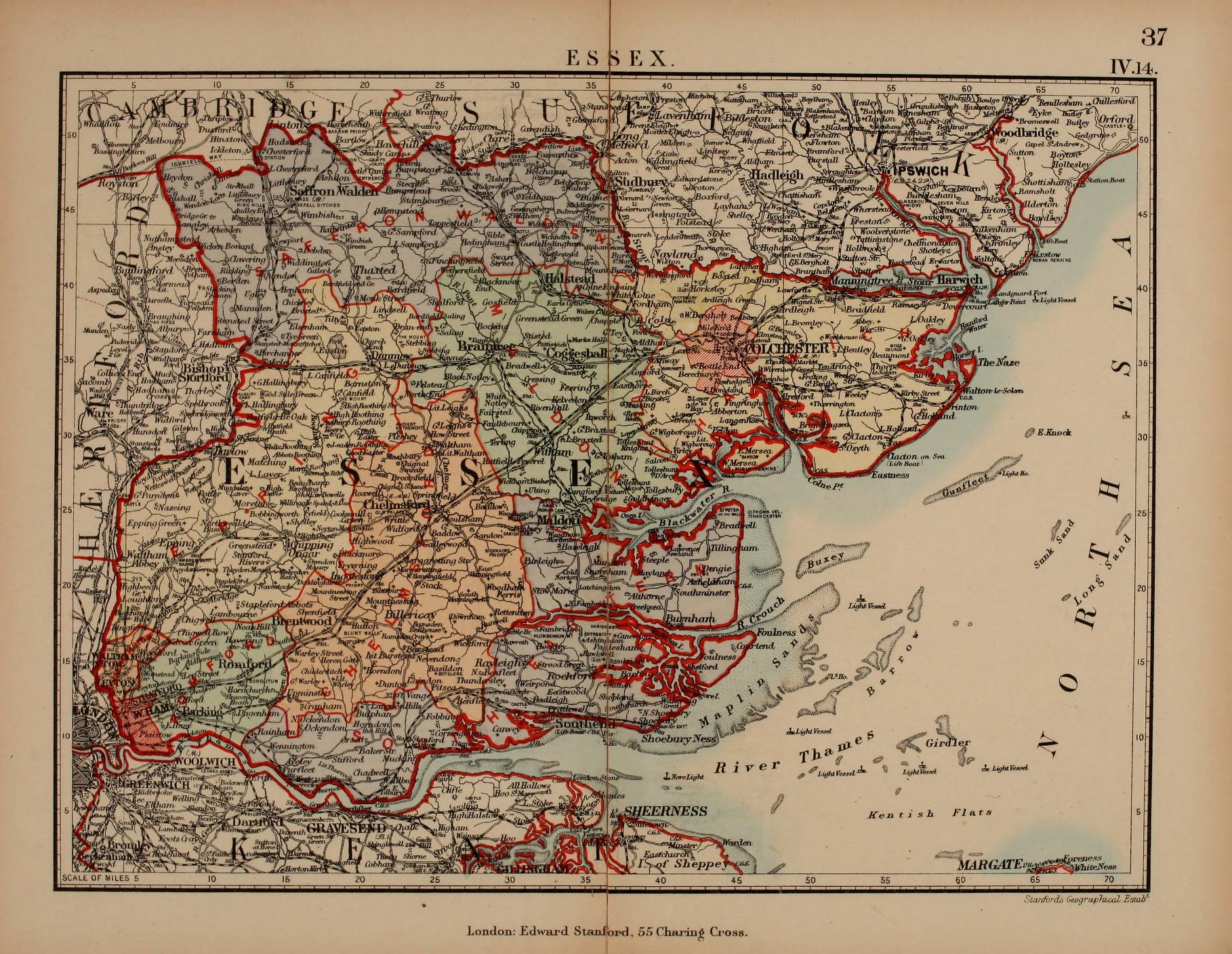
Essex 1885 Stanford's Parliamentary Atlas
Chelmsford (fire insurance plans) 1891 (British Library sheet 4 2 (BL_152908)
Leyton 1896 Rev. John Kennedy
(Image courtesy of The British Library King's Collection Maps K.Top)
%20Yale%20University%20Library%20%20(2022_02_01%2023_23_00%20UTC).jpg)
.JPG)
%20.JPG)
.jpg)
%20.jpg)
%20Thomas%20Badeslade%20in%20Chorographia%20Britanniae%20.jpg)
.jpg)
%20Image%20Courtesy%20of%20Biblioteca%20National%20de%20Espana).jpg)
.jpg)
.jpg)
%20MacMaster%20University%20Library%20%20%20.jpg)
.jpg)
.jpg)
.jpg)
.jpg)
.jpg)
%201891%20sheet%204%202%20(BL%20152908).tiff%20.jpg)
.jpg)