| |
 To resize image: hold CTRL and use mouse scroll- Resource consulted for Hertfordshire: Hertfordshire Maps: A descriptive Catalogue of the Maps of the County: 1579-1900 by Sir Herbert George Fordham: Steven Austin and Sons 1907 A Bibliography of County Maps - Large Scale County Maps of England. Tooley R.V. The Printed Maps in the Atlases of Great Britain and Ireland1579-1870 Chubb Thomas Dawson: 1927 Home |
 |
Hertfordshire 1579 Christopher Saxton in his Altlas 0f England and Wales (Fordham 12)
Hertfordshire 1597 Christopher Saxton for his English Atlas (Image courtesy of The Mechanical Curator & Wikimedia)
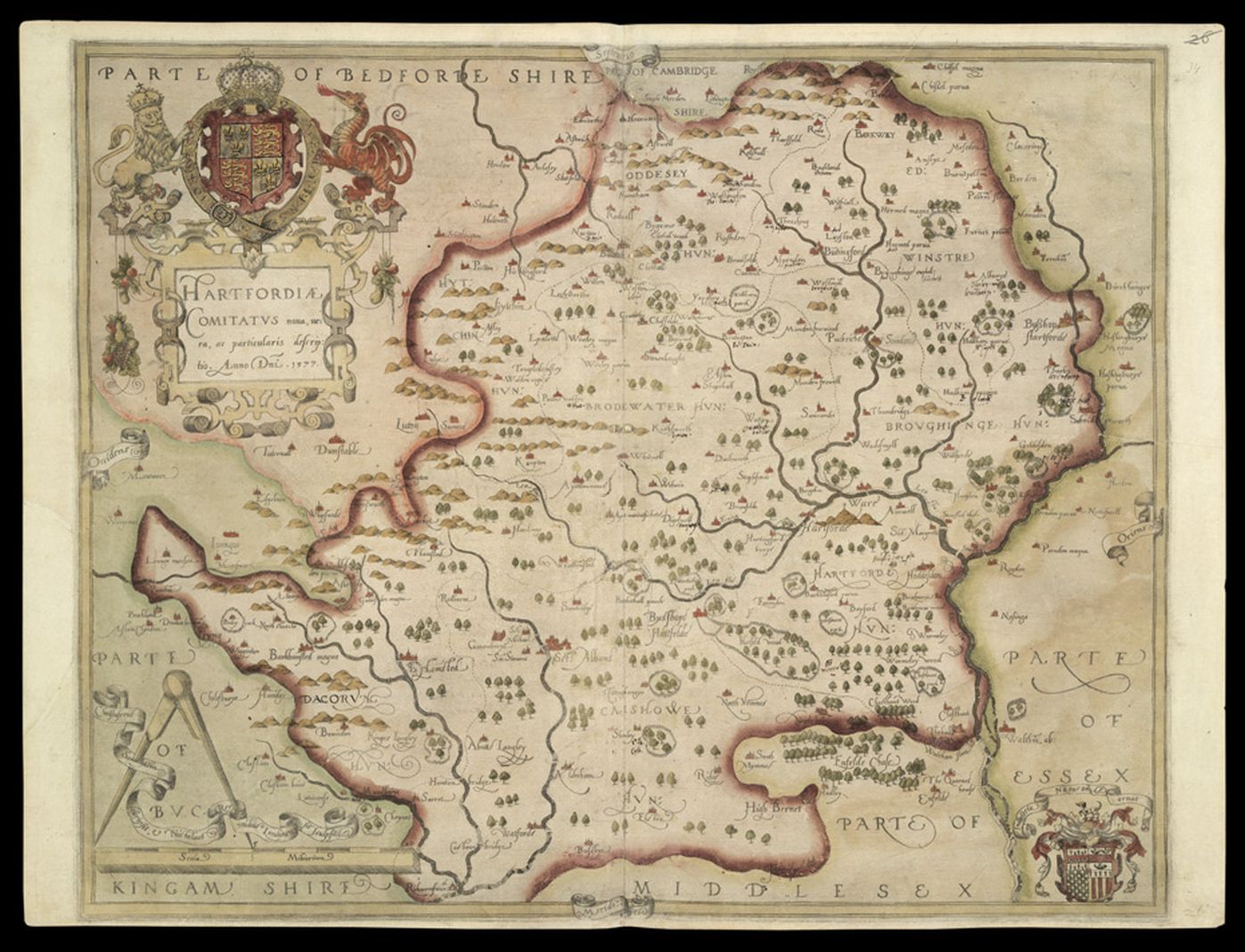
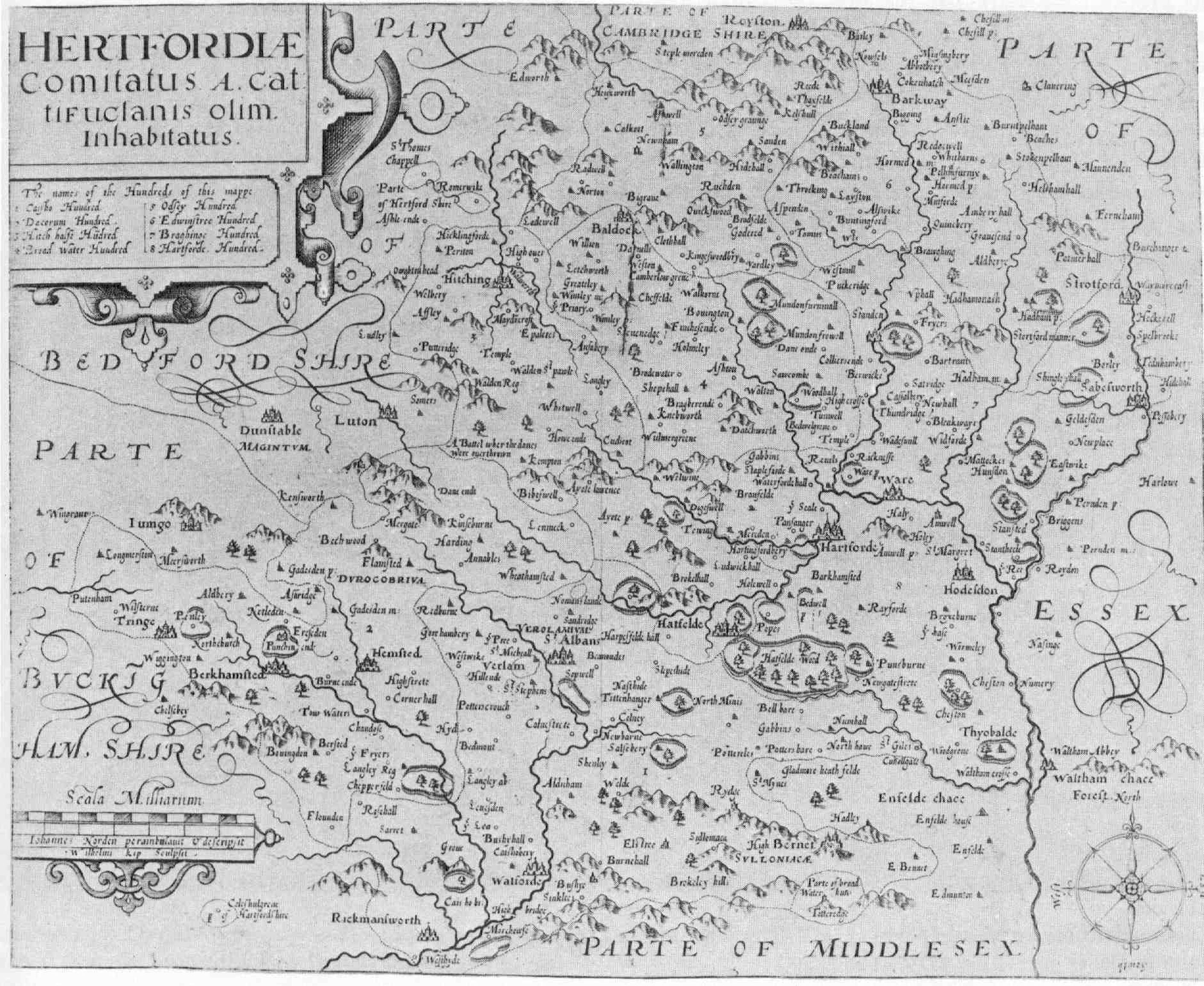
Hertfordshire 1598 John Norden engr. Wm. Kip for his uncompleted atlas: Speculum
Britanniae Pars (Fordham 13)
Hertfordshire 1607 Christopher Saxton for Camden's Britannia (Last Latin Edition)
revised William Hole and William Kip (Fordham 14)
from maps surveyed by Christopher Saxton:John Norden and John Owen
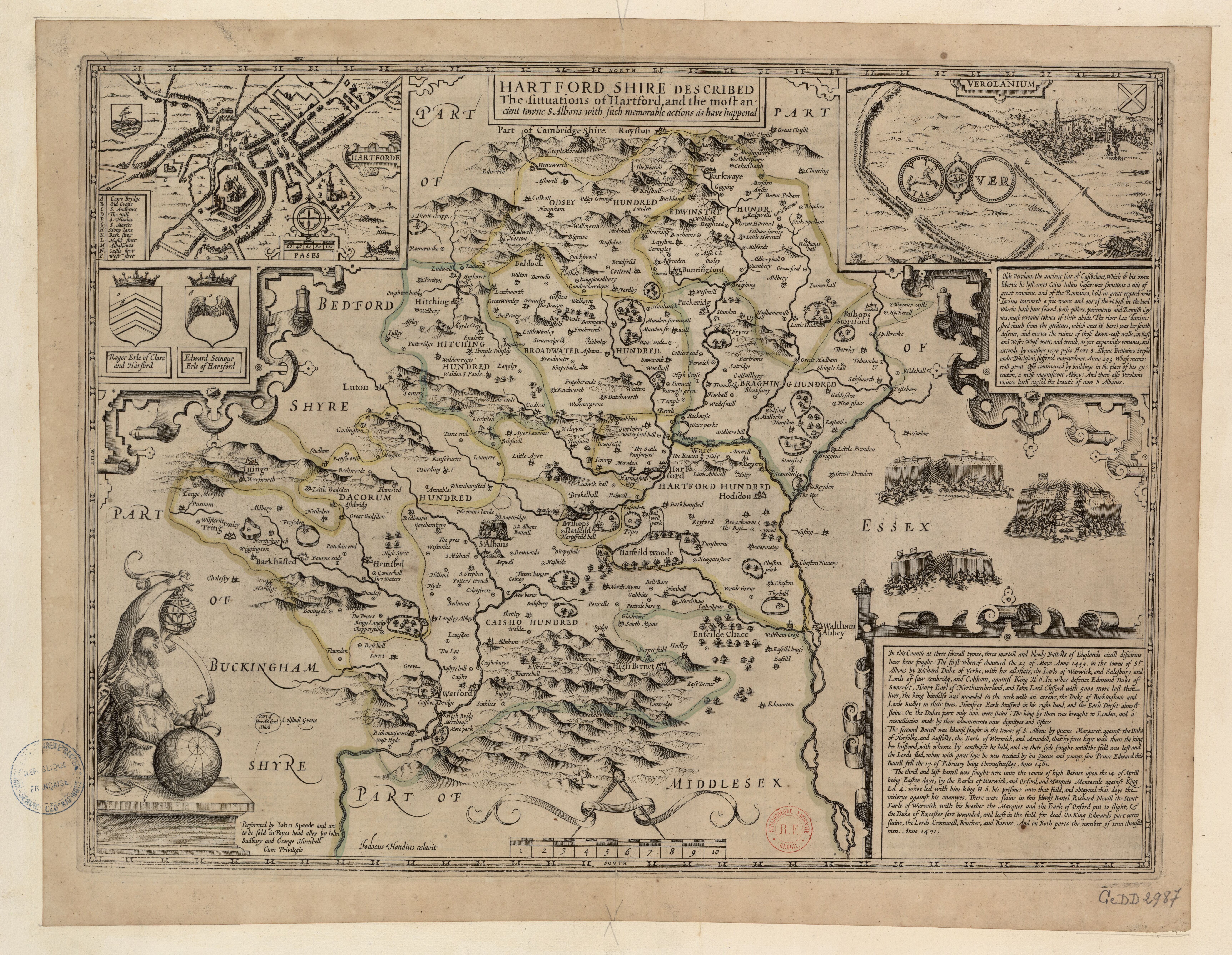
Hertfordshire 1610 John Speed in The Theatre of the Empire of Great Britaine (Fordham 15)
Hertfordshire 1612 Michael Drayton to illustrate his Polyolbion
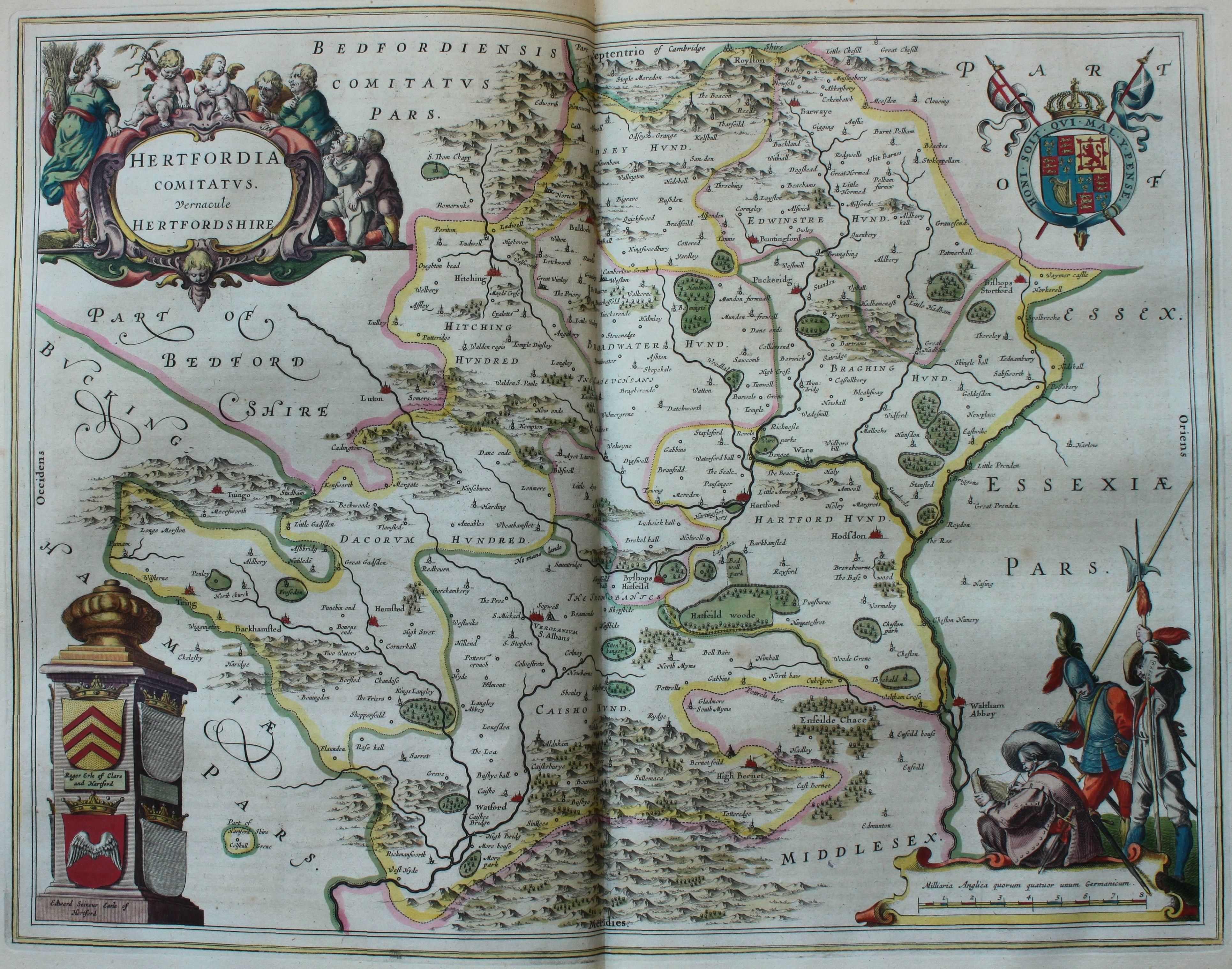
Hertfordia Comitatus 1645 Joan Blaeu for Theatrum Orbis Terrarum sive Atlas Novus
(Image courtesy of The British Library: King's Collection Maps K.Top.16.1.
Hertfordshire 1646 Jan Jansson in Atlas Van den Hagen .
All maps have Jansson's imprint except for" Surrey: Northamptonshire: Lincolnshire: Nottinghamshire: Shropshire: Cheshire: and Yorkshire (North: East: and West.
(Image courtesy of The British Library via Flickr& Wikimedia)
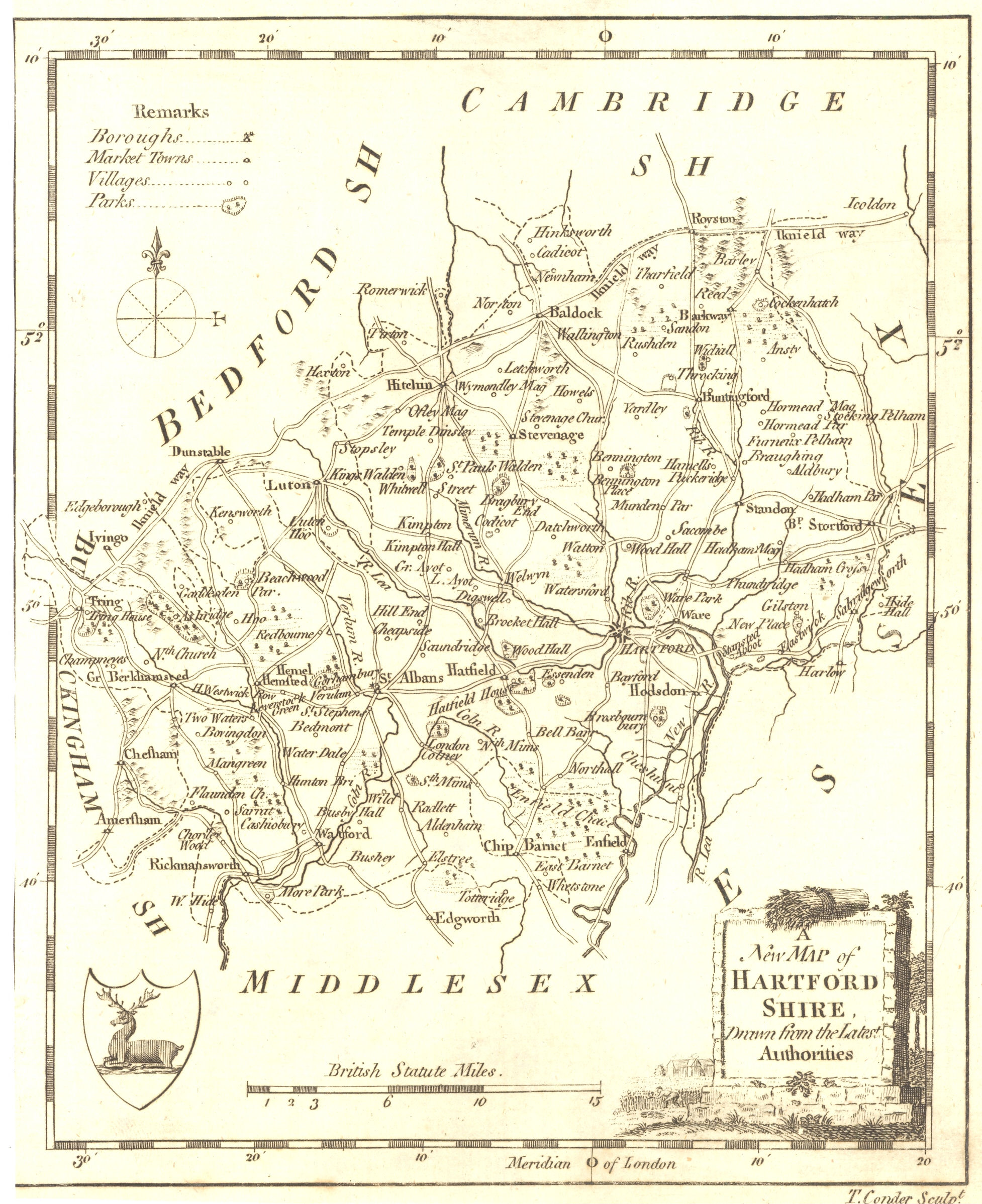
Hertfordshire 1659 Thomas Conder in The new and complete English Traveller
(Image courtesy of The British Library via Flickr& Wikimedia)
Hertfordshire 1659 Joan Blaeu in Atlas Major (Fordham 25) (Image courtesy of Wikimedia
Hertfordshire 1662 John Speed in A Prospect of the Most Famous Parts of the World (Roger Rea Edition)
(Image courtesy of The British Library King's Collection Maps K.Top)
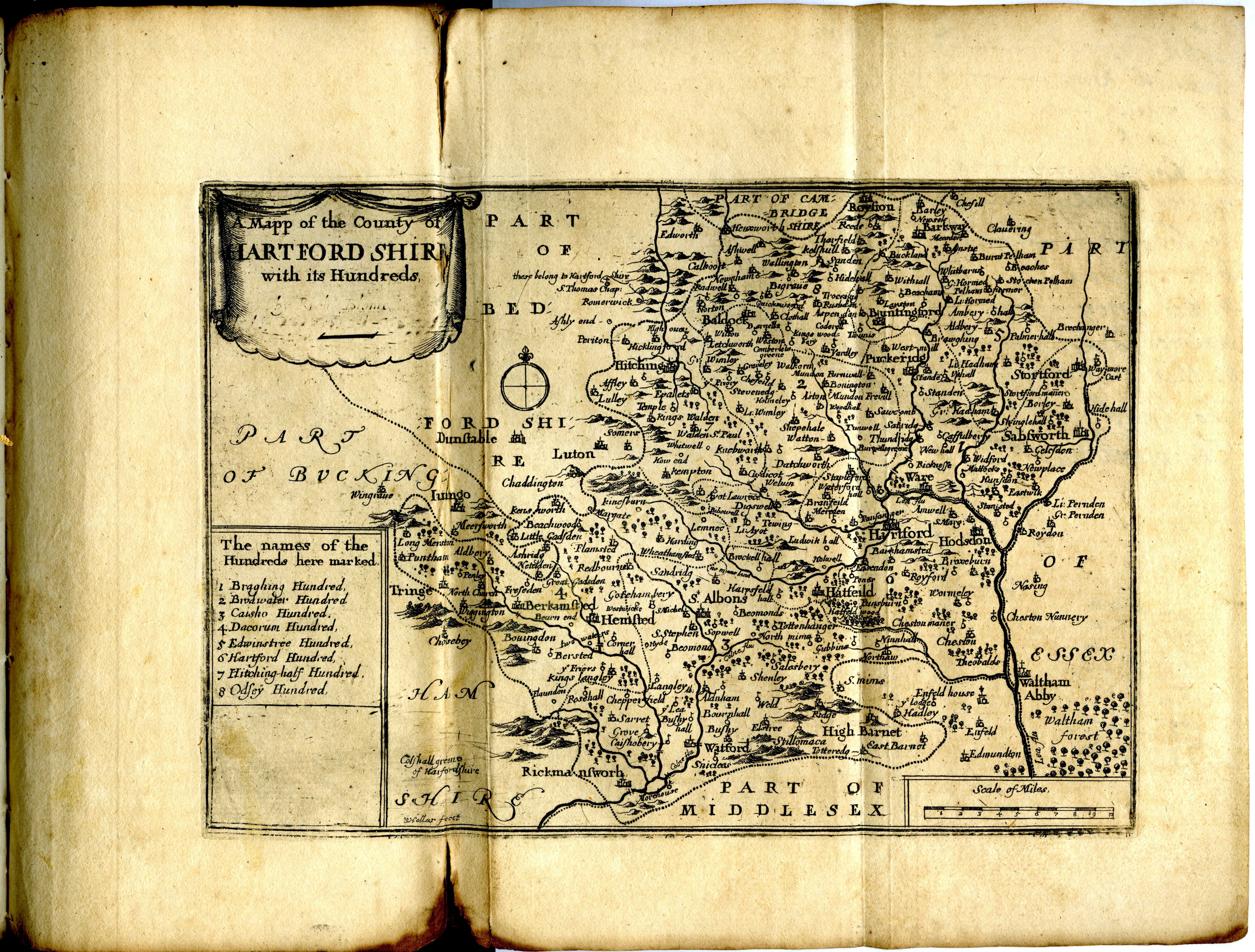
Hertfordshire 1676 John Seller (Image courtesy of The British Library)
Hertfordshire 1670 Richard Blome in Thomas Taylor's England Exactly Described (Fordham 31: 44)
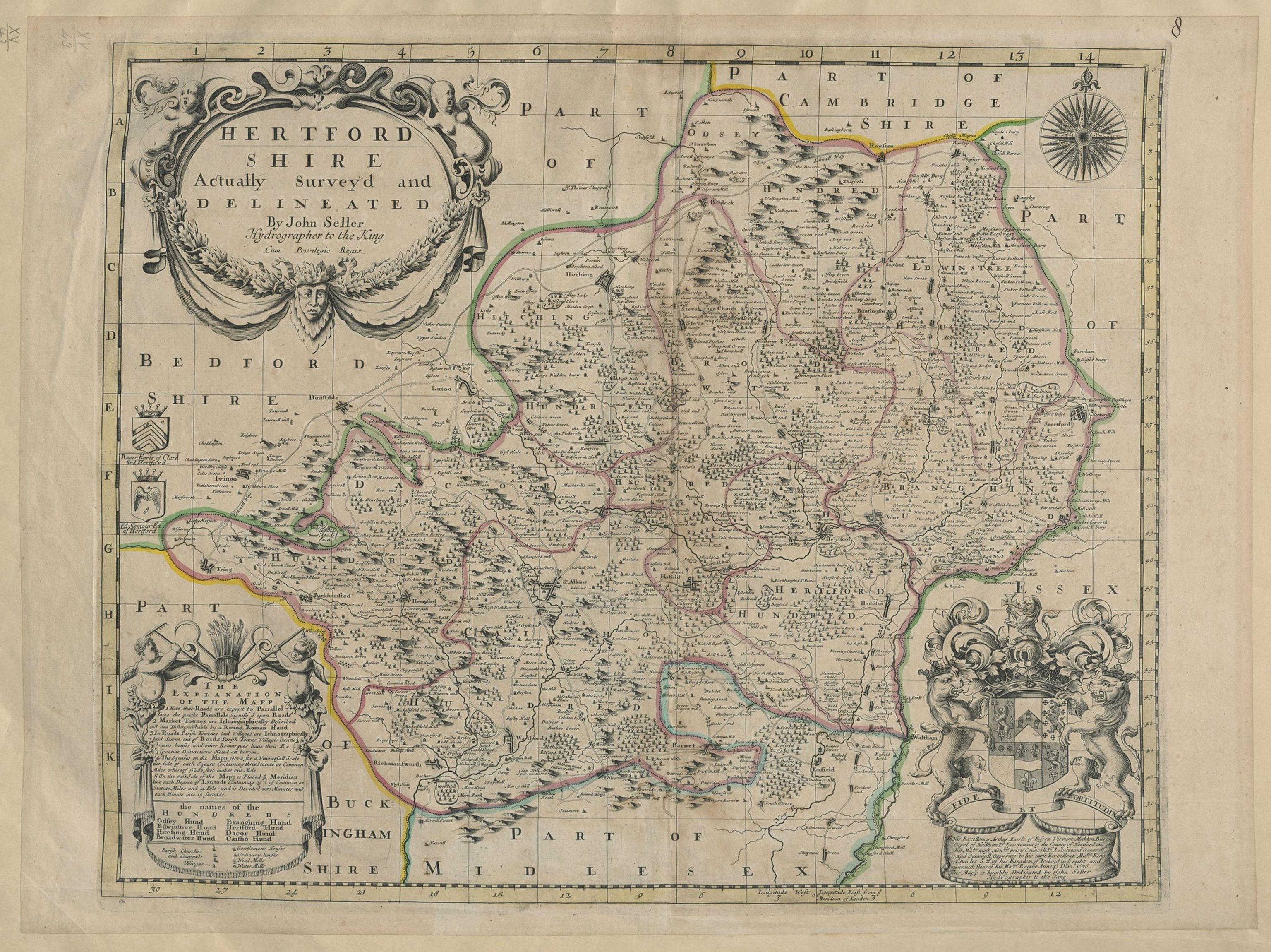
Hertfordshire Actually Surveyed and and Delineated 1676 for John Seller for John Oliver (Fordham 38)
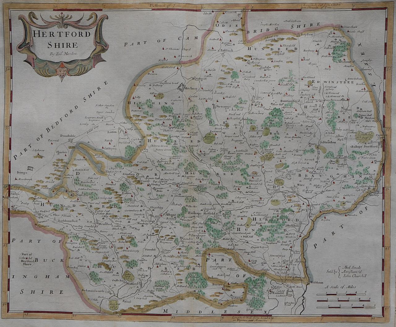
Hertfordshire 1690 Robert Morden for the first English Translation of Camden's Britannia. (Fordham 39)
(Image courtesy of Yale University Library)
Hertfordshire 1693 John Seller for his (incomplete) Atlas Anglicanus (Fordham 33)
Hertfordshie 1702 Robert Morden for Camden's Britannia (Fordham 39)
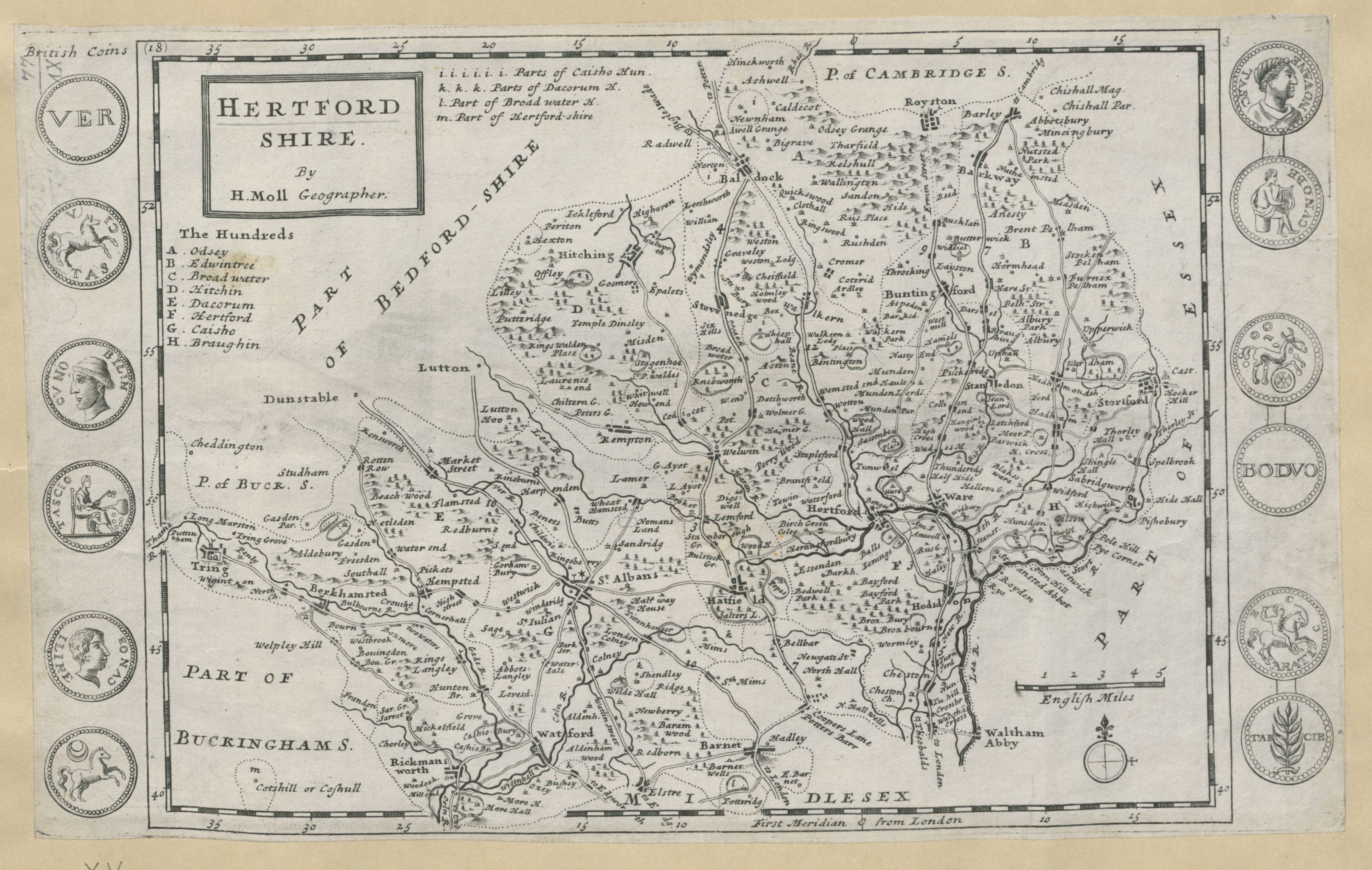
Hartfordshire 1724 Herman Moll in A New Description of England and Wales (Image courtesy of The British Library (Fordham 46)
Hertfordshire 1724 Robert Morden for Camden's Britannia (Fordham 39)
Hertfordshire (1st. State) 1742 Thomas Badeslade and William Toms in Chorographia Britanniae (Fordham 49)
Hertfordshire (2nd state) 1743 Thomas Badeslade and William Toms in Chorographia Britanniae (Fordham 50)
Hertfordshire 1743 John Speed in The Theatre of the Empire of Great Britaine (Henry Overton edition.)
(Image courtesy of Princeton University Historic Map Collection)
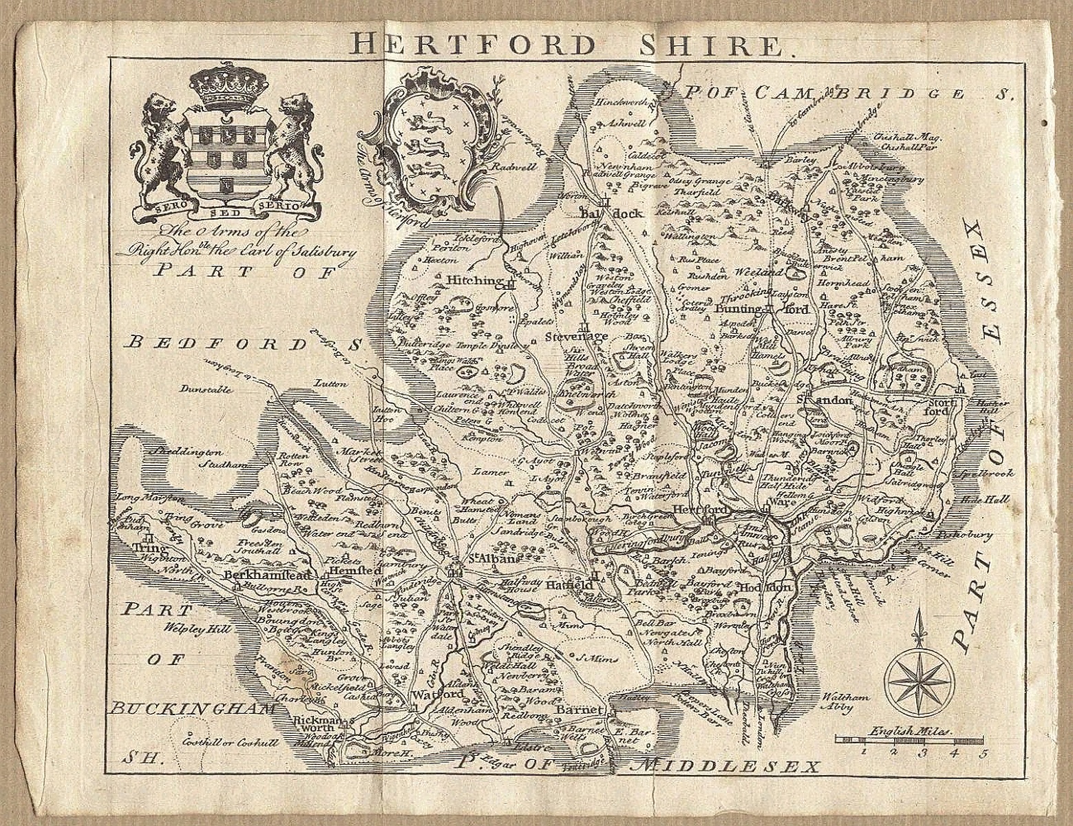
Hertfordshire 1746 Samuel Simpson in The Agreeable Historian...etc. (Fordham 52)
Hertfordshire 1743 Jean Rocque for The Small English Atlas - England Displayed - first published as The English Traveller (1746): and subsequently as The Small British atlas (Chubb p.172 CCVII)
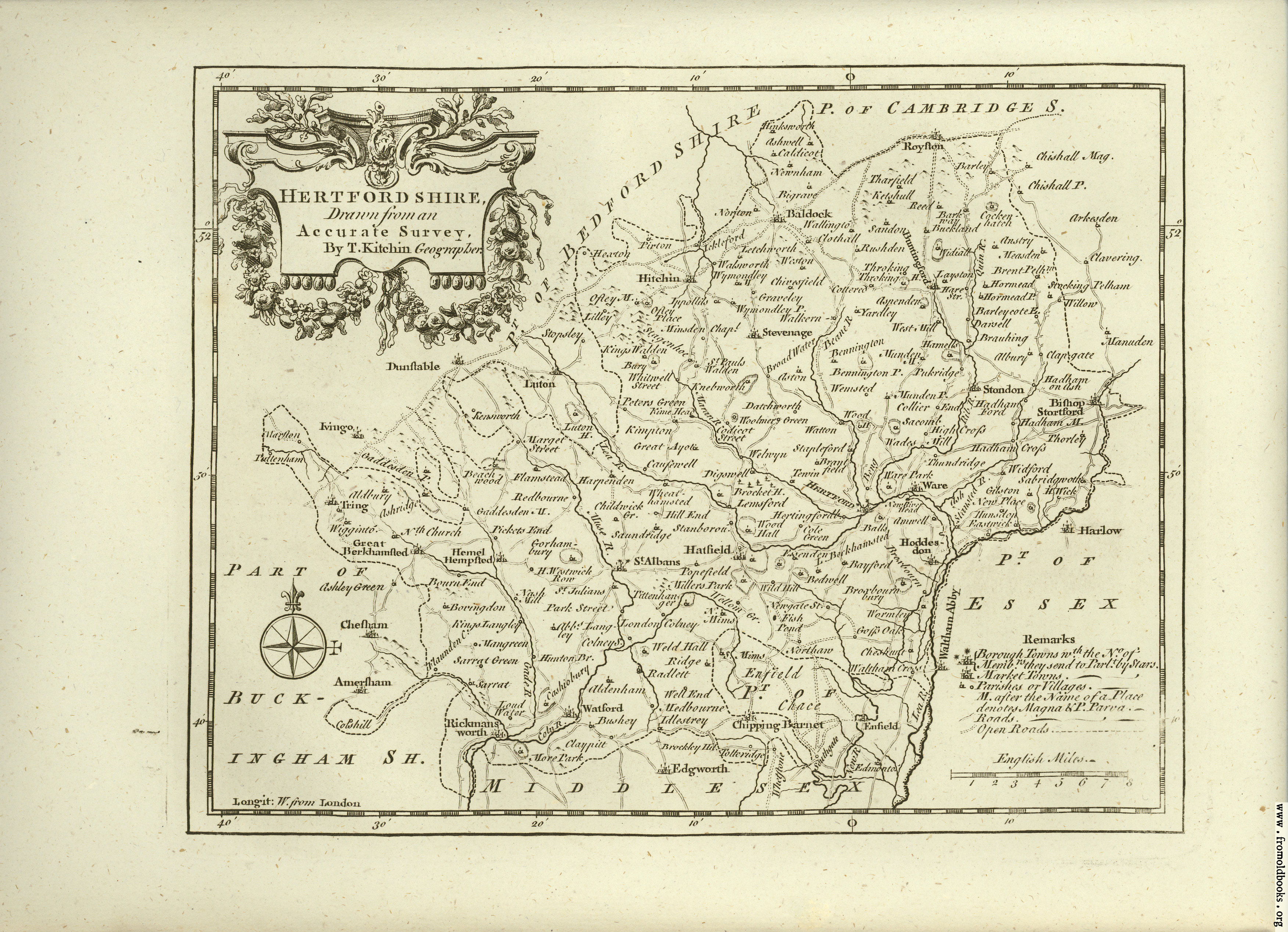
Hertfordshire 1749 Thomas Kitchin in The Small English Atlas being A New and accurate Sett of Maps of all the Counties in England and Wales. (Fordham 55) (Image courtesy of Yale University Library)
also published as An accurate map of Hertfordshire 1865 in The Royal English Atlas
(Image courtesy of The British Library via Flickr & Wikimedia)
Hertfordshire 1749 Thomas Kitchin in The Small English Atlas being A New and accurate Sett of Maps of all the Counties in England and Wales. (Fordham 55) (Image courtesy of Yale University Library)
Hertfordshire 1761 Robert Dodsley
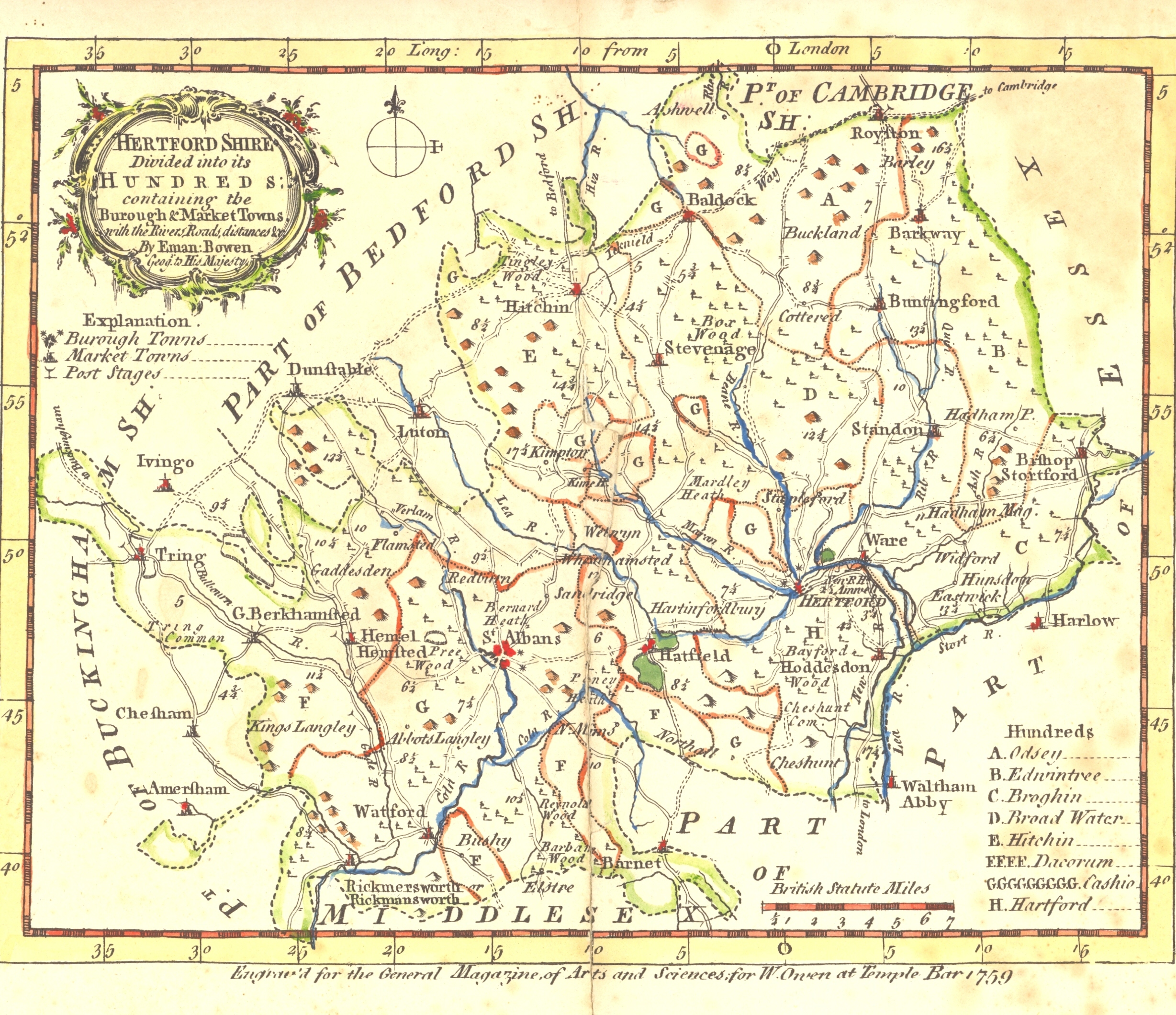
An accurate map of Hertfordshire divided into its hundreds 1765 Emanuel Bowen in The Royal English Atlas
(Image courtesy of Wikimedia)
A Plan of Hertford 1766 J. Andrews and M. Wren
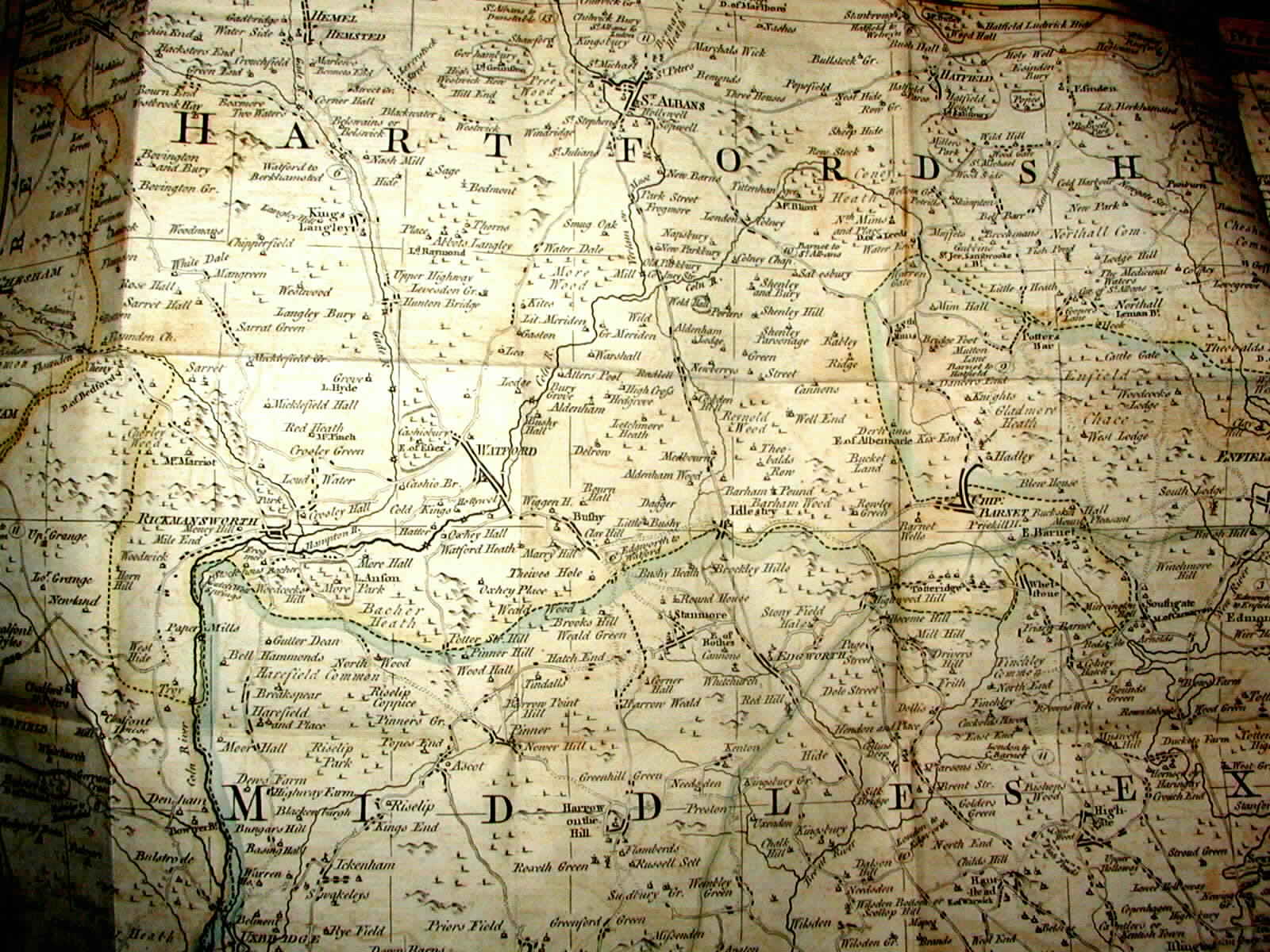
A Topographical Map of Hartford-Shire 1766 John Andrews
(Image courtesy of The British Library King's Collection K.TOP.15.52)
A topographical map of Hartford-Shire 1766 (A Reference Map to the Larger Map above) John Andrews
(Image courtesy of The British Library King's Collection K.TOP.15.52)
Hertfordshire 1746 Samuel Simpson in The Agreeable Historian...etc. (Fordham 52)
Hertfordshire 1743 Jean Rocque for The Small English Atlas England Displayed: first published as The English Traveller (1746) and subsequently as The Small Brit (Chubb p.172 CCVII)
Hertfordshire 1749 Thomas Kitchin in The Small English Atlas being A New and accurate Sett of Maps of all the Counties in England and Wales. (Fordham 55) (Image courtesy of Yale University Library)
Hertfordshire 1759 Emanuel Bowen for The Universal Magazine of Arts and Sciences (Image courtesy of The British Library
An accurate map of Hertfordshire 1765 Emanuel Bowen in The Royal English Atlas
(Image courtesy of The British Library via Flickr& Wikimedia)A Plan of Hertford 1766 J. Andrews and M. Wren From an index map to the 9 Sheet Map of Hertfordshire (Fordham 63)
Hertfordshire 1784 Thomas Kitchen and Emanuel Bowen in The Large English Atlas. (Fordham 70)
Hertfordshire 1786 Thomas Kitchen in The Antiquities of England and Wales
Hertfordshire 1793 John Aikin in England Delineated (second edition) "For the use of Young Persons." (Fordham 73)
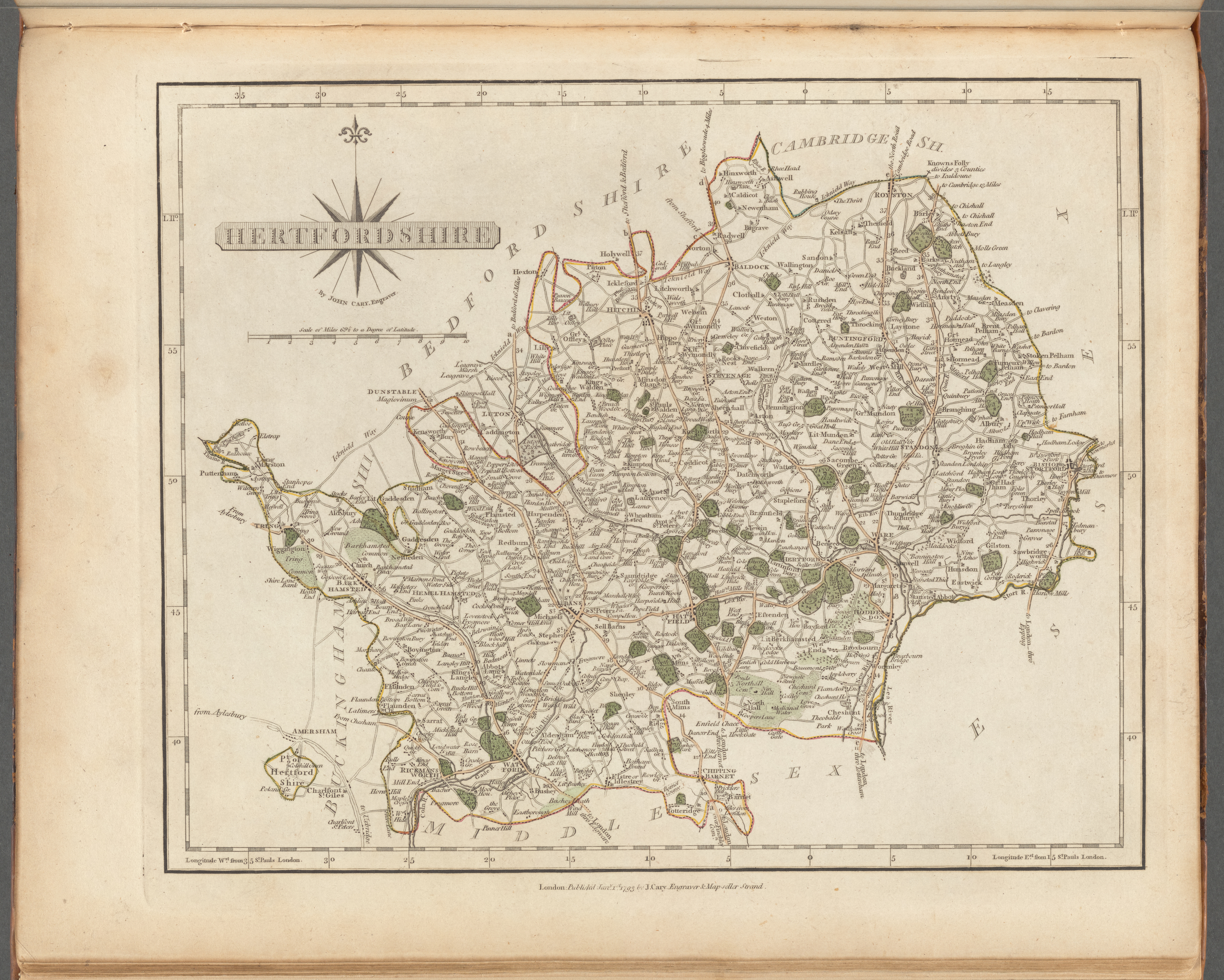
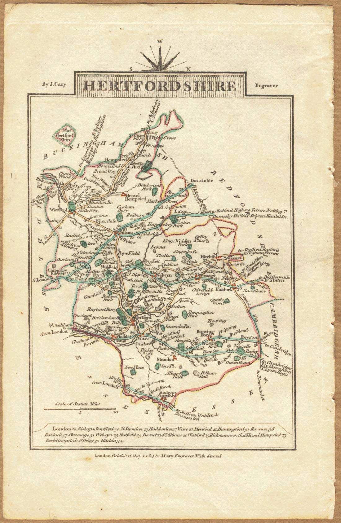
Hertfordshire 1793 John Cary in his New and Correct English Atlas (Fordham 70)
(Image courtesy of New York Library Digital Collections
Hertfordshire 1798 John Stockdale engr. S. Neele (Fordham 79)
(Image courtesy of Yale University Library)
Hertfordshire 1803-1804 William Green in An Atlas of England - Sold by R. Buttars 1803 .Many of the maps in this Atlas were inverted, mirror imaged and /or flipped. This example has a North-at-top alignment but but the Orienting Arrow points left.
Author presumed to be William Green, author of The Picture of England (1804) a 2 volume descriptive atlas where the same maps have been correctly aligned, (Chubb p.238 CCCX & p.243 CCCXVIII)
images courtesy of The British Library King's Collection Maps K.Top.)
Hertfordshire 1808 John Roper and George Cole in The British Atlas
Hertfordshire 1810 Benjamin Pitts Capper in A Topographical Dictionary of the United Kingdom (Fordham 85)
Hertfordshire 1810 George Cole and John Roper in their British Atlas (Fordham 86)
(Image courtesy of The British Library-King's Topographical Collection)
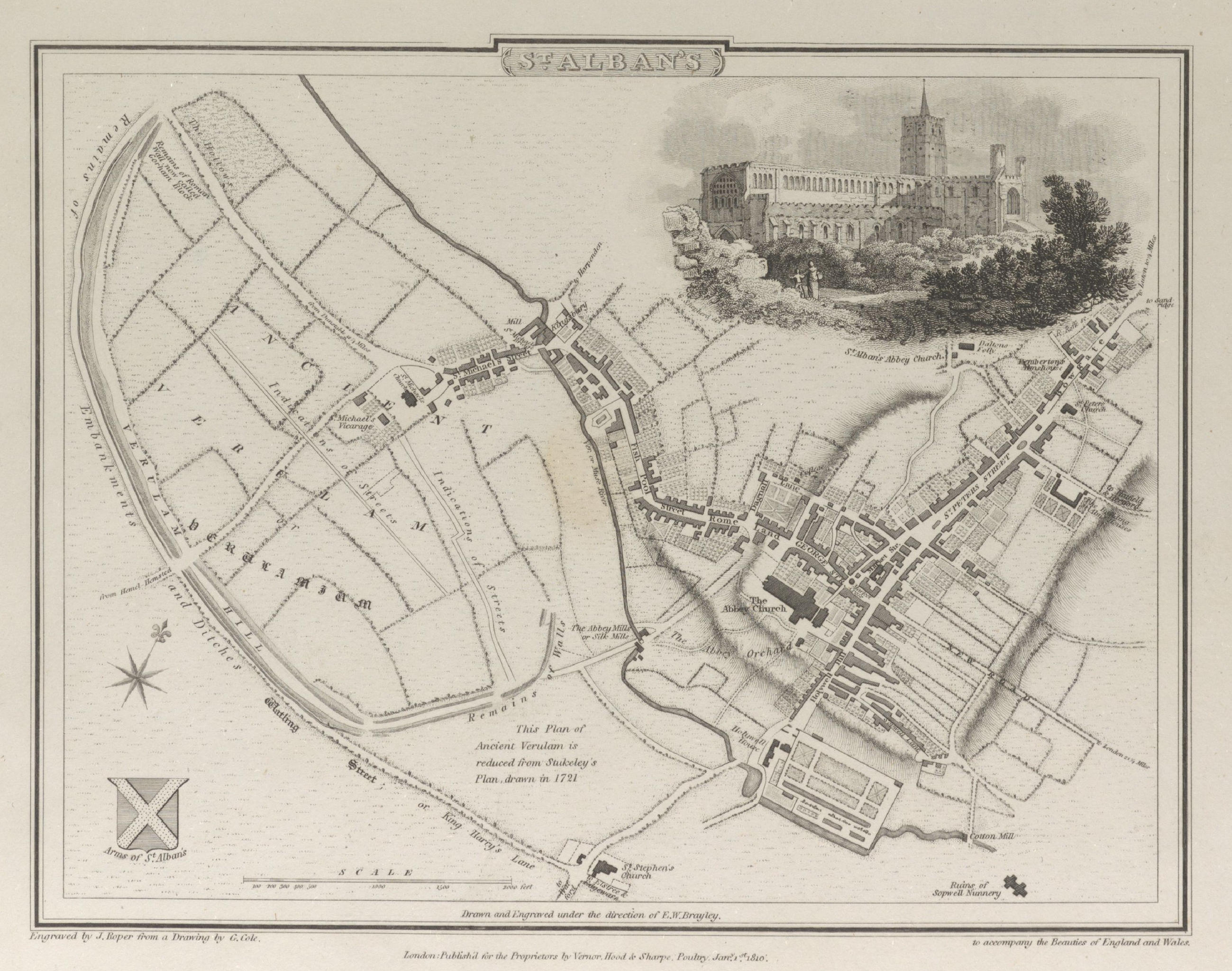
Plan of St Albans 1810 George Cole and John Roper in their British Atlas (Fordham 85)
(Image courtesy of The British Library-King's Topographical Collection)
.jpg)
.jpg)
(Image%20courtesy%20of%20The%20British%20Library%20King's%20Collection%20%20%20Maps%20K.To).jpg)
%20.jpg)
%20Atlas%20Anglicanus.jpg)
%201742%20Thomas%20Badeslade%20in%20Chorographia%20Britanniae%20.jpg)
%20Thomas%20Bades%3bade%20and%20William%20Toms%20(Chubb%20p.133%20CLXX).jpg)
.jpg)
,%20and%20subsequently%20as%20The%20Small%20Brit%20%20(Chubb%20p.172%20CCVII).jpg)
%20.jpg)
.jpg)
%20.jpg)
.jpg)
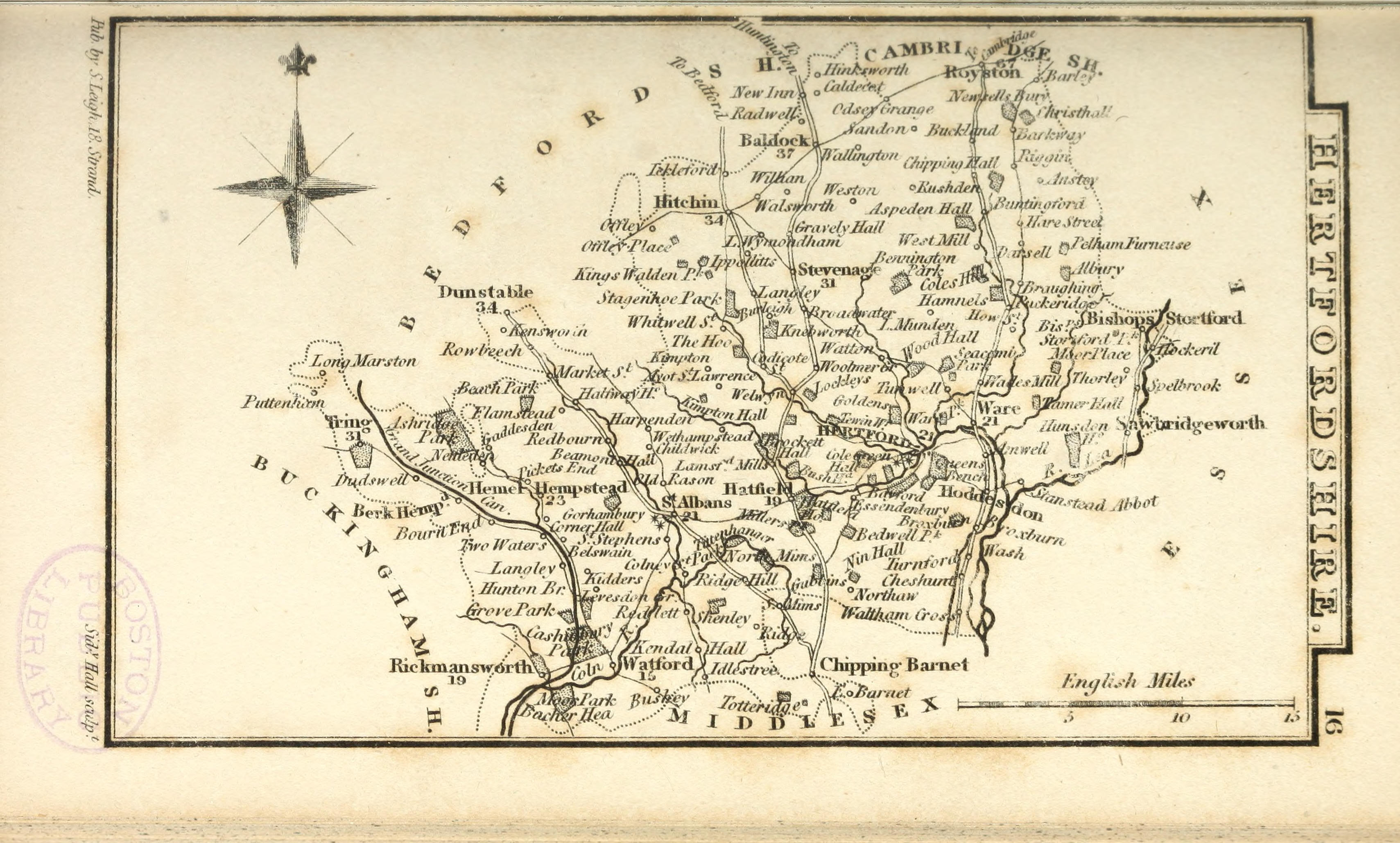
Hertfordshire 1814 John Cary in Cary's Traveller's Companion
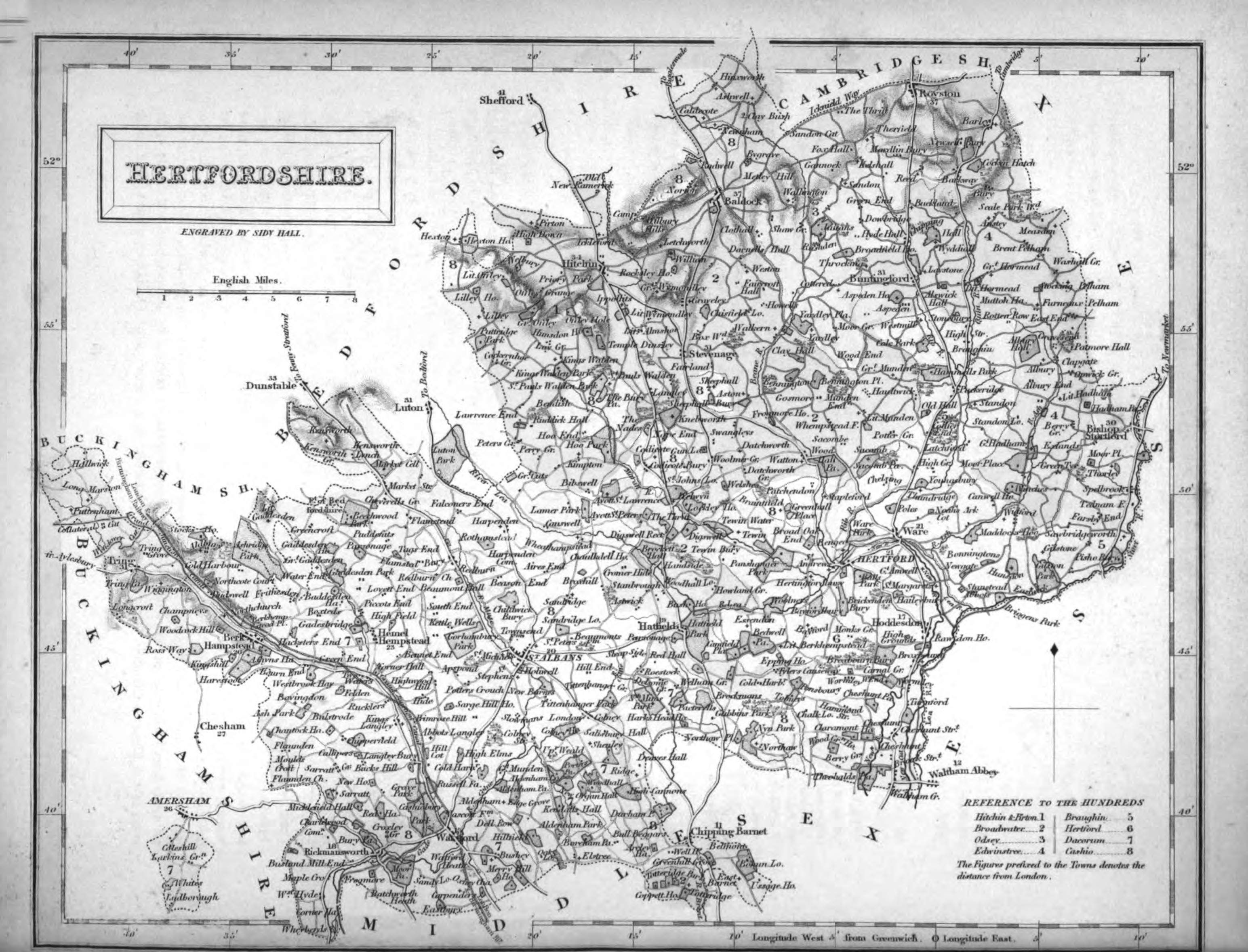
Hertfordshire 1822 Samuel Leigh engr. Sydney Hall for Leigh's New Pocket Atlas (Fordham 92 )
Hertfordshire 1824 George Carrington Gray in Gray's New Book of the Roads
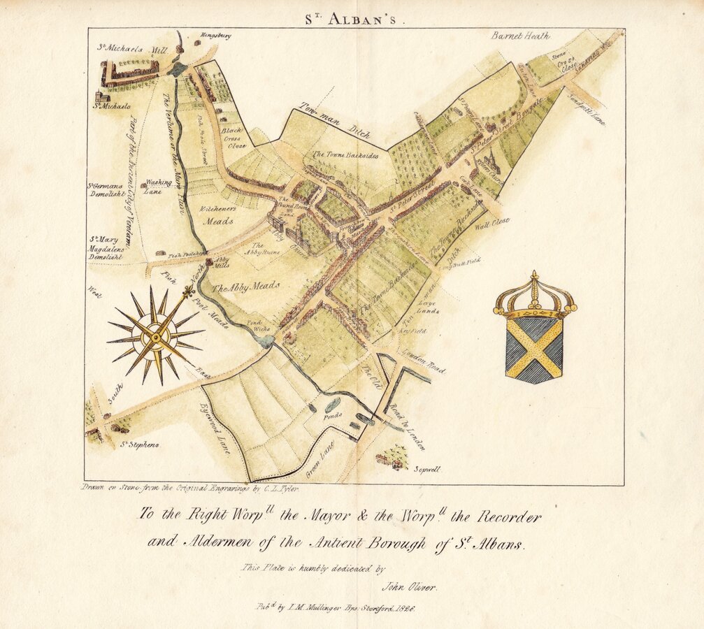
St.Albans 1826 Drawn on Stone from the Original Engravings by C.L.Tyler.
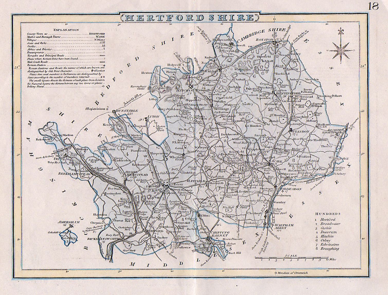
Hertfordshire 1830 Joshua Archer
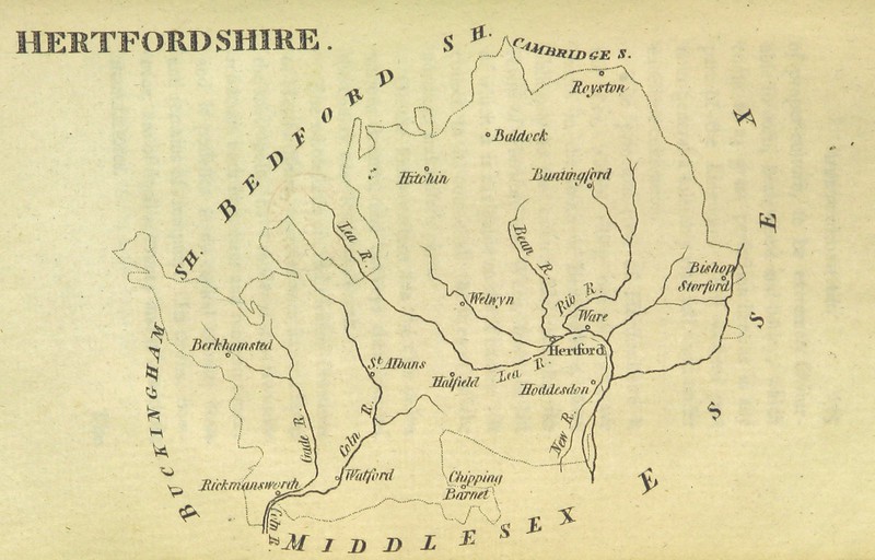
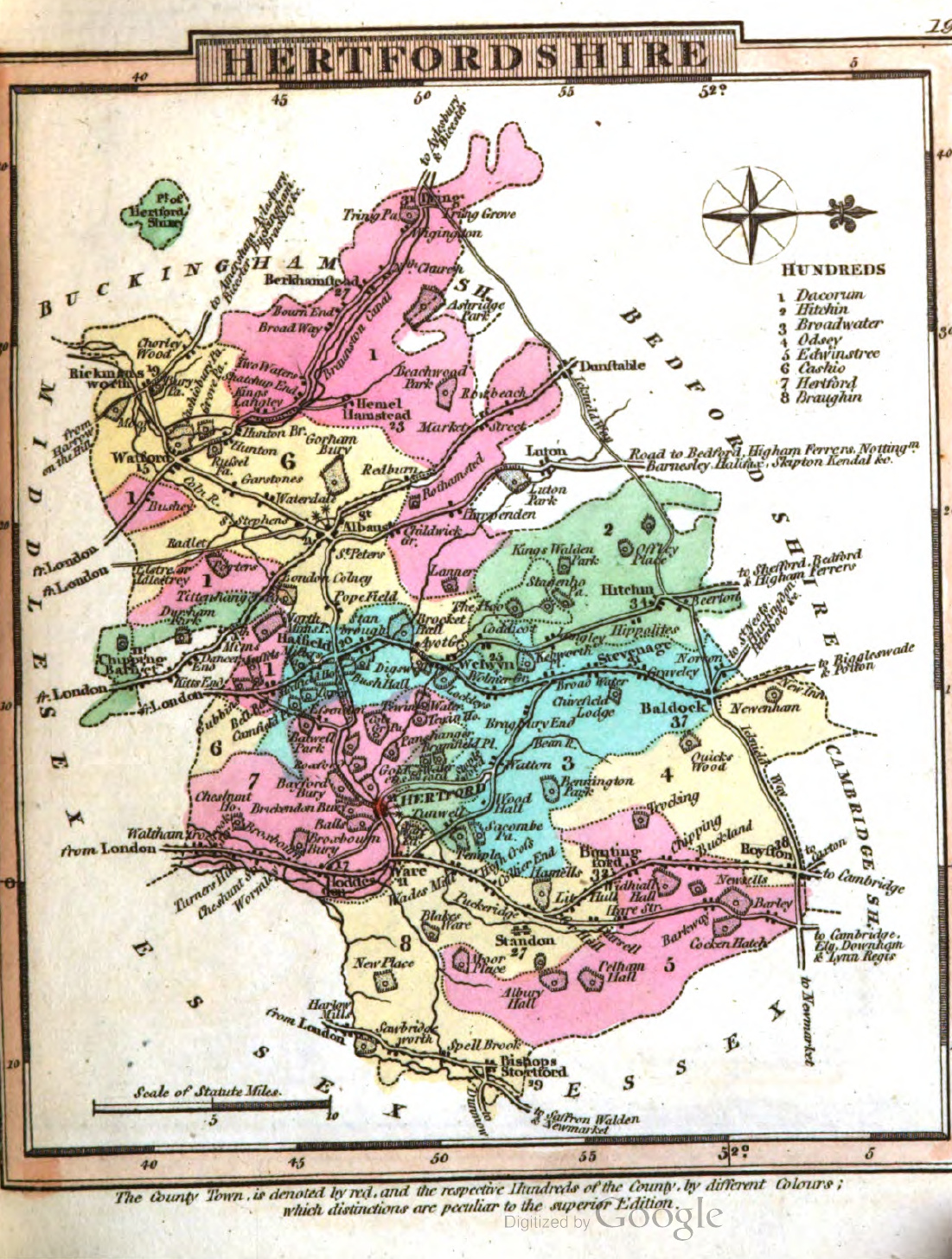
Hertfordshire 1831 Samuel Tymms in The Family Topographer (Fordham 1831)
St Albans 1832 Robert Kearsley Dawson for Plans of the Cities and Boroughs of England and Wales
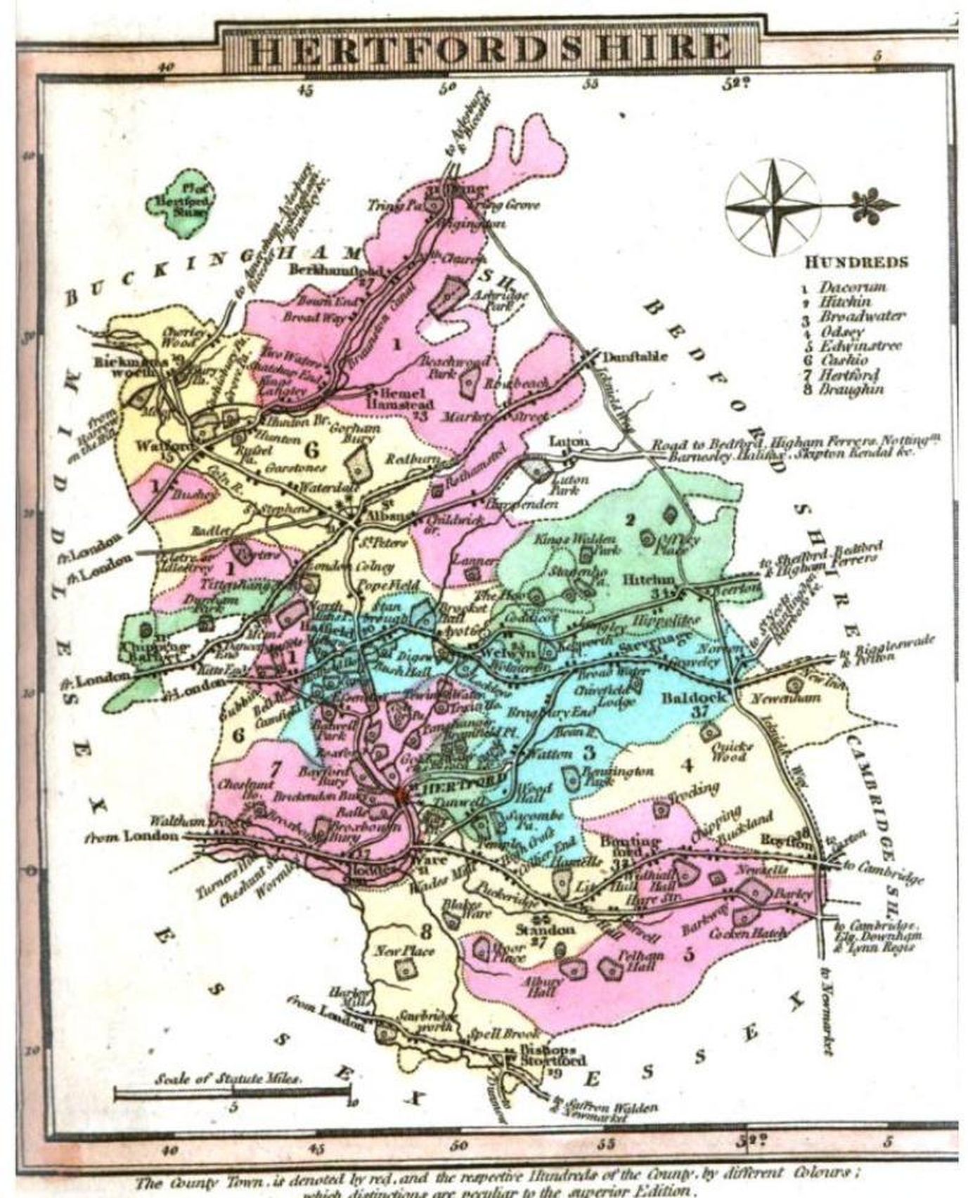
Hertfordshire 1834 C.&G.Greenwood (Fordham 103) ((Image courtesy of Yale University Library)
Hertfordshire 1834 George Carrington Gray in Gray's New Book of the Roads
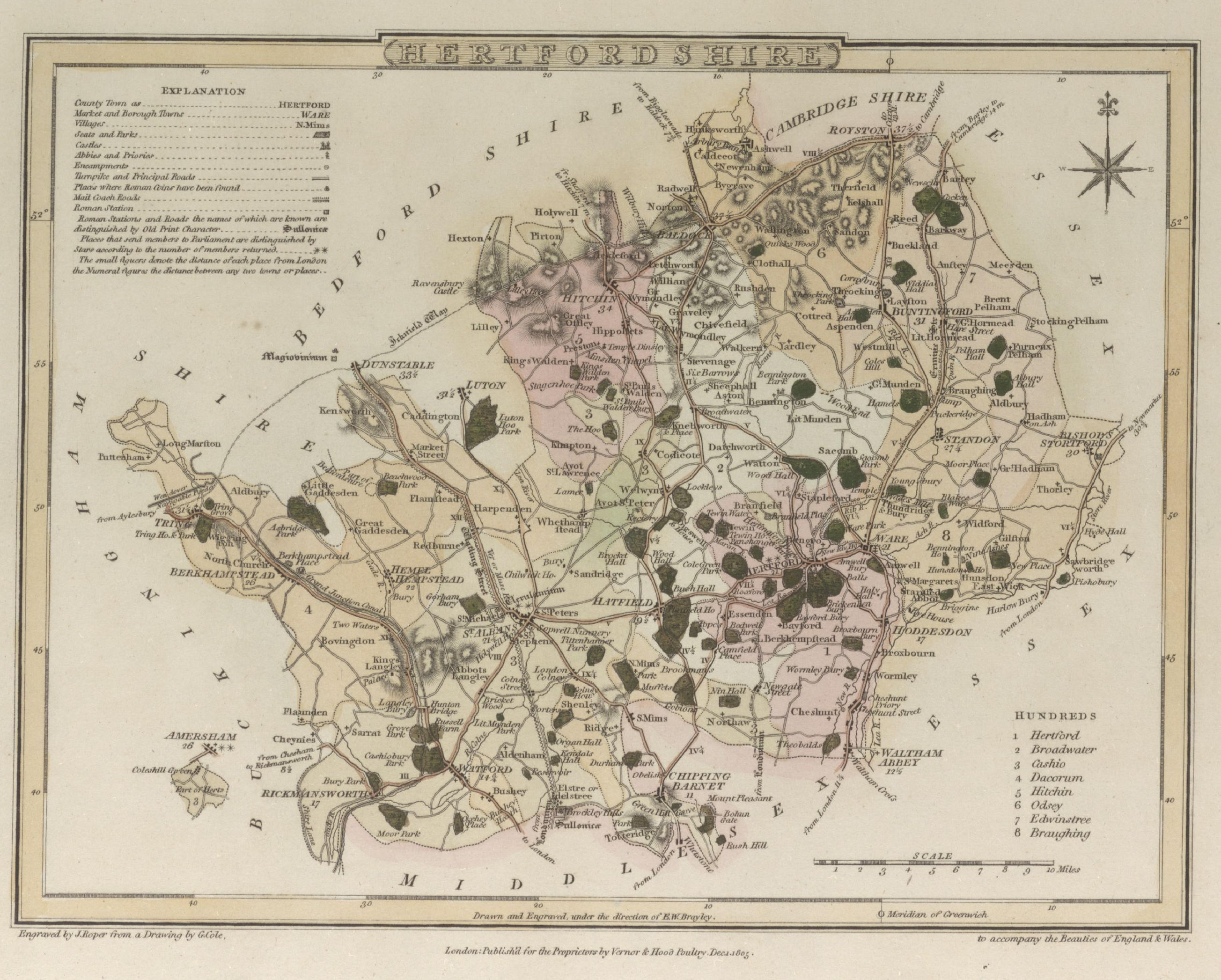
St.Albans 1835 Robert Creighton for Lewis' Topographical Dictionary (Fordham 106)
St.Albans 1835 (Detail) Robert Creighton for Lewis' Topographical Dictionary (Fordham 106)
Thetford 1835 Robert Creighton for Lewis' Topographical Dictionary (Fordham 106)
Hertfordshire 1836 Sydney Hall
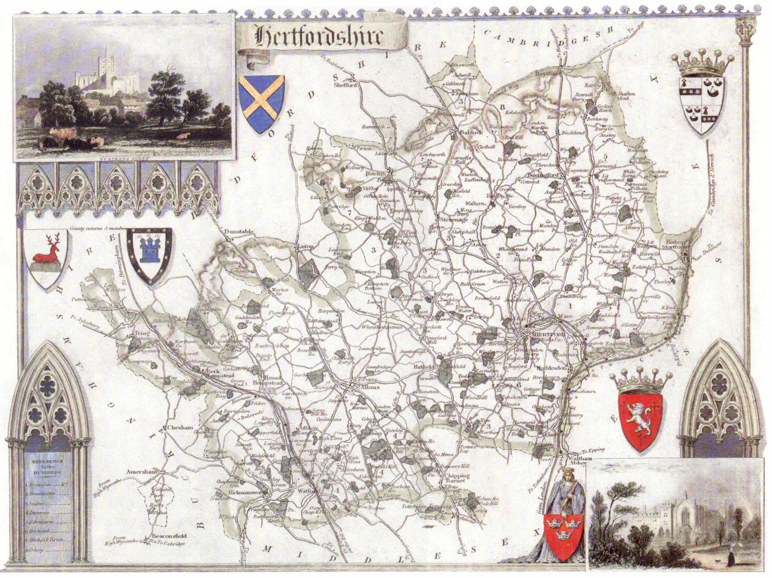
Hertfordshire 1836 Thomas Moule engr. Schmollinger in The English Counties Delineated (Fordham 107)
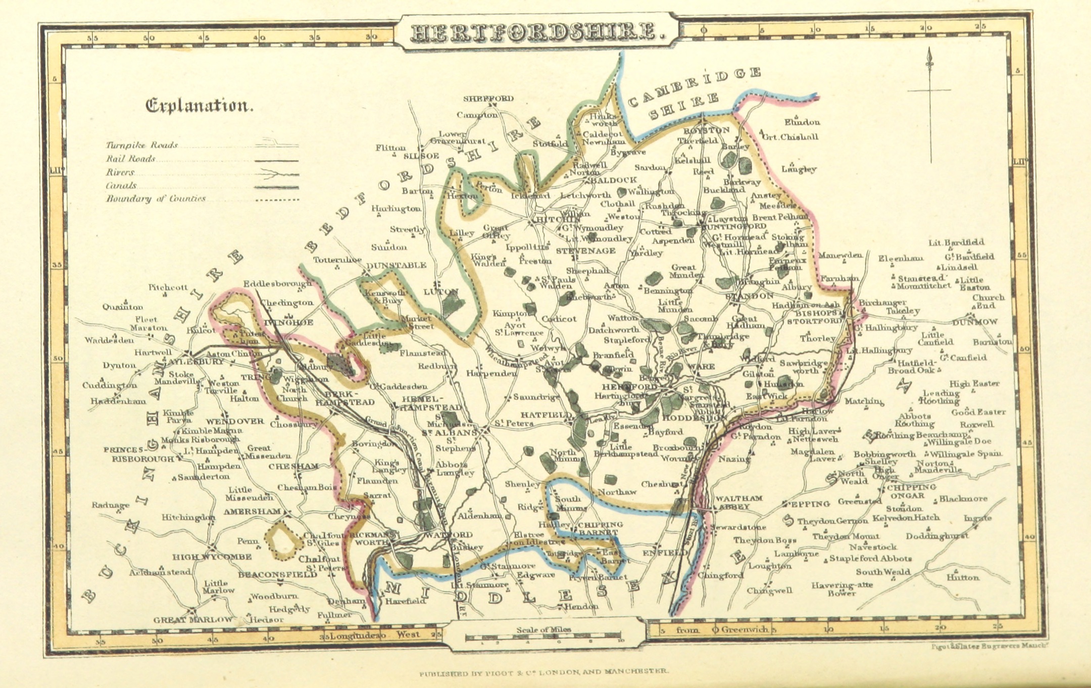
Hertfordshire 1842 Pigot & Co.
(Image courtesy of The British Library via Flickr & Wikimedia)
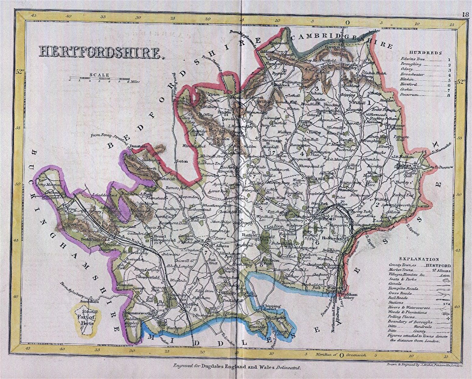
Hertfordshire 1843 Joshua Archer Thomas Dugdal's Curiosities of England and Wales' (Fordham 109)
Hertfordshire 1845 Rev. Samuel Clarke in Reuben Ramble's Travels in the Southern Counties of England
(Image courtesy of The British Library King's Collection Maps K.Top)
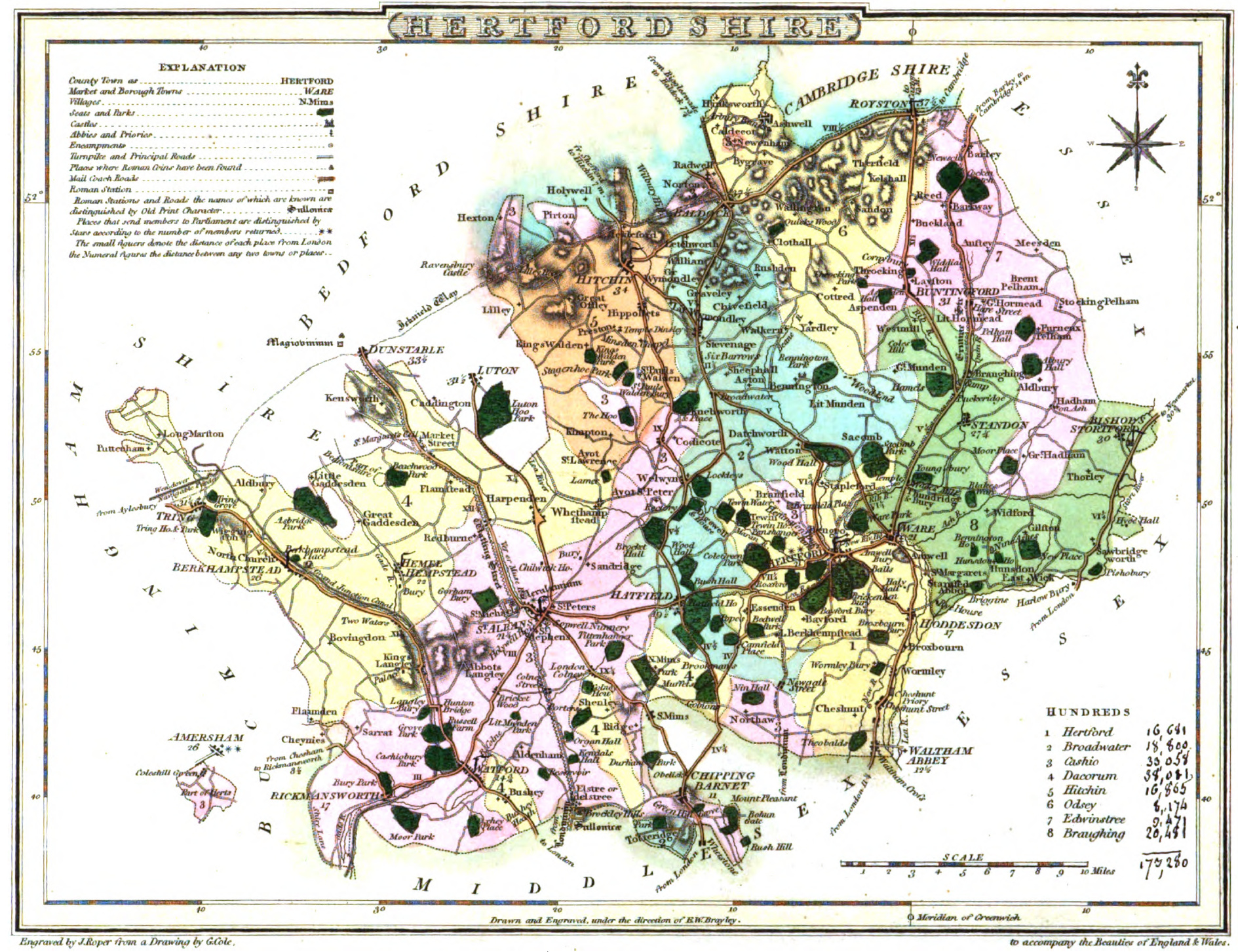
Hertfordshire 1848 Robert Creighton Atlas to Lewis' Topographical Directory
Plan of St. Albans 1889 H.J. Foley in Rural Rambles. The Herts Border ...
Hertfordshire 1890 George Bartholomew (Image courtesy of Yale University Library ) Large file-slow to load
%20.jpg)
%201835%20Robert%20Creighton%20for%20Lewis'%20Topographical%20Dictionary%20.jpg.jpg)
.jpg)
.jpg)