| |
 Resources consulted for Huntindonshire: A Bibliography of County Maps - Large Scale County Maps of England. Tooley R.V. The Printed Maps in the Atlases of Great Britain and Ireland1579-1870 Chubb Thomas Dawson 1927 |
To resize images:
Hold down CTRL and use mouse scroll-wheel |
Huntingdonshire 1579 Christopher Saxton (Chubb p.3 I.)
(Image courtesy of Princeton Historic Map Collection)
Fennes 1603 Hondius
Huntingdonshire 1605 Pieter van den Keere in his British Atlas (Chubb LX)
(Image courtesy of Clark Library University of Michigan)
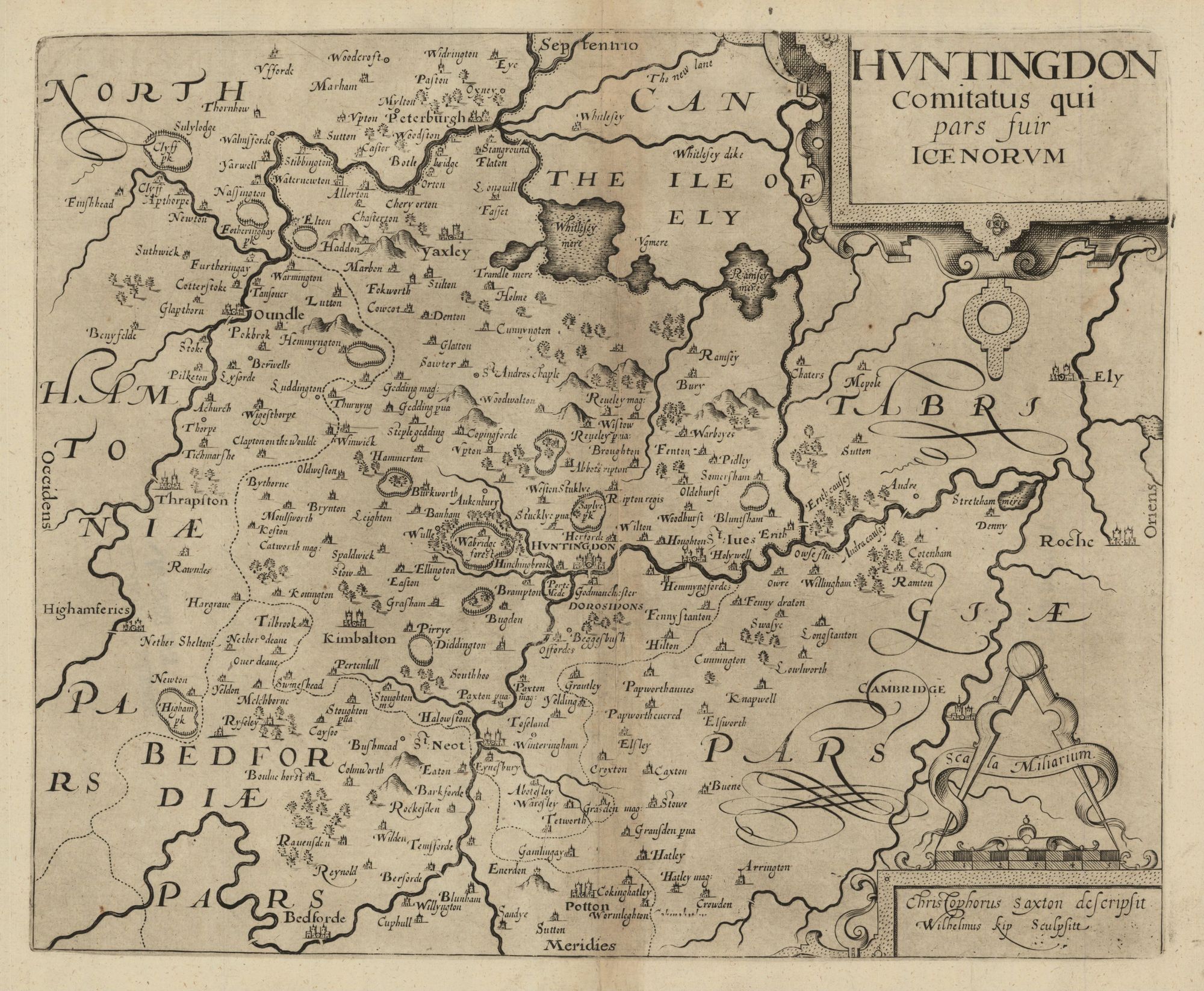
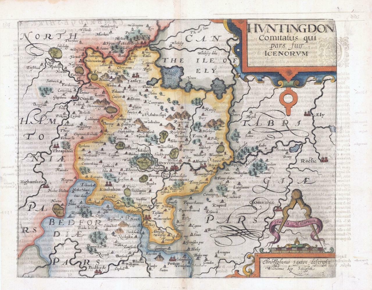
Huntingdonshire 1607 William Kip after Christopher Saxton (image courtesy of the British Library
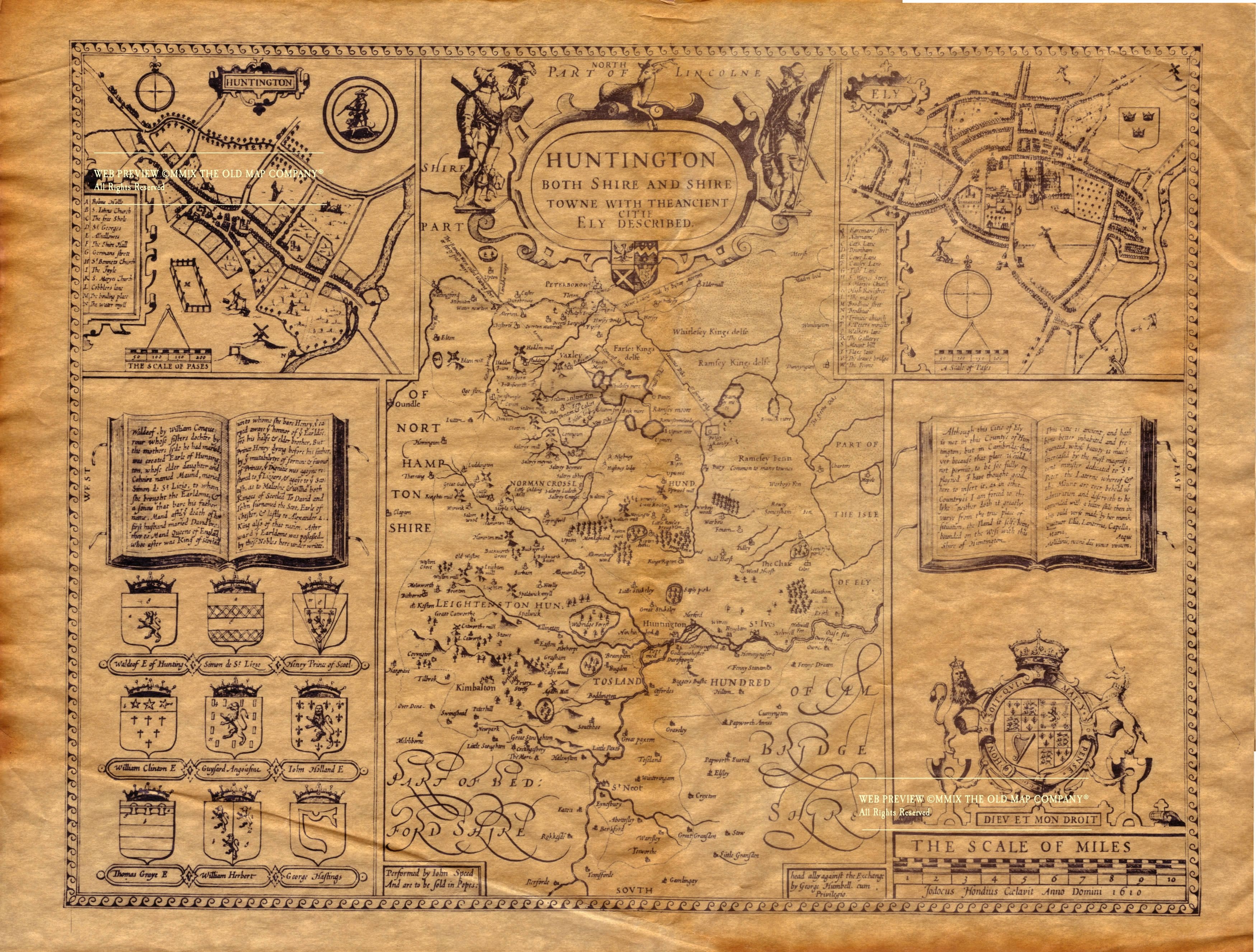
Huntingdonshire 1610 John Speed in The Theatre of the Empire of Great Britaine (Chubb p.23 XXII)
Huntingdonshire 1612 Michael Drayton to Illustrate his Polyolbion (Chubb p.45 XXXIII)Huntingdonshire) 1627 Pieter van den Keere Chubb LX)
(Image courtesy of The British Library via Flickr & Wikimedia)
Huntingdonshire 1645 Jan Jansson in his Atlas Novus
The Fennes 1645 Jan Jansson in his Atlas Novus (Image courtesy of The Mechanical Curator & Wikimedia)
Huntingdonshire 1662 John Speed in A Prospect of the Most Famous Parts of the World (Roger Rea Edition) (Image courtesy of The British Library King's Collection Maps K.TOP)
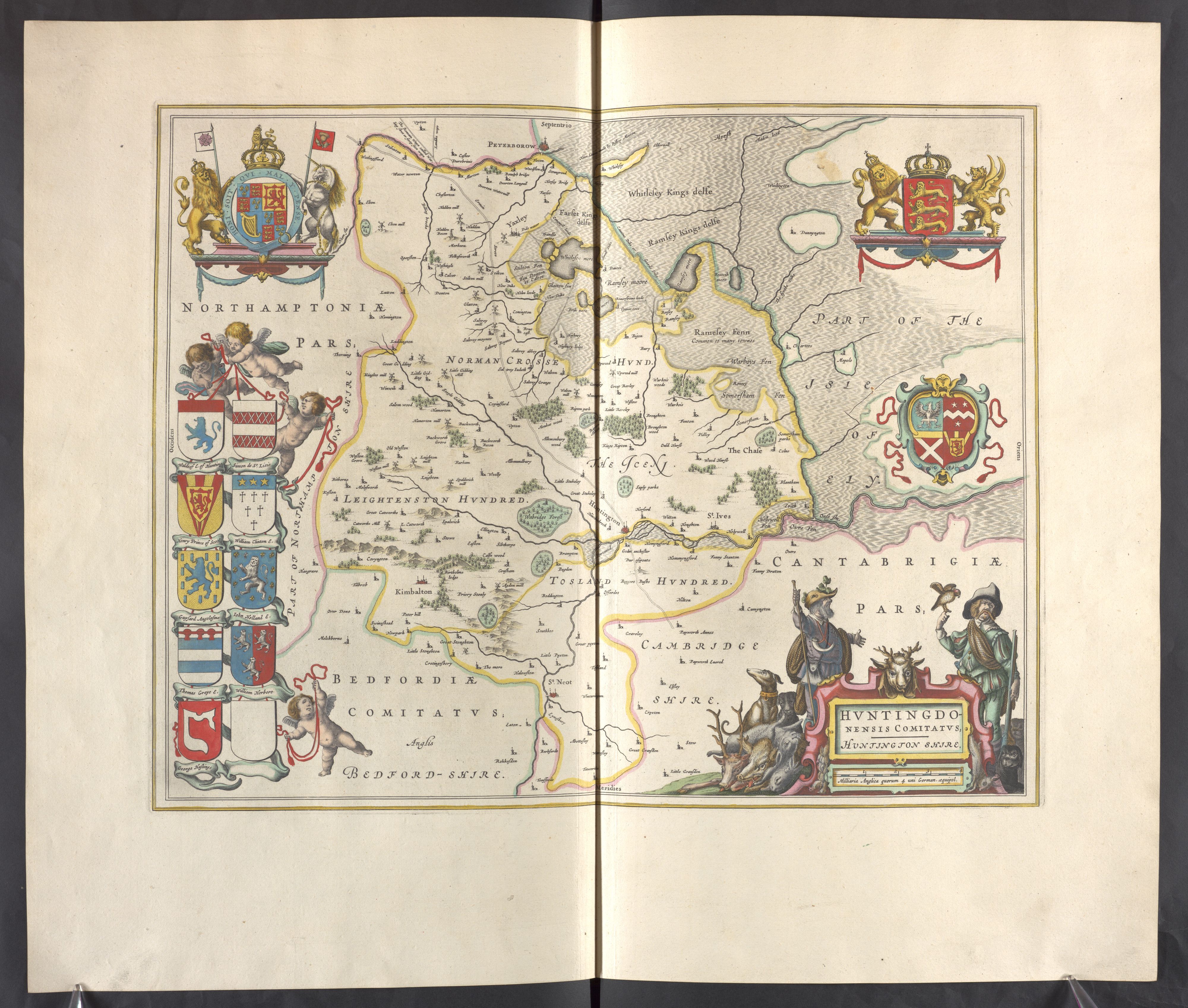
Huntingdonshire 1667 Joan Blaeu in Le Grand Atlas, volume 5
(Image courtesy of The British Library King's Collection Maps K.TOP)
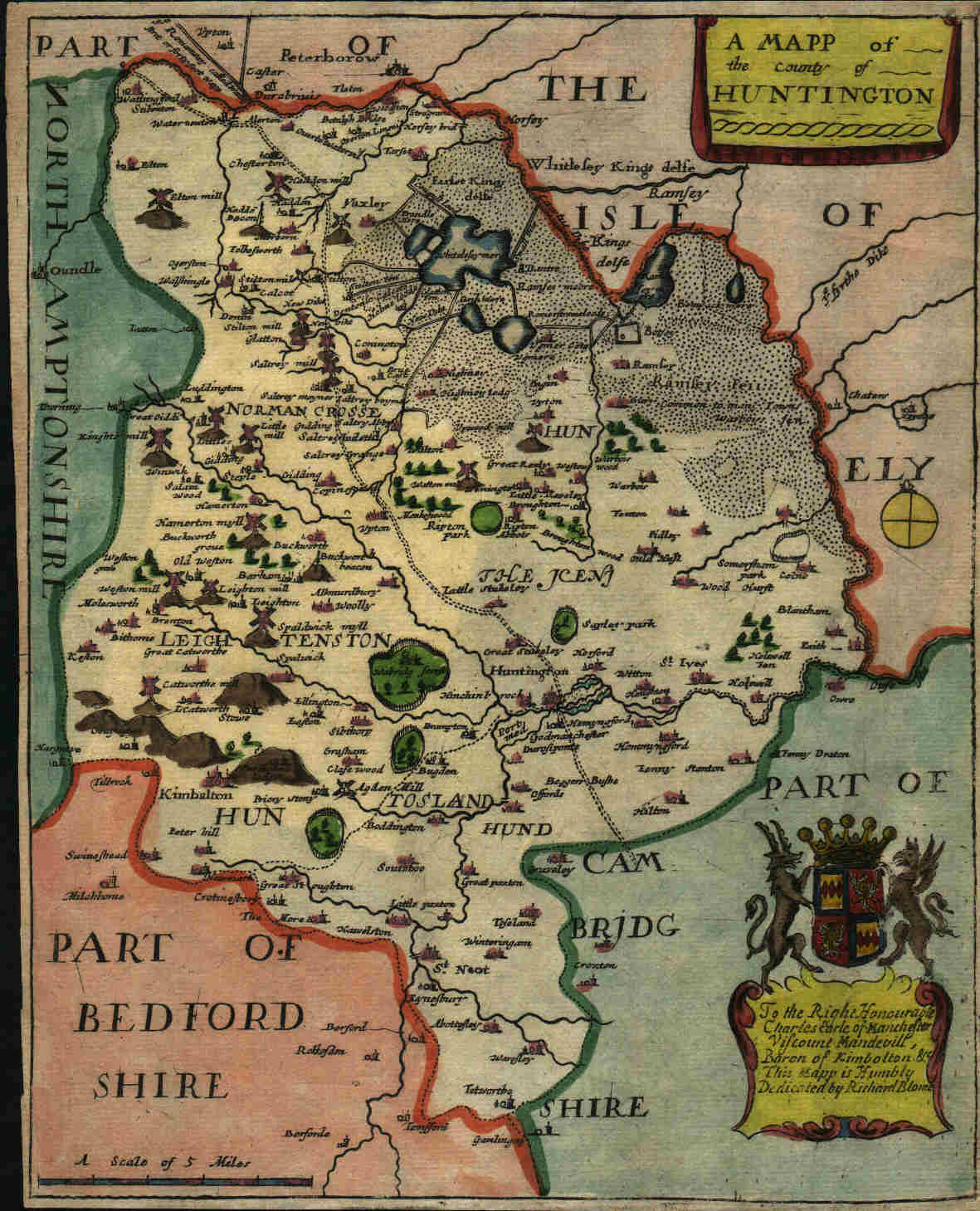
Huntingdonshire 1671 Richard Blome forThomas Taylor's in England Exactly Described republished here as Speed's Maps Epitomiz'd with Blome's name partially erased. (Chubb p.141 CLXXXVI)
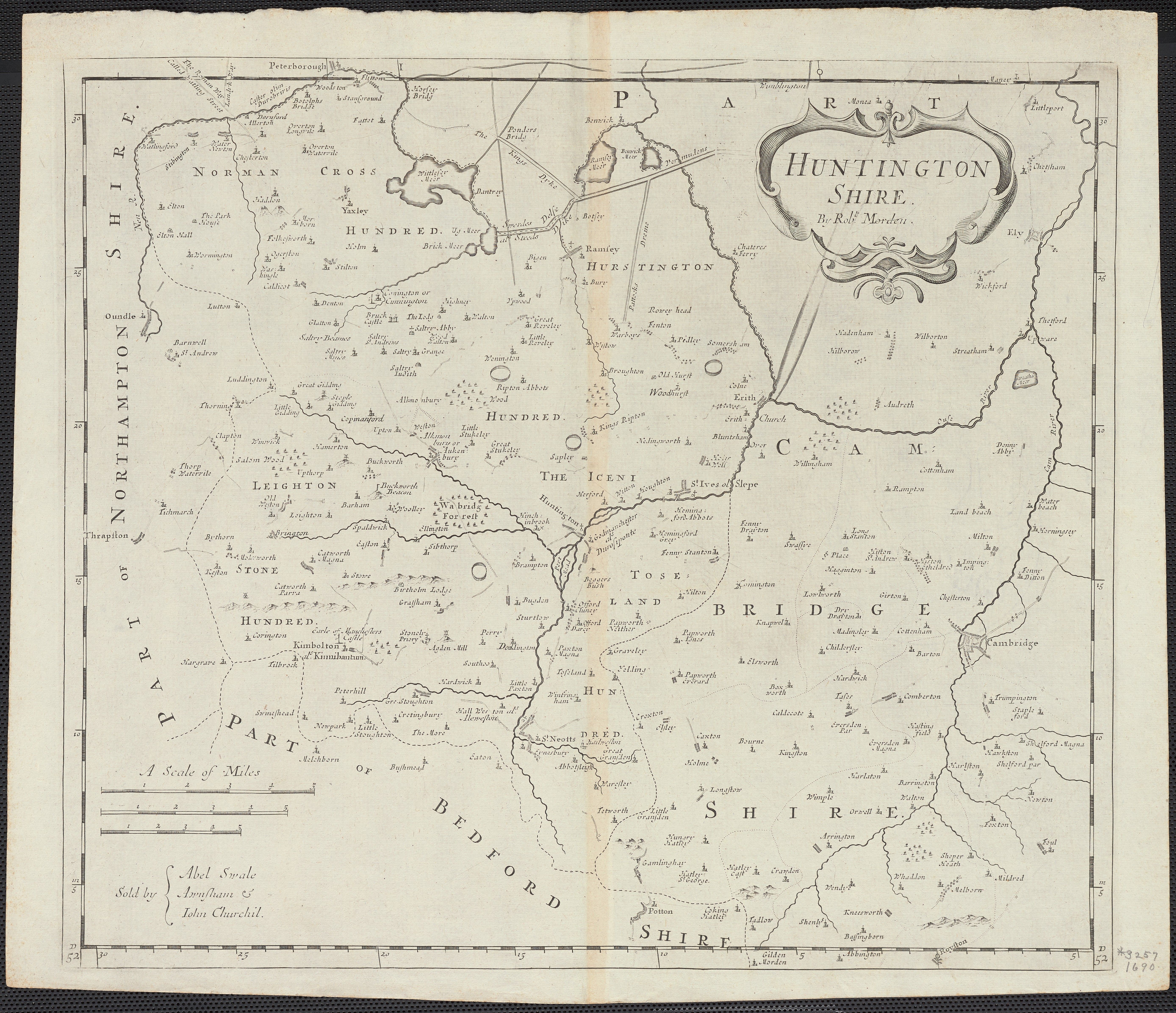
Huntingdonshire 1690 Robert .Morden
(Image courtesy of Yale University Library
Huntingdonshire 1724 Herman Moll in A New Description of England and Wales (Chubb CLX: CLXI)
Huntingdonshire 1731 William Gordon
(Image courtesy of The British Library King's Collection Maps K.Top.16.2.2 tab.)
Huntingshire (1st State) 1741 Thomas Badeslade and William Toms in their Chorographia Britanniae (Chubb p.135 CLXXIIV
A Map of Huntingdonshire (Second State1742 Thomas Badeslade_and William Toms in Chorographia Britanniae ( Image courtesy of Biblioteque National France)
An Accurate Map of the County of Huntingdon 1749 Emanuel Bowen (Image courtesy of The British Library King's Collection Maps K.Top.16.3.)
Huntingdonshire 1743 Jean Rocque in The Small British Atlas (Chubb p.172 CCVII)
Huntingdonshire 1746 Samuel Simpson in The Agreeable Historian (Chubb p.141 CLXXXIV)
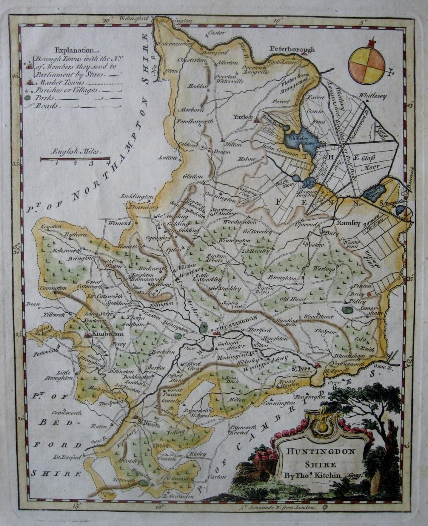
Huntingdonshire 1747 Thomas Kitchin for The London Magazine (Chubb CLXXXVII)
Huntingdonshire 1749 Emanuel Bowen in The Large English Atlas (Chubb p.158 CXCV)
(Image courtesy of Yale University Library) (large file -may be slow to load
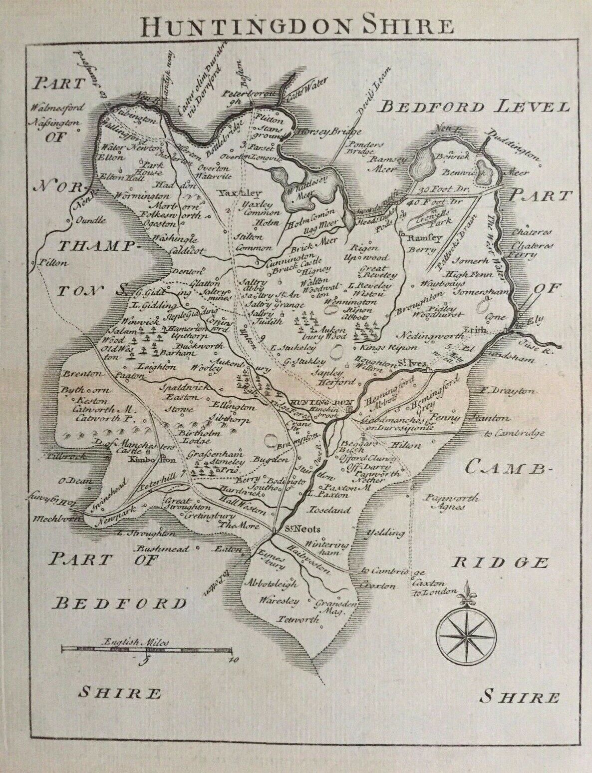
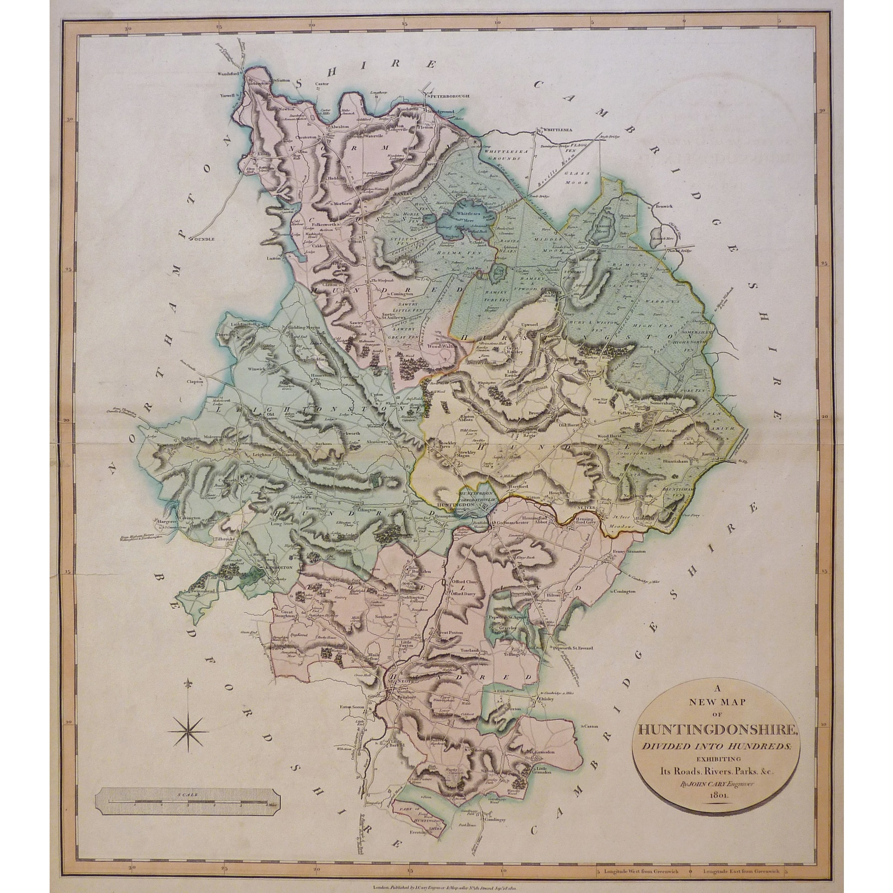
A New Map of Huntingdonshire 1778 Thomas Kitchin
Huntingdonshire 1780 Thomas Conder for Walpool's The New English Traveller.
(Chubb p.204 CCLI )Huntingdonshire ca. 1784 Thomas Kitchen in The London Magazine: and later in Henry Boswell's Historical Descriptions with The London Magazine's inscrip. removed
Whittlesea Mere 1786 John Bodger
(Image courtesy of The British Library: King's Collection. Maps K.Top .)
Forest of Whittlewood 1787- 1791 Richard Davis (Image courtesy of The British Library Maps K.TOP.32.5.3.tab
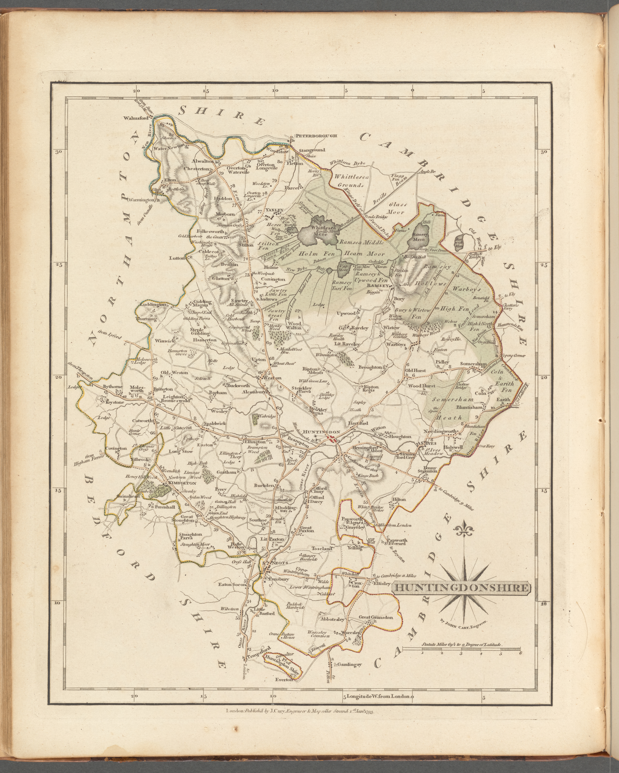
Huntingdonshire 1790 John Cary in his Traveller's Companion (Chubb p.220 CCLXXIII)Huntingdonshire 1793 John Cary in his New and Correct English Atlas (Chubb p.214 CCLXI)
(Image courtesy of New York Library Digital Collections)Huntingdonshire 1795 (including text) John Aikin in England Delineated
Huntingdonshire 1800 John Aiken in England and Wales Delineated (Image courtesy of The Mechanical Curator & Wikimedia)
Huntingdonshire 1803-1804 William Green in An Atlas of England - Sold by R. Buttars 1803 .Many of the maps in this Atlas were inverted, mirror imaged and /or flipped. This example has a North-at-bottom alignment but but the Orienting Arrow points South.
Author presumed to be William Green, author of The Picture of England (1804) a 2 volume descriptive atlas where the same maps have been correctly aligned, (Chubb p.238 CCCX & p.243 CCCXVIII)
images courtesy of The British Library King's Collection Maps K.Top.)
Huntingdonshire 1805 John Cary in A New British Atlas printed by John Stockdale Chubb p.243 CCCXIX )
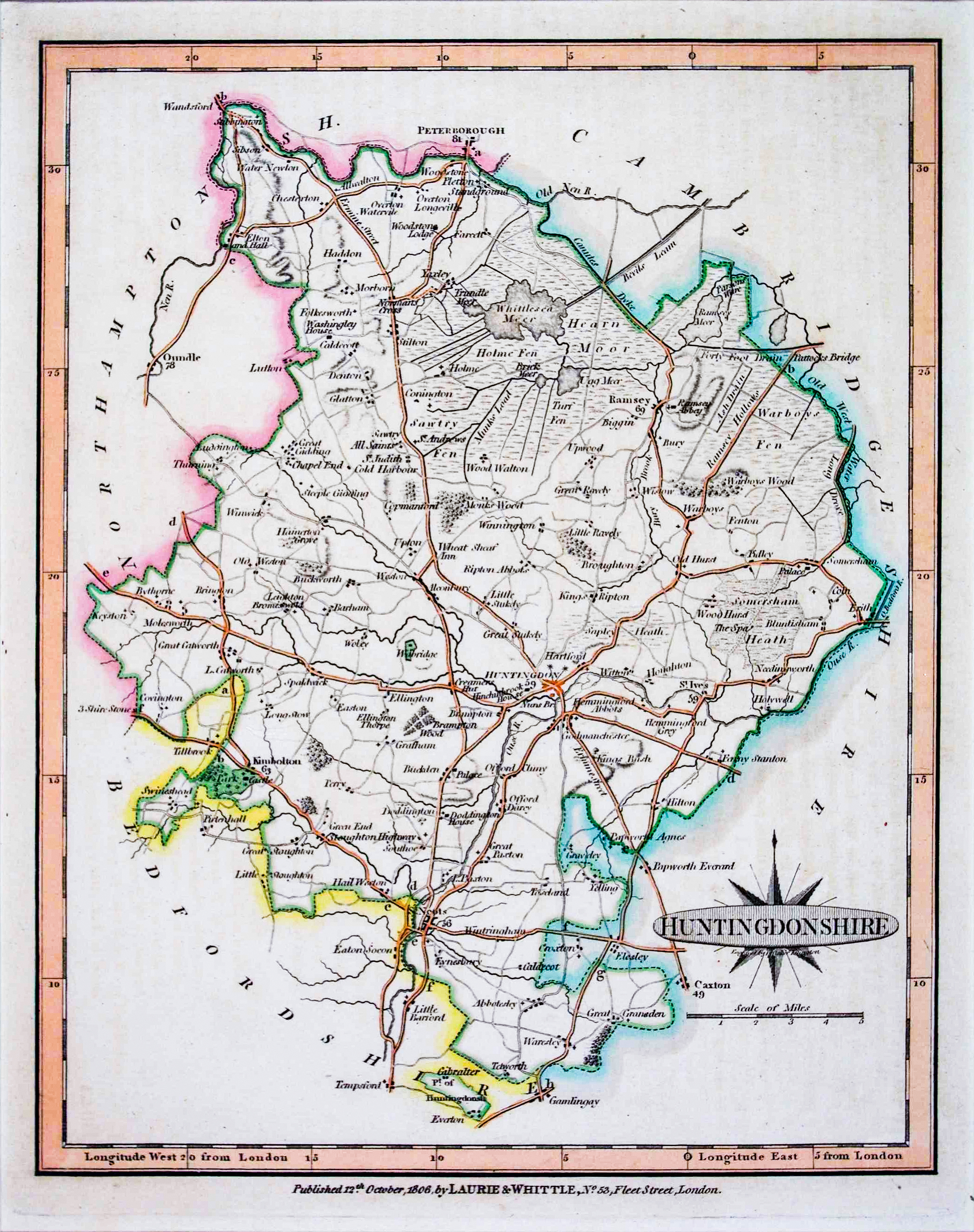
Huntingdonshire 1806 Lawrie and Whittle in A New Traveller's Companion (Chubb p.255 CCCXLIII )
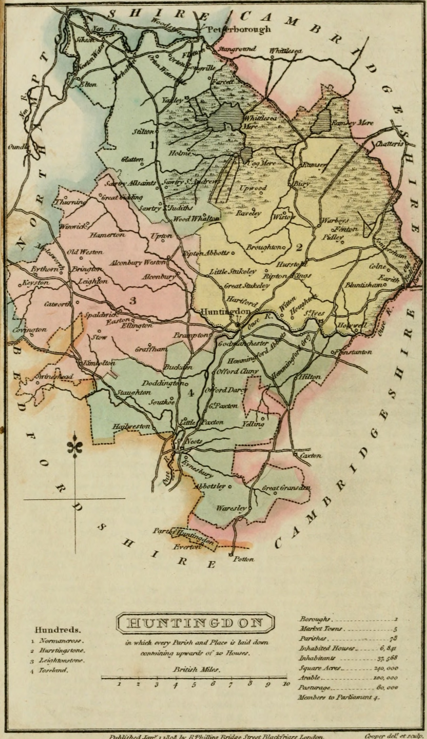
Huntingdonshire 1808 Benjamin Pitts Capper in A Topographical Dictionary of the United Kingdom (Chubb p.245 CCCXXVII)
Huntingdonshire 1809 John Cary in Cary's New English Atlas (Chubb p.247 CCCXXXIII )
Huntingdonshire 1809 John Roper in the British Atlas of England and Wales (Chubb p.250 CCCXXXIX)
Huntingdonshire 1810 George Cole and John Roper in their British Atlas
(Image courtesy of The British Library-King's Topographical Collection (Chubb p.249 CCCXXXIX)Huntingdonshire 1811 playing card by Joseph Allen & Robert Rowe
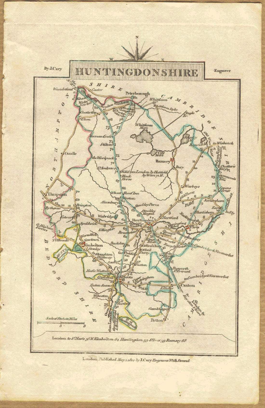
Huntingdonshire 1814 John Cary in Cary's Traveller's Companion (Chubb p.261 CCCLII)
Huntingdonshire 1819 Ellis's New and Correct Atlas Chubb p.266 CCCLXIII)
Huntingdonshire 1822 Samuel Leigh in Leigh's New Pocket Atlas (Chubb p.97 CXVIII)
Huntingdonshire 1831 J. Pigot in the British Atlas of England and Wales
A Plan of the Town of Huntingdon 1832 Robert Creighton and John Walker
Huntingdonshire 1834 C. and J: Greenwood in Atlas of the Counties of England (Chubb CCCCLVII1a)
(Image courtesy of www.davidrumsey.com) (Large File - May be slow to load)Huntingdonshire 1836 Sydney Hall in A Travelling English Atlas (Chubb p.314 CCCCLi)
Huntingdonshire 1840 Robert Creighton for Lewis' Topographical Dictionary (Chubb p.322 CCCCLXIV)
Huntingdonshire 1842 J. Pigot in Pigot & Co.'s British Atlas of the Counties of England
in their Pocket Atlas (Chubb p.321 CCCCLXII)
(Image courtesy of The British Library via Flickr & Wikimedia)Huntingdonshire (01) 1852 in The British Gazetteer
Huntingdonshire (02) 1852 in The British Gazetteer
Huntingdonshire 1860 Sidney Hall's Travelling Atlas With All The Railroads (Chubb p.354 DXLV)
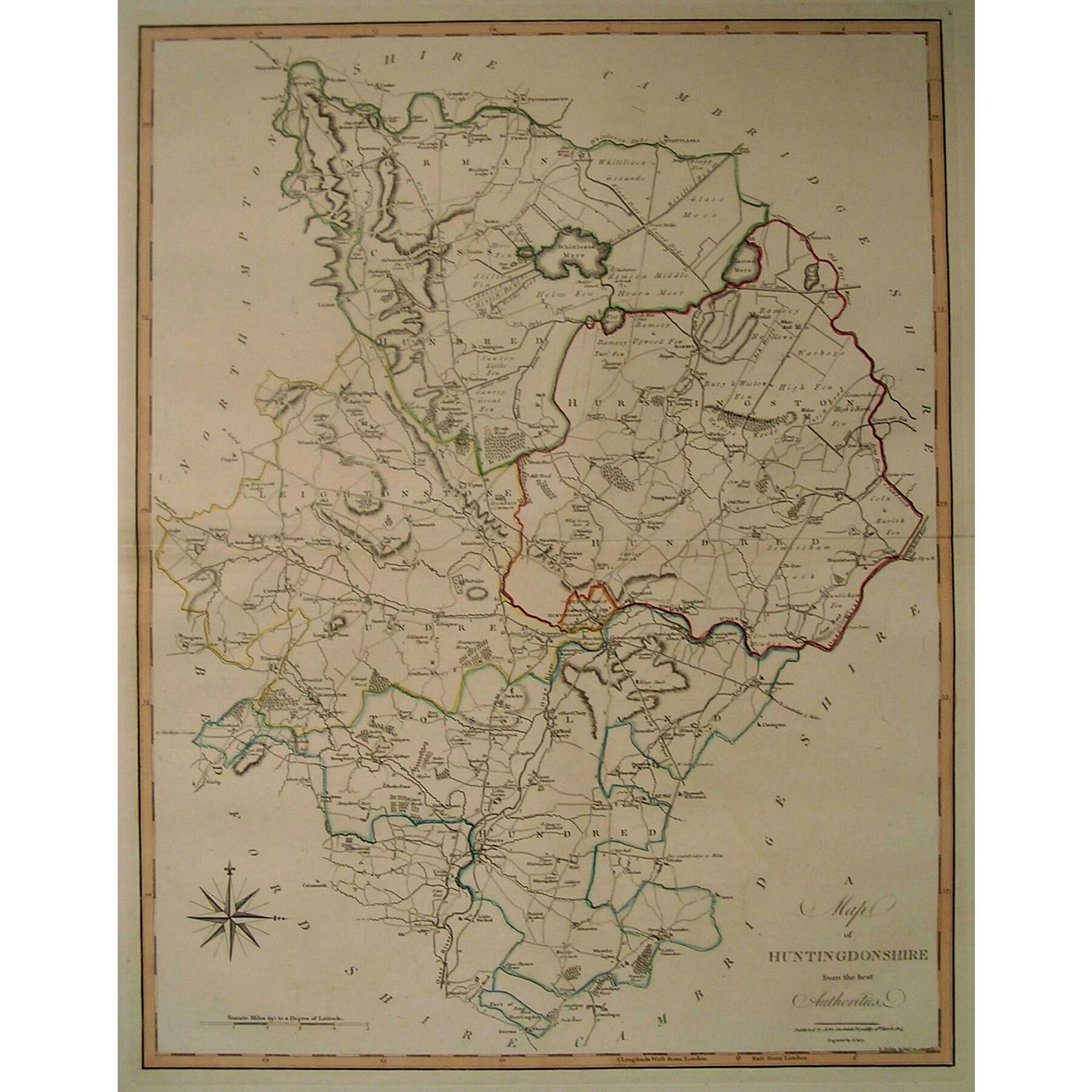
Huntingdonshire 1885 Stanford's Parliamentary Atlas
Pieter%20van%20den%20Keere%20in%20his%20British%20Atlas%20(2021_07_16%2002_57_18%20UTC).jpg)
.JPG)
.jpg)
(Image%20courtesy%20of%20The%20British%20Library%20King's%20Collection%20%20%20Maps%20K.).jpg)
%20%20.jpg)
%201741%20Thomas%20Badeslade%20in%20Chorographia%20Britanniae.jpg)
.jpeg)
%20.jpg)
%201786%20John%20Bodger%20%20(Image%20courtesy%20of%20The%20British%20Library,%20King's%20Collection.%20%20Maps%20K.Top%20.%20.jpg)
.jpg)
%20(Fordham%20p.80.jpg)
.jpg)
%201852%20in%20The%20British%20Gazetteer%20.jpg)
%201852%20in%20The%20British%20Gazetteer.jpg)