| |
 Resources Consulted for Lancashire: Printed Maps in the Atlases of Great Britain 1579-1870 Chubb: Thomas: Dawson 1927 County Atlases of the British Isles: Hodson Donald: Tewin Press1983 County Atlases of the British Isles: Parts 1 & 2: Skelton R.A. Map Collecters Circle No.9: No.32: 1962 A Descriptive List of the Printed Maps of Lancashire: Whitaker Harold:Chetham Society 1938 Home |
 To resize image:
L-click on image or hold CTRL and use mouse scroll-wheel |
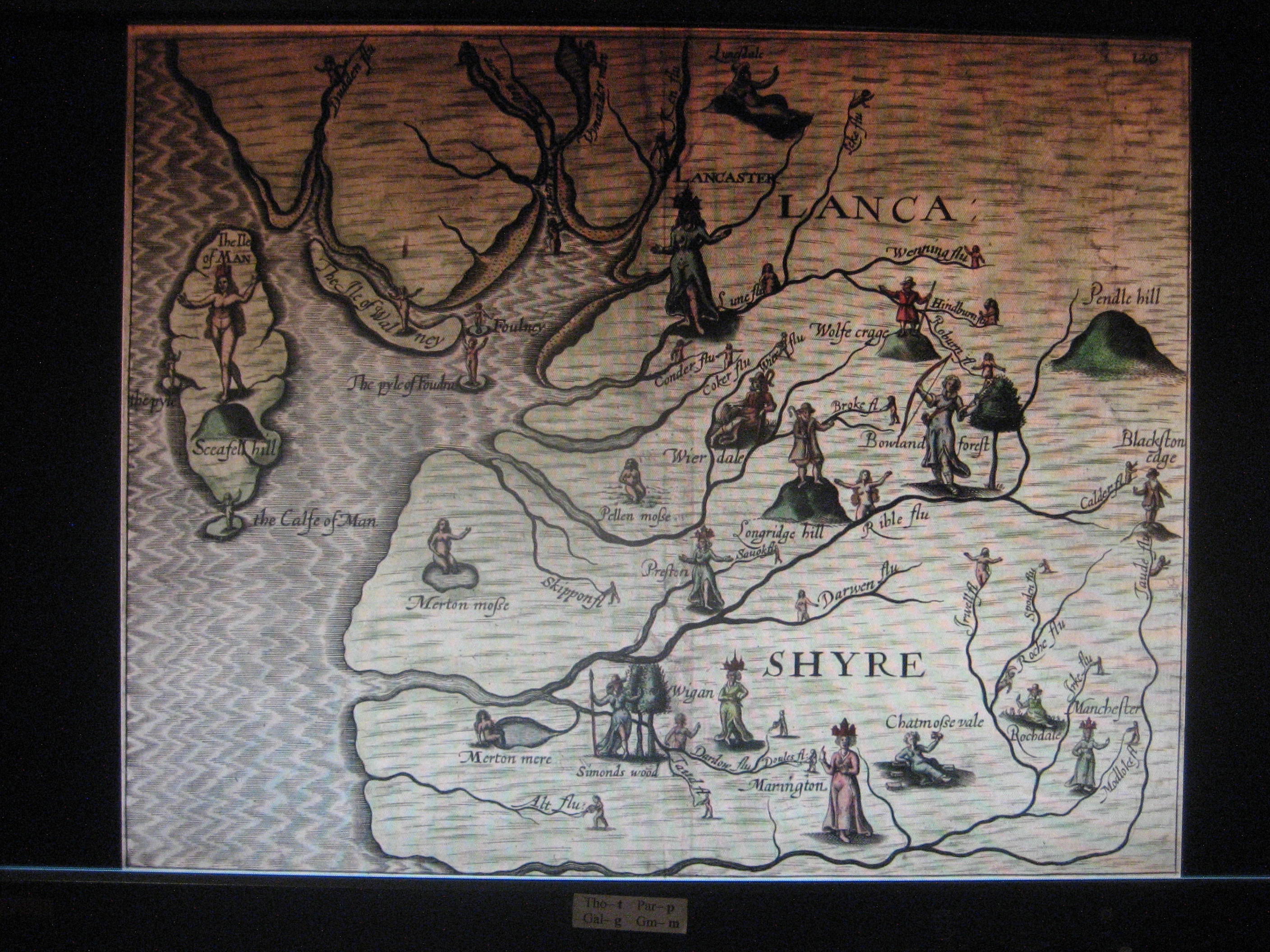
Lancashire (about 1577) manuscript map of Lancashire in Lord_Burghley's Atlas
Lancastriae Comitatus 1579 Christopher Saxton (Fordham p.001 Map 07 ) (Image courtesy of Bonhams Auctions)
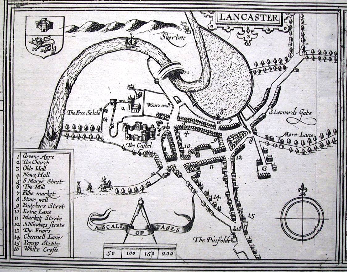
Lancashire 1598 William Smith
(image courtesy of The British Library via Flickr & Wikimedia)
(Fordham p005 Map 007 )
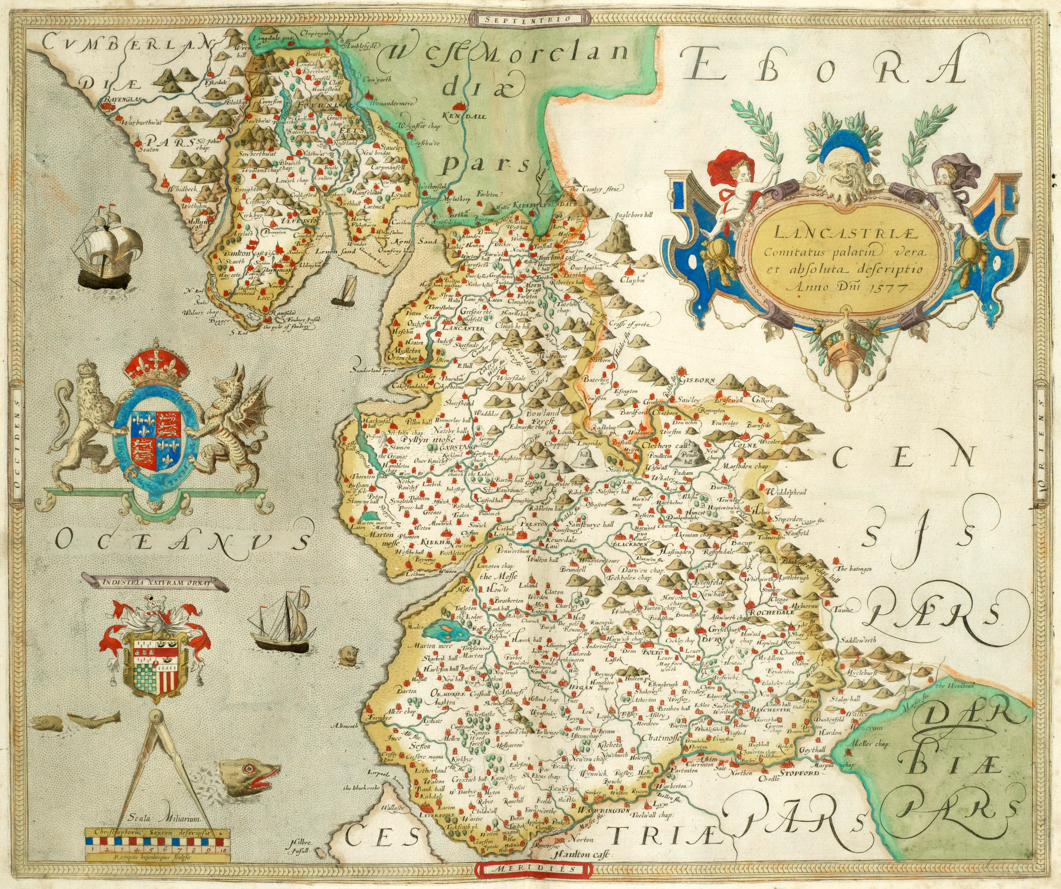
Lancastriae Comitatus Palatinus 1607 William Hole after Christopher Saxon
(Fordham p.006 map 010 )
Lancashire 1610 John Speed in The Theatre of the Empire of Great Britaine
(Fordham p.010 page 001 )
The Countie Palatine of Lancaster 1610 Pieter van den Keer
(Fordham p.004 map 0150 )
Lancashire 1612 Michael Drayton to illustrate his Polyolbion (Chubb pp.45 XXXIII)
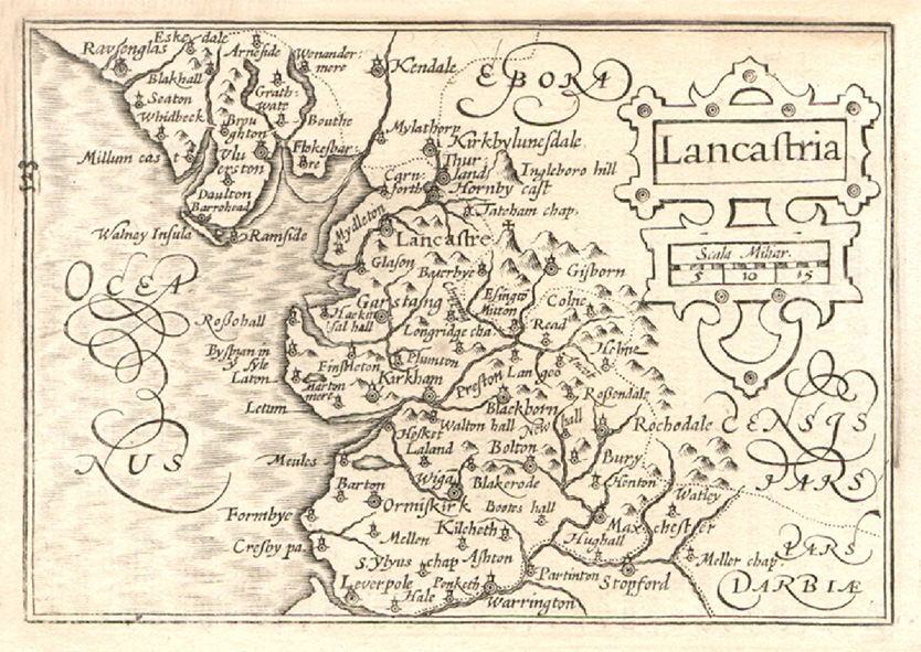
Lancaster 1617 Frans Braun and Remegius Hogenberg
Lancashire 1627 Pieter van den Keere
Lancastria Palatinus Anglis 1645 Joan Blaeu Atlas Van de Hagen (Fordham p.029 map 083 )
(image courtesy of The British Library via Flickr & Wikimedia)
Lancastria palatinatus, anglis Lancaster et Lancas shire 1646 Jan Jansson (Image courtesy of Harvard University Library)
Lancashire 1662 Roger Rea after John Speed in A Prospect of the Most Famous Parts of the World (Roger Rea Edition)
(Image courtesy of The British Library King's Collection Maps K.Top)
Lancashire 1664 Joan Blaeu in Atlas Maior (Fordham p.039 map 116)
(image courtesy of British Library - Albums)
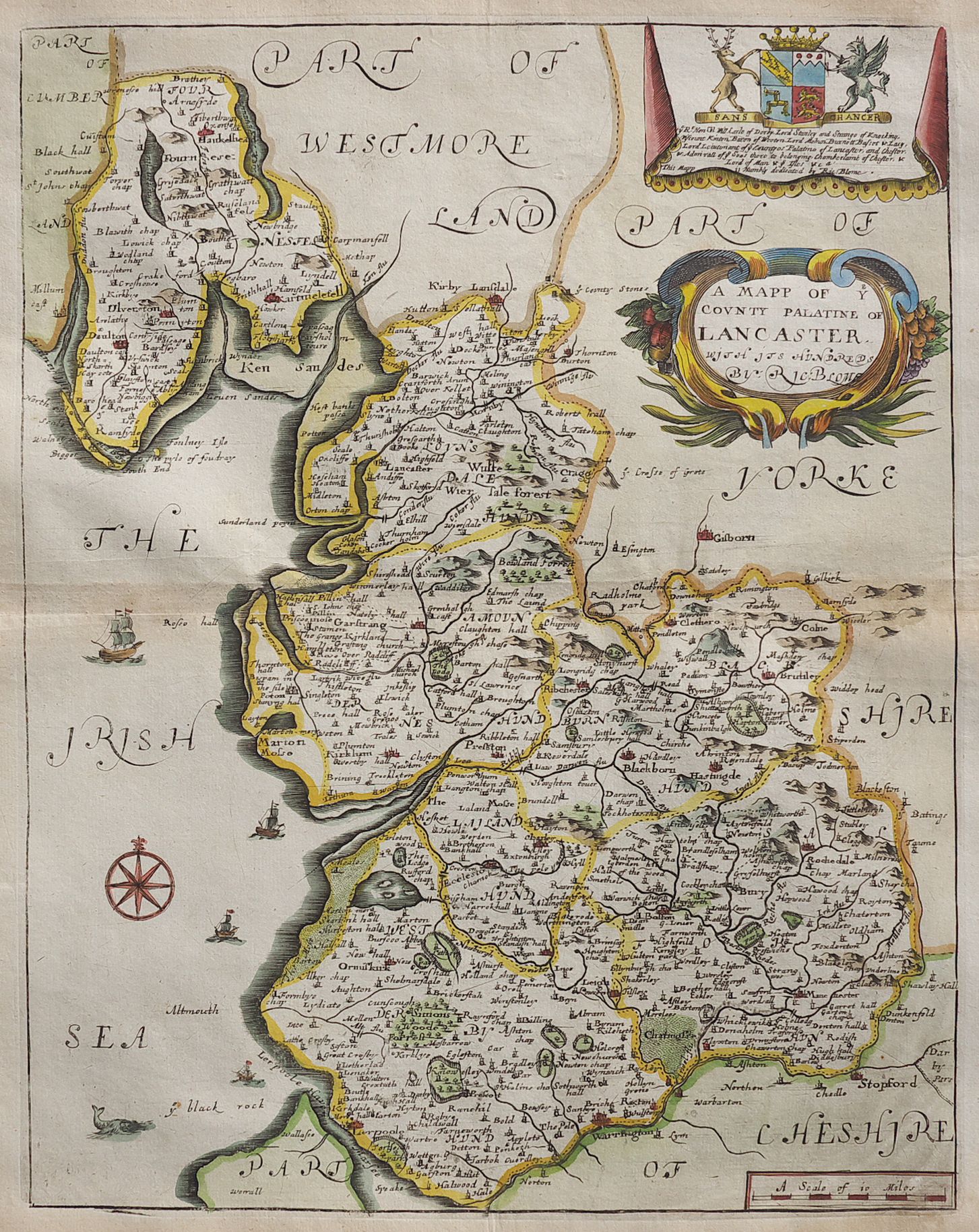
Lancashire 1673 Richard Blome in his Britannia (Fordham p.040 map 121 )
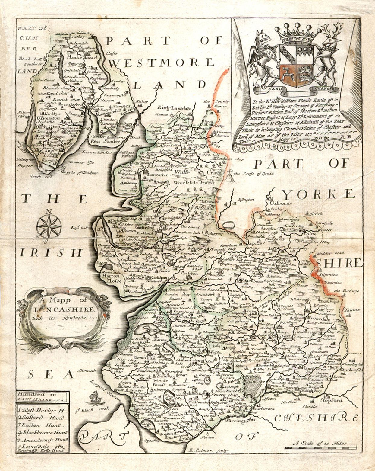
Lancashire 1681 Richard Blome in Speed's Maps Epitomised. (Fordham p.045 map 135 )
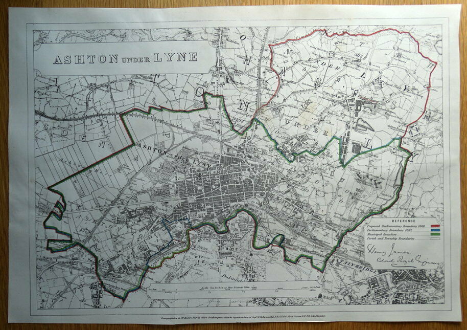
Ashton Under Lyne 1688 Henry James
The County Palatine of Lancaster 1693 after Christopher Saxton: Amended and re-published by Charles Lea
(Fordham p.47 map 142 ) (Image courtesy of Lancaster University Library)
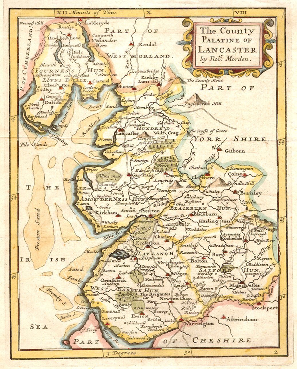
County of Lancaster 1695 Robert Morden for The First English Translation of Camden's Britannia (Fordham p.48 map 145 )
(image courtesy of Yale University Library)
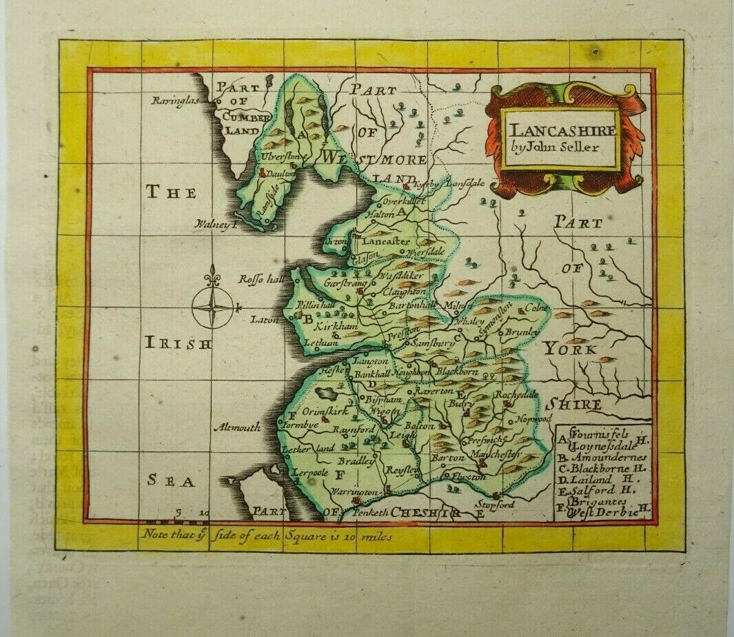
Lancashire 1695 John Seller in Anglia Contracta (Fordham p.048 map 146 )
the same plates being used for his In The History of England 1696 (Fordham p.050 map 151 ) and for
(Fordham p.048 map 121 ) and for Camden's Britannia Abridg'd (Fordham p.50 map 150 )
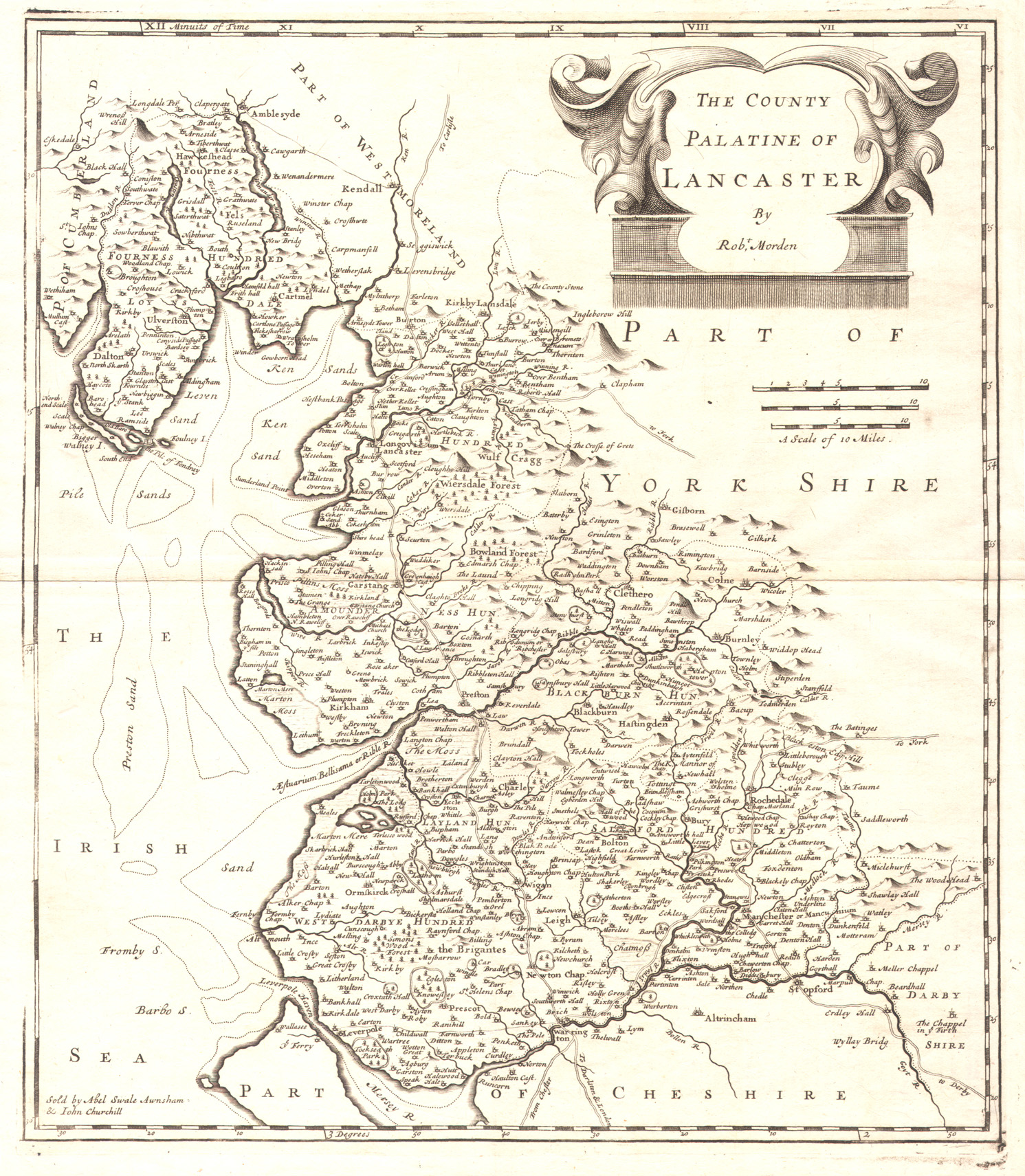
The County Palatine of Lancaster 1701 Robert Morden in his New Description and State of England (Chubb pp.100 CXXIV)
Lancashire 1715 Richard Blome for Thomas Taylor's England Exactly Described (Not in Fordham) (Chubb pp.107 CXXXVI)
Lancashire 1715 Jan Jansson re-published by Gerardum Valk & Petrum Shenk who acquired Jasson's plates after his death: and over time: amended Janssons imprint to their own (image courtesy of Wikimedia)
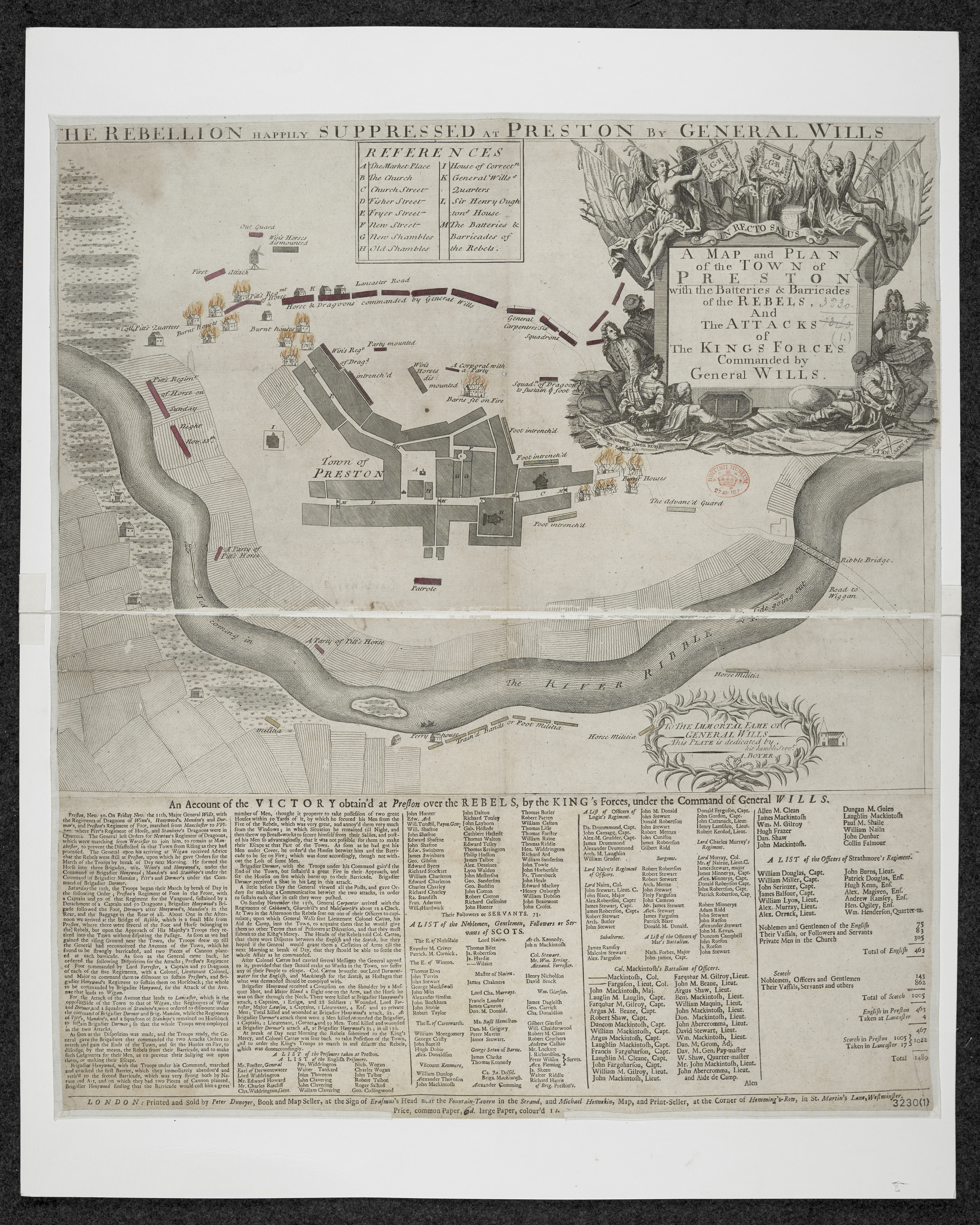
Lancashire 1715 Map and Plan of Preston A. Boyer
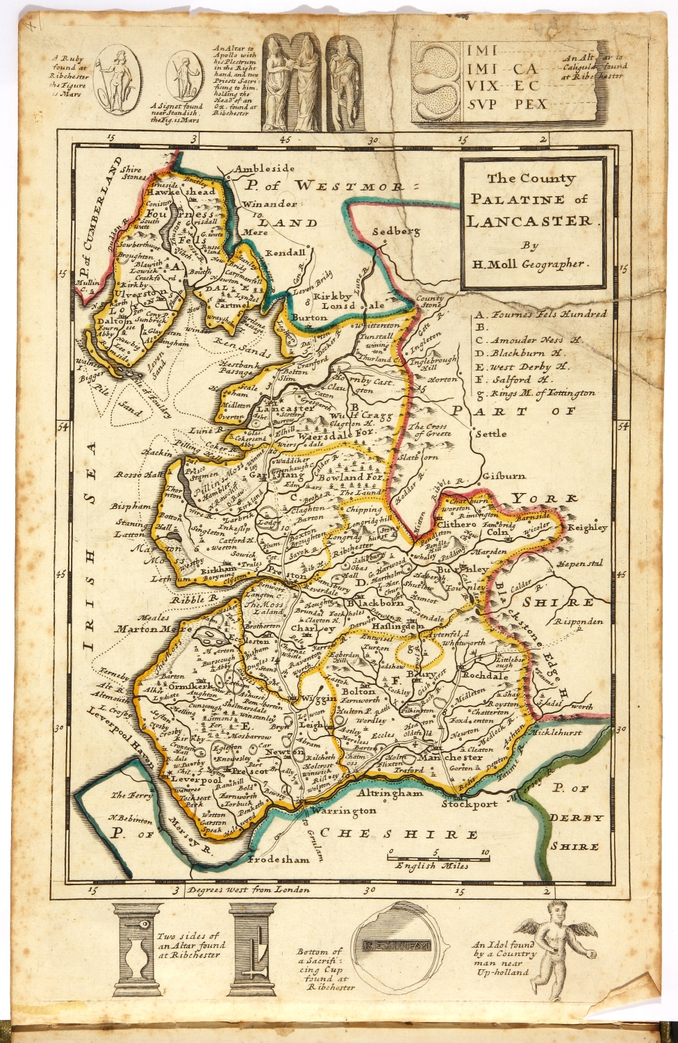
Lancashire 1724 Herman Moll in A New Description of England and Wales (Fordham p.56 map 172 )
A New and Accurate Plan of the Town of Leeds 1725 John Cossins (Image courtesy of The Thoresby Society)
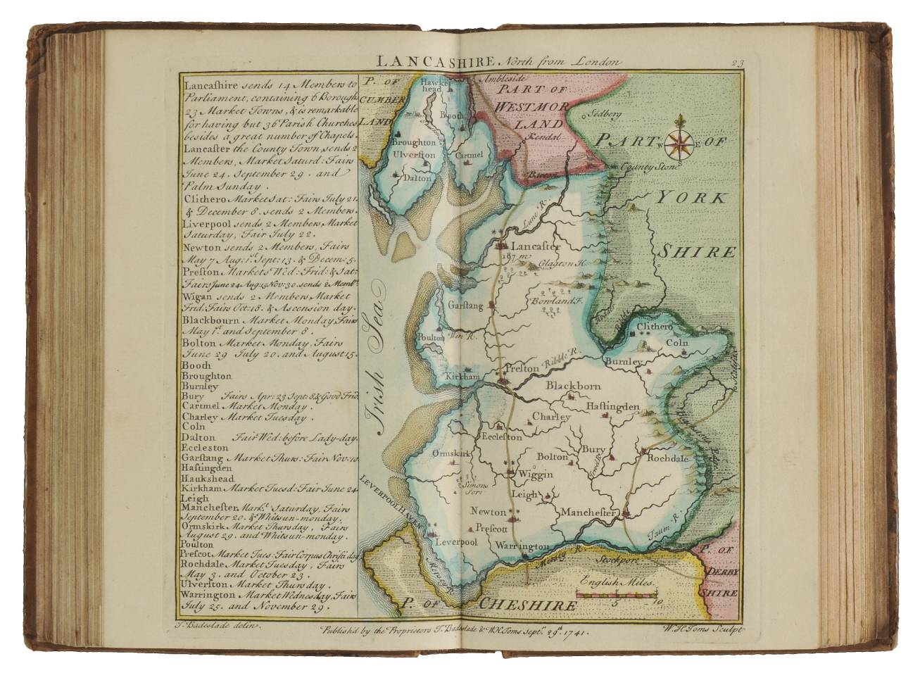
Lancashire 1741(First State)Thomas Badeslade and William Toms in Chorographia Britanniae (Fordham p.61 map 185 )
Lancashire 1742(Second State)Thomas Badeslade and William Toms in Chorographia Britanniae (Fordham p.47 map 185 )
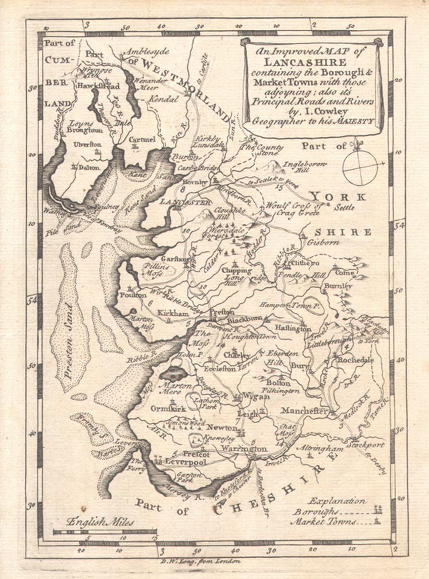
An Improved map of Lancashire 1743 John Cowley in R. Dodsley's Geography of England (Fordham p.62 map 189 )
Plan of Manchester and Salford 1745 Russel Casson
Lancashire 1746 Samuel Simpson in Robert Walker's Agreeable Historian (Fordham p.63 map 192 )
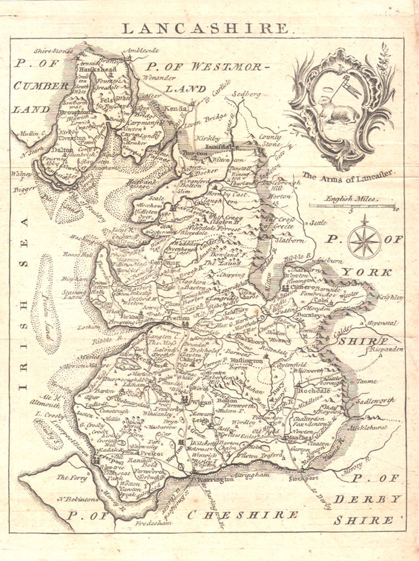
A Correct map of Lancashire 1748 Thomas Hutchinson in Osbourn's Geographia Magna (Fordham p.65 map 196 )
Lancashire 1750 Thomas Kitchin in Henry Boswell's The Antiquities of England and Wales
Lancashire 1750 Thomas Kitchen for The Gentleman's Magazine (Fordham p.67 map 202 )
(image courtesy of Lancaster University Library)
A Map of Lancashire 1751 Thomas Kitchin and Thomas Jefferys in The Small English Atlas (Fordham p.67 map 199 )
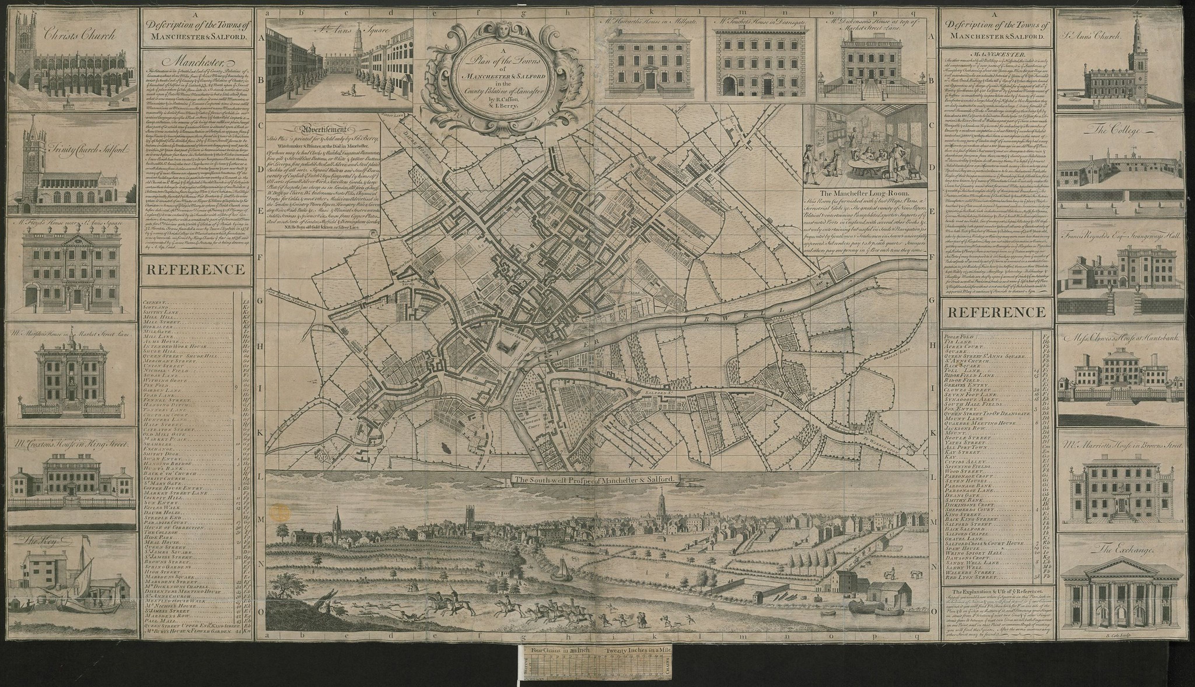
A Plan of the Towns of Manchester and Salford 1751 John Berry (Image courtesy of The British Library King's Collection. Maps K.Top.18.78.2 tab.)
County of Lancaster 1752 Eman.Bowen and Thomas Kitchin in The Large English Atlas (Image courtesy of Yale University Library)
Lancashire 1759 John Gibson from Carnan?s New and Accurate Maps of the Counties
(Fordham p.72 map 216 ) (image courtesy of Lancaster University Library)
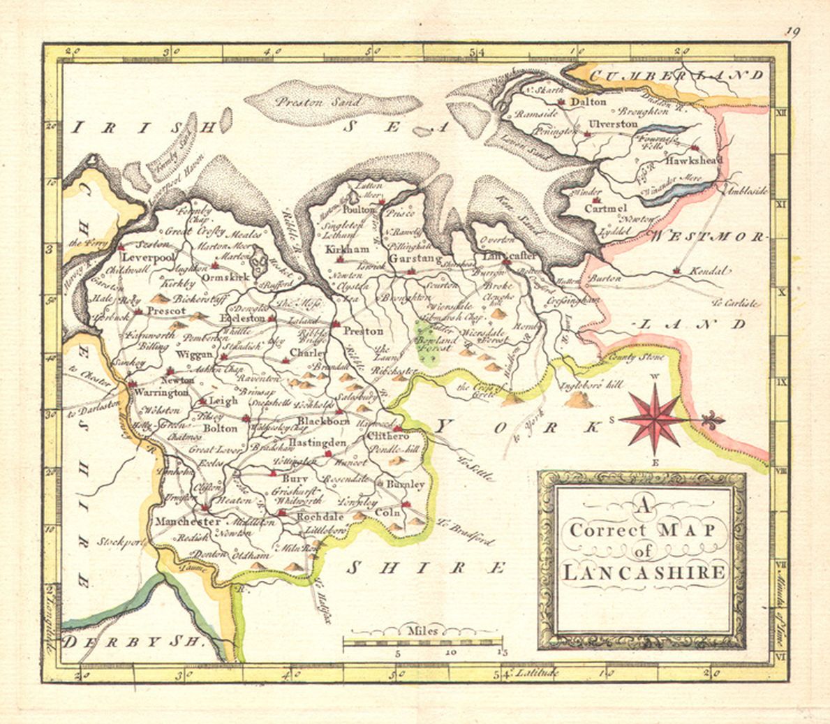
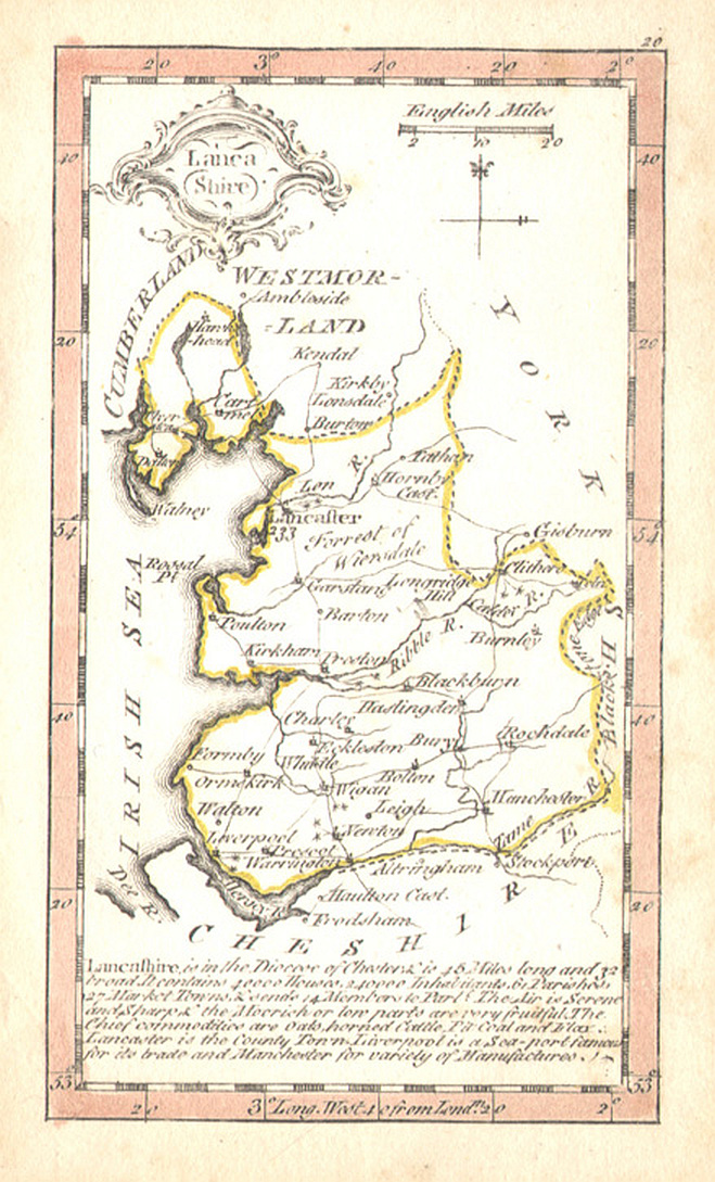
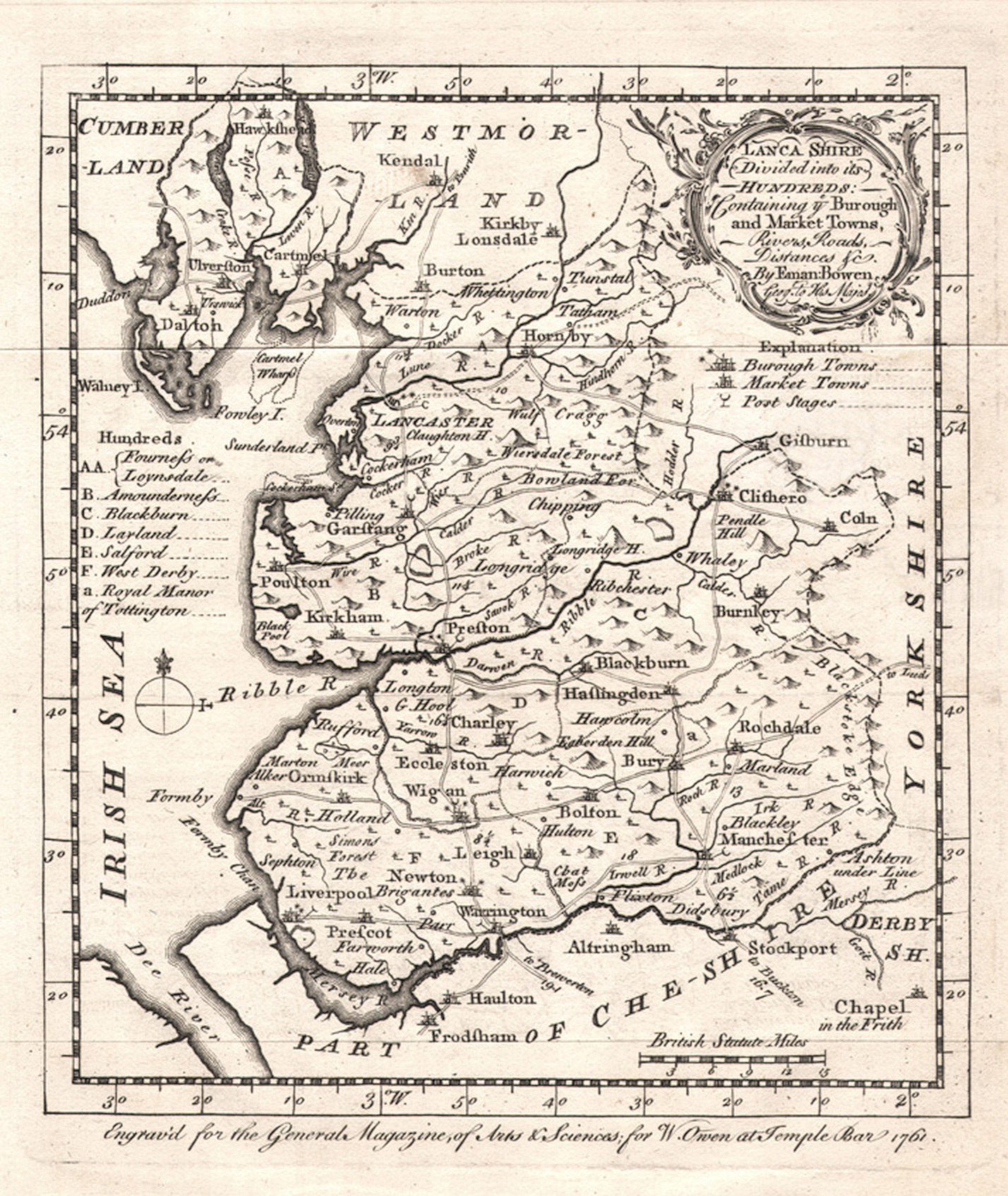
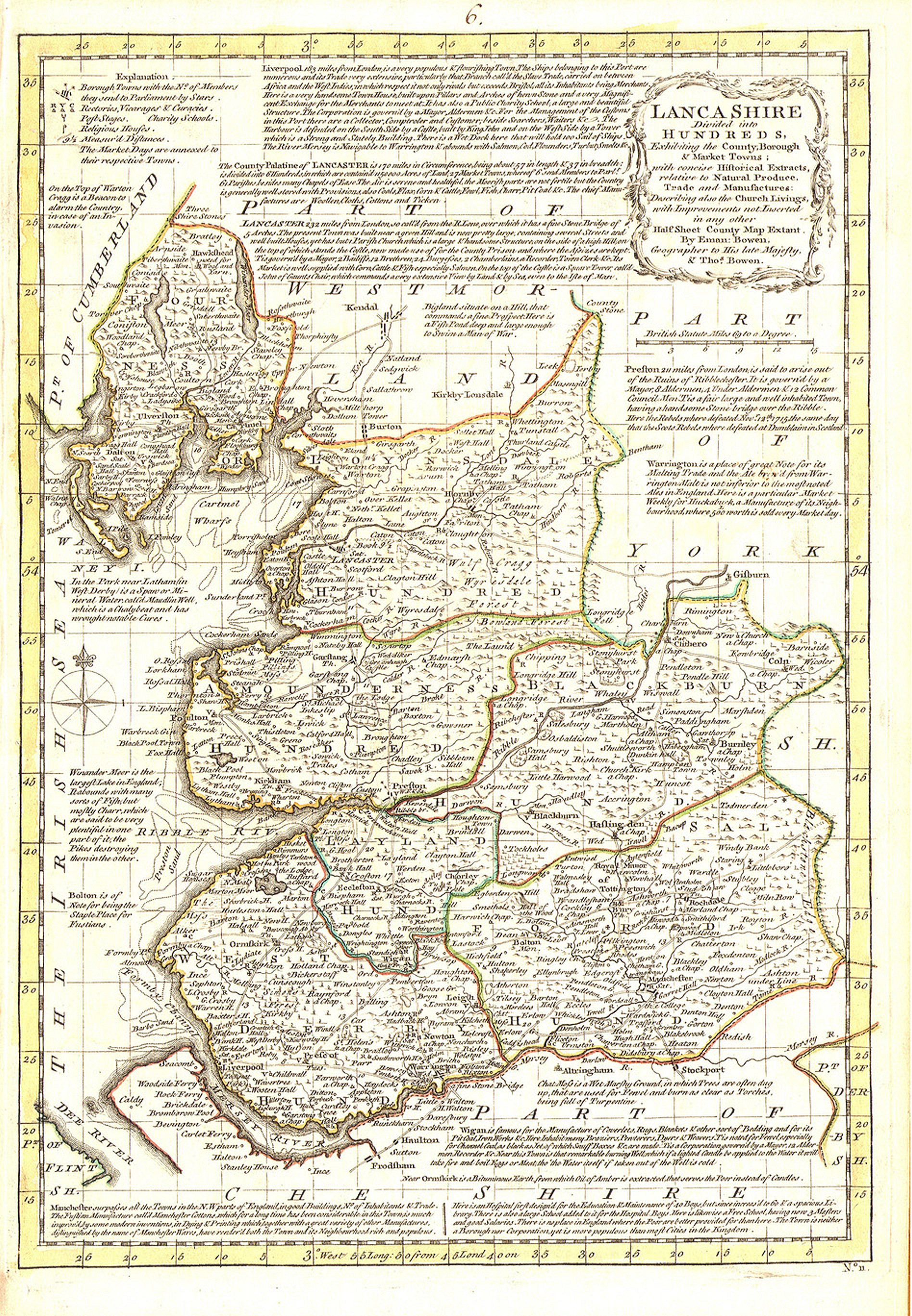
Lancashire Divided into it's Hundreds 1761 Emanuel Bowen from The General Magazine of Arts and Science (Fordham p.73 map 218) (image courtesy of Lancaster University Library)
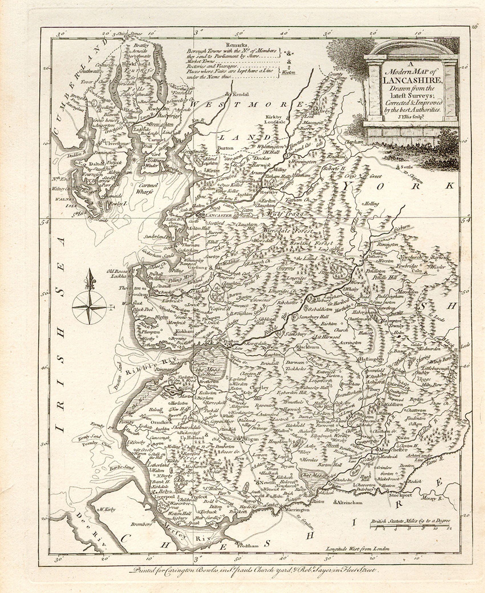
A Modern Map of Lancashire 1765 Joseph Ellis from Ellis's English Atlas (Fordham p.76 map 226)
(image courtesy of Lancaster University Library)
A Plan of Liverpool 1765 John Eyes
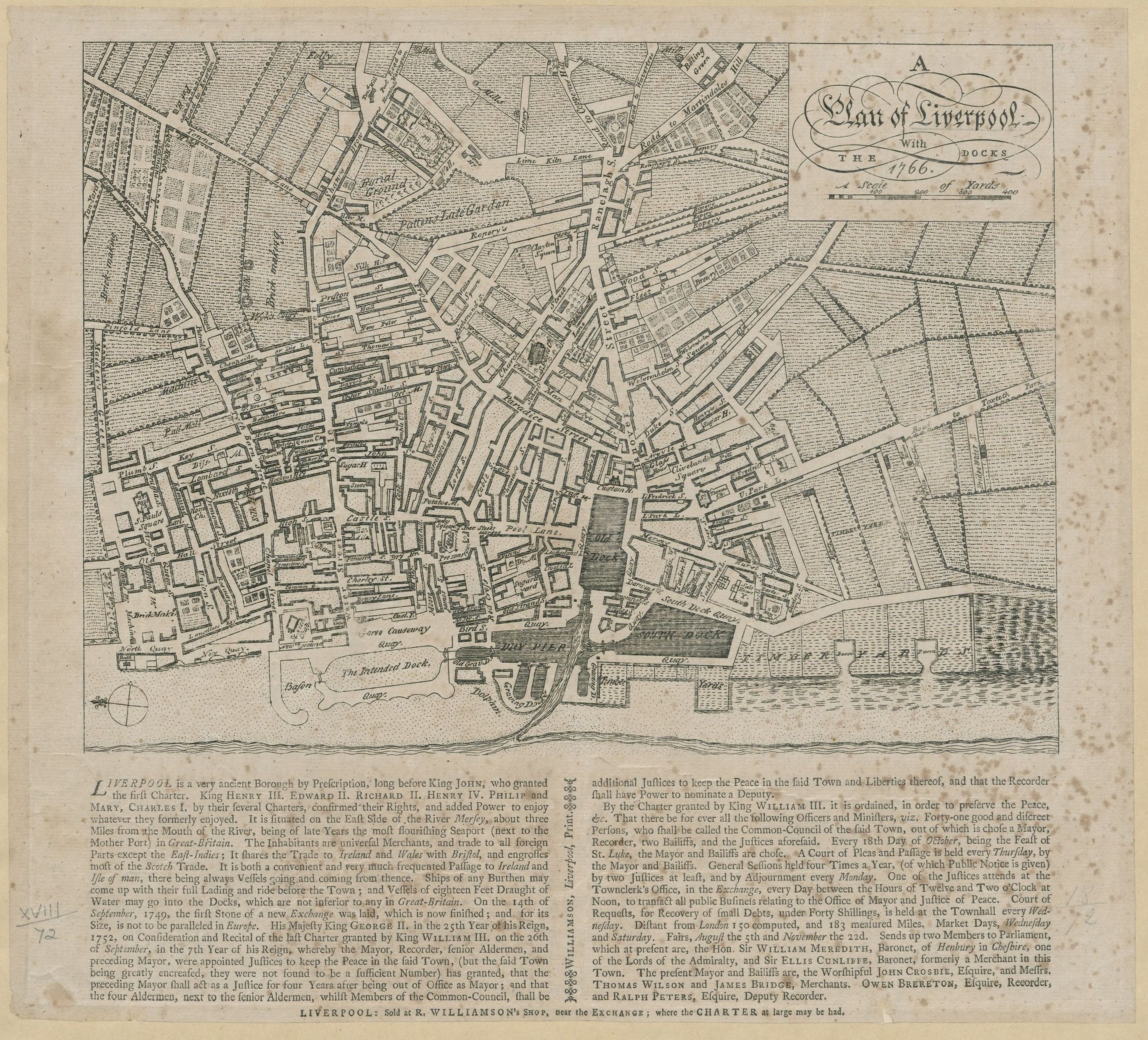
A Plan of Liverpool 1766 R. Williamson
Lancashire 1768 Emanuel and Thomas Bowen in Atlas Anglicanus (not in Fordham)
(image courtesy of Lancaster University Library)
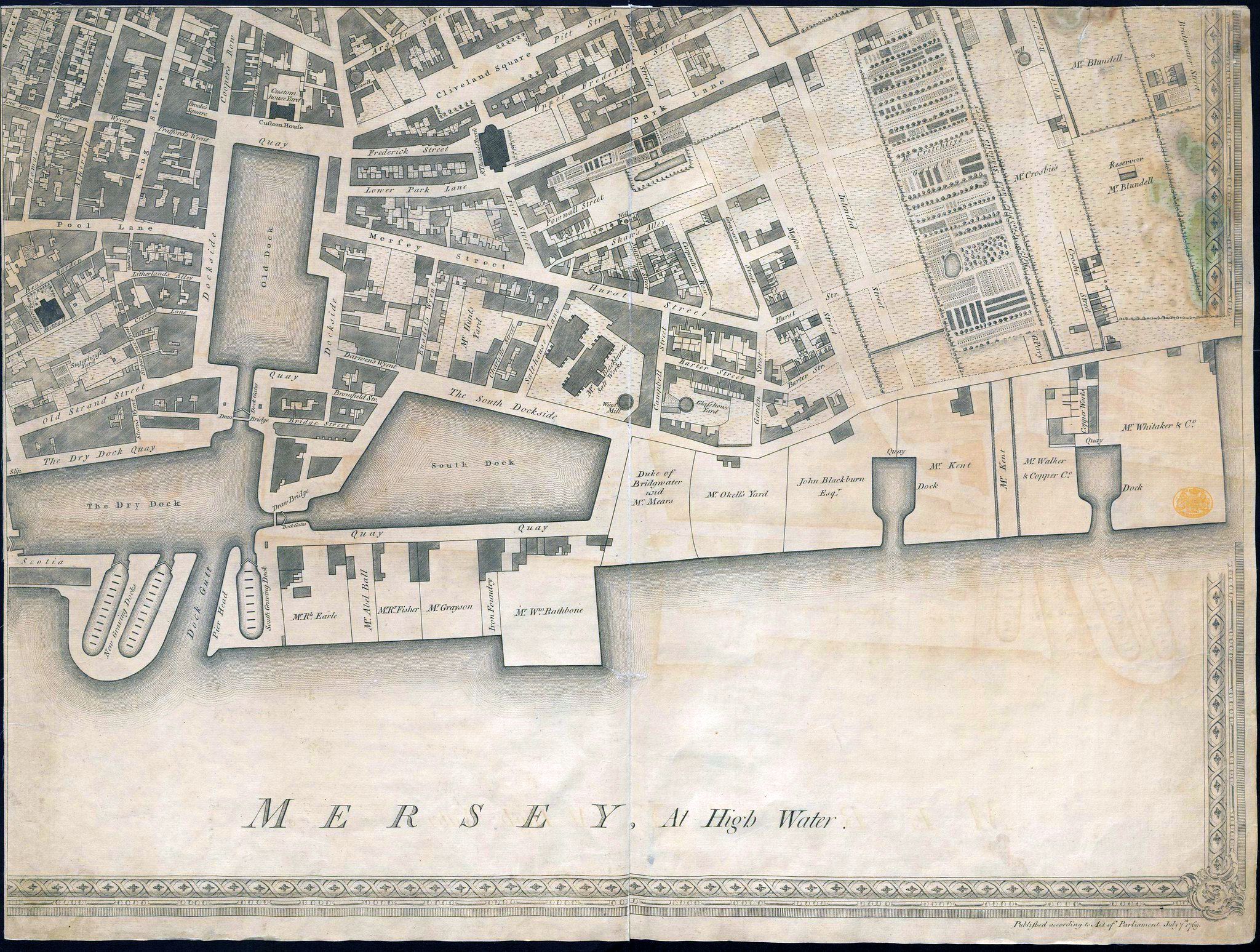
A Plan of Liverpool 1769 (lower-left) George Perry
A Plan of Liverpool 1769 (lower-right) George Perry
A Plan of Liverpool 1769 (top-left) George Perry
A Plan of Liverpool 1769 (top-right) George Perry
Lancashire 1769 Thomas Kitchin in Kitchin's Pocket Atlas (Fordham p.80 map 238) (image courtesy of Lancaster University Library)
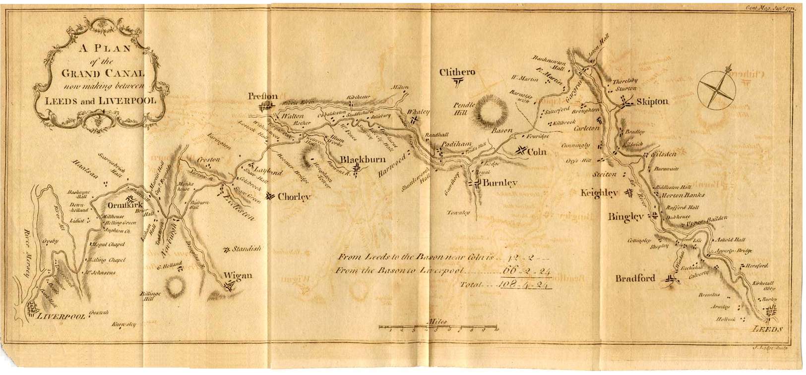
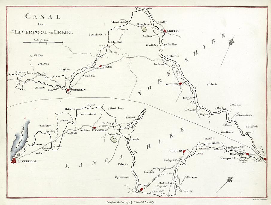
The Grand Canal 1772 Leeds to Liverpool
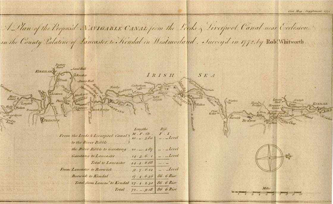
The Eccleston Kendal Canal 1772 (J.Roper) The Gentleman's Magazine
A Plan of Warrington 1773 J. Wallworth
Lancashire 1786 William Yates (Fordham p.86 map 260)
Lancashire 1786 Thomas Kitchin in Henry Boswell's The Antiquities of England and Wales (Fordham p.80 map 238)
with reference to The London magazine erased
A Map of Lancashire with Improvements 1789 John Harrison in Maps of the English Counties (Fordham p.91 map 268) (image courtesy of Lancaster University Library)
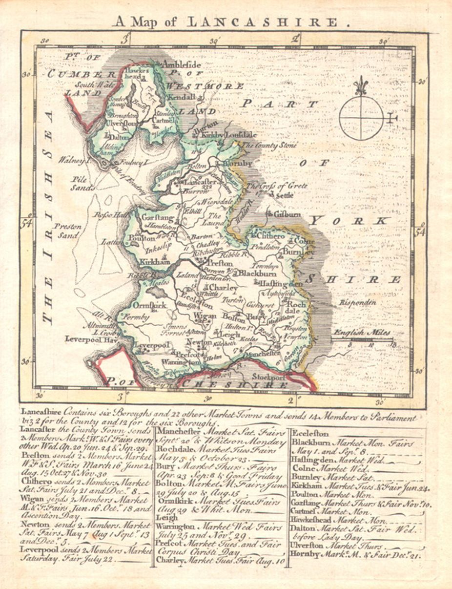
A New Map of Lancashire 1789 John Lodge (Fordham p.80 map 269)
(image courtesy of Lancaster University Library)
A Plan of Liverpool 1790 John Gore (Image courtesy of The British Library King's Collection.Maps K.Top.18.74.)
Lancashire 1790 John Aikin in England Delineated (Fordham p.92 map 270
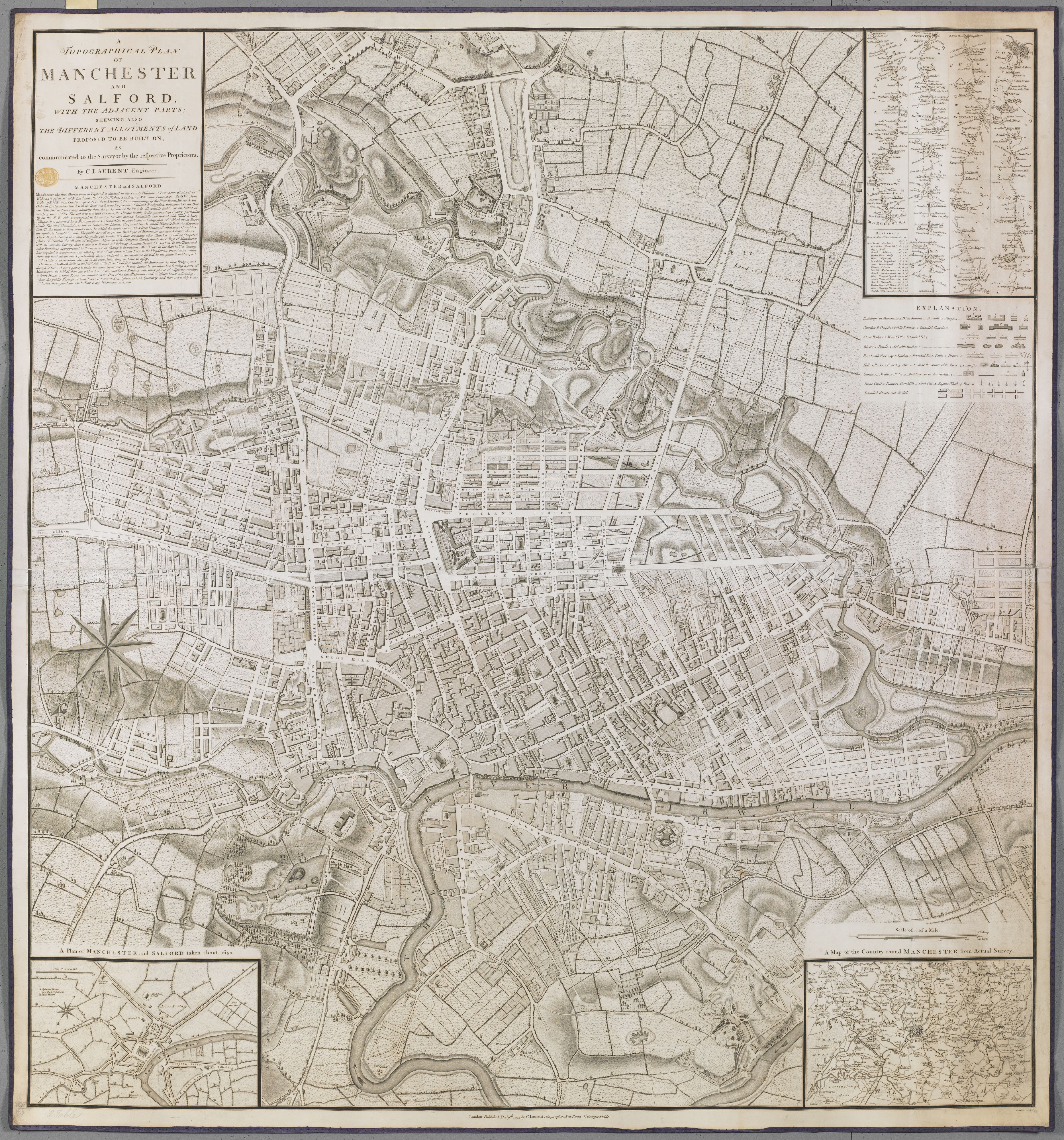
Manchester and Salford with the adjacent Parts 1793 C. Laurent
(Image courtesy of The British Library: King's Collection Maps K.Top.18.79.2 tab
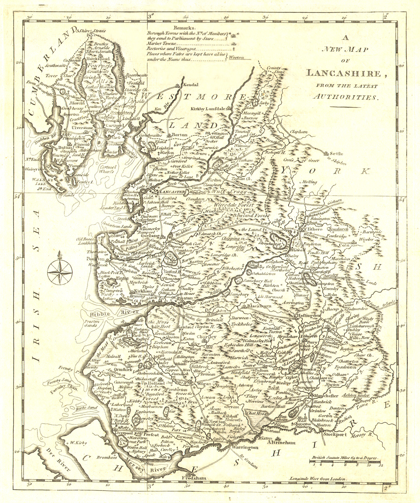
Lancashire 1793 John Cary in his New and Correct English Atlas (Fordham p.89 map 267)
(Image courtesy of New York Library Digital Collections)
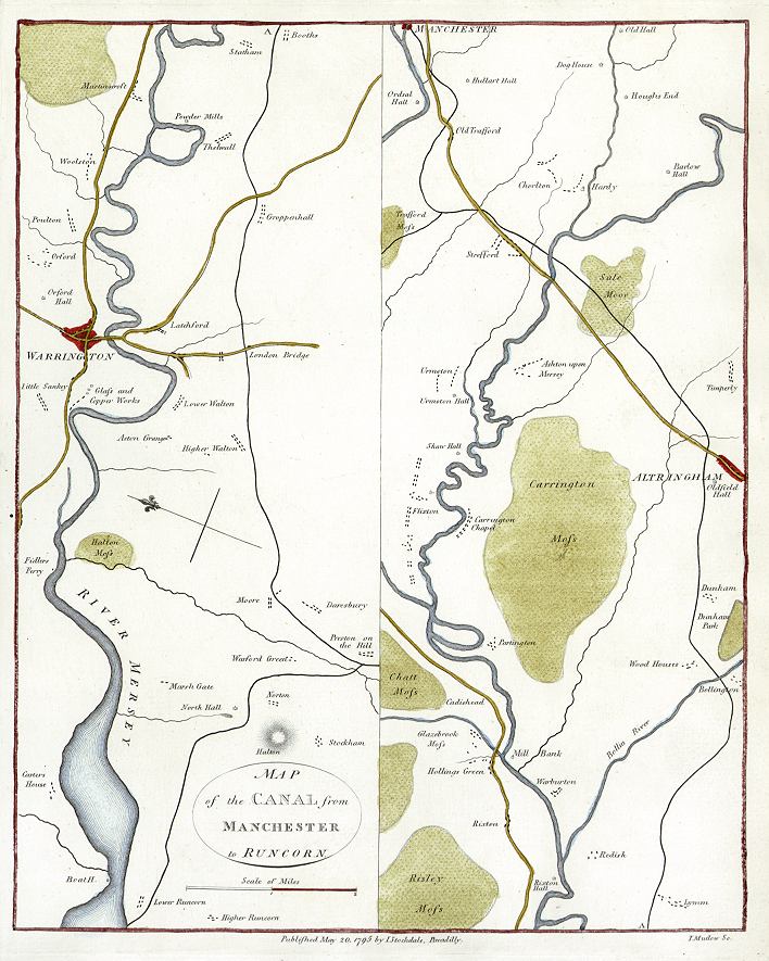
The Manchester to Runcorn Canal 1794 John Aiken & John Stockdale
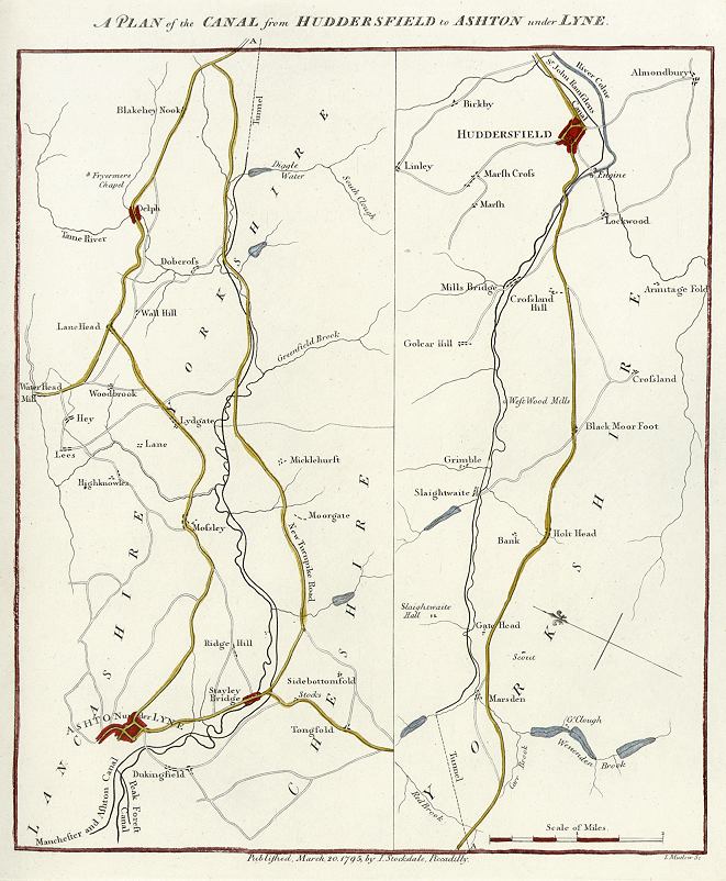
The Huddersfield-Ashton Canal 1794 John Aiken & John Stockdale
The Manchester to Runcorn Canal 1794 John Aiken & John Stockdale
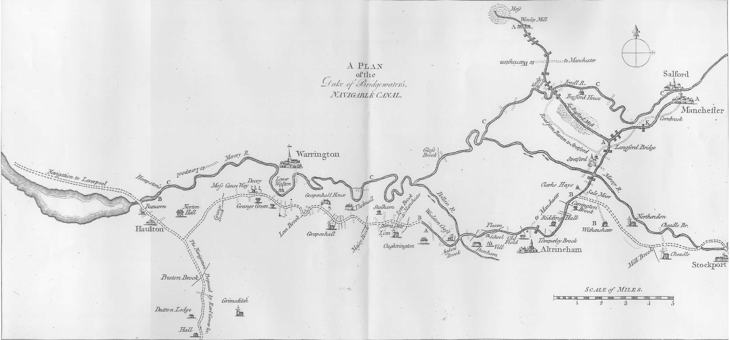
The Duke of Bridgewater's Canal 1794 John Aiken & John Stockdale
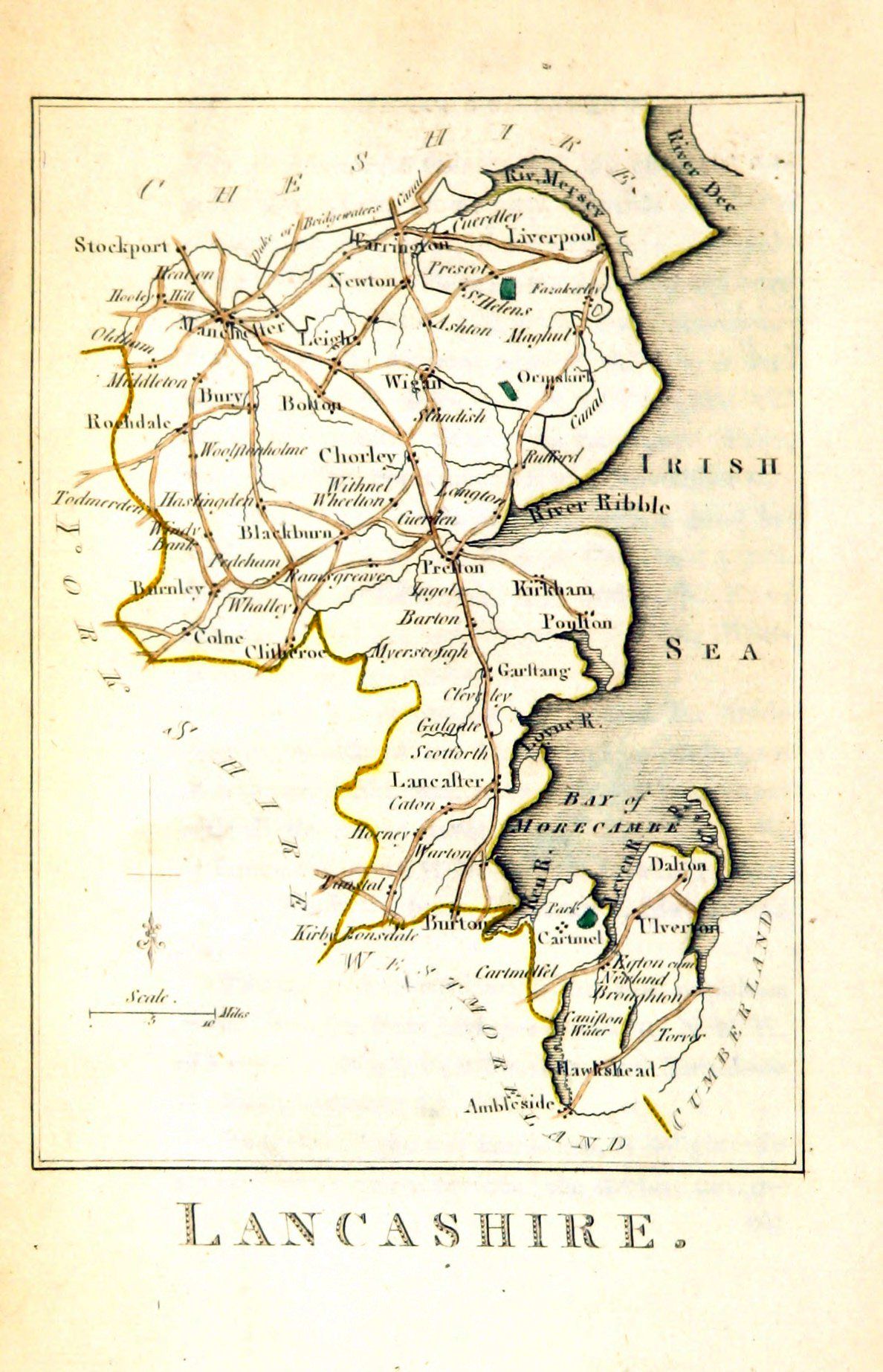
Lancashire 1795 John Aikin in England and Wales Delineated
Lancashire 1803 William Green for R. Butters' A Picture of England
(Fordham p.80 map 294
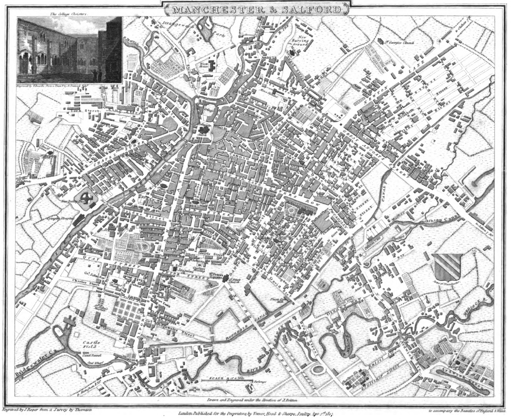
A Plan of Manchester and Salford 1809 John Roper and George Cole in their British Atlas
(Image courtesy of The British Library-King's Topographical Collection Maps K.Top)
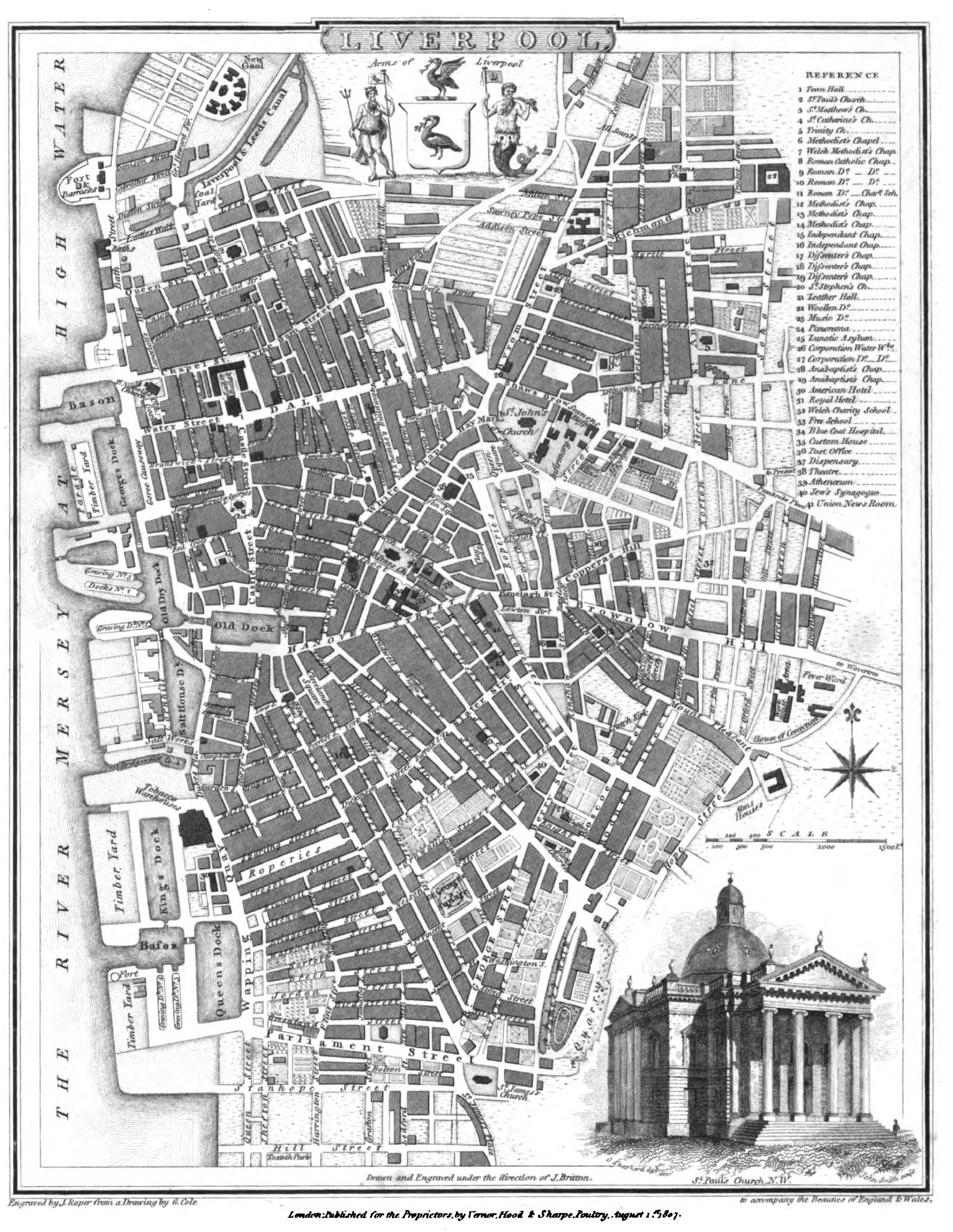
A Plan of Liverpool 1809 John Roper in The British Atlas of England and Wales
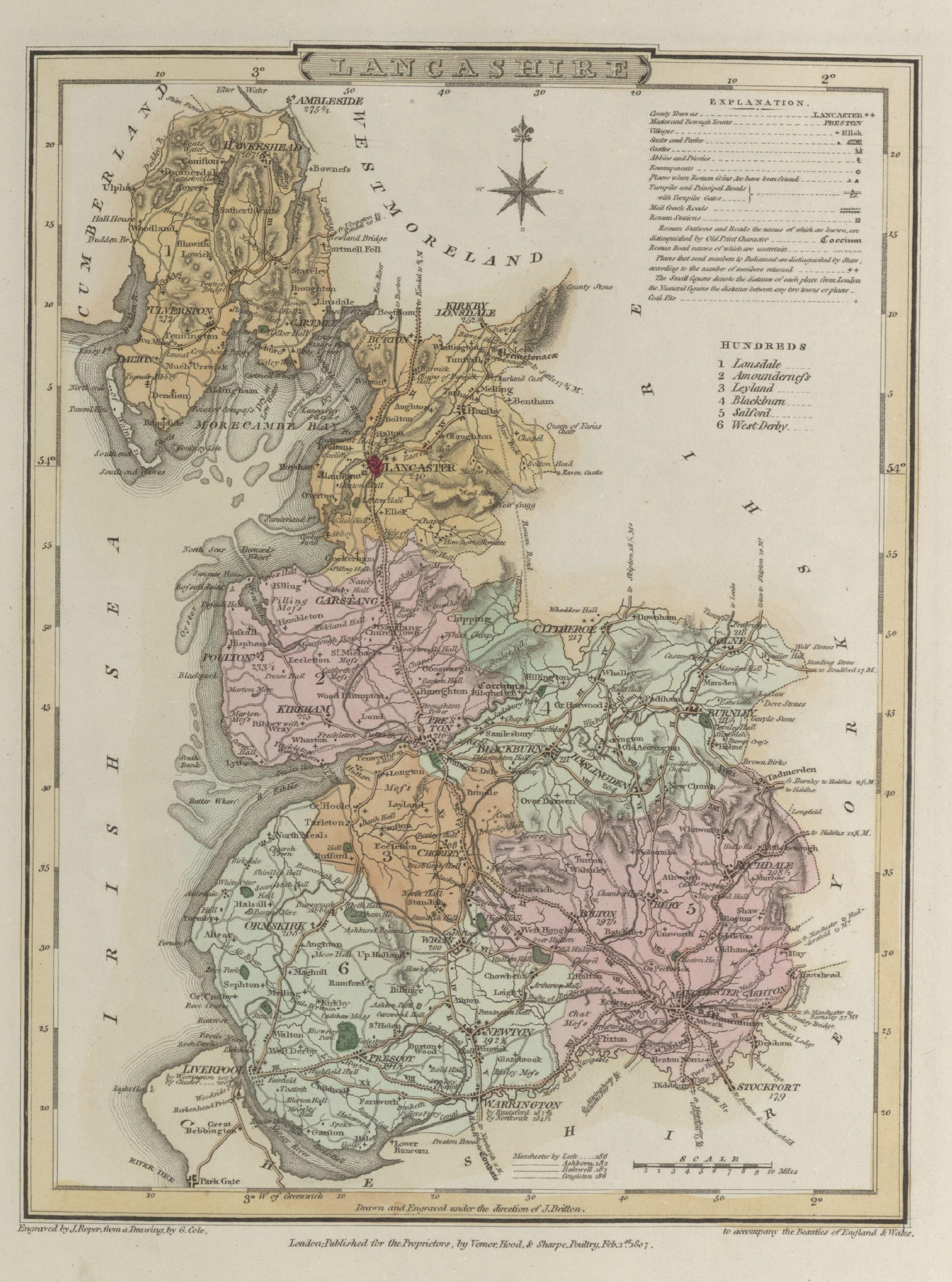
Lancashire 1810 George Cole and John Roper in their British Atlas
(Image courtesy of The British Library-King's Topographical Collection
A Plan of Preston (Part1) 1809 William Shakeshaft
A Plan of Preston (Part2) 1809 William Shakeshaft
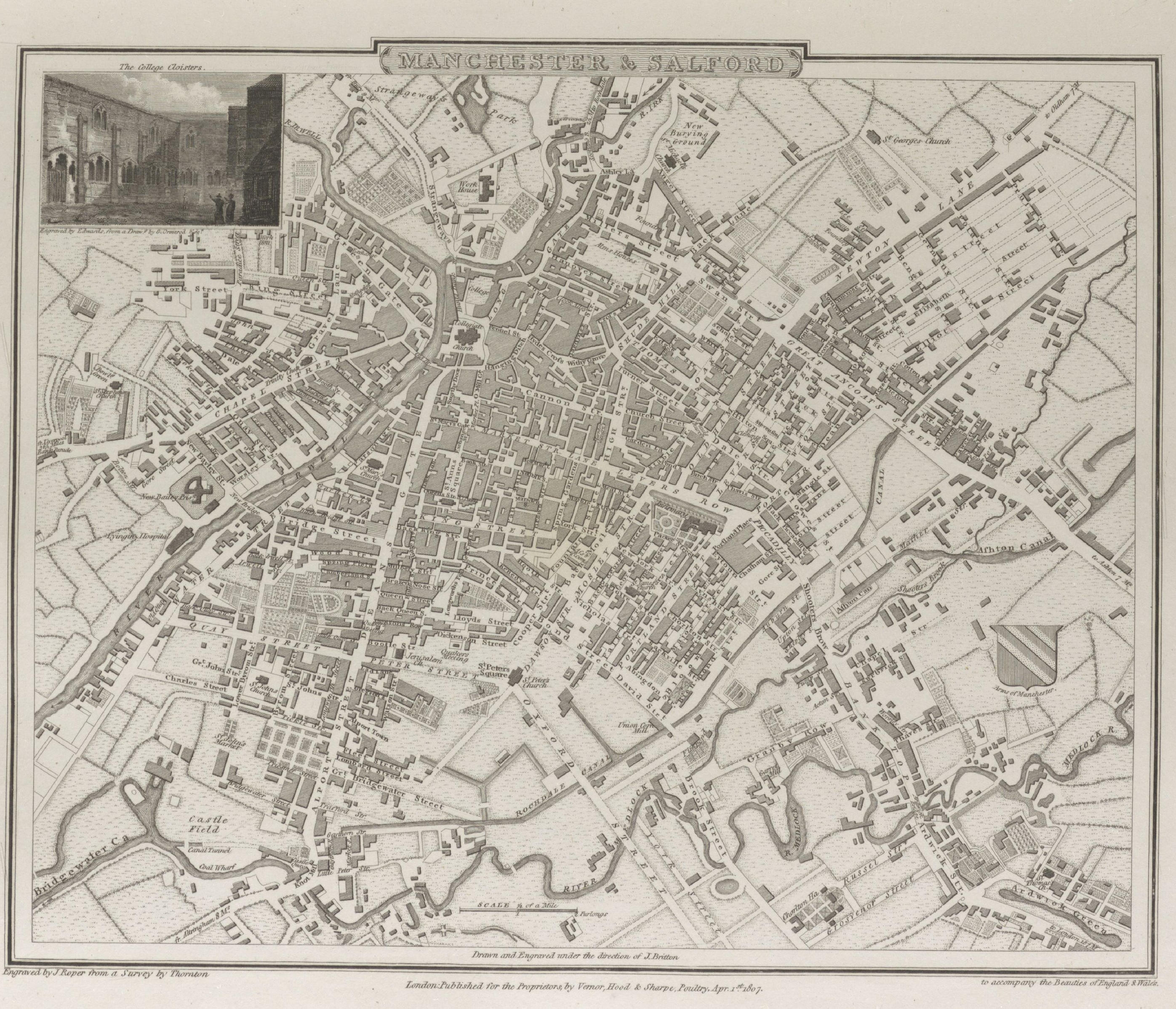
Manchester and Salford 1810 George Cole and John Roper in their British Atlas
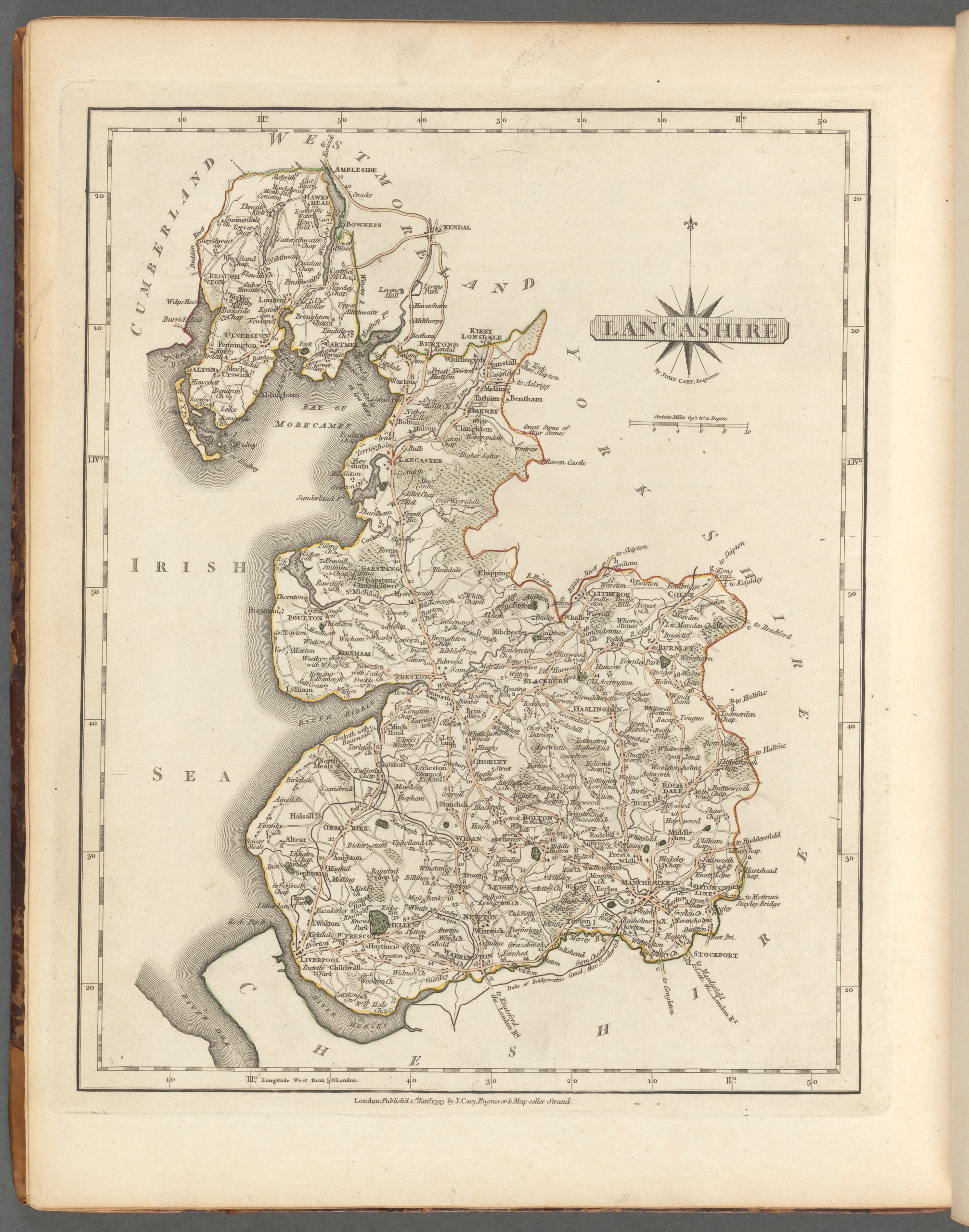
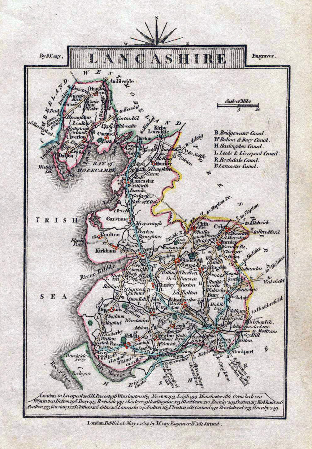
Lancashire 1814 John Cary in Cary's Traveller's Companion
(Image courtesy of Wikimedia)
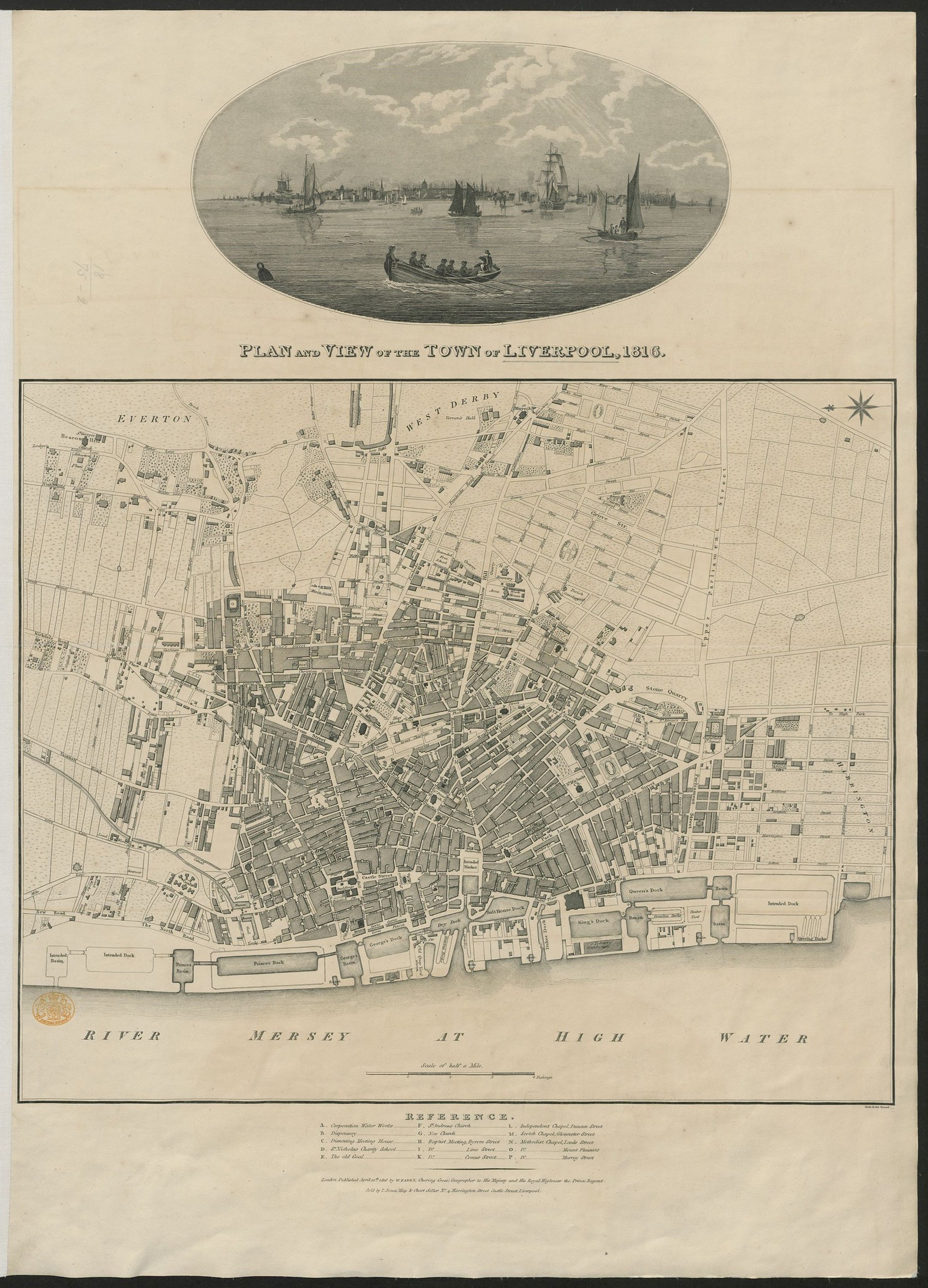
A Plan of Liverpool 1816 William Faden
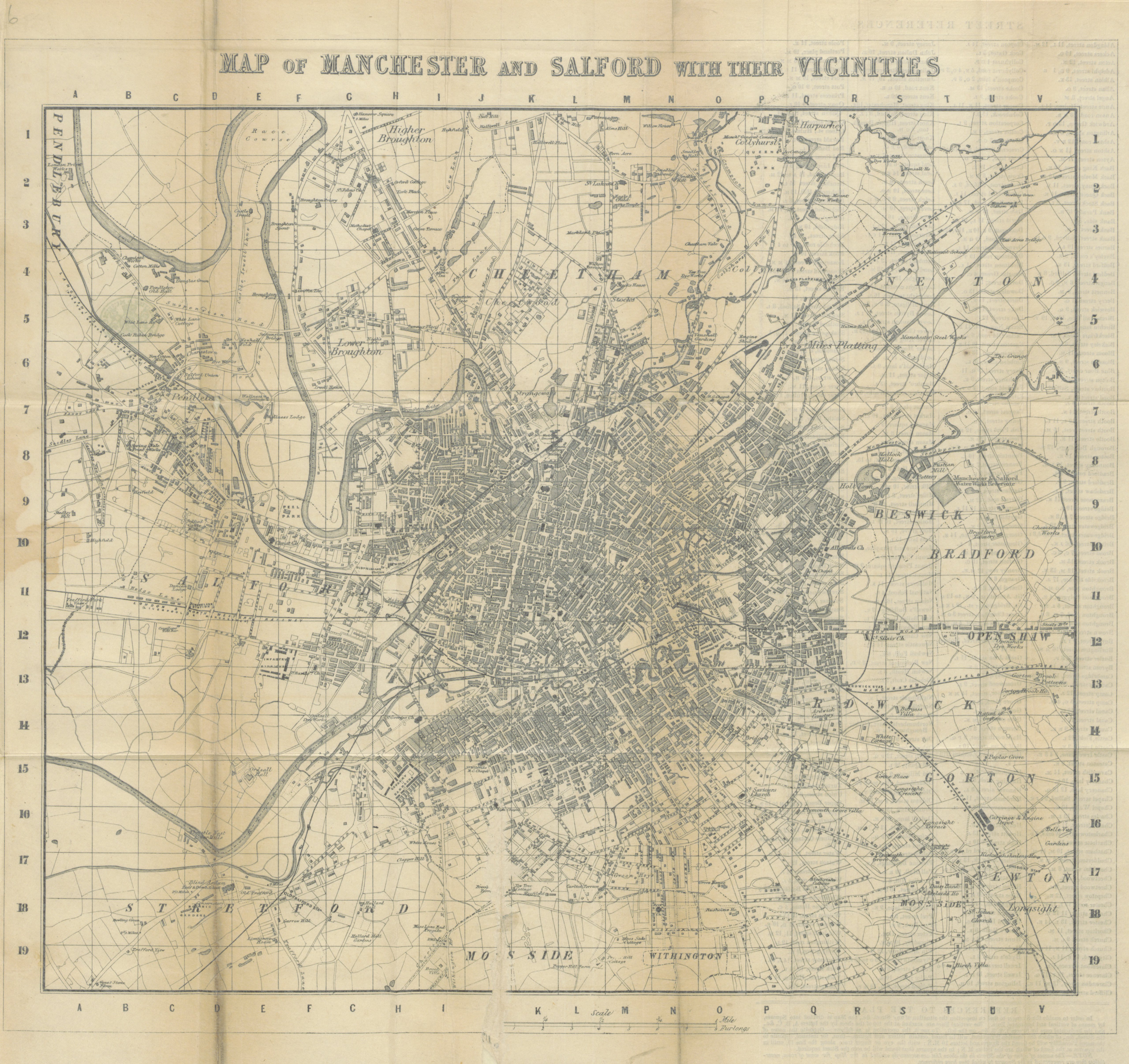
Map of Manchester and Salford with their Vicinities 1816 Joseph Aston
(Fordham p.80 map 269)
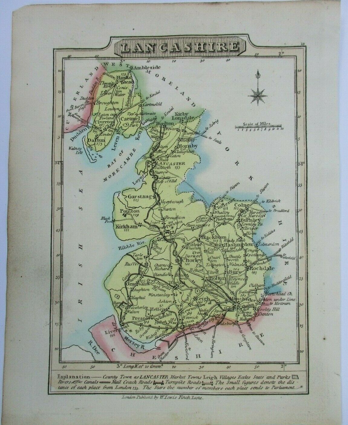
Lancashire 1819 William Lewis in A New Travellers Guide A reprint of J. Wallace's 1810 with additions by Lewis. Reprinted again 1812 with Ellis' name (Fordham p.119 map 354)
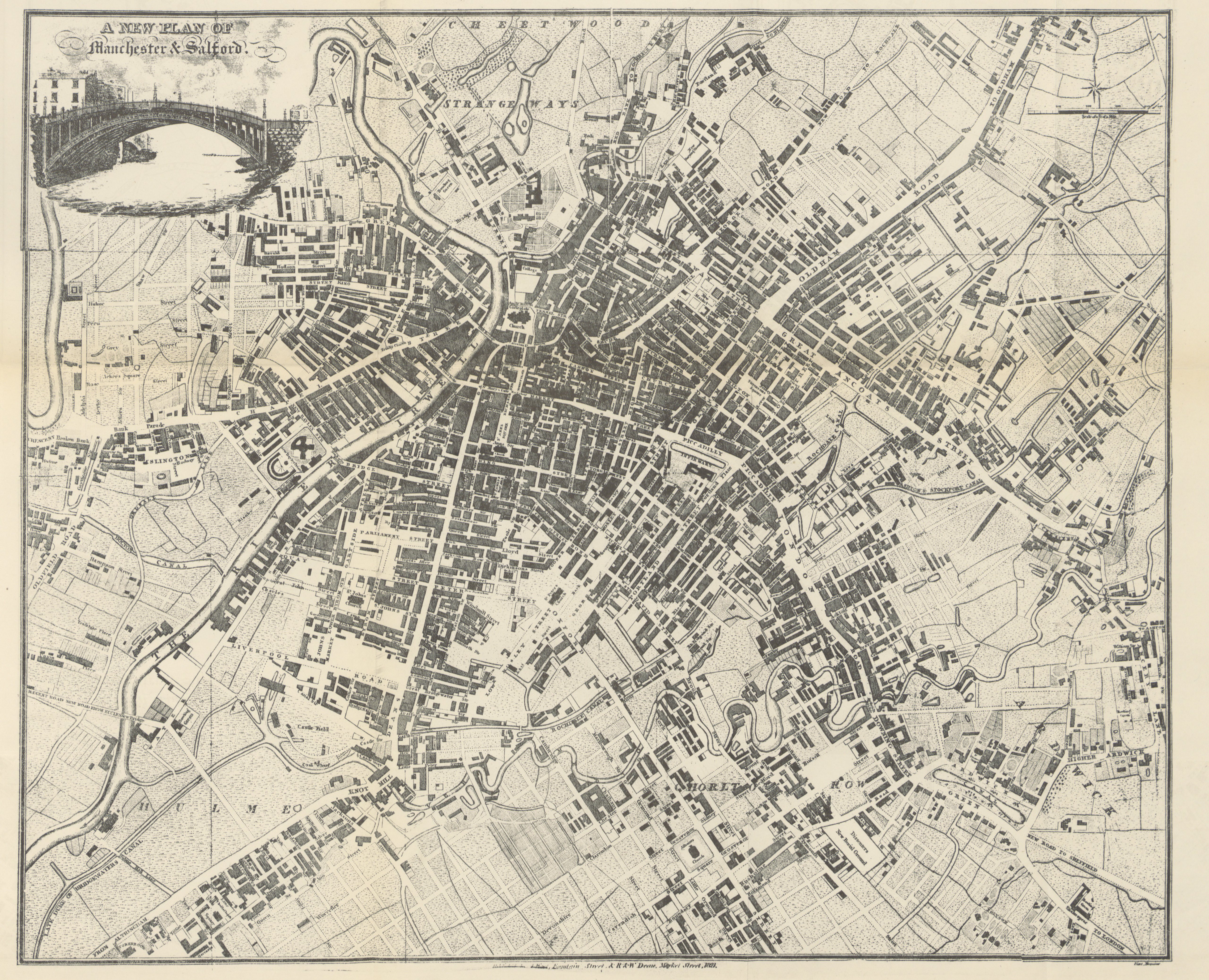
A New Plan of Manchester and Salford 1821 R. & M. Deane
Plan of Rochdale 1824 Edward Baines (Image courtesy of The Mechanical Curator & Wikimedia)
Lancashire 1824 George Carrington Gray in his New Book of the Roads (see under 'Cook:G.A.)
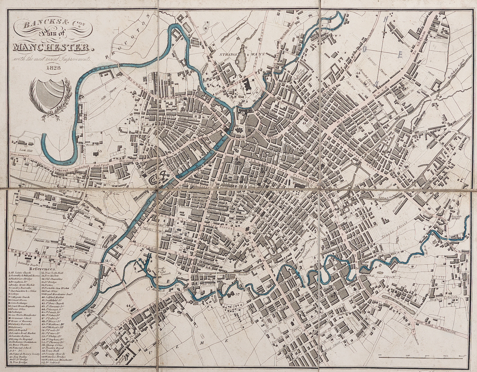
A Plan of Manchester 1828 Bancks Bros.
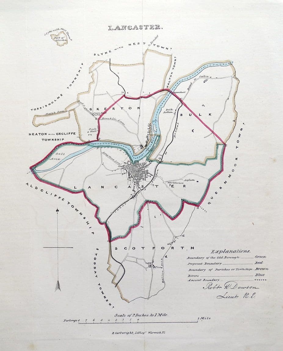
Lancaster 1832 Robert Kearsley Dawson for the Boundary Commission
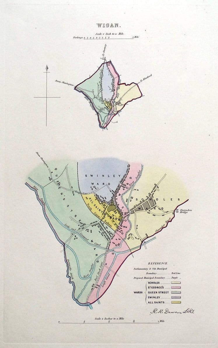
Wigan 1832 Robert Kearsley Dawson for the Boundary Commission
Stockport 1832 Robert Kearsley Dawson for the Boundary Commission
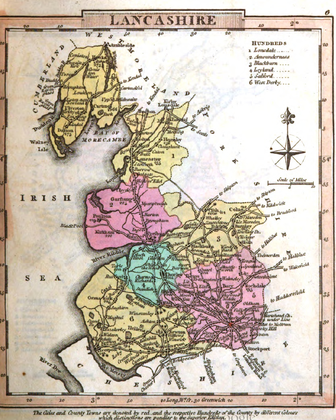
Lancashire 1834 C. and J. Greenwood in Atlas of the Counties of England (Chubb CCCCLVII1a)
(Image courtesy of www.davidrumsey.com)
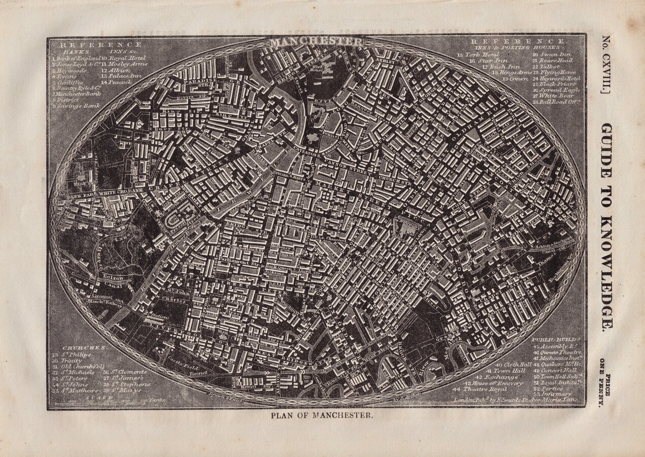
Plan of Manchester 1834 Joshua Archer for Guide to Knowledge CXVlll
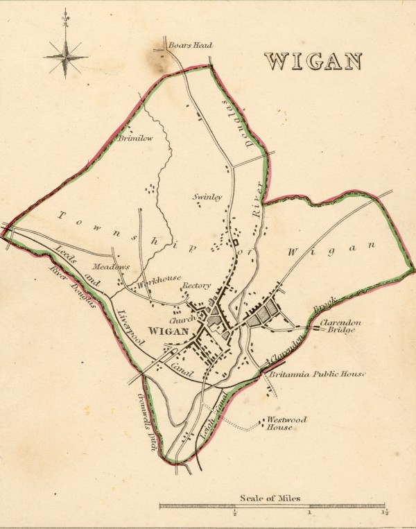
Wigan 1835 Robert Creighton for Lewis's Topographical Dictionary (Fordham p.145 map 447)
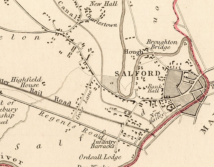
Salford 1835 (detail) Robert Kearsley Dawson for The Boundaries Commission
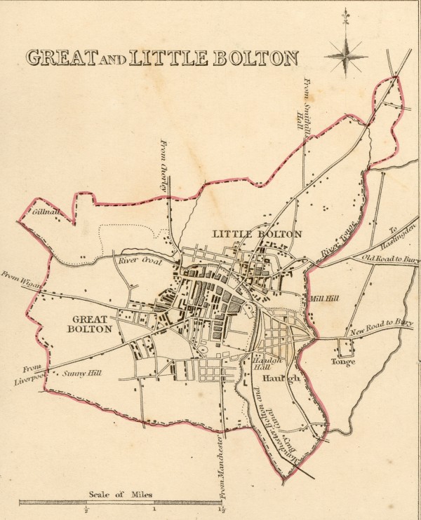
Bolton 1835 Robert Creighton for Lewis's Topographical Dictionary
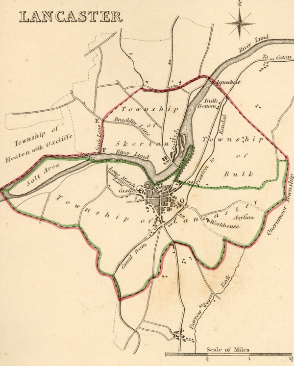
Lancaster 1835 Robert Creighton for Lewis's Topographical Dictionary
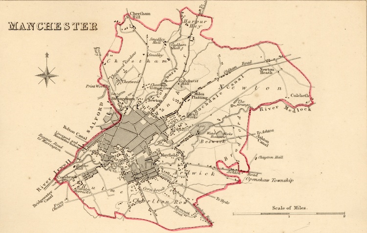
Manchester 1835 Robert Creighton for Lewis's Topographical Dictionary
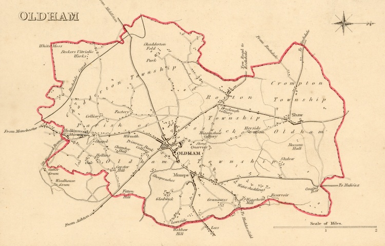
Oldham 1835 Robert Creighton for Lewis's Topographical Dictionary
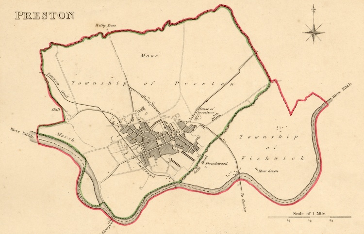
Preston 1835 Robert Creighton for Lewis's Topographical Dictionary
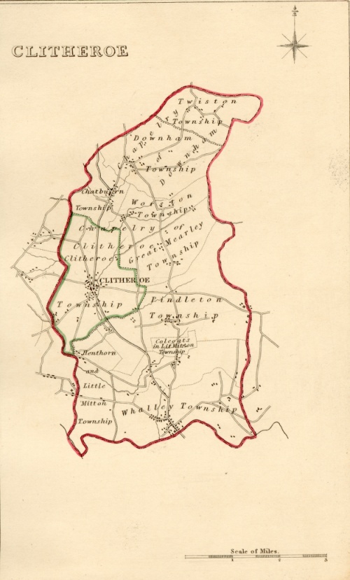
Clitheroe 1835 Robert Creighton for Lewis's Topographical Dictionary (Fordham p.145 map
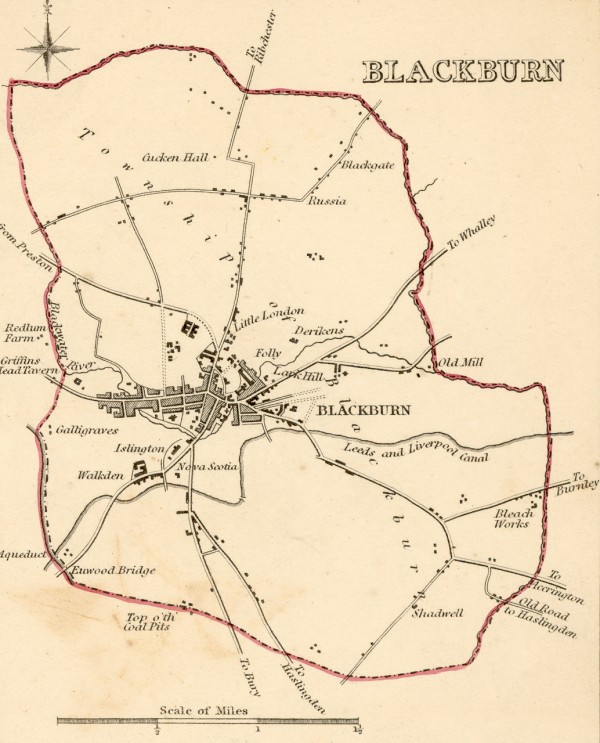
Blackburn 1835 Robert Creighton for Lewis's Topographical Dictionary (Fordham p.145 map
Lancashire 1835 Samuel Lewis in A Topographical Dictionary of England (Fordham p.145 map
Lancashire 1836 Samuel Hall in A New British Atlas (Fordham p.148 map454
Lancashire 1837 Thomas Moule in The English Counties Delineated (Fordham p.148 map 436 )
Lancashire 1837 Samuel Leigh for Leigh's Topographical Dictionary (Image courtesy of The Mechanical Curator & Wikimedia)
Blackpool Fleetwood and Latham 1844 anon.
Lancashire 1848 Robert Creighton in Atlas to Lewis' Topographical Dictionary
Street Plan of Manchester 1850 J. Rapkin for John Tallis
(Image courtesy of Manchester University Library)
Liverpool 1854 Bradshaw (Image courtesy of The Mechanical Curator & Wikimedia)
Lancashire 1854 Bradshaw (Image courtesy of The Mechanical Curator & Wikimedia)
The Manchester Ship Canal 1860 Mackenzie
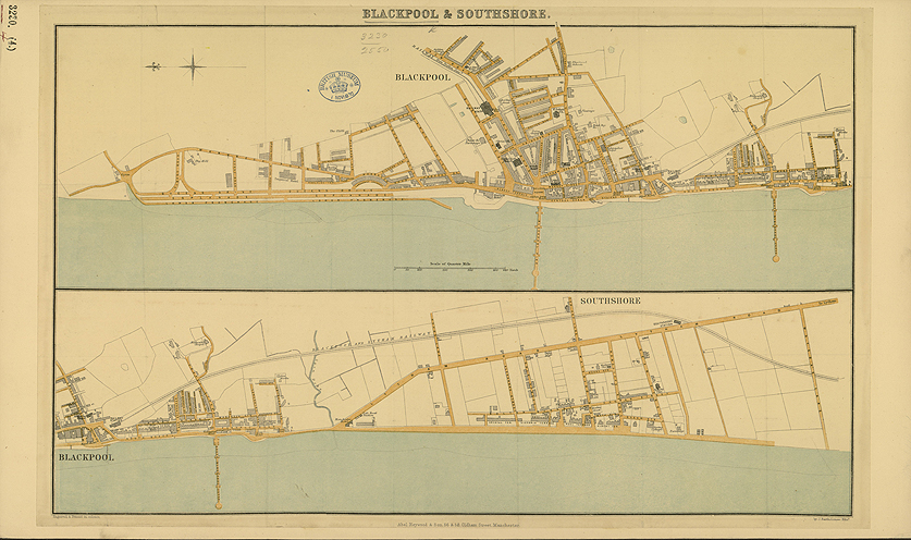
Blackpool and Southshore 1860 Author n.k
Lancaster and Carlisle Railway 1861 George S. Measom
Plan of Liverpool 1883 Adam Black in Black's Guide To England and Wales
Plan of Manchester 1883 Adam Black in Black's Guide To England and Wales
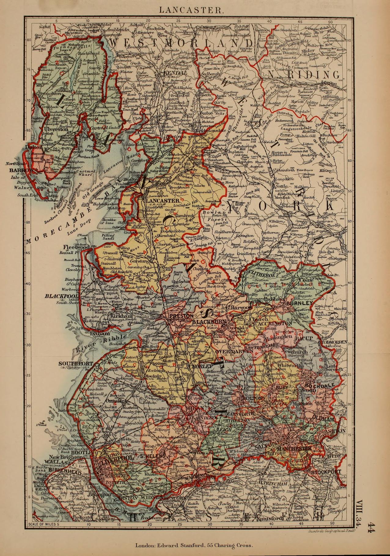
Lancashire 1885 Stanford's Parliamentary Dictionary of England and Wales
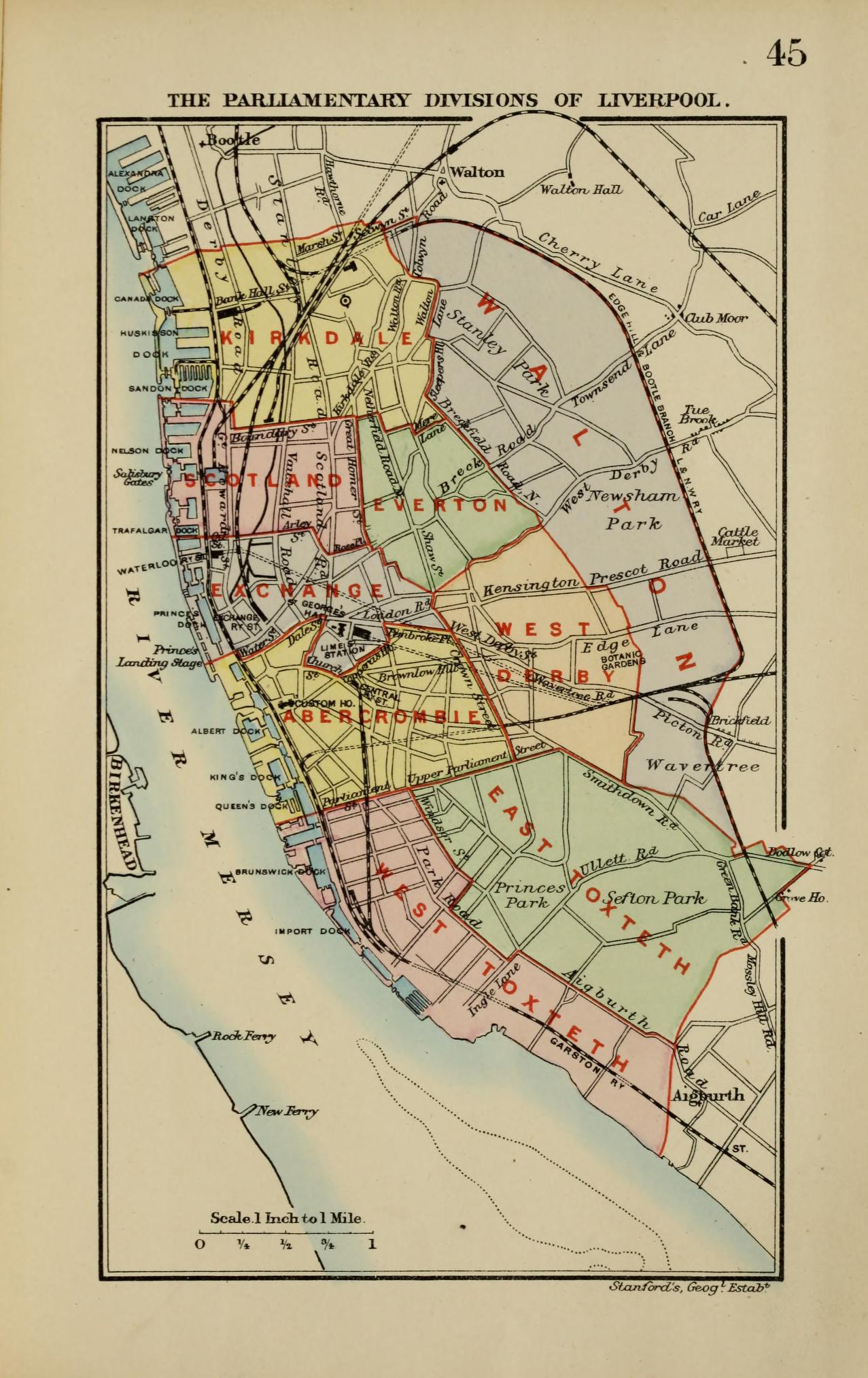
Liverpool 1885 Stanfords Parliamentary Dictionary of England and Wales
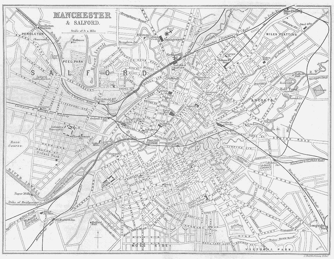
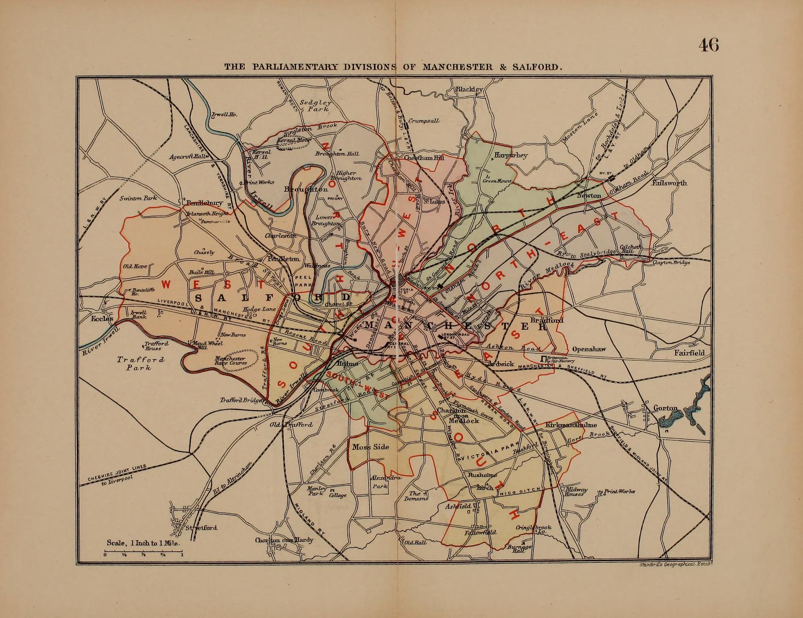
Manchester 1885 Stanford's Parliamentary Dictionary of England and Wales
The Turnpike Roads of Lancashire and Cheshire (Page 1) 1886 William Harrison
The Turnpike Roads of Lancashire and Cheshire (Page 2) 1886 William Harrison
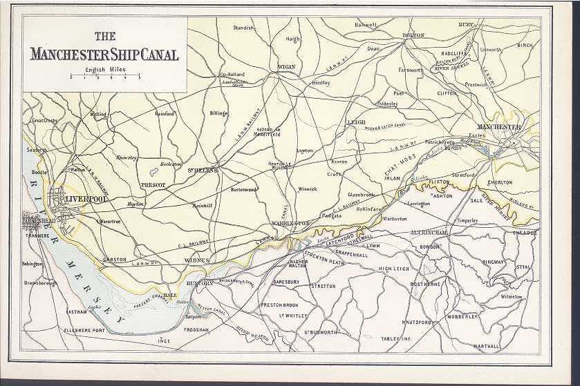
The Manchester Ship Canal 1890 W. Mackenzie
Preston 1891 Records of the Parish Church of Preston in Amounderness
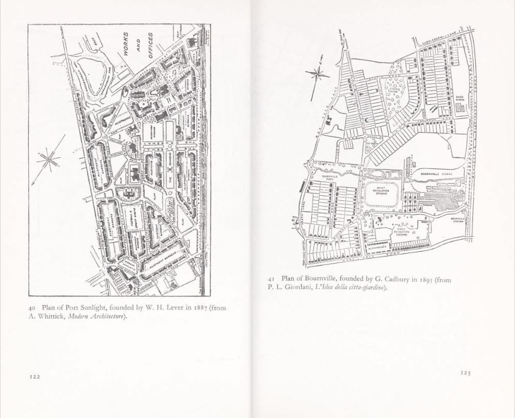
Plans of Port Sunlight and of Plan of Bournville 1895 P.I. Giordani in L'Idea della citi-gardin
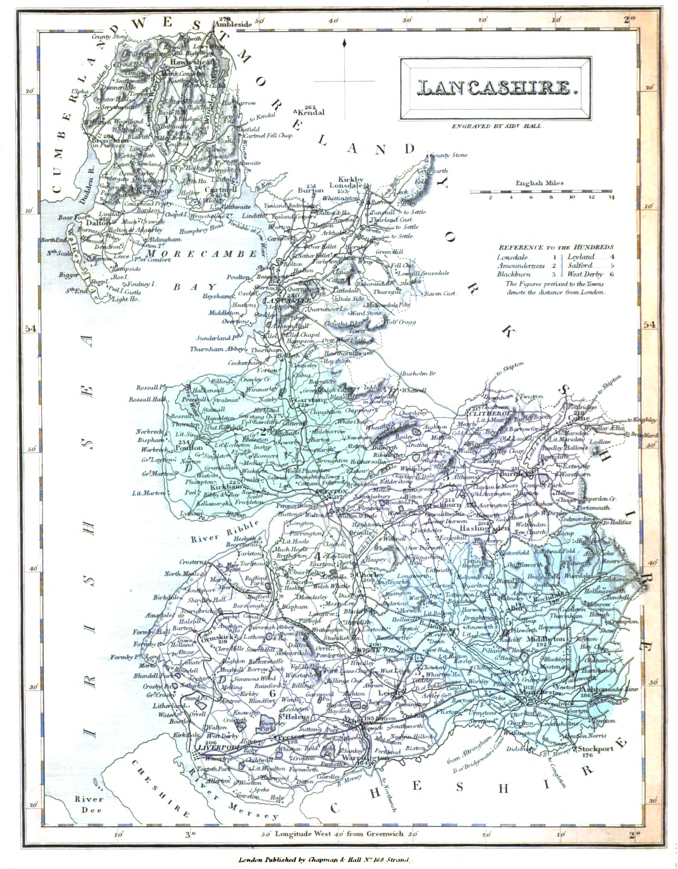
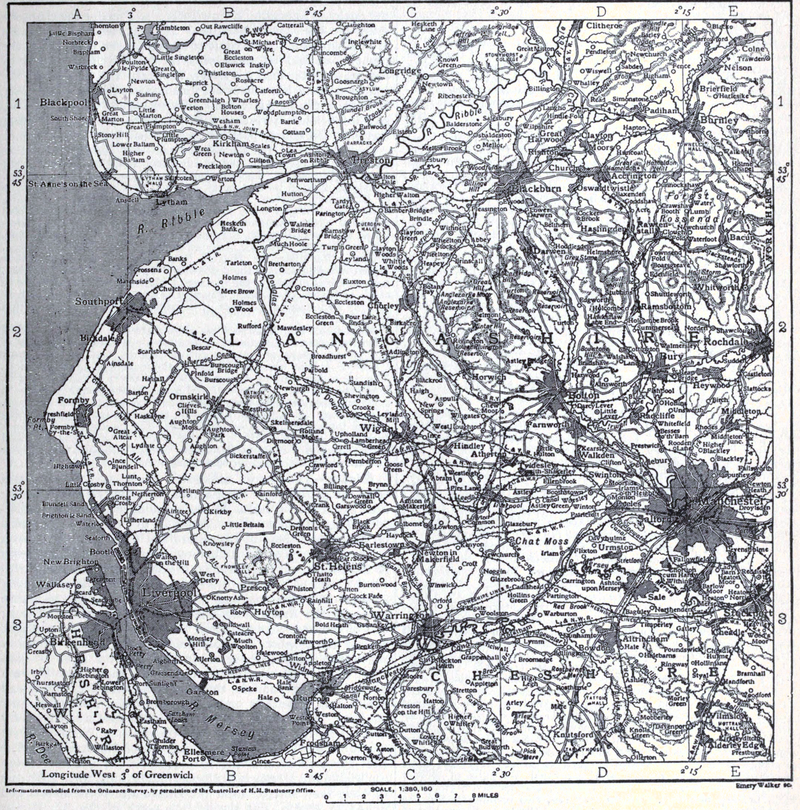
Lancashire 1911 Encyclopaedia Britannica
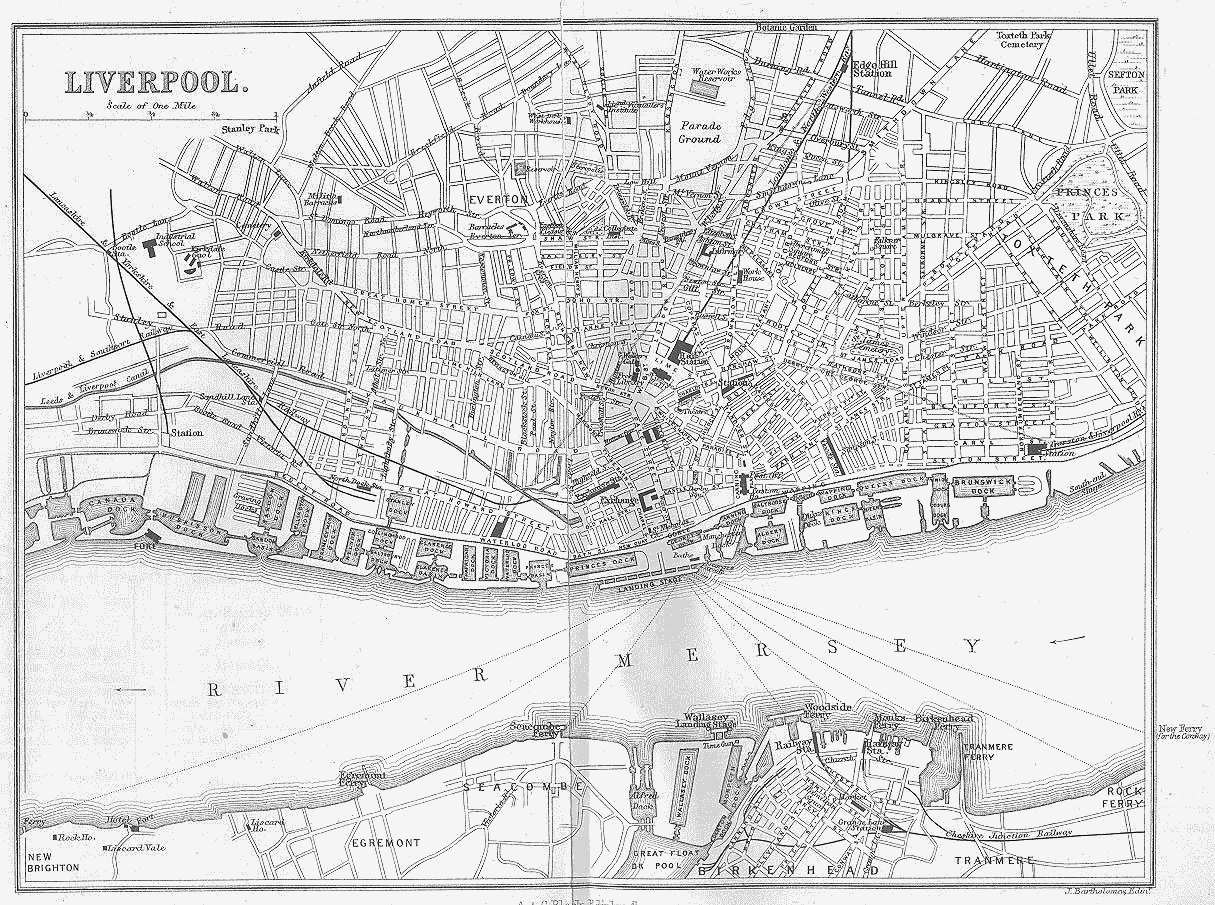
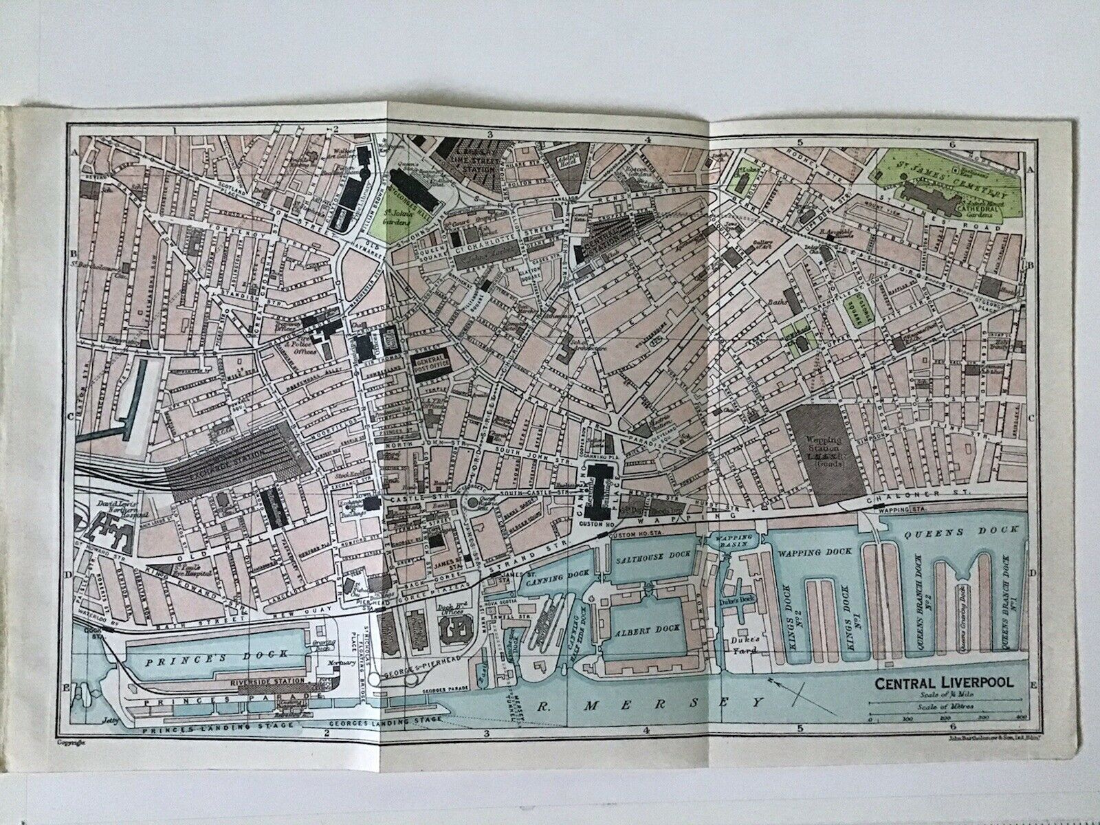
Plan of Central Liverpool 1922 John Bartholomew
.jpg)
.JPG)
.jpg)
(Image%20courtesy%20of%20The%20British%20Library%20King's%20Collection).jpg)
.jpg)
.jpg)
%20.jpg)
.jpg)
Thomas%20Badeslade%20and%20William%20Toms%20in%20Chorographia%20Britanniae.jpg)
.jpg)
.jpg)
%20.jpg)
%20George%20Perry.jpg)
%20George%20Perry.jpg)
%20George%20Perry%20.jpg)
.jpg)
.jpg)
%201809%20William%20Shakeshaft%20.jpg)
%201809%20William%20Shakeshaft.jpg)
.jpg)
%201832%20Robert%20Kearsley%20Dawson%20for%20the%20Boundary%20Commission.jpg)
%20(Image%20courtesy%20of%20www.davidrumsey.com)%20-%20Copy.jpg)
%20(Image%20courtesy%20of%20www.davidrumsey.com)%20-%20Copy.jpg)
%20%20.jpg)
.jpg)
.jpg)
%20manshipcanal_1860%20%20Mackenzie%20.jpg)
1886%20William%20Harrison.jpg)
1886%20William%20Harrison.jpg)
%201891.jpg)