| |
 References: |

To resize images: hold CTRL and use mouse scroll-wheel
|
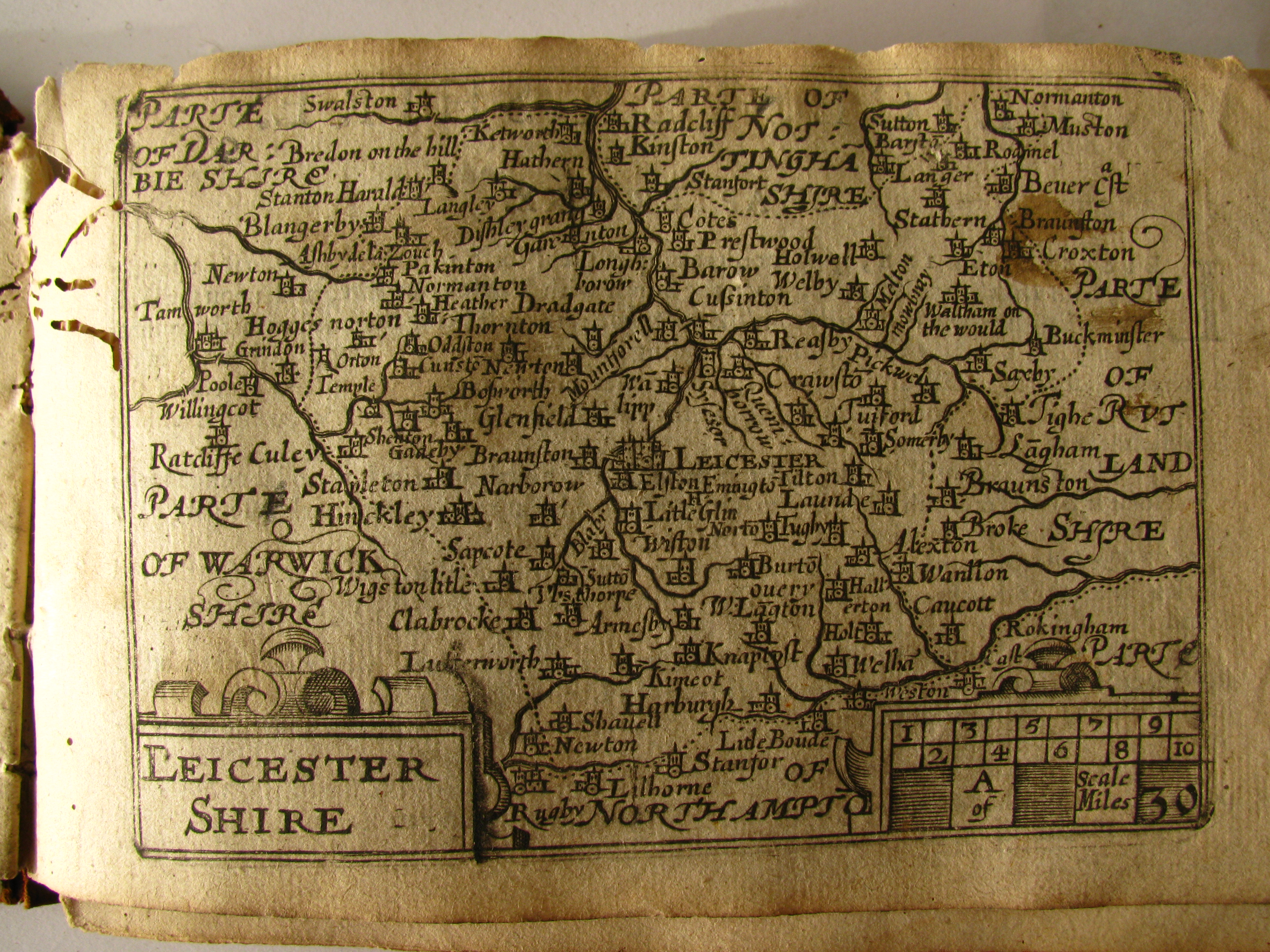
Leicestershire 1579 Christopher Saxton (Chubb p.3)
(Image Courtesy of Princeton Historic Map Collection)
Leicestershire 1605 Pieter van den Keere in his Atlas of the British Isles (Chubb LX)
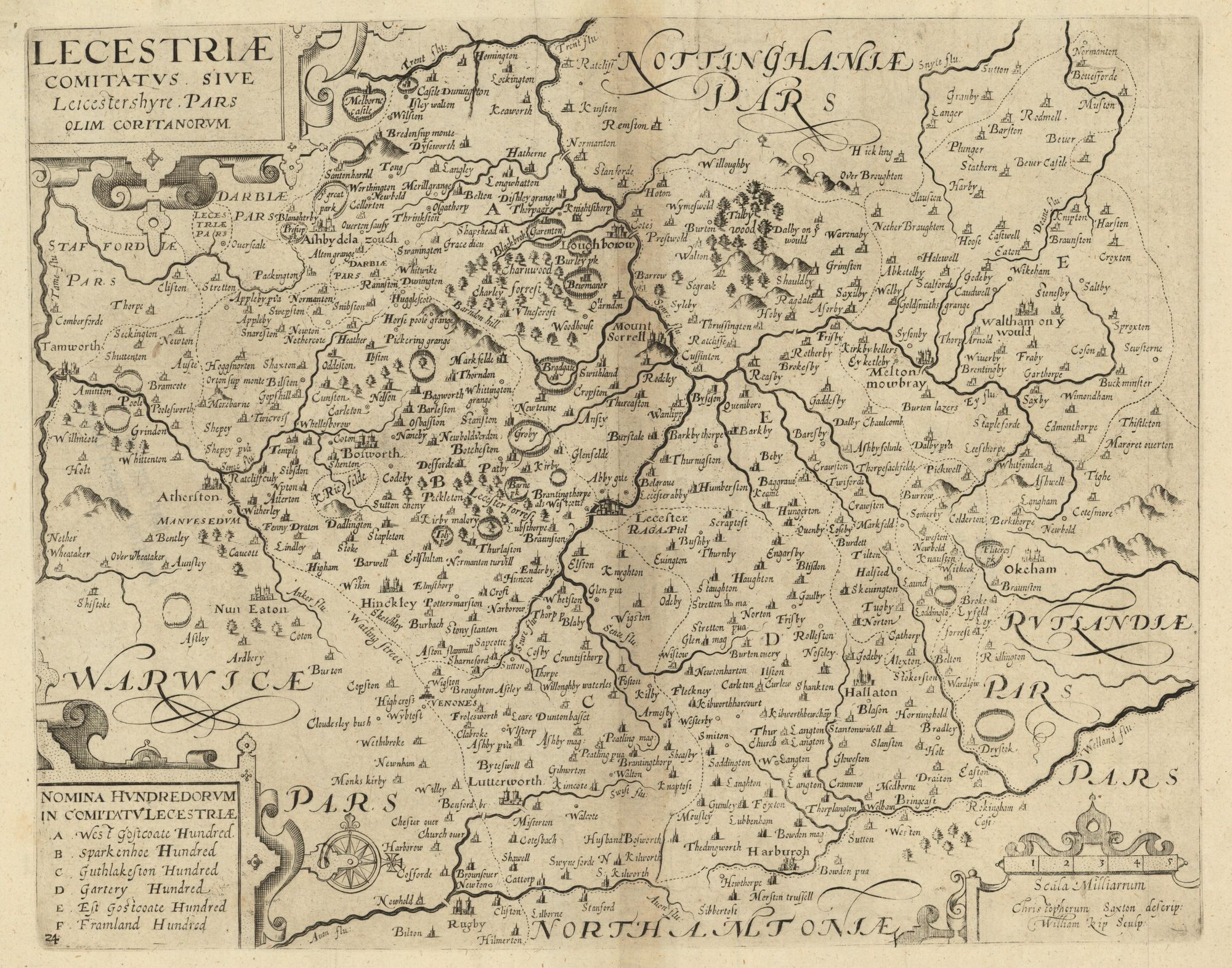
Leicestershire 1607 William Kip after Christopher Saxton for Camden's Britannia Image courtesy of Princeton Historic Map Collection
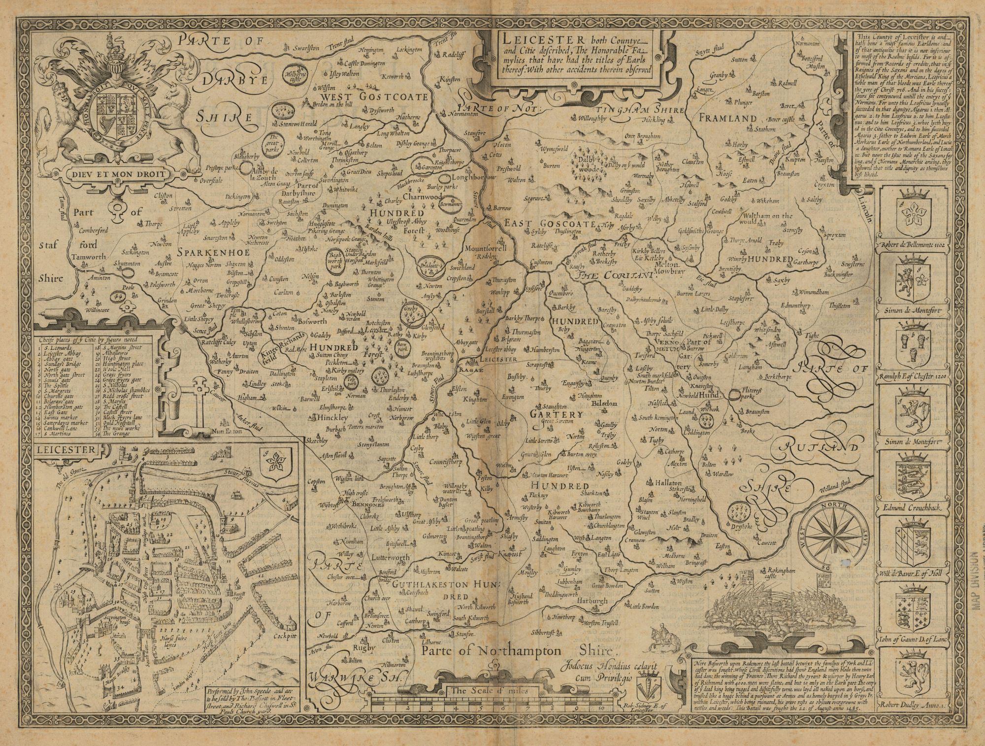
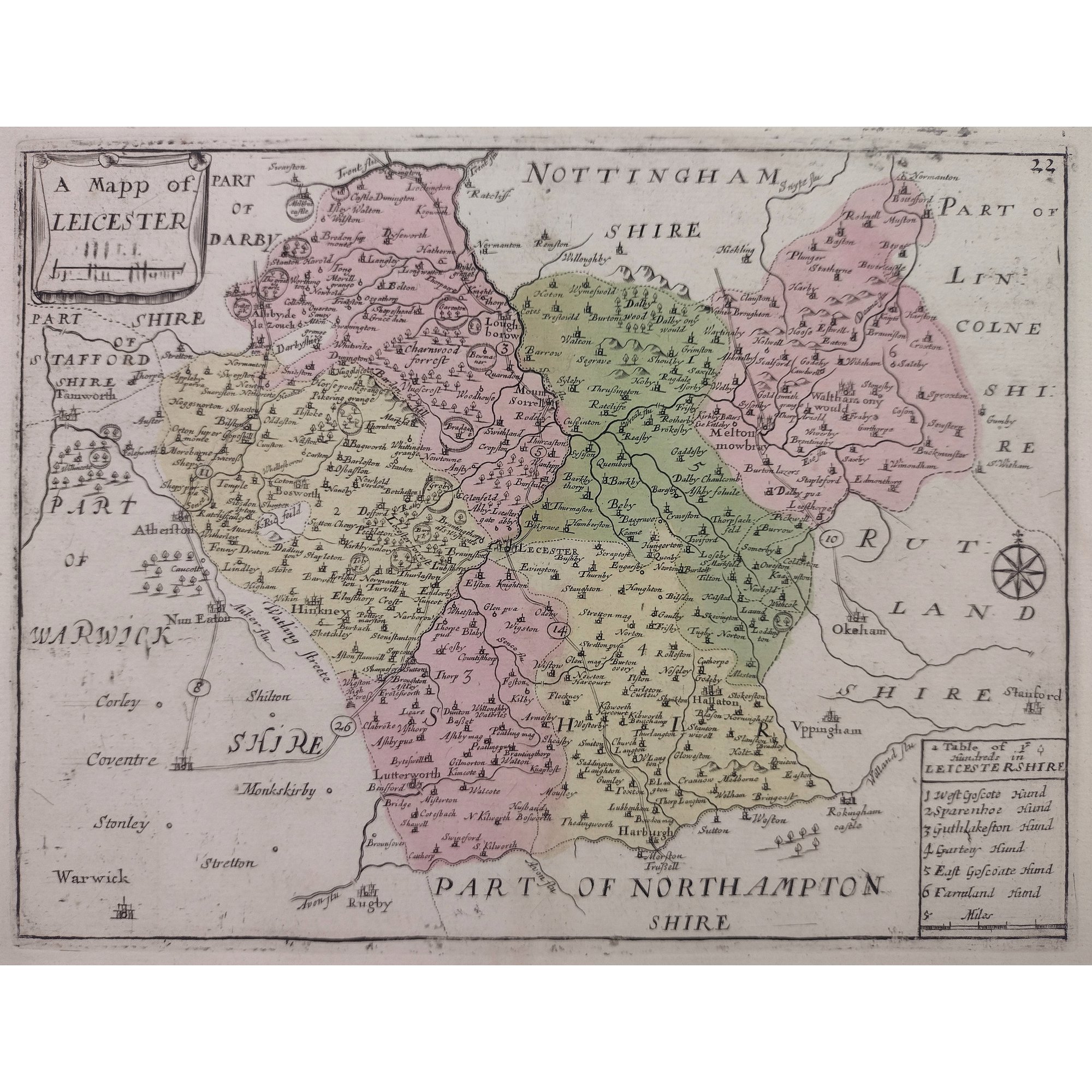
Leicestershire 1611 John Speed in The
Theatre of the Empire of Great Britaine (Basset & Chiswell edition)
(Chubb p.23 XXII) (Image courtesy of Princeton Historic Map Collection)
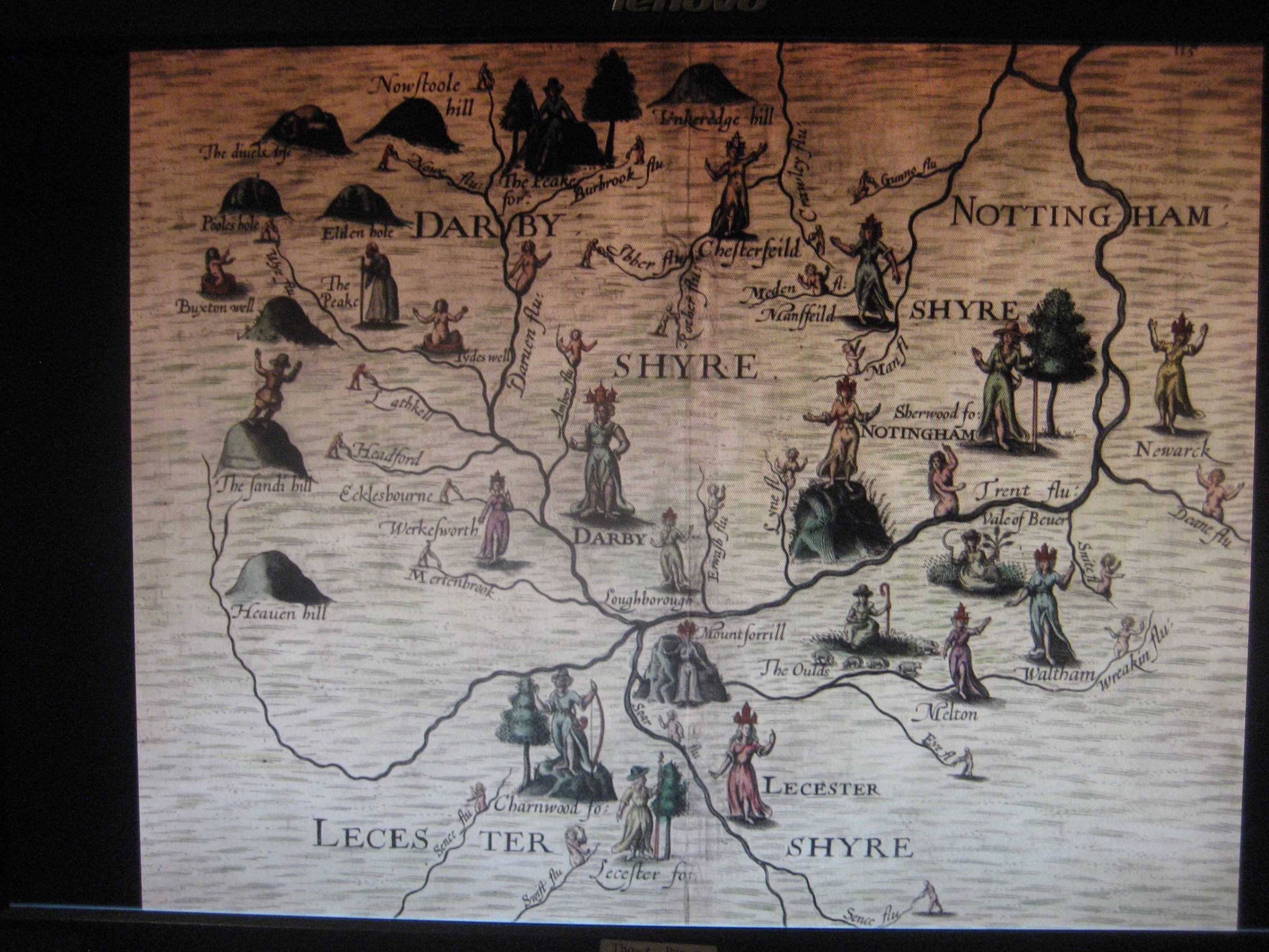
Leicestershire 1612 Michael Drayton to Illustrate his Polyolbion (Chubb p.45 XXXIII)
Leicestershire 1627 John Speed in The Theatre of the Empire of Great Britaine (Humble Edition)(Chubb p.35 XXV)
Leicestershire Rutland and Norfolk 1636 Henrik Hondius after Gerard Mercator
(Image courtesy of The British Library King's Collection)
Leicestershire 1646 Jan Jansson Atlas Van den Hagen (Chubb p.65 LXX) (Skelton)
Image courtesy of The British Library-King's Topographical Collection)
Leicestershire 1646 Joan Blaeu (Chubb p.57 LIX) (Skelton)
(Image Courtesy of the Princeton Historic Map Collection
Leicestershire1662 John Speed in A Prospect of the Most Famous Parts of the World (Roger Rea Edition)
(Image courtesy of The British Library King's Collection Maps K.Top)
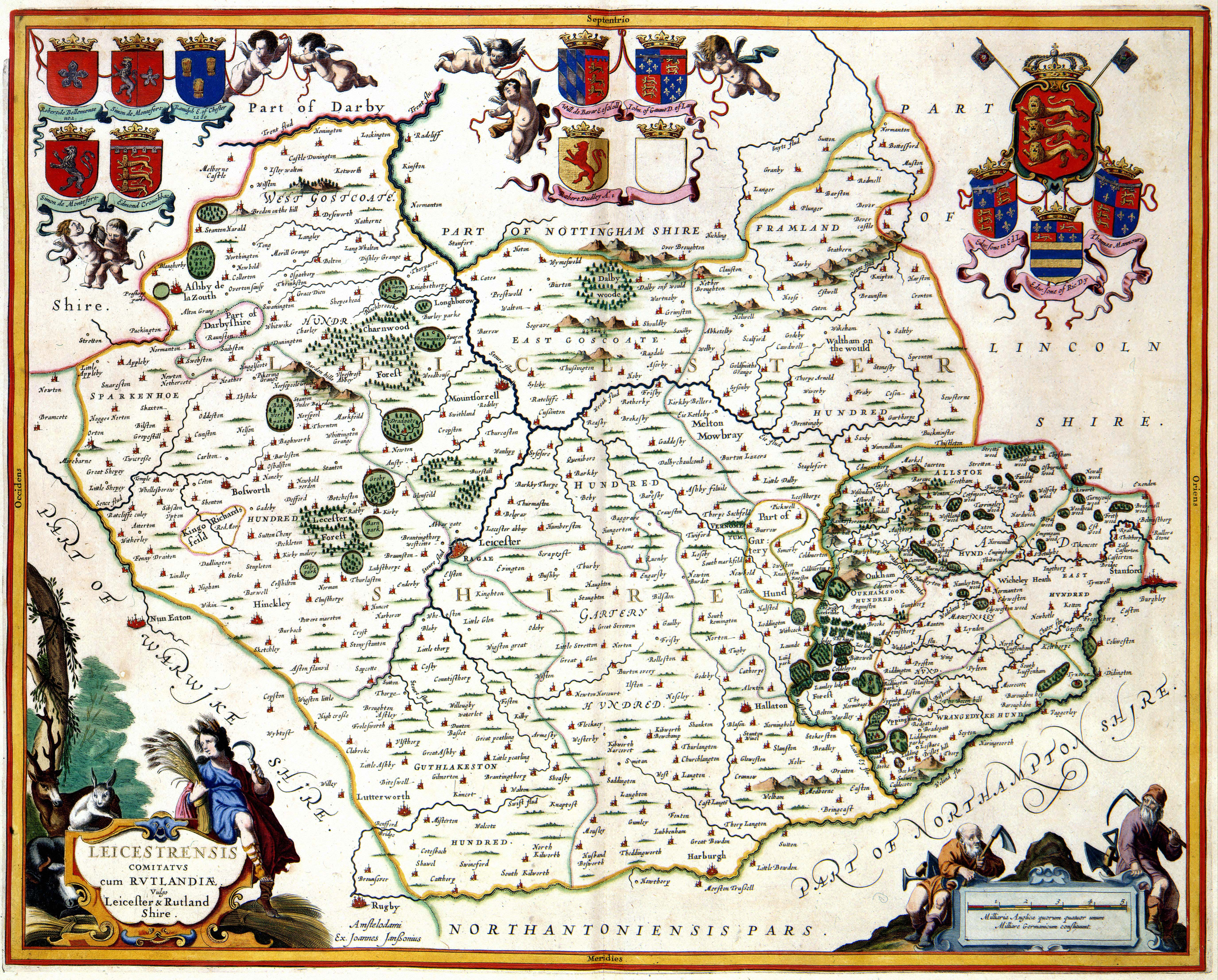
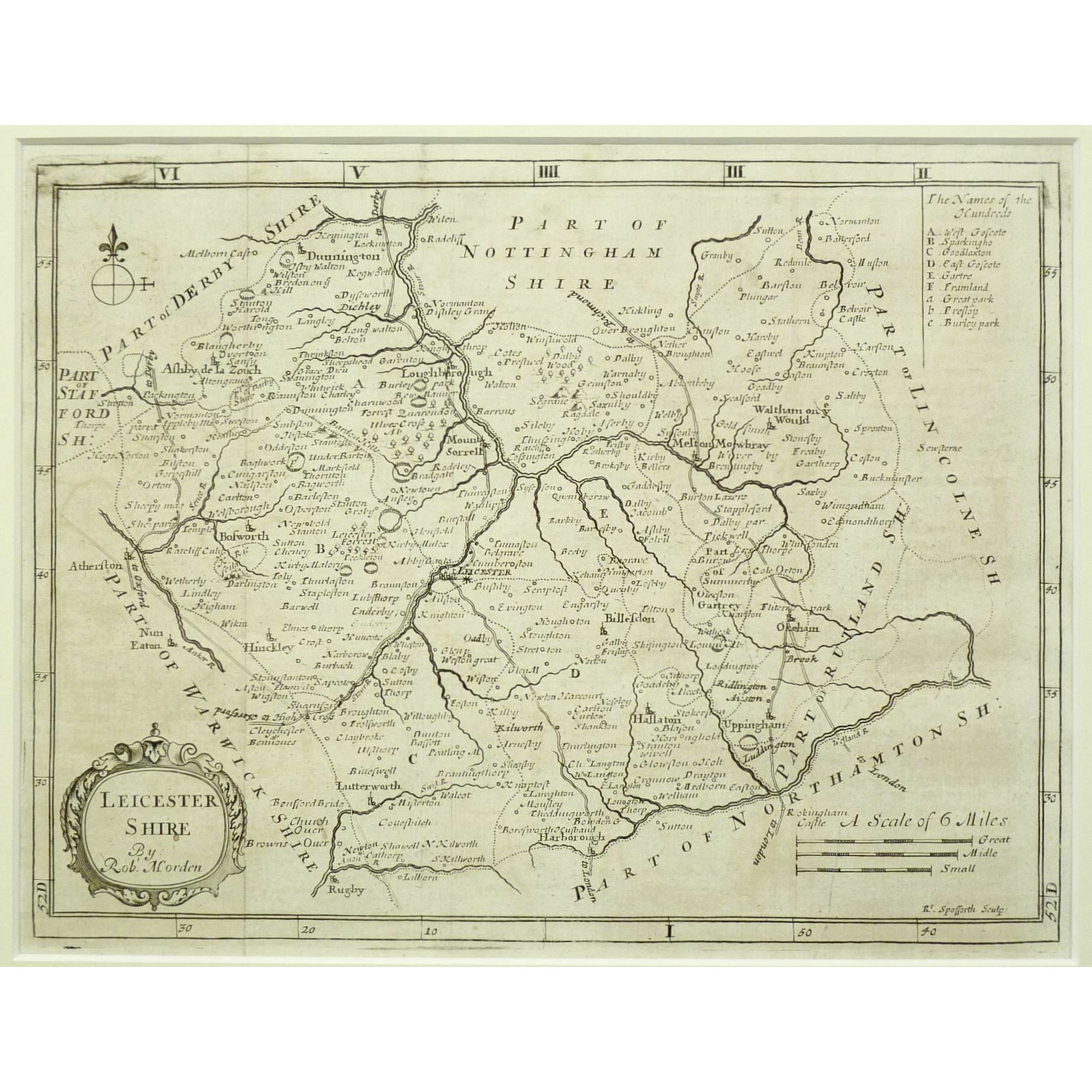
Leicester Shire 1690 Robt. Morden in Camden's Britannia (Chubb p.93 CXIII)
(Image courtesy of Yale University Library)
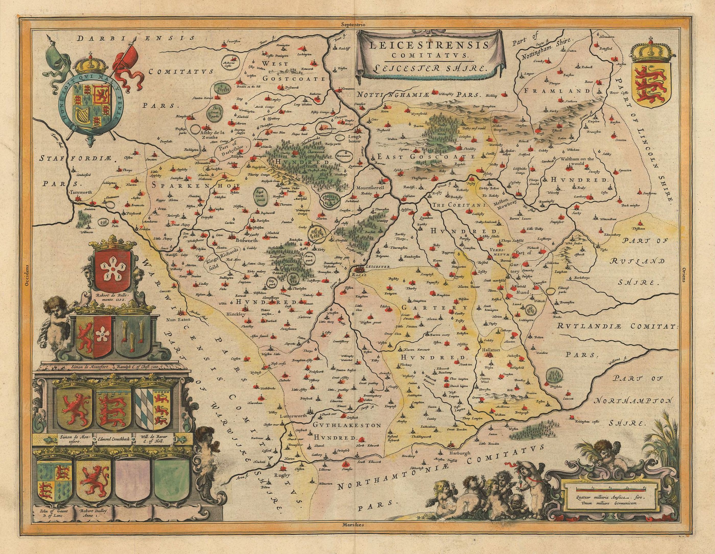
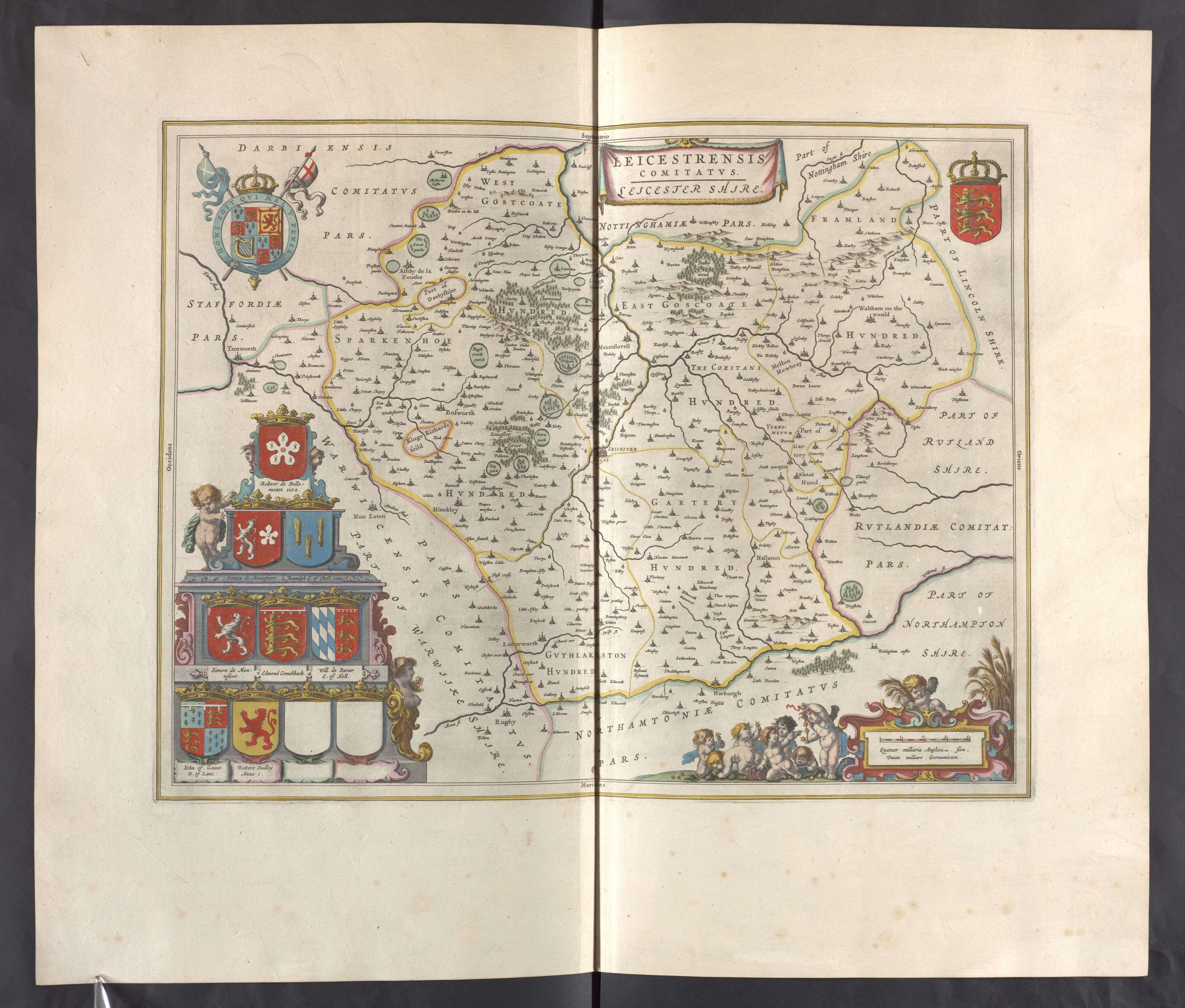
Leicestershire 1667 Joan Blaeu in Le Grand Atlas volume 5 (Skelton)
Leicestershire 1711 Robert Morden for Atlas Geographus (Image courtesy of The British Library
Leicestershire and Rutland 1715 Jan Jansson. Published after Jansson's death: with minor alteration: by Gerardum Valk & Petrum Shenk (Chubb p.74 LXXXIX)
(Image courtesy of The British Library via Flickr )
Leicester 1716 Thomas Taylor (Image courtesy of The British Library)
Leicestershire 1715 (01) Richard Blome in Thomas Taylor England Exactly Described (The same maps as in Blome's Speed's Maps Epitomis'd (Chubb p.107 CXXXVI) (Image courtesy of Wikimedia)
Leicestershire 1715 (02) Richard Blome in Thomas Taylor's England Exactly Described (Chubb p.107 CXXXVI) (Image courtesy of Wikimedia)
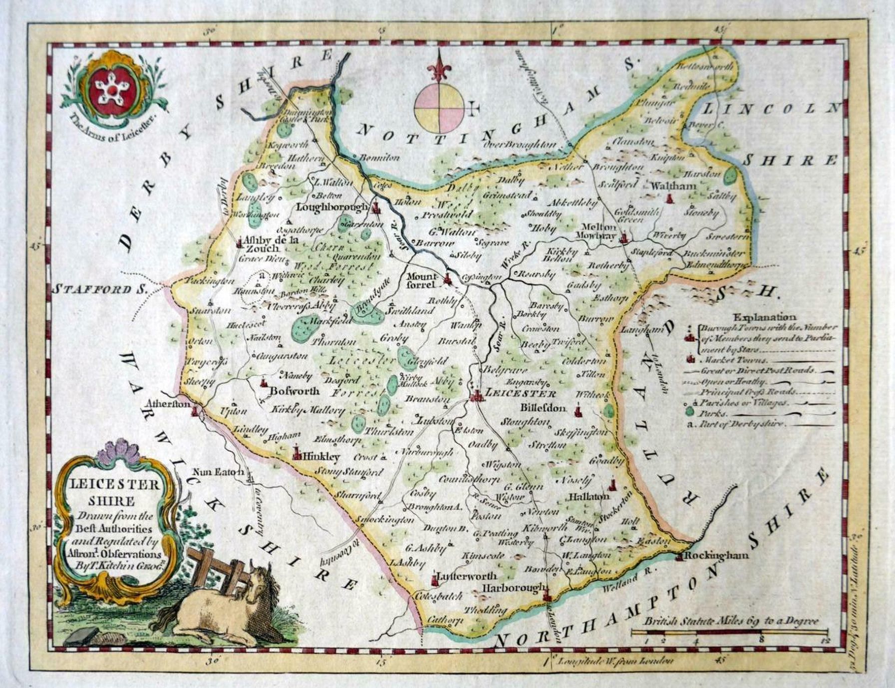
Leicestershire 1720 Emanuel Bowen in Britannia Depicta (Chubb p.117 CXLVII )
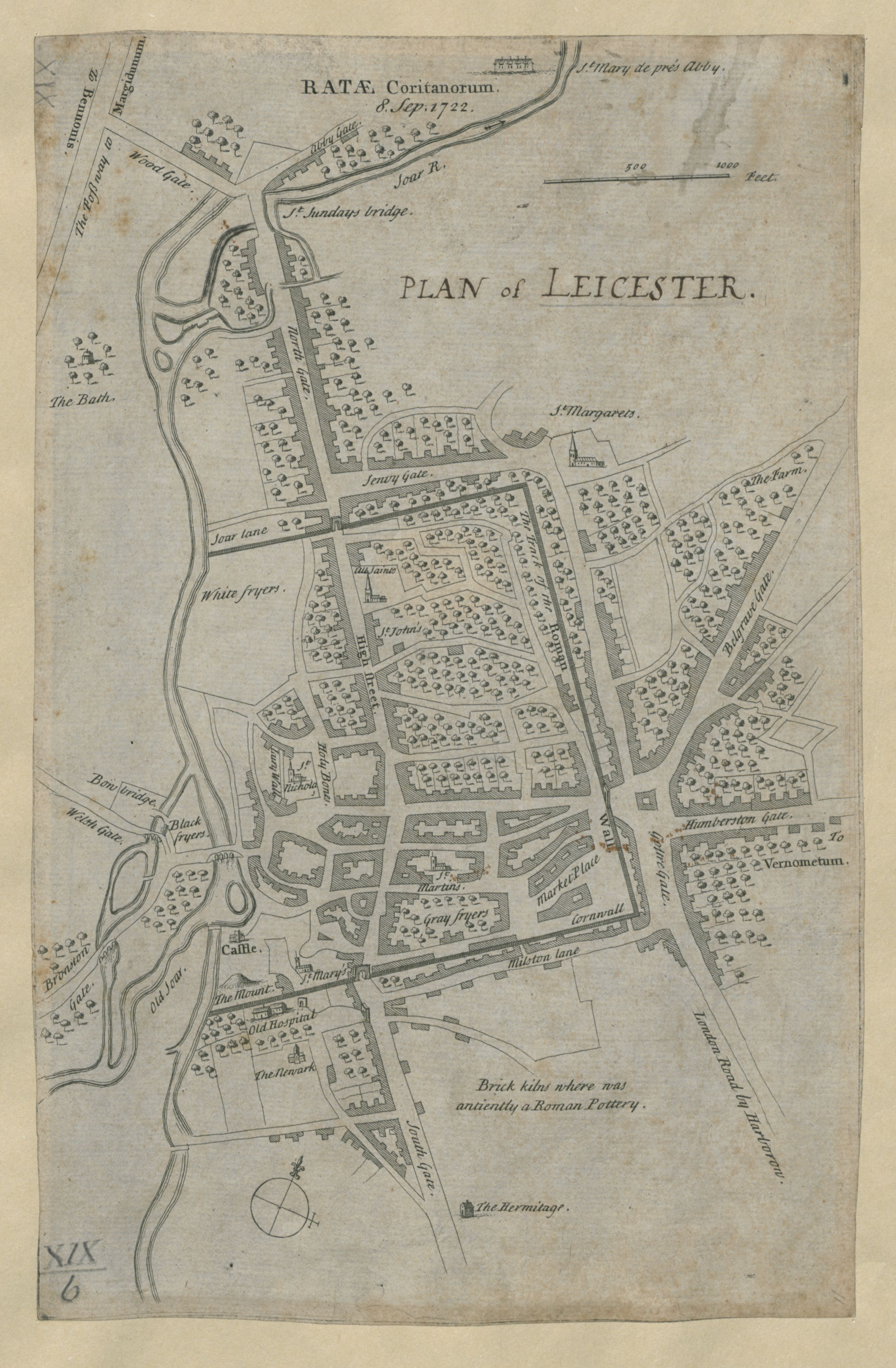
Plan of Leicester 1722 author nk (Image courtesy of The British Library Maps K.TOP
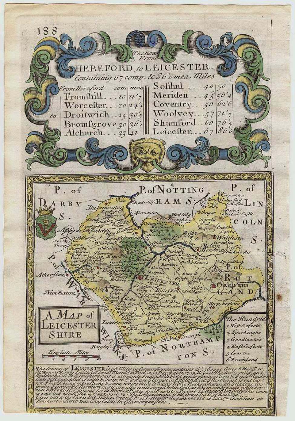
Leicestershire 1742 (First State) Thomas Badeslade and William Toms in
Chorographia Britanniae
Leicestershire 1742 (Second State) Thomas Badeslade and William Toms (Chubb p.133 CLXX) )
Leicestershire 1744 J.Cowley in Robert Dodsley's Geography of England (Chubb p.139 CLXXXI)
Leicestershire 1753 Jean Rocque in his Small British Atlas (Chubb p.172 CCVII)
An Accurate Map of the Counties of Leicester and Rutland 1760 Emanuel Bowen for The Large English Atlas
Leicestershire 1770 Thomas Kitchin in Kitchin's English Atlas (Chubb p.199 CCXXXVIII
Leicestershire 1779 (top left ) John Prior
Leicestershire 1779 (bottom left) John Prior
Leicestershire 1779 (top right) John Prior
Leicestershire 1779 (bottom right) JohnPrior
(Image courtesy of The British Library-King's Topographical Collection)
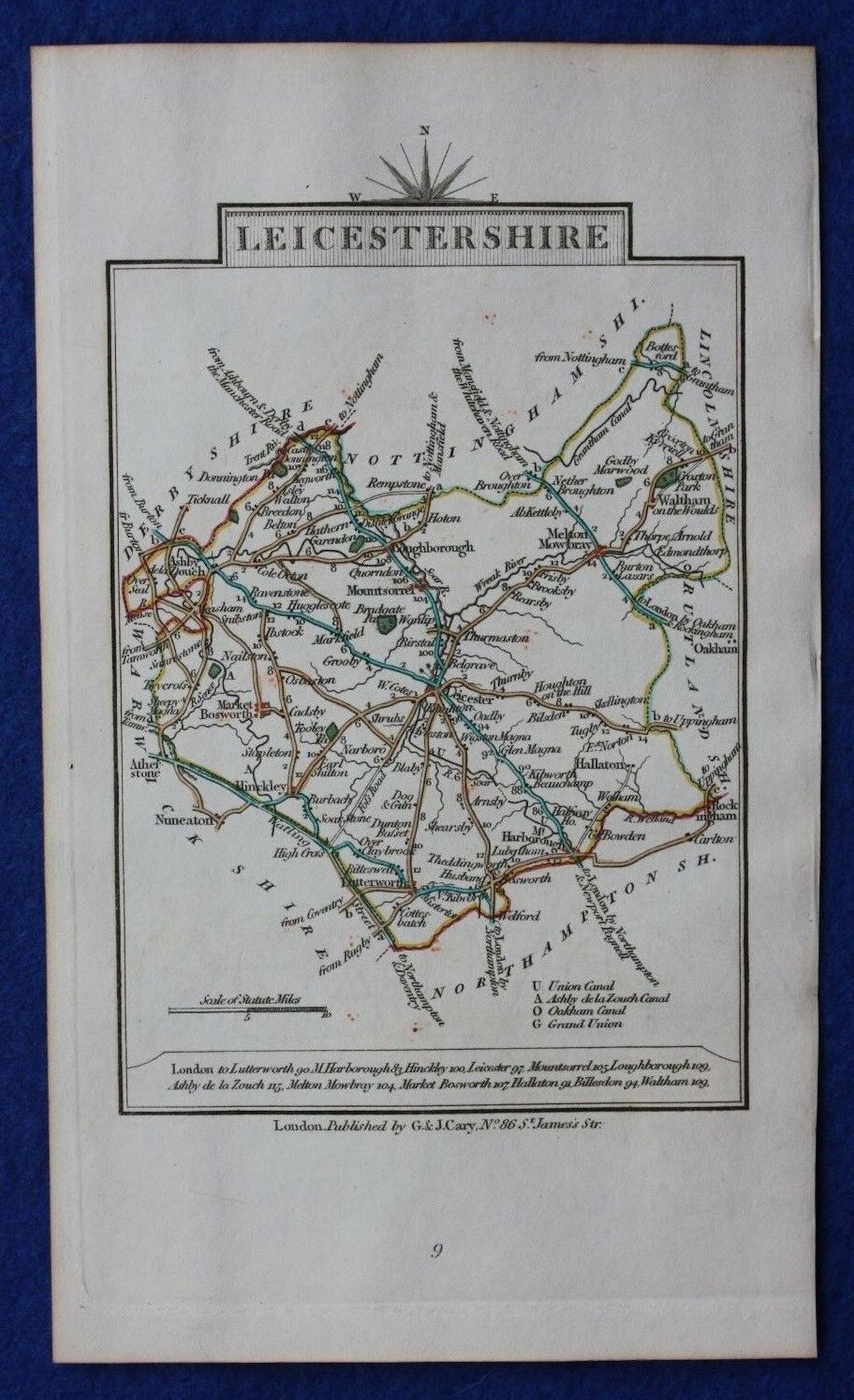
Leicestershire 1790 John Cary In Cary's Travellers' Companion (Chubb p.220 CCLXXIII)
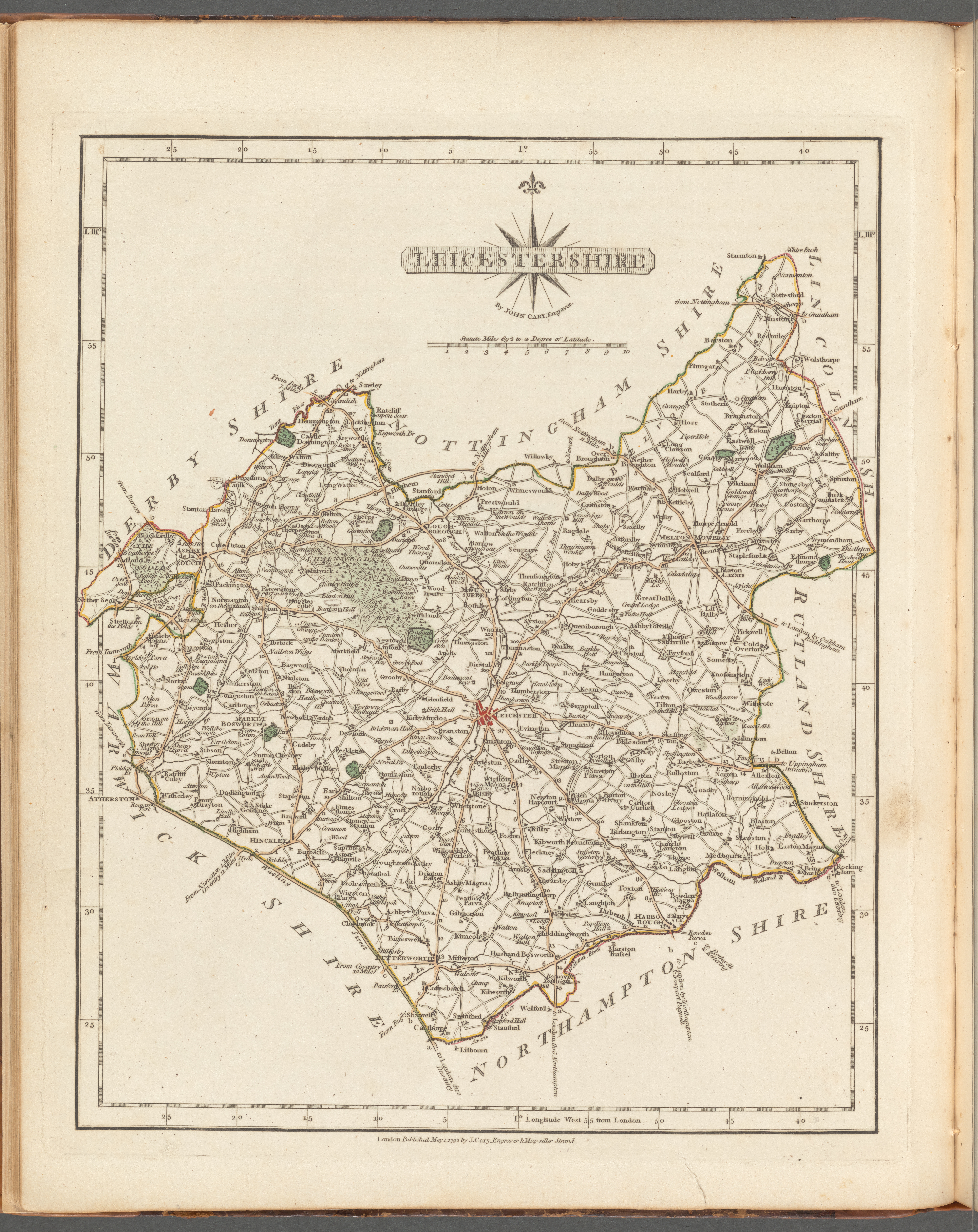
Leicestershire 1793 John Cary in his New and Correct English Atlas (Chubb p.214 CCLXI)
(Image courtesy of New York Library Digital Collections)
Leicestershire 1804 William Green in The Picture of England
(Image courtesy of The British Library Maps K.TOP
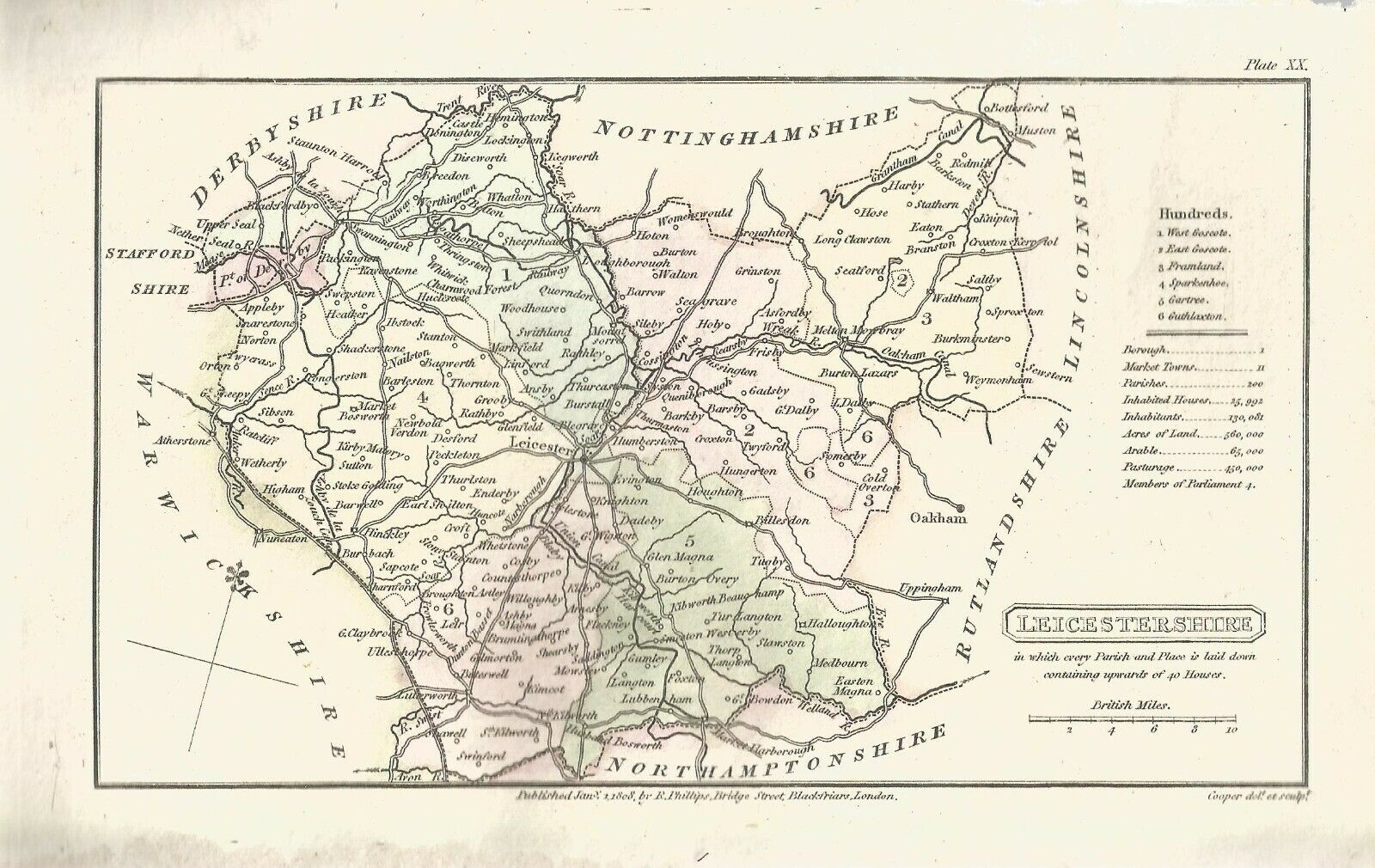
Leicestershire 1808 Benjamin Pitts Capper for Richard Phillips' A Topographical Dictionary of England and Wales
(Chubb p.245 CCCXXVII)
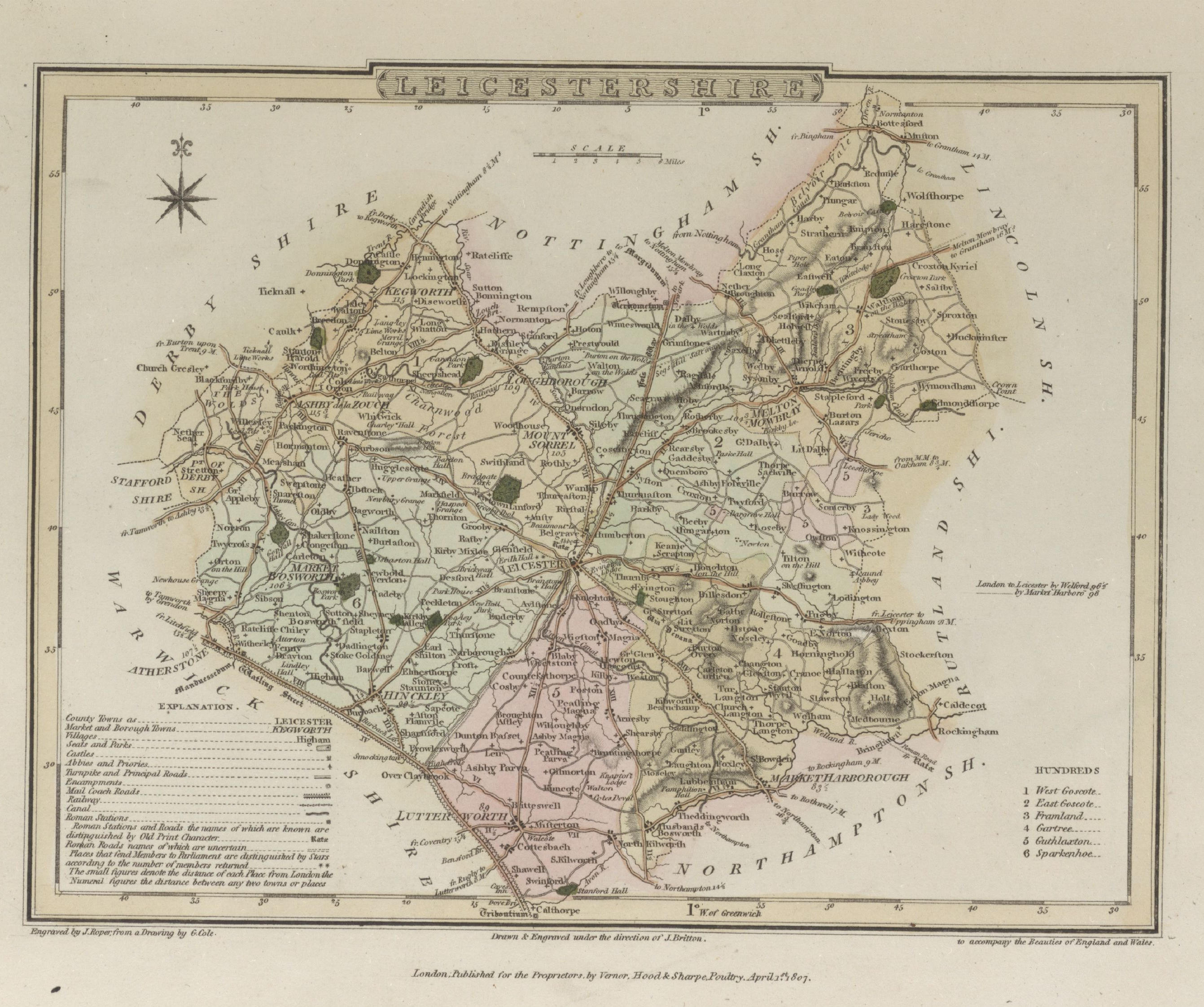
Leicestershire 1808 George Cole and John Roper in their British Atlas (Chubb p.249 CCCXXXIX)
(Image courtesy of The British Library - King's Topographical Collection)
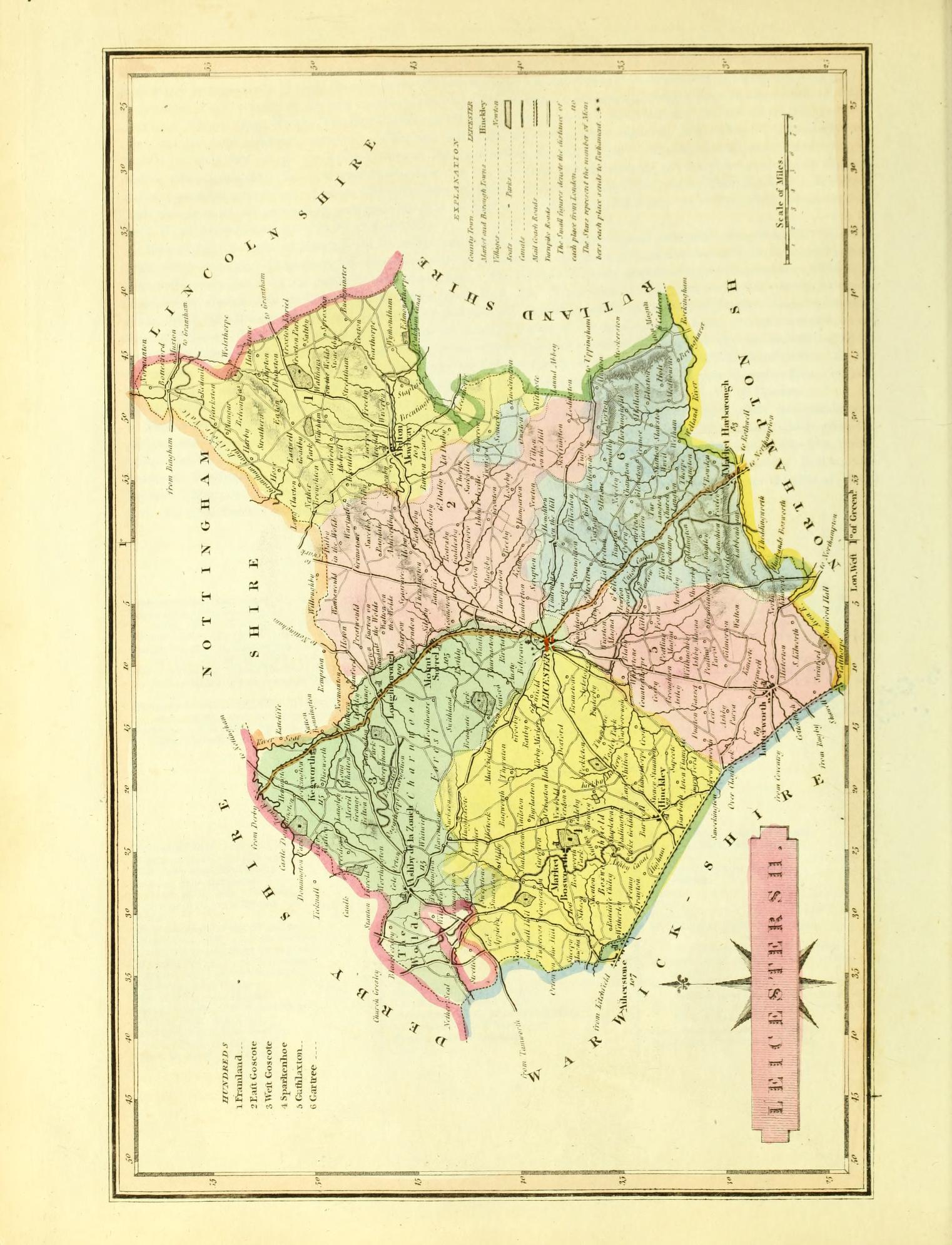
Leicestershire 1819 Joseph Ellis in Ellis's New and Correct Atlas (Chubb p.266 CCCLXIII)
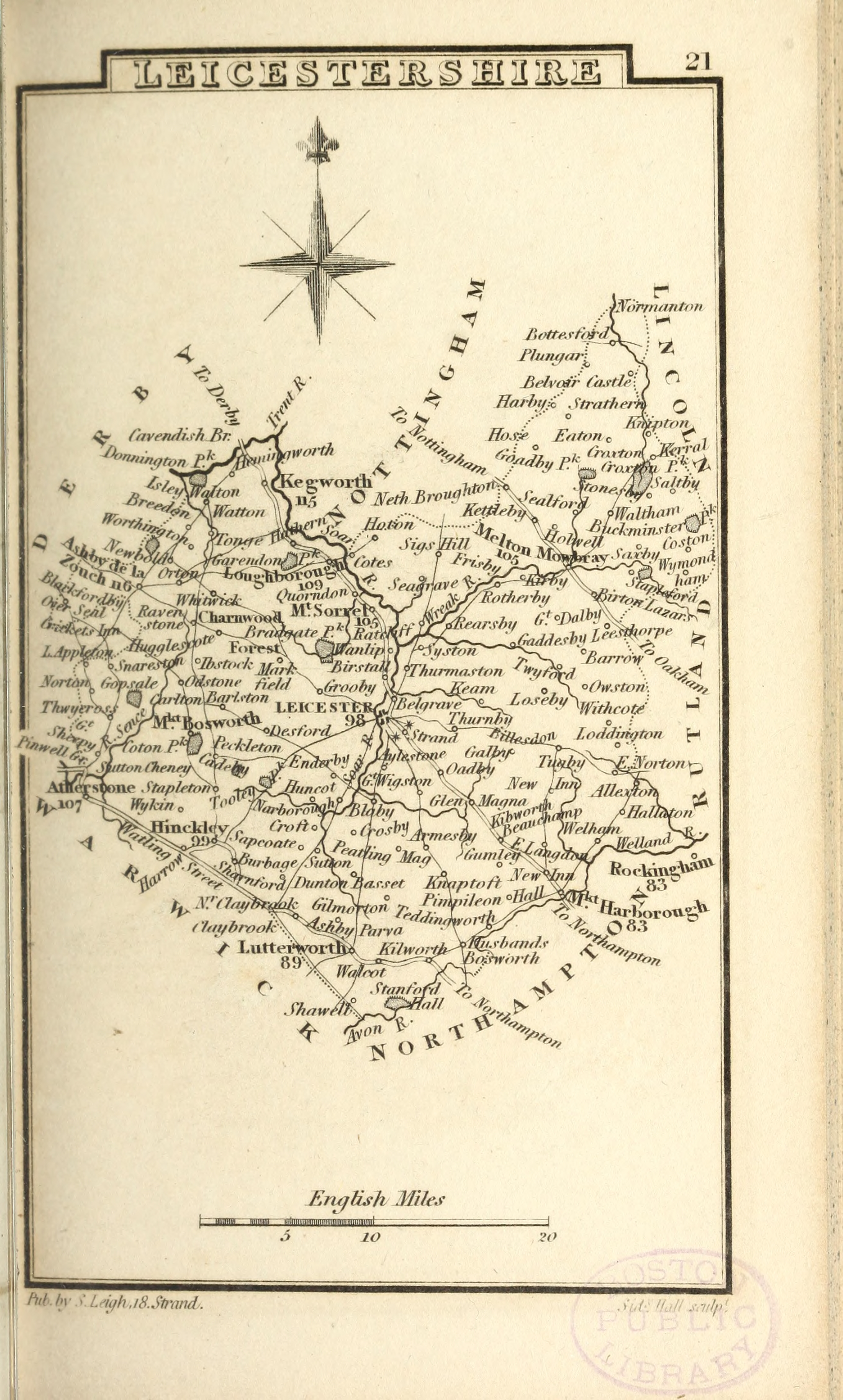
Leicestershire 1822 Samuel Leigh in Leighs New Pocket Atlas (Chubb p.273 CCCLXXIV)
Leicestershire 1824 George Carrington Gray in Gray's Book of Roads (Chubb p.281 CCCXCII)
Leicester town Plan 1832 Robert Kearsley Dawson for Plans of the Cities and Boroughs of England and Wales
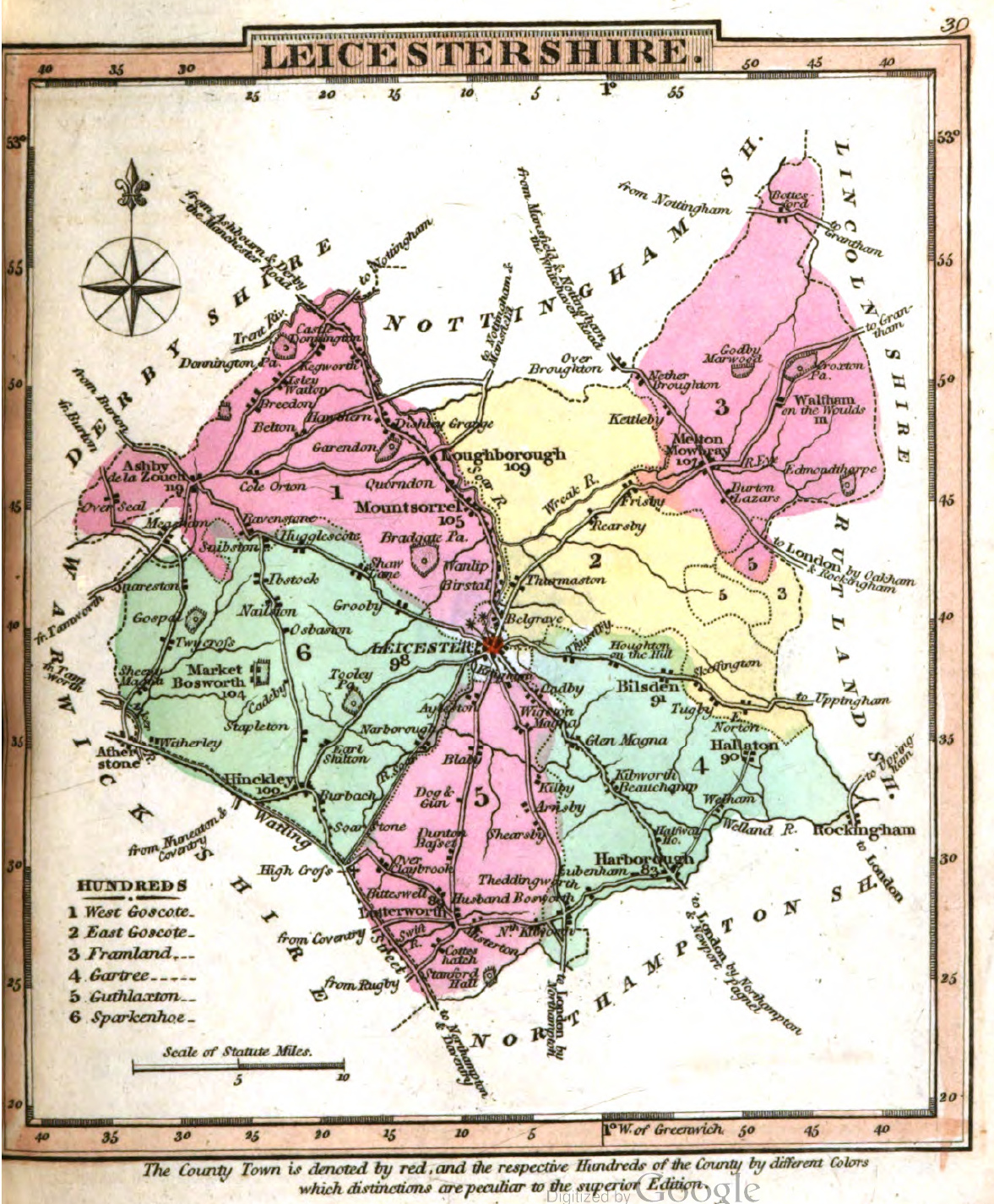
Leicestershire 1834 C. & J,Greenwood in Atlas of the Counties of England (Chubb CCCCLVIIl)
(Image courtesy of www.davidrumsey.com)
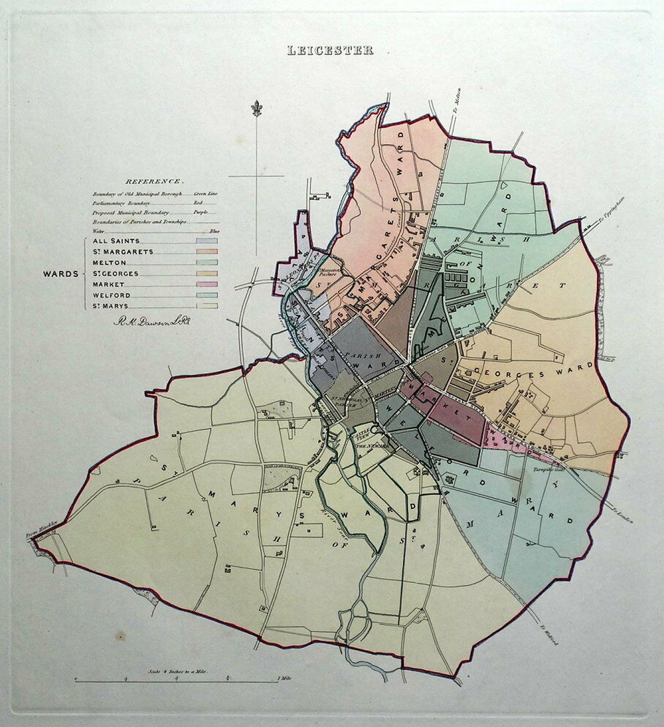
Leicester Wards 1835 Robert Kearsely Dawson for The Boundaries Commission (Chubb pp.297 CCCCXXXIX)
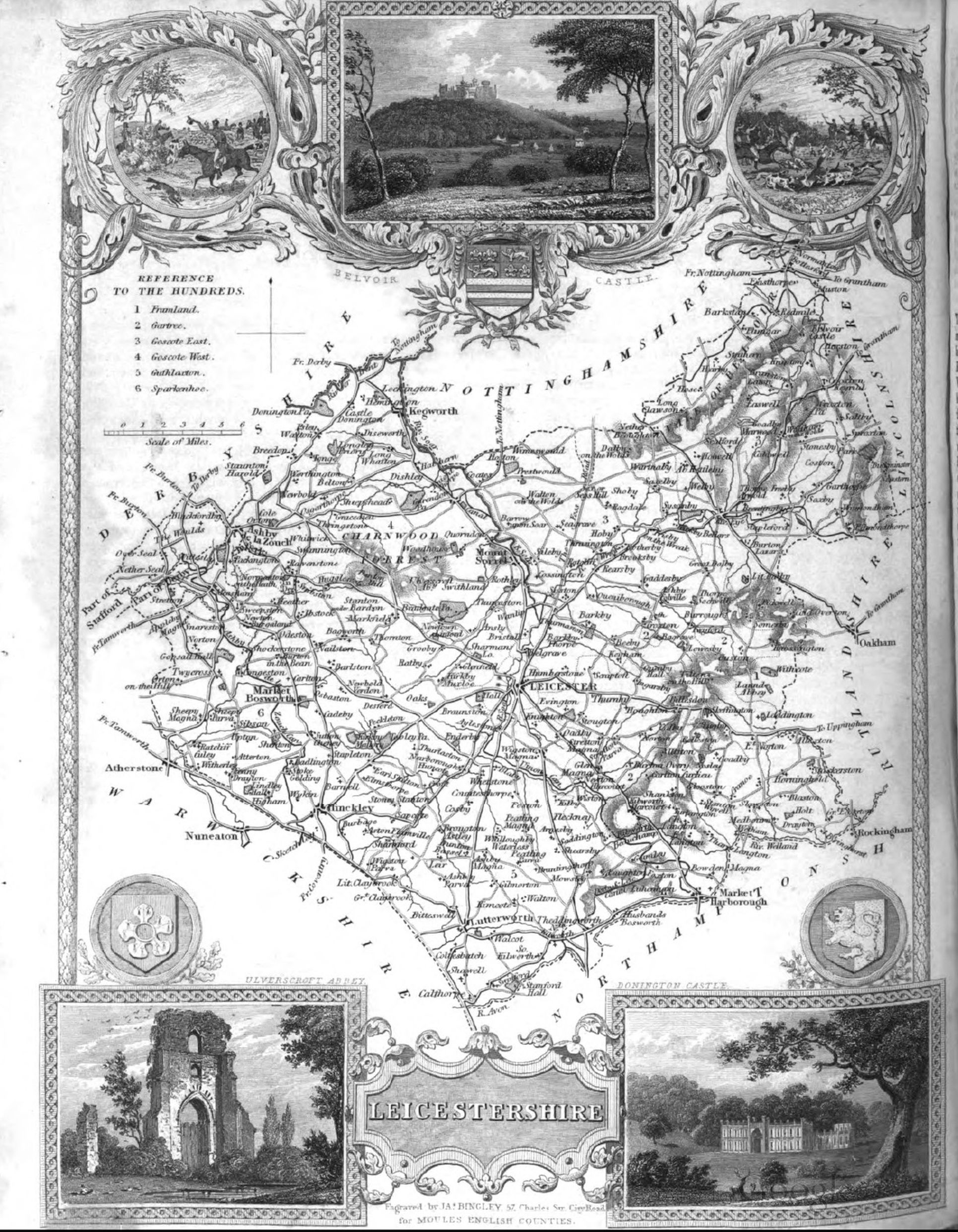
Leicestershire 1837 Thomas Moule in The English Counties Delineated (Chubb CCCCLXXll)
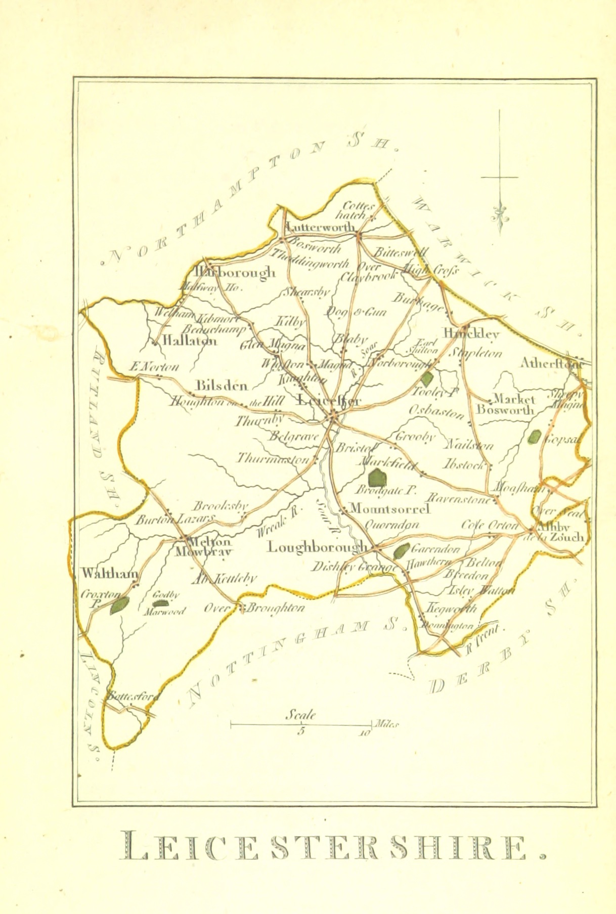
Leicestershire 1842 James Pigot in A Pocket Topography and Gazetteer of England (Chubb p.321 CCCCLXII)
(Image courtesy of Wikimedia )
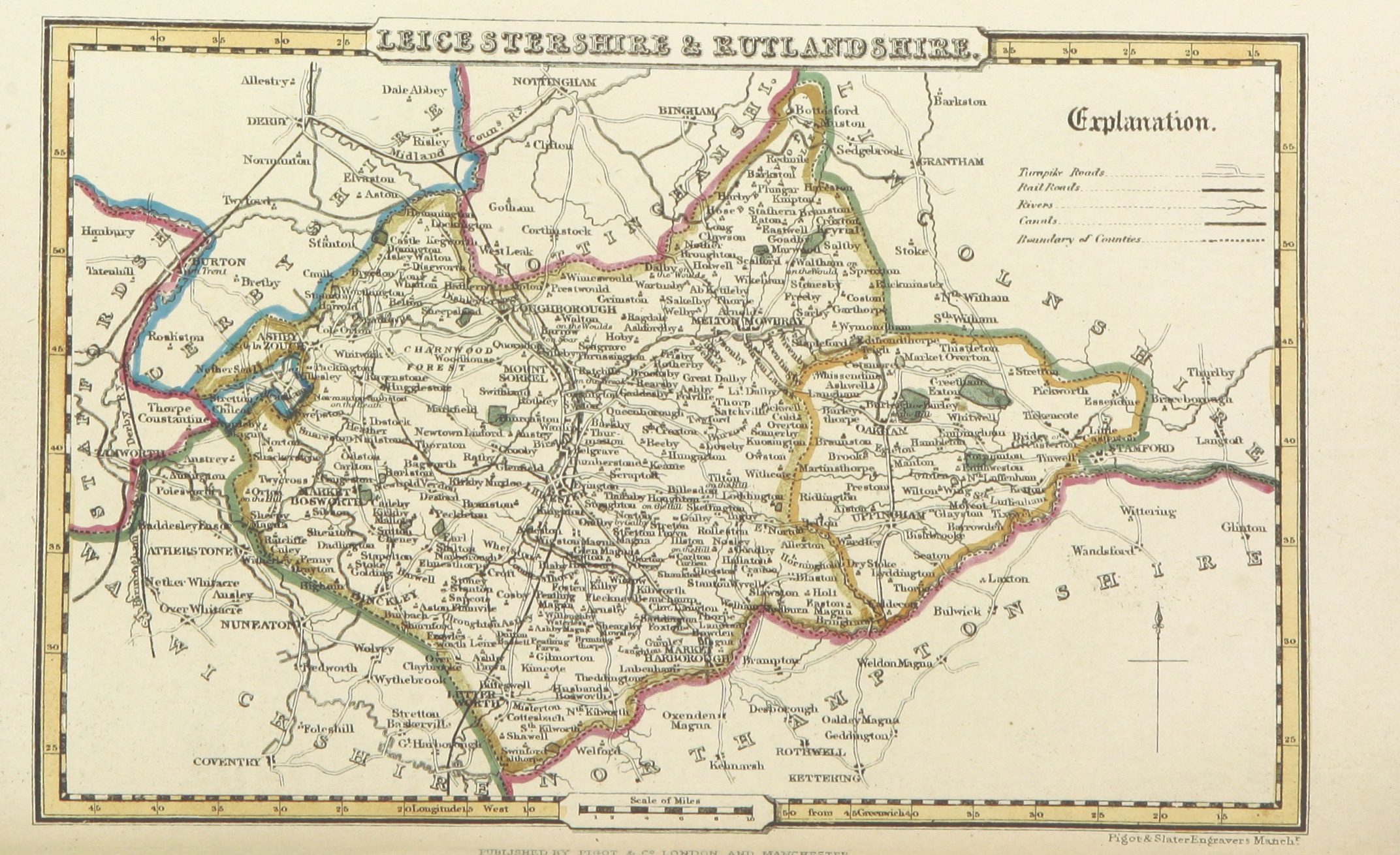
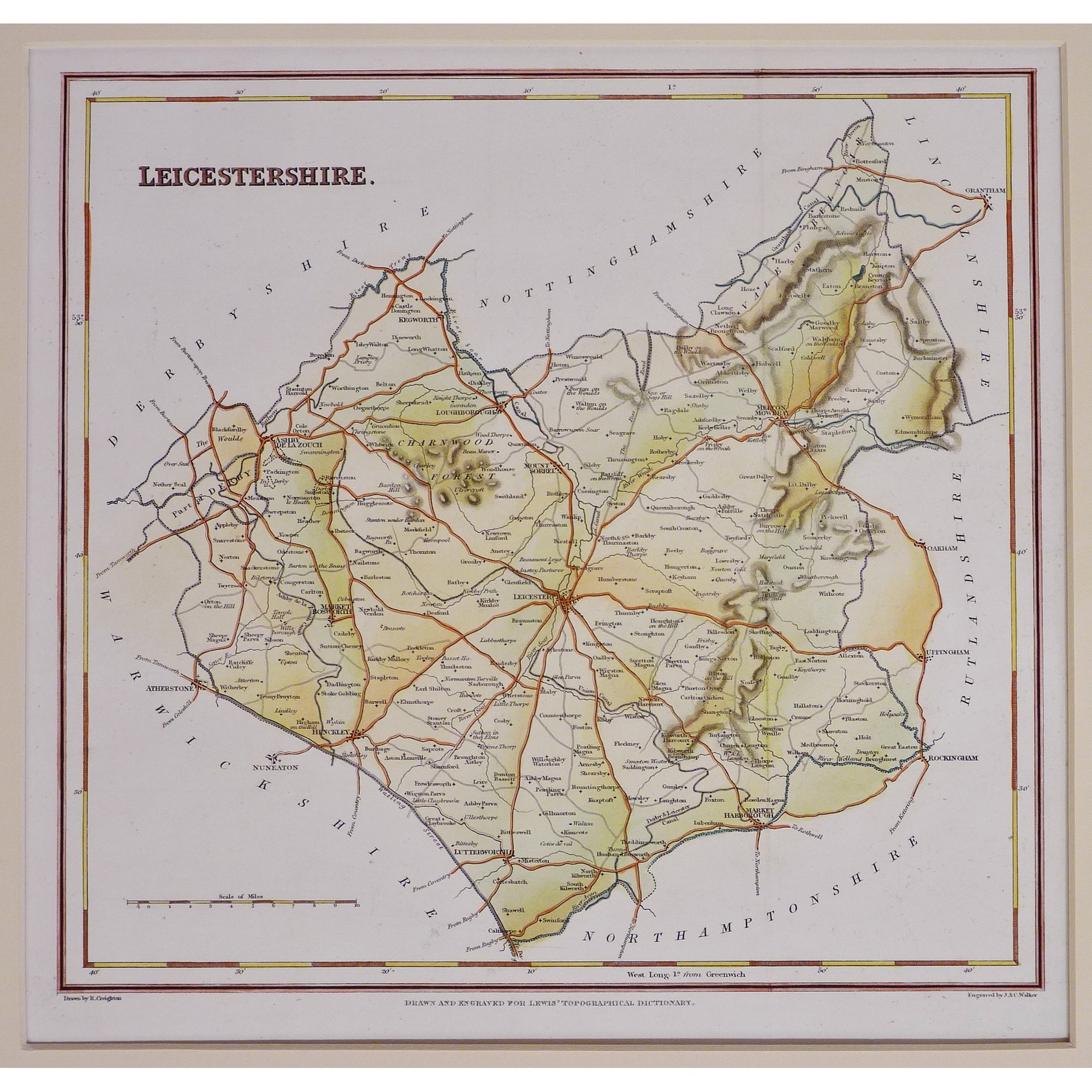
Leicestershire 1843 Robert Creighton for Lewis's Topographical Dictionary
Leicestershire 1845 Reverend Samuel Clarke for The Travels of Reuben Ramble (Chubb p.345 DXVII)
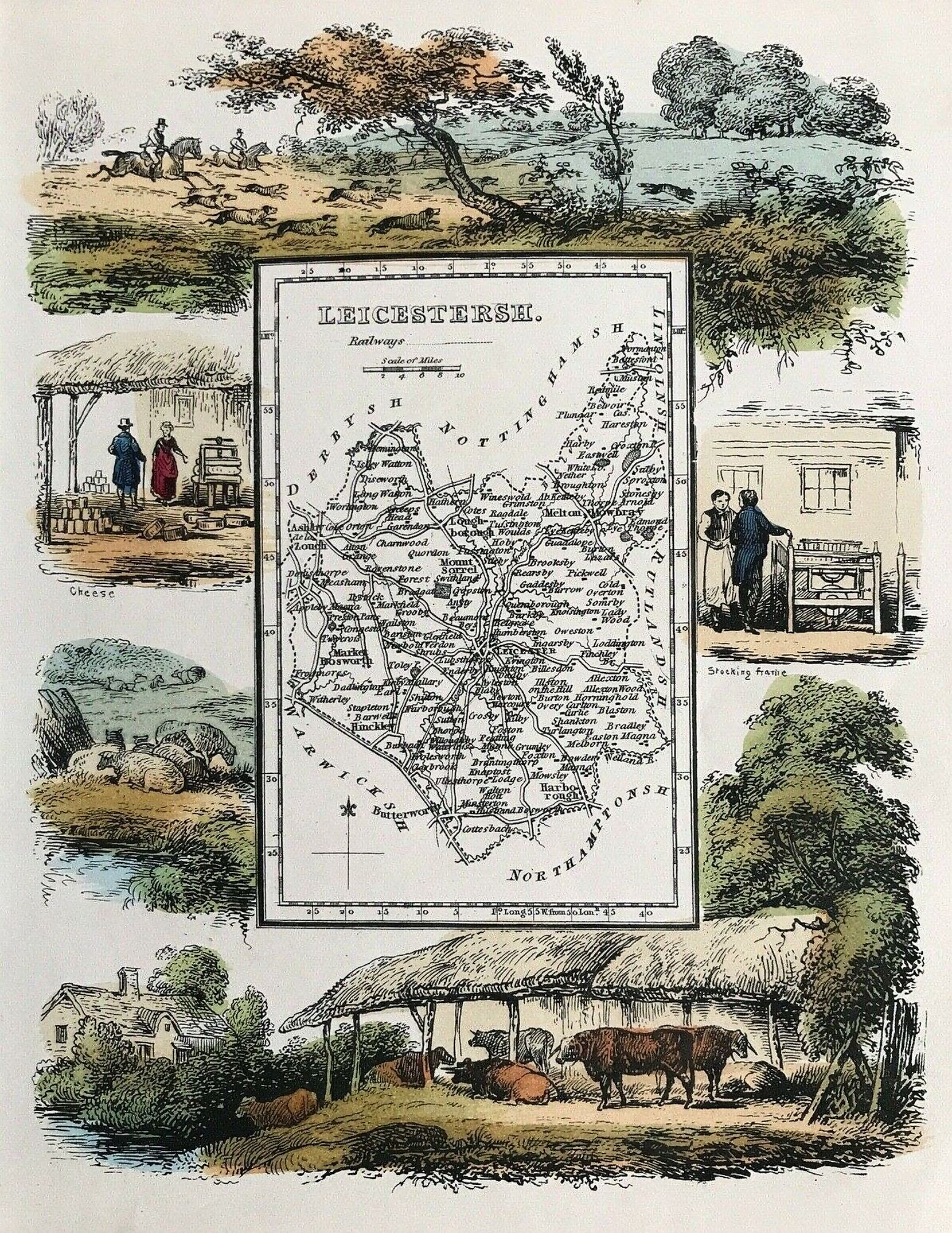
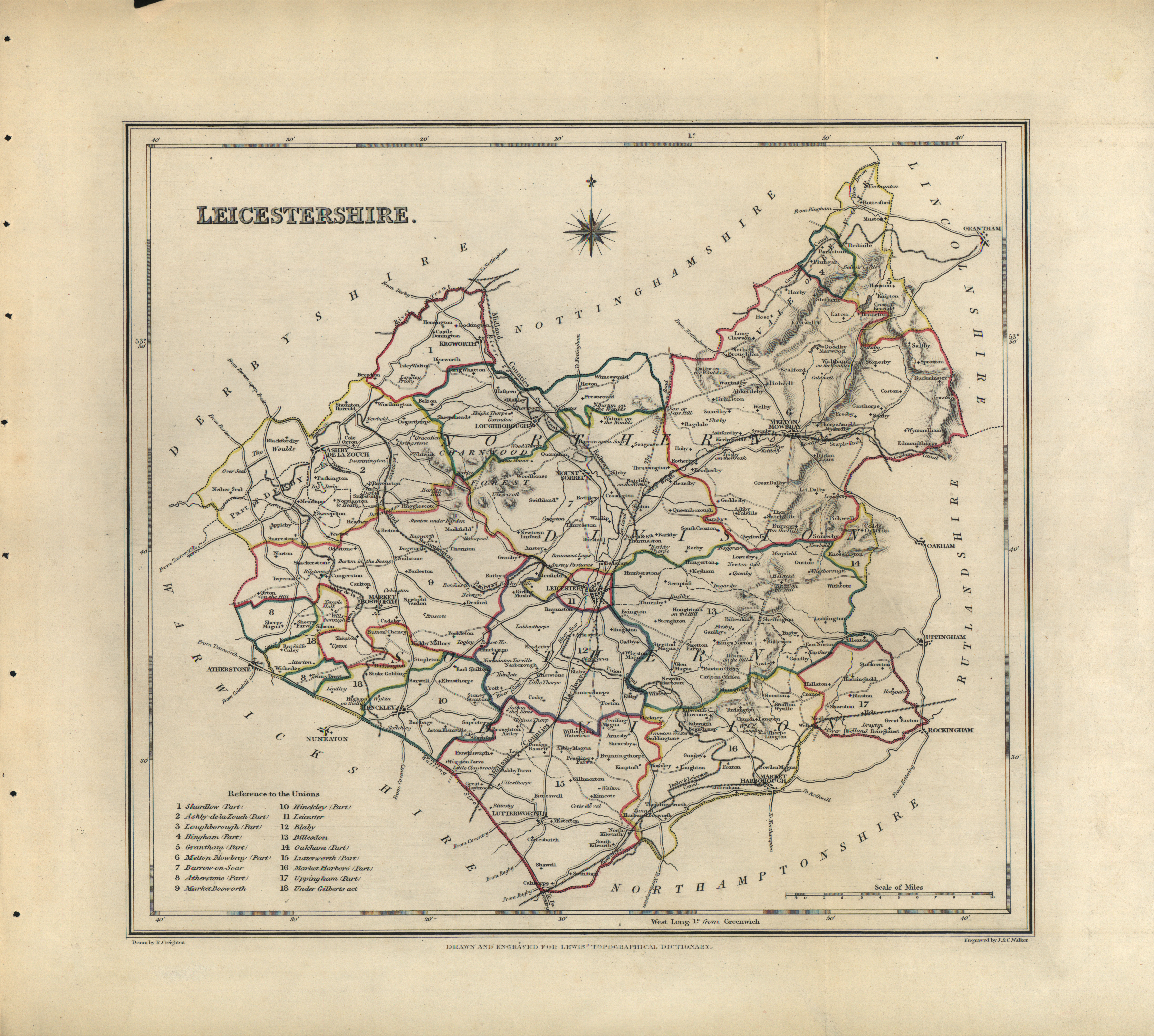
Leicestershire 1848 Robert Creighton with J.&C Walker in The Atlas to Lewis Topographical Directory Chubb p:296 CCCCXXXII)
An Aspect of the city of Leicester during the Civil war (1642-5) 1850 Hewitt
(Image courtesy of University of Leicester Special Collections)
Charnwood Forest 1858 John Henry Gray
(Image courtesy of Leicester University Special Collections)
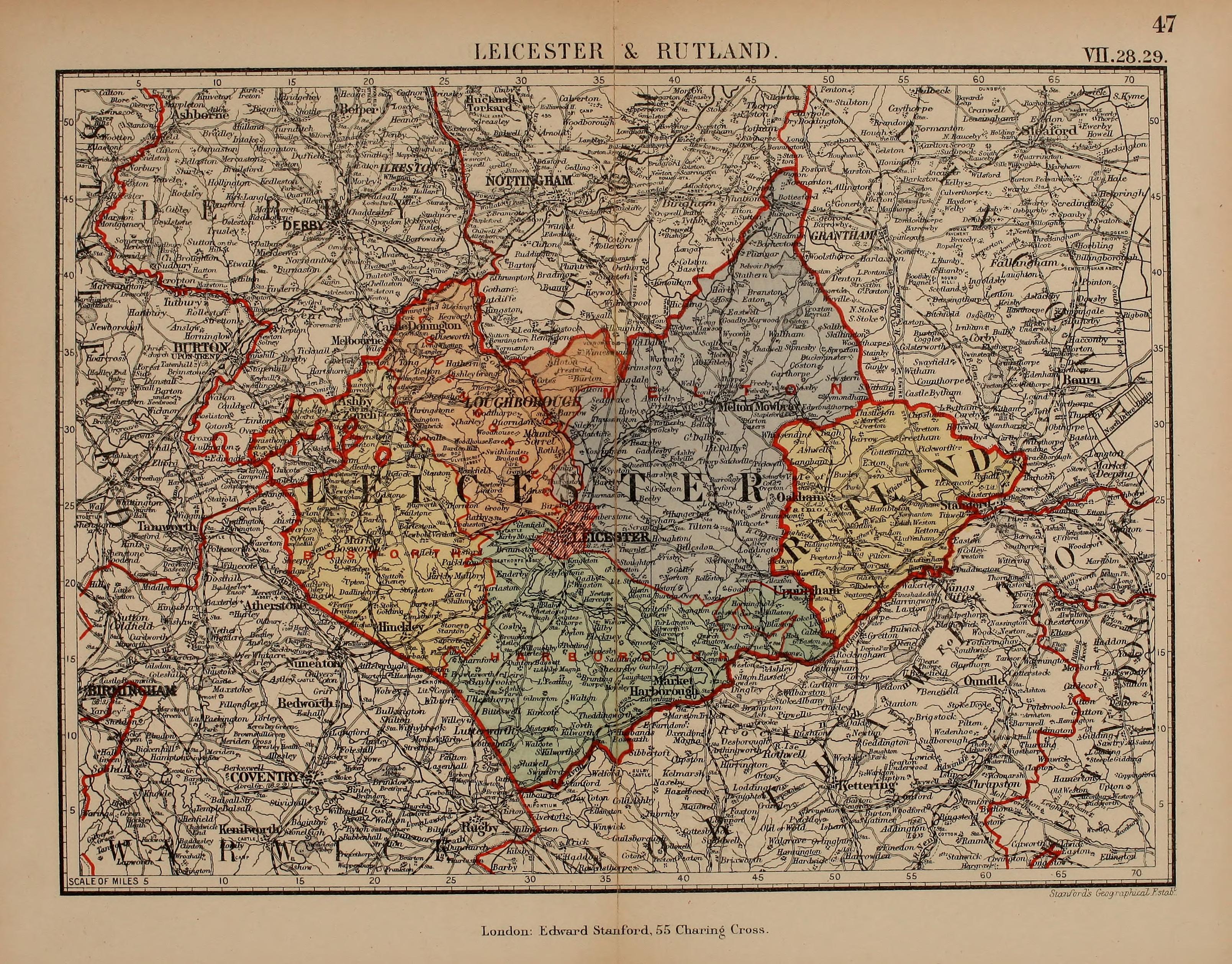
Leicestershire 1885 Stanford's Parliamentary Atlas of England and Wales

.jpg)
.jpg)
.jpg)
(Image%20courtesy%20of%20The%20British%20Library%20King's%20Collection%20%20Maps%20K.Top).jpg)
%20.jpg)
%20Richard%20Blome%20%20in%20Samuel%20Simpson'a%20England%20Exactly%20Described%20Wikimedia.jpg)
%20Richard%20Blome%20in%20Samuel%20Simpson'a%20England%20Exactly%20Described%20Wikimedia.JPG)
%20Thomas%20Badeslade%20and%20William%20Toms%20(Chubb%20p.133%20CLXX).jpg)
%20(Image%20courtesy%20of%20The%20British%20Library.jpg)
(Image%20courtesy%20of%20The%20British%20Library%20.jpg)
(Image%20courtesy%20of%20The%20British%20Library.jpg)
%20(Chubb%20CCCCLVII1a).jpg)
%20Hewitt%20(Image%20courtesy%20of%20University%20of%20Leicester%20%20Special%20Collections)%20%20.jpg)
.jpg)