 |
|
HomeReferences: | To resize image:
L-click on image or hold CTRL and use mouse scroll-wheel |
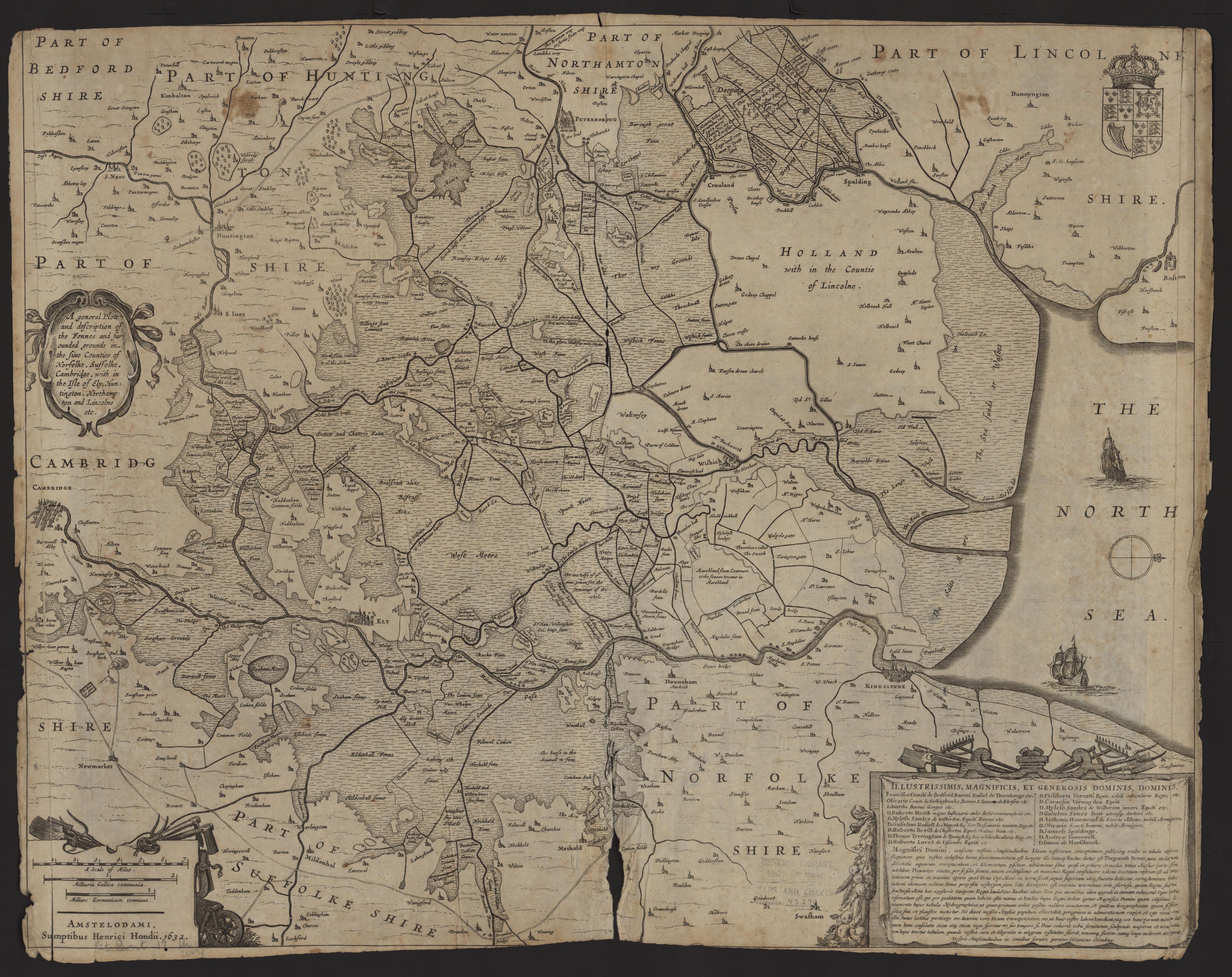
Fennes 1603 Hendrici Hondius (Image courtesy of Clark Library university of Michigan)
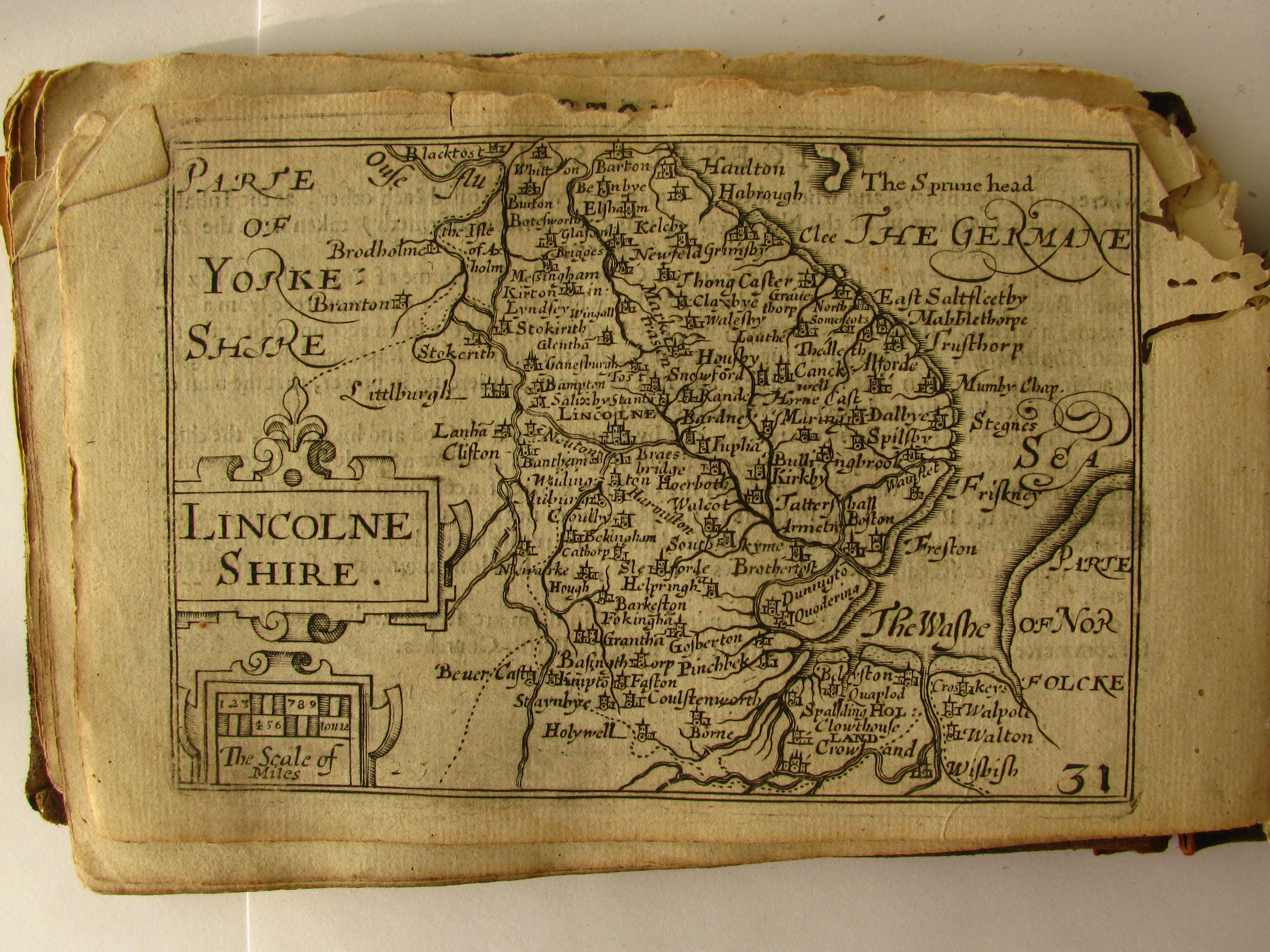
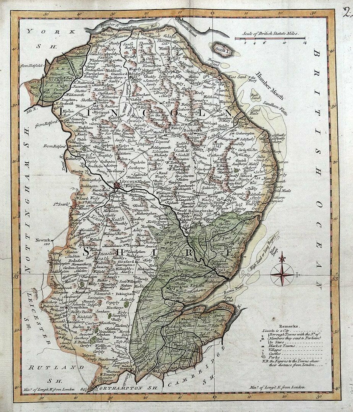
Lincolnshire 1605 Pieter van den Keere in his Atlas of the British Isles (Chubb LX)
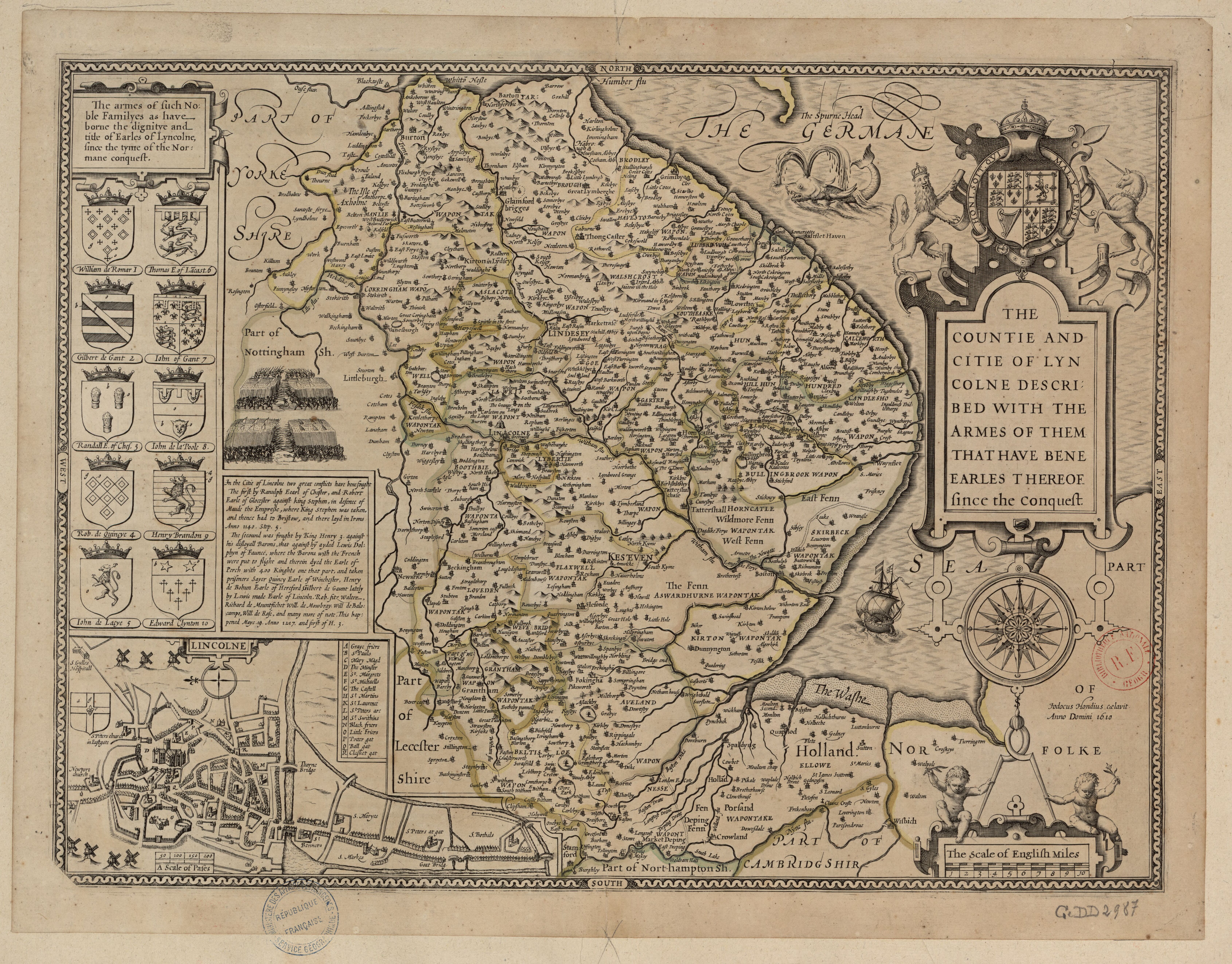
Lincolnshire 1610 John Speed in The Theatre of the Empire of Great Britaine (Image courtesy of The British Library)
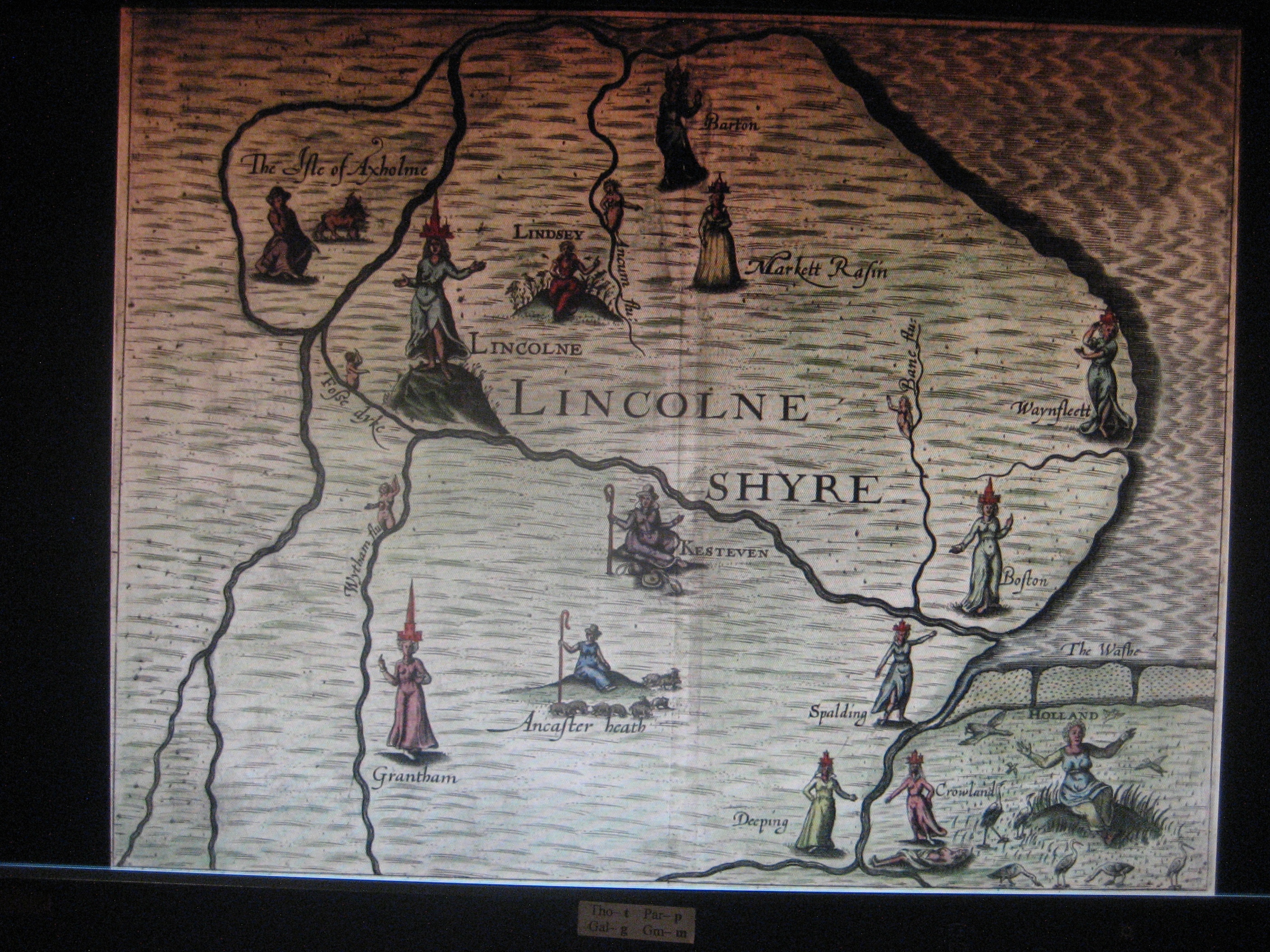
Lincolnshire 1612 Michael Drayton to Illustrate his Polyolbion (Chubb XXXV)
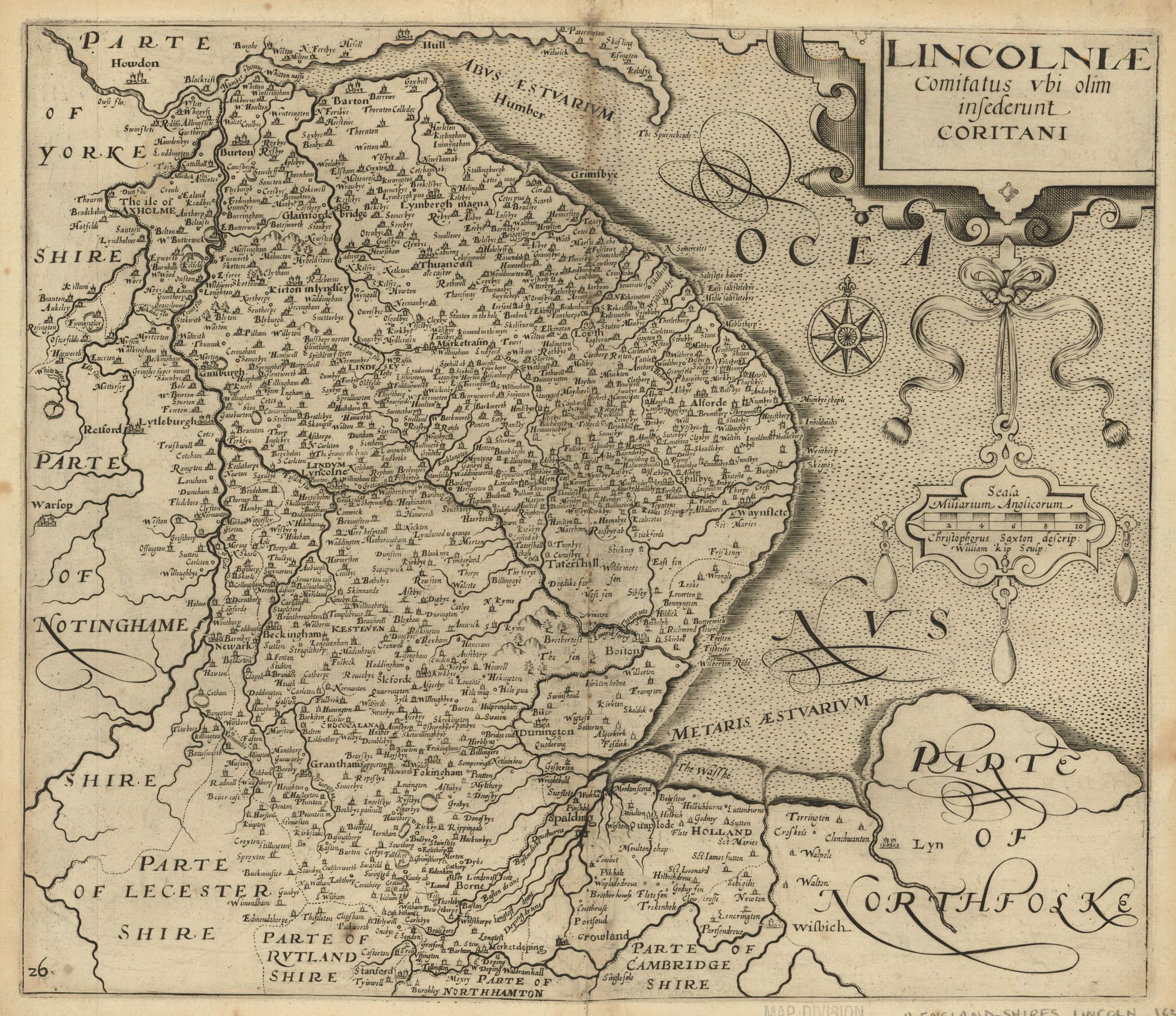
Lincolnshire 1620 William Kip after Christopher Saxton
(Image courtesy of Princeton Historic Map Collection)
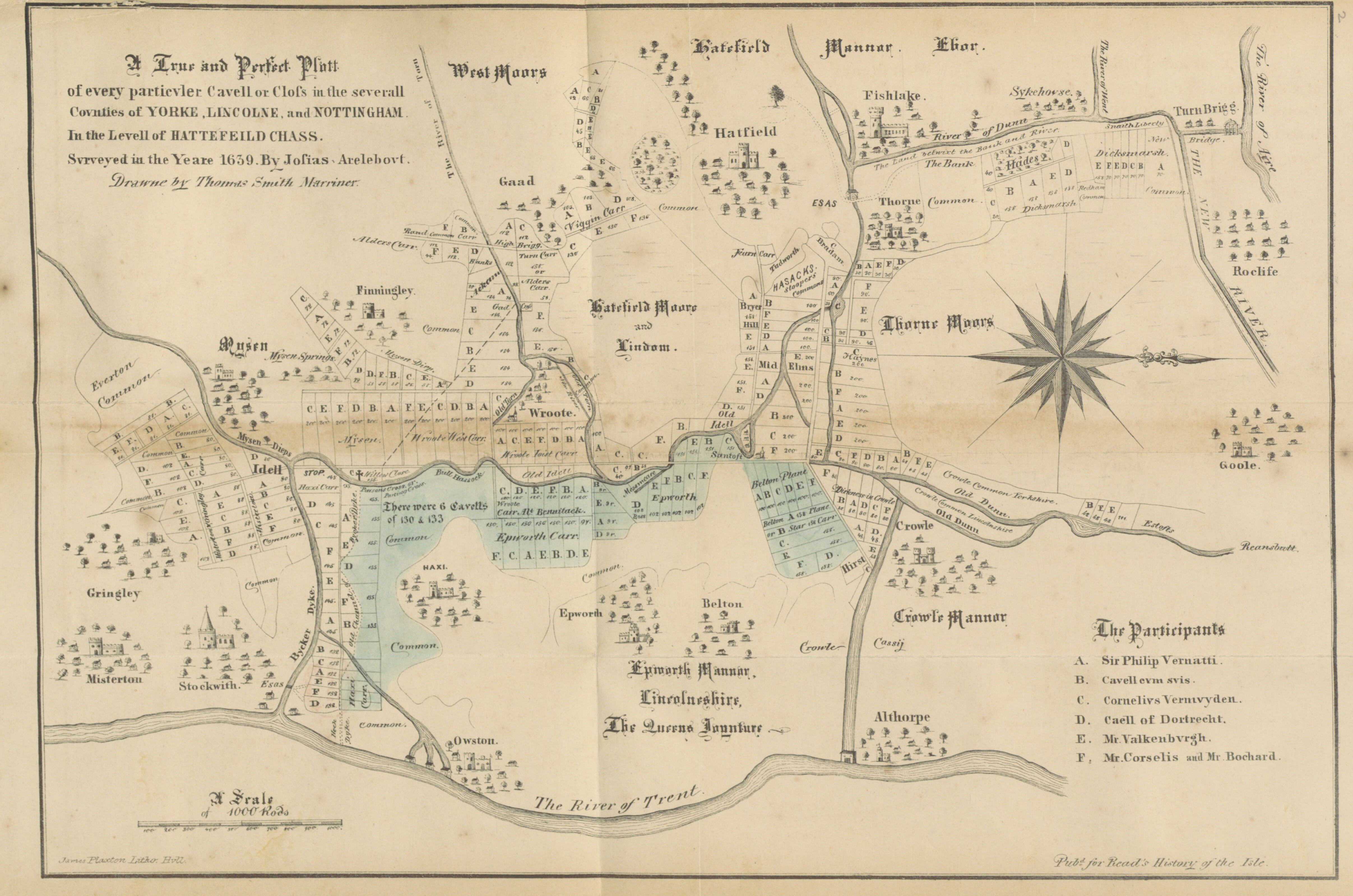
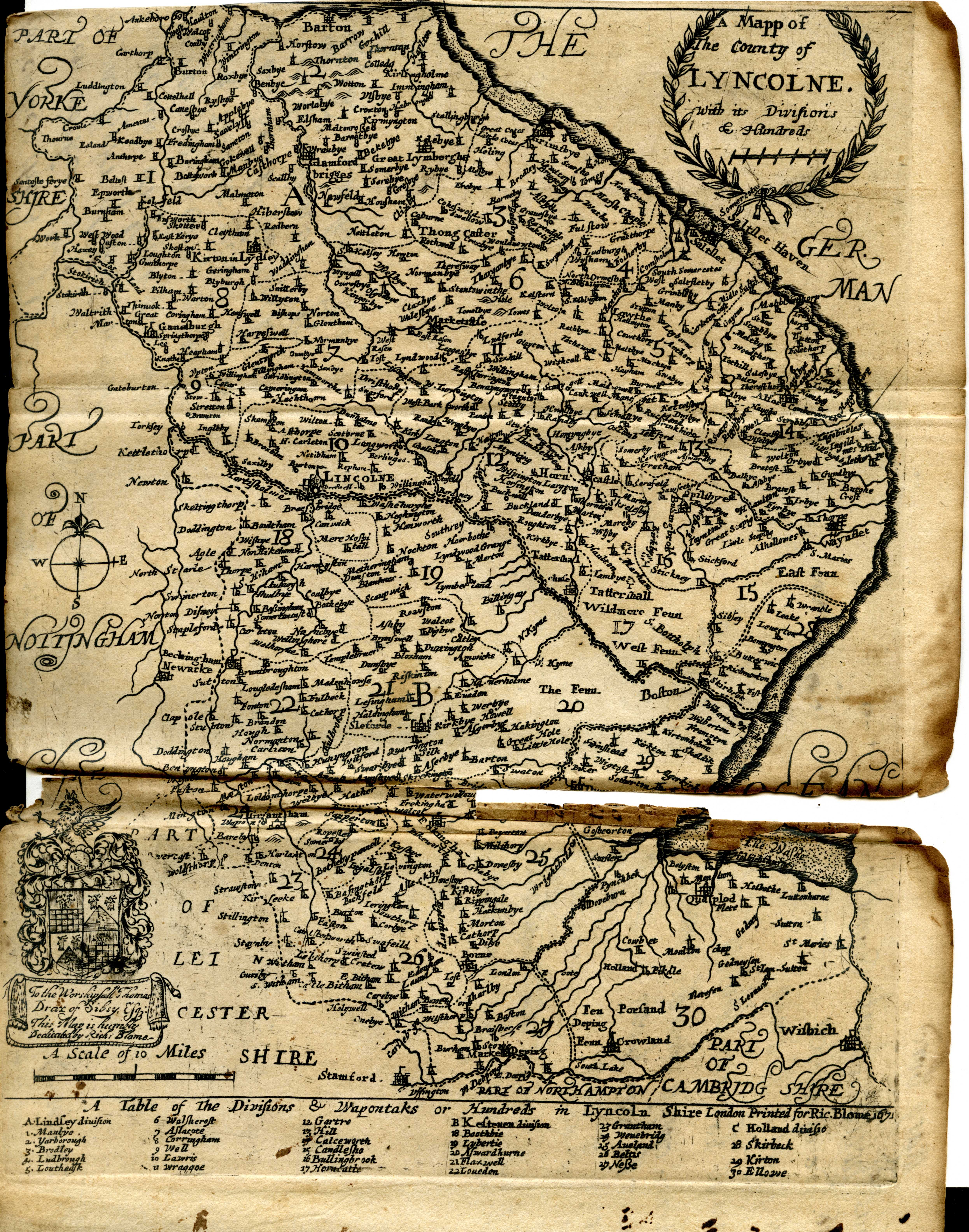
A True and Perfect Platt of every Particular Cavell or Close in the several Counties of Yorke, Lincolne and Nottingham in the Level of Hattefield Chass 1639 Josias Arelbout and Thomas Smith Marriner
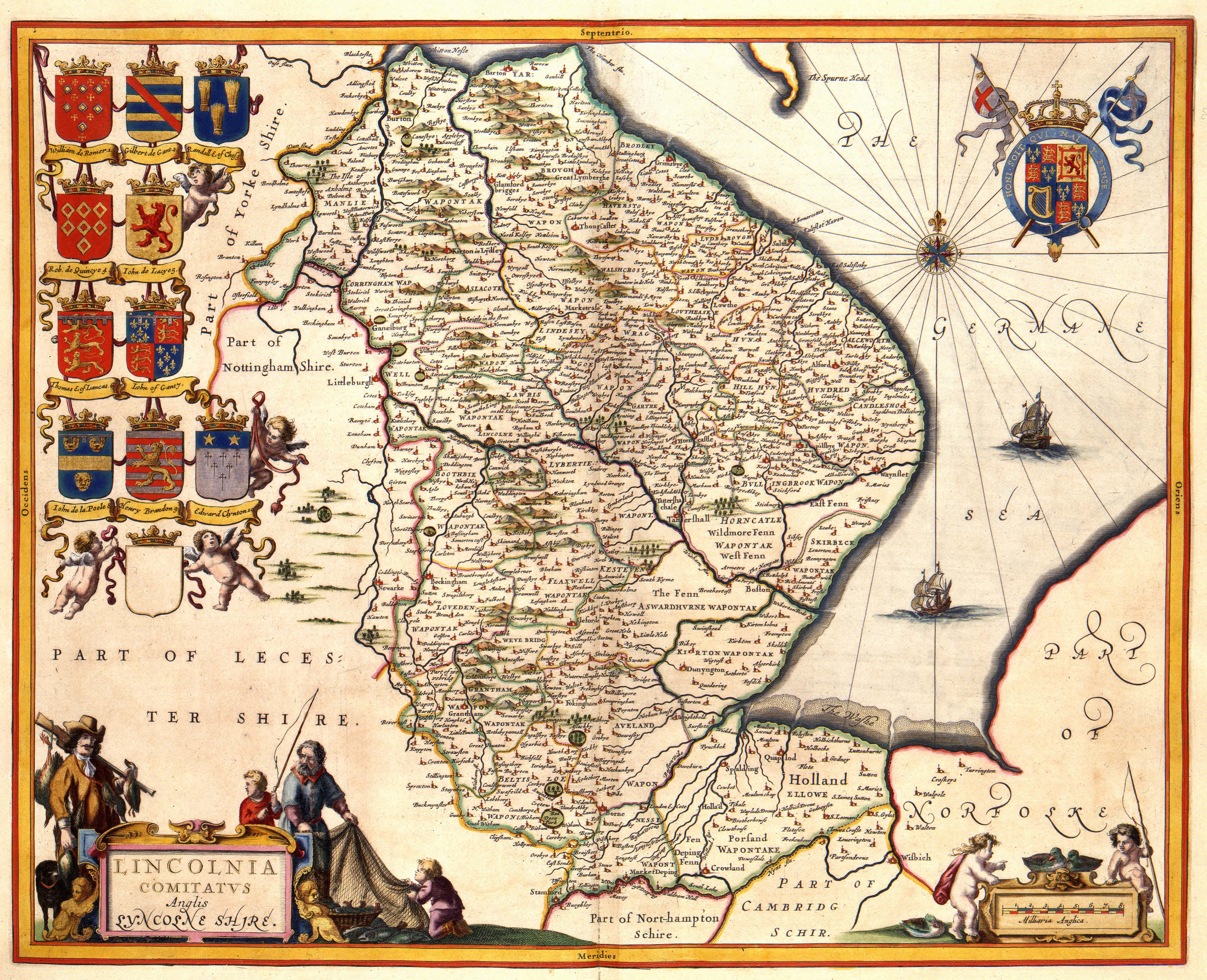
Lincoln 1645 Joan Blaeu in his Atlas Novus
The Fennes 1645 Jan Jansson in his Atlas Novus (Image courtesy of The Mechanical Curator & Wikimedia
.jpg)
Lincolnshire 1646 Jan Jansson Atlas Van de Hagen (Chubb LIX: )
(Image courtesy of Wikimedia)
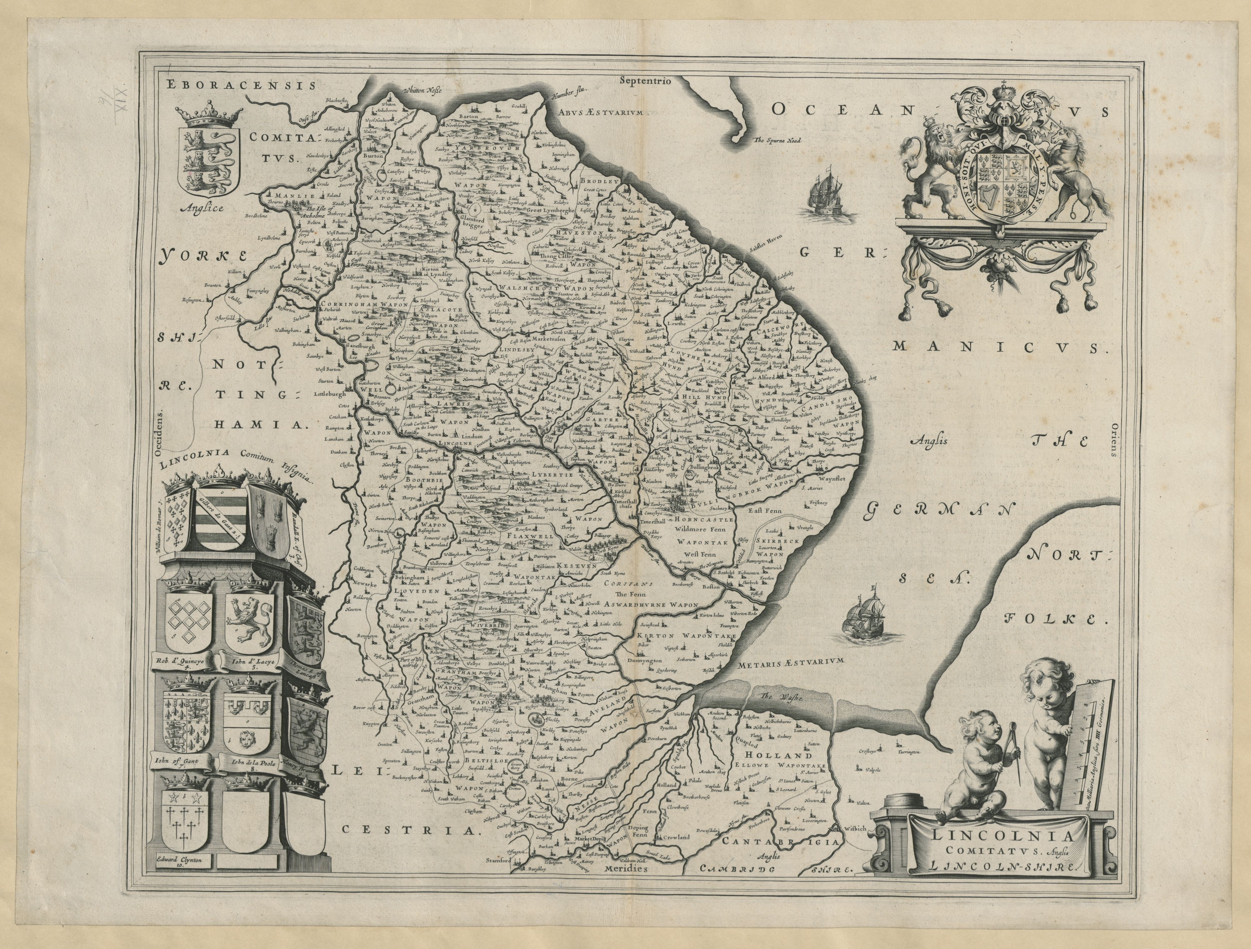
Lincoln shire 1659 Joan Blaeu Atlas Major (Chubb LIX: )
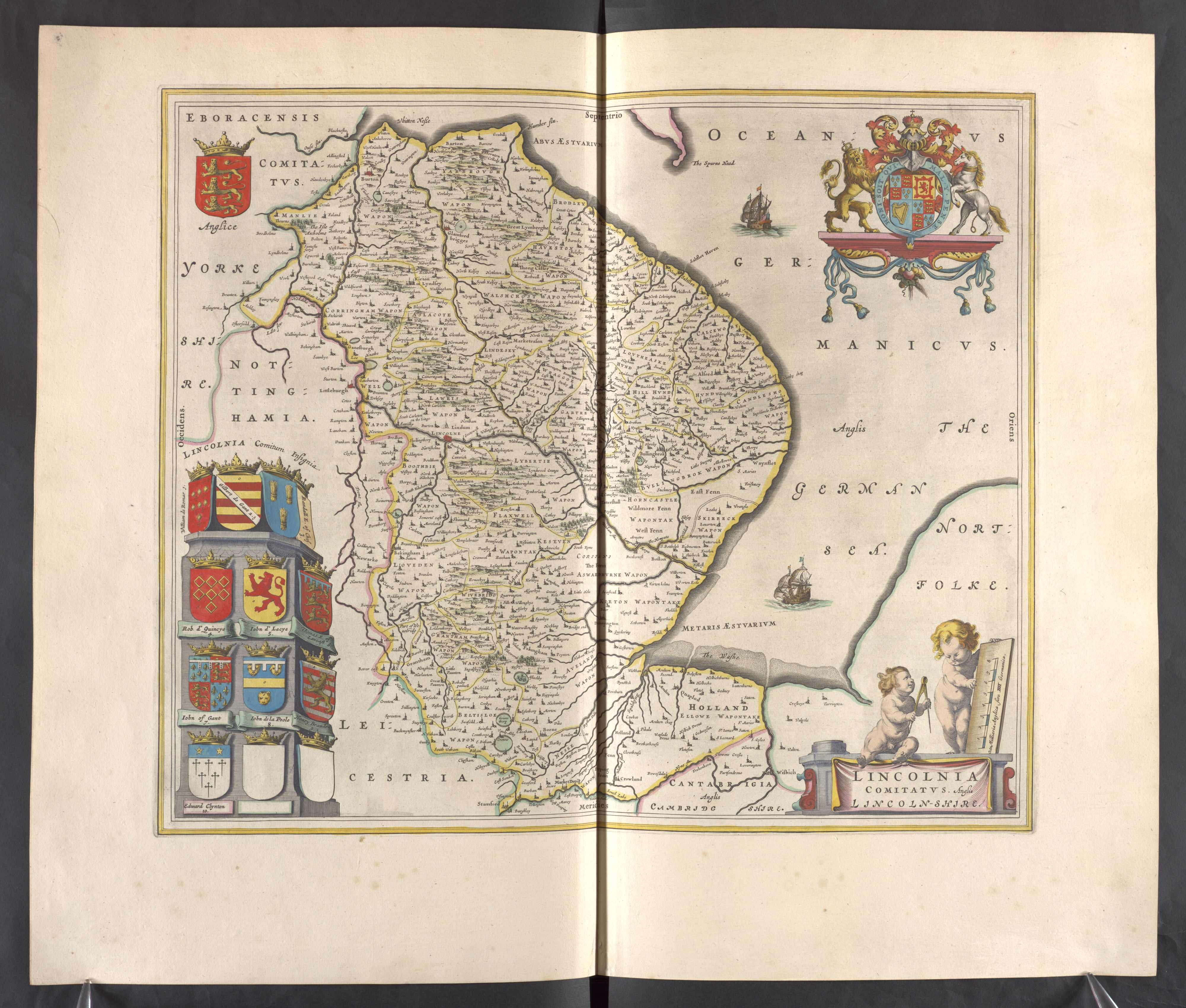
(Image courtesy of the British Library : Kings Collection)
Lincolnshire 1662 John Speed in A Prospect of the Most Famous Parts of the World (Roger Rea Edition)
(Image%20courtesy%20of%20The%20British%20Library%20King's%20Collection%20Maps%20K.Top).jpg)
(Image courtesy of The British Library King's Collection Maps K.Top)
Lincolnshire 1695 Robert Morden for Camden's Britannia (image Courtesy of the British Library
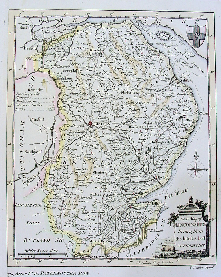
Lincolnshire 1698-1703
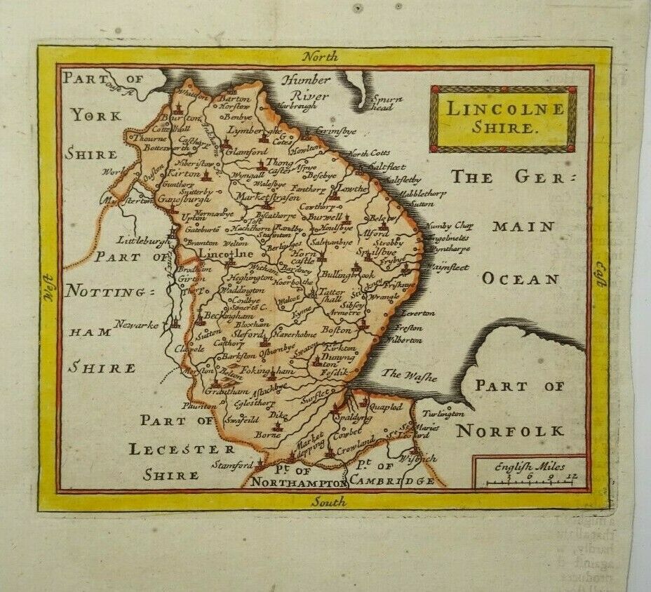
John Seller in Britannia Contracta.(1698)
The same plates also used for: Camden's Britannia Abridg'd (1701) (Chubb p.89 CVII)
A History of England (1703 ) (Chubb p.91-p.99)
and lastly for Francis Grose's Antiquities... (with Seller's imprint removed) (1787)
Lincolnshire 1715 Jan Jansson published by Gerardum Valk & Petrum Shenk
%20.jpg)
following the death of Jansson (Image courtesy of Wikimedia)
Lincolnshire 1715 Richard Blome in Thomas Taylor's England Exactly Described
(Image courtesy of Wikimedia)
Lincolnshire 1720 Emanuel Bowen in Britannia Depicta 1720 Lincolnshire
A Plan of Lincoln 1724 William Stukely (1882 Reprint)
%20.jpg)
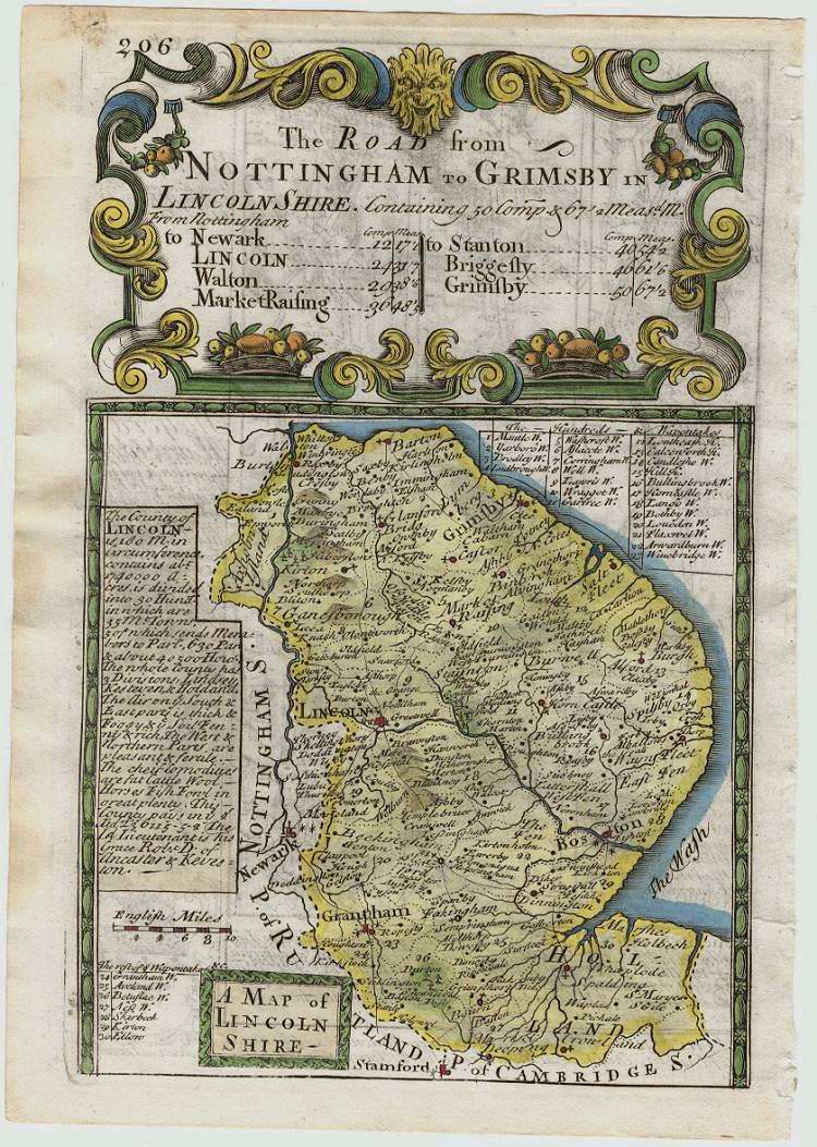
Lincolnshire 1724 Herman Moll in A New Description of England and Wales (Chubb CLX: CLXI)
Boston 1742 Robert Hall in A Travelling English Atlas Robert Wall (surveyor) William Nichols and Robert Hall (Image courtesy of The British Library-King's Topographical Collection)
%201742%20Robert%20Wall%20(surveyer,)%20William%20Nichols%20and%20Robert%20Hall%20(Image%20courtesy%20of%20The%20British%20Library.jpg)
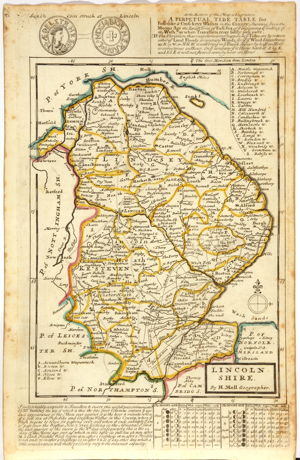
Lincolnshire 1742 Thomas Badeslade and William Toms in Chorographia Britanniae (Chubb p.133 CLXX)
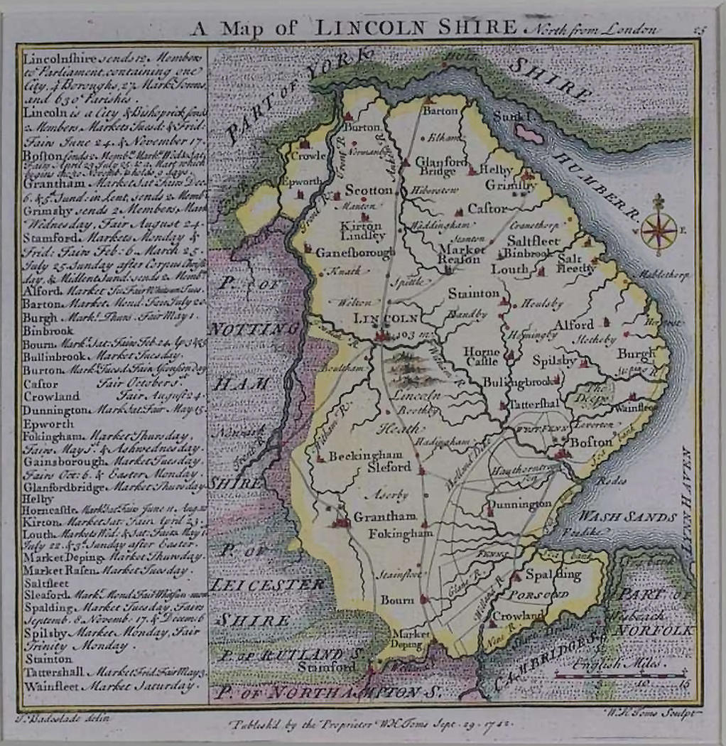
Lincoln shire 1751 Emanuel Bowen for The Universal Magazine of Knowledge and Pleasure
%20.jpg)
(Chubb p.133 CLX) (Image courtesy of Yale University Library)
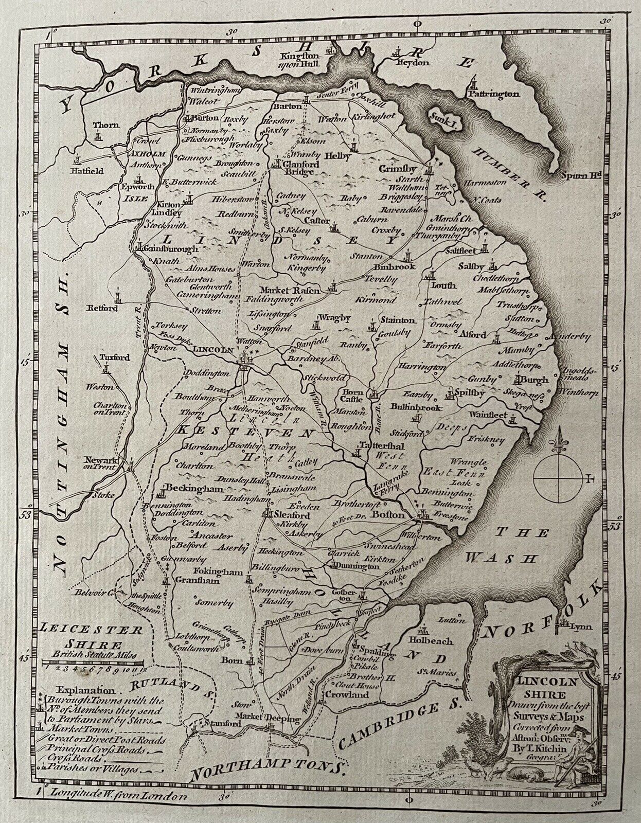
Lincolnshire 1760 Thomas Kitchin for The Gentleman's Magazine
A Modern Map of Lincolnshire 1766 John Ellis in Ellis's English Atlas
Lincolnshire 1769 Thomas Kitchen in his Pocket Atlas
Lincolnshire 1769 John Rocque in England Displayed (Chubb p.174 CCX)
Lincolnshire 1779 Captain Andrew Armstrong
(Image courtesy of The British Library-King's Topographical Collection)
A New Map of Lincolnshire 1784 Thomas Kitchen for Alexander Hogg's (aka: George Augustus Wallpoole) The New British Traveller
Lincolnshire 1786 Thomas Kitchin Originally published in The London Magazine and re-published in Thomas Boswell's
Antiquities of England and Wales (Chubb p.210 CCLVII)
Lincolnshire 1786 Thomas Kitchin in The Small English Atlas (Chubb p.206 CCLIII)
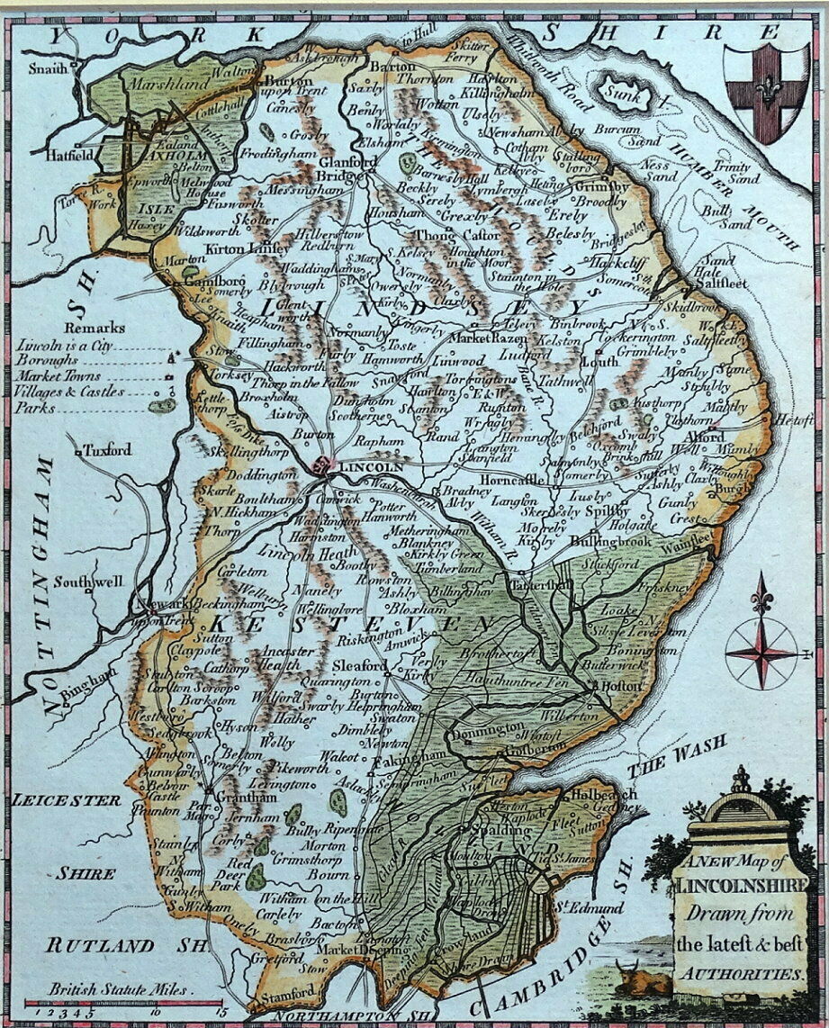
Lincolnshire 1787 John Seller for Francis Grose's Antiquities
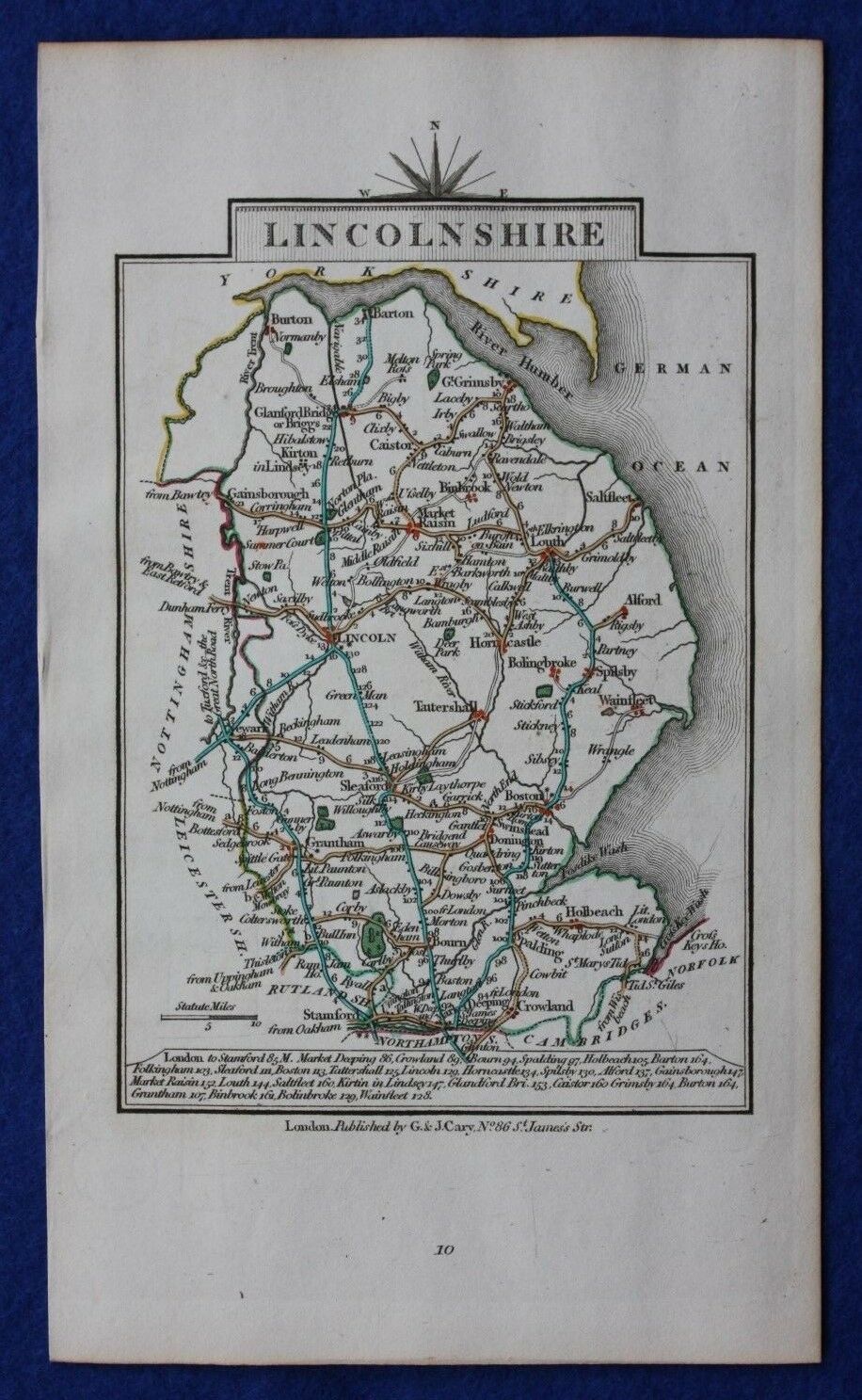
Lincolnshire 1790 John Cary in Cary's Travellers' Companion Chubb p.220 CCLXXIII)
Lincolnshire 1793 John Cary in his New and Correct English Atlas (Chubb p.214 CCLXI)
(Image courtesy of New York Library Digital Collections)
Lincolnshire 1800 John Aiken in England and Wales Delineated (Image courtesy of The Mechanical Curator & Wikimedia)
.jpg)
Lincolnshire 1803 William Green for R. Butters' A Picture of England (Fordham p.80 (Image courtesy of The Mechanical Curator & Wikimedia)
.jpg)
Lincolnshire 1805 W. Mille
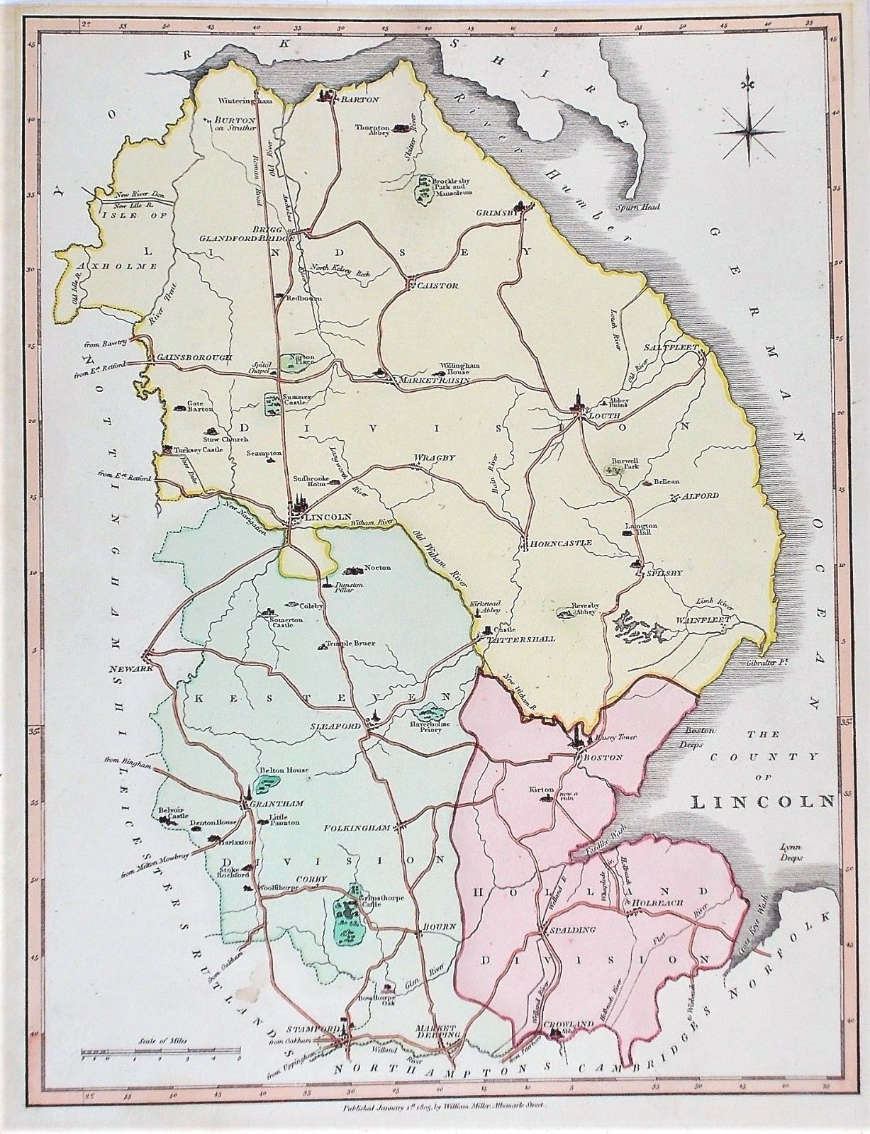
Lincolnshire 1805 Edward Noble
(Image courtesy of The Princeton Historic Map Collection)
Lincolnshire 1808 Benjamin Pitts Capper in
%20(14762083136).jpg)
A Topographical Dictionary of the United Kingdom (Chubb p.245 CCCXXVII)
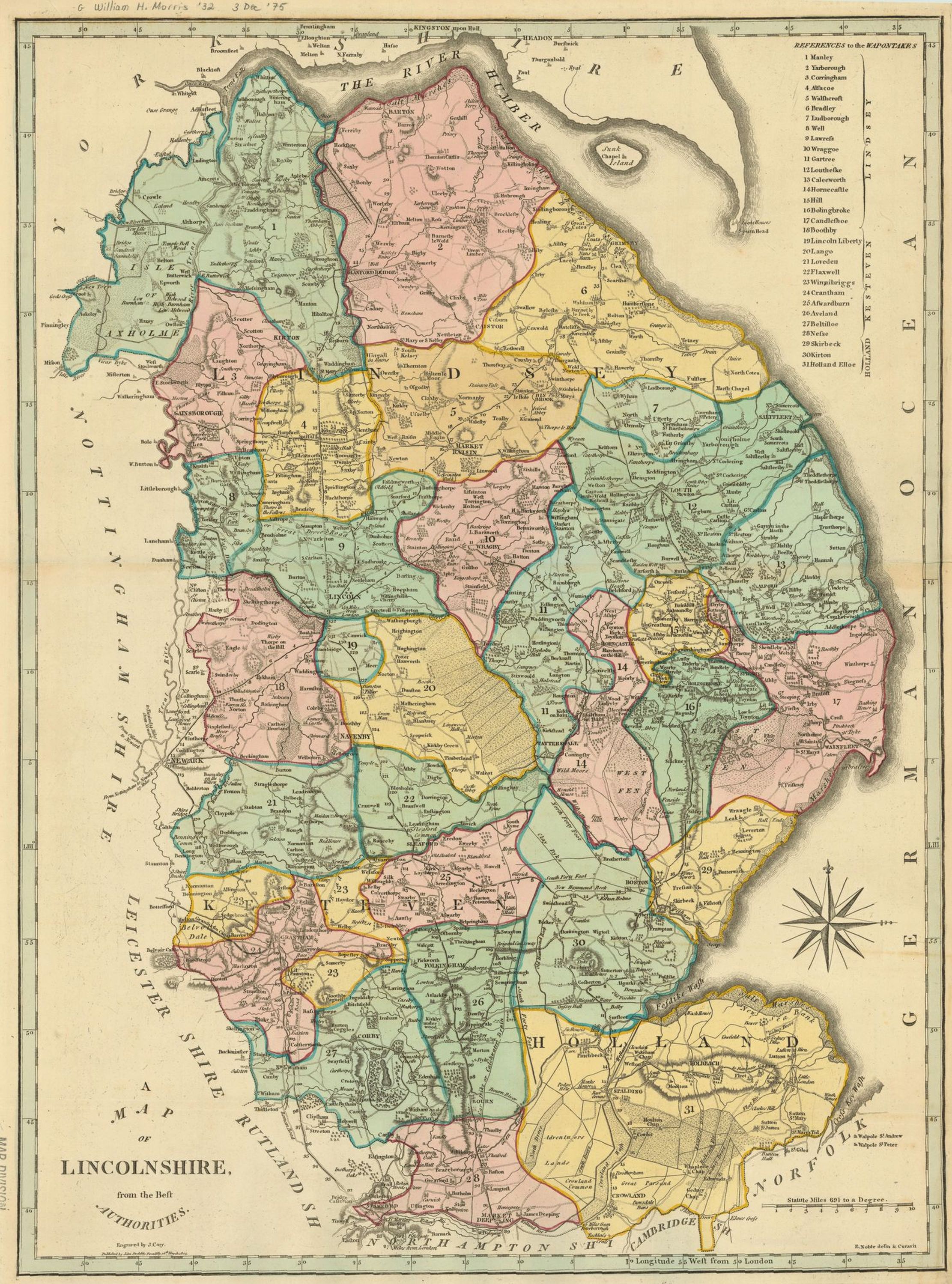
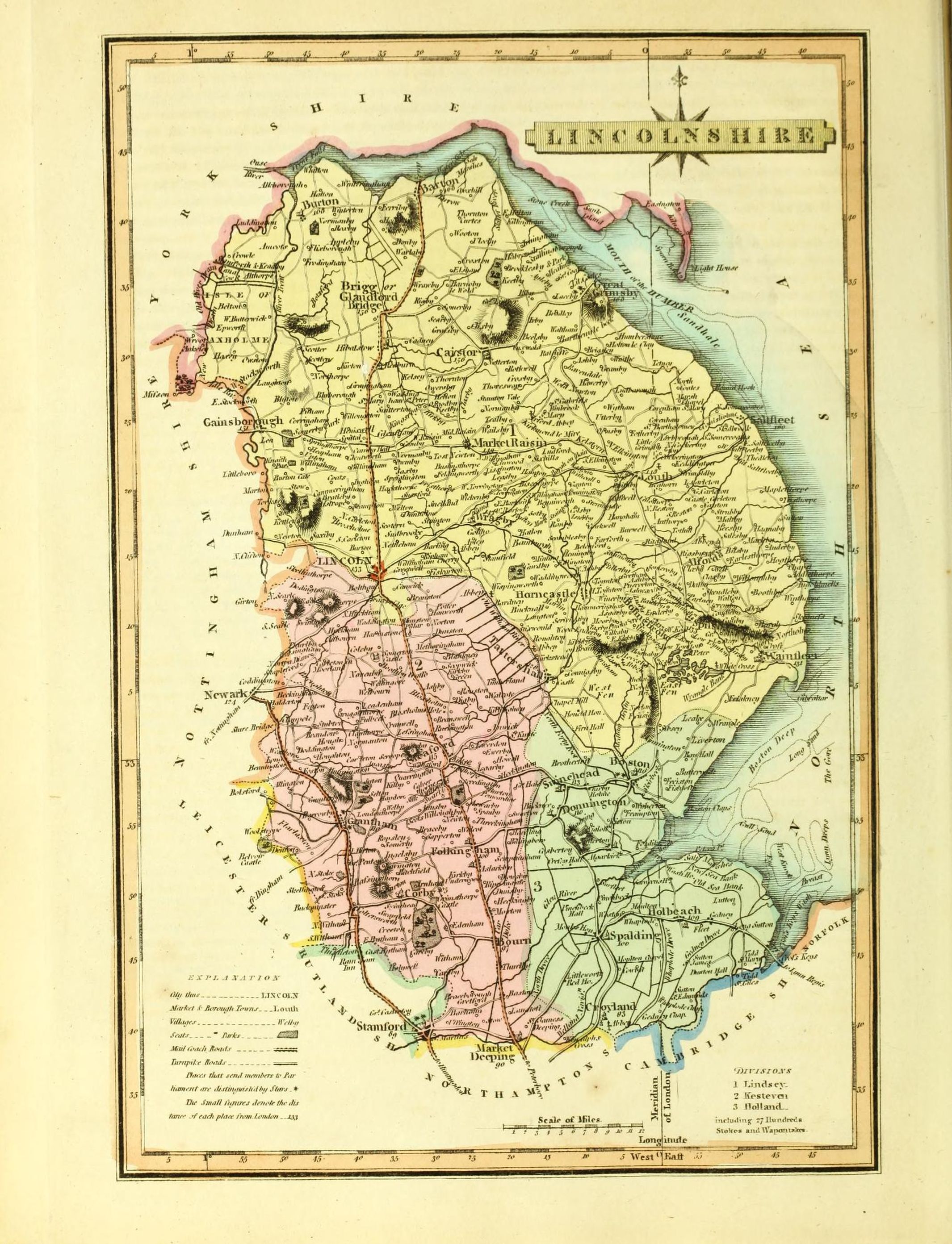
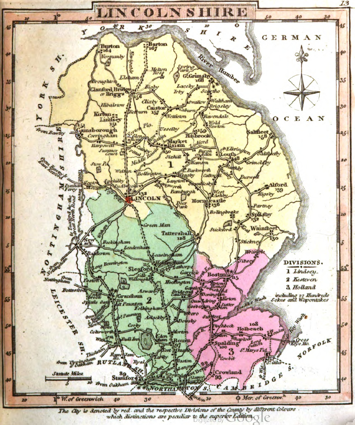
Lincolnshire 1816 Robert Rowe (Chubb p.262 CCCLIVa)
.jpg)
Lincolnshire 1810 George Cole and John Roper in their British Atlas
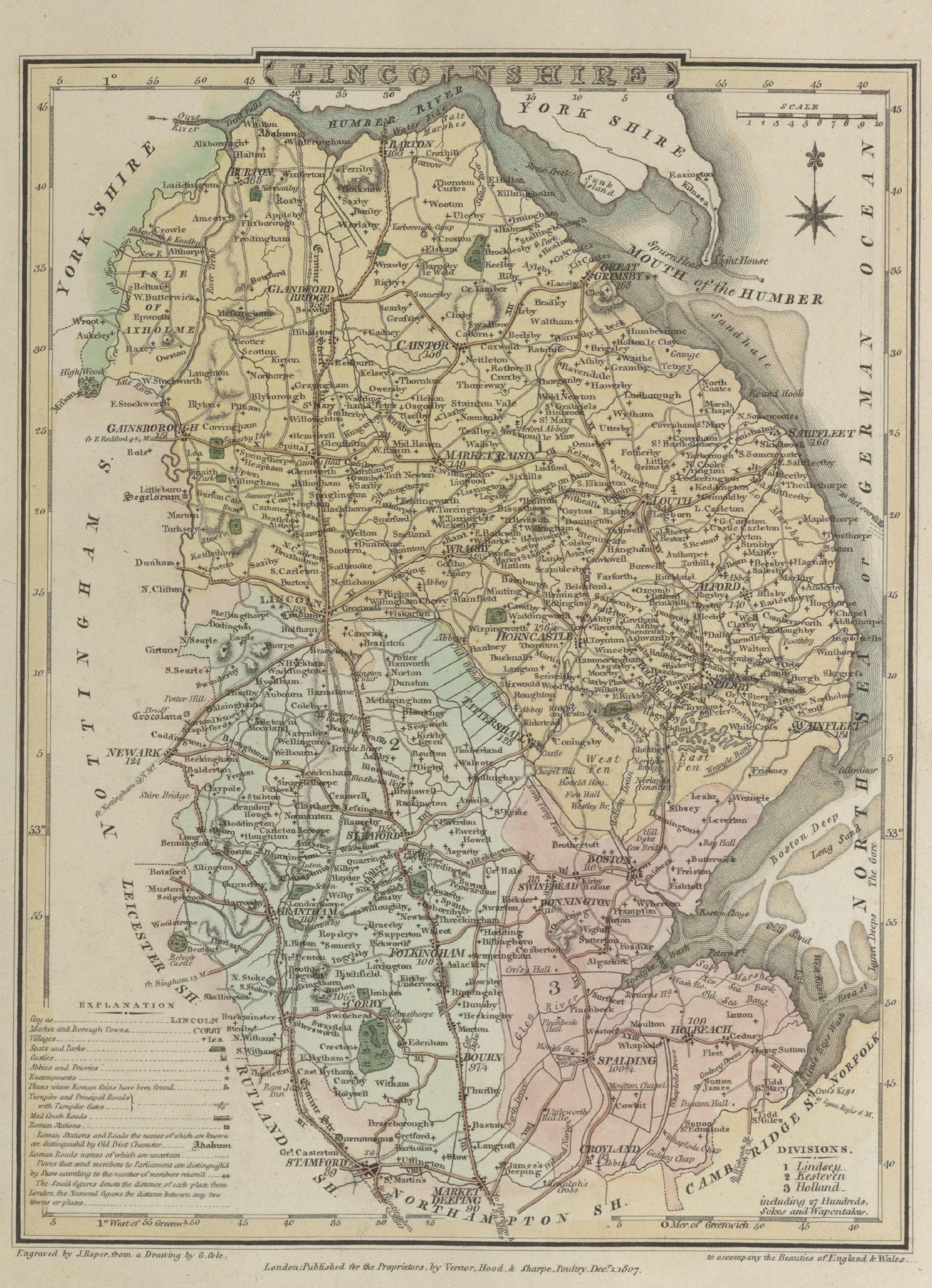
(Image courtesy of The British Library-King's Topographical Collection)
Lincolnshire 1819 William Lewis in The New Traveller's Guide
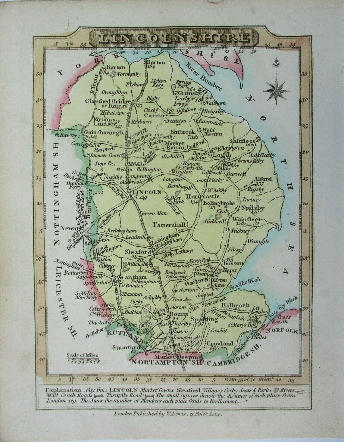
Lincolnshire 1819 John Ellis in Ellis's New and Correct Atlas Chubb p.168 CCCLXVII)
Lincolnshire 1824 George Carrington Gray in Gray's New Book of Roads (Chubb p.281 CCCXCII)
Lincolnshire 1828 John Cary in Cary's Travellers Companion
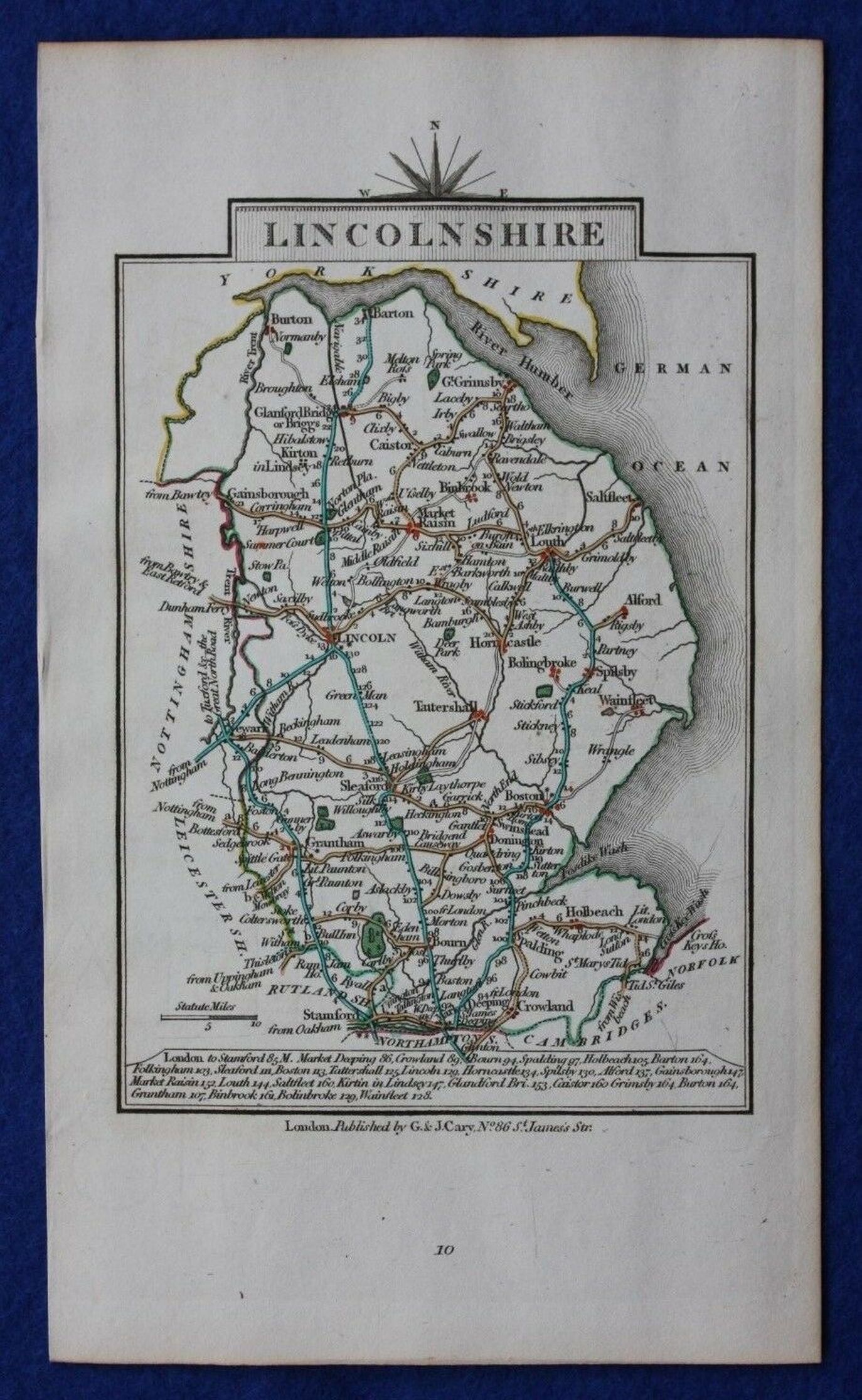
Louth 1832 Robert Kearsley Dawson for Plans of the Cities and Boroughs of England and Wales
1832%20Robert%20Kearsley%20Dawson%20for%20Plans%20of%20the%20Cities%20and%20Boroughs%20of%20England%20and%20Wales%20-%20Copy.jpg)
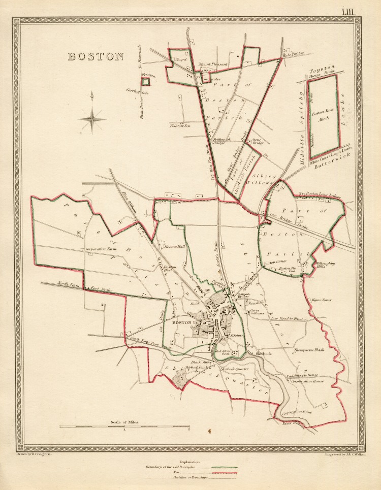
Boston 1835 Robert Creighton for Samuel Lewis's Topographical Dictionary (Chubb p.322 CCCCLXIV)
Lincolnshire 1834 C. and J. Greenwood in Atlas of the Counties of England (Chubb CCCCLVII1a)(Image courtesy of www.davidrumsey.com)
(Image%20courtesy%20of%20www.davidrumsey.com).jpg)
Boston (detail) 1835 Robert Creighton for Lewis's Topographical Dictionary
%201835%20Robert%20Creighton%20for%20Lewis's%20Topographical%20Dictionary.jpg)
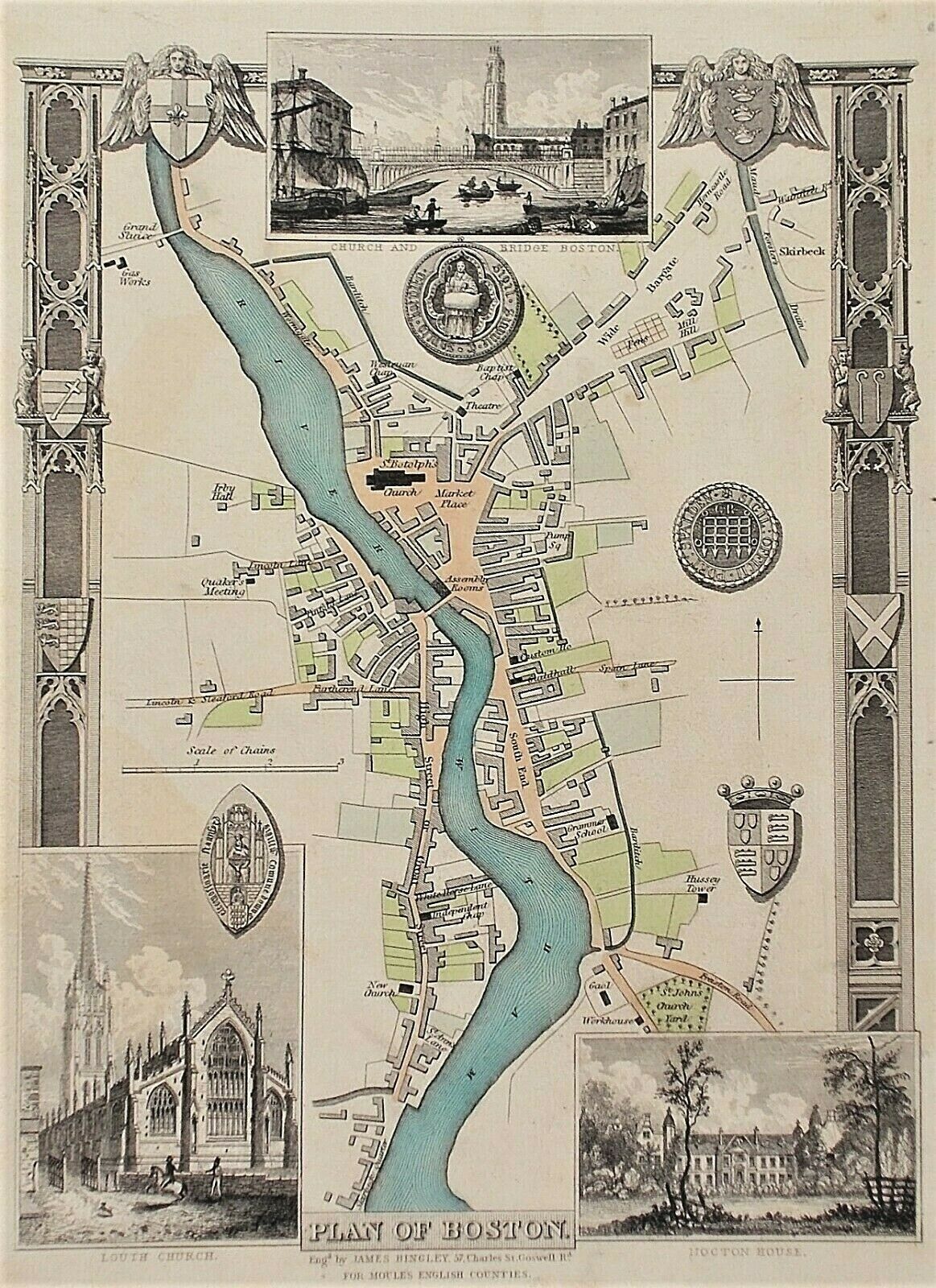
Boston 1836 James Hingley forThomas Moule's The English Counties Delineated
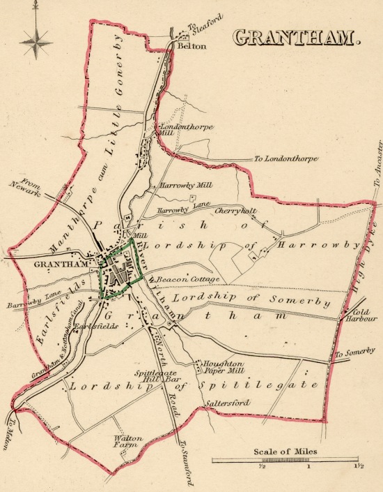
Grantham 1835 Robert Creighton for Samuel Lewis's Topographical Dictionary (Chubb p.322 CCCCLXIV)
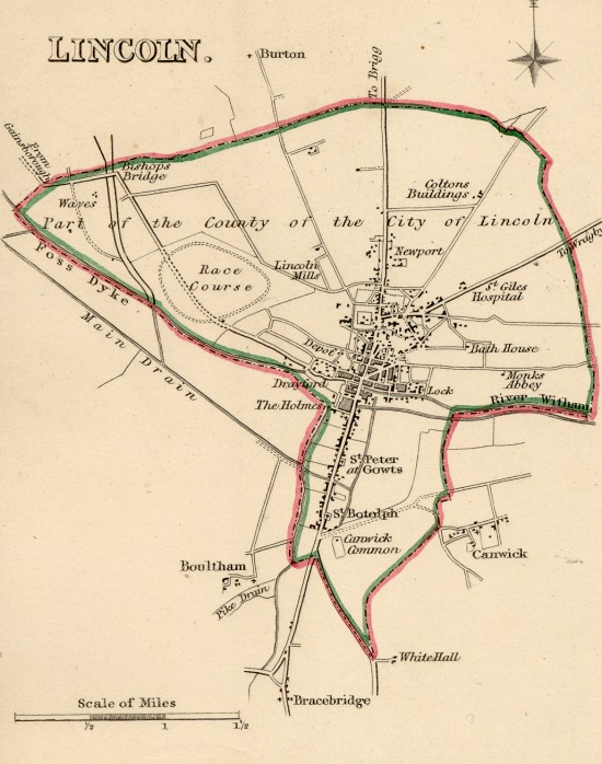
Lincoln 1836 Robert Creighton for Samuel Lewis's Topographical Dictionary Chubb p.322 CCCCLXIV)
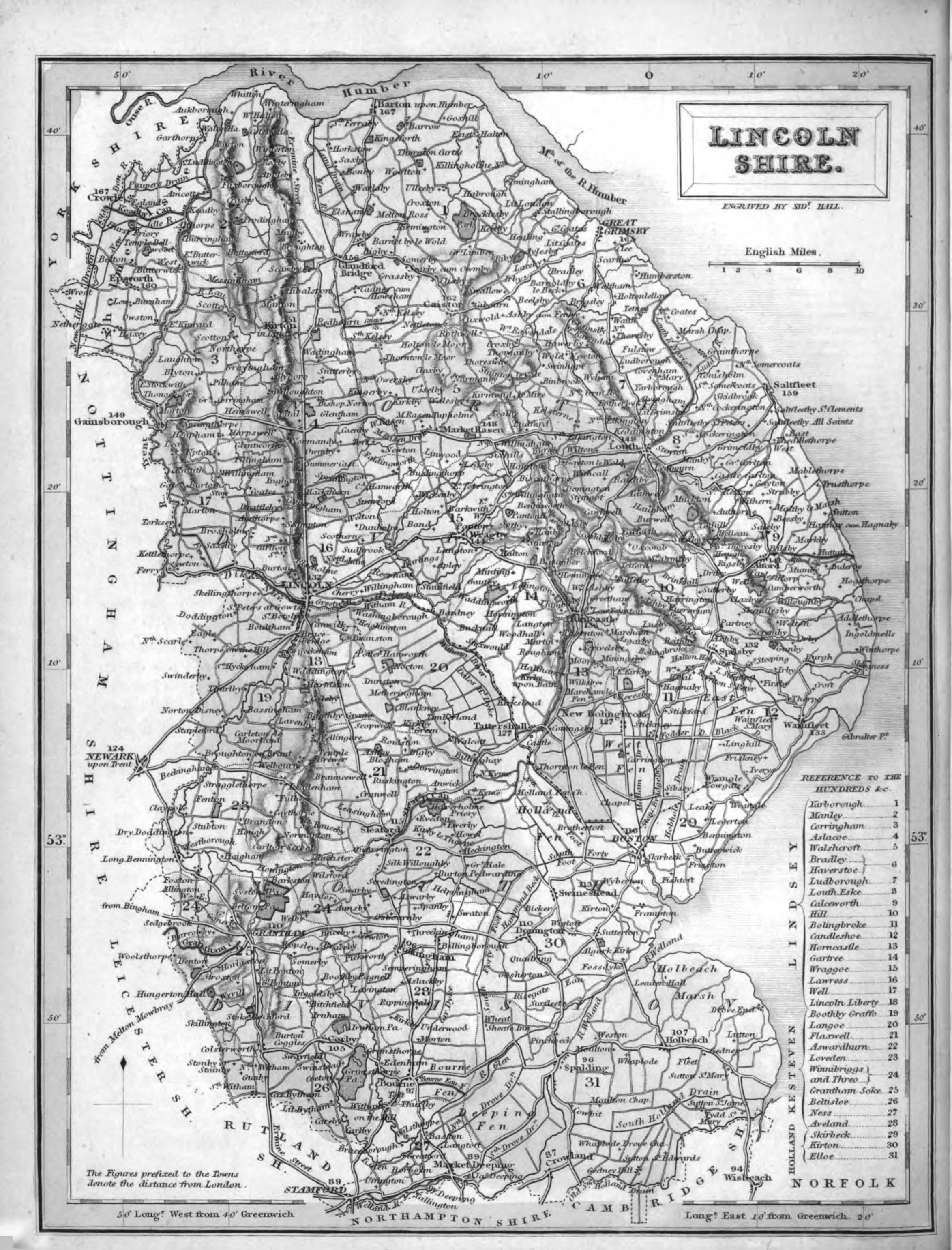
Lincolnshire 1836 Samuel Hall in his New British Atlas (Chubb p. 314 CCCCLI)
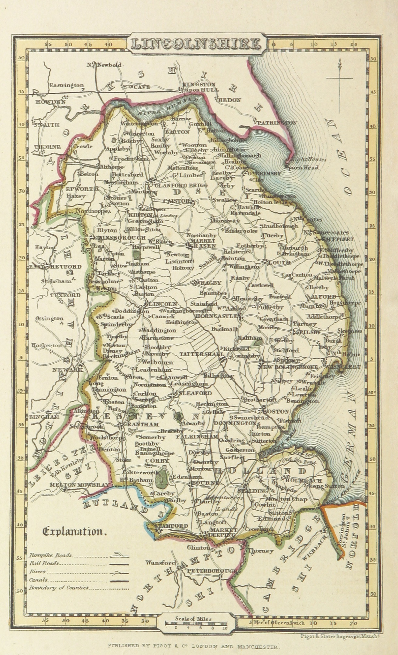
Lincolnshire 1842 James Pigot in A Pocket Topography and Gazetteer of England (Chubb p.321 CCCCLXII)
(Image courtesy of Wikimedia)
Lincolnshire 1868 Henry James
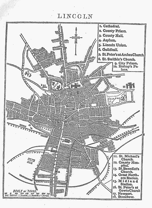
Plan of Lincoln 1883 Adam Black in Black's Guide To England and Wales
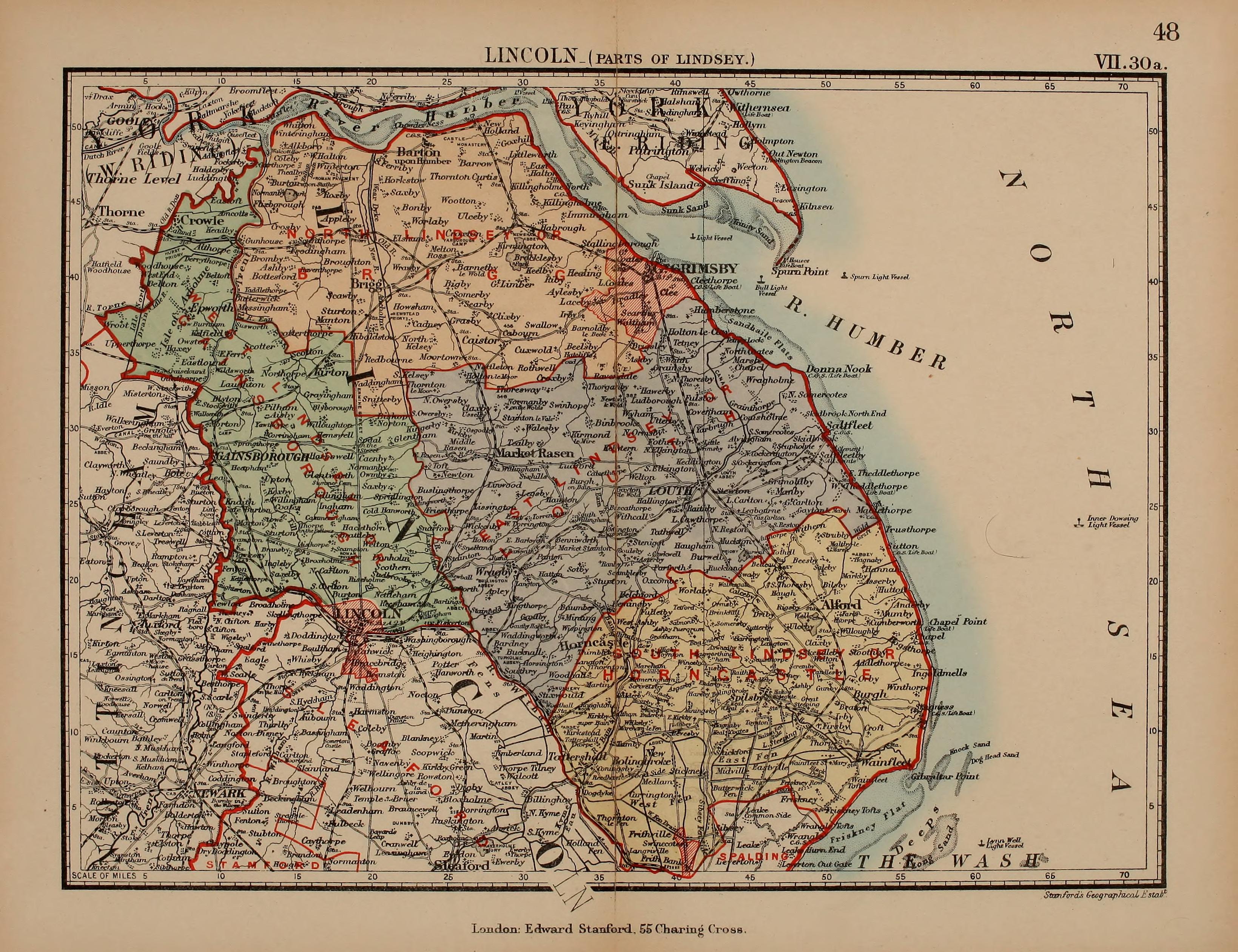
Lincolnshire: Parts of Lindsey 1885 Stanford's Atlas of England and Wales
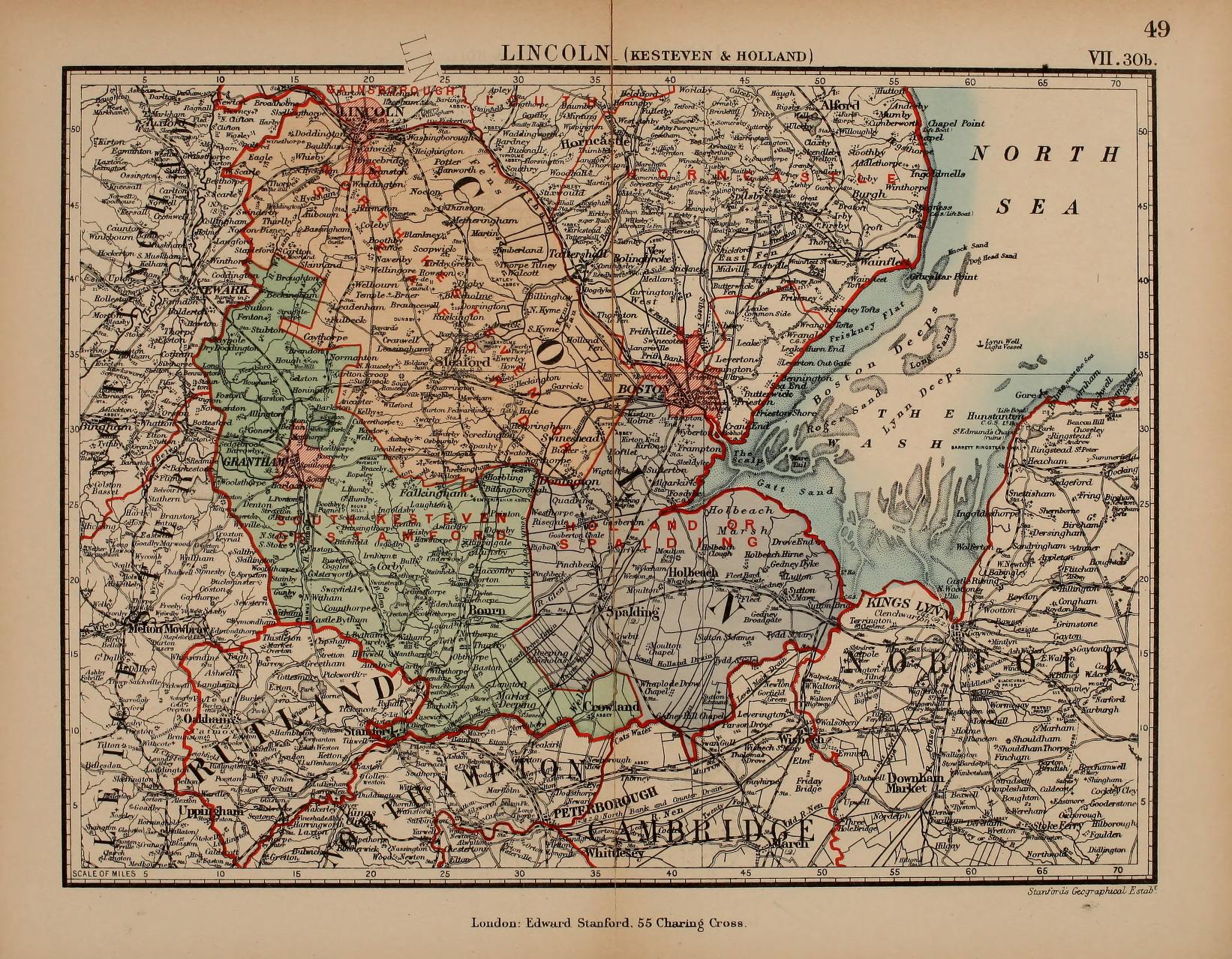
Lincolnshire-Kesteven and Holland 1885 Stanford's Parliamentary Atlas of England and Wales
Lincolnshire 1885 Stanford's Parliamentary Atlas of England and Wales