| |
 Home Resources Consulted for Norfolk Printed Maps in the Atlases of Great Britain 1579-1870 Chubb: Thomas: Dawson 1927 County Atlases of the British Isles: Hodson Donald: Tewin Press1983 County Atlases of the British Isles: Parts 1 & 2: Skelton R.A. Map Collecters Circle No.9: No.32: 1962 |

To resize image:
L-click on image or hold CTRL and use mouse scroll-wheel |
Kings Lynn 1561 Henry Bell
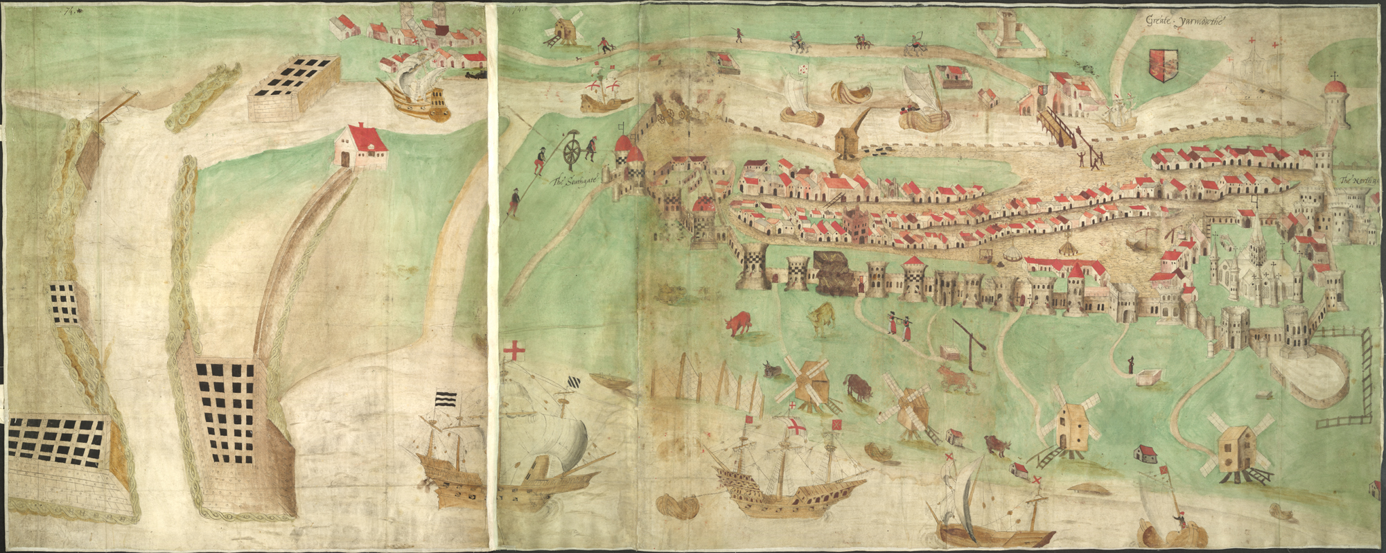
Plan of the town and harbour of Great Yarmouth 1570 Augustus Cotton
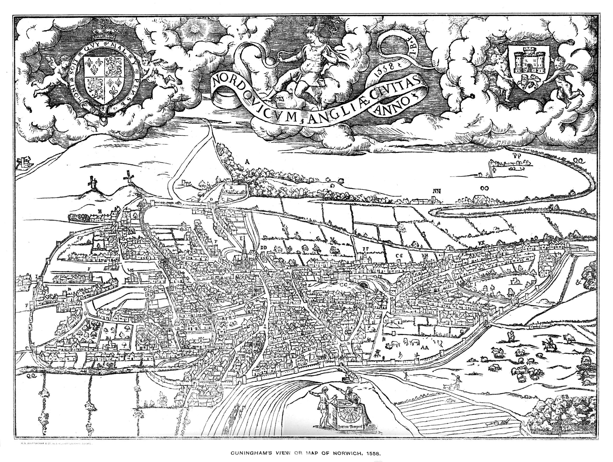
Norwich 1578 Dr. William Cunningham in The Cosmographer's Glass...etc. (Chubb p.23 XXII)
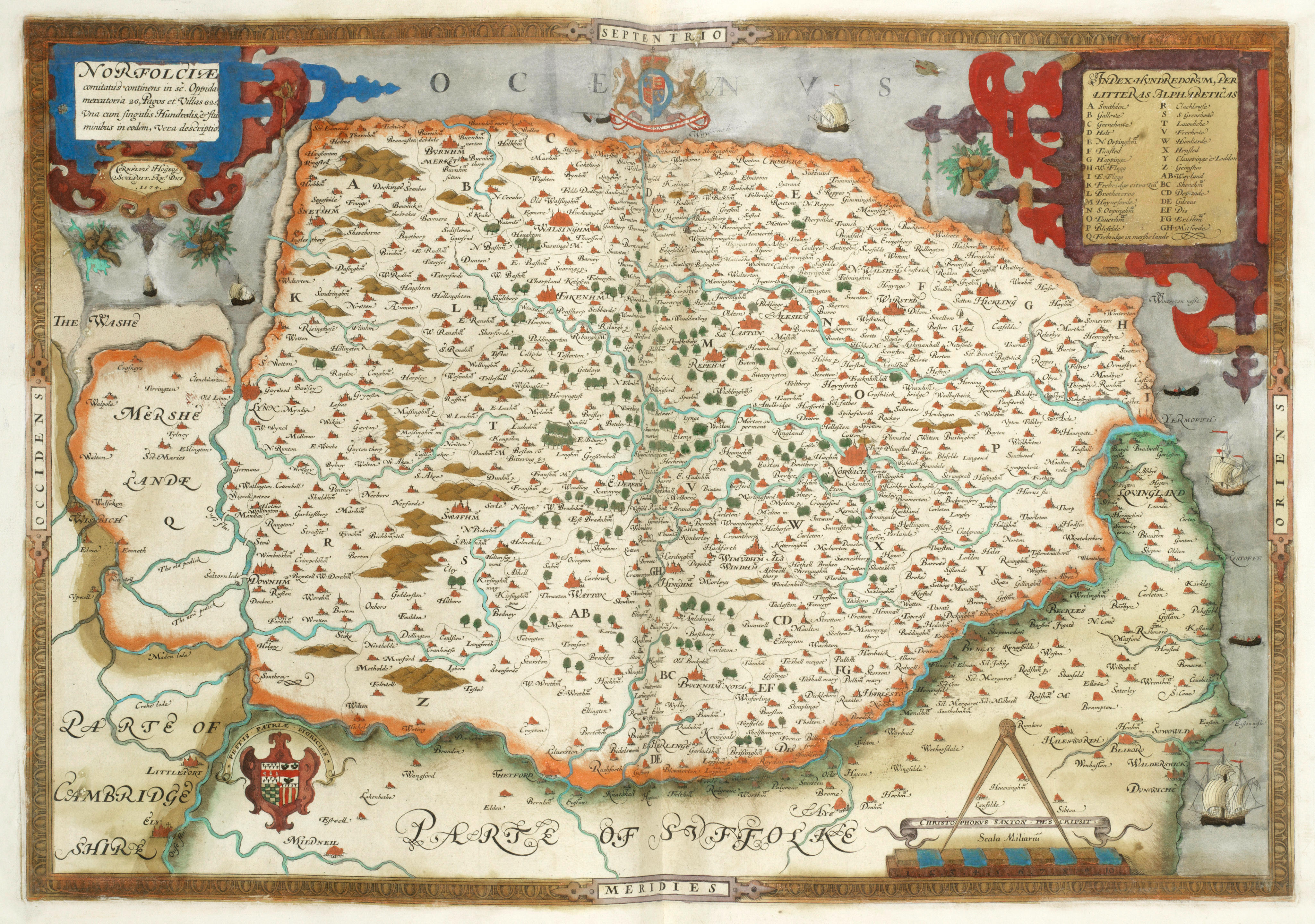
Norfolk 1579 Christopher Saxton (Chubb1.)
MarshlandTowns in Norfolk 1580 anon
Norwich 1581 Braun and Hogenburg (Image courtesy of Princeton Historic Map Collection
Norwich 1582 Georg Braun and Frans Hogenberg in Civitates Orbis Terrarum (vol. 3)
Norfolk 1579 Christopher Saxton (Image courtesy of Bonhams Auctions
Smallburgh 1582 John Darby
Norfolk 1583 Christopher Saxton revised edition engraved by Cornelis de Hooghe (Image courtesy of Wikimedia
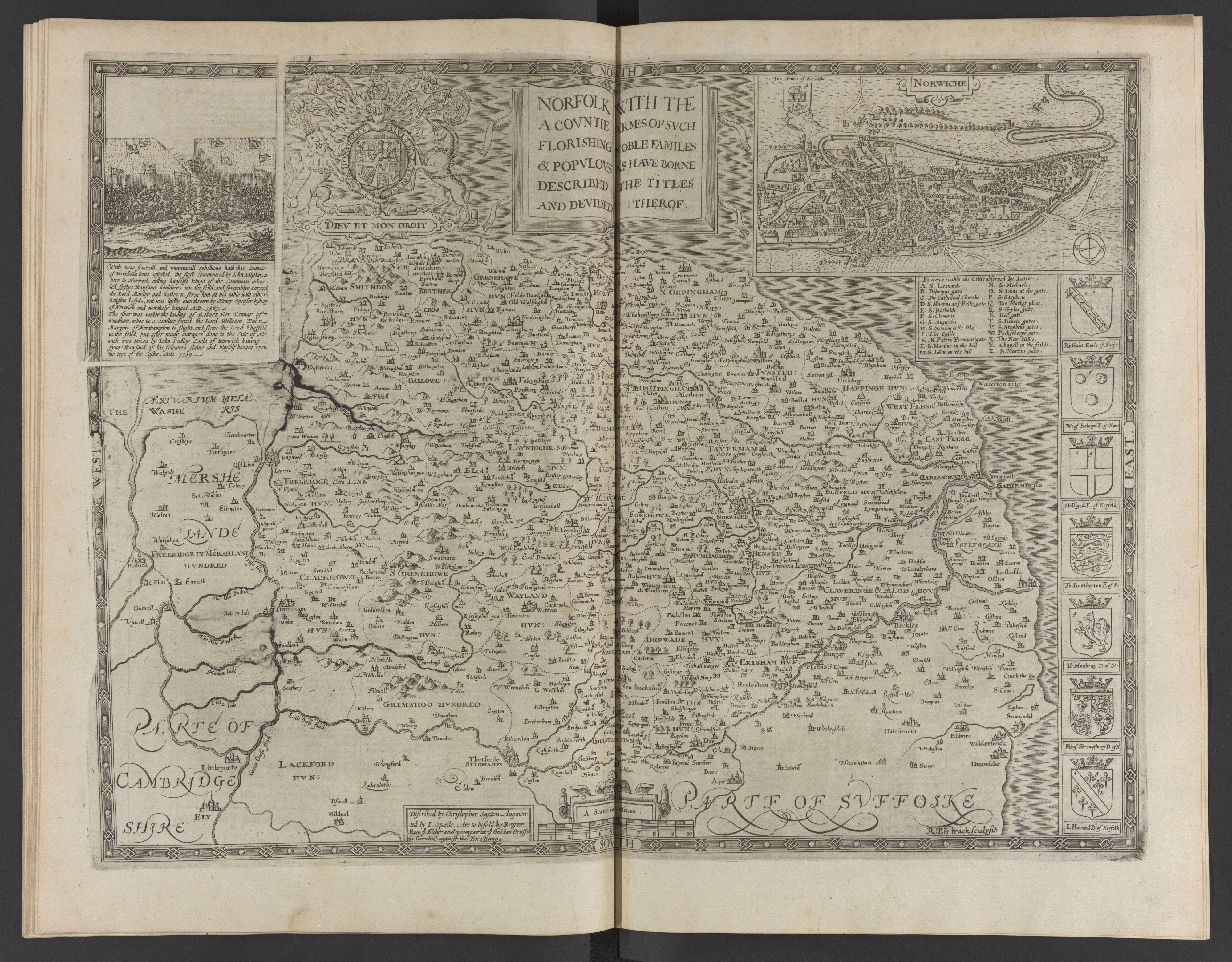
Norfolk 1610 John Speed in the Theatre of the the Empire of Great Britaine (Basset and Chiswell edition) (Chubb p.23 XXII)
Norwich 1630 K. Meisner
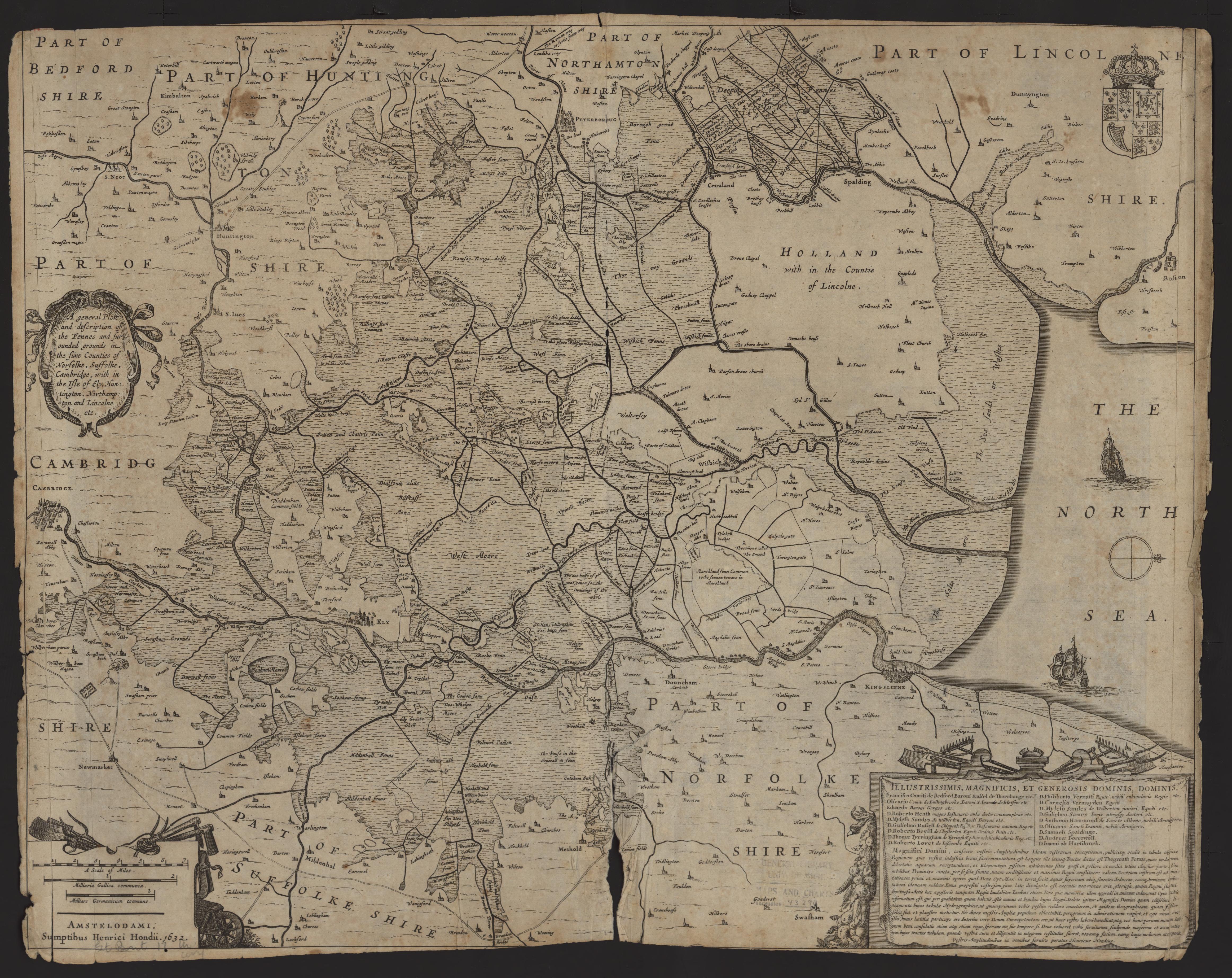
Fennes 1632 Henricus Hondius
(Image courtesy of Clark Library University of Michigan
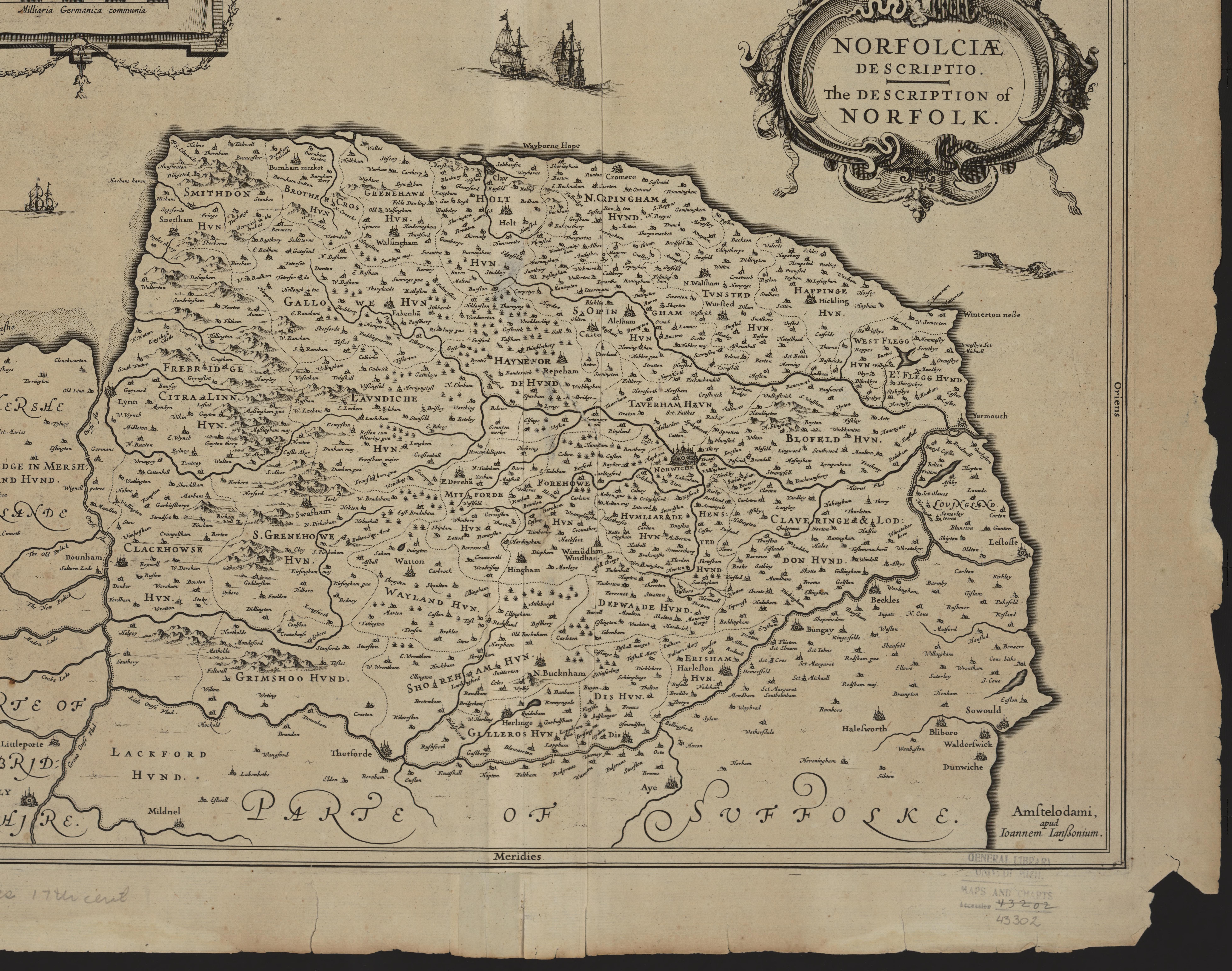
Norfolk 1636 Jan Jansson (not in Chubb
(Image courtesy of Stephen S. Clark Library University of Michigan Library
The Fennes 1645 Jan Jansson in his Atlas Novus (Image courtesy of The Mechanical Curator & Wikimedia)
Nordfolk 1645 Joan Bleau in Atlas Novus
(Image courtesy of Wikimedia)
The Fennes 1645 Joan Blaeu Chubb p.57 LIX )
(Image courtesy of Clark Library: University of Michigan)
Norfolk 1662 Roger Rea after John Speed in A Prospect of the Most Famous Parts of the World
(Image courtesy of The British Library King's Topographical Collection)
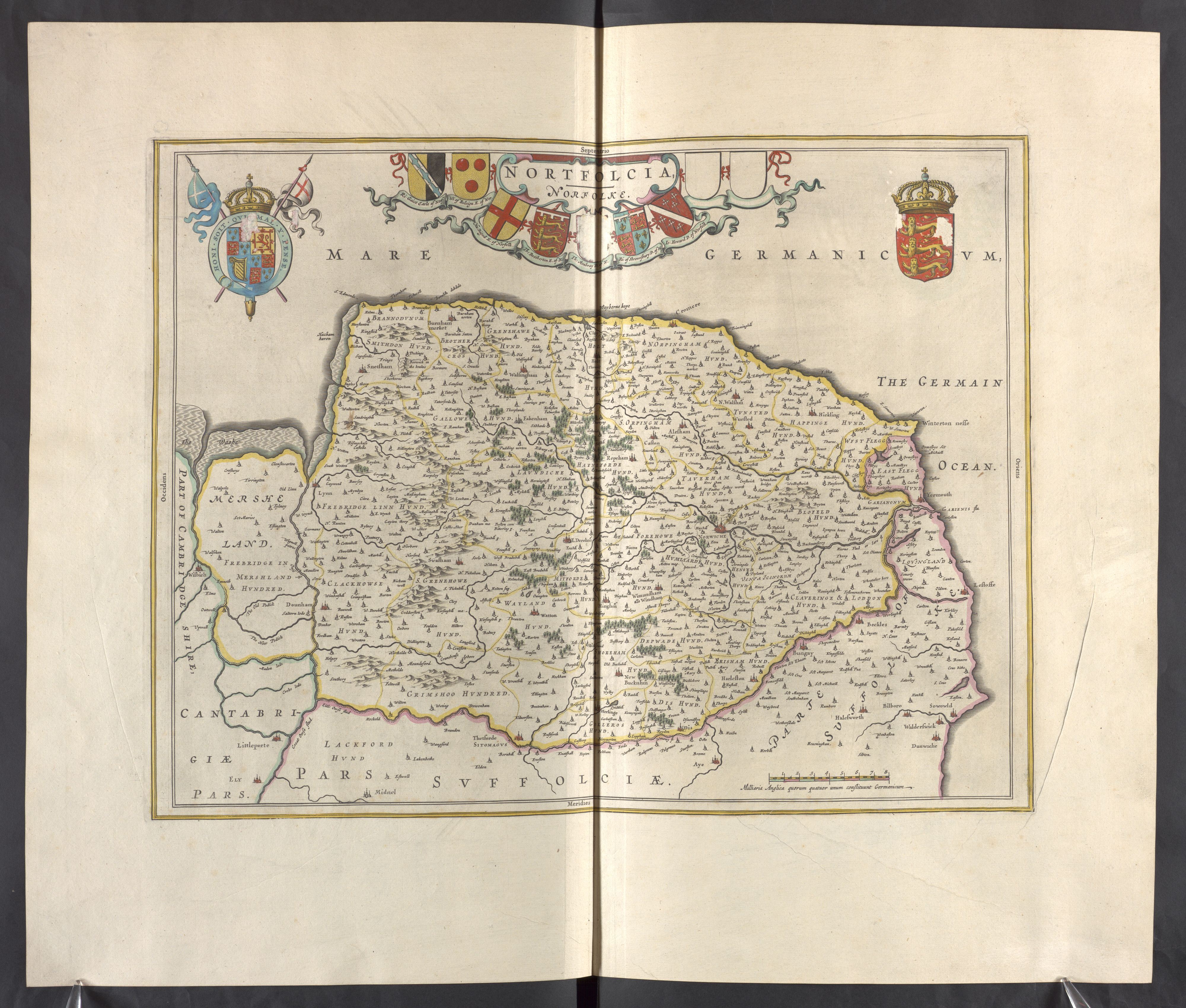
Norfolk 1667 Joan Blaeu
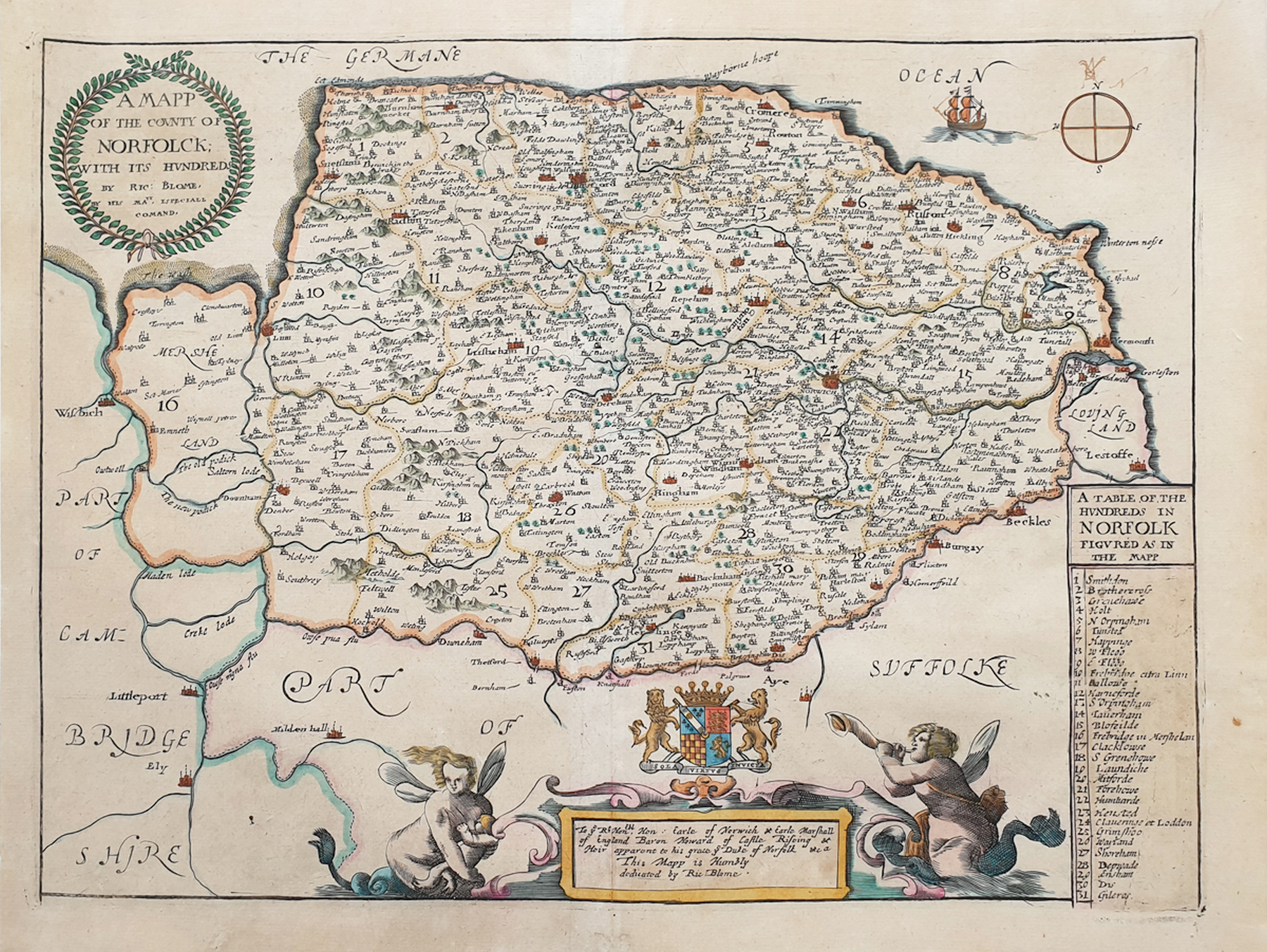
Norfolk 1670 Richard Blome (Image courtesy of Wikimedia)
Norfolk 1673 Richard Blome in his Britannia (Chubb XCIX)
Norfolk 1681 Richard Blome in Speed's Maps Epitomizd
Plan of Norwich 1689-1729 Sutton Nichols
(Image courtesy of
The British Library King's Topographic Collection Maps K.TOP)
Norfolk 1690 Robt. Morden John Sturt. Sculp (Chubb p.93. CXIII )
(image courtey ofYale University Library)
Norfolk 1695 Pieter van den Keere in his English Atlas (Chubb p.16 IX)
Norfolk 1701 John Seller for Camden's Britannia Abridged (Chubb CXX)
Also published using the same plates...
1703 for A History of England (Chubb CXXI) and
1695 as Anglia Contracta
Norfolk 1715 Jan Jansson republished by Gerardum Valk & Petrum Shenk with Jansson's imprint removed and their name inserted
Norfolk 1722 Robert Morden for Camden's Britannia (Chubb p.CLVII)
Norfolk 1730 Emanuel Bowen sculp. (Image courtesy of National Biblioteque de France via Wikimedia). (large file. may be slow to load)
A New and Accurate Plan of Norfolk 1731 T. Goddard and W. Chase (Image courtesy of The British Library, King's Collection. Maps K.Top 31.21.2.)
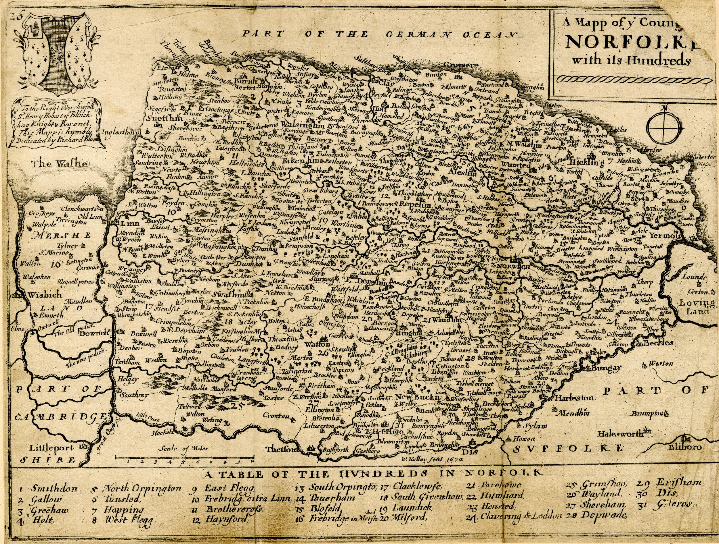
Norfolk 1740 Wenceslas_Hollar (Image courtesy of Wikimedia
Norfolk 1742 Thomas Badeslade and William Toms in Chorographia Britanniae (First State) (Chubb p.134 CLXXI)
Norfolk 1742 (Second State)Thomas Badeslade and William Toms in Chorographia Britanniae
Plan of the City of Norwich 1746 Francis Blomefield
(Image courtesy of The British Library: King's Collection. Maps K.TOP.31.31.)
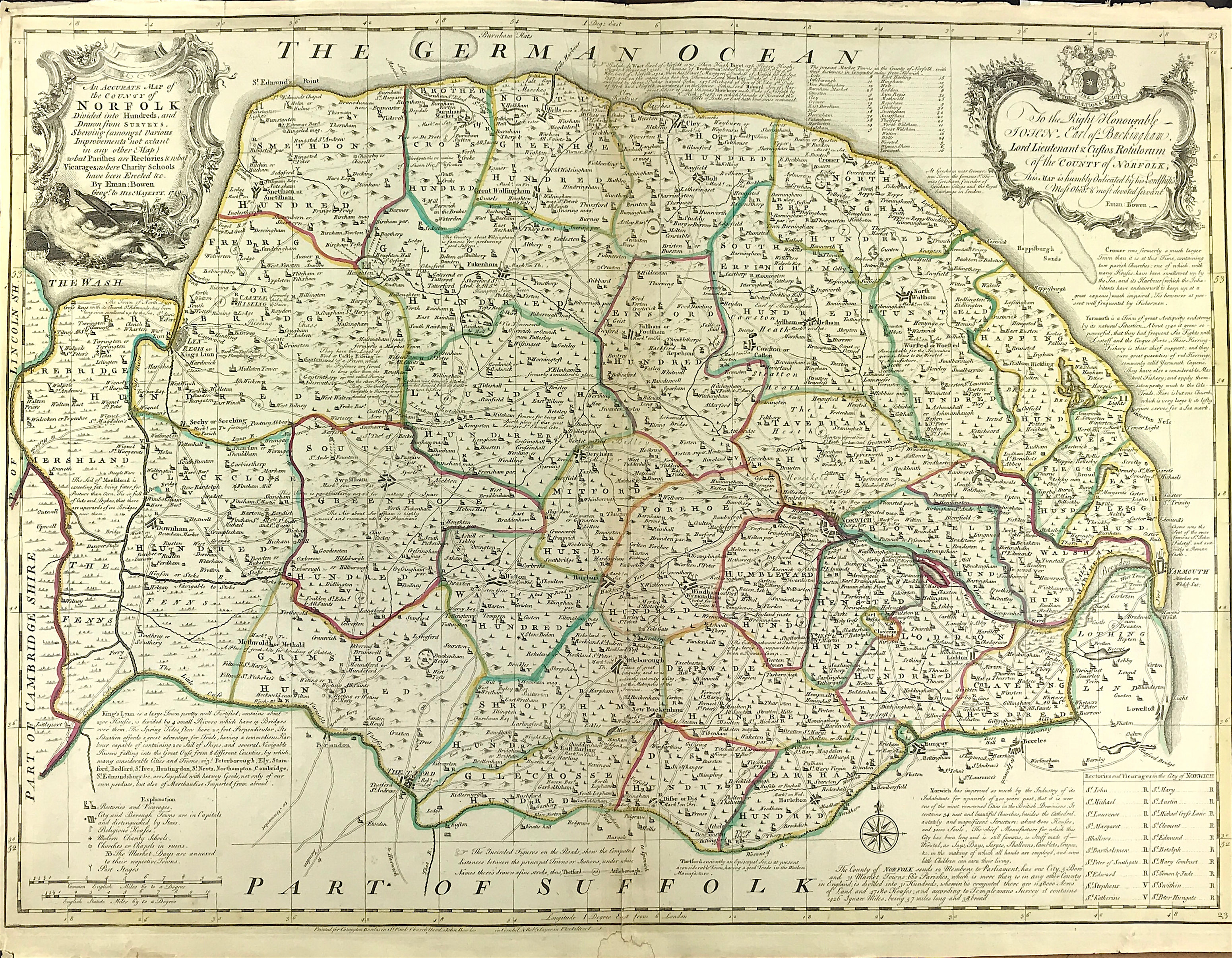
An Accurate Map of fthe County of Norfolk 1749 Emanuel Bowen for The Large English Atlas
Norfolk 1763 Thomas Bowen for the Royal English Atlas (Chubb p.179 CCXVII)
Norwich 1766 Samuel King
Norfolk 1768 John Ellis in Ellis's English Atlas
Norfolk 1769 Thomas Kitchen in England Displayed
This atlas has multiple contributors. compiled and published by P.Russell and Owen Price. The Northumberland page is unsigned and could be the work of Thomas Kitchen (1 plate) G.Rollos (4 plates) Jean Rocque (33 plates (reprinted from his Small British Atlas ) (Chubb p.174 CCX)
1799 Plan of Great Yarmouth ca.1779 Henry Swindon 1893 (Image courtesy of The British Library, King's Collection Maps K.TOP. 31.39.3.)
Norfolk 1786 Thomas Kitchen for Henry Boswell's Historical Descriptions...
(Chubb p.210 CCLVII) (Image courtesy of Wikimedia)
Norfolk 1785 Emanuel Bowen in The Large English Atlas
Norwich ca.1789 A Plan of the City of Norwich Anthony Hochstetter Survey'r and Samuel John Neele engr.
(Image courtesy of The British Library King's Collection Maps K.TOP )
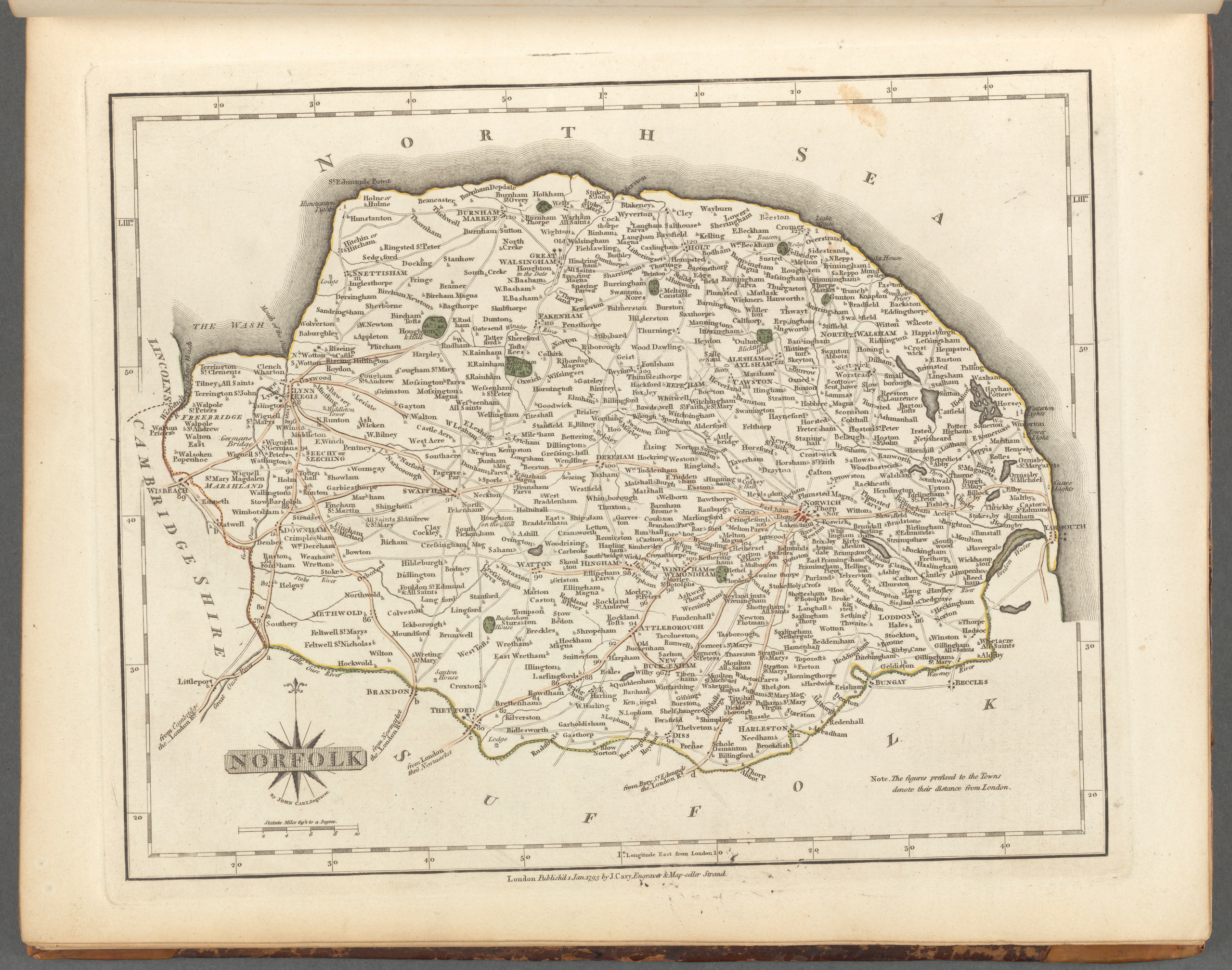
Norfolk 1793 John Cary in his New and Correct English Atlas (Image courtesy of New York Library Digital Collections (Chubb p.214 CLXI)
Norfolk 1797 Benjamin Baker
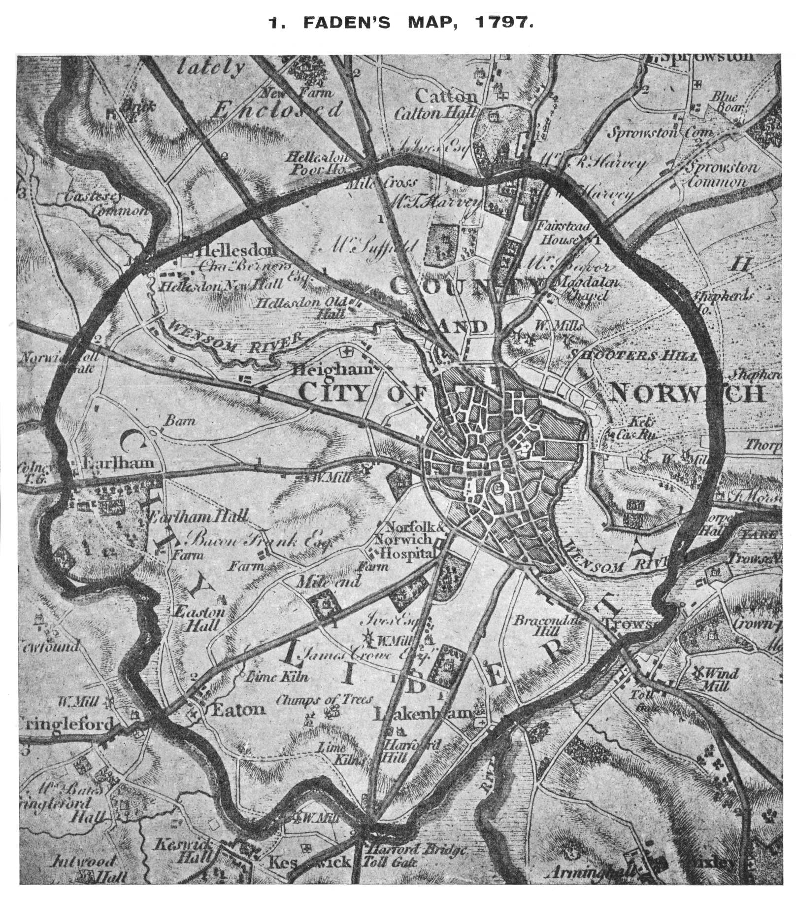
Norwich 1797 William Faden
Plan of Great Yarmouth ca.1779 Henry Swindon
(Image courtesy of The British Library King's Collection Maps K.TOP. 31.39.3.)
Norfolk 1803 John Aikin in England Delineated ( A simplified Atlas
...to make my young countrymen better acquainted than they are usually found to be with their native land) (Chubb p.223 CCLXXXIX)
Norwich 1803 William Green in The Picture of England
and 1804 for R: Butters' An Atlas of Britain. Chubb p.238 CCCX) Chubb p.238 CCCX)
(Image courtesy of The British Library: King's Collection. Maps K.TOP
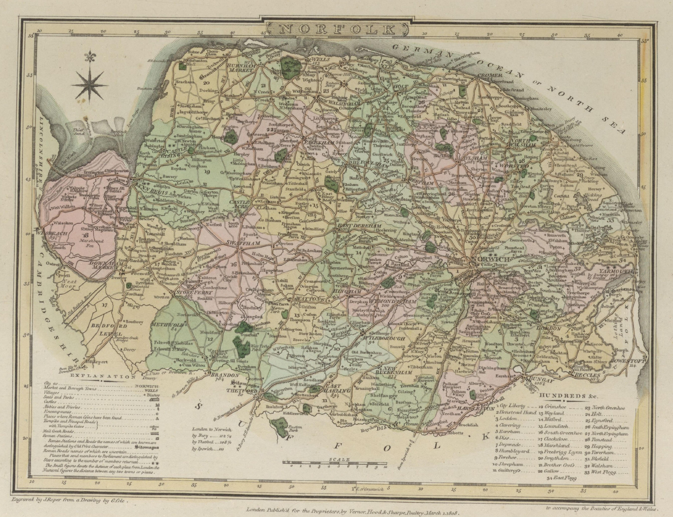
Norfolk 1810 John Roper in The British Atlas of England and Wales (Chubb p.249 CCCXXXIX)
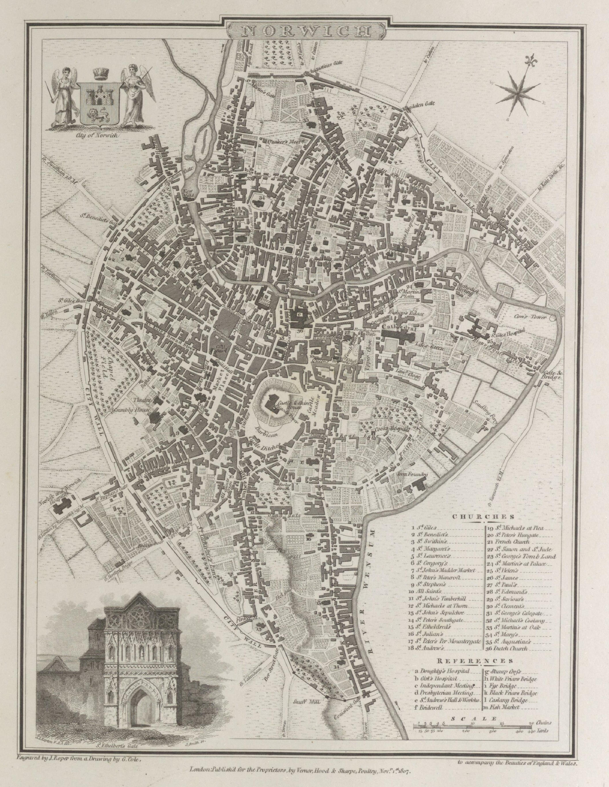
Plan of Norwich 1810 George Cole and John Roper in their British Atlas (Chubb p.249 CCCXXXIX)
(Image courtesy of The British Library-King's Topographical Collection)
Norfolk 1813 Benjamin Pitts Capper for A Topographical Dictionary of the United Kingdom
(Image courtesy of The British Library King's Collection (Image courtesy of The B)
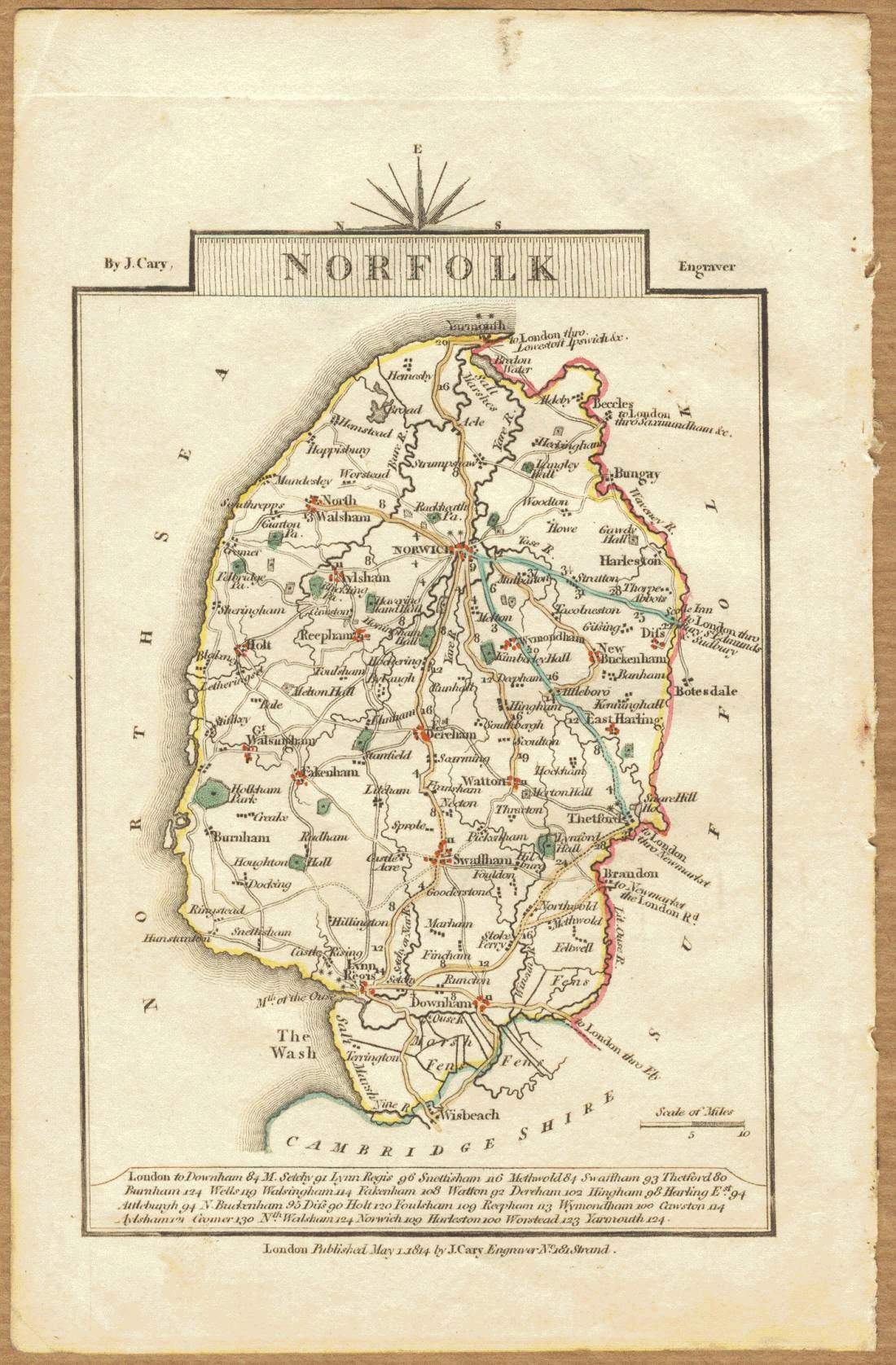
Norfolk 1814 John Cary in Cary's Traveller's Companion Chubb p.220 CCLXXIII)
Norfolk 1819 Ellis's New and Correct Atlas (Chubb p.168 CCCLXVII)
Norfolk 1819 Samuel Neele
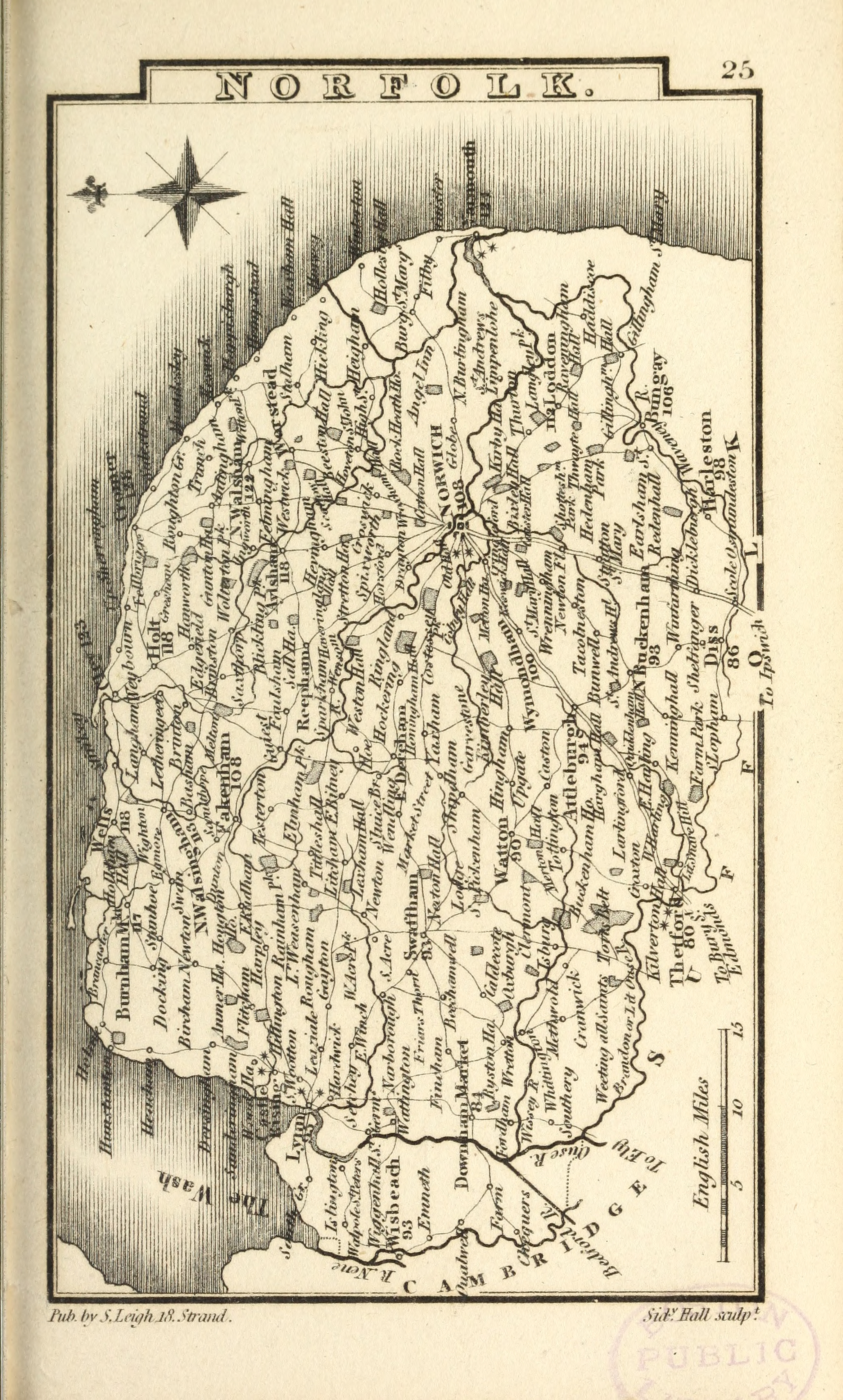
Norfolk 1822 Leigh's New Pocket Atlas Samuel Leigh
Norfolk 1824 George Carrington Gray in Gray's Book of Roads (Chubb p.281 CCCXCII)
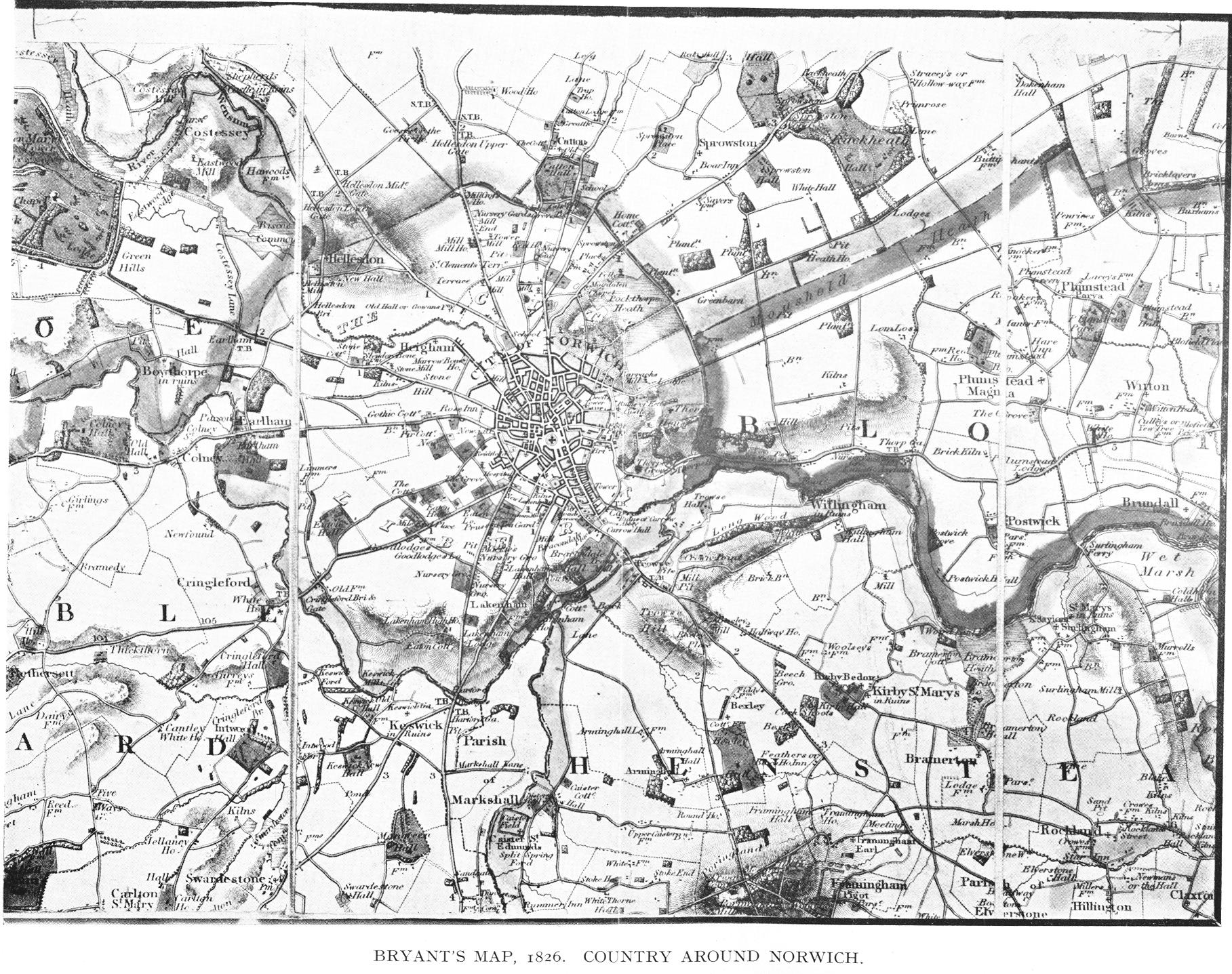
The Country Around Norwich 1826 Bryant
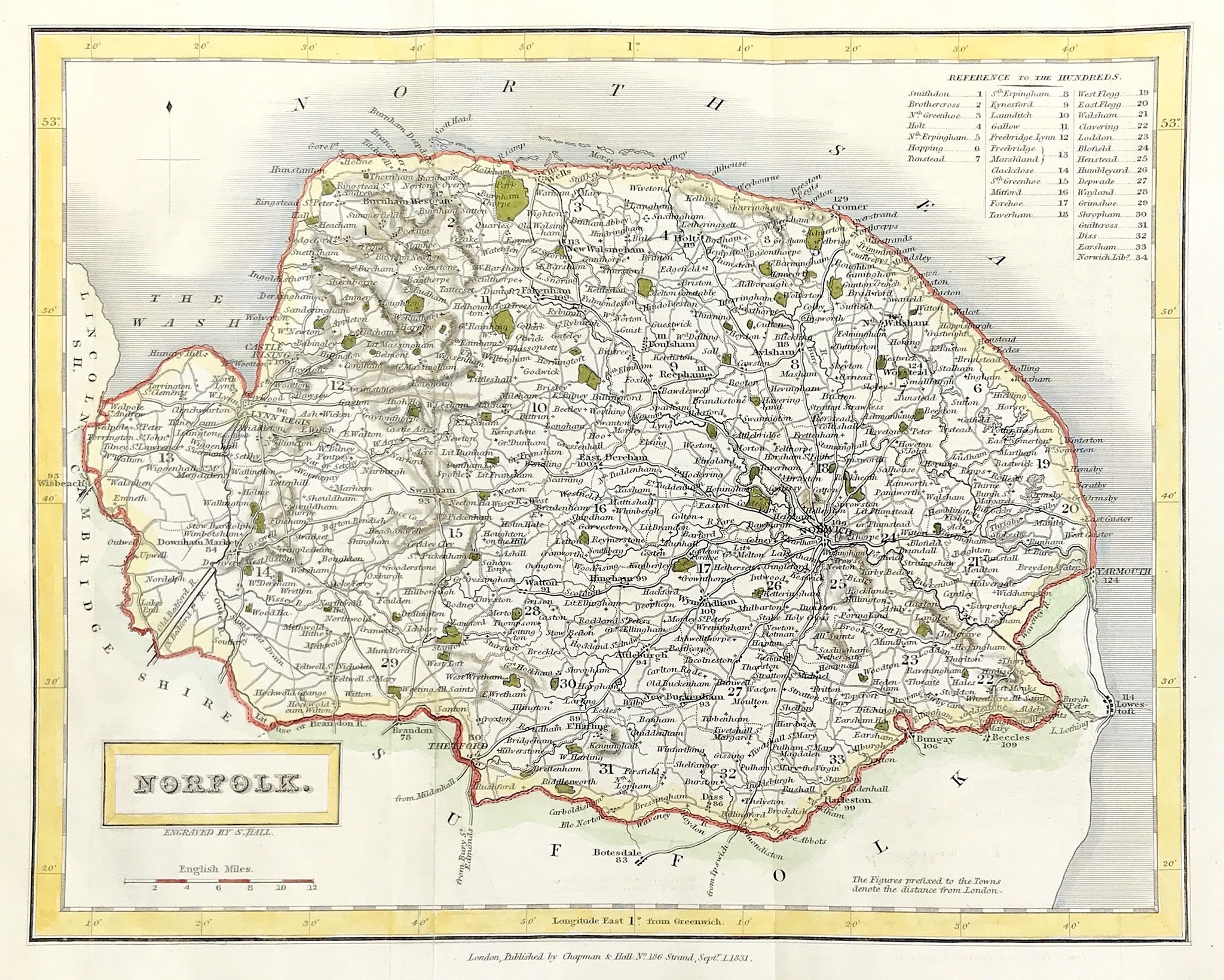
Norfolk c.1830 Sidney Hall from John Gorton's A Topographical Dictionary of Great Britain & Ireland
Kings Lynn 1832 Robert K. Dawson
Norfolk 1834 C. and J. Greenwood in Atlas of the Counties of England (Chubb CCCCLVIIIa) (Image courtesy of www.davidrumsey.com)
Kings Lynn 1835 Robert Creighton for Lewis's Topographical Dictionary Chubb p.322 CCCCLXIV)
Norwich 1835 (detail Robert Creighton for Lewis's Topographical Dictionary Chubb p.322 CCCCLXIV)
Thetford 1835 Robert Creighton for Lewis' Topographical Dictionary Chubb p.322 CCCCLXIV)
Thetford 1835 Robert K. Dawson
Yarmouth 1835 (detail 01) Robert Creighton for Lewis's Topographical Dictionary Chubb p.322 CCCCLXIV)
Yarmouth 1835 (detail 02) Robert Creighton for Lewis's Topographical Dictionary Chubb p.322 CCCCLXIV)
Norfolk 1836 Sydney Hall in The New British Atlas (Chubb p. 314 CCCCLI)
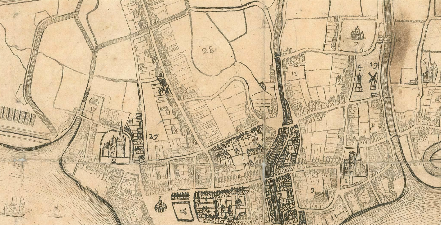
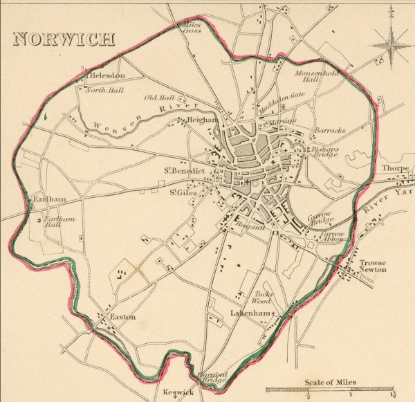
Norwich 1836 William Ionn. Shows the roads radiating out of Norwich
Norfolk 1837 W. Schmollinger. for Thomas Moule's The English Counties Delineated; or
A Topographical Description of England. (Chubb p.325 CCCLXXI)
Norfolk 1842 James Pigot in A Pocket Topography and Gazetteer of England (Chubb p.321 CCCCLXIII)
(Image courtesy of Wikimedia)
Norfolk 1848 Robert Creighton in The Atlas to Lewis' Topographical Directory Chubb p.322 CCCCLXIV)
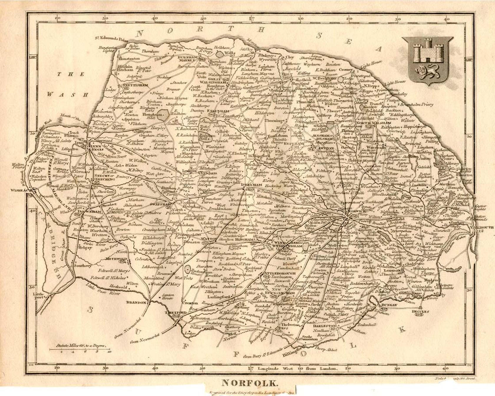
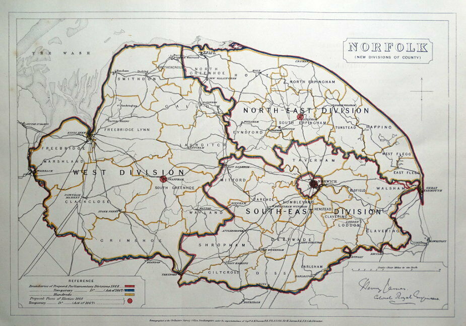
Norfolk 1868 H.James
Plan of Ipswich 1883 Adam Black in Black's Guide To England and Wales
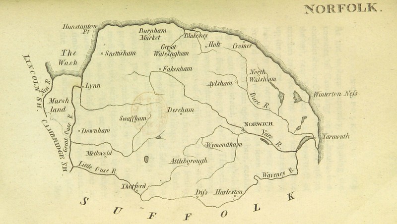
Norfolk 1884 Encyclopaedia Britannica
Norfolk 1885 Stanford's Parliamentary Atlas of England and Wales
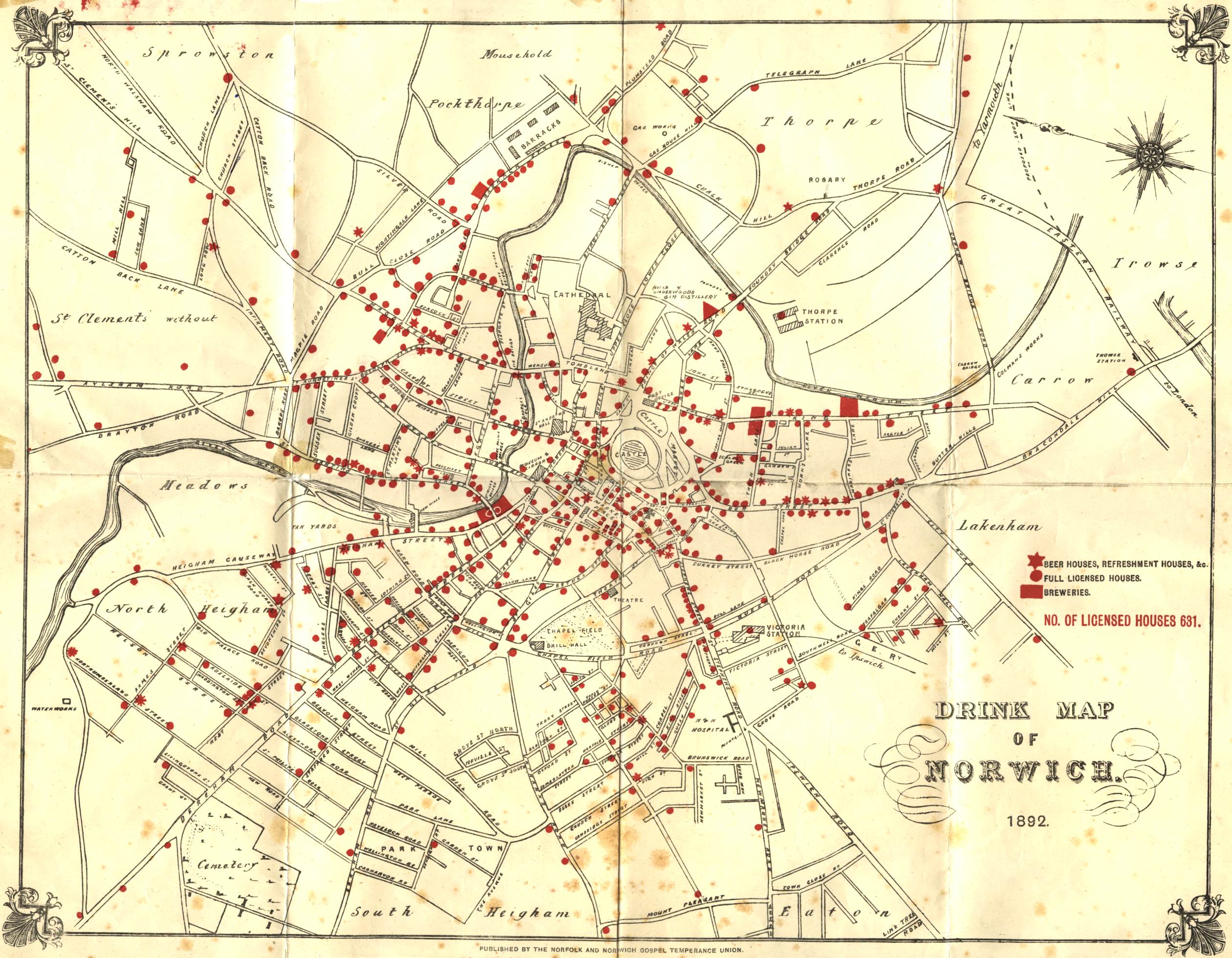
Norwich 1892 Licenced Premises Norfolk and Norwich Gospel Temperance Movement
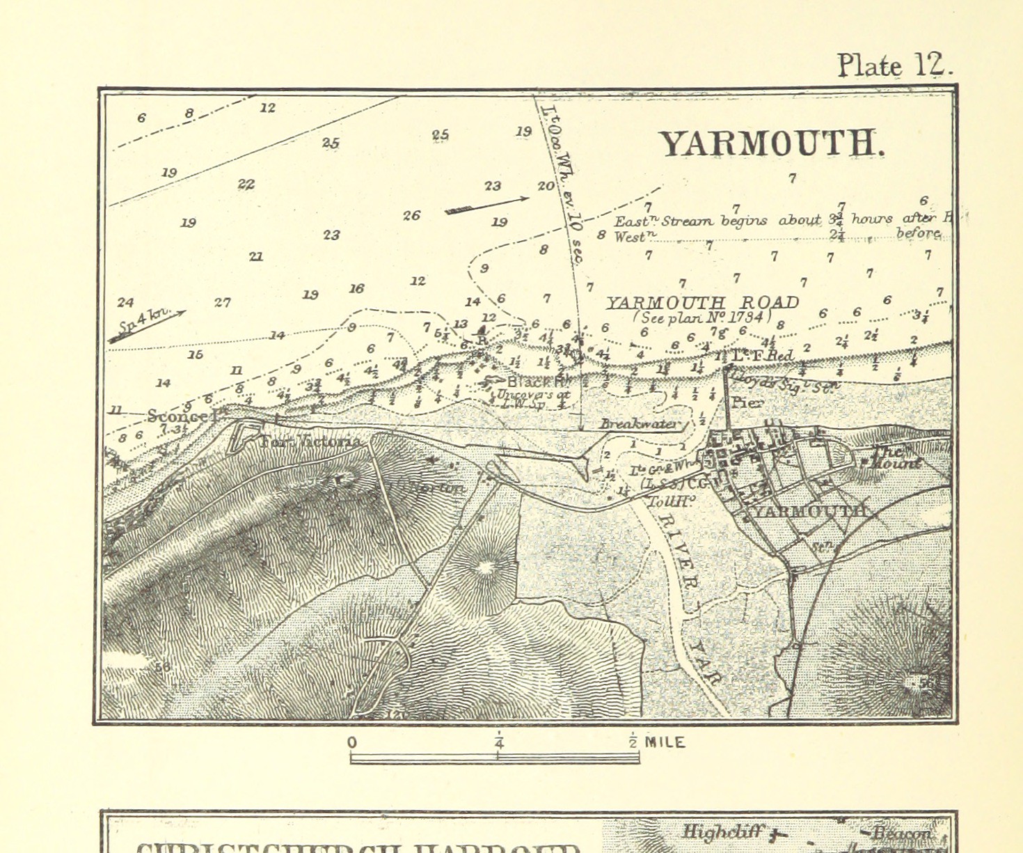
Yarmouth 1898 Darcy B. Kitchin in The Solent Chart Book
The_Parishes of Shipden and Cromer 1889 (Reproduction of a 1747 Plan by Samuel Belgard
Norwich 1910 Karl Baedecker
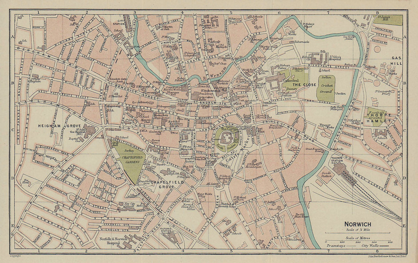
Norwich 1920 Bartholomew
.jpg)
.jpg)
.jpg)
.jpg)
.jpg)
.jpg)
%20.jpg)
.jpg)
%20.jpg)
%20Thomas%20Badeslade%20and%20William%20Toms%20in%20Chorographia%20Britanniae%20.jpg)
%20Thomas%20Badeslade%20and%20William%20Toms%20(Chubb%20p.133%20CLXX).jpg)
.jpg)
%20.jpg)
.jpg)
%20.jpg)
%201832%20Robert%20K.%20Dawson%20.jpg)
%20(Image%20courtesy%20of%20www.davidrumsey.com).jpg)
%20Robert%20Creighton%20for%20Lewis's%20Topographical%20Dictionary%20(2).jpg)
.jpg)
.jpg)
%20Robert%20Creighton%20for%20Lewis's%20Topographical%20Dictionary%20(2).jpg)
%20Robert%20Creighton%20for%20Lewis's%20Topographical%20Dictionary.jpg)
%201889%20.jpg)