| |
 Home Resources consulted for Oxfordshire A Bibliography of County Maps - Large Scale County Maps of England. Tooley R.V. The Printed Maps in the Atlases of Great Britain and Ireland1579-1870 Chubb Thomas Dawson 1927 |  To resize image:
L-click on image or hold CTRL and use mouse scroll-wheel |
Oxonium Buckingham and Berkshire 1579 William Kip after Christopher Saxton (Image courtesy of The Royal Collection Trust RCIN 1046848
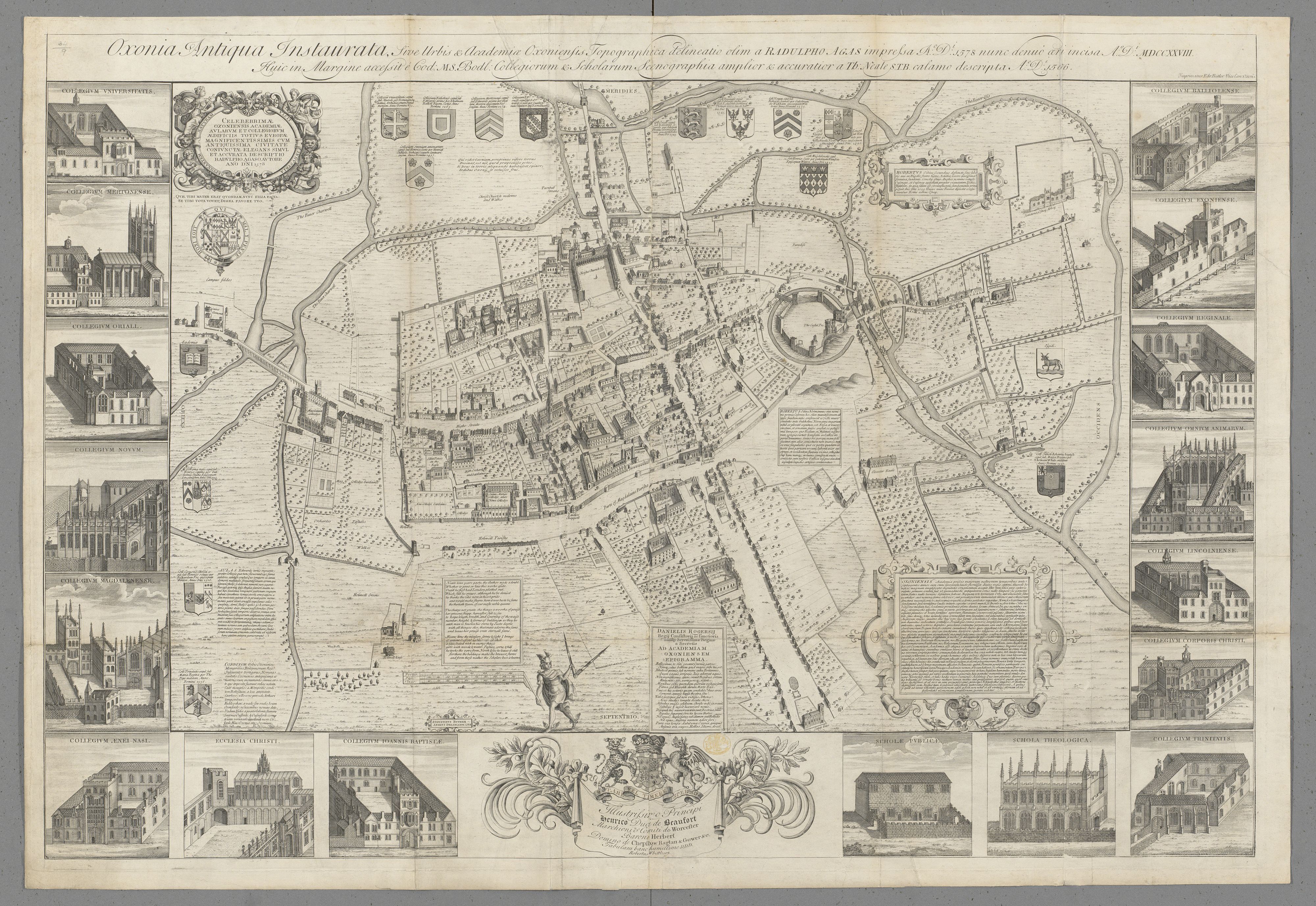
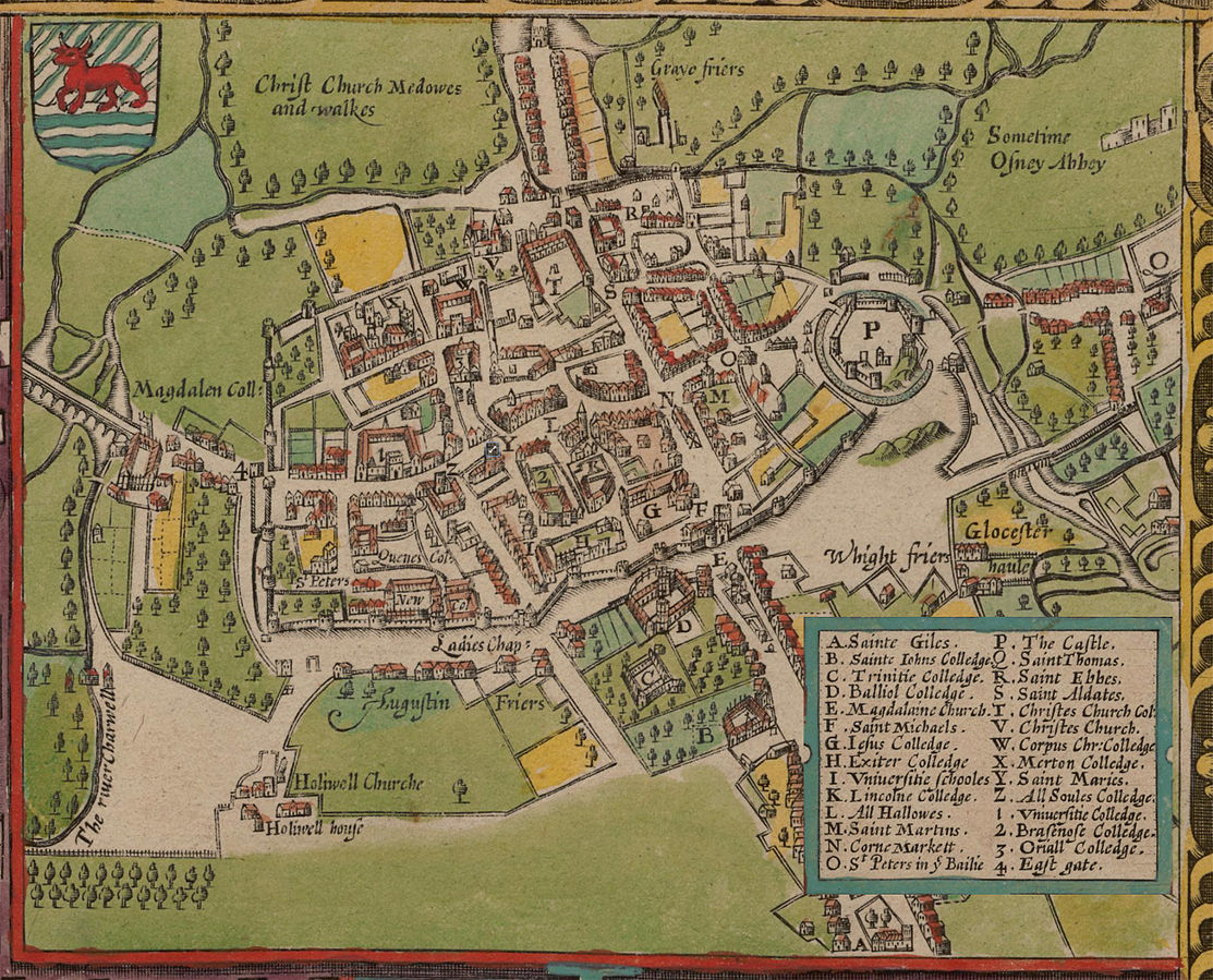
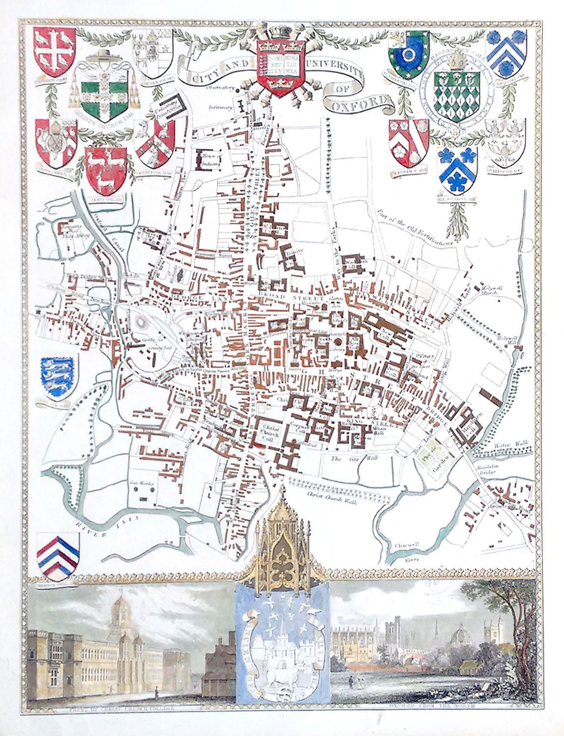
The City and University of Oxford Drawn originally by Radulpho Agas 1578 and re-engraved1728 by Robert Whittellesy . (Image courtesy of The British Library King's Collection Maps K.TOP.34.9.)
A Plan of Oxford 1605 John Speed in The Theatre of the Empire of Great Britaine (Chubb p.23 XXII)
Oxfordshire 1605 Pieter van -den Keere in his British Atlas (Chubb p.16 IX)
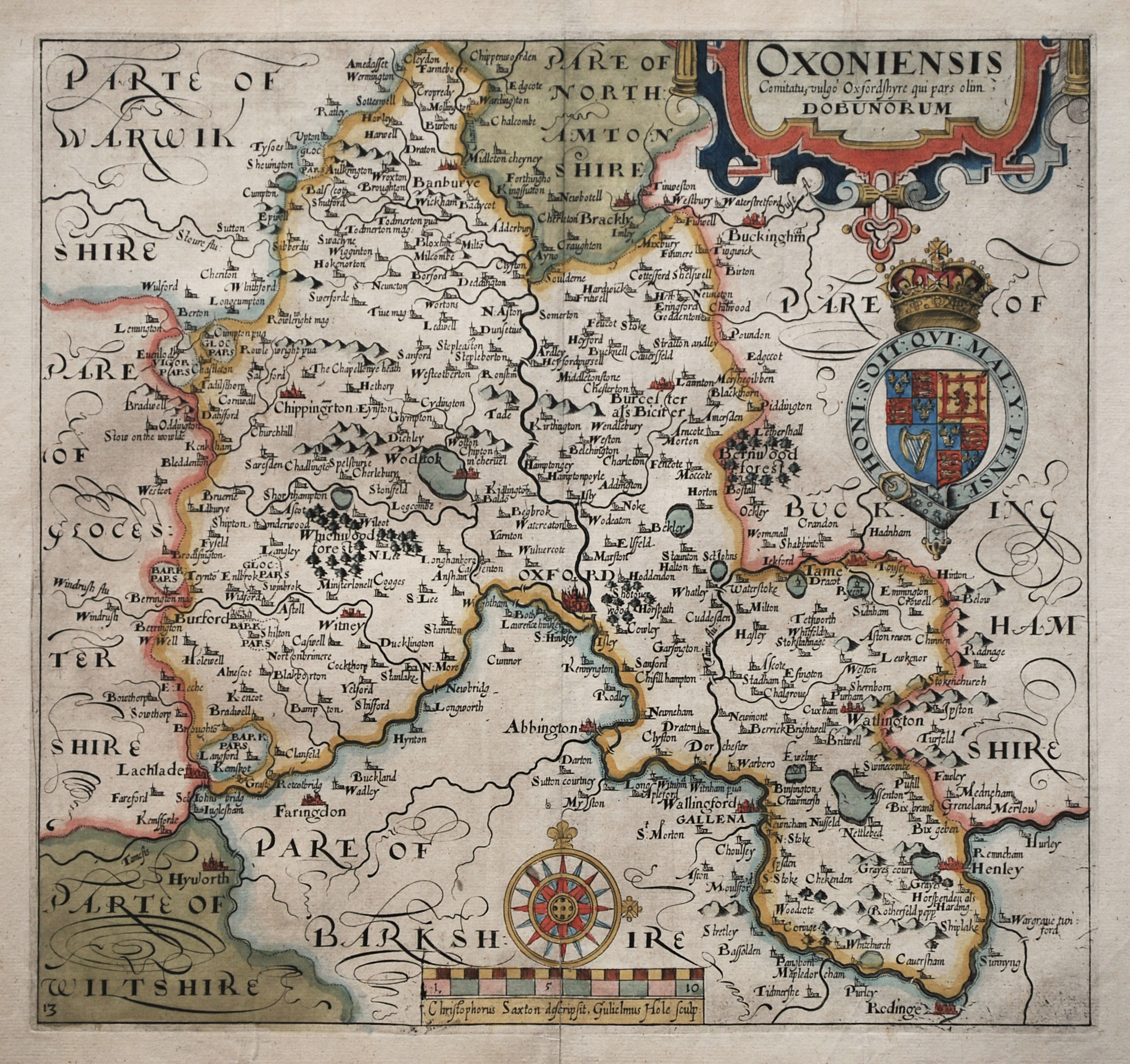
Oxford 1610 William Hole after Christopher Saxton (Chubb p.3)
Oxfordshire 1612 Michael Drayton to illustrate his Polyolbion (Chubb XXXV)
Oxfordshire 1614 John Speed in The Theatre of the Empire of Geat Britaine Chubb p.23 XXII)
Oxfordshire 1637 William Hole after Christopher Saxton for Camden's Britannia (Chubb p.22 XX )
Oxfordshire 1646 Jan Jansson in Atlas Novus (Image courtesy of The British Library
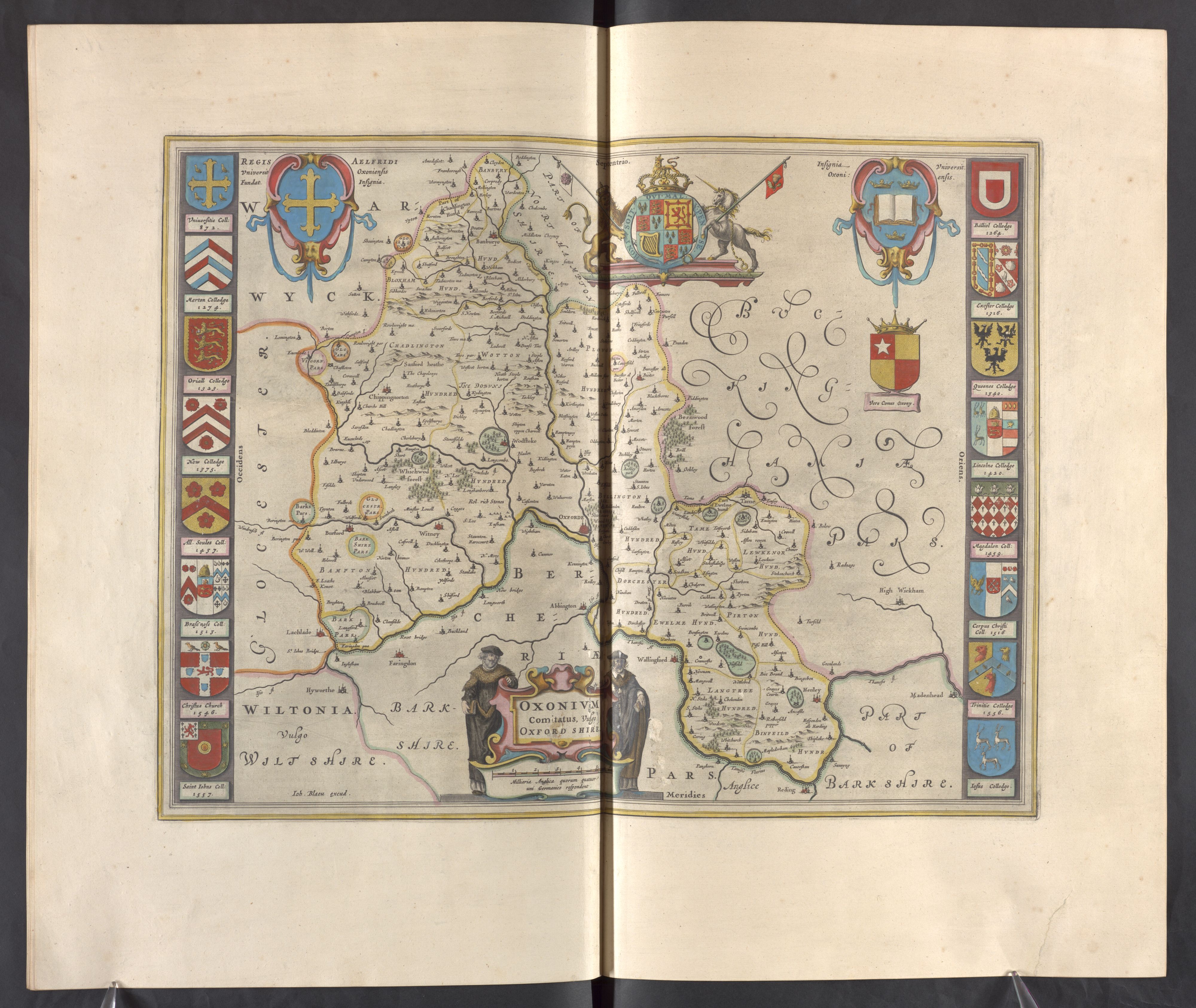
Oxfordshire 1650 Joan Blaeu In his Theatrum Orbis Terrarum (Chubb p.63 LX )
Oxfordshire 1653 Jan Janssen in Atlas Novus 1653 (Chubb p. 67 LXX map 15)
Oxfordshire 1662 John Speed in A Prospect of the Most Famous Parts of the World (Roger Rea Edition)
(Image courtesy of The British Library King's Collection)
Oxfordshire 1673 Richard Blome in his Britannia (Chubb p.81 XCIX)
Oxfordshire 1677 Robert Plot in his Natural History of Oxford (note similarity to Joan Blaeu 1650)
Oxford 1667 Joan Blaeu in Le Grand Atlas: volume 5
Oxfordshire 1695 Robert Morden in Camden's Britannia (Chubb p.93 CXIII )
A Map of Oxfordshire 1700 Phillip Lea (Image courtesy of (Yale University Library) (Large file: May be slow to load)
20 Miles Around Oxford 1706 Guil. Delaune Vice-Cancelarius Oxoniensis Benjamin Cole (Image courtesy of The British Library, King's Collection. Maps K.TOP.34.1)
Nova & Accuratissma Celeberimae Universitas Civitisque Oxoniensis Scenographia ca. 1710 David Loggan
(Image courtesy of The British Library King's Collection Maps K.Top.)
Oxfordshire 1715 Philip Overton (Yale University Library) (Large file: May be slow to load)
Oxfordshire 1724 Herman Moll in A New Description of England and Wales (Chubb CLXXXVII)
(Image courtesy of The British Library King's Collection. Maps K.TOP34.4.)
Oxfordshire 1730 Thomas Bowles (Image courtesy of The British Library King's Collection Maps K.TOP)
Oxfordshire 1744 John Cowley in R.Dodsley's Geography of England (Chubb 139 CLXXXI)
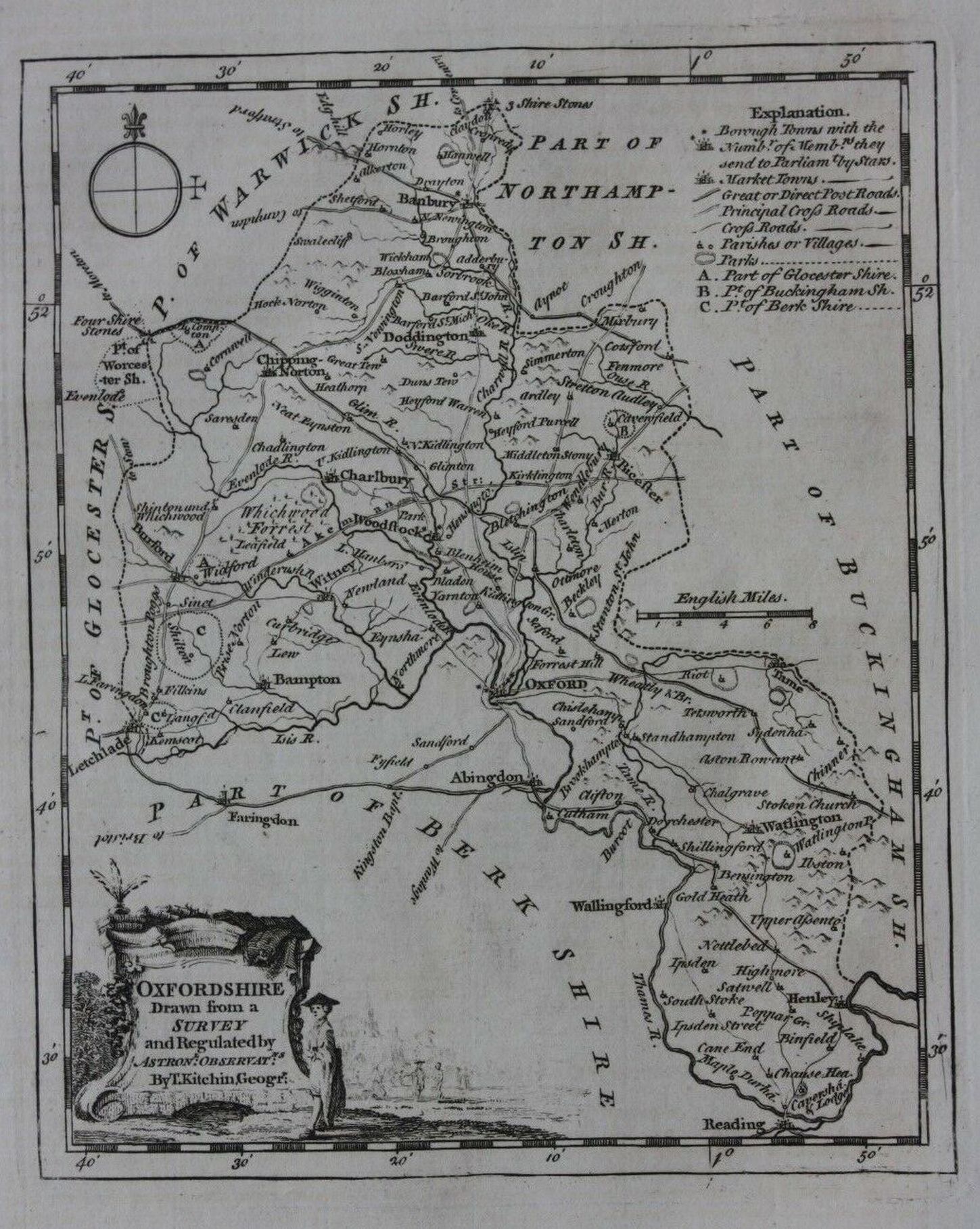
A New and Improved Map of Oxfordshire 1740 Thomas Kitchin
(Image courtesy of The British Library: King's Collection Maps KTOP.34.5.)
Oxfordshire 1769 Thomas Kitchin in Kitchin's Pocket Atlas (Chubb p.195 CCXXXV )
Oxfordshire 1766 Thomas Jeffereys. Possibly from one of the many reprints of Ellis's English Atlas.
Oxfordshire 1777-1787 John Seller for Francis Grose's Supplement to the Antiquities. (Seller's name can just be seen scratched out.
Plan of the City of Oxford 1789 Emanuel Faden (Image courtesy of The British Library
Oxfordshire 1786 Thomas Kitchen in The Antiquities of England and Wales (Chubb p.210 CCLVII)
Oxfordshire 1803 John Aikin 1788 in his England Delineated (A simplified atlas for chidren)
Oxford 1789 Emanuel Faden
Oxfordshire Reduced from an actual Survey in 16 Sheets 1797 Richard Davis
(Image courtesy of The British Library: King's Collection. Maps K.TOP.34.8.)
Oxfordshire 1793 John Cary in his New and Correct English Atlas (Chubb p.220 CCLXXIII
(image courtesy of New York Library digital collections)
Oxford 1794 Alex Hogg (AKA Augustus Walpoole) after Thomas Kitchin for William Hugh Dalton's The New and Complete English Traveller
A New Map of Oxfordshire 1797 Richard Davies (Large file: May be slow to load)
Oxfordshire 1800 John Aiken in England and Wales Delineated (A simplified atlas for chidren)
(Image courtesy of The Mechanical Curator & Wikimedia)
Oxfordshire William Green in A Picture of England Oxford 1804 William Green in The Picture of England (Image courtesy of The British Library King's Collection Maps K.TOP)
The country for twenty five miles round the University of Oxford 1805: Samuel Neele
Oxfordshire 1808 Henry Cooper in An Atlas of the British Islands (Chubb p.245 CCCXXVII)
Oxfordshire 1809 John Roper in The British Atlas of England and Wales (Chubb p.250 CCCXXXIX)
Oxfordshire 1810 J Wallis in the New Pocket Edition of the English Counties (Chubb p. 256 CCCXLIV )
Oxford 1814 John Cary in Cary's Traveller's Companion (Chubb p.220 CCLXXIII)
Plan of Oxford 1817 anon (Image courtesy of The British Library King's Collection Maps K.TOP)
Oxfordshire 1824 George Carrington Gray in Gray's New Book of Roads (Chubb p.281 CCCXCII)
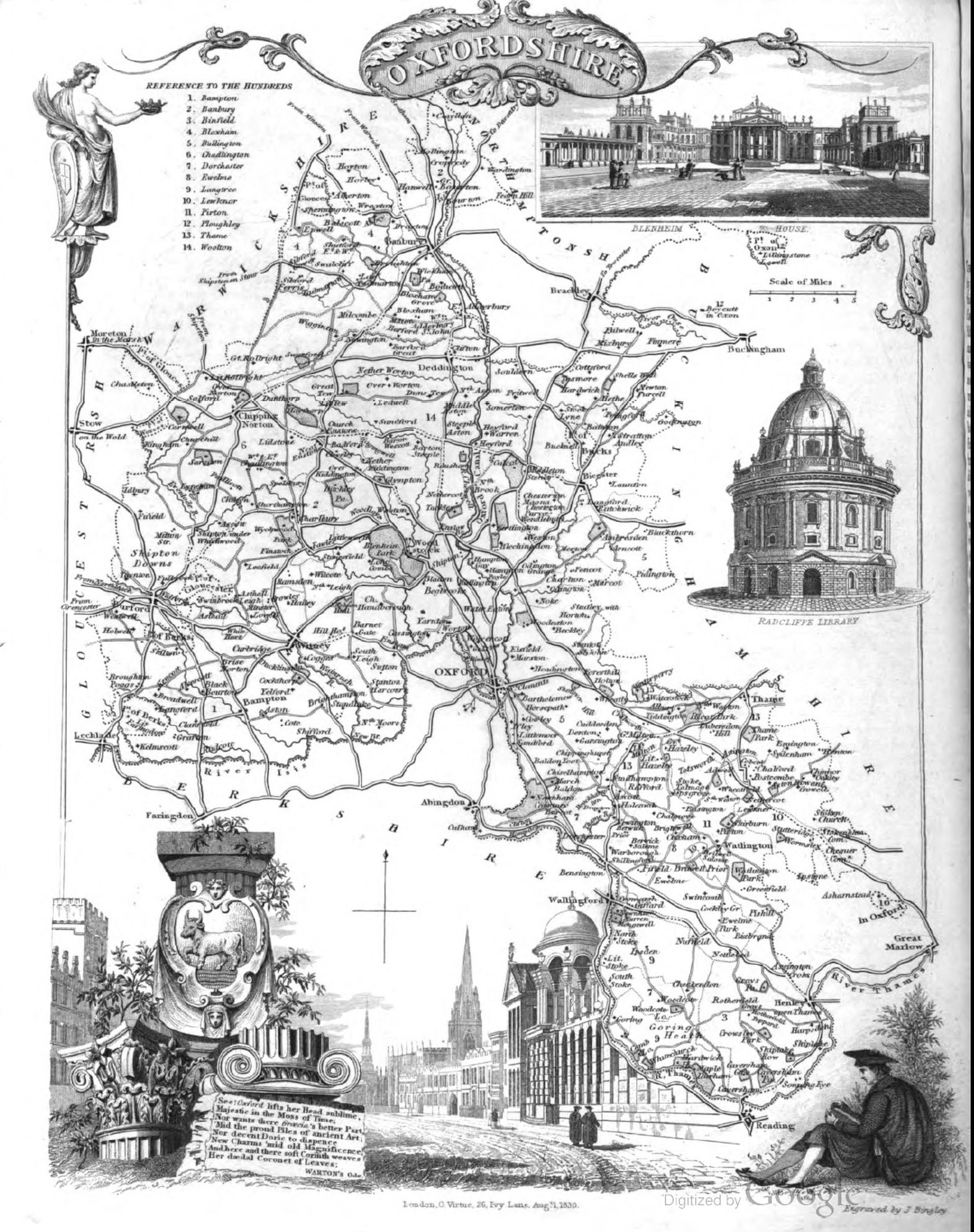
The County and University of Oxford 1827 Thomas Moule in his The English Counties Delineated
(Chubb p.325 CCCCLXII)
Oxfordshire 1831 Robert Creighton for Lewis's Topographical Dictionary of England and Wales (Chubb p.322 CCCCLXIV)
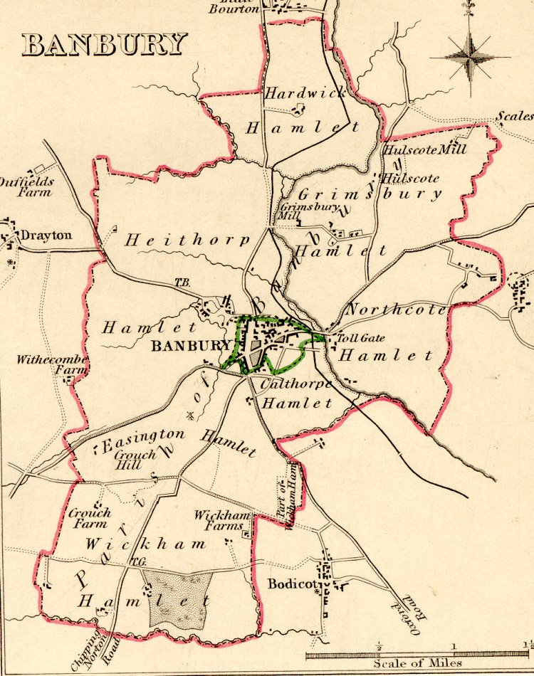
Banbury 1835 Robert Creighton for Lewis's Topographical Dictionary of England and Wales (Chubb p.322 CCCCLXIV)
Oxfordshire 1836 Sydney Hall in The New British Atlas (Chubb p:322 CCCCLXV)
Oxfordshire 1837 Thomas Moule in The English Counties Delineated (Chubb CCCCLXXll)
Oxfordshire 1842 Pigot and Co (Image courtesy of The Mechanical Curator & Wikimedia)
Oxfordshire and its Neighborhood 1847 H.Parker
(Large file - may be slow to load) (Image courtesy of Yale University Library)
Oxfordshire 1848 Henry Teesdale Pub H.G. Collins
Oxfordshire 1848 Robert Creighton in An Atlas to Lewis' Topographic Directory (Chubb p.322 CCCCLXIV)
Bacon's plan of Oxford 1850 G.W.Bacon
( Image courtesy of Harvard University Library)
Abingdon 1868 Henry James (Image courtesy of The Mechanical Curator & Wikimedia)
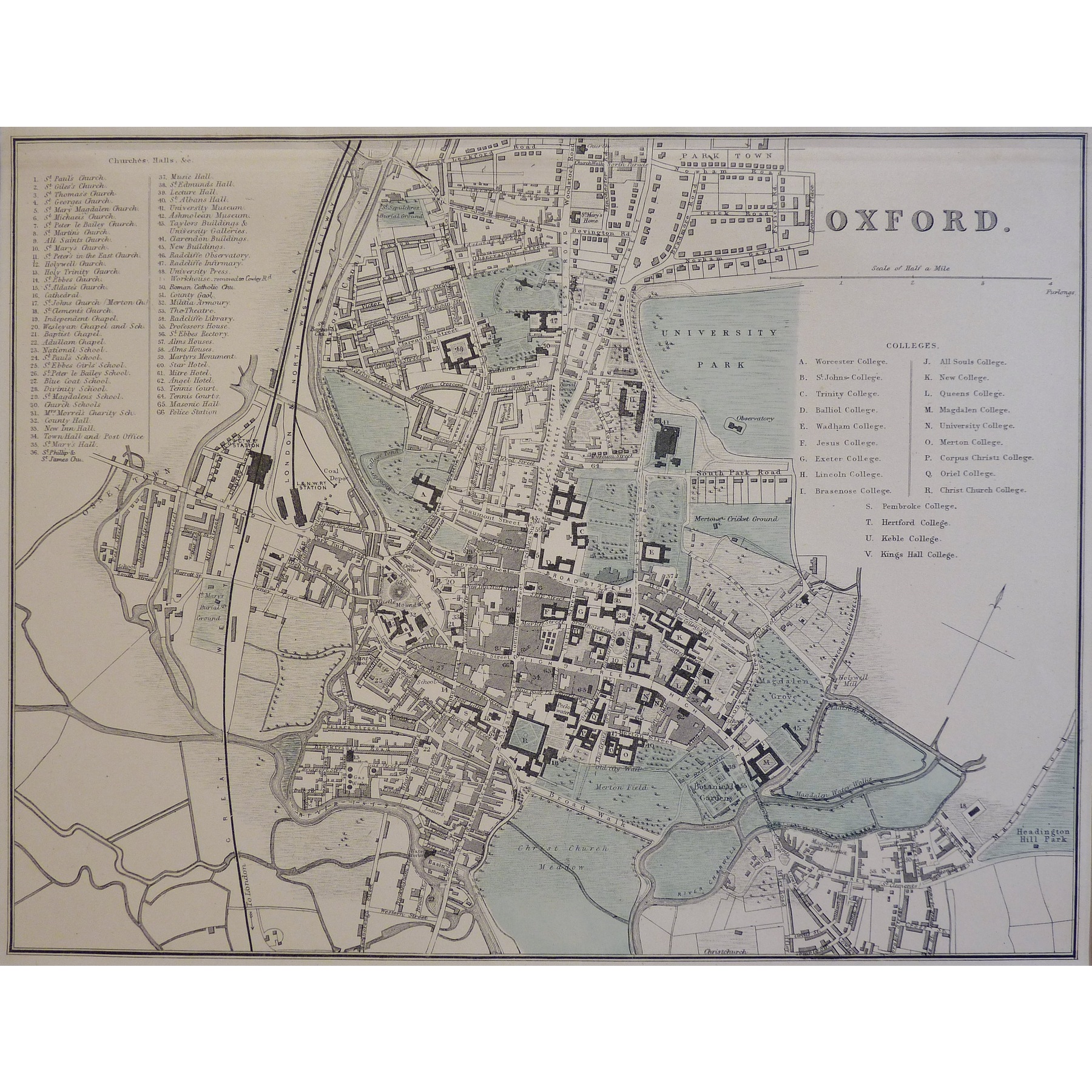
Plan of Oxford 1883 Adam Black in Black's Guide To England and Wales
Oxford 1884
(Left Sheet)
(Right Sheet)
A. & C. Black (Image courtesy of The Mechanical Curator & Wikimedia)
Oxfordshire 1885 Stanford's Parliamentary Atlas of England and Wales
Oxford 1889 George Bacon
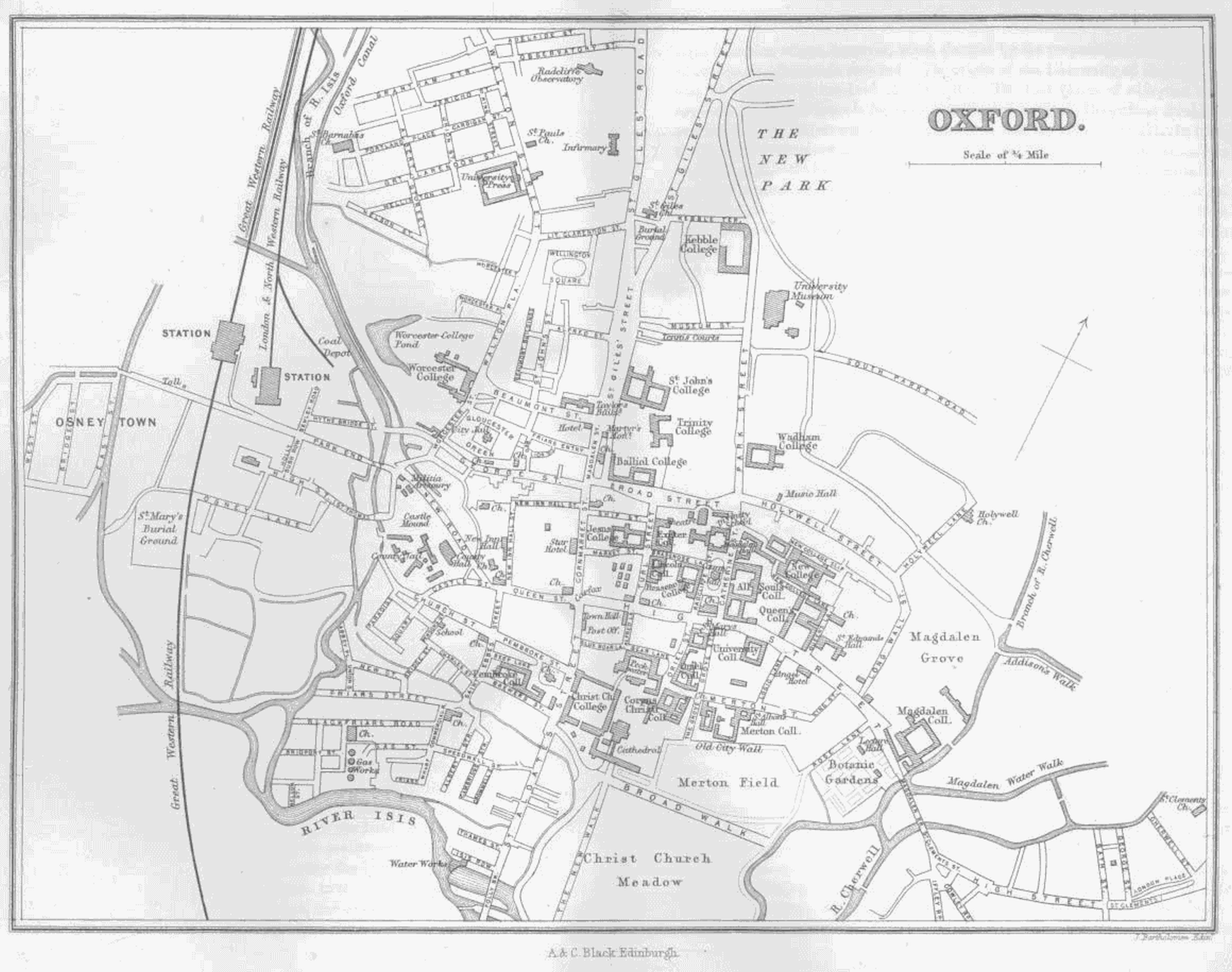
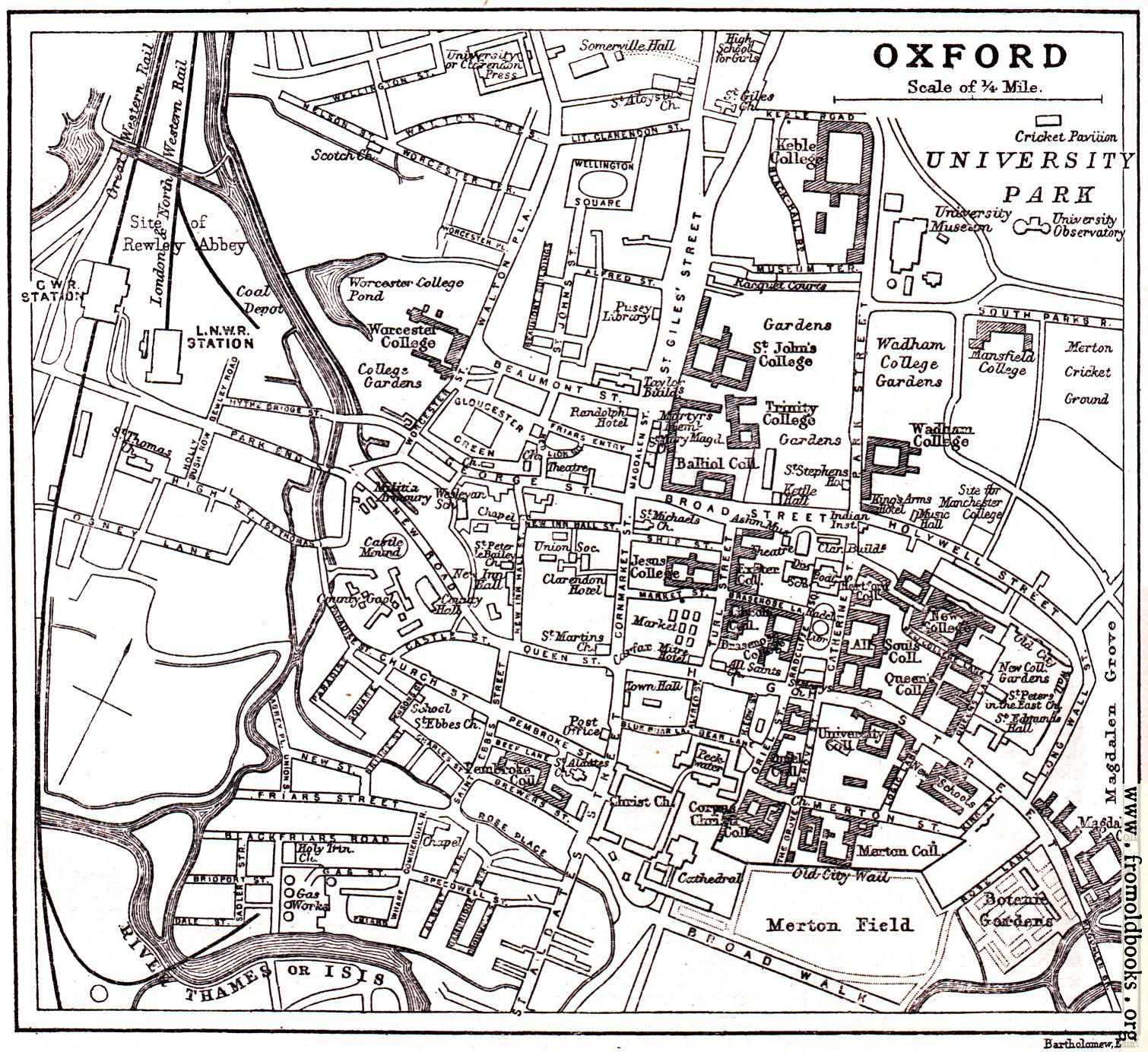
Plan of the City of Oxford 1890 John Bartholomew
.jpg)
.jpg)
%20.jpg)
%20.jpg)
.jpg)
%20.jpg)
.jpg)
.jpg)
.jpg)
.jpg)
.jpg)
%20%20%20.jpg)
.jpg)
.jpg)
.jpg)
%20.jpg)
%20.jpg)
.jpg)
%20.jpg)
%20.jpg)