| |
Home Resources consulted for Suffolk: A Bibliography of County Maps - Large Scale County Maps of England. Tooley R.V. The Printed Maps in the Atlases of Great Britain and Ireland1579-1870 Chubb Thomas Dawson 1927 |
 To resize image:
L-click on image or hold CTRL and use mouse scroll-wheel |
Plan of Aldeburgh 1500 anon
Suffolk 1564 Gerard Mercator in Anglia & Scotiae & Hibernie Nova Descriptio
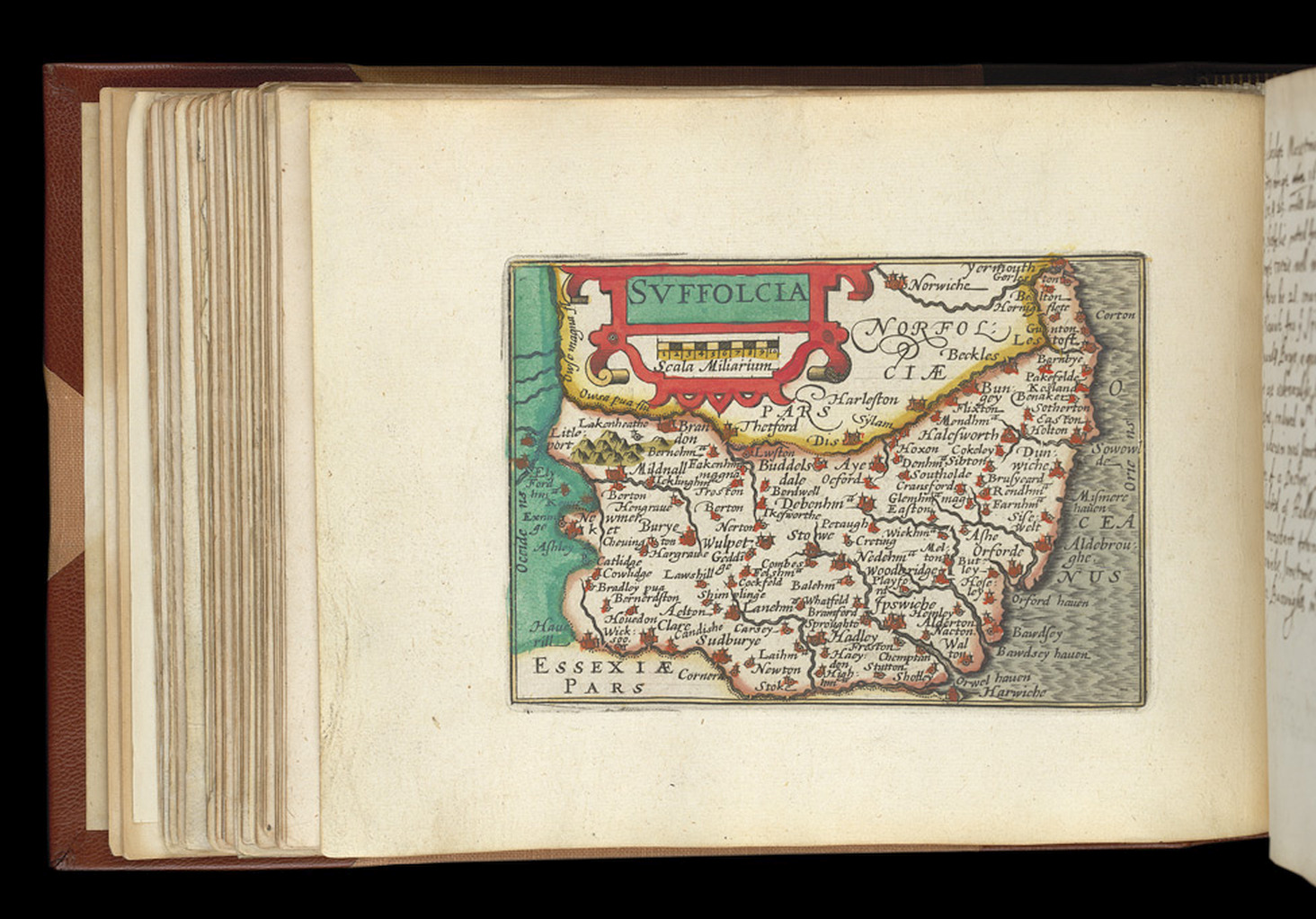
Suffolkae Comitatus 1579 Christopher Saxton (Chubb1.)
Map of Gunton 1578
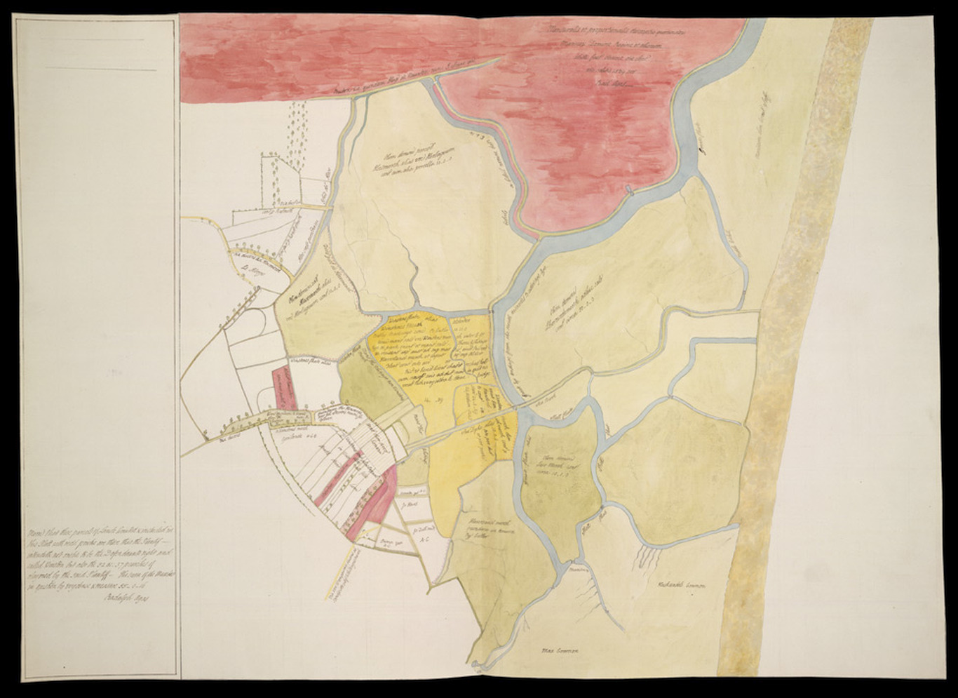
Plan of Bawdseye 1589 Radalph Agas
Fennes 1603 Joan Blaeu
(Image courtesy of Clark Library university of Michigan)
Suffolk 1605 Pieter van den Keere in his Atlas of the British Isles (Chubb LX)
Suffolk 1611 John Speed in The Theatre of the Empire of Great Britaine (Chubb p.23 XXII)
The Fens 1632 Henrici Hondii
Suffolk 1645 Joan Blaeu (Chubb p.57 LIX)
(Image courtesy of Princeton Historic Map Collection)
The Fennes 1645 Jan Jansson in his Atlas Novus (Image courtesy of The Mechanical Curator & Wikimedia)
Ipswich 1661 John Ogilby after John Speed
Suffolk 1662 Roger Rea after John Speed in A Prospect of the Most Famous Parts of the World (Image courtesy of The British Library King's Collection Maps K.TOP
Suffolk 1665 Joan Blaeu
(image courtesy of British Library - Albums)
Suffolk 1670 Richard Blome (Image courtesy of Wikimedia)
The Borough or Corporation of Ipswich actually surveyed and delineated, 1674, John Ogilby (Image courtesy of The British Library Maps K.TOP.39.20.11.
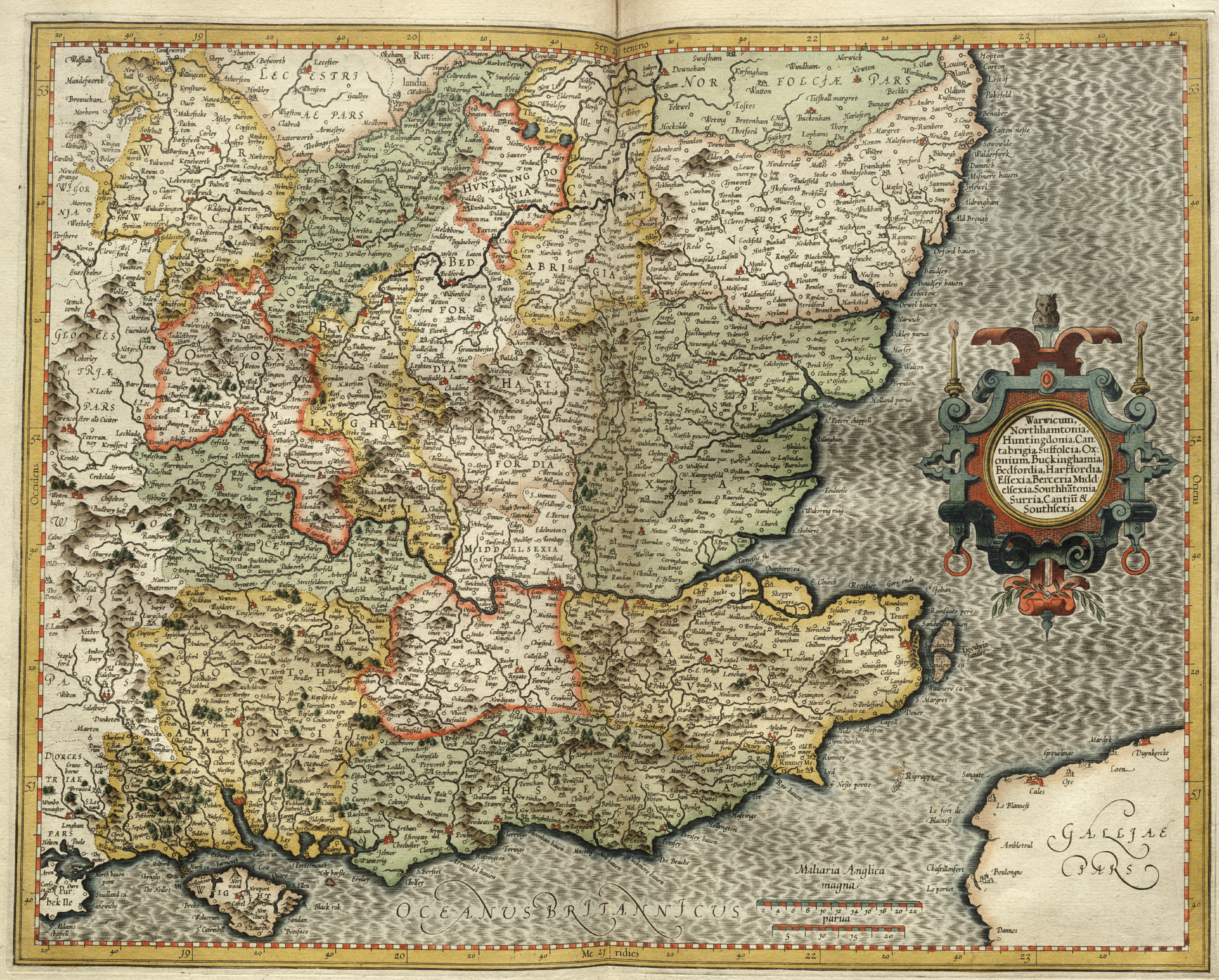
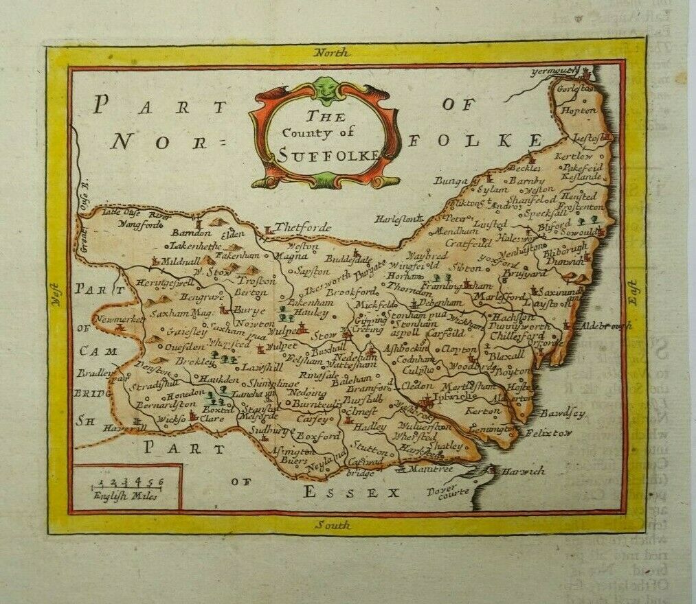
Suffolk 1690 Robt. Morden in Camden's Britannia Chubb p. 93 CXIII)
(Image courtesy of Yale University Library)
Suffolk 1680 John Seller in Britannia Contracta. The same plates also used for Camden's Britannia Abridg'd (1701) (Chubb p.89 CVII0) and A History of England (1703 ) (Chubb p.91-p.99) and lastly for Francis Grose's Antiquities... (with Seller's name removed.)
Suffolk 1715 Gerardum Valk & Petrum Shenk who bought the plates from Jansson's estate and re-published them removing Jansson's imprint and adding their own
Suffolk & Norfolk 1720 Emanuel Bowen in Britannia Depicta
Somerset 1724 Herman Moll in A New Description of England and Wales
Suffolk 1736 Herman Moll in A New description of England and Wales (Chubb p.125 CLX
(Image courtesy of The British Library Maps K.TOP.39.3.)
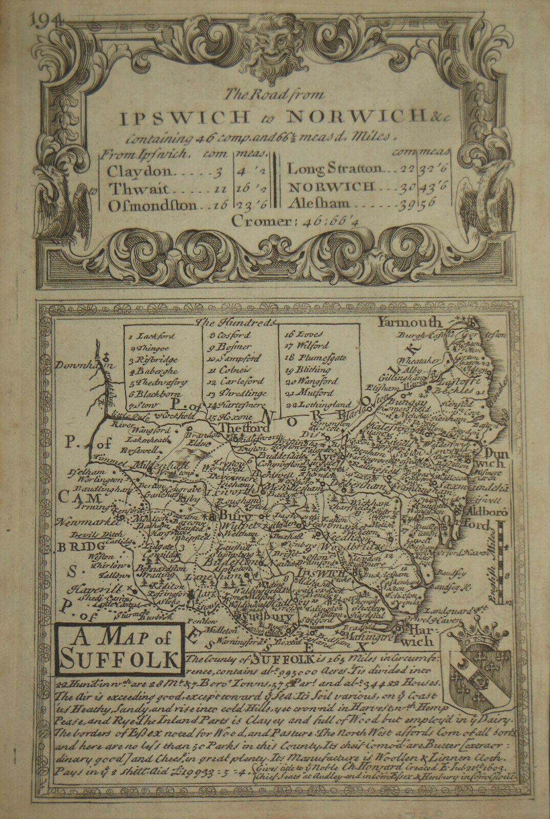
County of Suffolk 1736 John Kirby(Image courtesy of The British Library Maps K.TOP.39.4.11.(tab)
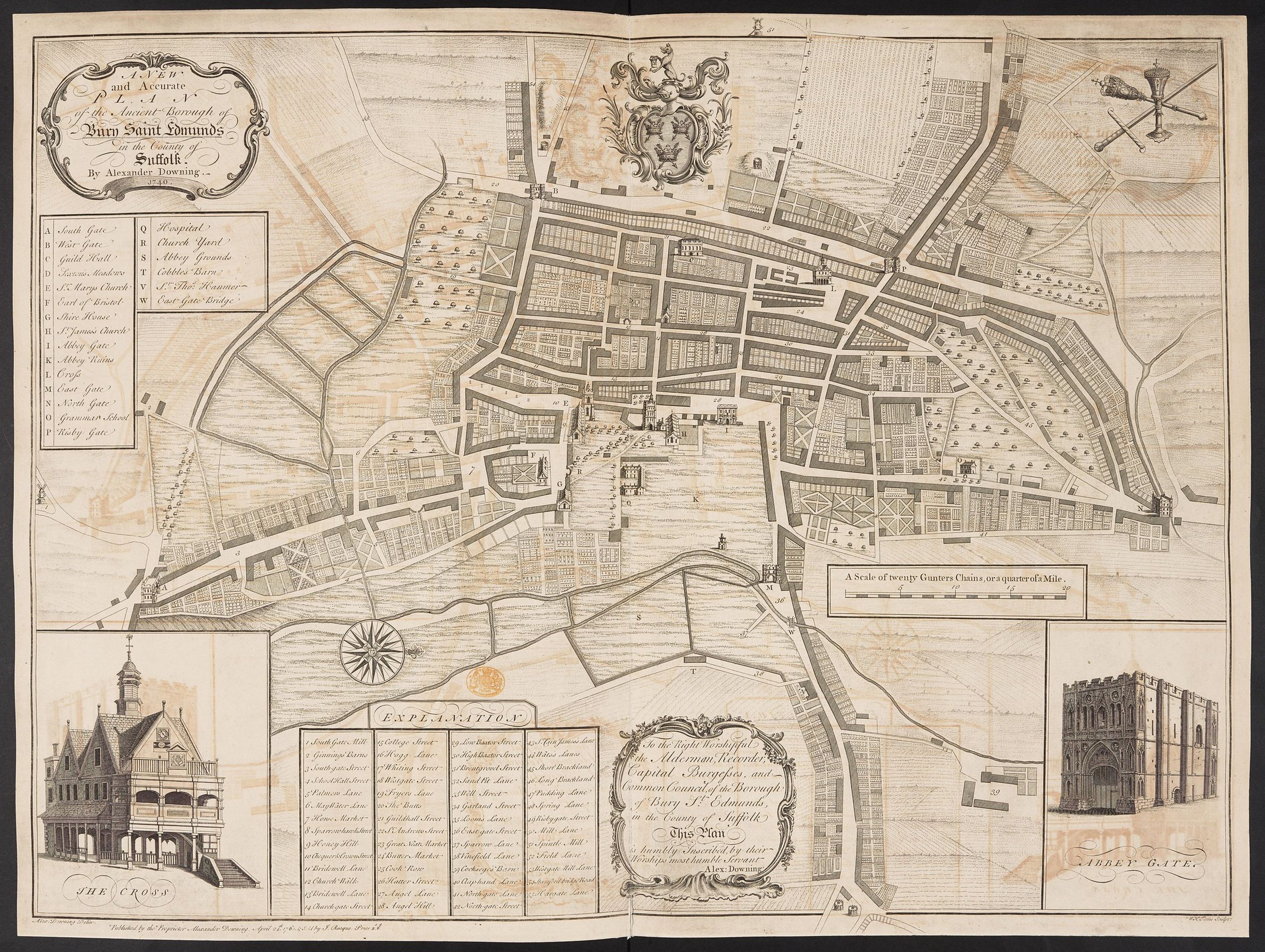
The Ancient Borough of Bury St. Edmonds1749 Alexander Downing
(Image courtesy of The British Library Maps K.TOP.39.11.
An Accurate map of Suffolk 1750 Emanuel Bowen (Image courtesy of The British Library, King's Collection. K.TOP.39.6.)
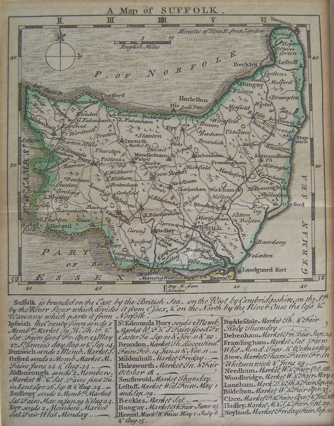
Suffolk 1742 Thomas Badeslade and William Toms in Chorographia Britanniae (Chubb CLX: CLXI)
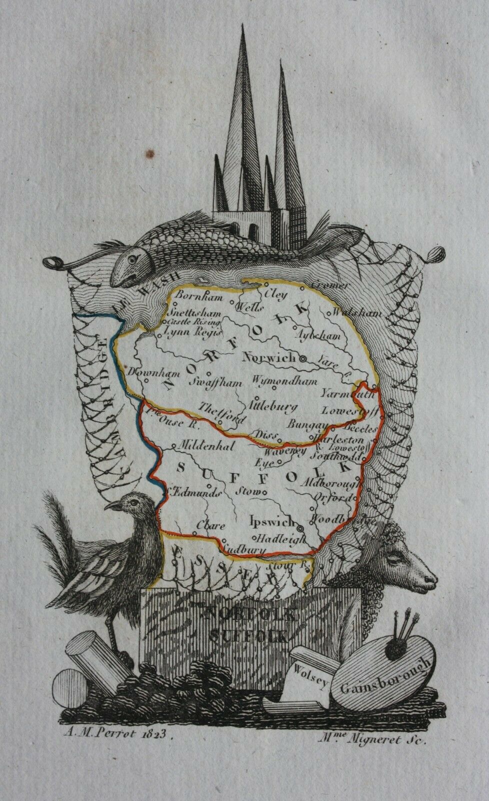
Suffolk & Norfolk 1745 Aristide Perrot
Suffolk 1747 Thomas Kitchin and Thomas Jefferys in The Small English Atlas
Part of Suffolk 1759 Emanuel Bowen
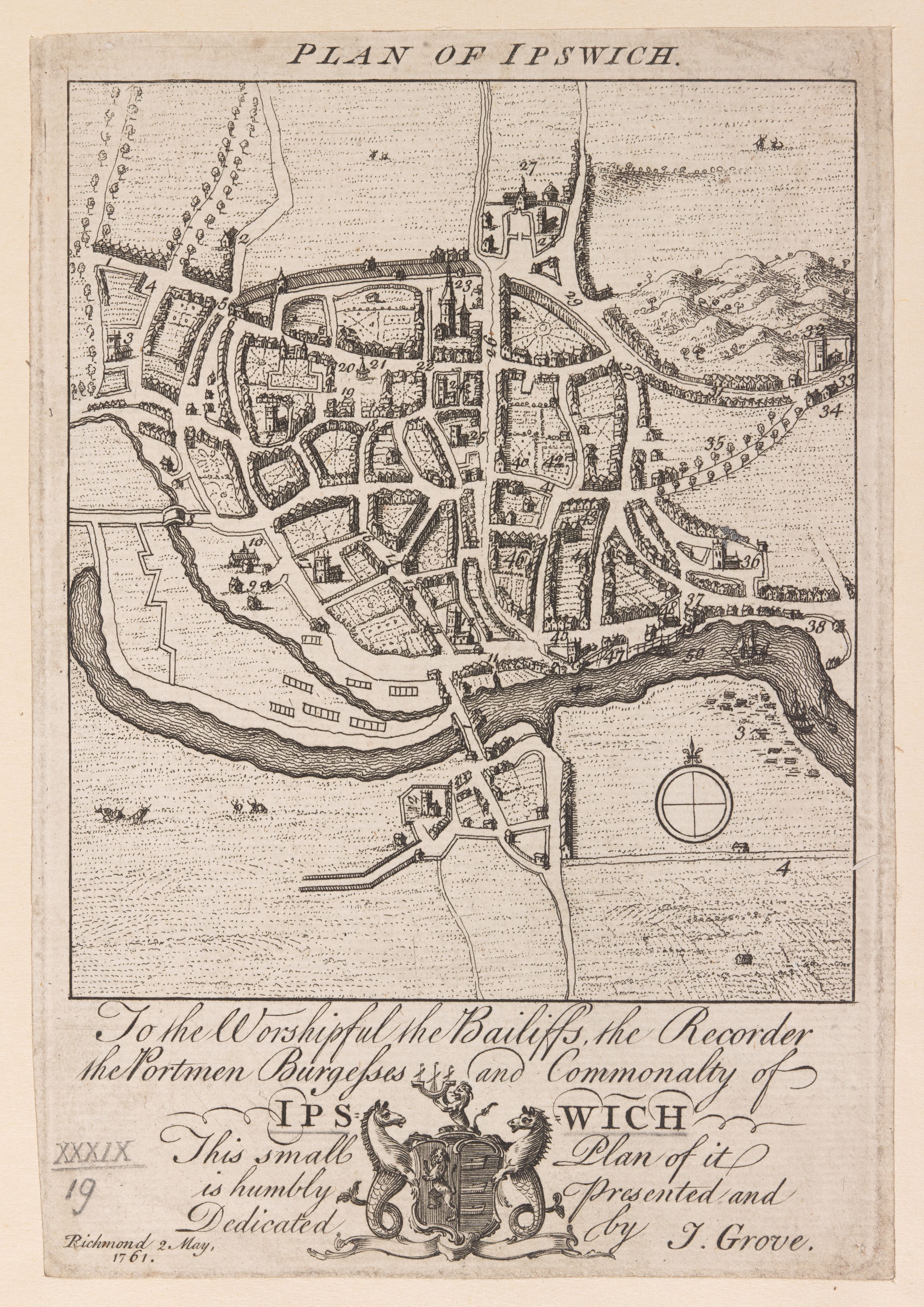
Plan of Ipswich 1761 J. Grove
(Image courtesy of The British Library Maps K.TOP.39.19. )
Suffolk 1764 Thomas Kitchin in England Illustrated
Suffolk 1766 ( 01of 4) John Kirby (Image courtesy of The British Library: King's Collection. K.TOP.39.5.1-5)
Suffolk 1766 ( 02 of 4) John Kirby (Image courtesy of The British Library: King's Collection. K.TOP.39.5.1-5)
Suffolk 1766 ( 03 of 4) Jno.Kirby (Image courtesy of The British Library: King's Collection. K.TOP.39.5.1-5)
Suffolk 1766 ( 04 of 4) John Kirby (Image courtesy of The British Library: King's Collection. K.TOP.39.5.1-5)
Newmarket Heath 1768 J. Chapman (Image courtesy of The British Library, King's Collection Maps K.TOP)
Suffolk 1769 Jean Rocque in England Displayed: first published as The English Traveller (1746):
and subsequently as The Small British Atlas (1753) Chubb p.172 CCVII)
Suffolk 1769 Thomas Kitchen in his Pocket Atlas (Chubb p.195 CCXXXV)
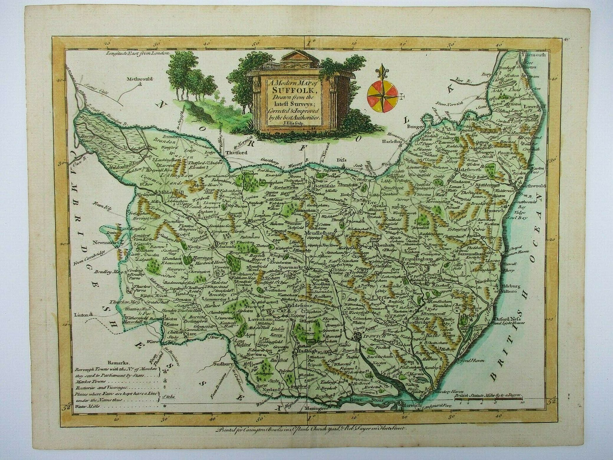
Suffolk 1773 John Ellis in Ellis's New and Correct Atlas of England and Wales
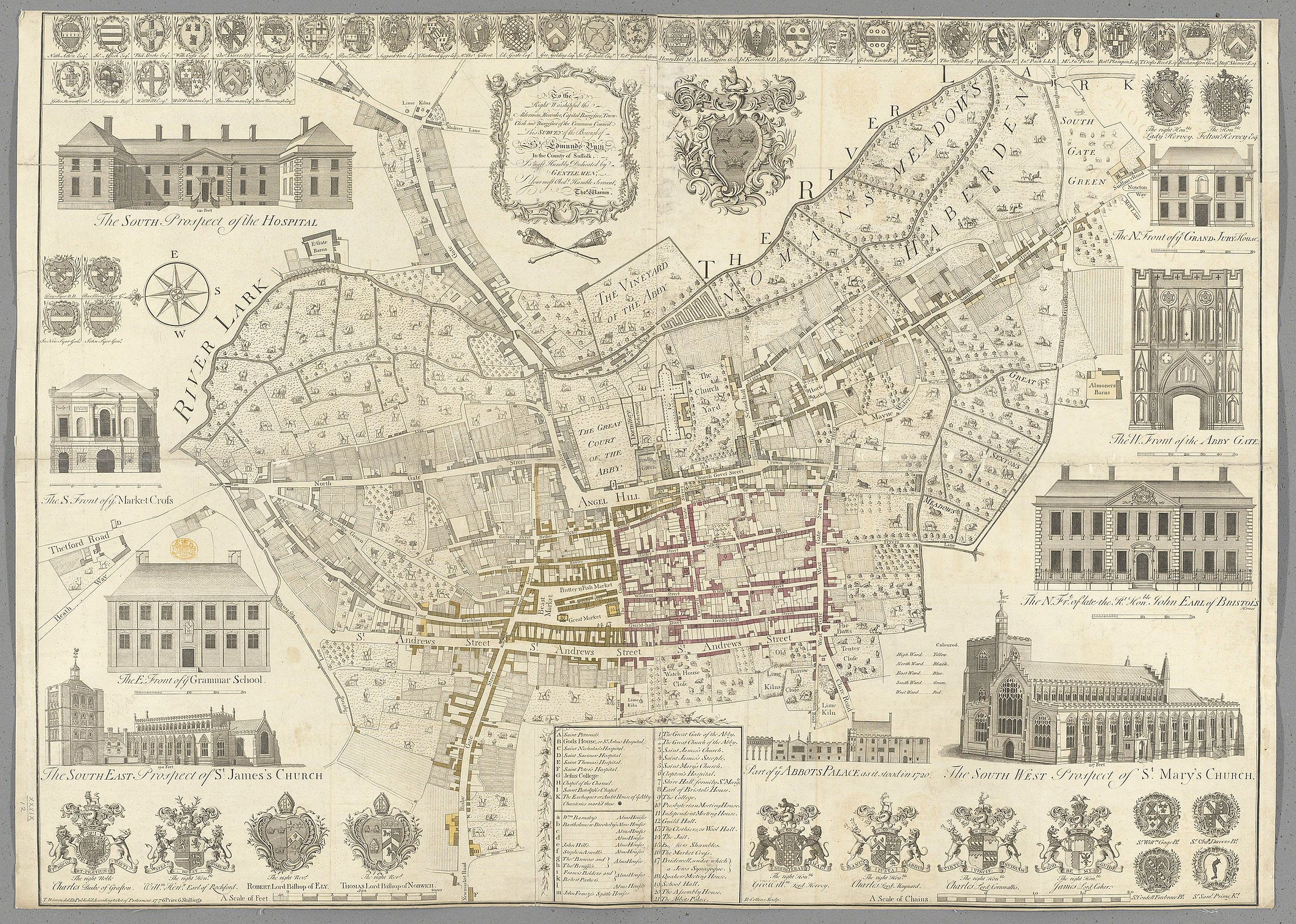
Bury St. Edmunds 1776 Thomas Warren
(Image courtesy of The British Library: King's Collection. K.TOP.39.!@.)
Plan of Ipswich 1778 J. Pennington
(Image courtesy of The British Library Maps K.TOP.39.21.1.)
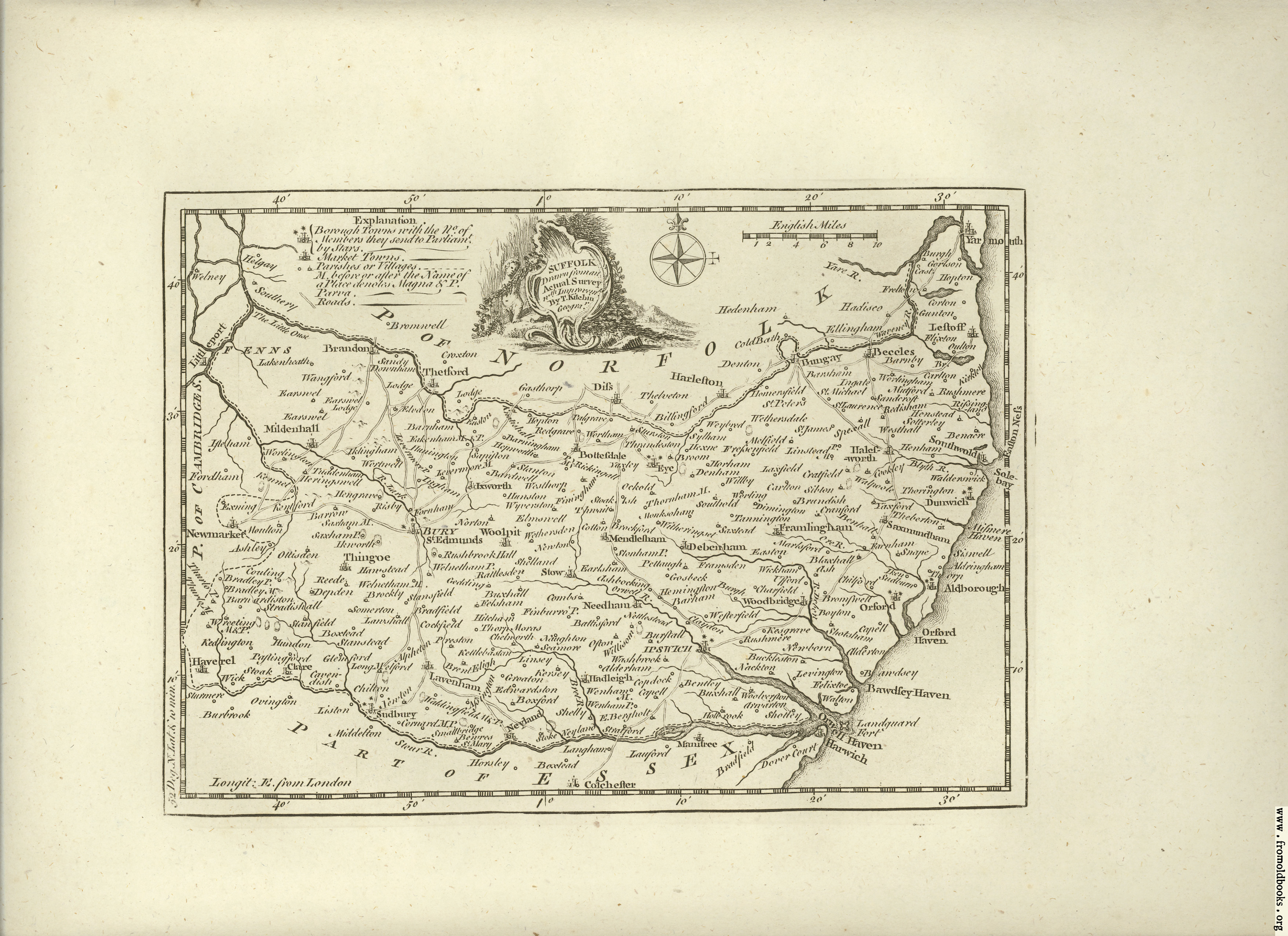
Suffolk 1786 Thomas Kitchen in The Antiquities of England and Wales (Chubb p.210 CCLVII)
Suffolk 1788 John Aikin in his England Delineated (Chubb p.223 CCLXXXVI))
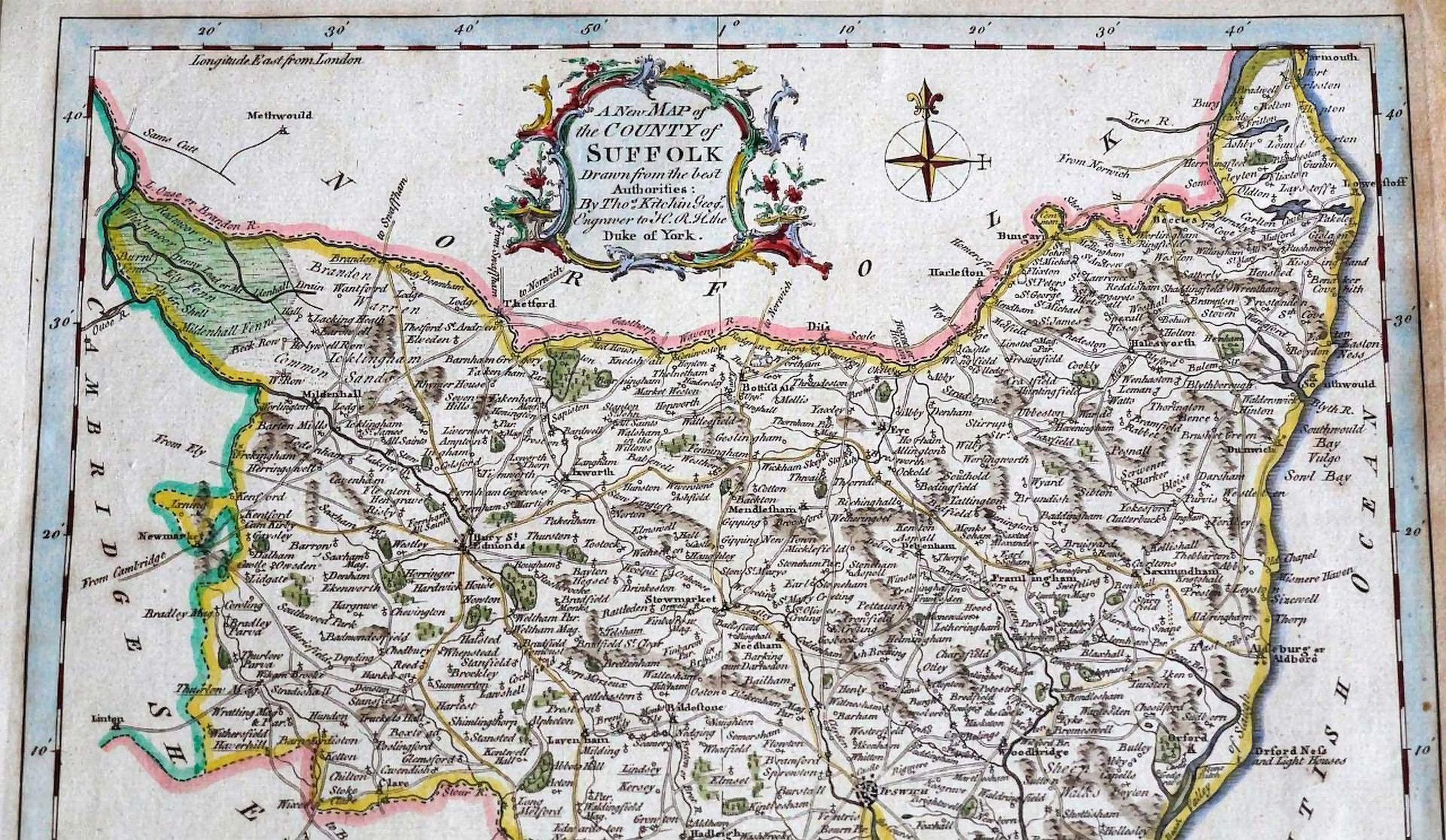
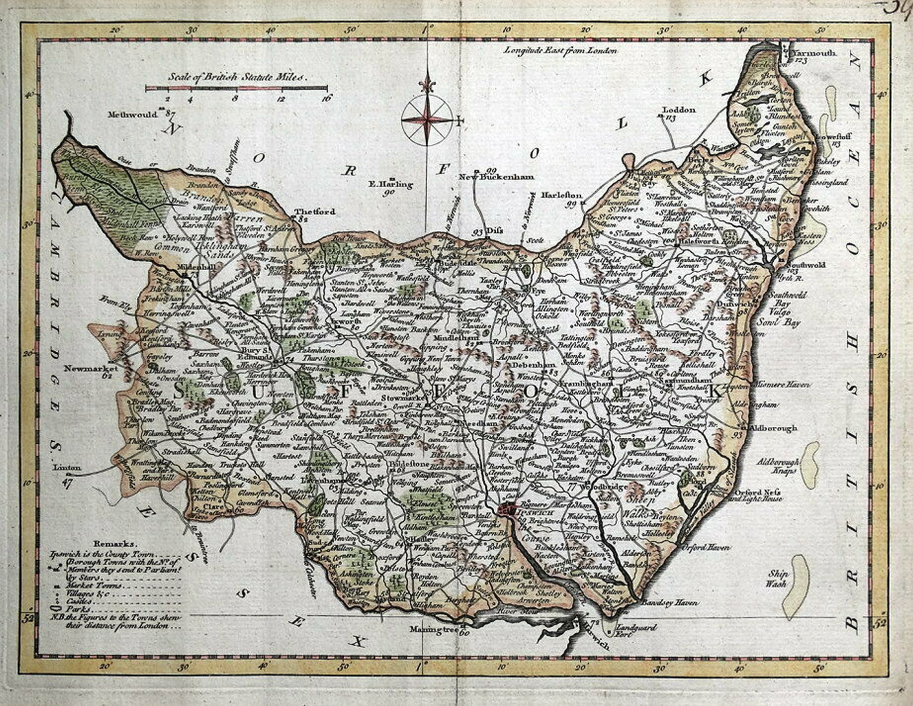
The County of Suffolk 1787 John Hodskinson. (Image courtesy of The British Library, King's Collection Maps K.TOP.)39.7.8..
Suffolk 1787 John Cary in his New and Correct English Atlas (Chubb p.210 CCLX)
(image courtesy of New York Library Digital Collections)
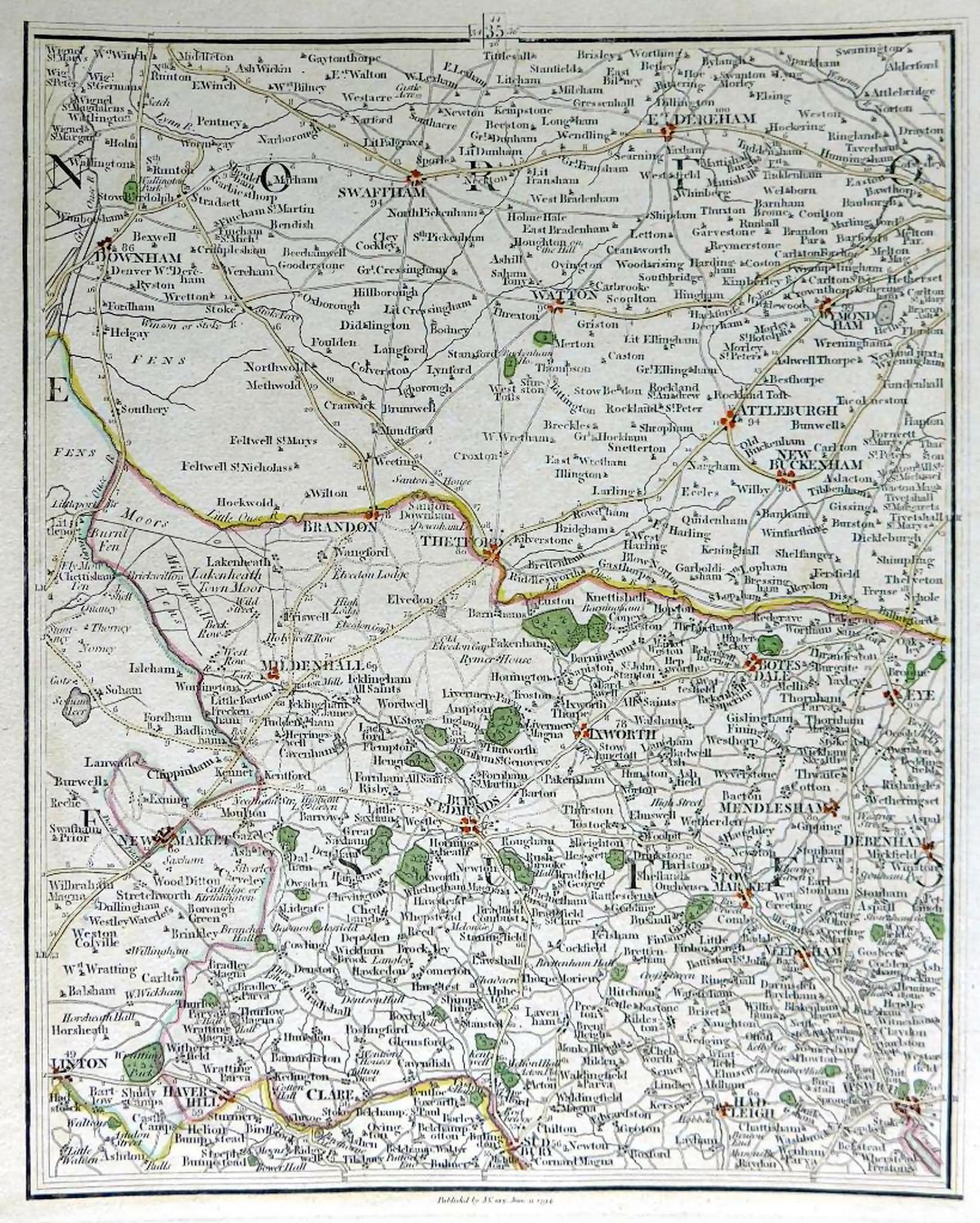
Suffolk and Norfolk 1794 John Cary in Cary's New Map of England and Wales
Suffolk 1804 William Green in The Picture of England
Suffolk 1808 Benjamin Pitts Capper in his Topographical Dictionary of England and Wales
(Chubb p.245 CCCXXVII)
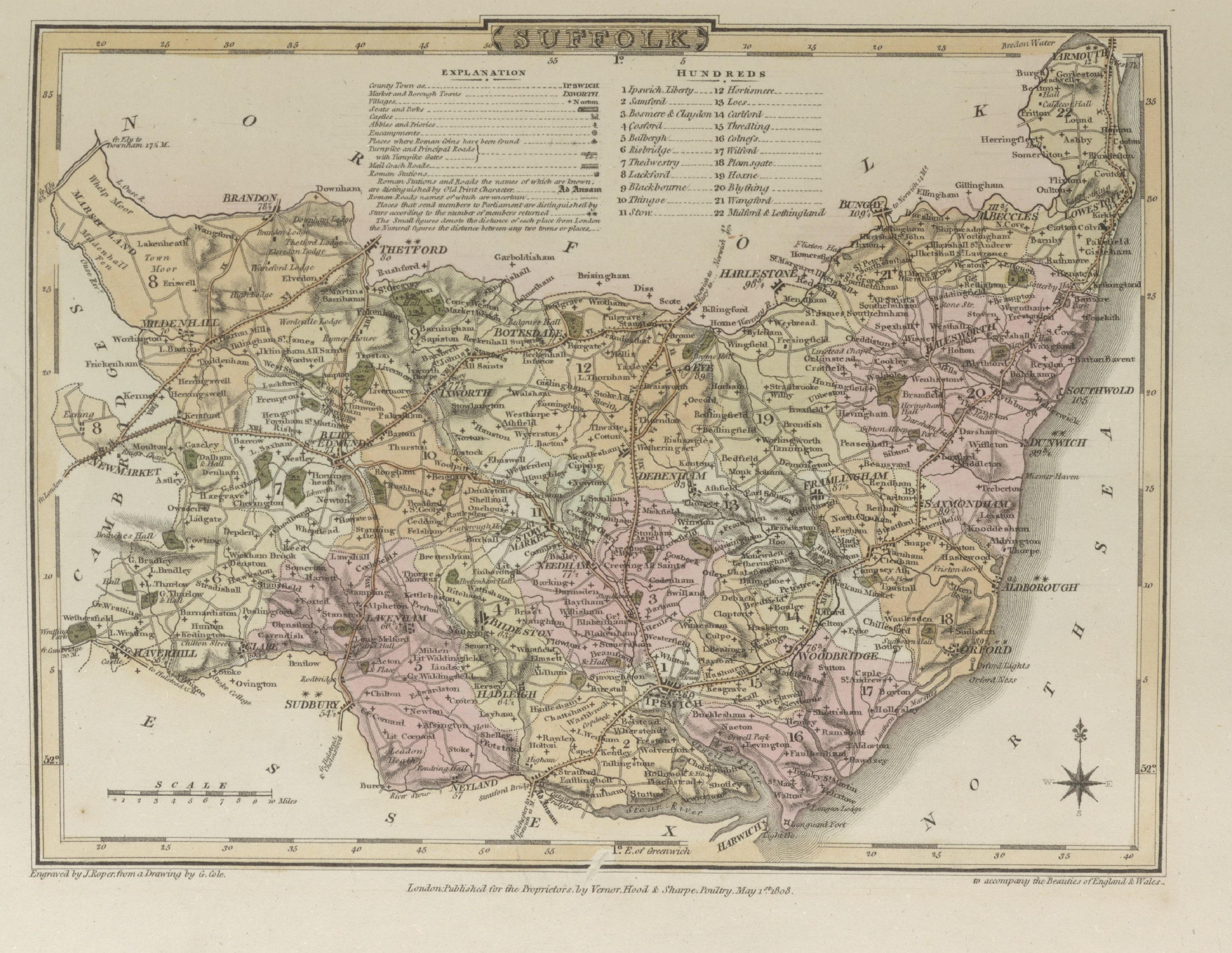
Suffolk 1809 John Roper in The British Atlas of England and Wales (Chubb p.249 CCCXXXiX)
Suffolk 1810 John Wallace in Wallis's New Pocket Edition of the Counties or Travellers Companion
Suffolk 1814 John Cary in Cary's Traveller's Companion (Chubb p.220 CLXXIII)
Eastern England 1818 Bartolomeo Borghi le Provenci
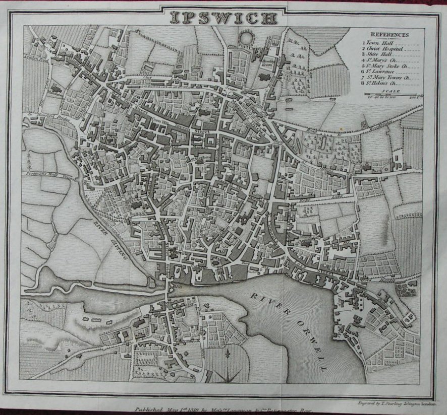
Plan of Ipswich 1819 Thomas Starling
Suffolk 1822 Robert Creighton for (Samuel)Leigh's New Pocket Atlas (Chubb p.97 CXVIII)
Suffolk & Norfolk 1823 Aristide Perrot for L'Angleterre...etc.
Suffolk 1824 George Carrington Gray in Gray's New Book of Roads (Chubb p.281 CCCXCII))
Suffolk 1826 Sidney Hall for Samuel Leigh in Leigh's New Atlas of England and Wales (Chubb p. 314 CCCCLI)
Suffolk 1827 Thomas Moule in his English Counties Delineated
Suffolk 1828 Ebden's Map of Suffolk
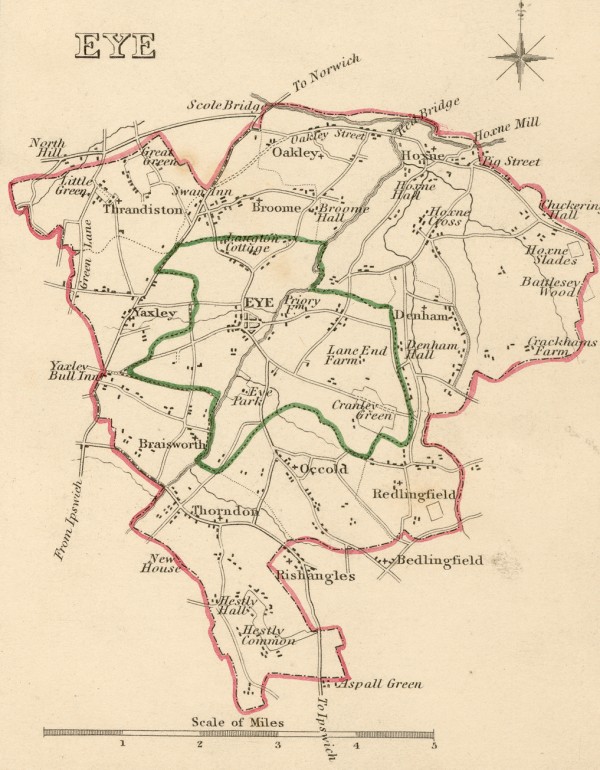
Eye 1835 Robert Creighton with J: and C. Walker Chubb p.322 CCCCLXIV)
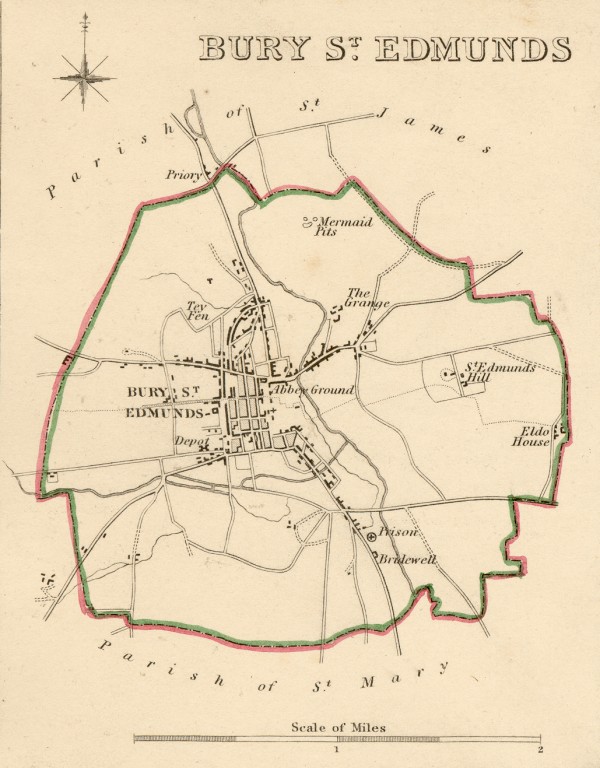
Bury 1835 Robert Creighton with J: and C. Walker for Lewis's Topographical Dictionary Chubb p.322 CCCCLXIV)
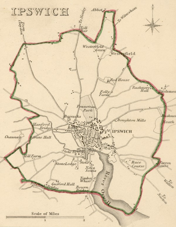
Ipswich 1835 Robert Creighton with J, and C. Walker 1835 for Lewis's Topographical Dictionary
Suffolk 1836 Sidney Hall in his New British Atlas (Chubb p. 314 CCCCLI)
Suffolk 1842 James Pigot in A Pocket Topography and Gazetteer of England (Chubb p.321 CCCCLXII)
(Image courtesy of Wikimedia)
Suffolk 1845 Rev. Samuel Clarke in Reuben Ramble's Travels in the Southern Counties of England
(Image courtesy of The British Library King's Collection)
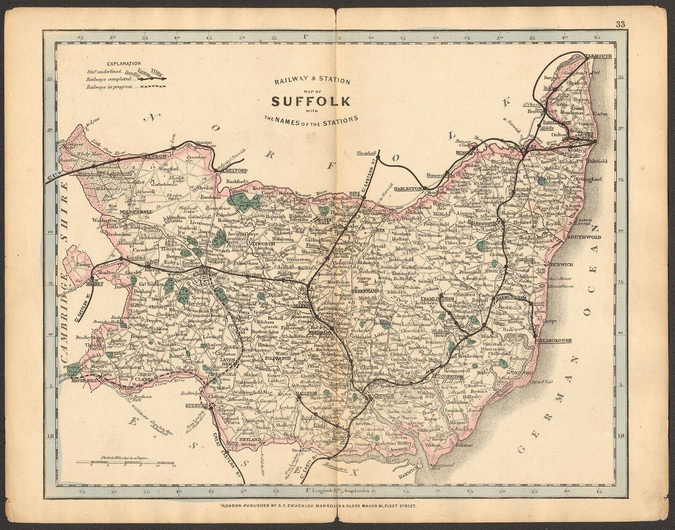
Suffolk Railway and Station Map 1864 in G.F. Cruchley's Railway Companion to England and Wales
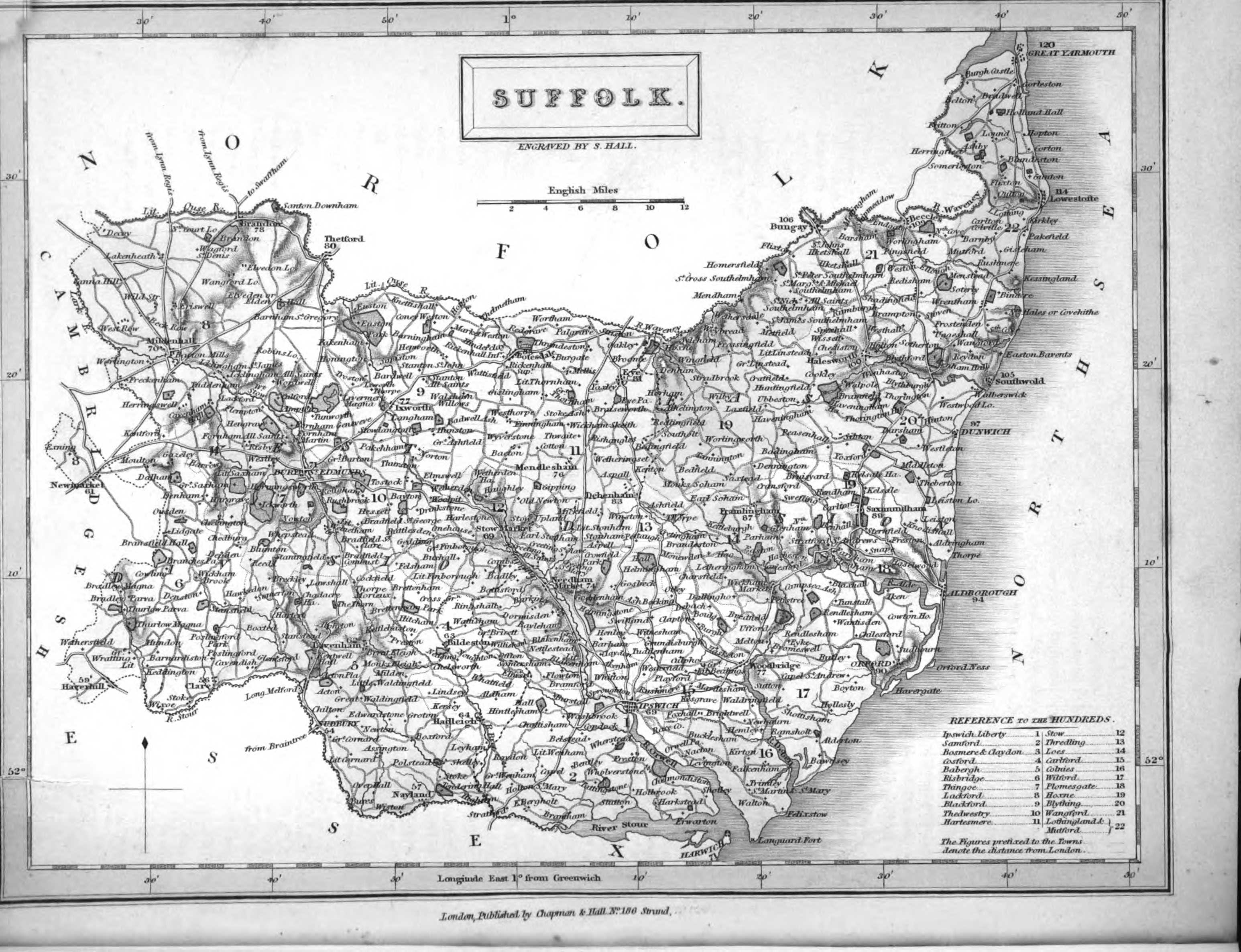
Suffolk 1868 William Hughes
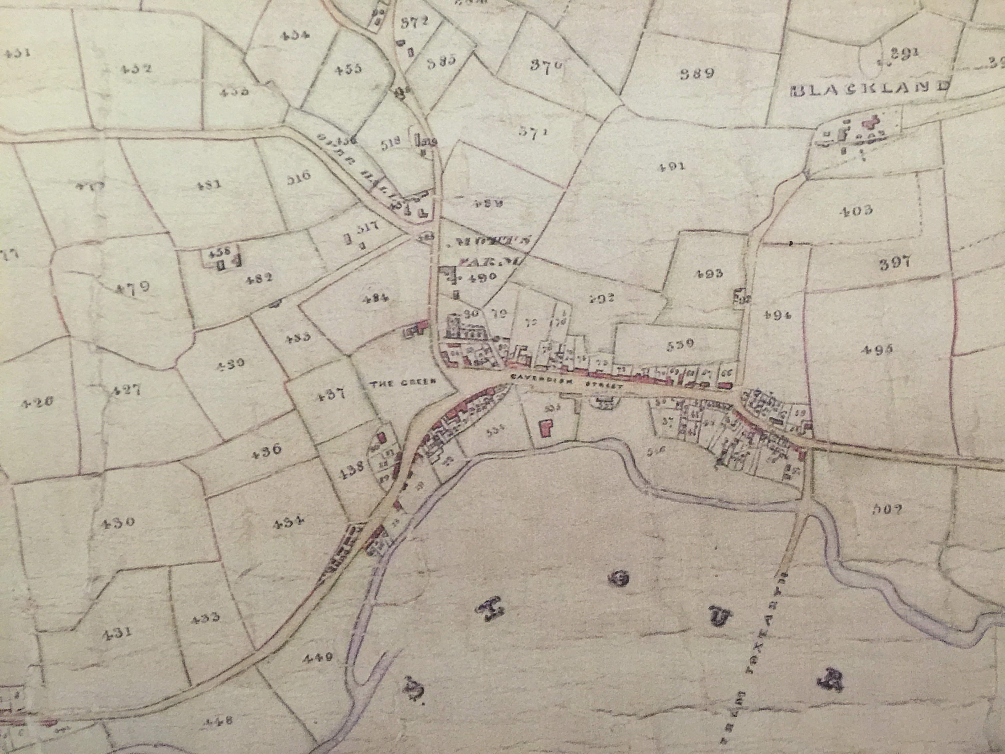
Cavendish Tithe Map 1875
Suffolk 1875 Henry Teesdale
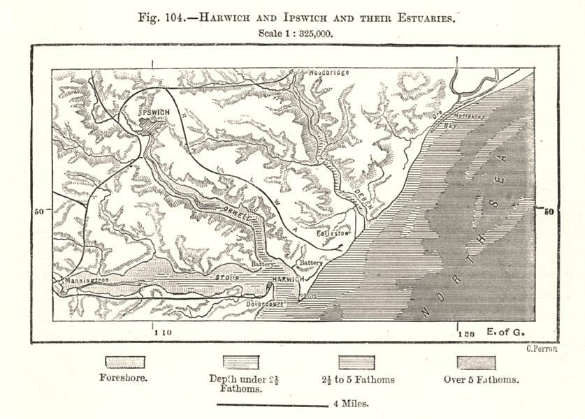
Harwich and ipswich and their Estuaries1885 by C. Perron from The Universal Geography by Elisee Reclus Edited by E.G.Ravenstein,F.R.G.S
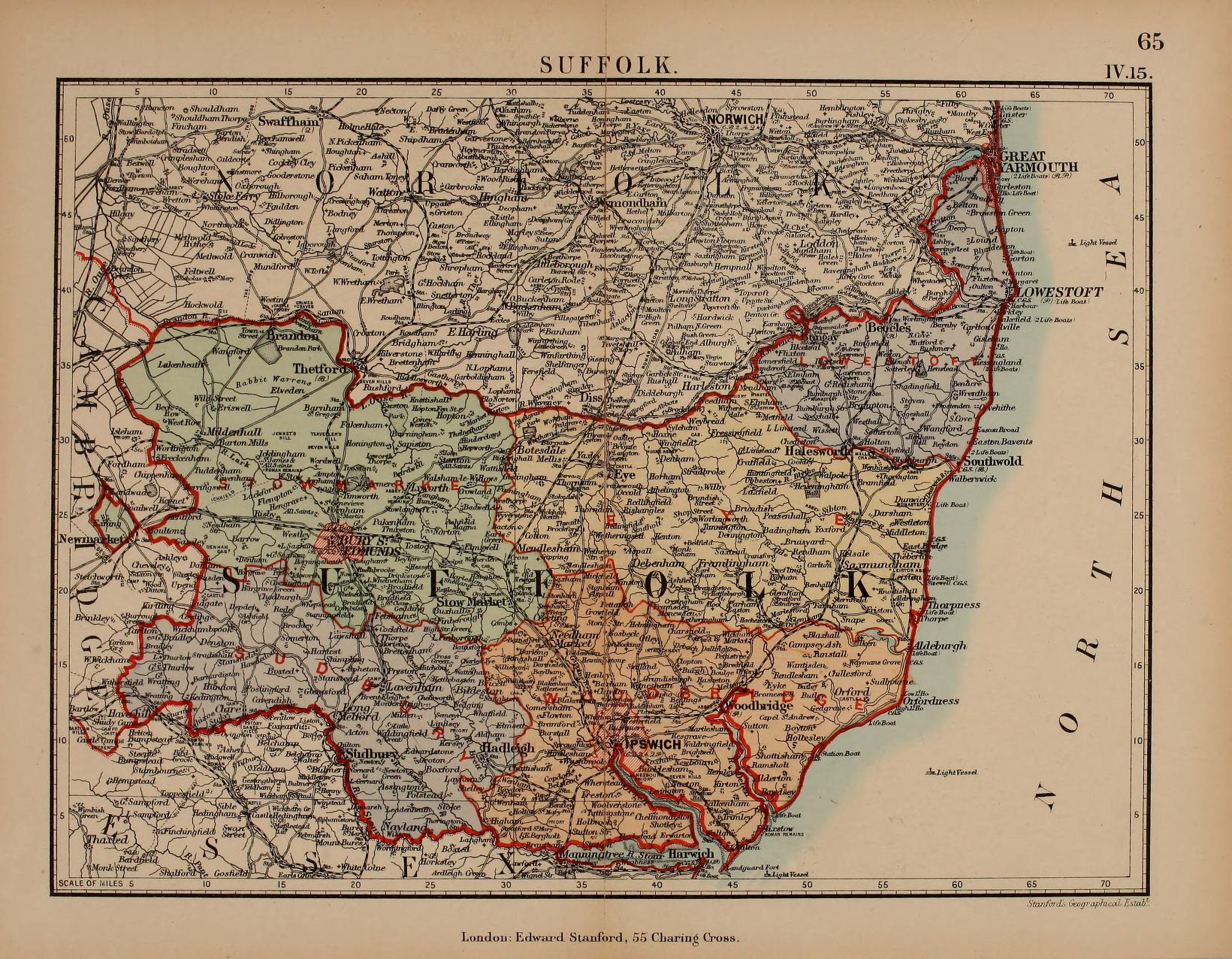
Suffolk 1885 Stanford's Parliamentary Atlas of England and Wales]
Insurance Plan of Ipswich 1893 (01) sheet 71 (BL 52963)
Insurance Plan of Ipswich 1893 (02) sheet 71 (BL 52963)
Plan of Ipswich 1884
(Left Sheet)
(Right Sheet)
A. and C. Black
(Image courtesy of The Mechanical Curator & Wikimedia)
.jpg)
(Image%20courtesy%20of%20The%20British%20Library%20King's%20Collection%20%20Maps%20K.TOP.jpg)
.jpg)
%20.jpg)
.jpg)
%20.jpg)
.jpg)
.jpg)
%20John%20Kirby%20.jpg)
%20John%20Kirby%20.jpg)
%20Jno.Kirby%20.jpg)
%20John%20Kirby%20.jpg)
.jpg)
.jpg)
39.7.8...jpg)
%20%20H+%20Wikimedia.jpg)
Leigh's%20New%20Pocket%20Atlas.jpg)
.jpg)
%20%20sheet_7%201%20(BL%2052963)%20.jpg)
%20%20sheet_7%201%20(BL%2052963)%20.jpg)
%20.jpg)
%20.jpg)